
20 ans, Lyon 🇫🇷, étudiant en Relations Internationales à Lille, cartes, analyses et suivi des conflits 🇸🇩🇨🇩🇦🇲🇲🇲🇺🇦🇸🇴🇸🇾
Directeur d'@atummundi
 As you can see, the number of reported Ukrainian drones (the ones downed) by Russian MOD continues to climb, while the number of reported Russian drones stalled and decreased.
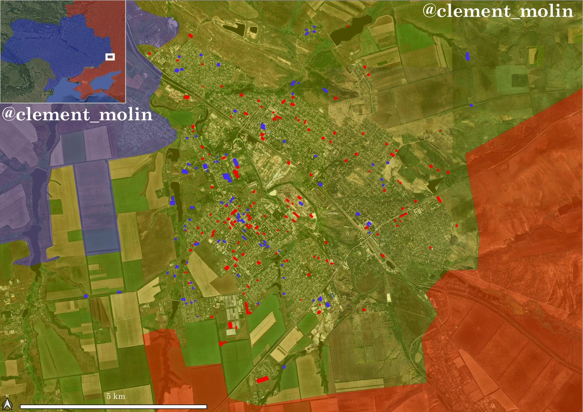 I gathered geolocations for the last 40 days in the city, from @UAControlMap, mainly done by @AudaxonX.
 Videos of the repelled assault : x.com/azov_media/sta…
 Yesterday, @414magyarbirds posted an update about strikes on the key R-280 highway, so called "Novorossia" road between Rostov and Crimea.
 Recently, most of Crimea has been without power after a large number of Ukrainian strikes (source : @georgewbarros).
 The number of strikes continue to increase, with nearly 600 trucks and vehicles hit in june 2026 (around 20 per day) and already 240 for the 1st week of july (34 per day).
 Russian flag videos are almost always the same. One or two Russian soldiers walk along the front line for weeks, evading Ukrainian detection.
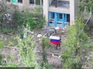
 With artillery and drones, airstrikes are the third phase of the Russian strike campaign.


 Data above is from @Pouletvolant3 who has a strong regularity, using @Majakovsk73 data.
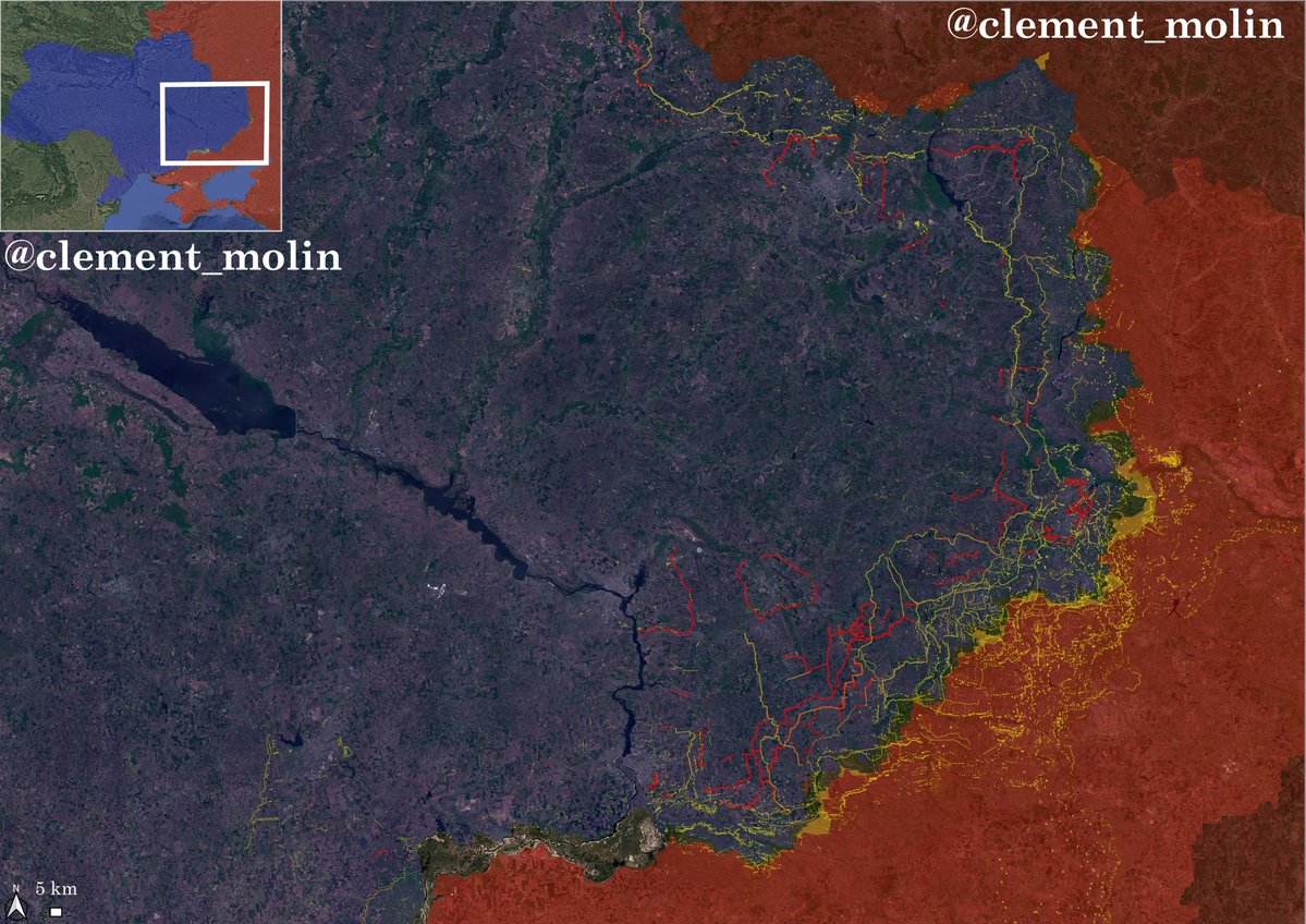 Here in red are all the new fortifications built from january to jun 2026. Lines are stretching from Chernihiv to Odessa.
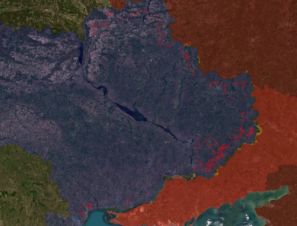
 Here is the video of the ~784 trucks and vehicles hit by the Ukrainians (mainly videos from the drones, since we can't always tell the difference with ground footage).
 Quel est l’objectif de guerre de la Russie, pays agresseur ?
 As a reminder, in February, the Ukrainian army conducted a discreet offensive for several weeks, clearing infiltrated areas, securing Pokrovsk'e and infiltrating areas that were previously under Russian control.
 Last night, the Code 9.2, Phalanx and the davinci units launched multiple strikes against targets in and around the key roads leading to Crimea.
 Crimea is connected with southern occupied Ukraine by multiple key bridges.
 The strike campaign is guided by multiple units, using a large veriety of drones.
 In May 2026, Russia conducted 7 486 airstrikes, I managed to locate 52% of those.
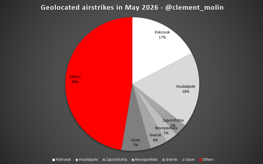
 In total, Ukraine 🇺🇦 striked around 270 trucks and vehicles more than 20km from the frontline since early may.
 In 2018, a popular uprising erupted in Armenia after President Serzh Sargsyan circumvented the constitution to secure his re-election as prime minister.
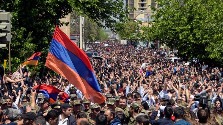
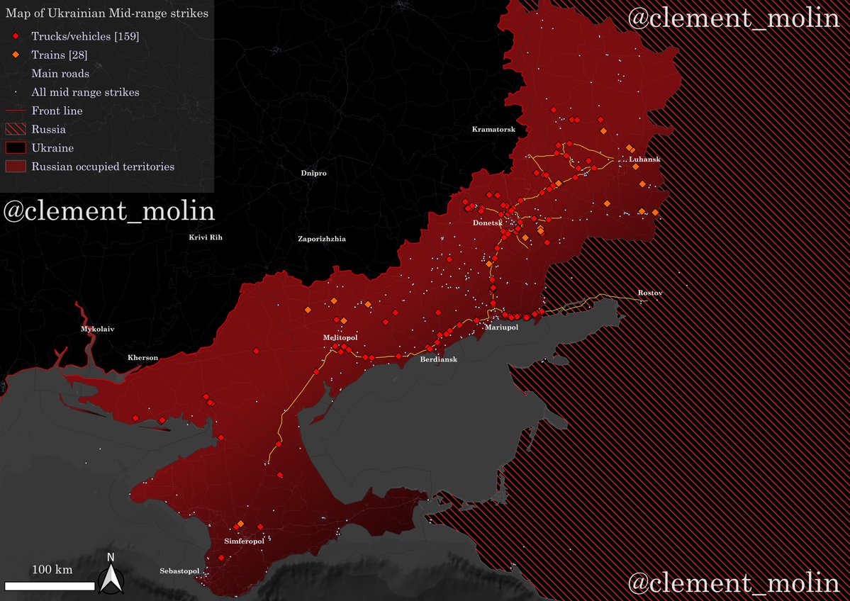 The ukrainian mid-range drone strike is quite recent. It started at the end of last year and quickly intensified in 2026.