Egyptian pyramids are not where they're supposed to be. Why?
Why is Cairo, the biggest African city, where it is today?
Alexandria?
Why do over 100M Egyptians live so densely clustered?
These questions all have the same answer. Look:
Why is Cairo, the biggest African city, where it is today?
Alexandria?
Why do over 100M Egyptians live so densely clustered?
These questions all have the same answer. Look:
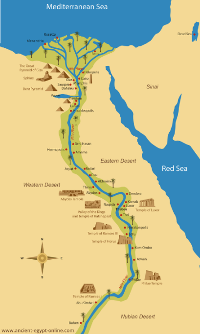
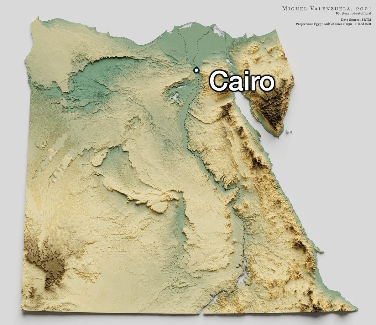
1st map: population density
2nd map: satellite
The "flower" is the inhabited part of Egypt, which is basically the Nile
2nd map: satellite
The "flower" is the inhabited part of Egypt, which is basically the Nile


It makes sense: outside of the Nile, Egypt is like the rest of the Sahara desert, an inhospitable hell for humans

That's because it's in the Horse Latitudes, which receive winds from the high atmosphere that fall here devoid of any moisture
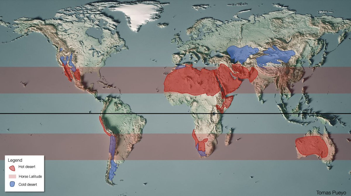
The Nile is the one river that crosses these Horse Latitudes, and hence the Sahara
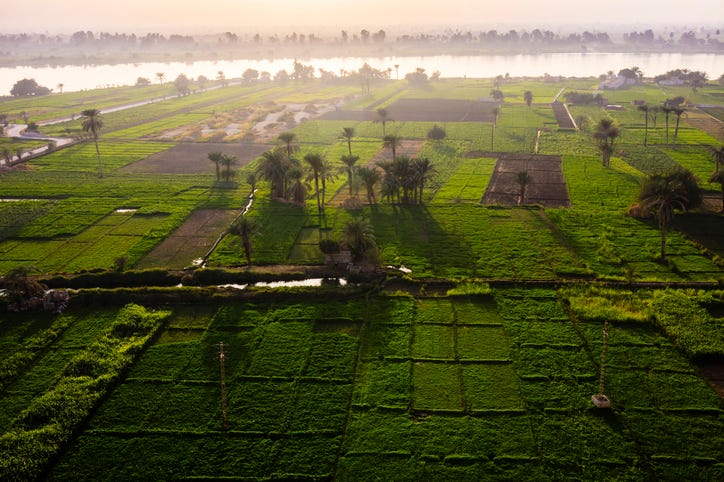
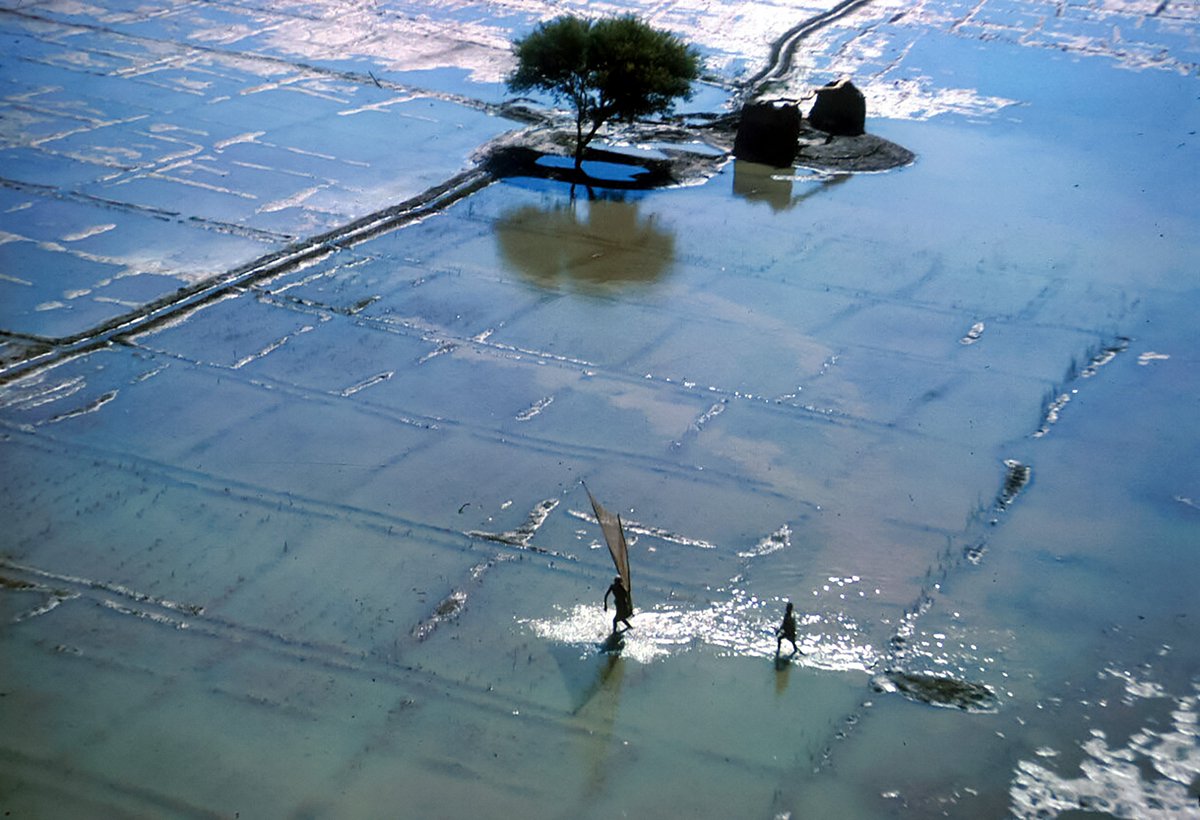
The Nile brings so much water and sediment with it that its entire banks are incredibly fertile. Its annual floods expanded the river, making kms around it fertile.
Fertility➡️agriculture➡️food➡️people
Fertility➡️agriculture➡️food➡️people
And why such massive floods?
The Nile starts in the Ethiopian highlands, which don't get big snowpacks (too close to the equator, not high enough)
Monsoons don't become ice. They just flood down.
The Nile starts in the Ethiopian highlands, which don't get big snowpacks (too close to the equator, not high enough)
Monsoons don't become ice. They just flood down.
So that's why Egypt was built around the Nile
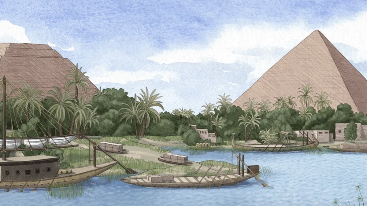
It made sense to build the pyramids near it too:
1. This is where people lived
2. How else could you carry stones that weigh 3 to 15 tons if not by boat?
It made sense to build the pyramids near it too:
1. This is where people lived
2. How else could you carry stones that weigh 3 to 15 tons if not by boat?
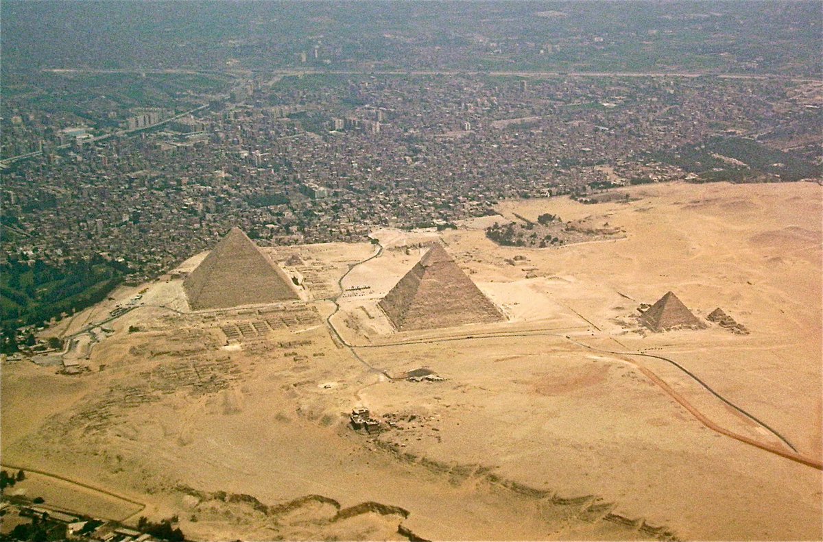
Here's the problem though: Many Egyptian pyramids are NOT so near the Nile!
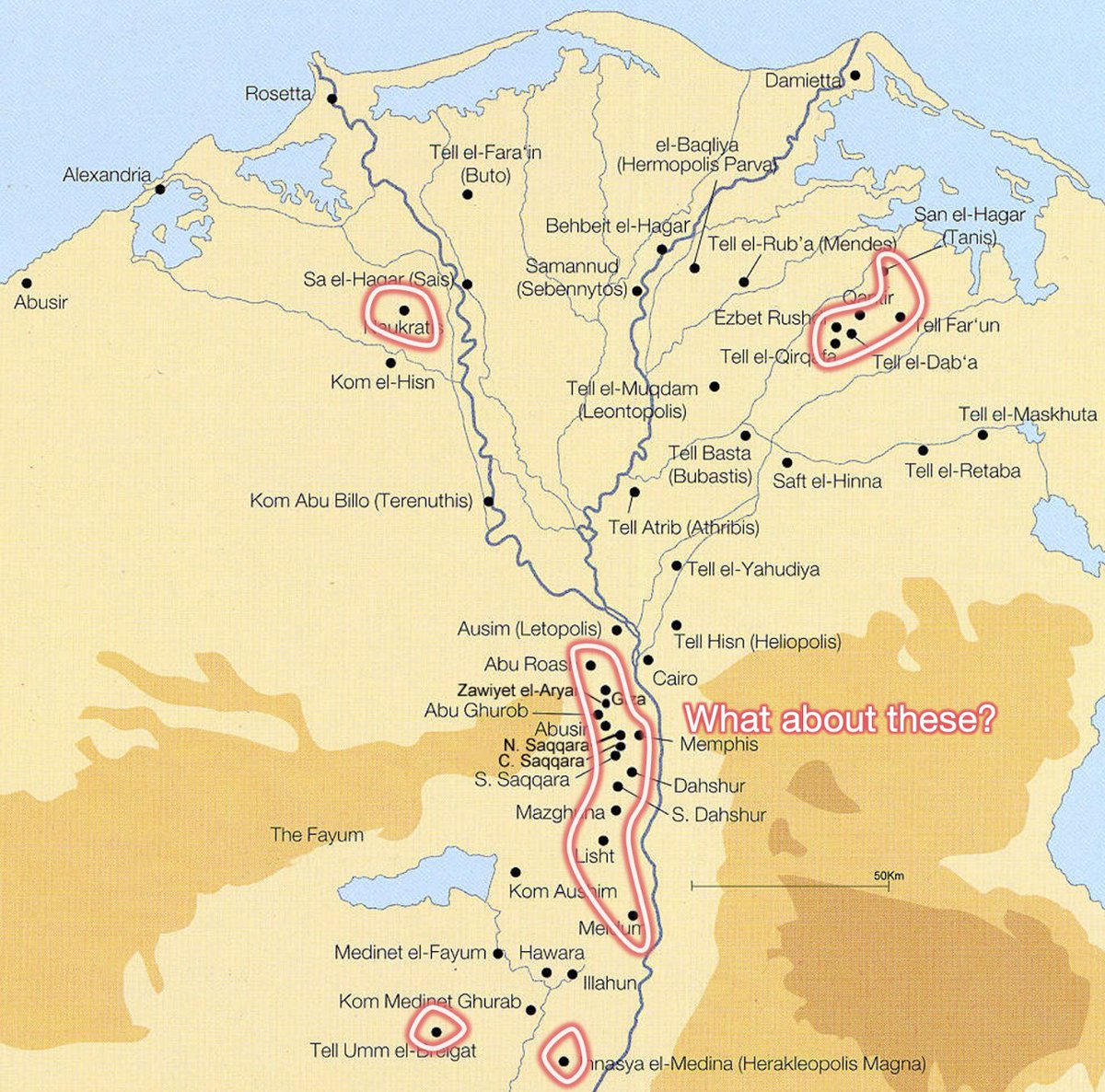
In the delta to the north it makes sense: River arms are cosntantly changing there. But what about these south of Cairo?
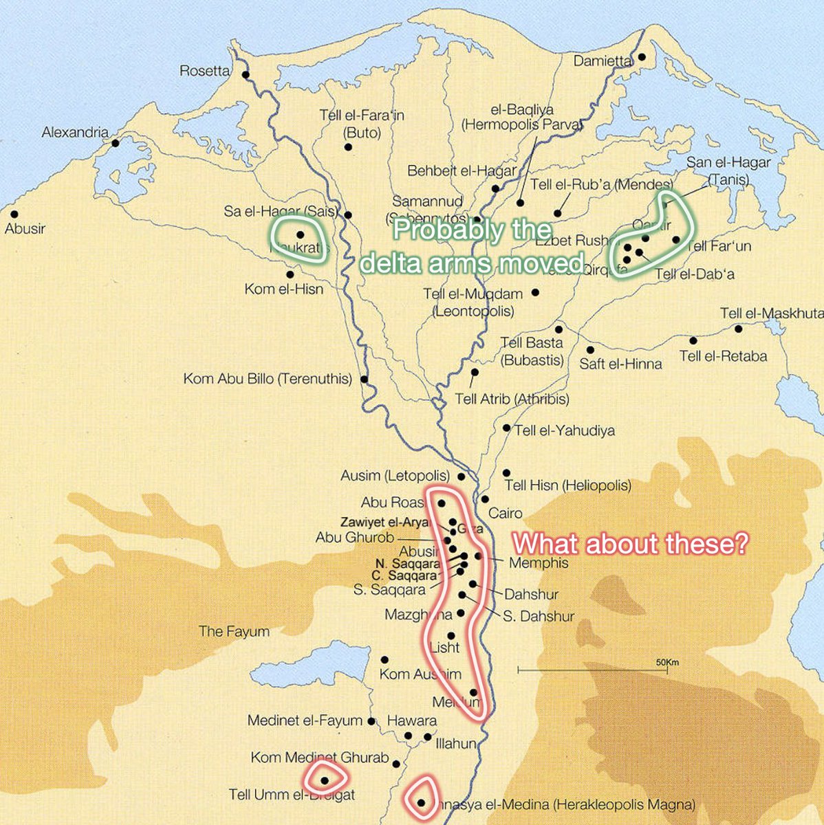
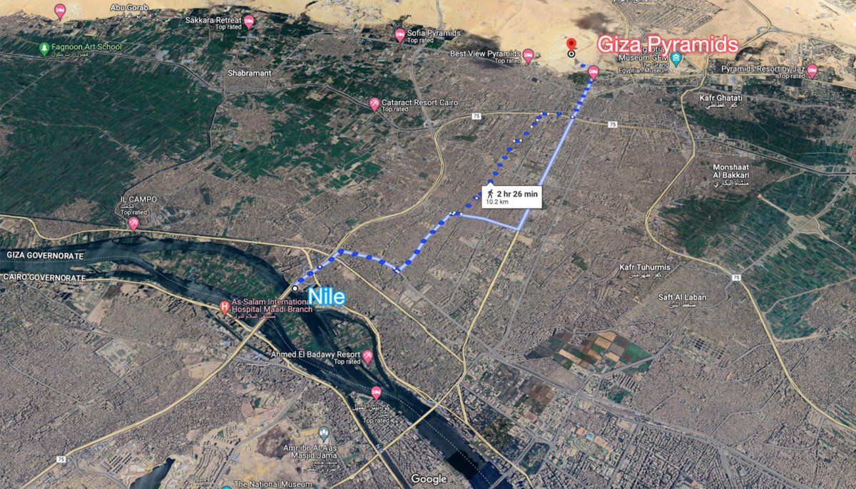
These are several km away from the Nile! Why so far? How could Egyptians carry stones all the way there?
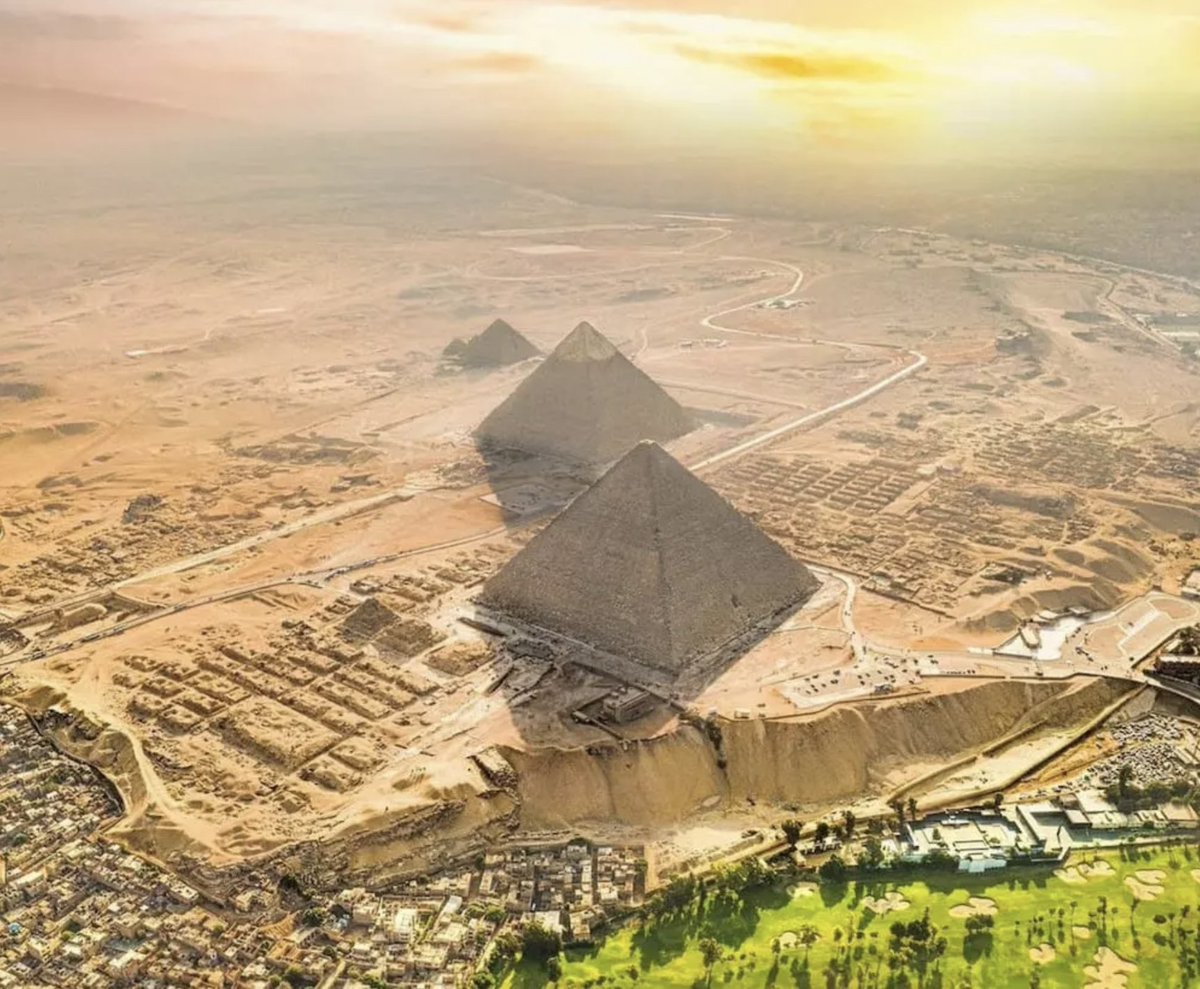
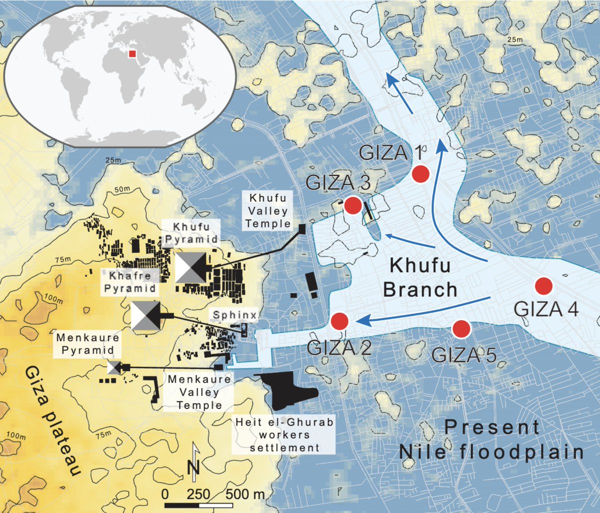
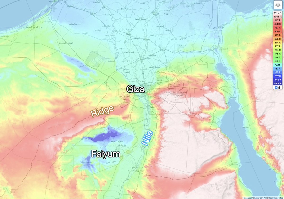
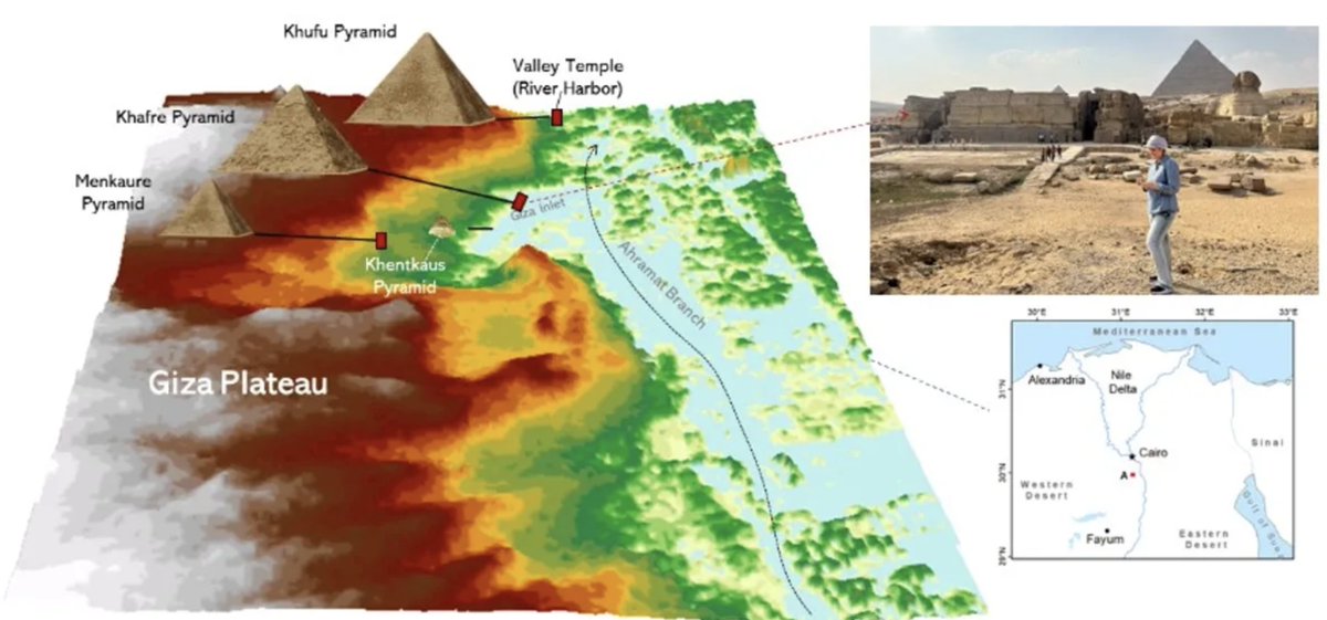
One tip comes from a topographic map (left) vs the map of the Giza pyramids (right). Notice how they're on a ridge, while the fertile floodplain is at their feet?
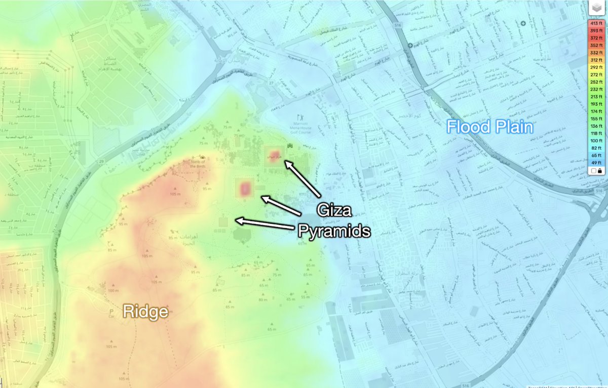
It turns out an arm of the Nile reached that area in the past! We know because scientists found ancient pollen in the area consistent with this type of environment
Could another arm of the Nile have reached the other pyramids? Maybe from the Faiyum area, a huge green area watered by the Nile?
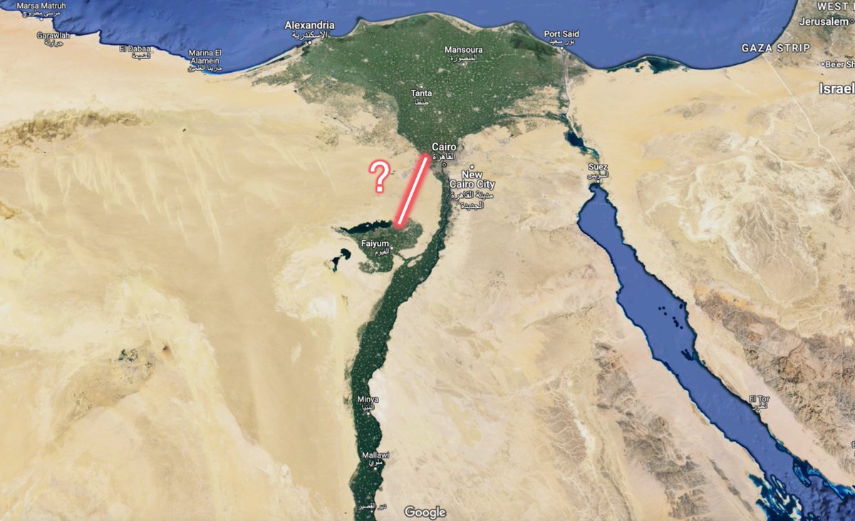
Impossible: the ridge on which the Giza pyramids stand is big!
Left: topographic map
Right: exaggerated relief map
Left: topographic map
Right: exaggerated relief map
Where are these pyramids exactly? If we trace a path between them, we see... a parallel path to the Nile today, east of that ridge!
Was there an arm of the Nile there in the past?
Was there an arm of the Nile there in the past?
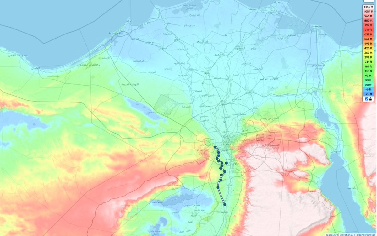
It appears so! A team of scientists shared at the end of 2023 the discovery of the "Ahramat Branch". They found it thanks to the latest radar technology
Egyptians would have enjoyed building pyramids on the banks of the calmer branch
So the pyramids followed rivers after all
Egyptians would have enjoyed building pyramids on the banks of the calmer branch
So the pyramids followed rivers after all
And why is Cairo where it is?
Here's a satellite picture of the delta of the Nile. Guess where Cairo is?
Here's a satellite picture of the delta of the Nile. Guess where Cairo is?
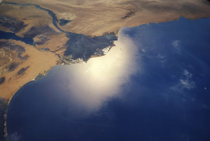
At the head of the delta!
It makes sense:
• The arms move all the time, but the head doesn't
• If you want to control both the upper Nile and the Delta, you better control that point
• It's the natural point of trade between the delta and the upper Nile
It makes sense:
• The arms move all the time, but the head doesn't
• If you want to control both the upper Nile and the Delta, you better control that point
• It's the natural point of trade between the delta and the upper Nile
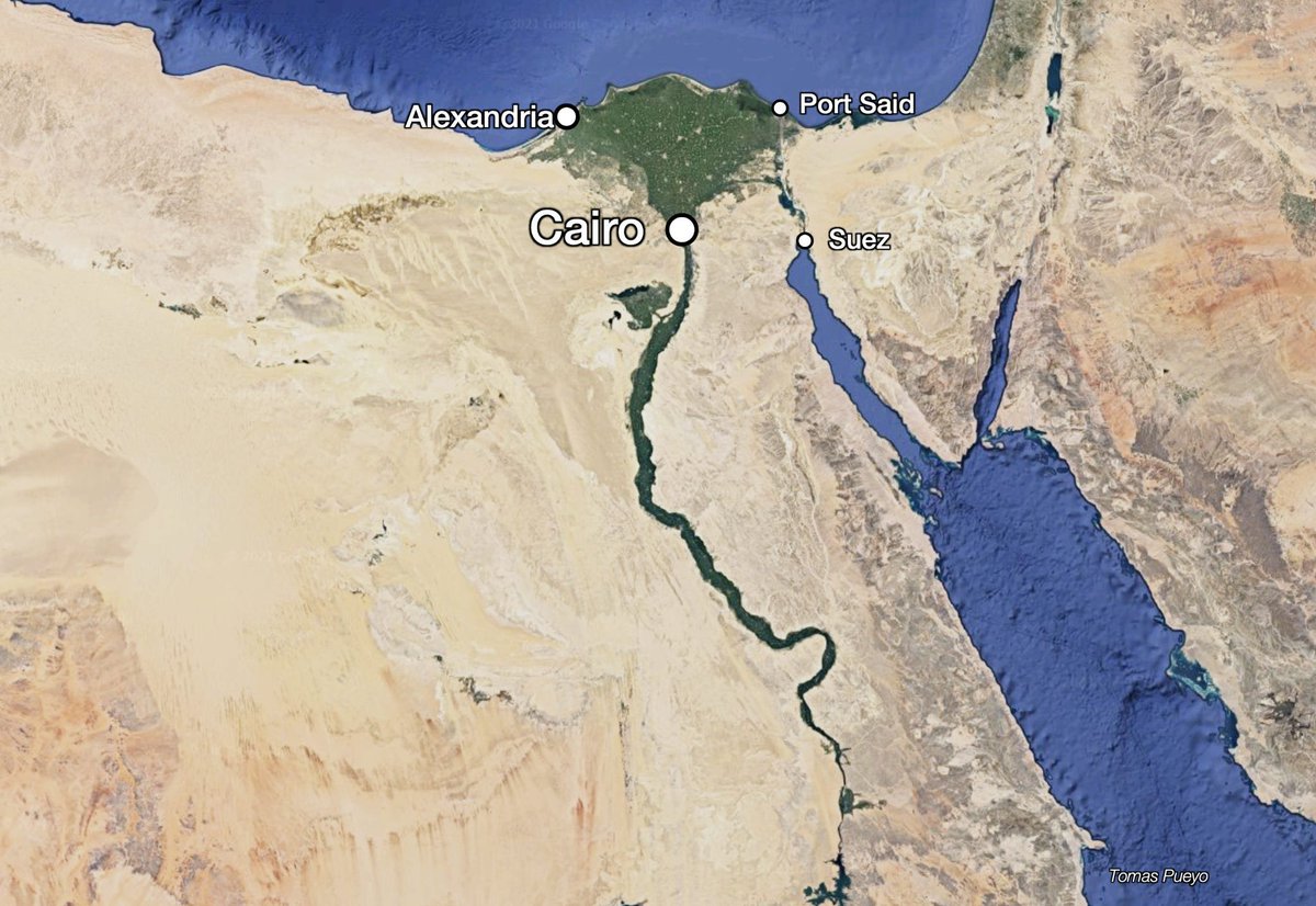
And you can see why the delta starts where it does: It's the topography! It's where the ridges left and right end. The Nile has been releasing sediments for millions of years into the delta, growing it little by little every year
And topography doesn't change. That's why the Giza pyramids and Cairo are at the same place today
This is also why Alexandria, the 2nd most important Egyptian city, is where it is, the westernmost part of the delta:
• It still gets freshwater from the Nile
• It's the only viable port in the delta, because east of it there's too much Nile sediment
• It still gets freshwater from the Nile
• It's the only viable port in the delta, because east of it there's too much Nile sediment

And so this is why the topography of Africa has created the Nile, Egypt, its 110M Egyptians, and placed Cairo, Alexandria, and its pyramids where they are
Here's a short video on Egypt (narrated)
Here's a short video on Egypt (narrated)
But why has that made Egypt an authoritarian regime today?
Why is it a US ally?
Why are Egypt's borders where they are?
Why is Egypt so old, yet only recently an independent country?
I answer these questions here:
Follow me for more! @tomaspueyounchartedterritories.tomaspueyo.com/p/egypt
Why is it a US ally?
Why are Egypt's borders where they are?
Why is Egypt so old, yet only recently an independent country?
I answer these questions here:
Follow me for more! @tomaspueyounchartedterritories.tomaspueyo.com/p/egypt
• • •
Missing some Tweet in this thread? You can try to
force a refresh