This video of the Rock of Gibraltar gives an intuition for why some areas of the world have deserts next to rainforests
What's happening here?
How can you use that to predict where there will be deserts or rainforests?🧵
What's happening here?
How can you use that to predict where there will be deserts or rainforests?🧵
Look at the map below: In some places, deserts and lush forests are side by side. Why?
The mountain chains between them
The mountain chains between them

The effect is called the Rain Shadow:
• Air comes wet from the sea
• As it hits mountains, it goes up
• Higher altitudes are cooler, so the air cools
• That condenses water (like the droplets on you Coke glass)
• Rain falls
• Air is dry past the mountains
• Air comes wet from the sea
• As it hits mountains, it goes up
• Higher altitudes are cooler, so the air cools
• That condenses water (like the droplets on you Coke glass)
• Rain falls
• Air is dry past the mountains

That's what's happening in Gibraltar: You can see the water condense as the air lifts up
If the mountains are tall enough, they can completely stop the water
If the mountains are tall enough, they can completely stop the water
With this, you can predict where there are a bunch of rainforests and deserts in the world:
1. In what direction do winds blow?
2. Where are there tall mountain ranges?
The 1st question is mainly determined by the rotation of the Earth:
1. In what direction do winds blow?
2. Where are there tall mountain ranges?
The 1st question is mainly determined by the rotation of the Earth:

This is why around tropical areas, east coasts tend to be wet while everything west of a high mountain range tends to be dry:
Brazil and northern Argentina are wet, but past the Andes it's drier—like the Atacama Desert
Eastern Australia is wet, western Australia is drier.
Brazil and northern Argentina are wet, but past the Andes it's drier—like the Atacama Desert
Eastern Australia is wet, western Australia is drier.


This effect is inverted if you go further north or south
This inversion is most striking around the Andes
This inversion is most striking around the Andes

But the rotation of the Earth is not the only driver of winds. Monsoons are driven by big masses of land dragging in moist air from warm oceans. This is true in Africa, where monsoons come to central Africa from the west and southern Africa from the east
This creates 2 African deserts:
The Nile—which gives life to ~200M ppl—forms in the Ethiopian Highlands, which take all water from monsoon winds, leaving Somalia as a desert
The reverse is true southwards: eastern South Africa and Mozambique are wet, while Namibia is dry
The Nile—which gives life to ~200M ppl—forms in the Ethiopian Highlands, which take all water from monsoon winds, leaving Somalia as a desert
The reverse is true southwards: eastern South Africa and Mozambique are wet, while Namibia is dry

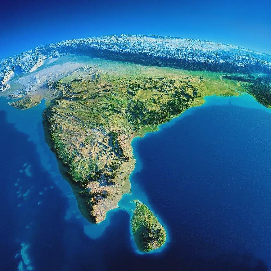
The same is true in Asia. This is why India is so much wetter than Tibet. This is a side view of the Himalayas and Tibet.
Left: India (south)
Right: Tibet (north)
Left: India (south)
Right: Tibet (north)

The same happens in in Northern Spain and Northwestern Africa: Prevalent winds come from the Atlantic, and both areas have mountains, catching the wind's moisture and creating vegetation
Past the mountains, it's dry or even desertic
Past the mountains, it's dry or even desertic

Look at these 2 pictures. They're taken 5km away, before and after a tunnel in northern Spain


Similar effects can be seen in other areas of the world, where mountain ranges split deserts from rainforests. Here, in the Middle East, you have 3 such areas

This is how you get amazing pictures like those of Tehran, the capital of Iran, which is at the edge of a desert but towered by snowy mountains
If you thought Iran was just desert, I present you the Hyrcanian Rainforest
If you thought Iran was just desert, I present you the Hyrcanian Rainforest


This is also true in Saudi Arabia and Yemen. Why do you think people live mostly on the west and eastern borders (where Mecca and Medina are)? They get the little water carried by the wind from the Red Sea
Left: Arabian Peninsula
Right: Population density
Left: Arabian Peninsula
Right: Population density


This topographic map shows the mountains that cause all these rain shadows in Spain, northwestern Africa, Turkey, Iran, the Levant, and Saudi Arabia

So that's the rain shadow effect
I'm soon going to cover a very related (and hot) topic: Why are warmer countries poorer?
Follow me to see it, or better yet, subscribe to my free newsletter
unchartedterritories.tomaspueyo.com/subscribe
I'm soon going to cover a very related (and hot) topic: Why are warmer countries poorer?
Follow me to see it, or better yet, subscribe to my free newsletter
unchartedterritories.tomaspueyo.com/subscribe
Sorry I meant west and southern borders
Somebody has mentioned the Foehn Wind, which is the dry wind that blows past the mountains. In the Bay Area it's part of @KarlTheFog
In the rest of the world, I think we call it rolling fog
In the rest of the world, I think we call it rolling fog
What are other examples where this happens? Share pictures and maps!
Original Gibraltar video from @MetOGibraltar !
• • •
Missing some Tweet in this thread? You can try to
force a refresh