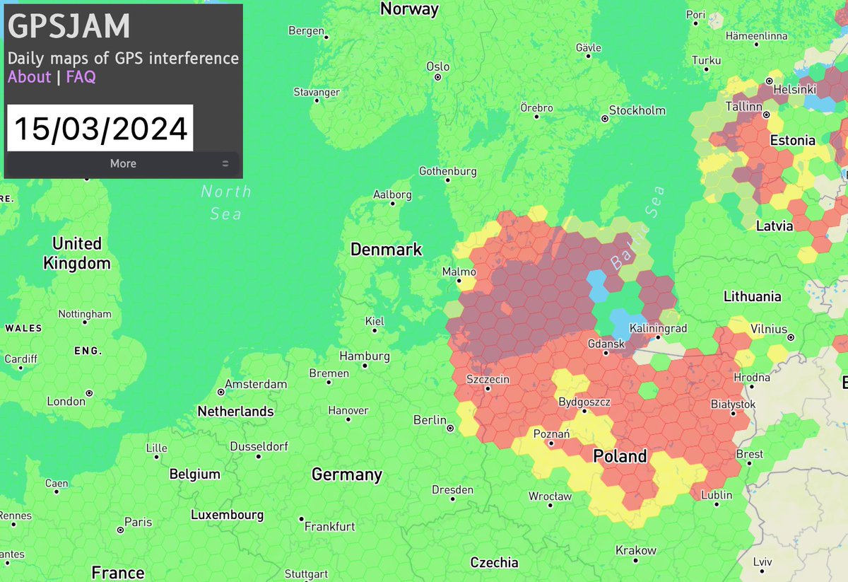
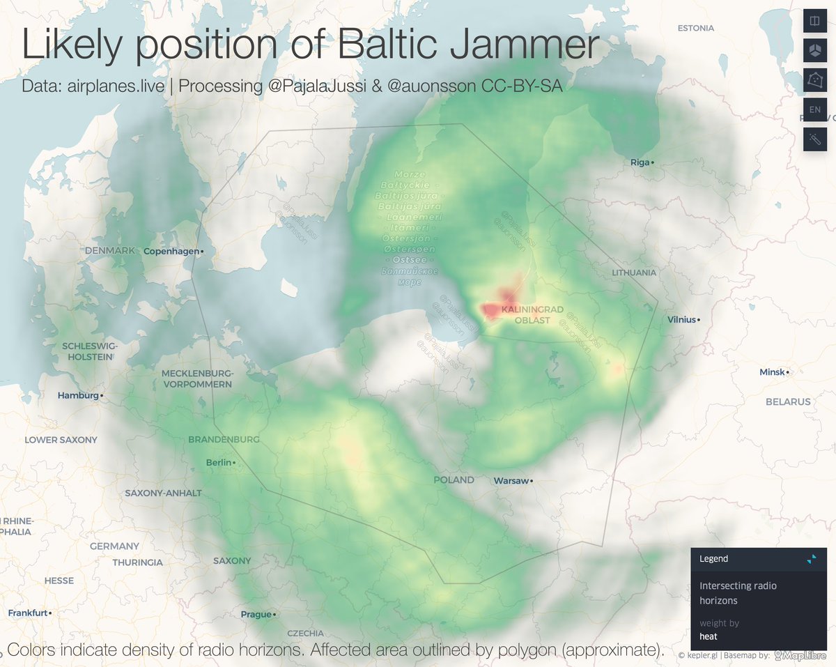
The Baltic Jammer is in Kaliningrad.
5th proof, 3rd method.
This time with numbers on likelyhood. We just need a statistician to tell us how sure we are. Surely over 9000.
@PajalaJussi computed how many radio horizons of first jammed plane intersect. Here, heatmapped.
5th proof, 3rd method.
This time with numbers on likelyhood. We just need a statistician to tell us how sure we are. Surely over 9000.
@PajalaJussi computed how many radio horizons of first jammed plane intersect. Here, heatmapped.
The Baltic Jammer is in Kaliningrad. 5th proof, 3rd method.
This time with numbers on likelyhood. We just need a statistician to tell us how sure we are.
@PajalaJussi computed how many radio horizons of first jammed plane intersect. Here, all 10x10km cells.
This time with numbers on likelyhood. We just need a statistician to tell us how sure we are.
@PajalaJussi computed how many radio horizons of first jammed plane intersect. Here, all 10x10km cells.

This part of the map is obviously the most interesting one. The KALININGRAD part.
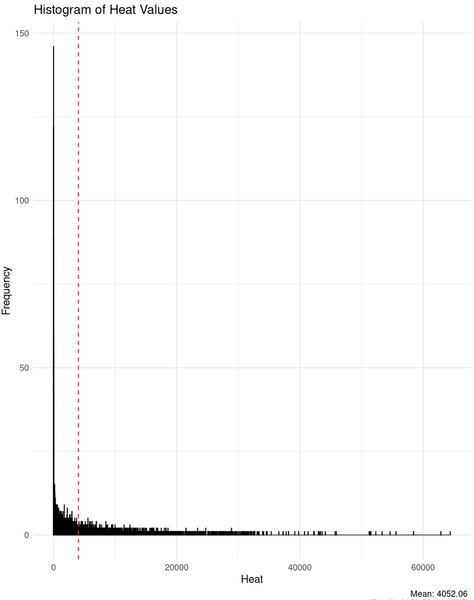
Top cells in KGD have +60k circles intersecting, mean is around 4k.
All the top cells (ie most likely ones) are concentrated around the central cape of KGD, where also the highest peaks are.
Top cells in KGD have +60k circles intersecting, mean is around 4k.
All the top cells (ie most likely ones) are concentrated around the central cape of KGD, where also the highest peaks are.

Method is best described in code:
In short this method checks for all 25-165° intersections of radio horizon circles and counts how many there are in each 10x10km cell.
It uses my previous set of only first jammed positions from Feb & Mar 2024. N=11496github.com/jpajala/GpsJam…
In short this method checks for all 25-165° intersections of radio horizon circles and counts how many there are in each 10x10km cell.
It uses my previous set of only first jammed positions from Feb & Mar 2024. N=11496github.com/jpajala/GpsJam…
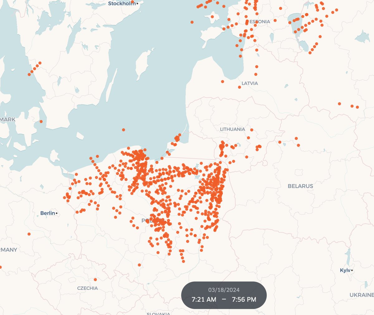
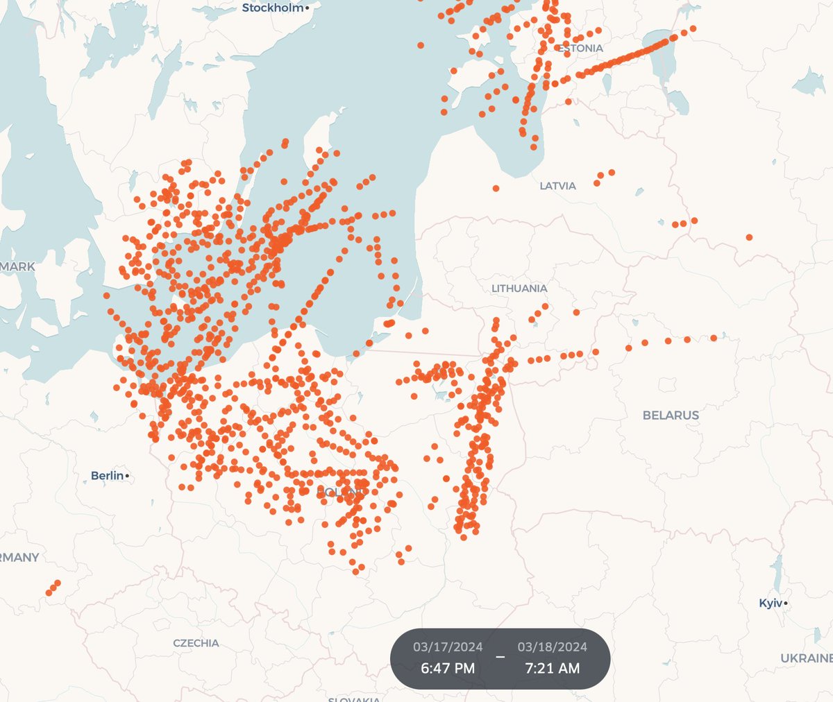
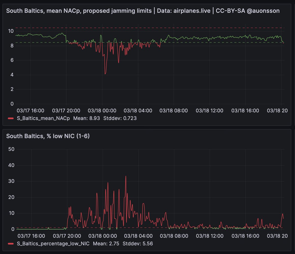
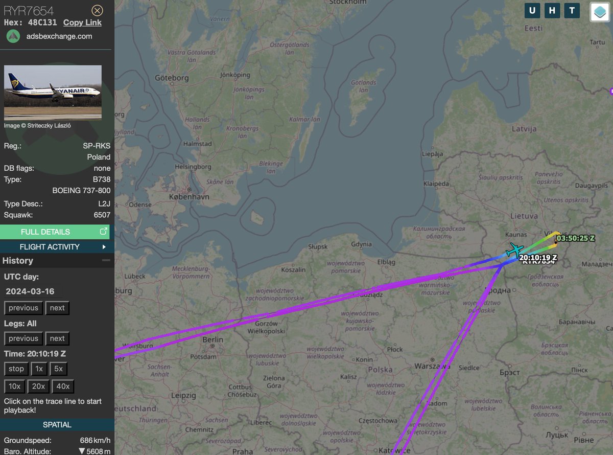
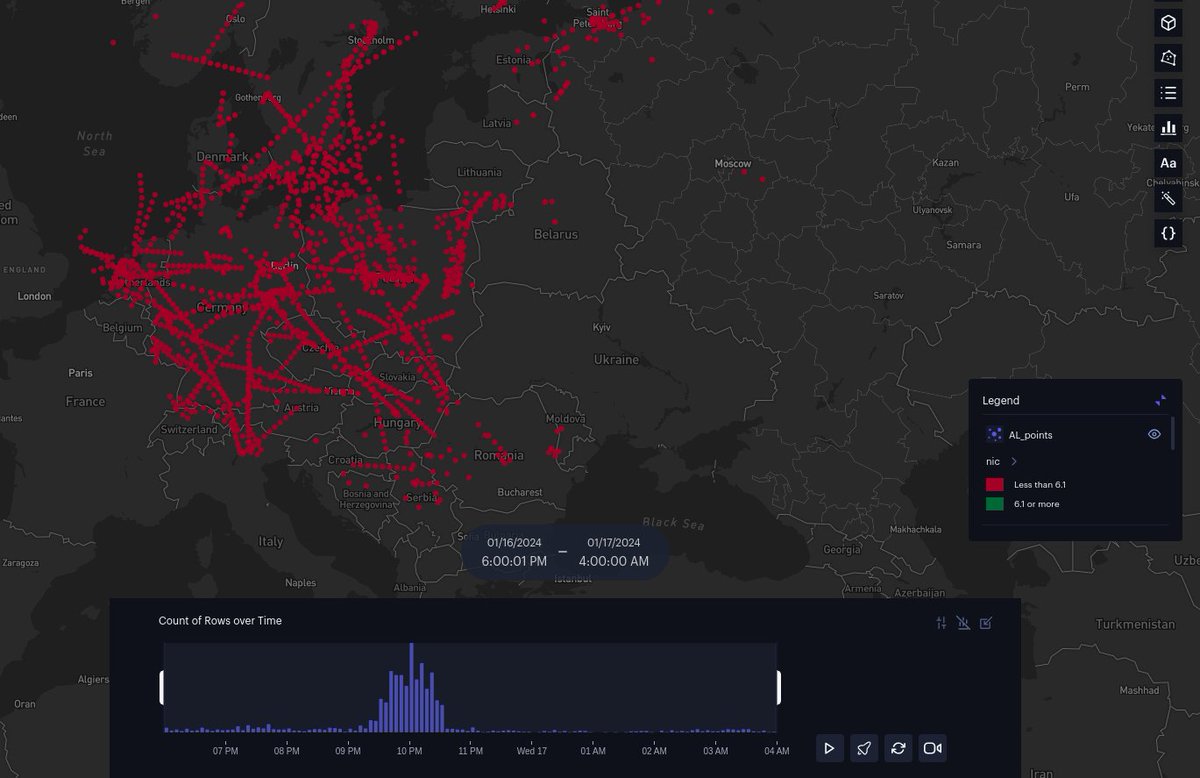
For selection of points see this and the following posts:
https://x.com/auonsson/status/1774173733634166997
This is the distribution of numbers of circles intersecting in each cell. Very left-heavy.
Input on feasible stat-testing welcome.
Input on feasible stat-testing welcome.
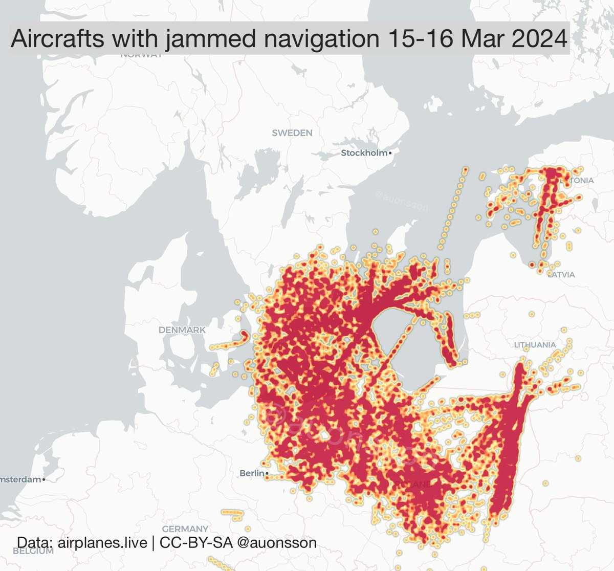
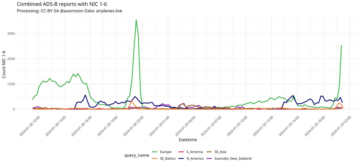
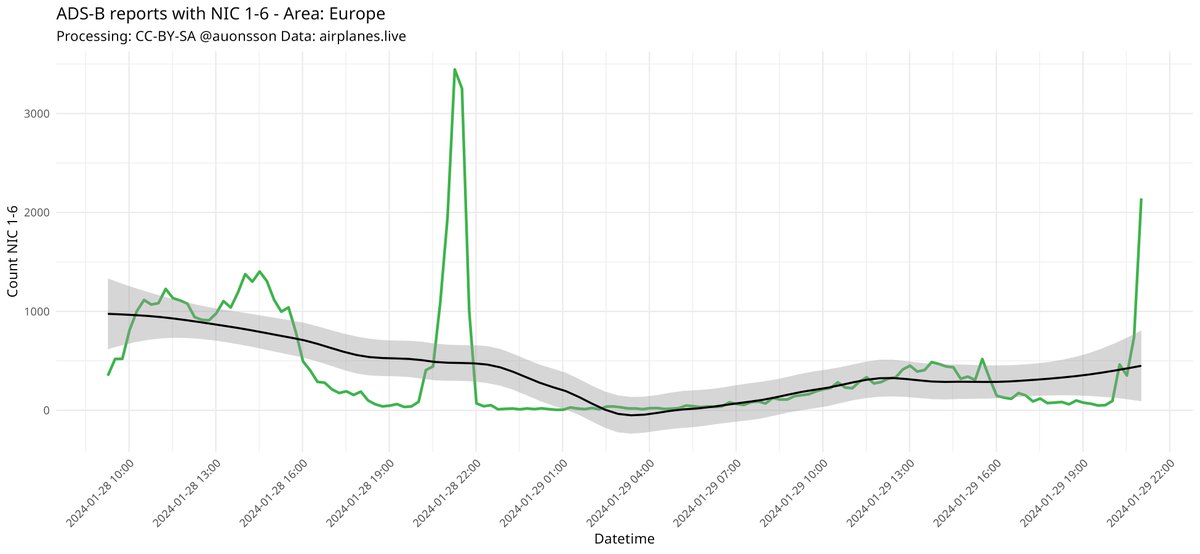
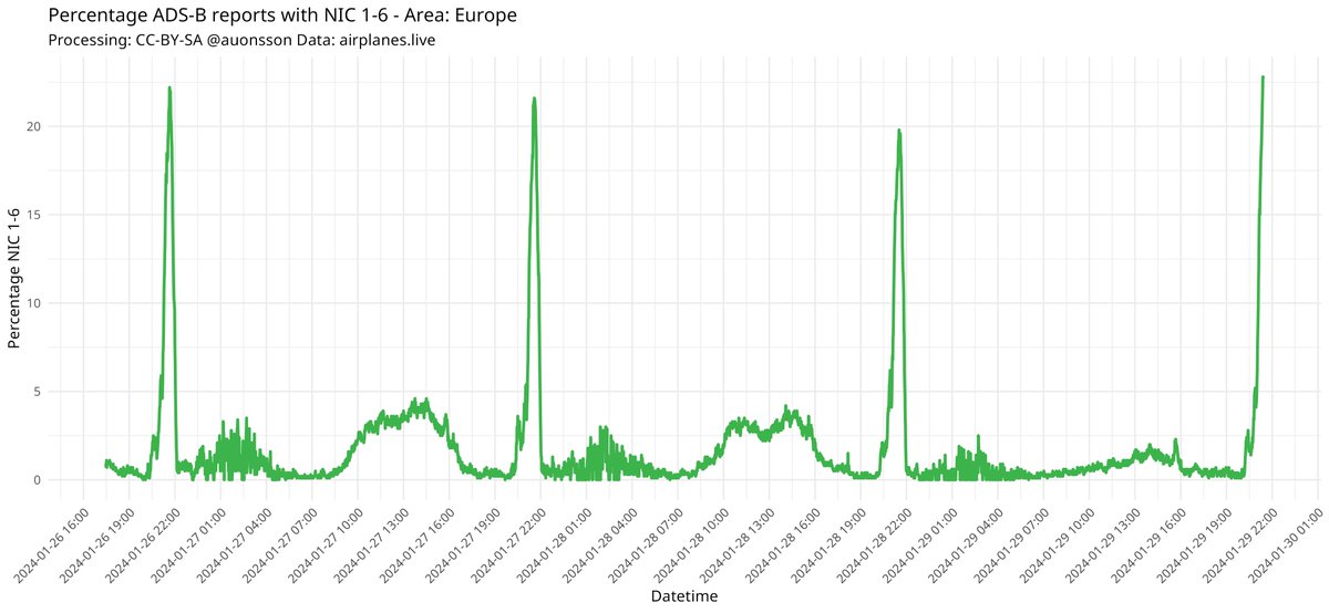
Fortunately, the Baltic Jammer has quited down drastically now.
Last 7 days have only seen activity very limited but in coverage and in length of time.
A few beams against Gdansk airport, but that seems to be it. Still too few observations to say anything certain.
Last 7 days have only seen activity very limited but in coverage and in length of time.
A few beams against Gdansk airport, but that seems to be it. Still too few observations to say anything certain.

More persons are recording it now. A few people are working on other localization project. More to come unless Russian EW forces shut it down fully.
Many thanks to @lemonodor @rundradion @giammaiot2 @VelvetBlade @Dmojavensis @EyeofStolas for input.
Many thanks to @lemonodor @rundradion @giammaiot2 @VelvetBlade @Dmojavensis @EyeofStolas for input.
And for data!airplanes.live
Previous analyses here:
https://x.com/auonsson/status/1775216532030713871
• • •
Missing some Tweet in this thread? You can try to
force a refresh