 Details from Swedish politician: a Greenpeace protest was under way, Russian corvette closed in at high speed, initially not replying to radio from German Coast Guard. German CG then escorted activists/politicians/media away.
 Method is best described by @SeanGorman in this article, my inspiration.
 Last months have seen some drones stray into eg Finland, Estonia and latest Latvia.
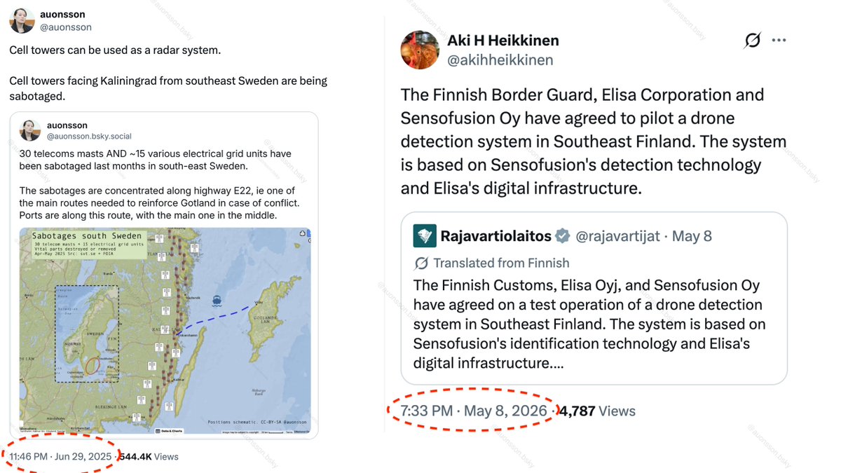
 GRIF claims to be flagged in Madagascar. Madagascar on the other hand denies having a international ship registry =)
 * It is unusual to not see daily sanctioned tanker arrive to Baltic Sea, usually a few each day.
 I might not have been that wrong.
  @butafly Coast Guard patrol is about to dock in Höganäs, port a few kms south.
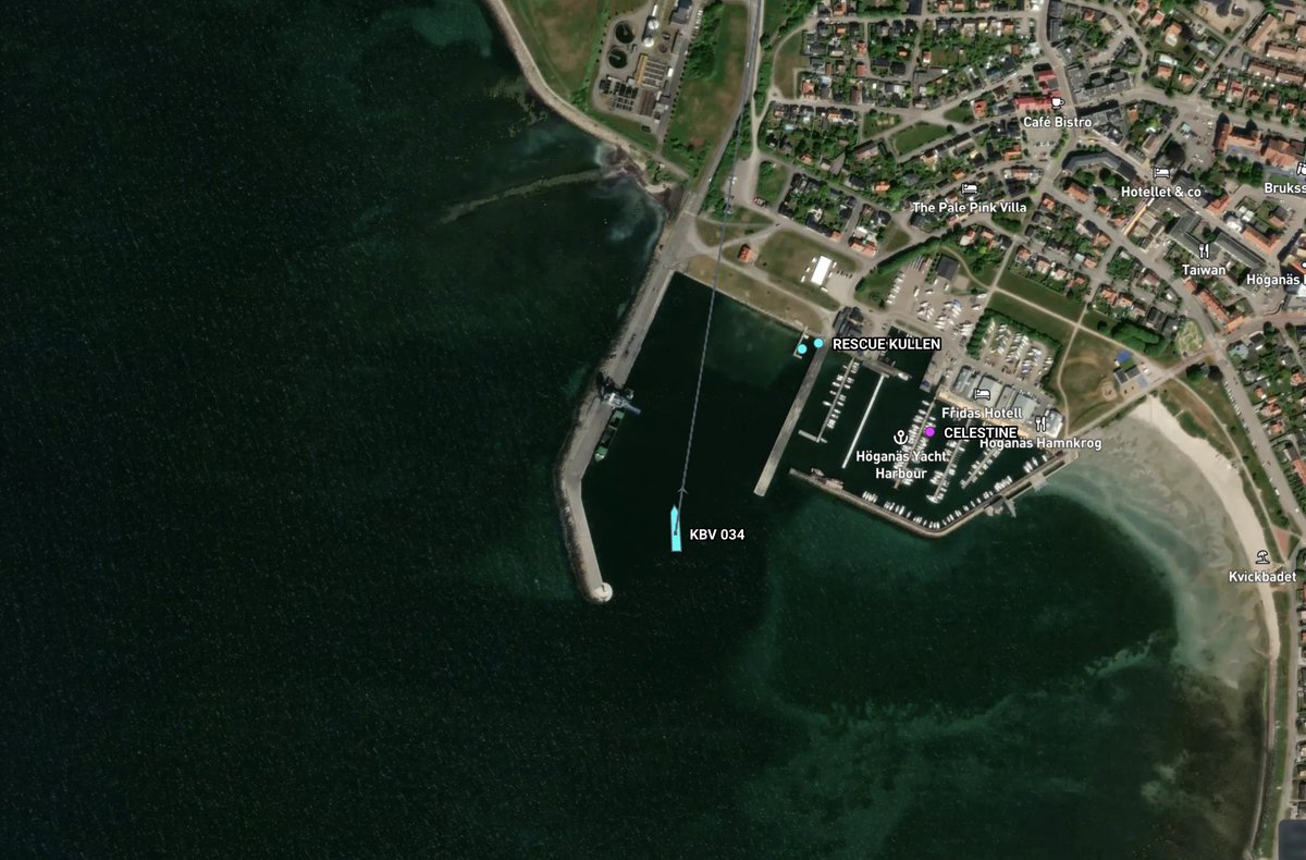
 Article that led me down this rabbit hole, by @pmolpmol nyheder.tv2.dk/live/krimi/202…
 Plane diverting last minute.


 Calm weather is substantiated by an anonymous maritime professional witness to YLE.


 DK Navy observed. Thanks anon follower.
