🧵A very brief OSINT methods thread to share how I found the location of a Burmese junta camp that was captured by the resistance today, it's a method I've used a lot for more obscure unnamed places that would be nearly impossible to find otherwise.
Today news came out from a reputable local media source of a junta camp that was captured in Southern Myanmar, normally news in Burma is reported with the name of a nearby village or at least the township. But not here, only that it was in the KNLA's 4th Brigade 11th Battalion.
The KNLA's 4th Brigade operates in Tanintharyi Region, and google searching for info about the 11th battalion shows it is mainly active in Bokpyin township
But of course, finding one tower with a loose lead of maybe a township is going to be tricky.bnionline.net/en/news/killin…
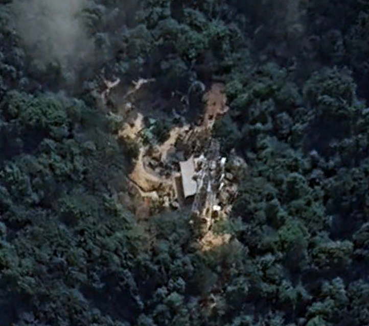
After finding the facebook page of one of the resistance units involved in the attack, you can see that they put out a battle report of the attack (which is standard), where the base is named the Hill 1020 Outpost. This is where a little trick comes in very handy.
Often, when there is a battle or an outpost in an otherwise unnamed and unnotable area, it is often named after the spot height listed on the hill on old topographic maps. This has been the case in most wars since the Korean War, including in Burma.
In Myanmar it can be tricky, because depending on the topographic map it can either be in meters or feet. I generally assume meters. And for this purpose I have written a Google Earth Engine script where you can specify the target spot height and see that 'contour' band mapped.
(for anyone who wants to copy my work, here is a link to the code, but you need to activate Earth Engine on your Google Account first
To interpret these maps, you want to ignore the donut bands (since spot heights are generally put at the tops of peaks) and instead focus on where the terrain only just pokes into the specified height and looks like a small dot - some indicated with blue arrow here.
In this case, after loading the code in, an elevation of 1020m seems too high for the Bokpyin area, though I did first check a few of the most obvious looking peaks in that elevation range in the wider region since I wasnt sure of the township. To no luck.
So, I guess the height is in feet. Load in the feet values instead and there are quiet a few interesting places to check. Following the level of infrastructure in the drone picture, i assumed it was near the main highway through the township and started looking around there.
By the way, if you want to follow this method without using Earth Engine code, you can draw a polygon in Google Earth and set the elevation as absolute. That does a similar thing, but due to the curvature of the earth is only suitable for relatively small areas - so narrow down.
Anyway, with feet in mind, i started looking at hills of the right height overlooking or nearby the highway in Bokpyin township - and the 2nd or 3rd I checked had a similar looking tower. But since it's probably a pretty standard design, I wanted to make sure.
Using @planet's NICFI progam (), i have another GEE code that loads in composite planet imagery over time-periods. Comparing this hill from the pre-coup and recent imagery shows that there has been significant clearing consistent with the drone imagery. planet.com/nicfi/
@planet And luckily, for absolute confirmation - beyond what you can often get - Google Earth has recently updated their imagery from that area for the first time since the coup, showing how the hill look in March 2024, and confirming it is exactly the same hill that was captured.
• • •
Missing some Tweet in this thread? You can try to
force a refresh
🧵Geolocations of ALL sites that the Indian Army has claimed to have hit in Pakistan and Kashmir. 1. Masjid Syedna Bilal/Hazrat Bilal
34.385846°N 73.456974°E
It appears to have been a direct hit, according to after-strike ground photos. google.com/maps/place/34%…
2. Reported training camp in Gulpur, Kotli
33.402328°N 73.876957°E
No post-strike imagery yet. google.com/maps/place/33%…
3. Masjid Ahl-e-Hadis in Barnala, Bhimber.
32.867802°N 74.256469°E
Quadcopter-dropped munition appear to miss the target building and strike a courtyard around 50m away. google.com/maps/place/32%…
There's a horrendous amount of violence happening over the past few days in Syria, and a tremendous amount of uncertainty in numbers, details & actors. Yet it's astounding just how few people (including mainstream journalists) are engaging with these incidents in any good faith.
So many people are visibly giddy at the idea that the new Syrian government is committing atrocities. And as a result, absolutely misrepresenting the violence that is occurring. It's pulling in the pro-SDF crowd (biji!biji!) the Assadist crowd (counter-revolution!), the pro-Israel crowd (only the IDF can protect minorities!), the idiot Westerners (Assad was the thin blue line!) and even mainstream journalism (finally some spice to report).
And as a result, its the most counter-productive information environment I've seen around Syria since the chemical attack information ops.
It's imperative we find the details of these atrocities, who is involved and hold them accountable. It's crucial this is prevented from becoming a wider sectarian conflict.
And it's wild that most reporting and commentary is acting as a barrier to this, not a help.
🧵Look towards the light.
As Rebel forces in Syria advanced across Syria & never stopped a key question was why the Regime evaporated. Syria by night provides some clues on how the Regime's social contract collapsed.
Read my analysis here
& read onaspistrategist.org.au/just-look-at-t…
There are three pillars to why the Regime collapsed so suddenly and drastically: 1. Complete lack of foreign firepower and air support 2. Increased professionalism and good governance in Opposition territory 3. Economic stagnation and the collapse of Assad's social contract.
I'm sure lots will be written on that first pillar, @azelin recently wrote a detailed and helpful article on the 2nd (warontherocks.com/2024/12/the-pa…), and @E_of_Justice's thread here is helpful too x.com/E_of_Justice/s…
I think the rest of the world just has to realise the US we thought we all knew probably just doesn't exist and hasn't for a while. We need to shift our assumptions and look at the US in the same way we look at India.
Harris didn't lose this race, and post mortems are useless. America made an informed and considered choice and picked the man they did. There's probably not much a reasonable democratic campaign could've done to change that. America saw Trump. And they liked him.
This also isn't a slight on India, it's a remarkable (and deeply flawed) country that we work with productively and well, it's just an entirely different ballgame (and sense of exceptionalism), and honestly the lens we will need to look at the States through imo.
🧵On May 17, fire swept through Rohingya neighbourhoods in Buthidaung.
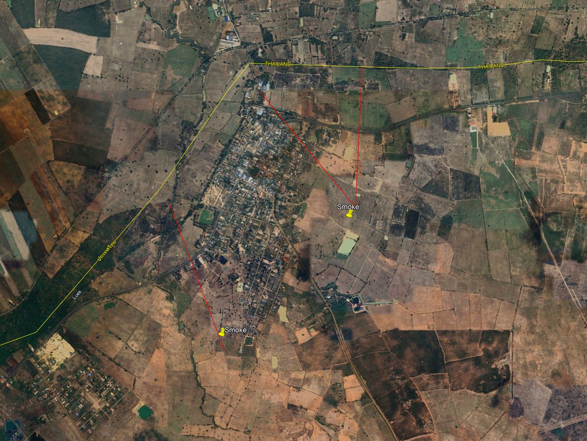
Satellites show what burnt and when, and my new investigation reveals an arson campaign against 50-60 villages & demonstates who carried it out.
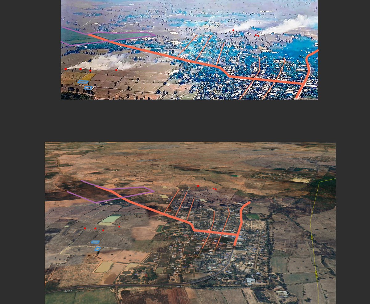
Through April and May, arson attacks burnt around 900 acres and over 10,000 homes across Buthidaung township in the most concerning and dangerous bout of sectarian and communal violence since the 2017 pogrom that expelled Rohingyas from much of northern Arakan state.
As flames rose above Buthidaung town on the night of May 17th, the activist community and eyewitnesses pointed the finger at the Arakan Army, an ultra-nationalist Ethnic Resistance Organisation rapidly capturing that part of Burma. Something the AA viciously denied.
I've started reading Our Enemies Will Vanish, a masterful book on the Ukraine War by @yarotrof. Highly recommend it. It contains heaps of tidbits and insights that even someone who followed the invasion closely (i'll count myself) had no idea of.
I'll share some threaded here.
@yarotrof (get your hands on the book if you possible can, the tidbits here are just the tip of the iceberg, truly recommend reading the whole thing).
Firstly, this account of a meeting between Bill Burns and Putin months before the invasion where Putin cited US' impotence post Afghanistan
@yarotrof And that Ukraine's military preparations on the heel of US intel warnings were so secret that even Washington had no idea about them (to prevent info going from GUR > DC > Kyiv > Russian Fifth Column)