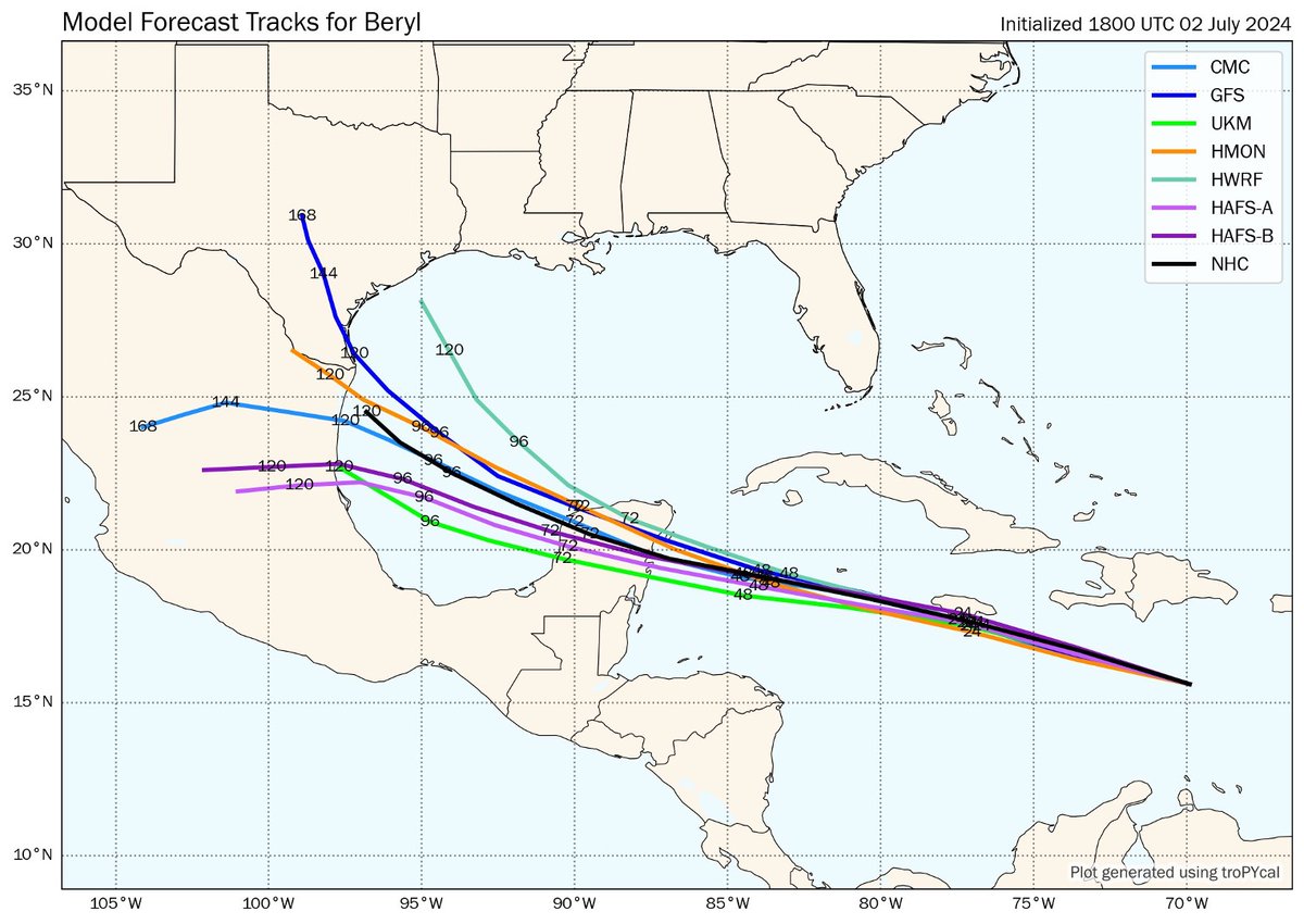
Here's a look at the multi-model ensemble forecast track for Beryl over the last 12 days.
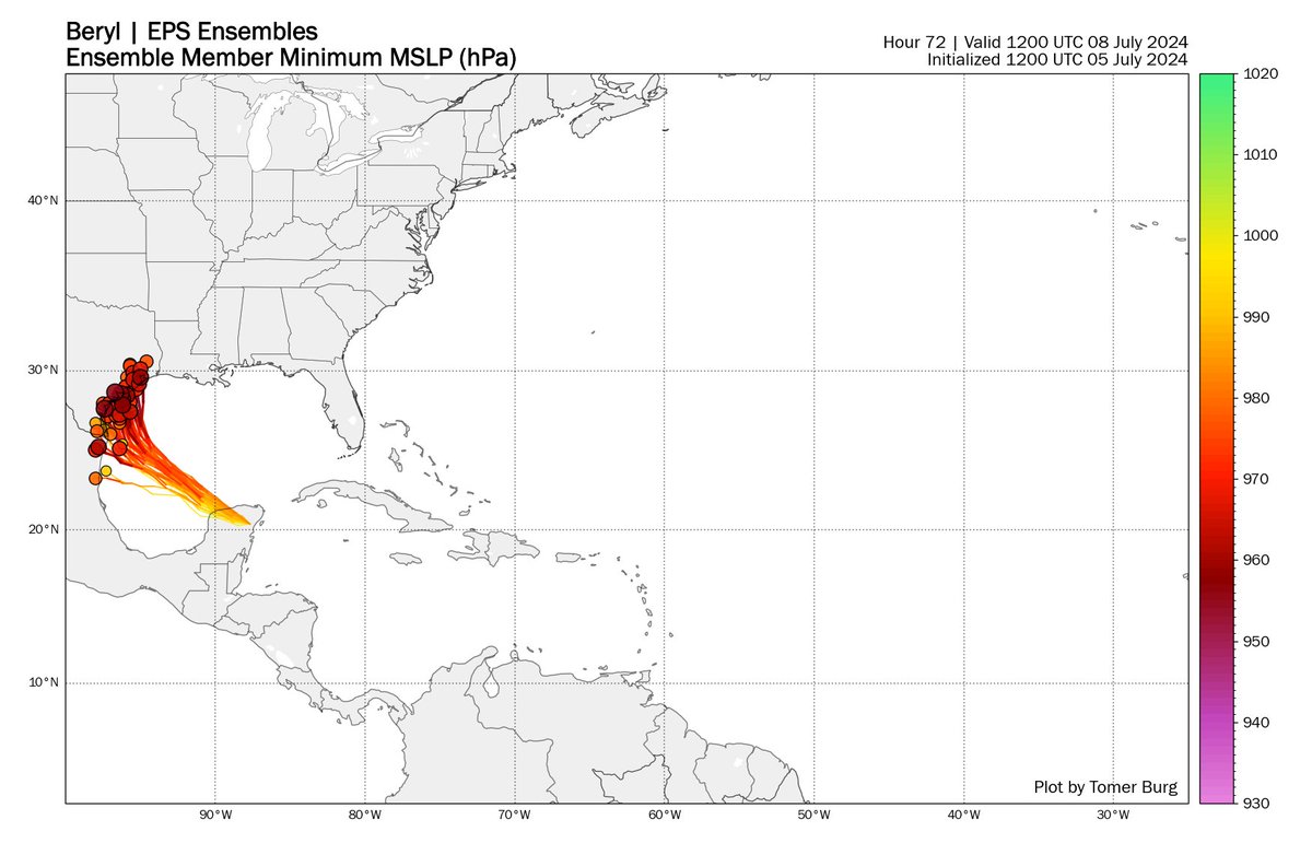
There was a clear picture of a long-track Caribbean storm, but with larger errors for its ultimate Gulf landfall location - ensemble tracks ranged from the Bay of Campeche to New Orleans.
Coarse global ensembles were consistently too weak & too far south with Beryl once it passed west of Jamaica, accordingly depicting its Gulf landfall too far south.
Short-term observations vs. forecasts made it easier to rule out the outliers:
Intensity errors were quite large in the Gulf - Beryl was disrupted by dry air more than most models anticipated, and accordingly many ensembles & hurricane models incorrectly showed a major hurricane landfall.
Some others, like the GFS/HAFS, were far too weak in the Gulf.
The ICON particularly received attention for being consistently east of & stronger than most models, which were too weak & too far south.
The ICON, however, was still too strong & too slow/far east vs. verification:
Some models can also be right for the wrong reason.
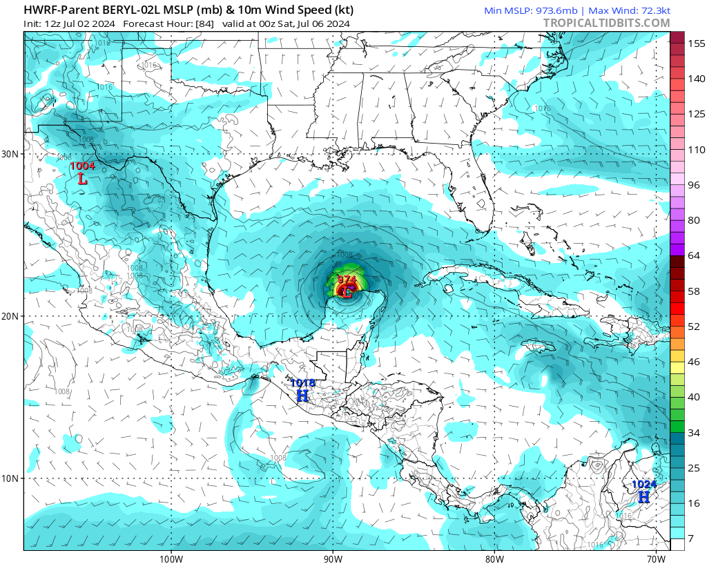
The 7/2 12z cycle of the HWRF did much better than other hurricane/global models with Beryl's track and right turn... but had Beryl emerging into the Gulf intact with 974 hPa min MSLP. Verification was 998 hPa.
• • •
Missing some Tweet in this thread? You can try to
force a refresh
It's no exaggeration to say today brought a truly historical weather event to the Gulf Coast - lots of places all the way down to the water got over 6-8 inches of snow, shattering records going as far back as 1895 in some places.
Let's review what caused this historic event 🧵
Snowstorms are rare in the Deep South, but they have happened on rare occasions, such as December 1989 & February 1973.
To get a major snowstorm that far south, you need the perfect combination of lots of cold air making it far south & upper-level forcing to get a storm to form.
Most rare southern snowstorms have had 2 common ingredients, which I show here in this very simplified schematic
1. sequential upstream ridging to dislodge cold air deep into the US
2. well-timed shortwave trough to force precip where it's cold enough for snow
Many of you have likely seen maps like this floating around over the last 2 days, showing a major blizzard affecting the Mid Atlantic & Northeast.
But why do some models show a major blizzard, while others show practically nothing? Let's take a deeper look:
First, consider how we're only ~5 days out from the possible storm, and there's still lots of uncertainty.
5 days out from today's storm, we already knew a major snowstorm would happen.
Some situations are inherently more predictable than others - it varies by each case.
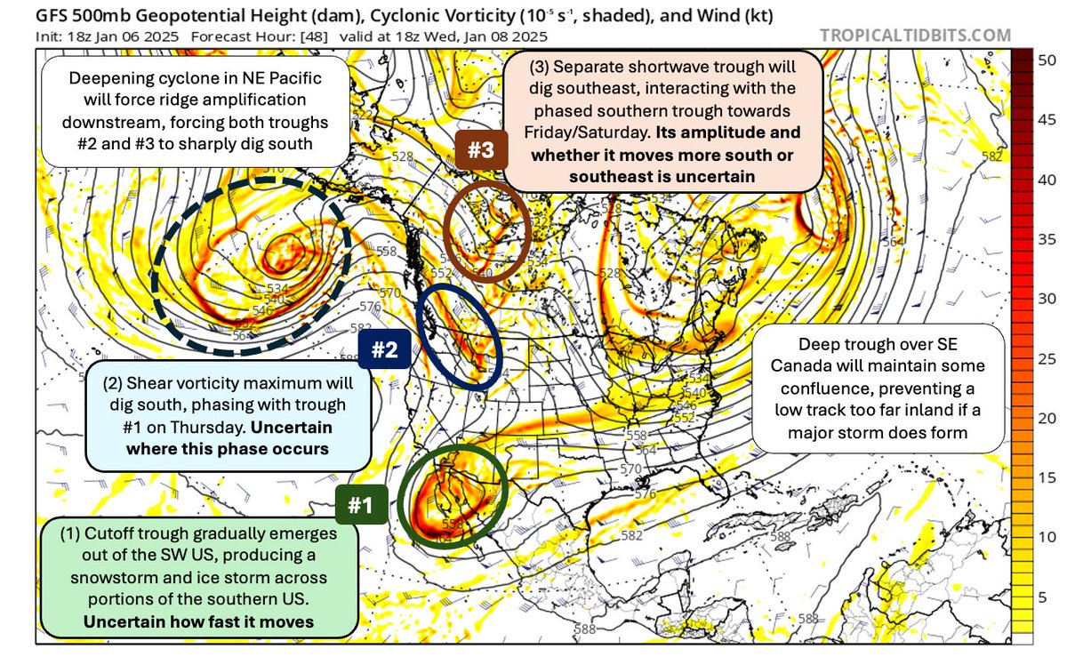
This forecast is made exceptionally difficult by the complex interaction of multiple moving parts - all of these have to align at the right place at the right time for a major snowstorm to happen, which is *very* sensitive to each's exact movement and interaction with the others.
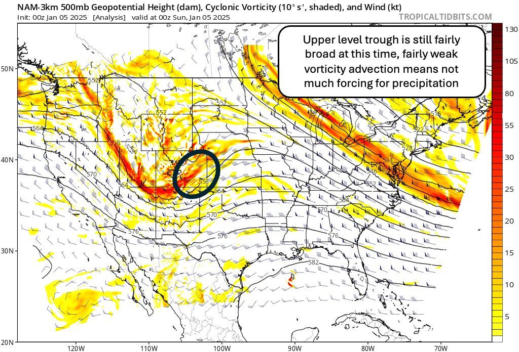
Quick meteorology lesson - if you're not a meteorologist or experienced with weather, it might seem odd how a big storm "seemingly came out of nowhere" - but this isn't what's happening at all.
The atmosphere is a 3-dimensional field - there's a lot more than just radar!
[Thread] Latest models have abandoned a major Mid Atlantic snowstorm for next weekend, and it's easy to see why:
1. Insufficient ridge amplification upstream of 12/20 shortwave to force it farther south and neutral/negatively tilted early enough for cyclogenesis near the coast
2. Antecedent 12/19 trough is too progressive/weak to serve as an effective transient 50/50 low with strong downstream confluence over New England
3. By the time the Pacific trough forces more significant ridge amplification over the Rockies, the ridge axis is too far east
However, none of this means *no* snow is expected in the region.
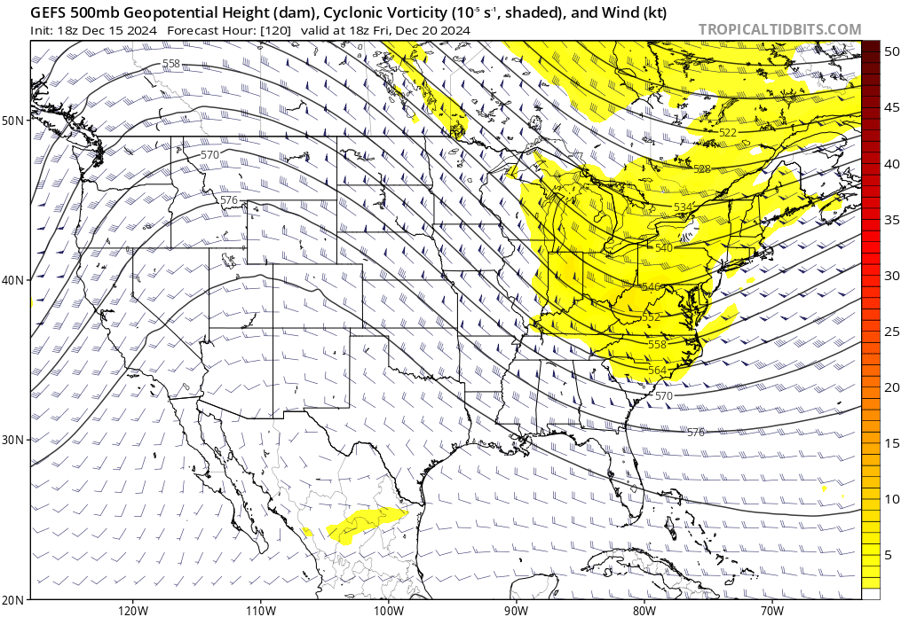
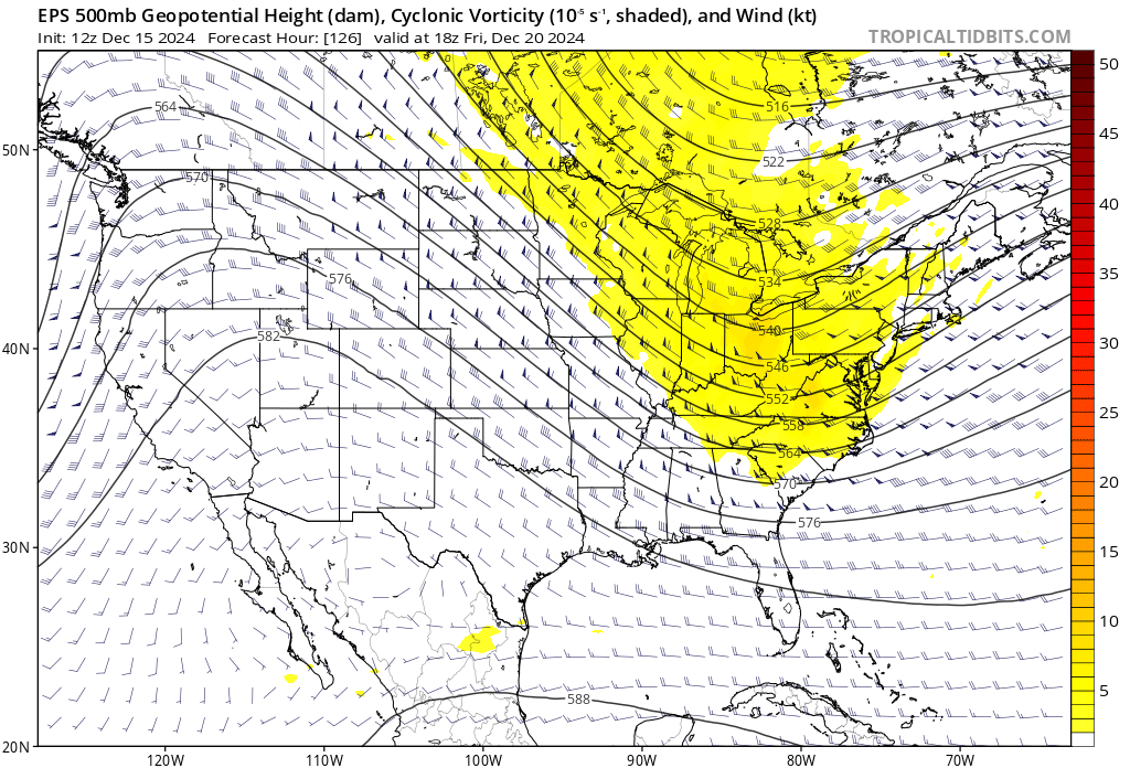
There is ensemble support for a NW flow shortwave trough on 12/20, but with uncertainty wrt its amplitude, orientation, and the magnitude of downstream confluence, as the GEFS & EPS ensemble means below show.
[Thread] Weather forecasting isn’t perfect — as is anything that involves predicting the future — but it’s truly under-appreciated just *how* much it’s improved.
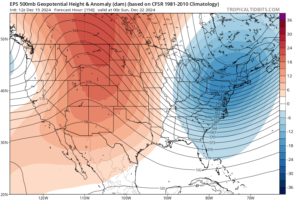
Over a week (!!) ago, weather models correctly identified the trough & ridge placement over North America:
Some details in the weather forecast are naturally harder to predict farther out than others, but it doesn’t mean we don’t have skill.
We can’t say for sure if the high temperature a week from now will be 49 or 50, but we do know it will substantially cool down in the East US.
Think of weather forecasting as approaching an object with bad vision and no glasses.
When you’re far away, you can tell there’s an object, but it’s real blurry — you have several guesses but don’t know if it’s a chair, couch, sofa, etc.
[Thread] While it's too far away for specific details, confidence is increasing in another tropical cyclone forming in the western Caribbean, and the Greater Antilles & Southeast US should monitor this potential.
I annotated the big picture key players in this map:
There is still the possibility a storm doesn't develop. But if one does, as is increasingly likely, how quickly it develops & where it forms will influence whether it quickly gets picked up by a trough and steered into the ocean, or keeps brewing in the western Caribbean:
Assuming the storm misses the trough to its northeast, a transient ridge is expected to build to its north, steering it northwest for a period of time.
While it's too far out to know its exact intensity, the environment in the Caribbean may be favorable for a hurricane.