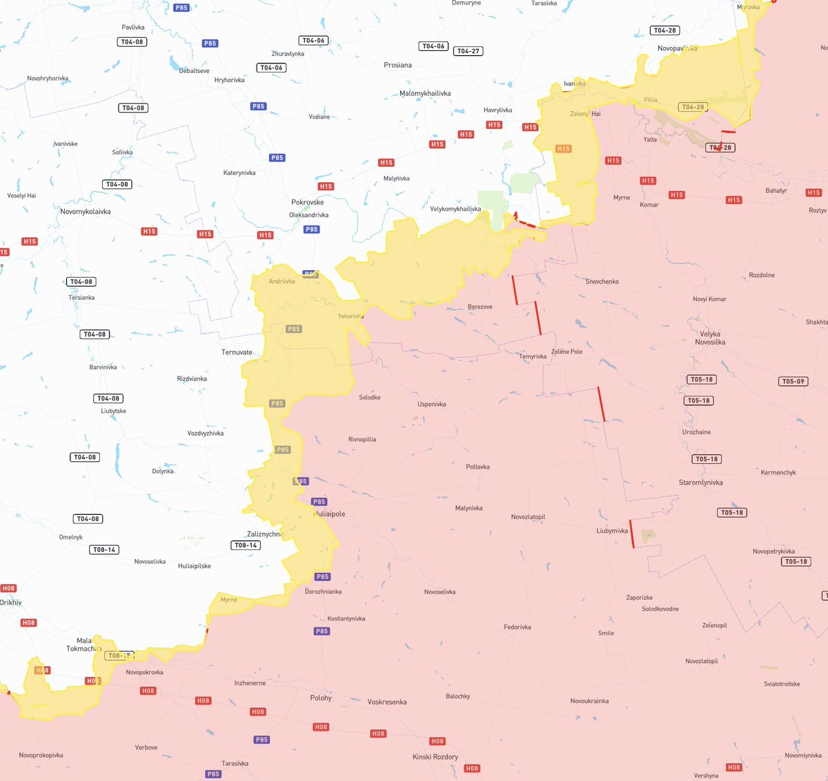
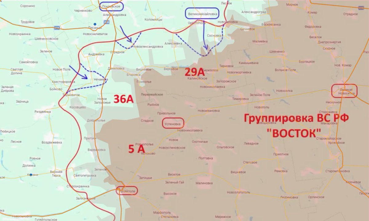
Ukrainian 🇺🇦 fortress facing russian 🇷🇺 offensive
Since january 2024, Ukraine began improving existing defensive lines and digging new ones to prepare for russian attacks.
Maps and images of those defenses :
🧵THREAD🧵1/17 ⬇️
Since january 2024, Ukraine began improving existing defensive lines and digging new ones to prepare for russian attacks.
Maps and images of those defenses :
🧵THREAD🧵1/17 ⬇️
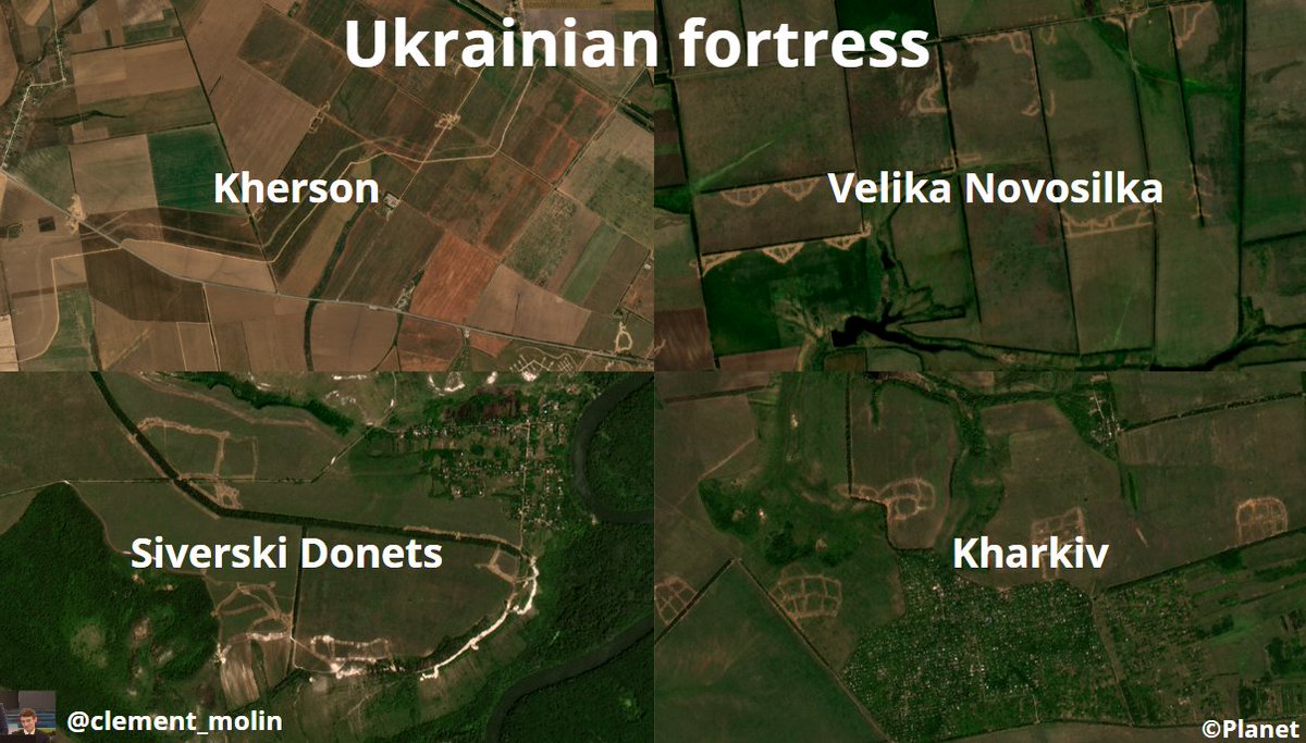
With @Playfra0, we are mapping these defensive fortifications.
What have we observed ? New fortifications everywhere, improving of old defensive lines, from 2014, 2022 or even 2023.
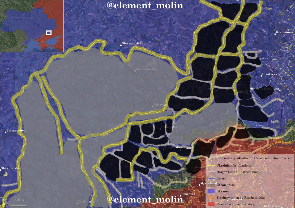
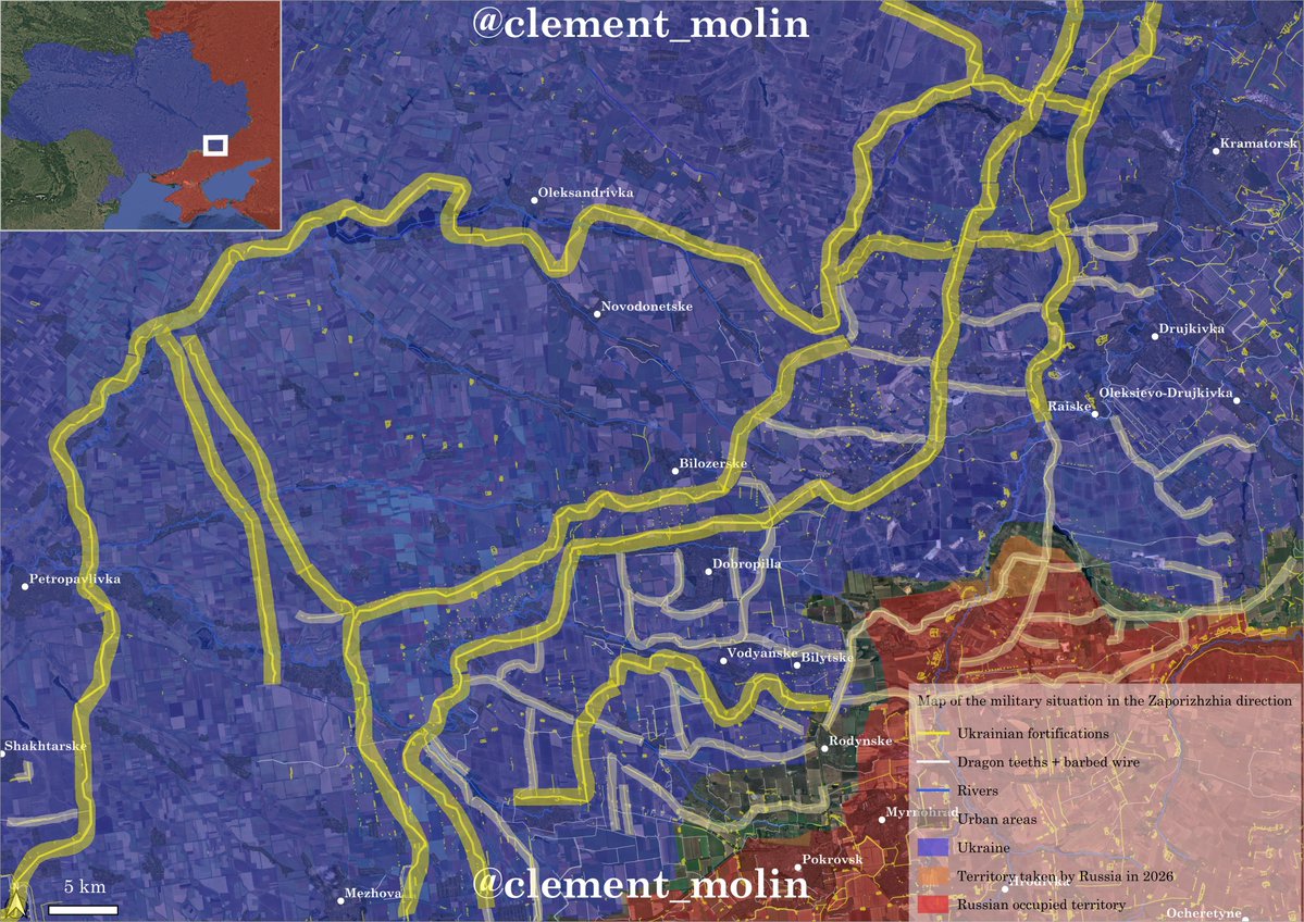
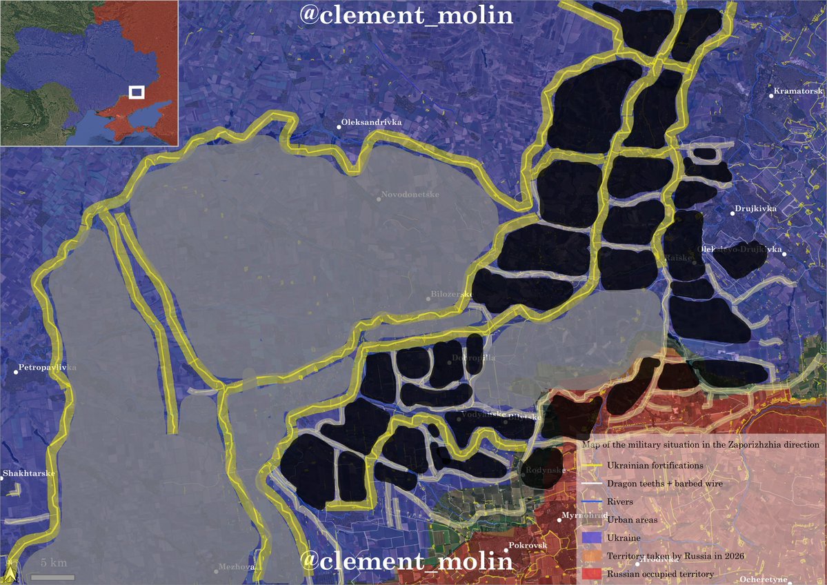
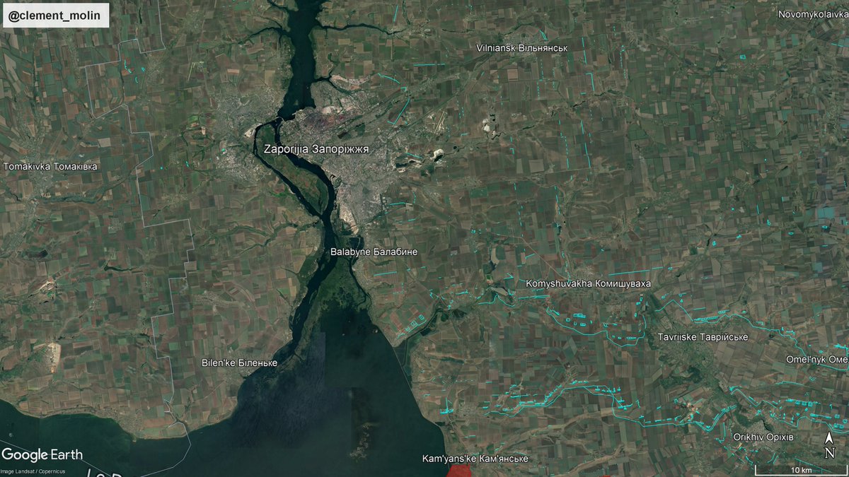
Here is the line south of Zaporizhia city.
What have we observed ? New fortifications everywhere, improving of old defensive lines, from 2014, 2022 or even 2023.
Here is the line south of Zaporizhia city.
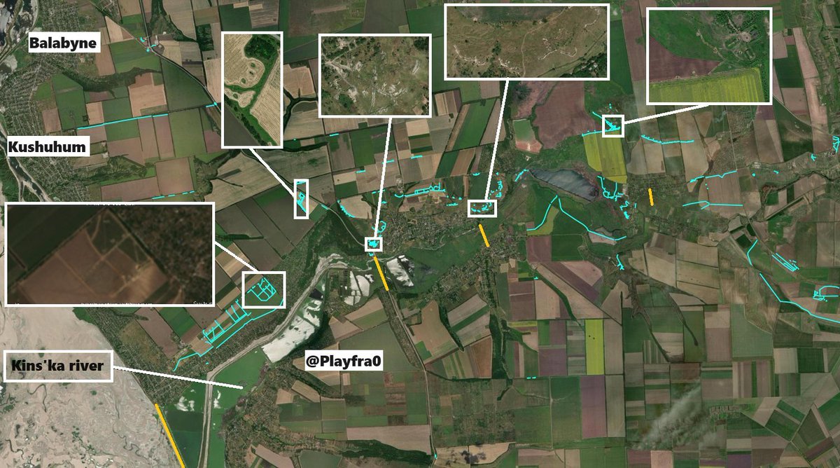
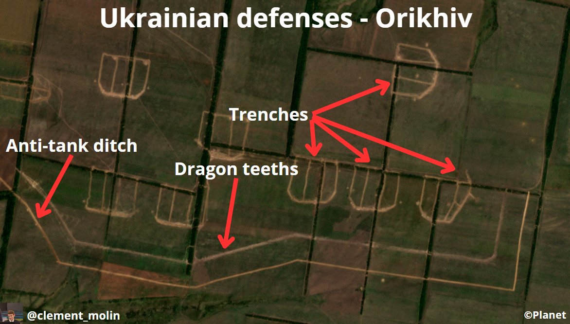
Here is an example for Orikhiv, which we renamed "fort Orikhiv".
This is just north of that strategic town in Zaporizhia oblast. You can see some dots which are russian airstrikes.
This is just north of that strategic town in Zaporizhia oblast. You can see some dots which are russian airstrikes.
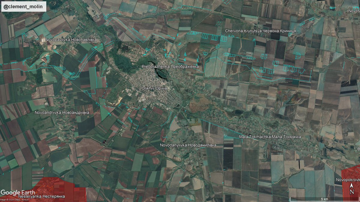
Here is a clear view of this city which is a road and rail hub. The terrain south of the city is mainly mined.
The new defensive line is mainly north and west of the city, since it's too dangerous to dig near the frontline.
The new defensive line is mainly north and west of the city, since it's too dangerous to dig near the frontline.
Here is Zaporizhia city istself with its main defensive lines south and some trenches dug in 2022 east, north and west. 
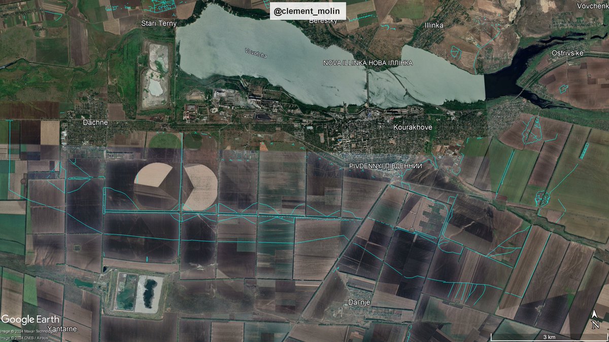
In the Donbass, we have now a few fortress, including Kourakhove.
This little industrial city is located est of Donetsk city. With defenses facing every direction, the city will be the next stop after Vouhledar and Krasnohorivka.
This little industrial city is located est of Donetsk city. With defenses facing every direction, the city will be the next stop after Vouhledar and Krasnohorivka.
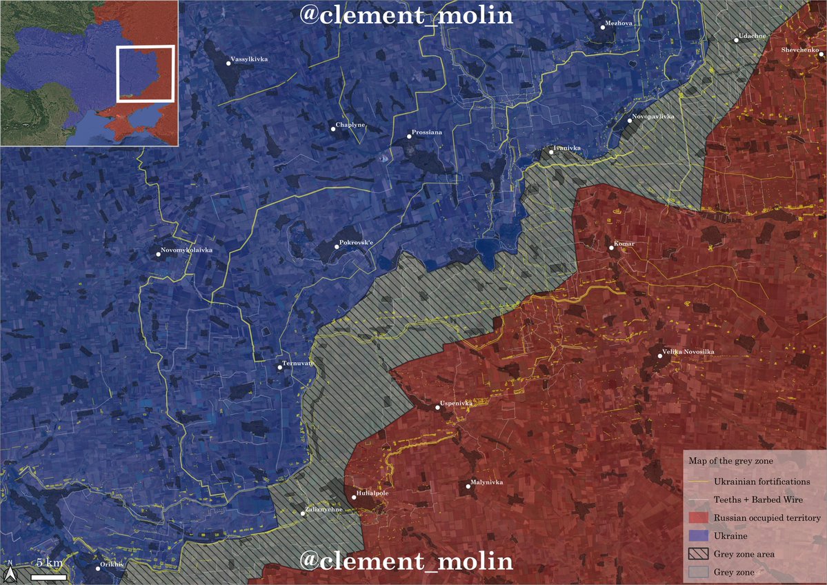
Here is what playfra mapped around Pokrovsk. You can see a few defensive lines running around that city. 
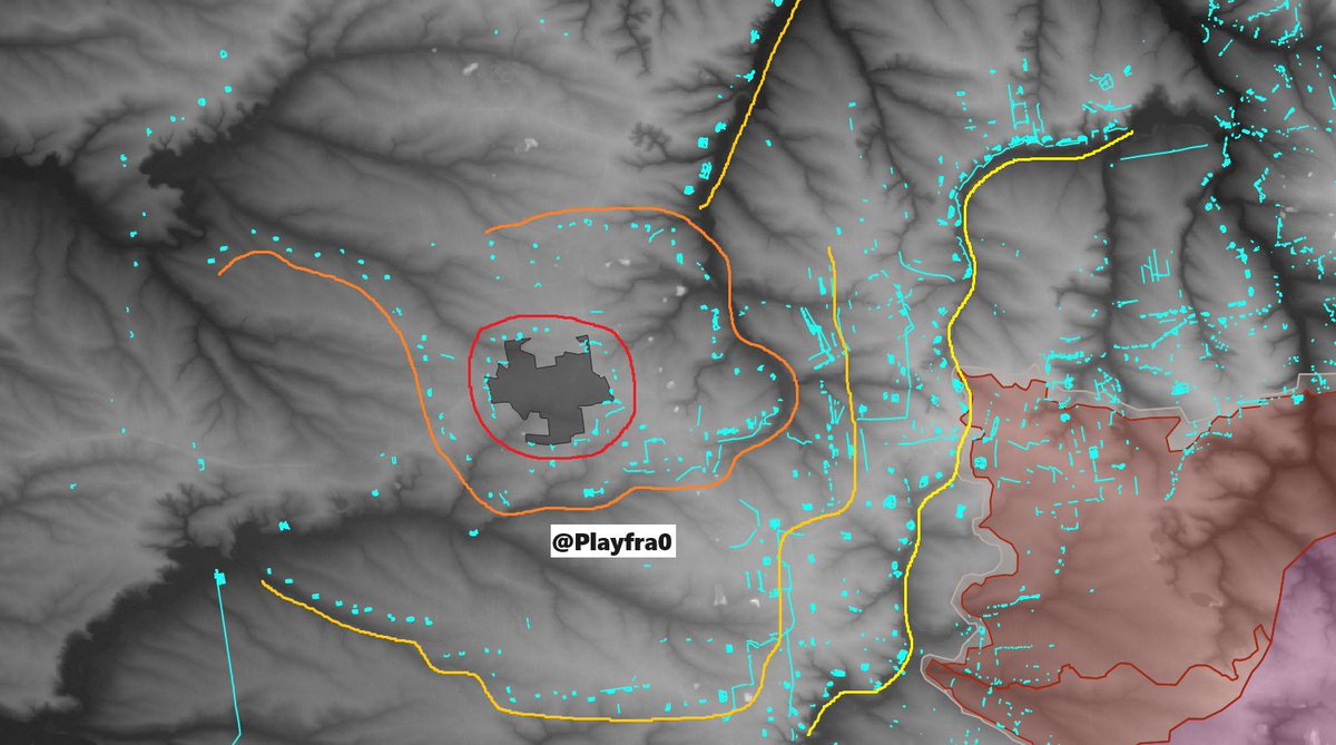
Looking east, here is how it looks. On the right you'll recognize Kourakhove, near the big green part, you have the best defenses in front of Pokrovsk. On the left you'll see the valley from Kostiantynivka to Sloviansk. 
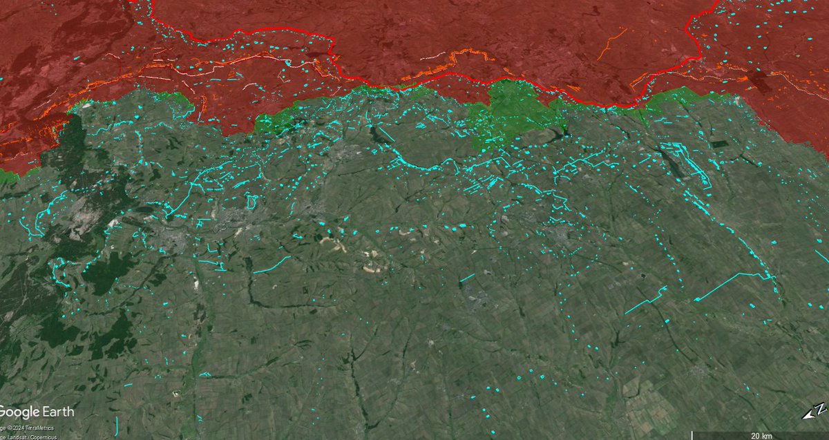
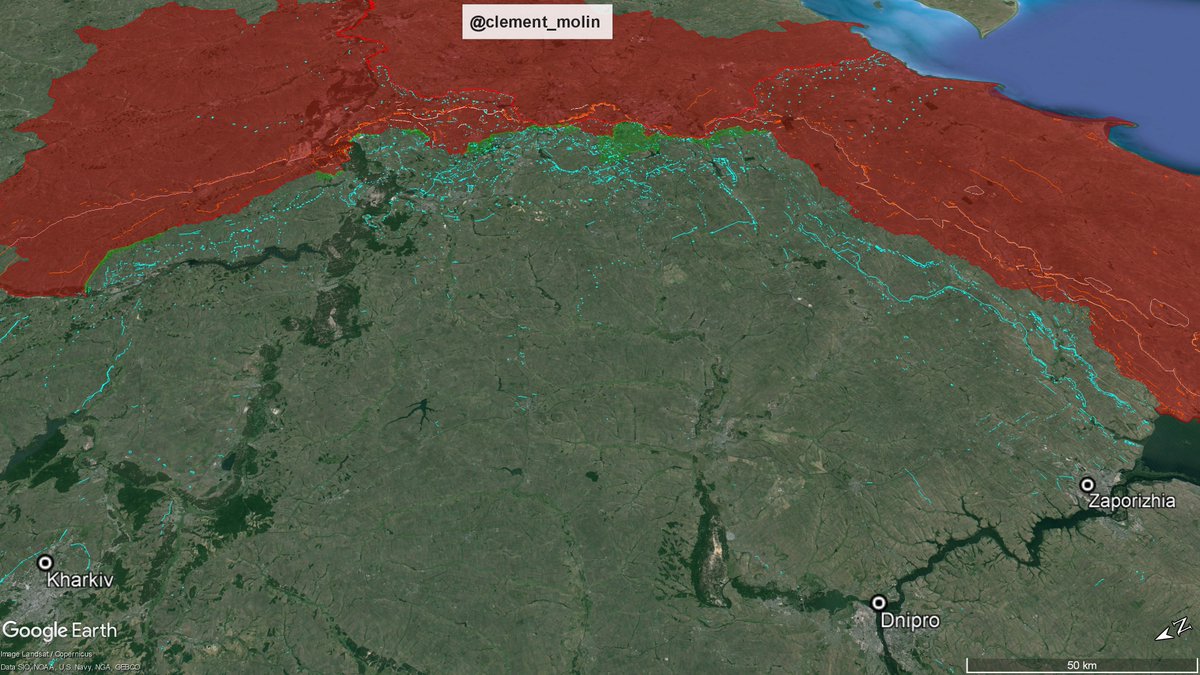
The main defensive effort is concentrated in eastern Ukraine.
On this image you can find the view from Zaporizhia-Dnipro and Kharkiv. This is north eastern, eastern and southern ukraine.
On this image you can find the view from Zaporizhia-Dnipro and Kharkiv. This is north eastern, eastern and southern ukraine.
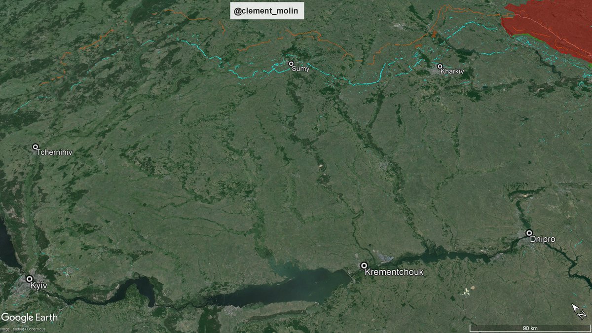
And yes, we have the same view for north-eastern Ukraine.
There is now a continuous line from Yampil (northern Sumy oblast) to Kupiansk (eastern Kharkiv oblast).
Sumy and Kharkiv have mainly turned into fortress while the line is also being dug north of Tchernihiv.
There is now a continuous line from Yampil (northern Sumy oblast) to Kupiansk (eastern Kharkiv oblast).
Sumy and Kharkiv have mainly turned into fortress while the line is also being dug north of Tchernihiv.
While Belarus 🇧🇾 is conducting joint exercices with China 🇨🇳, Ukraine 🇺🇦 is boosting its defenses near the border.
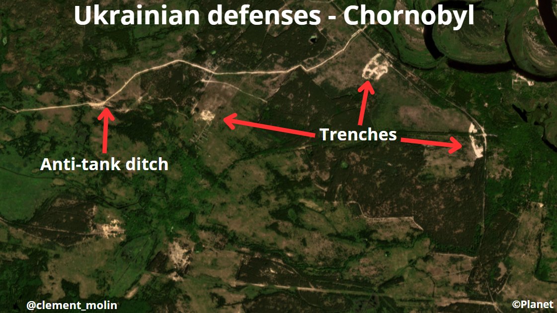
Here is north of Chornobyl, in the exclusion zone where we can see new trenches and anti-tank ditches.
Here is north of Chornobyl, in the exclusion zone where we can see new trenches and anti-tank ditches.
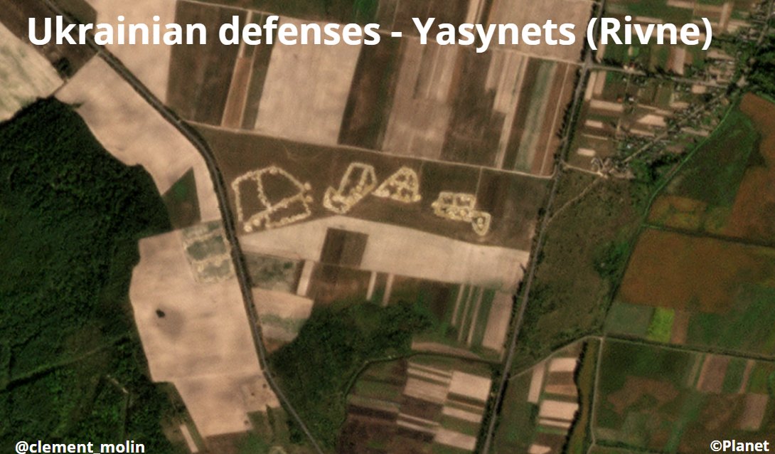
These last months, we witnessed new defenses on all the main roads going to Belarus. This is the case for this one going from Rivne to Stoline (Belarus). 
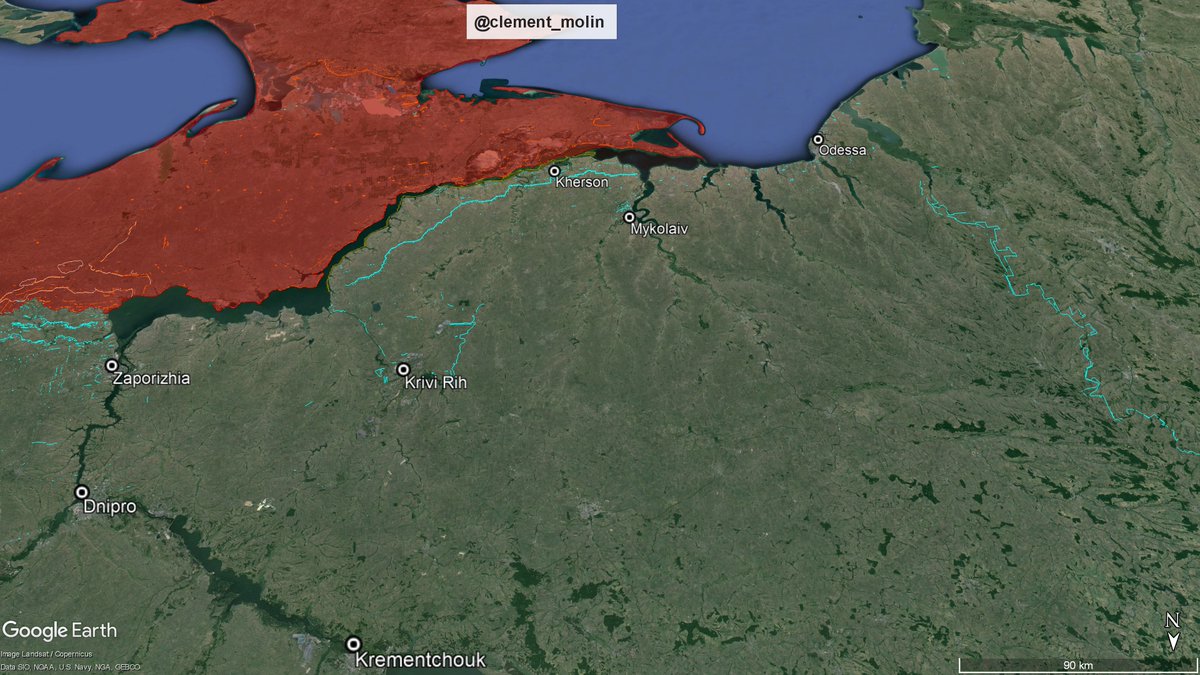
Finally, we couln't forget the southern and south-western direction. On the right is Transnistria a pro-russian separatist state.
And you'll see the black sea - dniepr defensive line from Odesa to Krivi Rih.
And you'll see the black sea - dniepr defensive line from Odesa to Krivi Rih.
There are many, many other places to look at, to zoom in and to analyse.
For the ones wondering if this could help Russia, here is my response :
Russian drones are flying to Poltava and Dnipro to look at airbases, of course they can see the fortifications...
For the ones wondering if this could help Russia, here is my response :
Russian drones are flying to Poltava and Dnipro to look at airbases, of course they can see the fortifications...
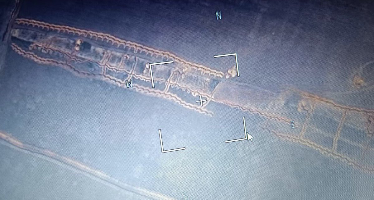
For the ones wondering about the incomplete fortifications. This happened near Kharkiv, the only place where they didn't bothered to reinforce their defenses.
Also, the main things you need in those trenches is men.
(example with K2 defending a trench).
Also, the main things you need in those trenches is men.
(example with K2 defending a trench).
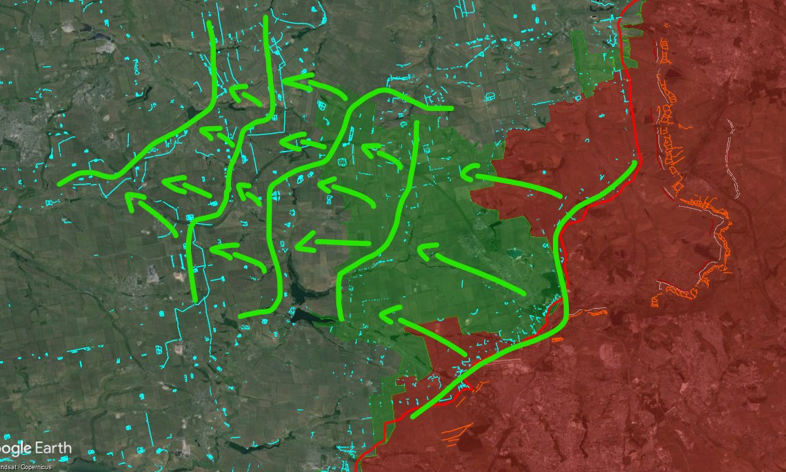
A good example is the faith of the current Pokrovsk defensive line. without a continuous line, you can't hold, and you need to have men everywhere.
Also, these fortifications are only temporary defensive before stepping back to one to another line. (image example).
Also, these fortifications are only temporary defensive before stepping back to one to another line. (image example).
Since more than a year I'm mapping russian and ukrainian defenses around the frontline.
This work allows geolocations, analysis and precise maps.
You can follow my account @clement_molin and also @atummundi
17/17
This work allows geolocations, analysis and precise maps.
You can follow my account @clement_molin and also @atummundi
17/17
• • •
Missing some Tweet in this thread? You can try to
force a refresh


