Raj Bhagat P #Mapper4Life Profile picture
Aug 16 24 tweets 8 min read Read on X
#Thread
#Marina beach is one of the most iconic destinations in Chennai and one of the most visited beaches in the world. However the beach as we see today didn't exist a century ago.

This thread explains the formation of #Chennai's Marina beach
1/n Image
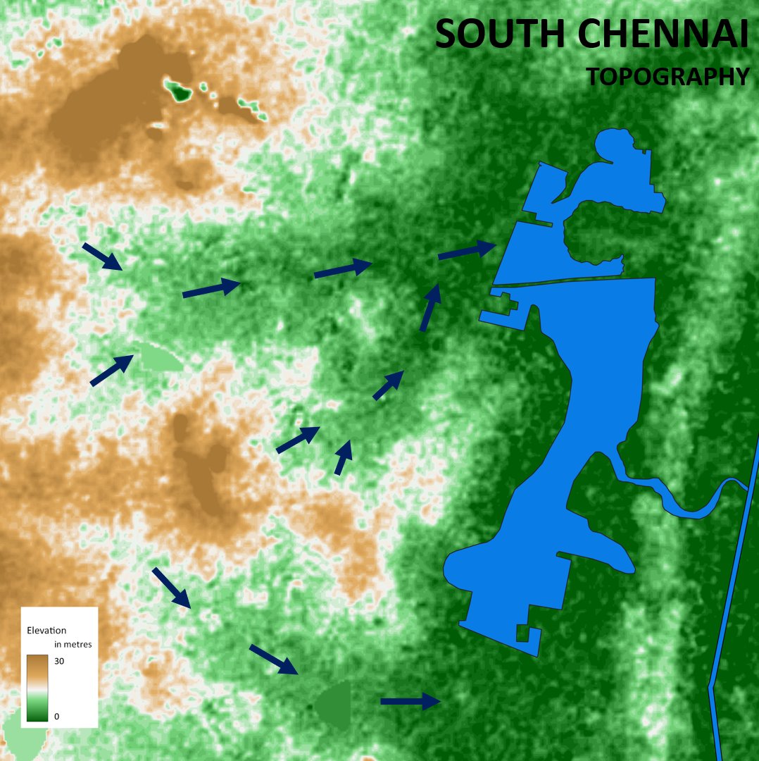
This map below shows the approximate original coastline of Chennai during British era. It was much closer to the Kamarajar road. A promenade was developed during the british era and that is when it got the name, "Marina". However the big sandy expanse itself didnt exist
2/n Image
Seas are very dynamic in nature. Whenever the waves hit the beach which is called as "swash", they bring in sand and when the water goes back ("backwash"), it removes the sand. This balance is critical for beach existence.
The sand which the beaches need are brought by the sea from other places and one of the biggest suppliers of sand are our rivers. The rivers bring a lot of sand particularly during rainy seaons and these help in providing sand for the beaches Image
But these waves when they hit the land, they dont actually move straight. Becaue of the winds prevailing in that season, they have a slight angle to them. This means that it takes sand from one place and moves to another place. Image
For Chennai, during the winter months of November, December, January, the drift is from north to south. Because of this and moves from north to south in that time period Image
This can be clearly observed in this satellite image where the plume of Cooum river can be seen going towards the south. The plume (black in colour) is clearly identifiable because of the difference in the nature of water brought by Cooum river Image
But in the rest of the months of the year, the drift moves from south to north Image
This can be observed in this satellite image from April where the plume from Cooum river is moving to the north direction Image
Though both the direction exist in different months, the south to north one is dominant in Chennai. It is more like "2 steps forward and 1 step back". Image
So in this context, when the breakwaters for the Port of Chennai were constructed, it began obstructing the drift. The sudden disruption meant that sediment movement was not even anymore Image
Acting as a wall the port began stopping the sediment flow. This resulted in the settling of sand to the south of the port. The land expanded into the sea slowly and thus forming the Marina beach Image
So the sediment was settled in south side, rest taken to deeper sea. This means that the swash hitting on the north side near Kasimedu didnt have enough sand. The incoming wave didnt bring sand but the backwash began taking sand. This led to erosion and loss of land Image
In this image we can see how the coastline had existed in British era, the Chenai port, the marina beach and the areas eroded close to the north of Chennai Image
The modern Marina beach hence is much more wider closer to the port and is narrower near lighthouse and much smaller near the mouths of Adyar river. It is in these wide areas were the memorials for leaders have been built. Image
It doesnt stop here. Satellite image below shows the mouth of Cooum river. There is a good amount of sediment settlement in the mouth which typically reduces the capacity of the river (and was cited as a problem during flooding episodes) Image
So the government decided to build new groynes in the mouth to prevent the siltation last year. This means that another hard wall is built further into the sea Image
Satellite image animation shows the changes to the beach near the cooum river mouth since the construction

These Groynes have resulted in further growth of the beach. The Marina would grow further which would be a few hundred metres near the groyne.
In short, the Marina beach in Chennai was created by the obstruction of the longshore drift by the breakwaters of Chennai port. As a consequence, it also caused the erosion of land in the northern side. Based on current trends it is expected to grow further
End of Thread :)
Photo taken from Light House. The Kamarajar road is to the left of the image and the green arrow is where the port is (far end). Area to the right of the red line was all created by this process. This includes all the memorials for the leaders, the shops, etc. Image
Some similar threads for further reading in related subjects

• • •

Missing some Tweet in this thread? You can try to force a refresh
 

Keep Current with Raj Bhagat P #Mapper4Life

Raj Bhagat P #Mapper4Life Profile picture

Stay in touch and get notified when new unrolls are available from this author!

Read all threads

This Thread may be Removed Anytime!

PDF

Twitter may remove this content at anytime! Save it as PDF for later use!

Try unrolling a thread yourself!

how to unroll video
  1. Follow @ThreadReaderApp to mention us!

  2. From a Twitter thread mention us with a keyword "unroll"
@threadreaderapp unroll

Practice here first or read more on our help page!

More from @rajbhagatt

Jul 30
#Thread of #Maps that can help understand the #WayanadLandslide incident, its causes & impact

Please note that all the maps below were created with the information available as of now. Some of the damages outside the areas denoted might have been missed as info keeps coming Image
1. This part of #Wayanad is within the Chaliyar river system. It is a west flowing river which drains into the laccadive sea on Kerala coast (though at this part it is north and east flowing)

This map shows where the water drains. The area that is affected is shown in red. Image
2. In this particular section, the stream arises at around 2000 metres above mean sea level and has a steep fall of around 1200 m to reach Vellarmala, Chooralmala section. Image
Read 8 tweets
Jun 1
#Thread
A collection of geographical myths & unknown facts about #Kanyakumari

1. Kanniyakumari is NOT the southern most point of mainland India, the southern most point is near star of the sea rock in nearby #Kovalam. In the last 20 years,it has been popularized as sunset point Image
2. Contrary to popular opinion, the three seas (Arabic Sea, Bay of Bengal, Indian Ocean) don't meet in Kanniyakumari.

Officially, the sea around Kanniyakumari district is Laccadive sea. Check map below for official extents of the seas and their names Image
3. Before 1956, Kanniyakumari was part of Travancore which pre-independence was a separate princely state. The South Travancore lines (a series of fortifications) were built to protect #Travancore. Currently, a small amount of this fortification is visible near Kanniyakumari
Image
Image
Read 7 tweets
Feb 25
Here's a compilation of my #maps which can help you in understanding the #Bengaluru #Water situation a bit better.

Bengaluru is unofficially a hill station which is located nearly a kilometre above sea level. Image
Being in the top of a ridge line, the city is partly within Kaveri watershed and partly in Ponnaiyar (Dakshina Pinakini watershed).
Being on top, water from elsewhere dont flow through Bengaluru but flow outward from the city
Image
Image
Bengaluru right now depends on Kaveri river for water supply. Because of its height, Water is pumped for a height of 1000 feet from the river 100km away from the city Image
Read 15 tweets
Feb 4
Here is the story of how @googlemaps helped me recover items stolen in a moving train from my father.

My father was travelling from Nagercoil to Trichy in sleper class in Nagercoil - Kacheguda express. He had boarded at 1:43 AM from NCJ. The train was relatively empty & another person who boarded along with my dad stole my dad's bag and mobile phone from him, and deboarded the train in Tirunelveli Junction.Image
When my dad realized it, he searched in the train and rang me from his friend's phone at 3:51 AM to inform that his phone was stolen. Luckily, among immediate family members we have location sharing "on" which meant I could track the location of mobile. When I checked it, I realized that the mobile was moving along the track near Melapalayam in Tirunelveli so I deduced that the thief was returning back to Nagercoil in another train.Image
I called my close friend Babin who is also a local DMK (@arivalayam) functionary to help me recover this. And we both went to Nagercoil station to catch the theif. The railway police listened to us and one of them came along. This is a snapshot of Google maps at the time when I was waiting railway station and the theif was still having my dad's phone.Image
Read 8 tweets
Dec 10, 2023
Thread:
I'll summarise the #Chennai cyclone event and the flooding issue once again as I feel that there is a lot of misinformation floating around which could guide people and government in wrong way w.r.t future actions
#ChennaiFloods2023
1/n Image
1. The cyclone path had been more or less accurately predicted by IMD, private forecasters

2. The intensity of rainfall however was not clear as per official forecast though it was expected to be heavy, it was not indicated that it would be near record rainfall
3. Though private forecasters including myself had warned about the possibility of extreme nature of rainfall, there was always a doubt and it is difficult for the government to take decisions based on non-official arms like mine and it would be too much of a risk for them Image
Read 23 tweets
Dec 4, 2023
Short thread:
#Chennai, lakes, and floods

I have written some threads about the flooding in Chennai, this one would focus specifically on the lake aspect.

#Map below shows the flood forecasted areas in Chennai for an extreme amount of rainfall. If we carefully look into this forecast map, we can see that apart from the major rivers, there are many other paths for the water to run which appear like a tree branching out.

This forecast based on coarser DEM with extreme rainfall & was prepared by my team mates @smkirthiga & pavithra

Pardon the visual quality of maps since I dont have much time to prepare this
Image
If we look at the topography map, the flow paths become clearer as in the map below. When water falls in these places, they are supposed to drain along these streams which appear only during monsoons Image
Let us zoom in further, these "conduits" are the ones that are supposed to carry water. I have added some water flow lines on top of the topography map here near Pallkaranai wetlands Image
Read 15 tweets

Did Thread Reader help you today?

Support us! We are indie developers!


This site is made by just two indie developers on a laptop doing marketing, support and development! Read more about the story.

Become a Premium Member ($3/month or $30/year) and get exclusive features!

Become Premium

Don't want to be a Premium member but still want to support us?

Make a small donation by buying us coffee ($5) or help with server cost ($10)

Donate via Paypal

Or Donate anonymously using crypto!

Ethereum

0xfe58350B80634f60Fa6Dc149a72b4DFbc17D341E copy

Bitcoin

3ATGMxNzCUFzxpMCHL5sWSt4DVtS8UqXpi copy

Thank you for your support!

Follow Us!

:(