The weather over Africa is very weird right now and it's affecting hurricane season.
Typically, African Easterly Waves, or hurricane seedlings, swirl from the Guinea Highlands in West Africa into the tropical Atlantic where they strengthen during late August and September.
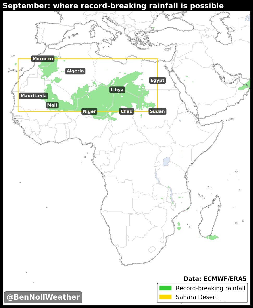
This year, the wave train is displaced north of its average position and waves are instead rolling into... the Sahara Desert! 🌵
The map below illustrates where rainfall over the next 10 days is forecast to exceed the *record maximum monthly rainfall* in September, dating back to 1940.
It includes Algeria, Mali, Libya, and parts of Niger where little or no rainfall typically falls this time of the year!
The northward-displaced wave train is one of the factors influencing the current lack of tropical activity in the Atlantic.
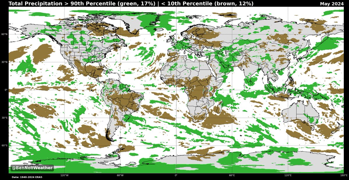
This data quantifies just how unusual things currently are over Africa...
Typically, African Easterly Waves, or hurricane seedlings, swirl from the Guinea Highlands in West Africa into the tropical Atlantic where they strengthen during late August and September.
This year, the wave train is displaced north of its average position and waves are instead rolling into... the Sahara Desert! 🌵
The map below illustrates where rainfall over the next 10 days is forecast to exceed the *record maximum monthly rainfall* in September, dating back to 1940.
It includes Algeria, Mali, Libya, and parts of Niger where little or no rainfall typically falls this time of the year!
The northward-displaced wave train is one of the factors influencing the current lack of tropical activity in the Atlantic.
This data quantifies just how unusual things currently are over Africa...
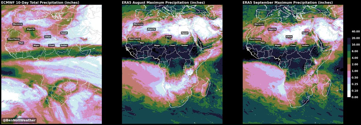
Rain in the Sahara Desert! 💧
This three-panel image shows the 10-day forecast rainfall (left) vs the August monthly maximum rainfall (center) vs the September monthly maximum rainfall (right).
Rain is forecast to fall in places that it never has, on record, in these months 😳
This three-panel image shows the 10-day forecast rainfall (left) vs the August monthly maximum rainfall (center) vs the September monthly maximum rainfall (right).
Rain is forecast to fall in places that it never has, on record, in these months 😳
• • •
Missing some Tweet in this thread? You can try to
force a refresh