Round-up of verified Iran ballistic missile strike videos:
1. A strike in Glilot, Tel Aviv, possibly near Mossad headquarters, verified by @TwistyCB (POV: 32.162814, 34.814391)
2. A crater in Glilot, Tel Aviv, also possibly near Mossad headquarters, possibly the result of the strike seen in video 1. Verified by @fab_hinz (32.148475, 34.80782)
@fab_hinz 3. A second video documenting the crater shown in video two at the same location
4. A strike on the north side of Tel Aviv, seen near Ayalon Mall, verified by @NemoAnno. (POV: 32.098561, 34.828177)
5. A strike on the north side of Tel Aviv, verified by The Post, @TwistyCB and others. Possible that this is the same strike shown in multiple videos near Mossad headquarters. (POV: 32.086607, 34.769713)
@TwistyCB 6. A strike on Nevatim Airbase, verified by The Post, @JakeGodin and others. One of the heaviest documented so far.
7. Another view of the strike on Nevatim Airbase, verified by @GeoRaccoon. (POV: 31.218534, 34.859118)
8. Crater and damage near a school in Gedera, verified by @nemoanno. (Location: 31.802099, 34.787821)
9. Another view of the strike on Nevatim Airbase, verified by @JakeGodin. (POV: 31.076197, 35.028013)
10. Impacts on or near Ort Tel Nof airbase, verified by @TwistyCB. (POV: 31.833837, 34.857067)
(Reminder to check out @GeoConfirmed and everyone named in this thread for more verifications and proofs.)
11. @nickschifrin reports from the crater near Mossad headquarters shown in videos two and three
Shortly after the war began, America's two largest satellite imagery providers, Planet and Vantor, bowed to government requests to withhold imagery of the region while the conflict continued.
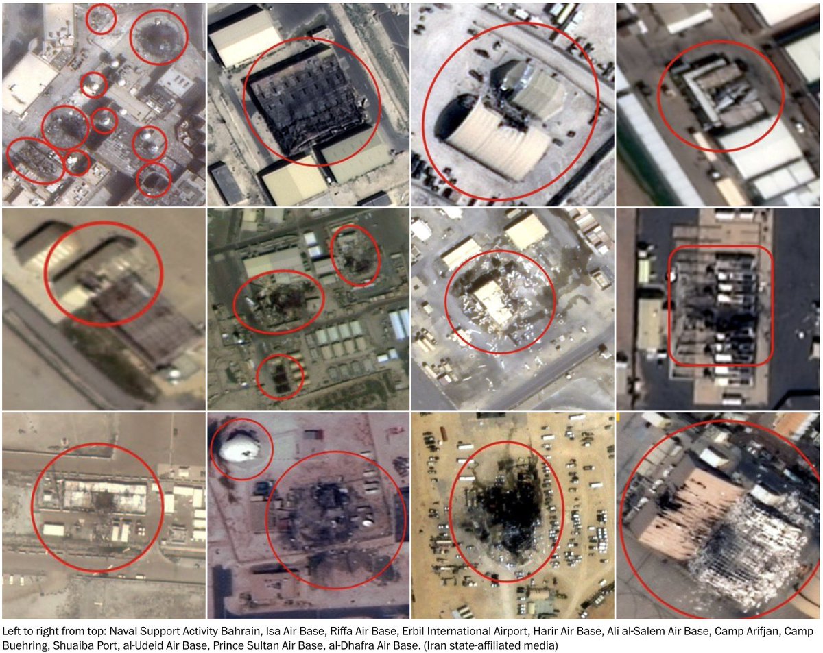
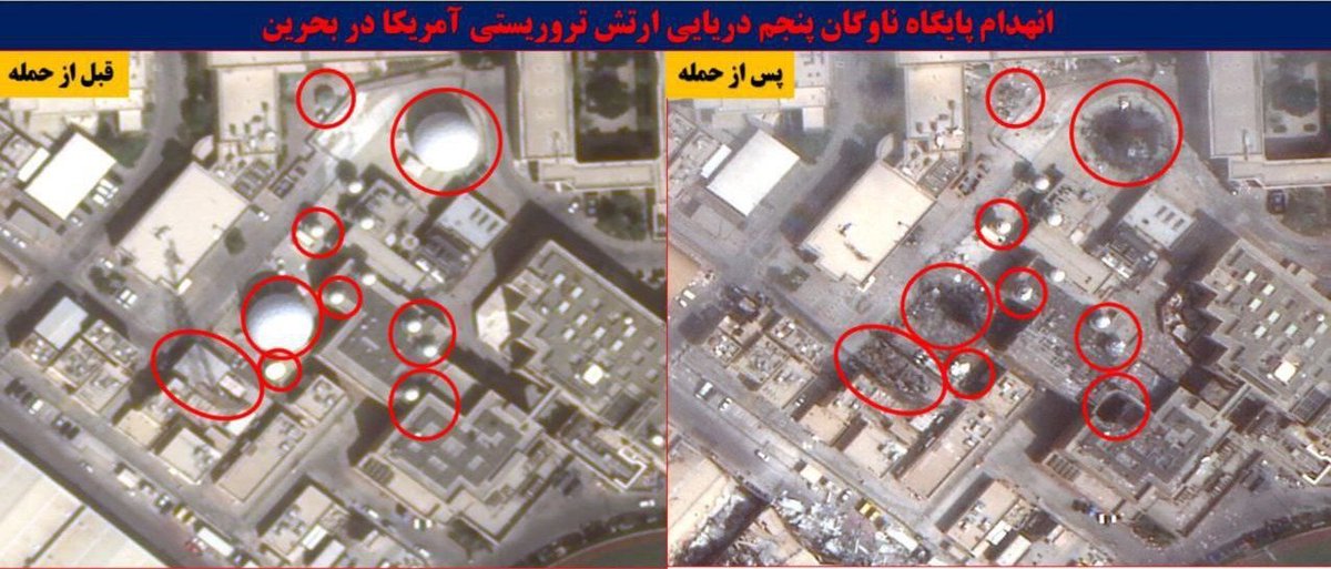
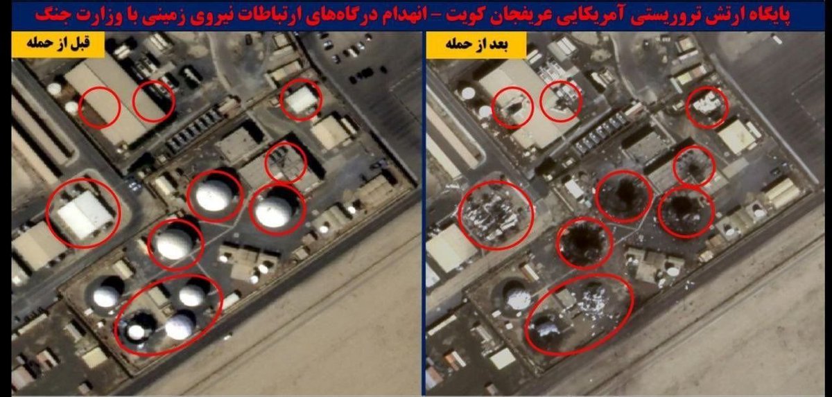
But Iranian state-affiliated media published scores of high-resolution images:
We accumulated 128 Iranian images, geolocated them, and compared them to open-source Sentinel-2 satellite imagery and Planet imagery when available, ultimately confirming 109 of the images. We found no evidence the Iranian images had been manipulated.
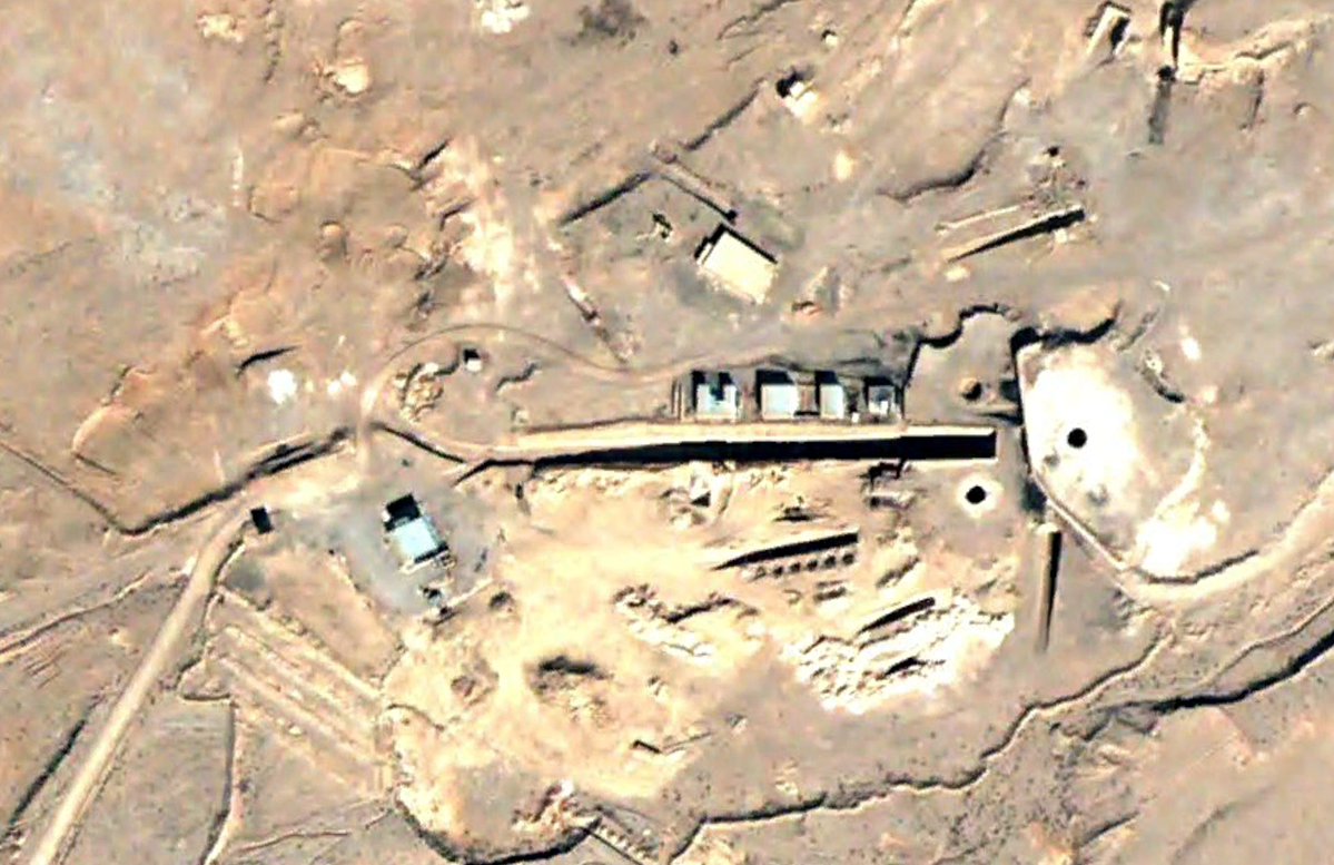
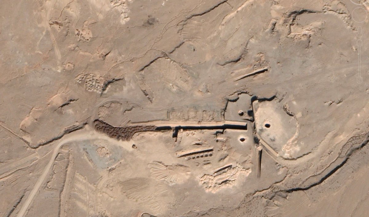
Interesting timing for this push from US intelligence. Isfahan has been a site of some intrigue so it's worth understanding what we know and don't know about it. (For example, this tunnel and the dirt mounds next to it have been there for years.) 🧵
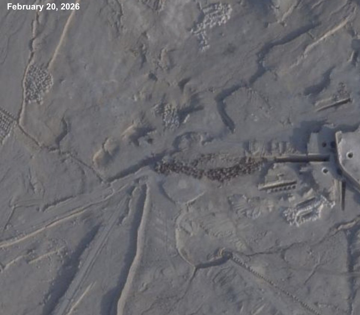
Here is one of the earliest satellite images of that tunnel, taken 3/11/02 (L). And the earliest visible dirt mounds, taken 11/30/22 (R). The latter would predate the Trump administration's first Iran strikes by about two and a half years.
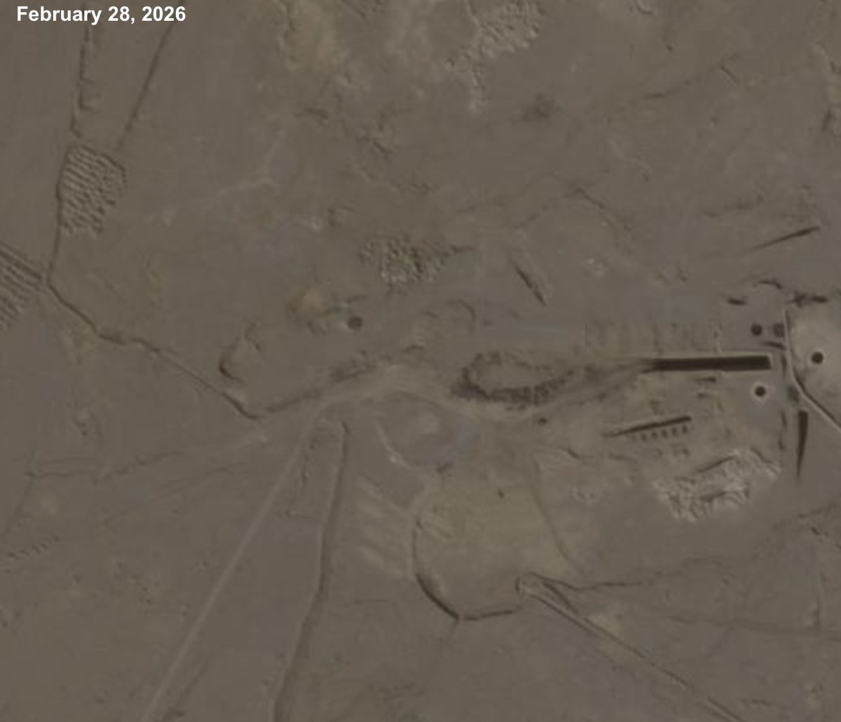
Interestingly, there was almost no change in the tunnel in advance of the Trump administration's June 2025 strikes, not even to cover it. And while there was some kind of soil removal occurring this February, it appears to have halted since the new strikes began on Feb. 28.
We obtained footage showing a man who appeared to be refugee Nurul Amin Shah Alam being dropped off by Border Patrol outside a Buffalo coffee shop after 8pm. The shop locks its door at 7pm. He never made it inside, and was found dead five days later: wapo.st/3OCwNx8
This video, taken from the drive-thru of a Tim Hortons coffee shop, shows a man from an unmarked white van unloading the person who appears to be Shah Alam before driving away. The person is wearing clothes that match those Shah Alam was wearing when arrested a year prior.
This video shows Shah Alam, visible wearing what Mayor Sean Ryan described as orange jail booties, walk to the Tim Hortons front door, pause, and walk away. An employee told us today that they look the doors at 7pm every night. The time was 8:19pm.
Our new investigation (linked below) finds that nearly 6,000 buildings have been damaged or destroyed in southern Lebanon, around 80% of them since Israel’s Oct. 1 invasion. I’ll go into some of our findings and work here 🧵:
To conduct this analysis, we relied on @coreymaps and @jamonvdh’s excellent damage maps and estimates, which are based on Sentinel-1 satellite radar analysis. Combined with Microsoft building footprints, they allow you to make a map of damage (in red) that can look like this:
Scher and Van Den Hoek's satellite radar analysis provides a country-wide view of damage that often picks up signals that can't be seen with the naked eye, even on very high resolution optical imagery (for reasons the experts understand much better than me).