How #Ukraine 🇺🇦 is preparing to defend #Pokrovsk
Engineering troops began digging new lines around Pokrovsk but also, and for the first time, on the road to Dnipro.
Here is a new analysis, including high-res images.
🧵THREAD🧵1/22 ⬇️
Engineering troops began digging new lines around Pokrovsk but also, and for the first time, on the road to Dnipro.
Here is a new analysis, including high-res images.
🧵THREAD🧵1/22 ⬇️

These few shots from the 23rd Engineering Positional Regiment of the Ukrainian Support Forces building dragon teeth lines in the east are quite interesting.
First, having engineering brigades is crucial for Ukraine to prepare fortified lines.
First, having engineering brigades is crucial for Ukraine to prepare fortified lines.


Each unit should be preparing fall back lines on their frontline perimeter.
However, if some are able to do so thanks to crowdfunding (like the one done by @Teoyaomiquu), many have to dig positions with their hands and shovels.
However, if some are able to do so thanks to crowdfunding (like the one done by @Teoyaomiquu), many have to dig positions with their hands and shovels.

This is a big problem because there are many important part of the frontline where there are no fortified positions. To survive at the front, you have to dig.
Russia has done this work with great quality. When i mapped their positions last year, I saw they dug everywhere.
Russia has done this work with great quality. When i mapped their positions last year, I saw they dug everywhere.


Then, I looked at ukrainian frontline. There were barely no trenches, only some dugouts...
They started digging a lot in january 2024, after they saw Avdiivka fell because there were no defenses in Stepove (north of the city).
They started digging a lot in january 2024, after they saw Avdiivka fell because there were no defenses in Stepove (north of the city).

Then I made a few threads on the situation of ukrainian defensive lines to understand what was their strategy.
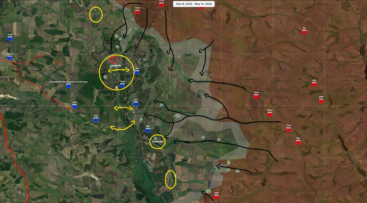
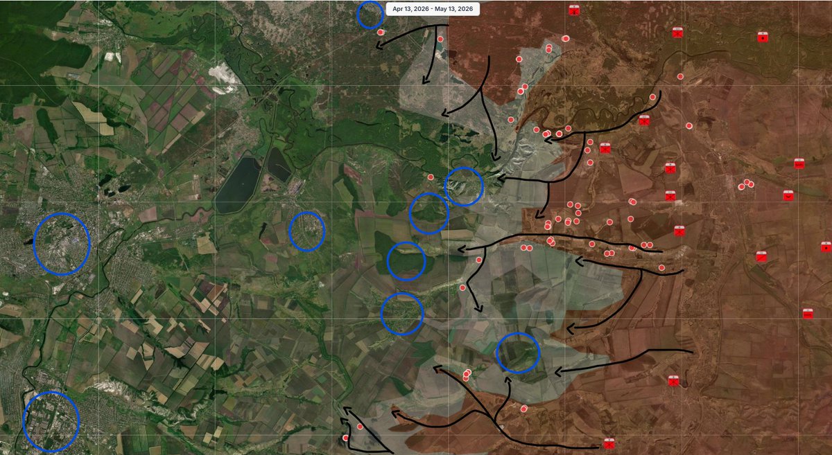
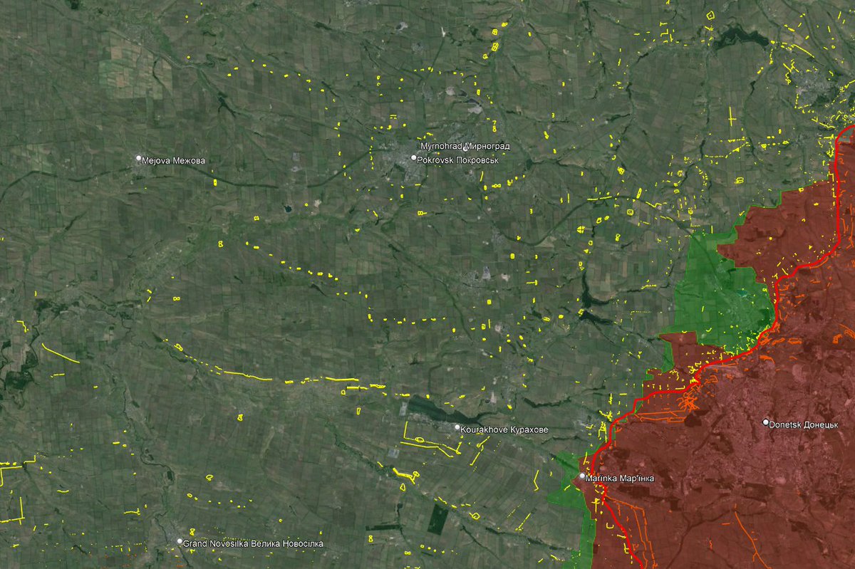
So I mapped the 4 lines defending Pokrovsk. The situation is still +/- the same with lines 3 and 4 still holding.
So I mapped the 4 lines defending Pokrovsk. The situation is still +/- the same with lines 3 and 4 still holding.

On this map, you can see how there are 2 rings around Pokrovsk. The city will be an important stronghold in the south-Donetsk region.
Russians are stopped in front of the third line since a month and half, but they may soon take the trenches defending this line.
Russians are stopped in front of the third line since a month and half, but they may soon take the trenches defending this line.

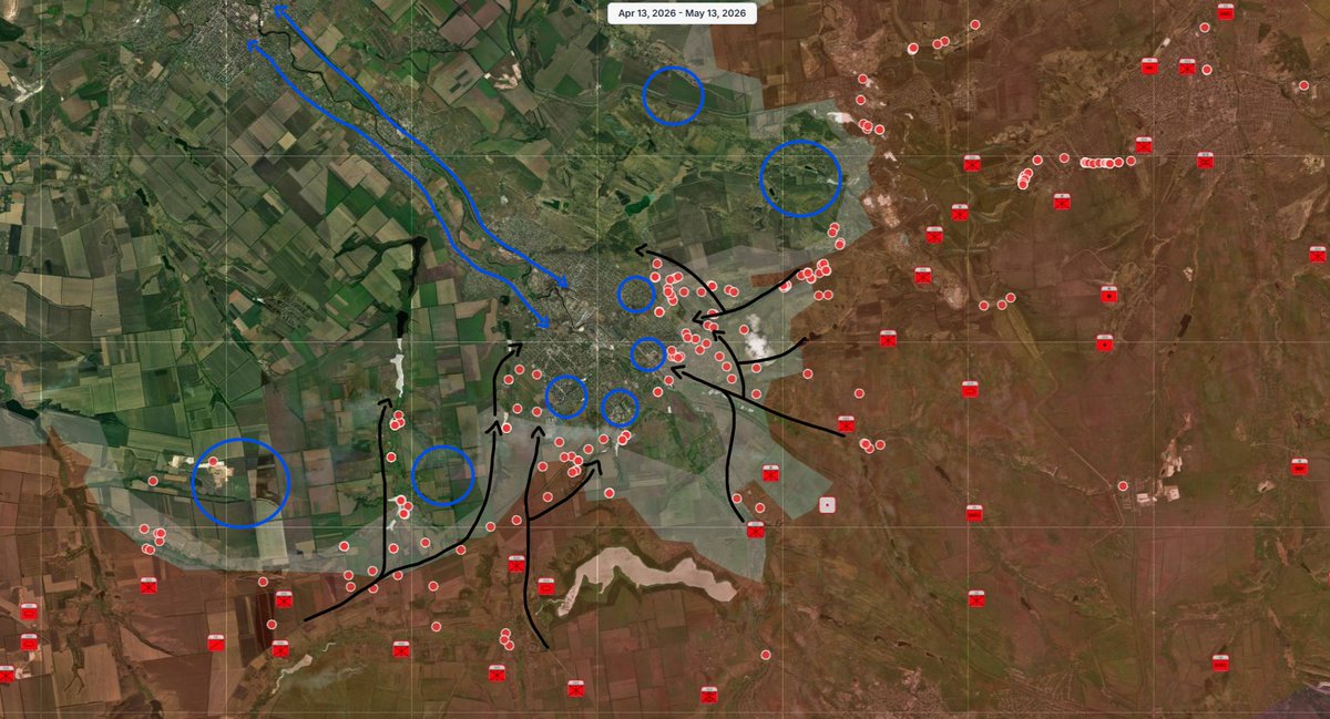
This is the reason Ukraine began preparing new defensive positions after Pokrovsk. The new line from the last days is at the border of Donetsk and Dnipro oblast.
It seems it is being dug between Mejova and Slovianska, two important cities I highlighted a few weeks ago.
It seems it is being dug between Mejova and Slovianska, two important cities I highlighted a few weeks ago.

I believe Ukraine will prepare the Slovyanka - Mejova - Novopavlivka line, using rivers to help.
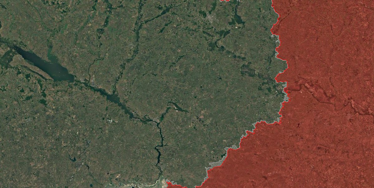
This is also for political region, at the border between Donetsk and Dnipropetrovsk oblast, one that hasn't been annexed by russia.
This is also for political region, at the border between Donetsk and Dnipropetrovsk oblast, one that hasn't been annexed by russia.

I believe engineering brigades received the order to prepare this new defensive line. We can see, (as well as russian drones can see), new trenches and anti-tank ditches.
This is from 3 weeks ago, the line is bigger now, as seen on my map.
This is from 3 weeks ago, the line is bigger now, as seen on my map.

As you may already know, I'm working with @Playfra0 on these maps.
Here is his first map with the Pokrovsk ring defenses. You can see how they are organized on top of hills. Pokrovsk is on top of one, which will help turning the city into a stronghold.
Here is his first map with the Pokrovsk ring defenses. You can see how they are organized on top of hills. Pokrovsk is on top of one, which will help turning the city into a stronghold.

@Playfra0 also bought some images of the defensive lines east of Pokrovsk.
These images show trench network, some are well organized, some are not.
Follow him !
These images show trench network, some are well organized, some are not.
Follow him !


A guy that claims to have served in the serbian army in like 2007 sent an early 2000s serbian battle manual.
He told Playfra the ukrainian trenches seemed too wide. This is something, when drones are constantly flying, trenches are not enough covered and too wide.
He told Playfra the ukrainian trenches seemed too wide. This is something, when drones are constantly flying, trenches are not enough covered and too wide.

However, there are sometimes trenches very well prepared, with a lot of firing positions, dugouts, bunkers...
But it takes time to prepare and you have to man this trench.
But it takes time to prepare and you have to man this trench.

When russian air guided bombs are falling everydays on ukrainian positions, the best response is to dig trenches.
Here are some images from Orikhiv in the south where you can see some concrete bunkers.
Here are some images from Orikhiv in the south where you can see some concrete bunkers.


Fortifications have prooved to be efficient when they are defended, when one is defending another one, when coordination between units is present.
Ukraine lost 2 lines in late august, but since 2 months, the 3rd line is holding.
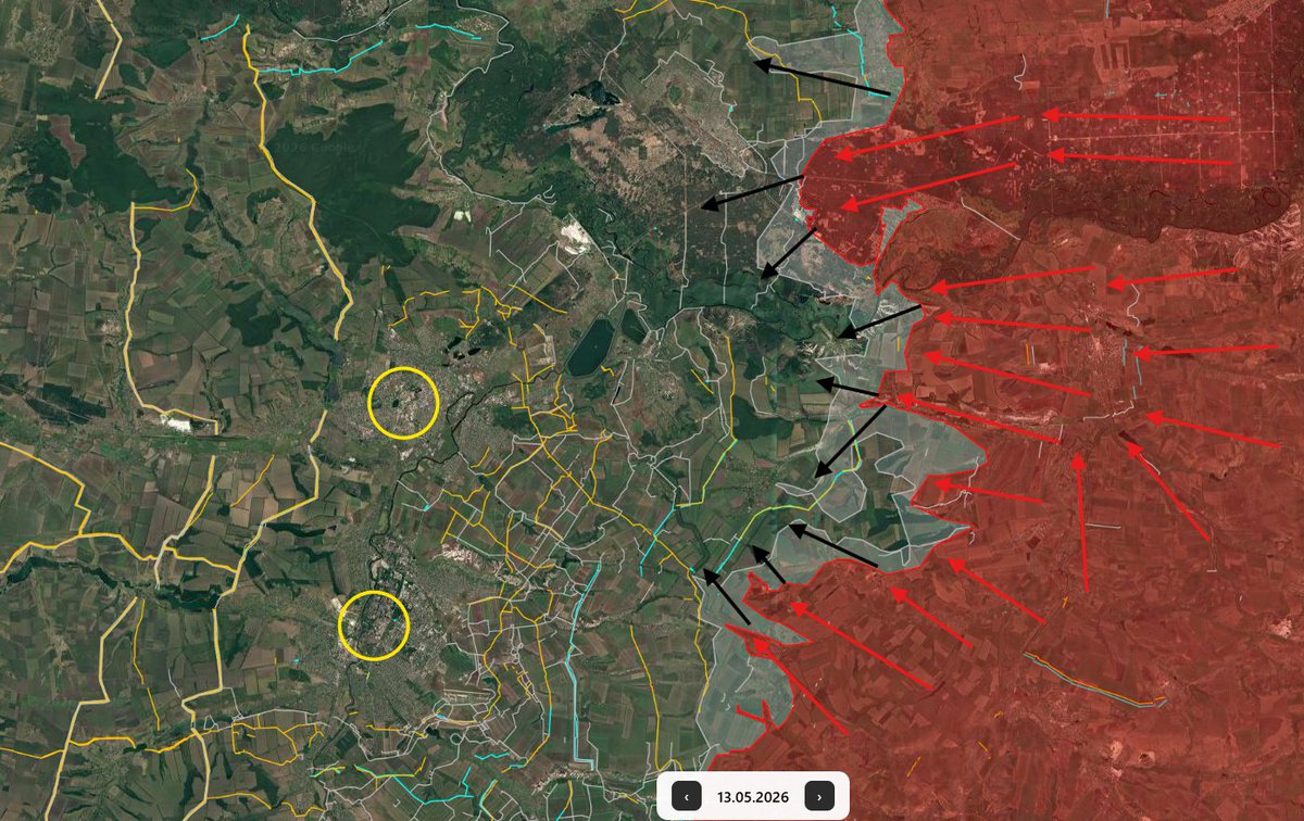
Russia is now seeking to bypass Pokrovsk.
Ukraine lost 2 lines in late august, but since 2 months, the 3rd line is holding.
Russia is now seeking to bypass Pokrovsk.

Since a few days, new trenches appeared east of Selydove, where Russia is currently advancing.
This is the most difficult direction of the front since Russia reached Tsukuryne.
This is the most difficult direction of the front since Russia reached Tsukuryne.

On the direction north of Pokrovsk, Ukraine had the time to prepare new defenses since Russia choosed to follow the path of the railway to Pokrovsk.

This was my first map of the ukrainian defensive program.
Without these trenches, many cities (like Chasiv Yar) would have fallen, and many more soldiers would have been killed on both sides.
Without these trenches, many cities (like Chasiv Yar) would have fallen, and many more soldiers would have been killed on both sides.

Here are 3 other maps from march to may 2024. Ukraine engineering troops and civilian workers are still needed to prepare and fortify positions.
This is why I believe foreign aid should help creating new engineering brigades.
This is why I believe foreign aid should help creating new engineering brigades.


This is the end of this new thread, I wish you liked it.
If you wish to support this long work (hours and hours of work to map everything), you can support me here :
buymeacoffee.com/clement.molin
If you wish to support this long work (hours and hours of work to map everything), you can support me here :
buymeacoffee.com/clement.molin
You can also follow @atummundi, a think tank with students on many subjects, geopolitics, international relations, conflict monitor...
22/22
22/22

• • •
Missing some Tweet in this thread? You can try to
force a refresh