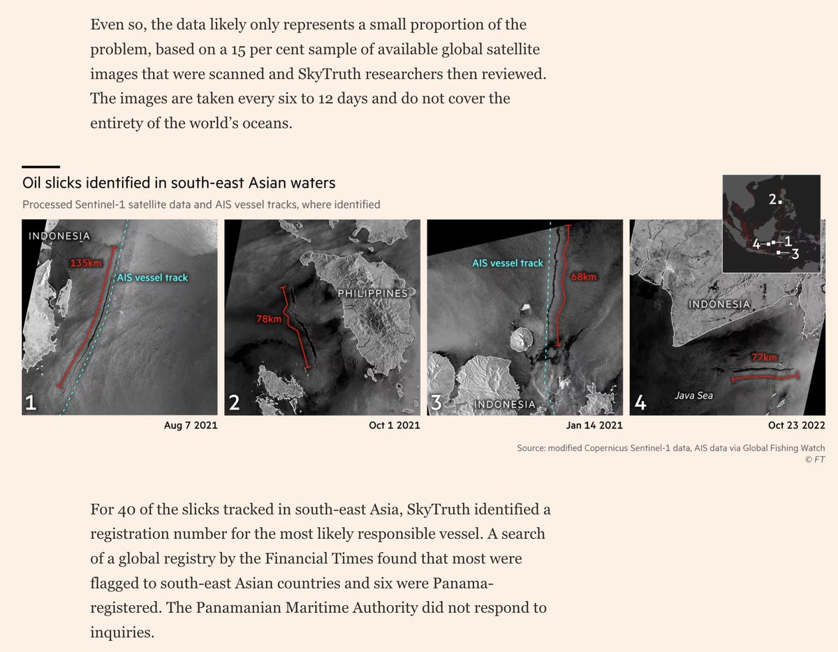
Since it didn't make it into this story, threading some geolocations of airstrikes near Tinzaouaten by Turkish-made drones. These strikes could be conducted by Mali and/or Burkina Faso.
https://twitter.com/trbrtc/status/1852363362987876396
Overview map. Pink line is Wagner's route toward Tinzouaten, pink pins are location of first battle, green line is earth berms around the gold mines, and yellow pins are the drone strikes. 

On July 30, three days after Wagner's defeat, multiple drone strikes hit in the middle of the gold mine known as Inatiyara, as well as a refugee camp known as Ekhariban. Location of damage filmed is at: 19.924667, 2.980035 (@GeoConfirmed).
https://x.com/Mossa_Karim1/status/1818325943095824650
On Aug. 25, a likely double-tap strike happened. The first strike hit some vehicles outside of a pharmacy, and half an hour later another strike hit first responders. Location: 19.951159, 2.972886. x.com/apmazawad/stat… x.com/DirpaFa/status…
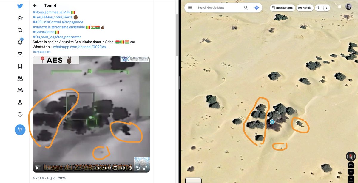
On Aug. 27, a drone strike hit very close to the Algerian border again, at 19.929167, 3.014806 (@GeoConfirmed). x.com/DirpaFa/status… x.com/CheickIbtidian…
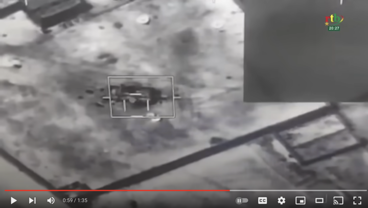
@GeoConfirmed On Aug. 8, a drone strike hit the MRAP captured by CSP fighters, parked inside a compound in Tinzaouaten. Coordinates: 19.945661, 2.970240 (@GeoConfirmed). Satellite image is outdated.

• • •
Missing some Tweet in this thread? You can try to
force a refresh