Breaking from @hntrbrkmedia: China’s DJI, the world's largest drone manufacturer, has disabled U.S. geofencing on its drones, enabling flights over airports, military bases, and no-fly zones.
DJI says it is putting “control back in the hands of the drone operators”
DJI says it is putting “control back in the hands of the drone operators”

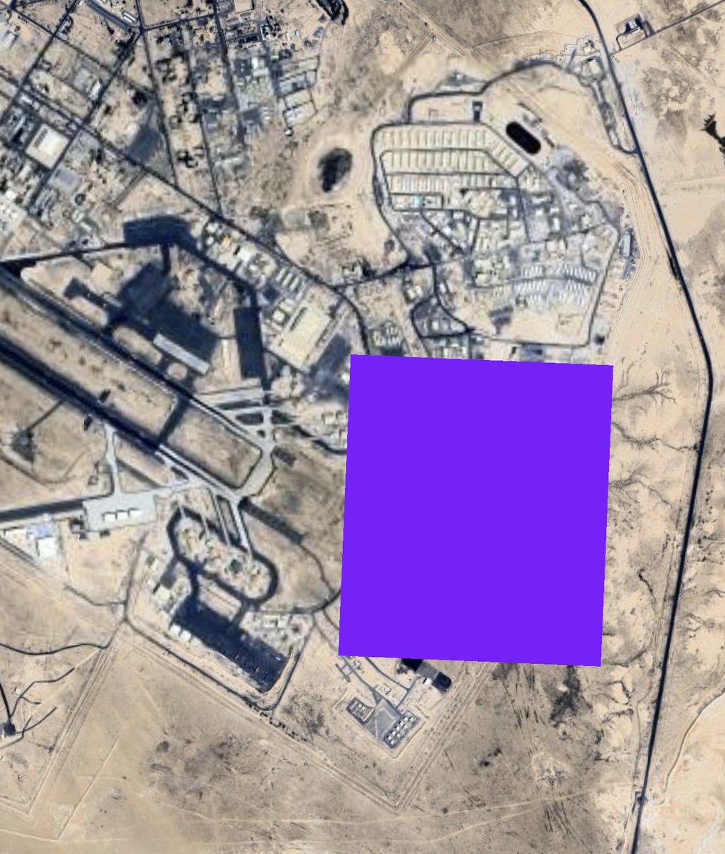
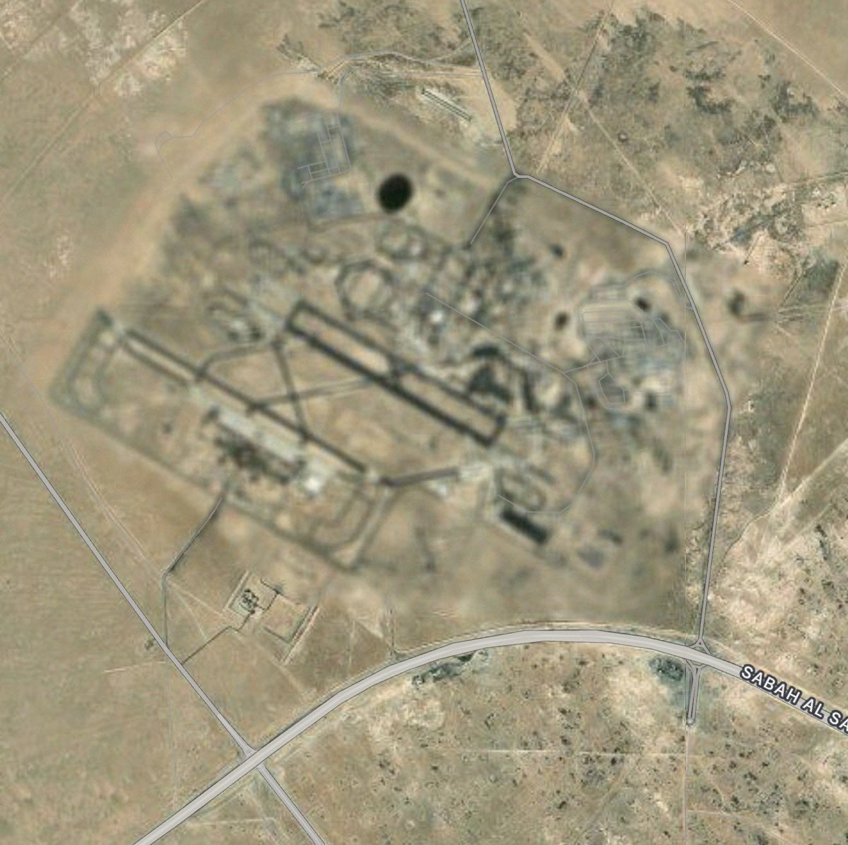
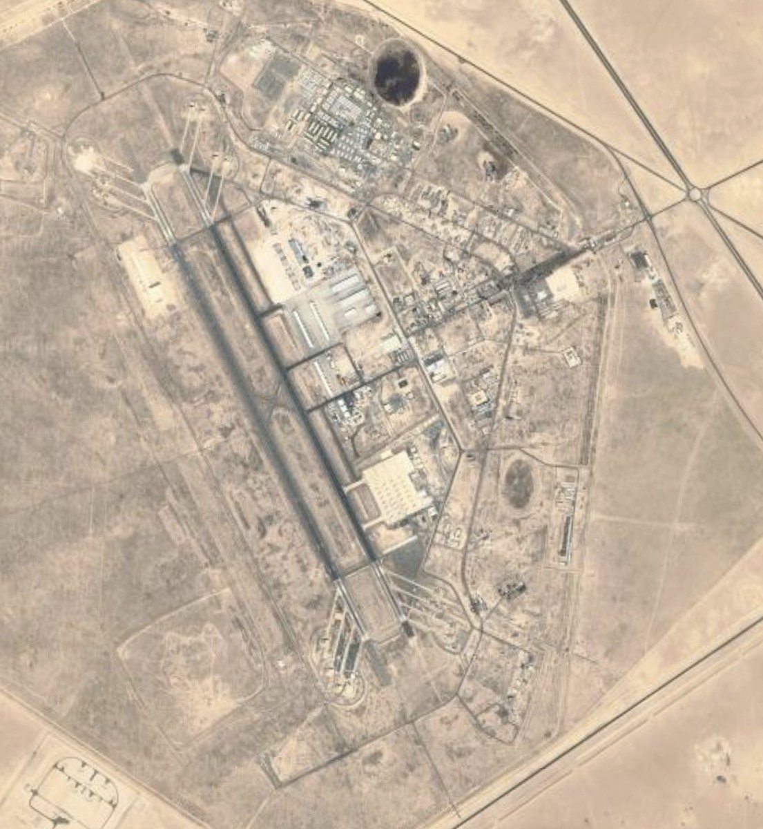
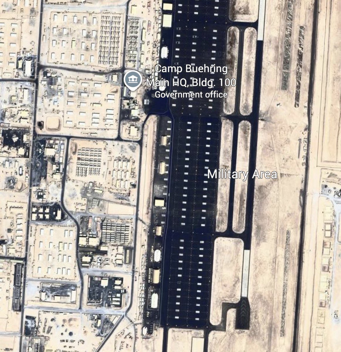
DJI's Restricted Zones reflect restricted airspace where drone use is heavily limited or entirely prohibited due to safety, security, or legal concerns. These zones are defined within DJI’s geofencing system and typically include locations such as airports and military bases, and sensitive infrastructure like nuclear power plants, prisons, and government facilities.

DJI restricted zones in the Washington, D.C., area. Red denotes no-fly zones. Blue denotes zones that require authorization to fly into.
Source: DJI.
Source: DJI.

In these zones, DJI drones are unable to take off. If a drone flies into the border of a zone, per DJI “it will automatically decelerate and hover in place.” If a drone somehow manages to enter the zone, “it will automatically land… during the landing, the person operating the unmanned aerial vehicle (UAV) will only be able to move the UAV in horizontal directions and unable to ascend or descend.”
After today’s DJI update, all that users will receive is an “in-app alert” notifying them that they are “flying near FAA-designated controlled airspace.”
DJI said the update would “place control back in the hands of the drone operators,” claiming it is “in line with regulatory principles of the operator bearing final responsibility.”
DJI said the update would “place control back in the hands of the drone operators,” claiming it is “in line with regulatory principles of the operator bearing final responsibility.”
Notably, any person can walk into a Best Buy and walk out with a DJI Mavic 3 Pro, the same model heavily used in Ukraine as a reconnaissance and bomber drone.

In 2015, DJI used its Fly Safe system to ban Washington, D.C.-area flights following a string of high-profile incidents, including one in which a DJI Phantom quadcopter crashed into the White House grounds.

The danger of a non-geofenced DJI drone was highlighted Thursday, January 9, when a Canadian firefighting aircraft suffered serious damage after colliding with a DJI Mini illegally flying over the Palisades Fire in Los Angeles.
https://x.com/FBILosAngeles/status/1878892641883967629
Last September, following arguments that DJI was a threat to national security, the U.S. House of Representatives passed the Countering CCP Drones Act with bipartisan support. If signed into law, the bill would add DJI to the Federal Communications Commission’s Covered List, effectively banning new DJI drones. The act also holds bipartisan support in the Senate.
DJI strongly rebuked the bill, denouncing it for “baseless allegations and xenophobic fear” in a December statement.
In a statement, DJI told Hunterbrook that the “FAA has imposed Remote ID requirements that means that drones flown in the US broadcast the equivalent of a license plate for drones. This requirement went into effect in early 2024 and gives authorities the tools they need to enforce existing rules.”
The FAA told Hunterbrook that “The FAA’s role is to ensure drones operate safely within the National Airspace System. Drone operators must comply with FAA regulations including obtaining proper airspace authorization, when required.” The agency added, “The FAA does not require geofencing from drone manufacturers.”
My only response to the community note is that DJI’s official DJI Fly app says that my drone can take off right now from Runway 27L at Philadelphia International Airport.
Which uh, I’m fairly certain would not end well.
Which uh, I’m fairly certain would not end well.

Additionally, the changeover has left key national infrastructure sites without geofenced protection.
Calvert Cliffs Nuclear Power Plant, a multi-reactor complex on the Chesapeake Bay, also lost its hard DJI Fly Safe no fly zone.
DJI Fly Safe vs DJI’s official DJI Fly App.
Calvert Cliffs Nuclear Power Plant, a multi-reactor complex on the Chesapeake Bay, also lost its hard DJI Fly Safe no fly zone.
DJI Fly Safe vs DJI’s official DJI Fly App.


On the other side of the Old Bay State, Maryland's Western Correctional Institution, a site that saw a drone-smuggling incident in 2016, no longer had a geo-fence.
Flying a drone over a correctional institution in Maryland can land a pilot in jail for up to 3 years.
Flying a drone over a correctional institution in Maryland can land a pilot in jail for up to 3 years.


DJI rolled out a similar Fly Safe update in Europe last year, with researchers finding multiple flaws in the system.
They found that the new system does not put a hard stop on drone intrusions into no-fly zones, offering possibly confusing warnings.
dronewatch.eu/elevating-conc…
They found that the new system does not put a hard stop on drone intrusions into no-fly zones, offering possibly confusing warnings.
dronewatch.eu/elevating-conc…

• • •
Missing some Tweet in this thread? You can try to
force a refresh