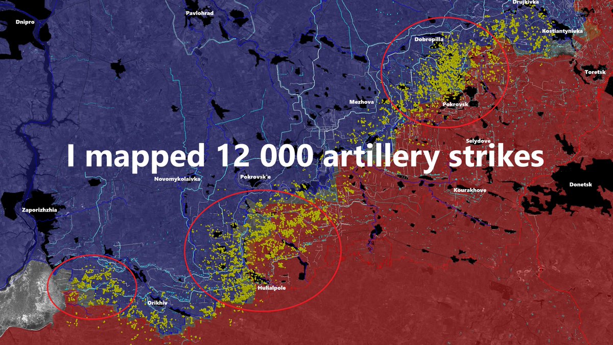
Dangerous situation for ukrainian 🇺🇦 forces in the Donbass as the russian 🇷🇺 breakthrough between Kostiantynivka and Pokrovsk continue.
Ukrainian engineering units also started digging a defensive line west of the Donbass region.
🧵THREAD🧵1/24 ⬇️
Ukrainian engineering units also started digging a defensive line west of the Donbass region.
🧵THREAD🧵1/24 ⬇️

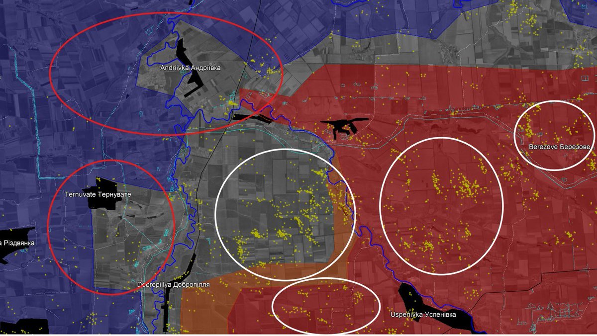
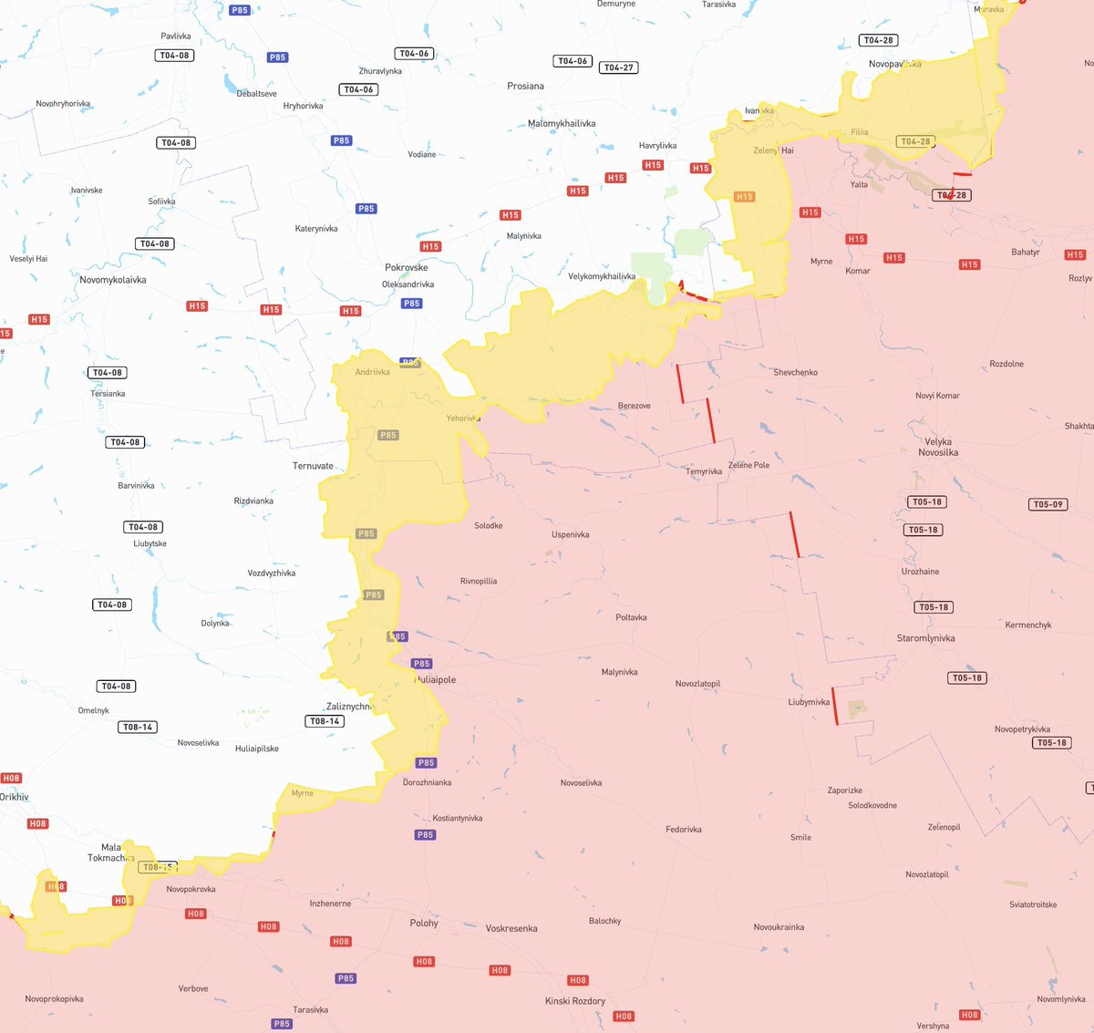
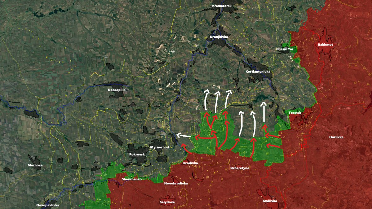
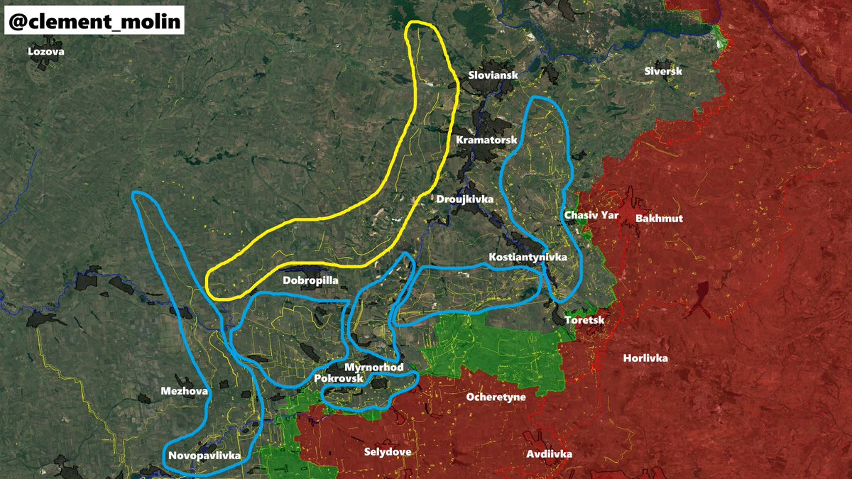
Day after day, the situation is worsening, russian forces, dominating the Ocheretyne heights continue to push north in the fields between Myrnohord and Kostiantynivka.
Ukrainian forces have been gradually forced to abandon empty zones between cities.
Ukrainian forces have been gradually forced to abandon empty zones between cities.

Those empty zones (large fields, without proper natural defenses and any urban area) are the favorites ones for russian forces, who prefer going around cities than to enter them.
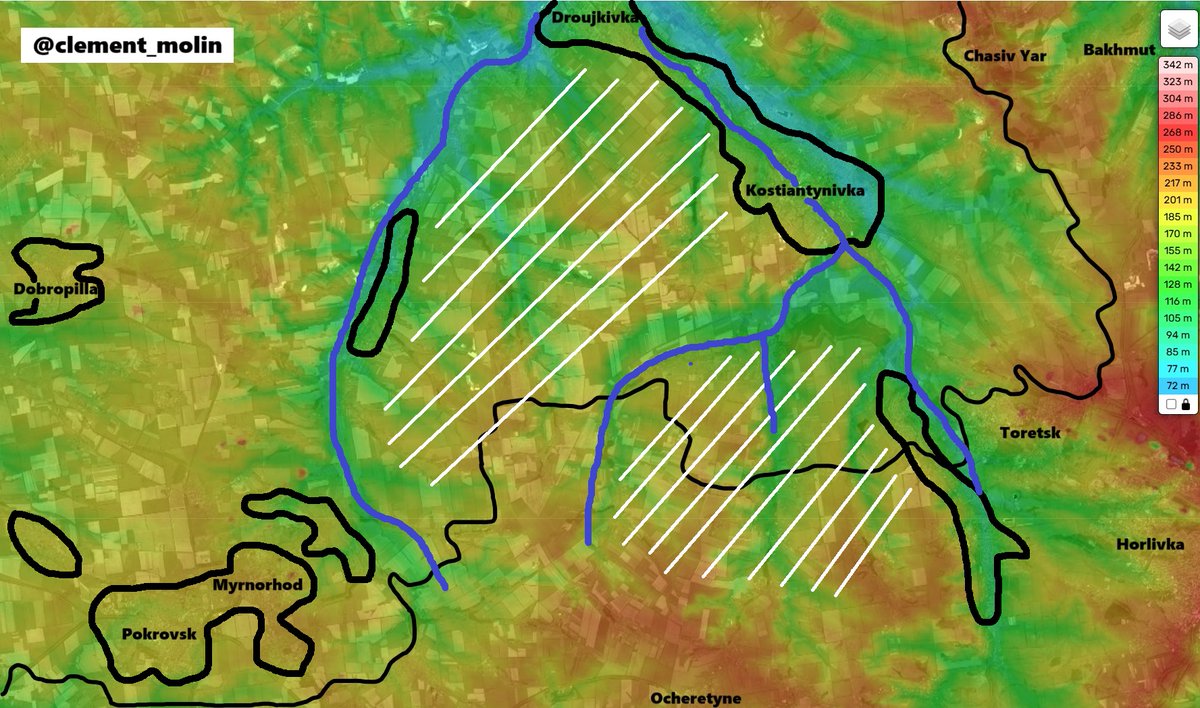
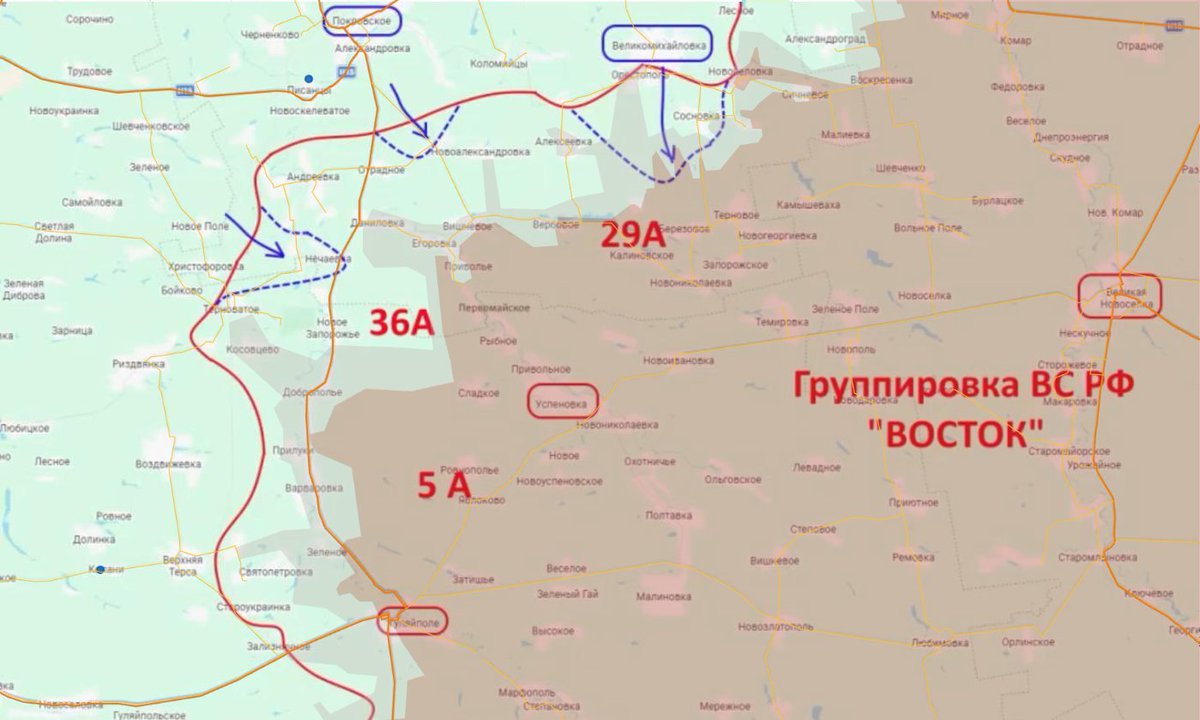
Russian forces managed to defeat the ukrainian group between Pokrovsk and Kostinatynivka, further isolating the Kostiantynivka-Toretsk one from the Pokrovsk one.
Ukrainian forces will now be forced to establish a Pokrovsk-Droujkivka line, while ressuplying Kostiantynivka.
Ukrainian forces will now be forced to establish a Pokrovsk-Droujkivka line, while ressuplying Kostiantynivka.

What failed ?
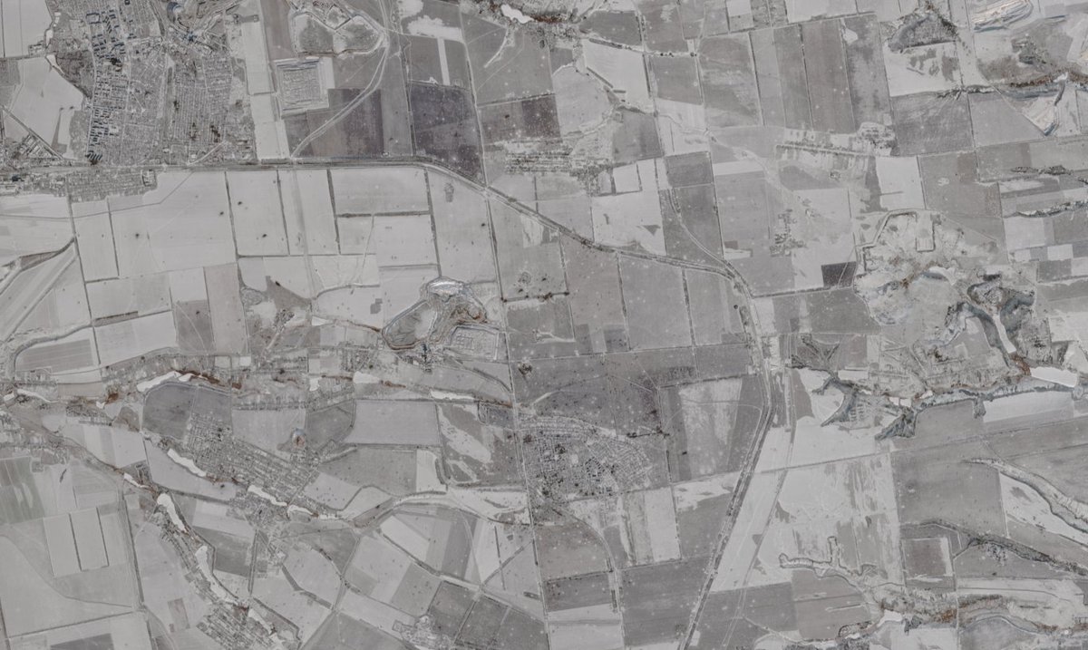
Russian army still have large mobile forces and infantry reserve. They first pushed behing the main line and continue now with the exploitation of the breakthrough.
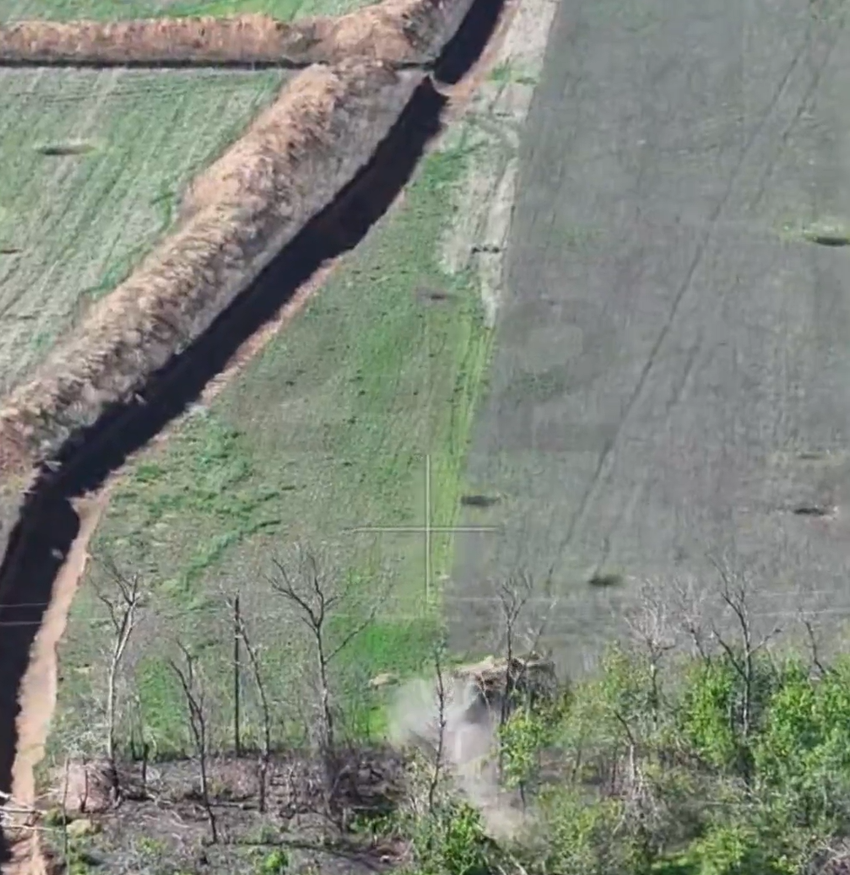
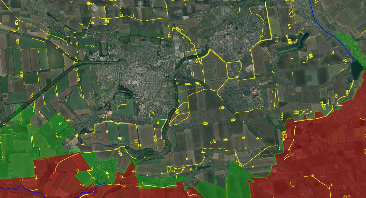
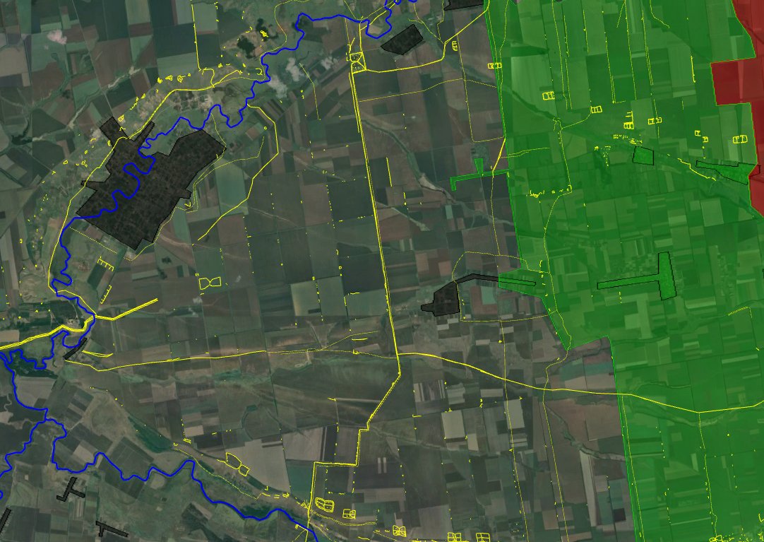
Take a look at the anti-tank ditches.
Russian army still have large mobile forces and infantry reserve. They first pushed behing the main line and continue now with the exploitation of the breakthrough.
Take a look at the anti-tank ditches.
The armoured vehicle is forced to avoid them and follow a path decided by ukrainian forces, mainly roads and the few holes in the ditch.
But without proper drone and artillery support + infantry defending villages and strongholds, the vehicle can still manage to make it.
But without proper drone and artillery support + infantry defending villages and strongholds, the vehicle can still manage to make it.
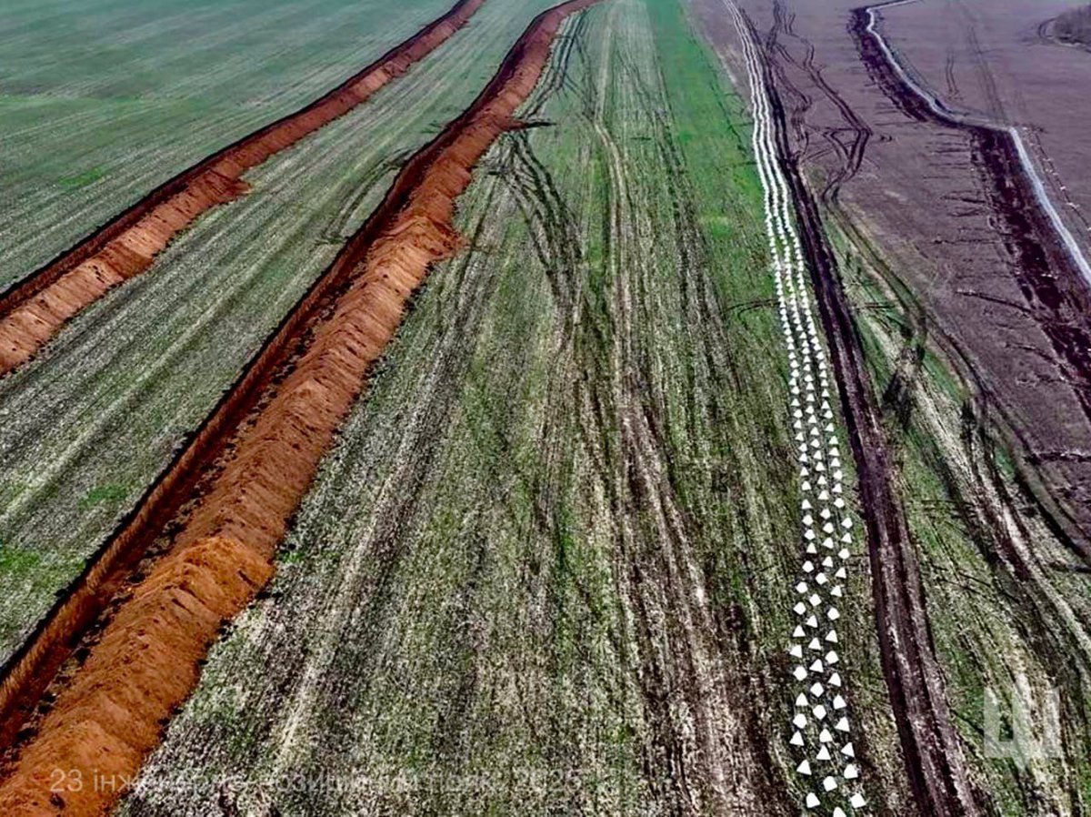
What is the solution ?
The defense must be complete :
-Dragon teeths with a wire to avoid them from being pushed
-Barbed wire on top (avoiding cuting of the wire and infantry penetration)
-2 anti-tank ditches
-mines on the roads where there is no ditch or teeths.
The defense must be complete :
-Dragon teeths with a wire to avoid them from being pushed
-Barbed wire on top (avoiding cuting of the wire and infantry penetration)
-2 anti-tank ditches
-mines on the roads where there is no ditch or teeths.
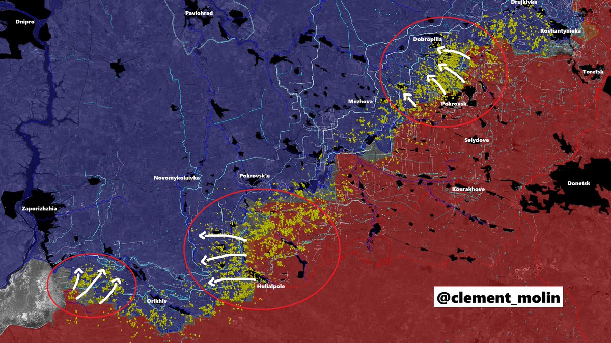
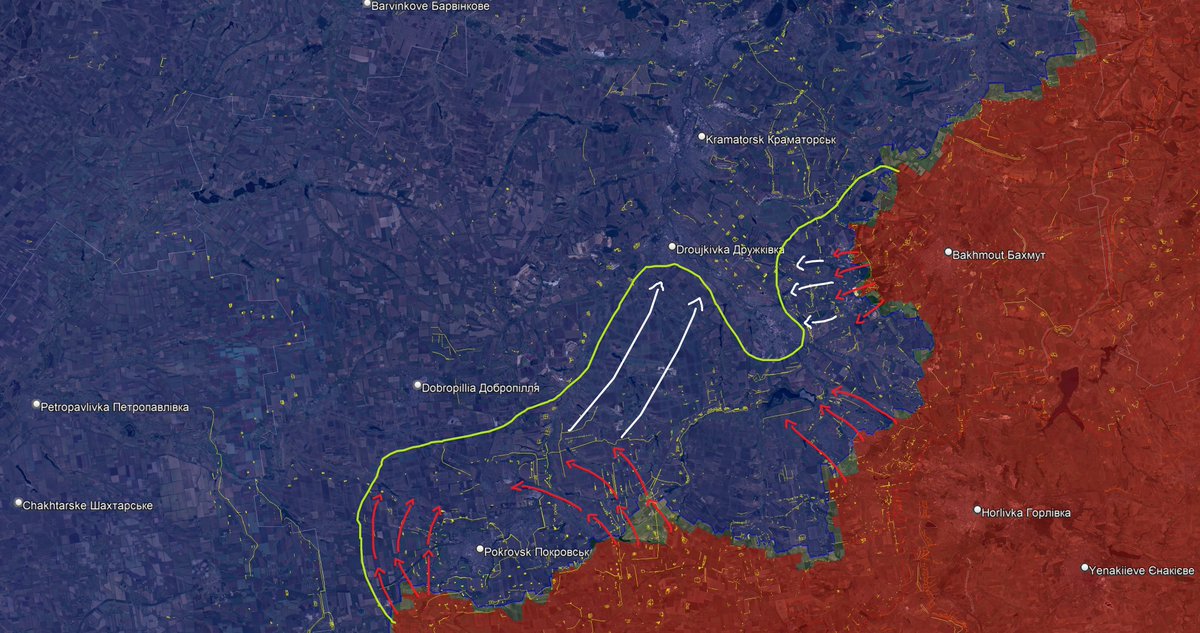
Russian offensive in the central part of Donetsk region comes after months of battles to secure the southern approch of Pokrovsk.
Now, they are trying to isolate Pokrovsk from the Sloviansk-Kostiantynivka agglomeration.
Now, they are trying to isolate Pokrovsk from the Sloviansk-Kostiantynivka agglomeration.
Disrupting supply lines :
The current russian offensive will try to occupy the empty fields between Pokrovsk, Droujkivka and Kostiantynivka.
-> this will disrupt the Dobropilla-Kramatorsk highway and Kramatorsk-Kostiantynivka highway.
The current russian offensive will try to occupy the empty fields between Pokrovsk, Droujkivka and Kostiantynivka.
-> this will disrupt the Dobropilla-Kramatorsk highway and Kramatorsk-Kostiantynivka highway.
In a few months, russian army is hoping to capture the tactical hights of Stepanivka (west of Kostiantynivka) and Chasiv Yar (east). This will force a steady withdrawal from the city.
Ukrainians will try to establish a Droujkivka-Pokrovsk line with the help of Dobropilla.
Ukrainians will try to establish a Droujkivka-Pokrovsk line with the help of Dobropilla.

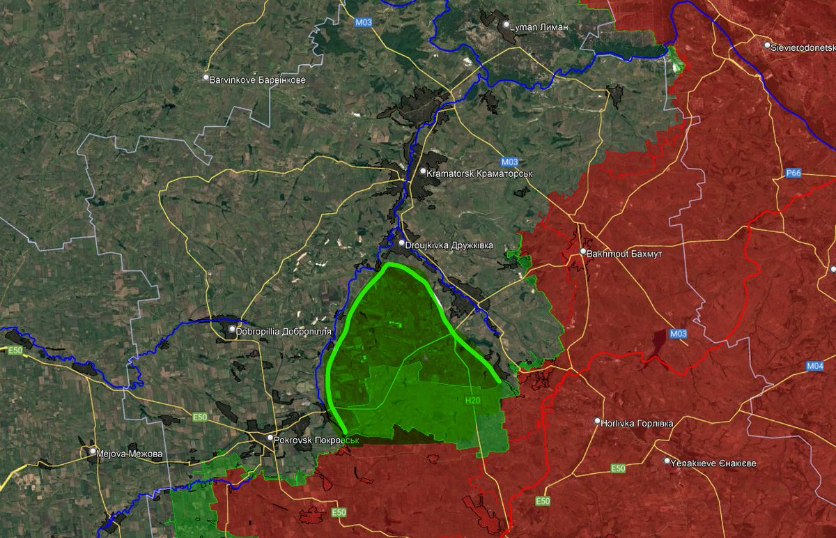
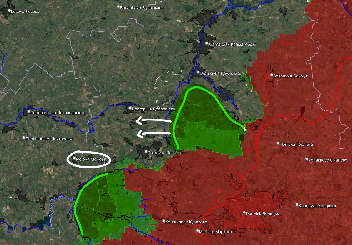
In my january 2025 hypothesis for 2025, I did this map, showing the possible objective of russian offensive of 2025.
I thought Russia would try to capture Pokrovsk first, in fact, they tryied to progress around the city in january and february before shifting their objective.
I thought Russia would try to capture Pokrovsk first, in fact, they tryied to progress around the city in january and february before shifting their objective.
Pokrovsk and Myrnorhod remained safe because ukrainian forces managed to deter them from attacking : efficient anti-tank ditches, well built and hidden strongholds, large number of troops hidden in the city, high buildings for the observation.
I think that russian strategic objectives for 2025 remain the same as I wrote in late january : capturing both Pokrovsk and Kostiantynivka.
The success of this operation depends on when the green areas will be captured.
Then they may try again to climb to Pokrovsk, by taking Mezhova and cutting the Dobropilla road, while assaulting Kostiantynivka.
The success of this operation depends on when the green areas will be captured.
Then they may try again to climb to Pokrovsk, by taking Mezhova and cutting the Dobropilla road, while assaulting Kostiantynivka.
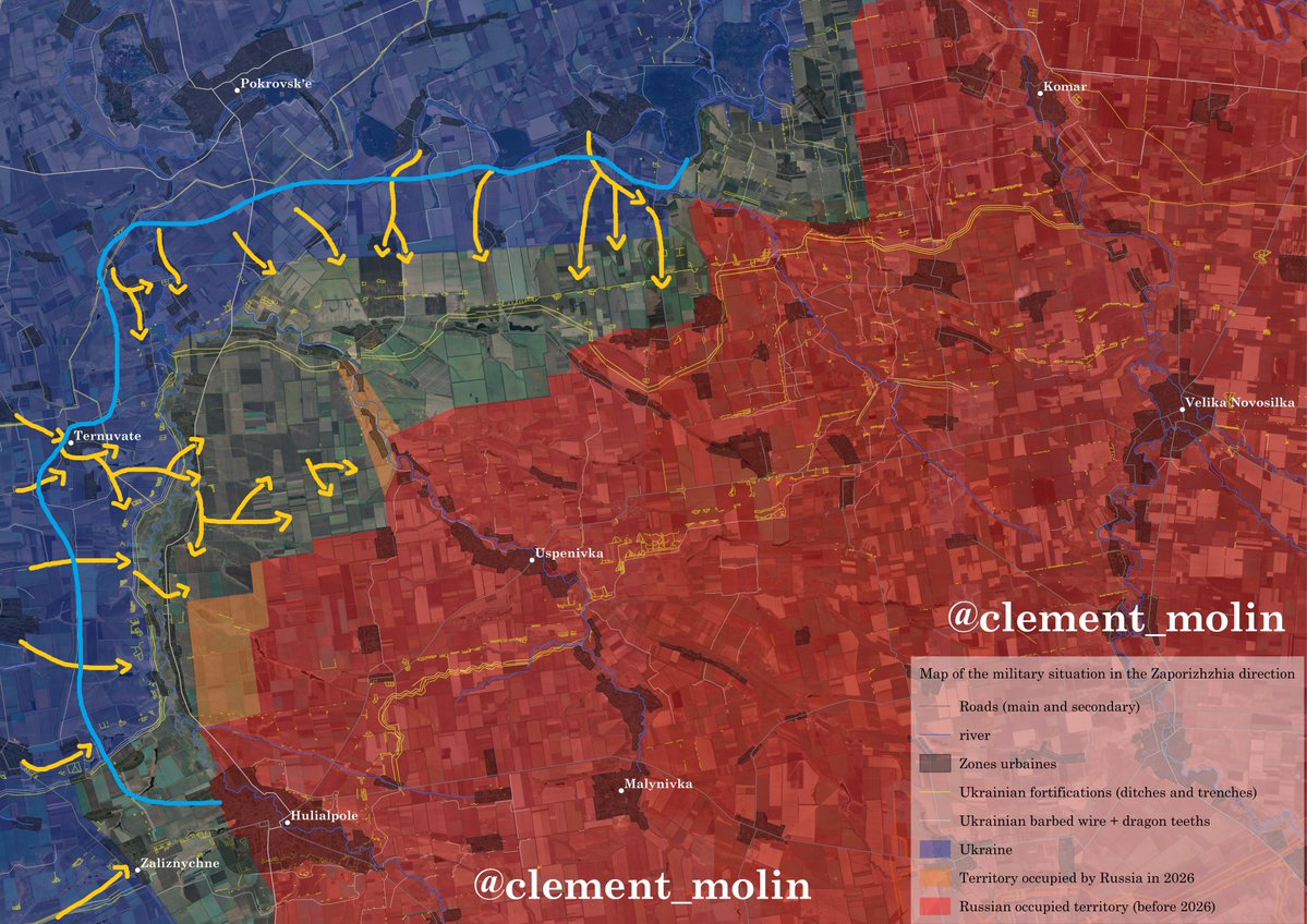
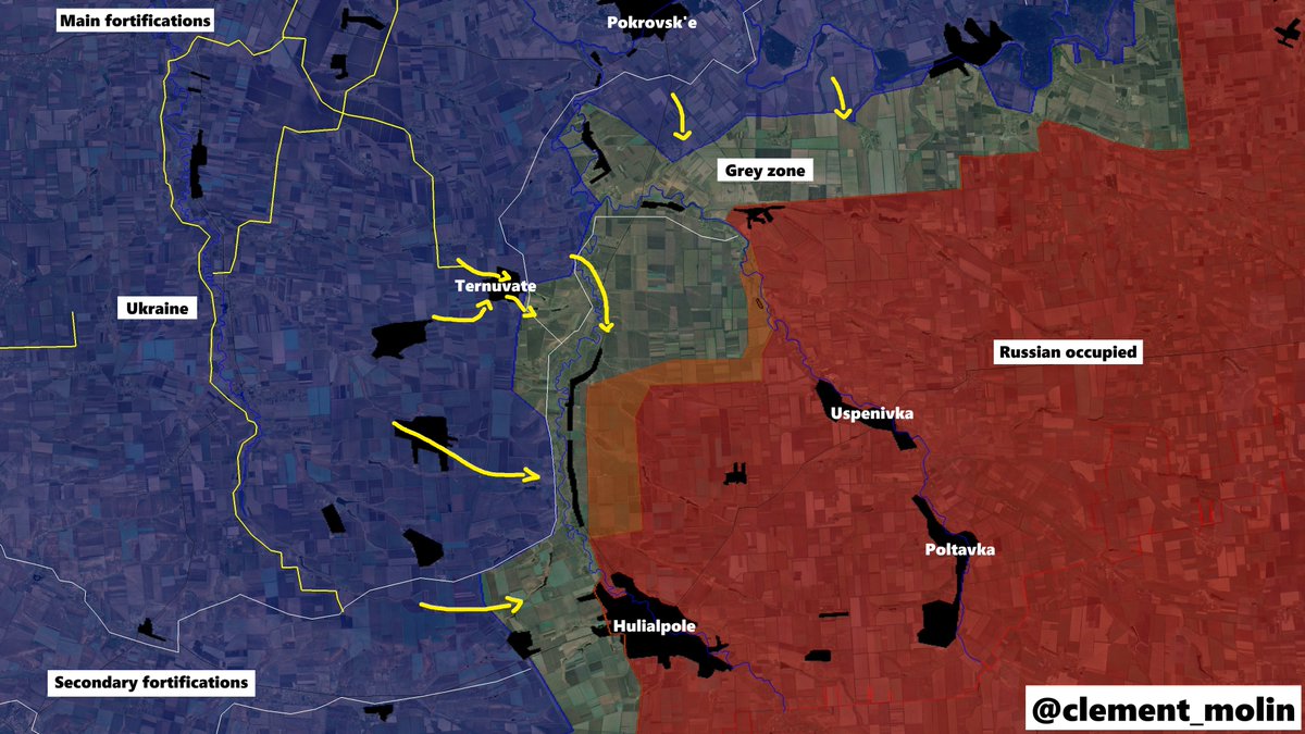
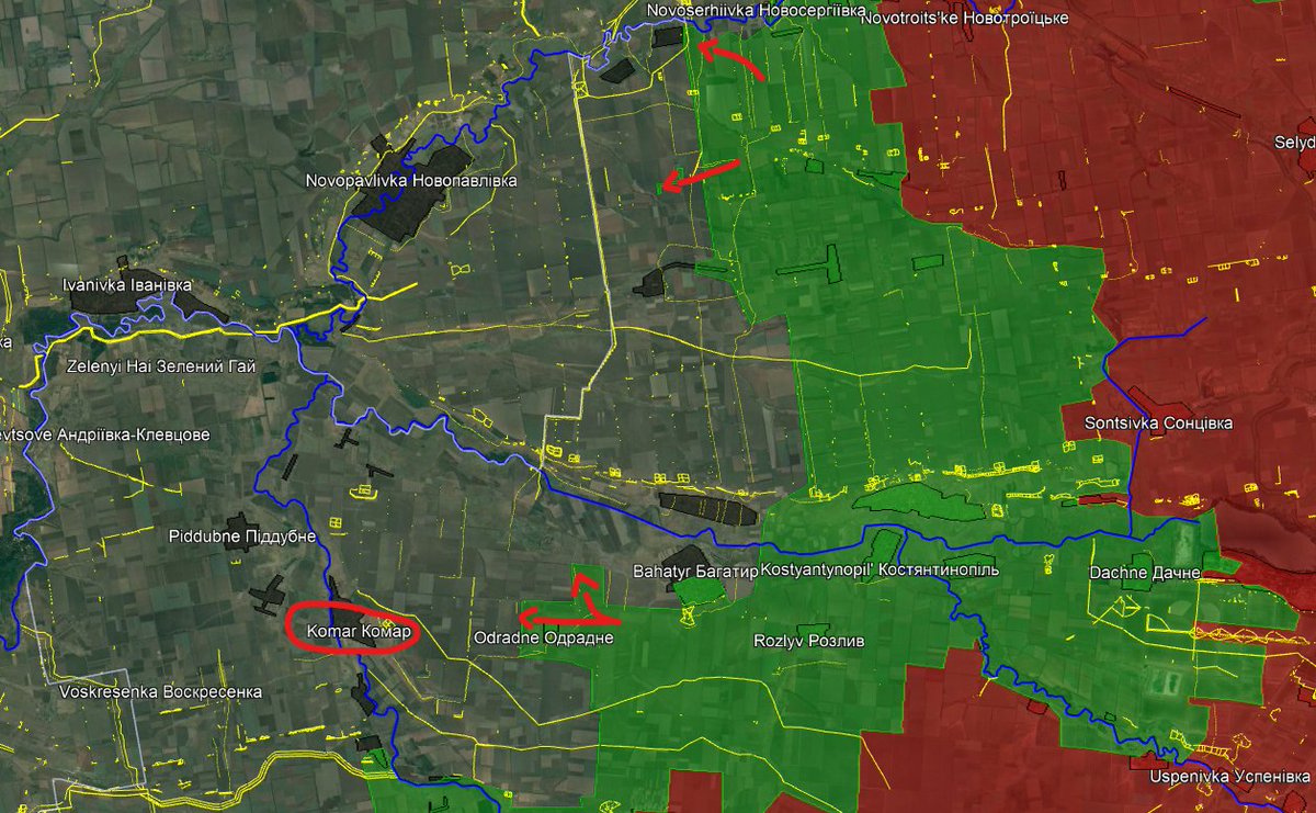
Talking about south of Pokrovsk, russian army entered Odradne and Bahatyr, threatening the remaining empty fields before the junction of Solena, Mokri Yali and Vovocha rivers.
Behind is set to be the next main defensive line. However, Komar direction is not well defended...
Behind is set to be the next main defensive line. However, Komar direction is not well defended...
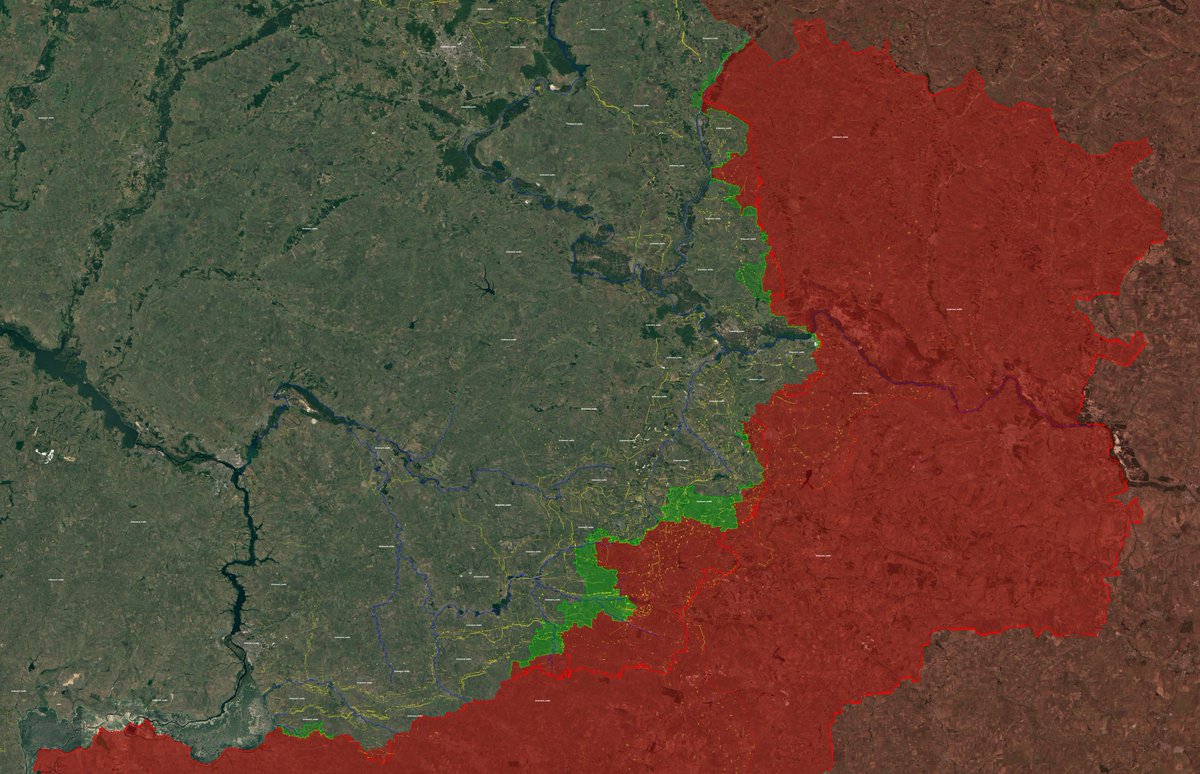
This is my map from september 2024. After the capture of Selydove, I wrote that there will be different phases of russian offensive.
The red and orange one have now been finished (it took very long, despite what commentators say) and we are on the pink one now.
The red and orange one have now been finished (it took very long, despite what commentators say) and we are on the pink one now.
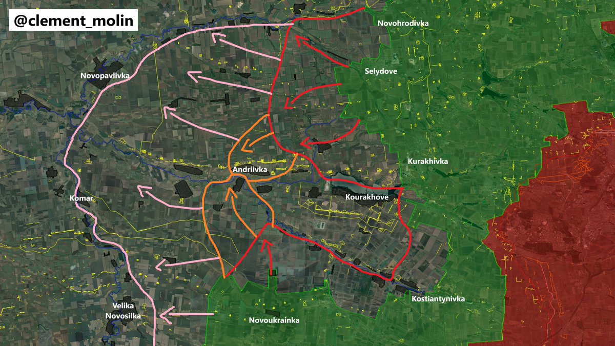
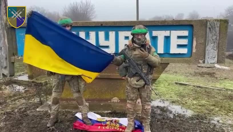
In this direction, every treeline have been successfully defended since october and the russian forces have been largely delayed, now 2 defensive lines stand behing the Solena river.
Multiple entrenched positions in treelines remains after the Dnipropetrovsk oblast border.
Multiple entrenched positions in treelines remains after the Dnipropetrovsk oblast border.
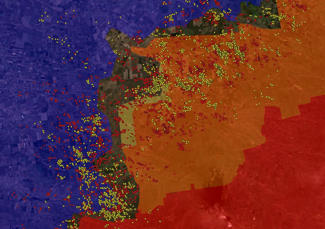
We now know what russian strategy is. They launch attrition batlles to fix ukrainian forces (in Toretsk), while launching months long offensives between cities and town.
This strategy slowly manages to isolate big agglomerations (highly defended), forcing an abandon.
This strategy slowly manages to isolate big agglomerations (highly defended), forcing an abandon.
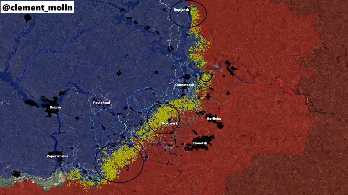
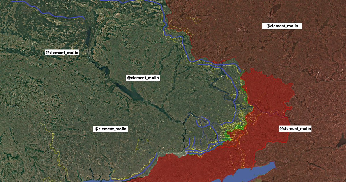
As you can see on my fortification map, I isolated 7 main fortification groups.
From the east, we have the Sloviansk-Toretsk lines, then the Kostiantynivka-Pokrovsk lines (now under attack), then 3 defensive groupings for Pokrovsk, South, North-East and North West.
From the east, we have the Sloviansk-Toretsk lines, then the Kostiantynivka-Pokrovsk lines (now under attack), then 3 defensive groupings for Pokrovsk, South, North-East and North West.
Then the Dnipropetrovsk oblast lines.
Finally, a new massive line is under construction. It stretch from the Siverski Donets river to the Pavlorhad-Donetsk highway, west of Donetsk oblast and after the main cities.
This will be the main final retreat line from Donbass.
Finally, a new massive line is under construction. It stretch from the Siverski Donets river to the Pavlorhad-Donetsk highway, west of Donetsk oblast and after the main cities.
This will be the main final retreat line from Donbass.

This is the maximum quality map I could make, you should click on it to zoom and see all the fortifications in Ukraine.
To conclude this thread, we can see a sort of continuity of all defensive lines, from the Belarussian border to Tchernihiv, Sumy and Kharkiv oblast, followed by Izioum-West Donetsk line and finally the southern ukraine Zaporizhia lines and Kherson line.
If you want a more tactical overview, you should read playfra's thread on the topic.
https://x.com/Playfra0/status/1926308776182681734
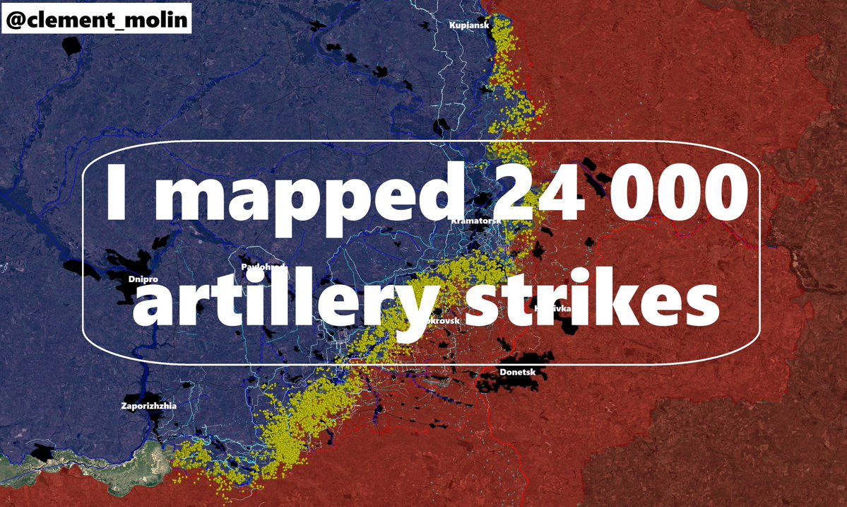
Together, we map fortifications, here is a snapshot from the new strategy, double or triple anti-tank ditches and multiple small positions hidden in the treelines, easier to defend.

This mapping job takes me very long and is essential to understand war dynamics, especially defensive lines and to predict offensive paths.
If you wish to support me and buy me a coffee, you can do it here
Those remain the most importants❤️🔃
Thanks !buymeacoffee.com/clement.molin
If you wish to support me and buy me a coffee, you can do it here
Those remain the most importants❤️🔃
Thanks !buymeacoffee.com/clement.molin
• • •
Missing some Tweet in this thread? You can try to
force a refresh