Can there be an invasion of Iran? Hardly. Two maps explain why, and also why Iran is the way it is today, whether its regime will fall, what other superpowers will do, and in general why Iran is the way it is today
1. Iran is a mountain & desert fortress
1. Iran is a mountain & desert fortress

Here's a topograhic map
West: Zagros
North: Caspian Sea + Caucasus, Albroz, & Kopet-Dag mountains + Karakum Desert
East: Mountains + Dasht-e Kavir / Lut Deserts
South: Sea
The only truly exposed area is the southwestern corner of Khuzestan, which is a swamp
West: Zagros
North: Caspian Sea + Caucasus, Albroz, & Kopet-Dag mountains + Karakum Desert
East: Mountains + Dasht-e Kavir / Lut Deserts
South: Sea
The only truly exposed area is the southwestern corner of Khuzestan, which is a swamp

The biggest superpowers lie to the west, and there the very broad Zagros make it really hard to conquer Iran. The mountain range is tall and wide, making logistics similar to Afghanistan. Very hard.
Iraq learned it the hard way when it tried to attack there in 1980
Iraq learned it the hard way when it tried to attack there in 1980

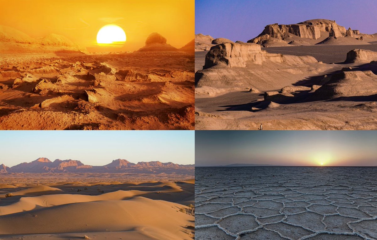
Here are images of the Dasht-e Kavir Desert. It's one of the hottest and driest places in the world. Only one invasion ever succeeded following this path 
2. Iran is in the middle of a highway
If you want to go from Europe / Middle East to China / the Steppes / India, you have to go either through Iran or through the narrow pass in the north between the Caspian Sea and the Ural Mountains. Dozens of armies chose Iran
If you want to go from Europe / Middle East to China / the Steppes / India, you have to go either through Iran or through the narrow pass in the north between the Caspian Sea and the Ural Mountains. Dozens of armies chose Iran
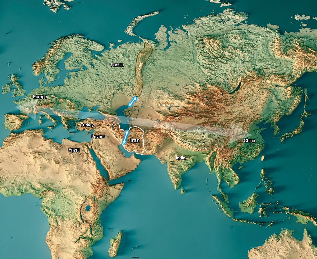
This means that, despite the defense provided by the mountains in history, Persia (former name for Iran) was invaded dozens of times. But only 2 invasion paths were consistently successful
• 5 from Khuzestan in the southwest
• 7 from the desertic steppes in the northeast
• 5 from Khuzestan in the southwest
• 7 from the desertic steppes in the northeast
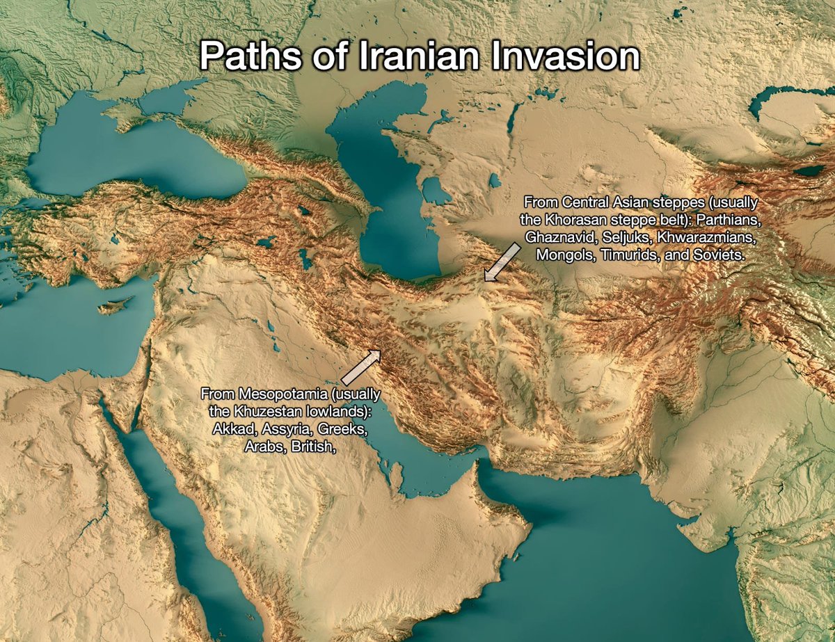
Iran is not worried about the northeast: Nomadic invasions stopped after gunpowder. That region is now weak & safe, no strong enemies
In general, it's reasonably safe in the southeast region of Khuzestan: In the last 1400 years, only the British successfully invaded Iran there
In general, it's reasonably safe in the southeast region of Khuzestan: In the last 1400 years, only the British successfully invaded Iran there
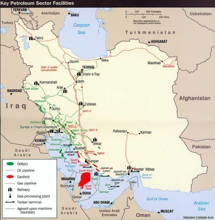
Still this is where Iran is most exposed:
• Flatland (albeit swampy)
• Fertile (Mesopotamia)
• Most of the oil is there
• Easy access from the sea
• It's ethnically Arab (and not Persian)

• Flatland (albeit swampy)
• Fertile (Mesopotamia)
• Most of the oil is there
• Easy access from the sea
• It's ethnically Arab (and not Persian)
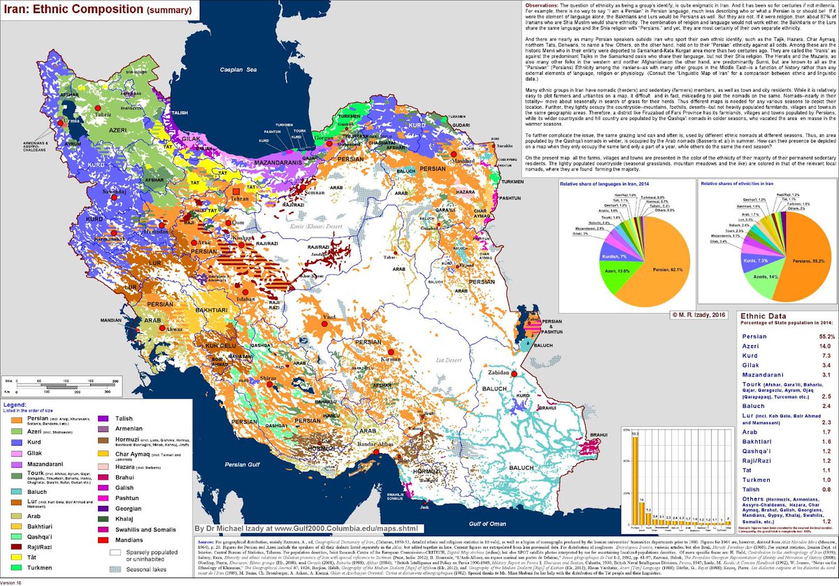
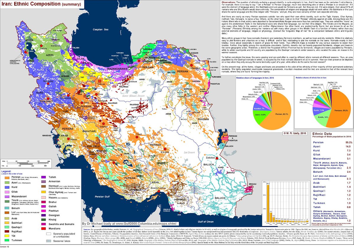
But the ethnic diversity is not only a problem in Khuzestan: Only 60% of Iranians are Persians. A full 25% are Azeri. There are more Azeris in Iran than in Azerbaijan!
And then there are Kurds, Balochis...
Why so many ethinicities? Again, because of the mountains
And then there are Kurds, Balochis...
Why so many ethinicities? Again, because of the mountains
In temperate areas like Europe, the US, or Argentina, ppl live in plains, ideal for cheap transportation, and thus trade and wealth generation
Iran is too hot for that, so ppl live in valleys nearby mountains—which gather moisture from the wind
Iran is too hot for that, so ppl live in valleys nearby mountains—which gather moisture from the wind
You can see how the rains are concentrated in the tallest mountains in the west and north
The result is that ppl live in mountains, which makes transportation and infrastructure very expensive, so trade is lower, and the country is poorer
The result is that ppl live in mountains, which makes transportation and infrastructure very expensive, so trade is lower, and the country is poorer
When transportation is expensive, it's not just trade that suffers. When ppl communicate less, they diverge. This is why Iran is so ethnically diverse
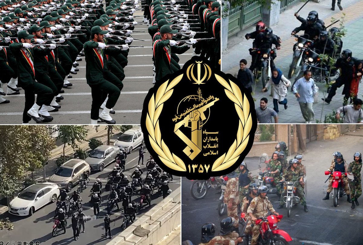
This is why the Iranian state is so oppressive: To keep minorities and their nationalism subdued, and the country united
This is why the Iranian state is so oppressive: To keep minorities and their nationalism subdued, and the country united
OK now imagine you're a Persian leader, safe in your mountains. What would you invade?
East: more deserts and mountains (Afghanistan & Pakistan), only good as a buffer
Northeast: steppes without agriculture
Northwest: mountains
South: mountains & the sea
But to the west...
East: more deserts and mountains (Afghanistan & Pakistan), only good as a buffer
Northeast: steppes without agriculture
Northwest: mountains
South: mountains & the sea
But to the west...
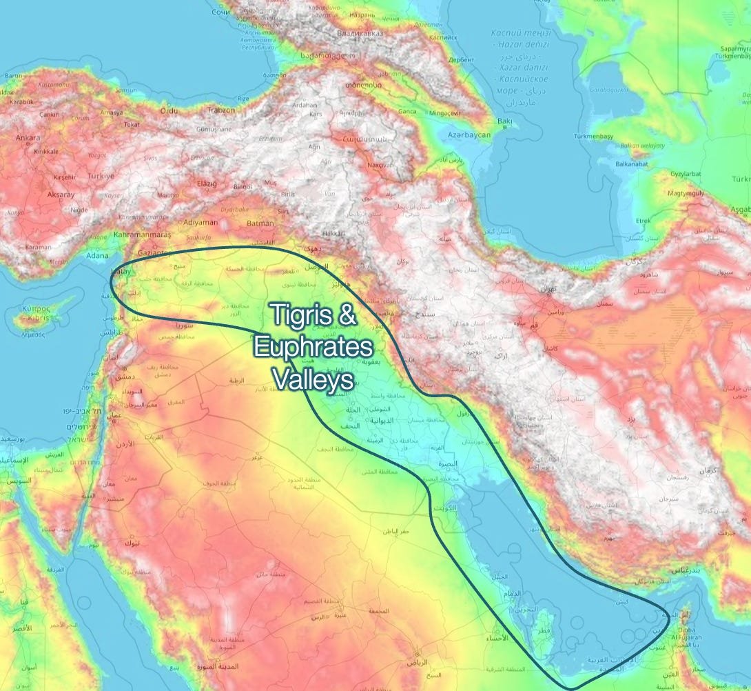
Mesopotamia is so flat because the weight of the Zagros & Anatolia Mountains push land down
Rivers follow that path (like the Indus & Ganges to the east)
And make one of the most fertile lands on Earth
This is why, over history, Persian expansion tended to be in this direction
Rivers follow that path (like the Indus & Ganges to the east)
And make one of the most fertile lands on Earth
This is why, over history, Persian expansion tended to be in this direction
(expansions to the east & northeast were not economic, but as military buffers)
So historically, Persia's area for expansion is naturally towards the Mediterranean. That was true until just a few years ago. Here was Iran's strongest presence
So historically, Persia's area for expansion is naturally towards the Mediterranean. That was true until just a few years ago. Here was Iran's strongest presence
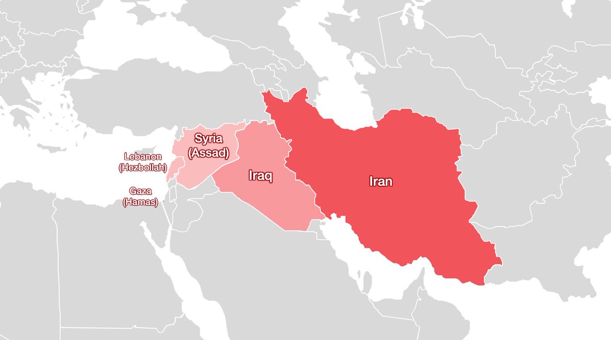
So here you have some of the most important aspects to understand Iran:
• In a highway, invaded many times, it's very wary of foreign invaders
• It feels safe from invasions, perched in its mountains
• These mountains also make it poor though
• And ethnically diverse
• In a highway, invaded many times, it's very wary of foreign invaders
• It feels safe from invasions, perched in its mountains
• These mountains also make it poor though
• And ethnically diverse
• Which begets a strong oppressive authoritarian state
All this tells you Iran's main priorities:
1. Secure borders against foreign powers, especially Khuzestan
2. Keep internal unity
3. Freedom from foreign influence
4. Trade oil
5. Project power towards the Med
All this tells you Iran's main priorities:
1. Secure borders against foreign powers, especially Khuzestan
2. Keep internal unity
3. Freedom from foreign influence
4. Trade oil
5. Project power towards the Med
Of those, it has achieved 1 and 2, it's been fighting to achieve 3 since the 1979 Revolution, has suffered in 4 because of that, and has attempted 5 but failed, mainly because of Israel
What does that say about the current war?
What does that say about the current war?
1. Neither the US nor Israel will ever invade Iran. All 3 countries know this. This war will be limited to air fights and special operations.
2. The regime can fall because it's been oppressive for decades, ppl are poor, and there's lots of ethnic diversity
2. The regime can fall because it's been oppressive for decades, ppl are poor, and there's lots of ethnic diversity
Much more about this—and about Iran and the war with Israel—in Uncharted Territories
More things I'm covering:
• Why Israel attacked now
• Was Iran getting a nuclear bomb?
• When will the war end?
• Will there be regime change?
& moreunchartedterritories.tomaspueyo.com/p/iran
More things I'm covering:
• Why Israel attacked now
• Was Iran getting a nuclear bomb?
• When will the war end?
• Will there be regime change?
& moreunchartedterritories.tomaspueyo.com/p/iran
• • •
Missing some Tweet in this thread? You can try to
force a refresh


