Ukrainian 🇺🇦 forces are building two massive defensive lines 20km from the frontline
Thousands of small positions and difficult-to-penetrate obstacles have been erected. A second line is being prepared - UPDATE.
🧵THREAD🧵1/23 ⬇️
Thousands of small positions and difficult-to-penetrate obstacles have been erected. A second line is being prepared - UPDATE.
🧵THREAD🧵1/23 ⬇️

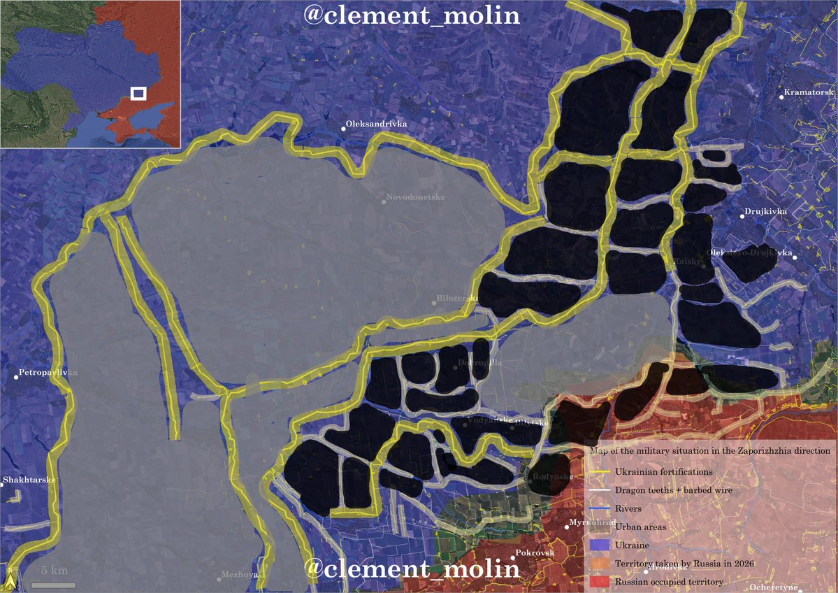
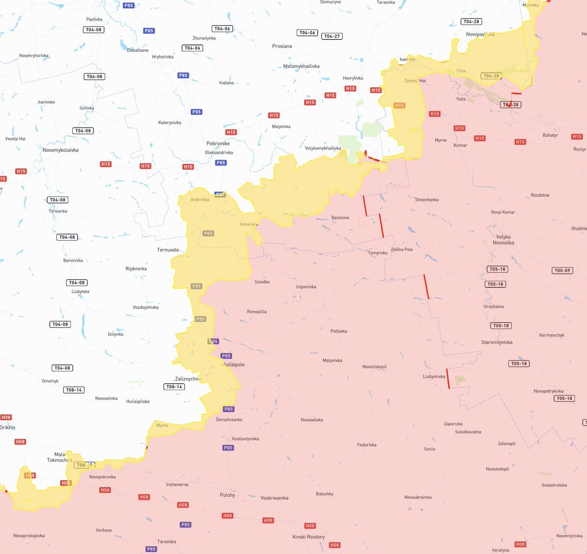
West of Pokrovsk, the reader will notice that anti-tank ditches, obstacles, and trenches are increasingly numerous in the open countryside.
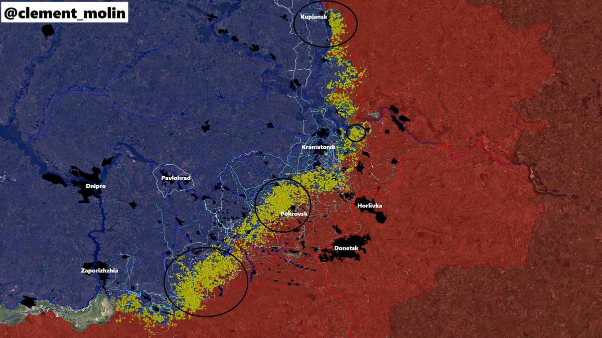
After fortifying the immediate rear of Pokrovsk, the Ukrainian army began its "New Donbass Line."
After fortifying the immediate rear of Pokrovsk, the Ukrainian army began its "New Donbass Line."

I already mapped and analysed part of this New Donbass line. It is stretching from Zaporizhia oblast to Kharkiv.
Now, a new ditch is being completed a few kilometers east, especially behind main Donbass cities.
Now, a new ditch is being completed a few kilometers east, especially behind main Donbass cities.

West of Pokrovsk, you can now see two lines of the 3 rows of ditches and multiple positions behind.
This is the first part and the main one of the upgrade of the current line by a second one.
This is the first part and the main one of the upgrade of the current line by a second one.

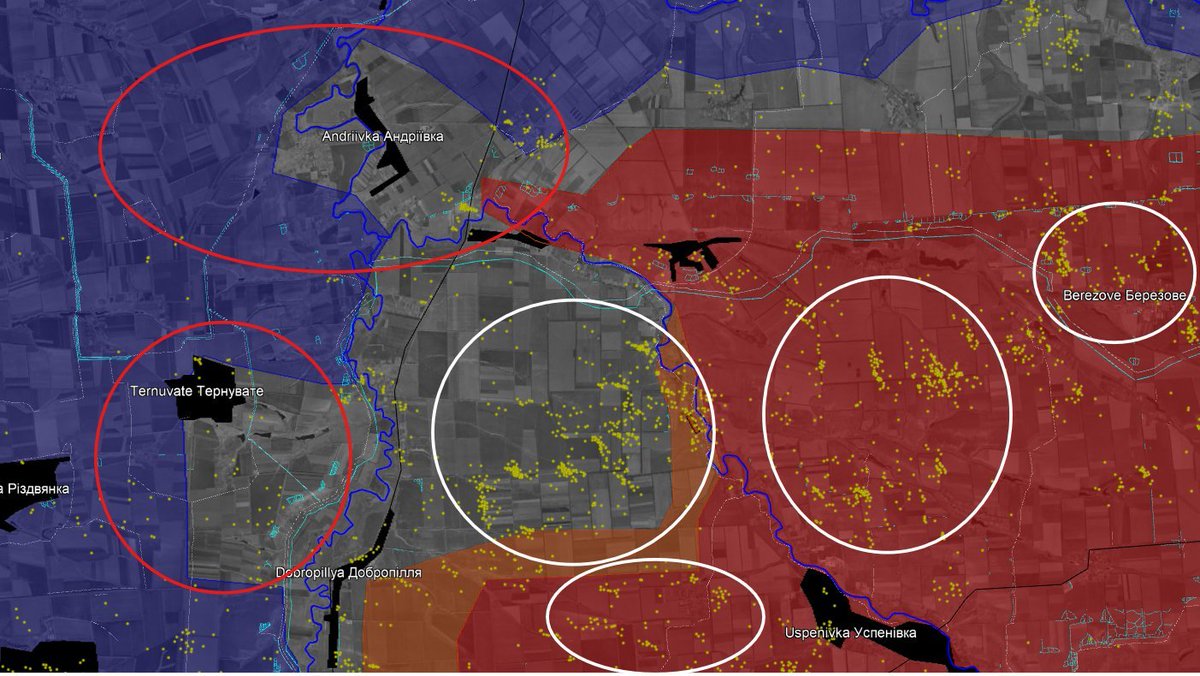
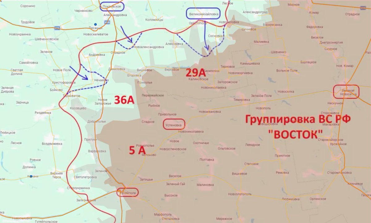
On this map, you can see the new ditches and trenches dug around the mining city of Dobropilla this month.
This small city is strategic, because it is now the main supply hub for ukrainian controlled Donbass.
This small city is strategic, because it is now the main supply hub for ukrainian controlled Donbass.
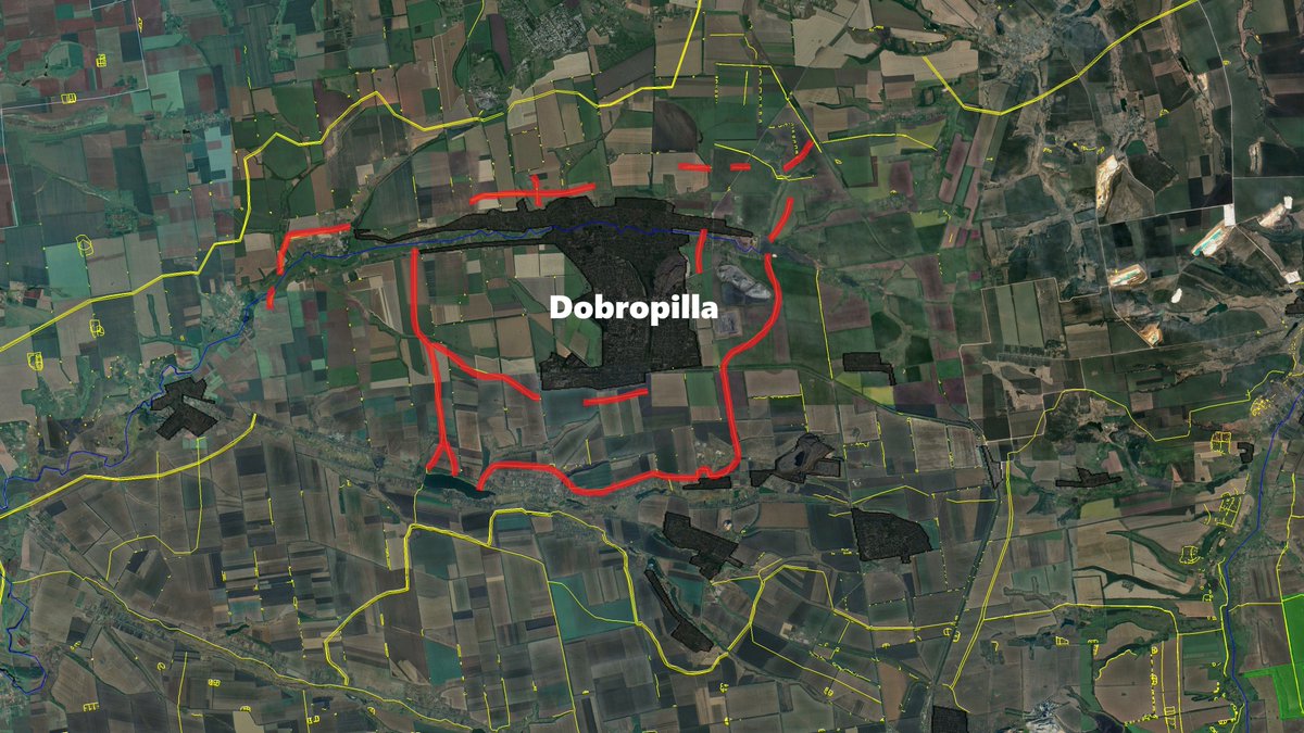
In blue, I added the possible continuity of new ditches and defensive lines around the city in the next few weeks.
This will turn Dobropilla into a fortress.
This will turn Dobropilla into a fortress.

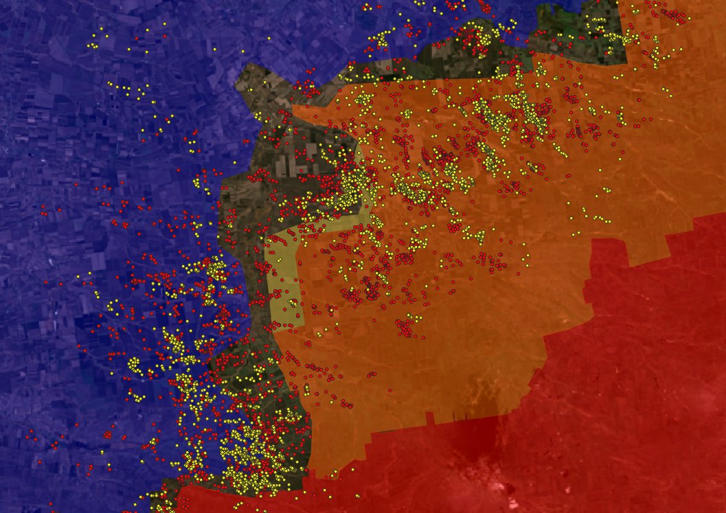
The two ukrainian lines forming together the "New Donbass Line" are both beyond all Donbass cities, Izioum, Lyman, Sloviansk, Kramatorsk, Droujkivka, Kostiantynivka, Dobropilla, Pokrovsk.
The new one, in orange, is not yet very developped, only few positions and 1 to 2 ditches.
The new one, in orange, is not yet very developped, only few positions and 1 to 2 ditches.

In total, there are nine major cities in Donetsk Oblast, all with a dedicated defensive network (in yellow) and defenses connecting these points of interest (in white).
The two lines behind are new because they do not defend any cities.
The two lines behind are new because they do not defend any cities.

The capture of these nine important cities : Siversk, Lyman and Myrnohrod as frontline cities, Kostiantynivka, Pokrovsk, Sloviansk and Druzhkivka as populated industrial cities, Kramatorsk as the capital of ukrainian Donbass, and Dobropilla as a general stronghold ; will enable the russian victory of Donbass.

As the territory west of Donbass, mainly in Kharkhiv and Dnipropetrovsk oblast is open fields, it requires new tactics and new defensive lines.
You cannot defend the same way as the Donbass. It is then crucial to prepare for it, now.
You cannot defend the same way as the Donbass. It is then crucial to prepare for it, now.
I've already mentioned it several times, the new Ukrainian strategy is as follows:
- barbed wire
- 3 anti-tank ditches with barbed wire inside
- 1 row of dragon's teeth + barbed wire
- small trenches and camouflaged bunkers
- barbed wire
- 3 anti-tank ditches with barbed wire inside
- 1 row of dragon's teeth + barbed wire
- small trenches and camouflaged bunkers

1- Barbed wire, to prevent Russian infantry attacks, is present on several heights and in several rows.

2- Three anti-tank ditches were built to prevent Russian armored vehicles from crossing. Barbed wire was placed in the middle.

3- Dragon teeth tied together with an iron cable and topped with barbed wire to prevent any clearing work. Perhaps some mines are also placed there?

4- Small positions and bunker, between the trees, with good cover against drone strikes, to hide infantry and drone teams.

-> The holes in the defensive lines must be covered. Quite often, lines are stopping when there is a forest, a river or a village.
Barbed wire must be placed in remote places where russian infantry can infiltrate.
Barbed wire must be placed in remote places where russian infantry can infiltrate.

As you can imagine, ditches cannot cover everything. Roads must be prepared for ukrainian logistic and retreat.
In this case, the ditch is stopping, forcing russian vehicle to take the road and being more exposed.
In this case, the ditch is stopping, forcing russian vehicle to take the road and being more exposed.
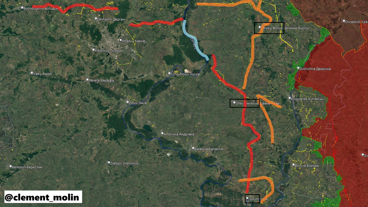
The main defensive line continued as far as Kharkiv. Several small towns, such as Veliky Burluk, Shevchenkove, and Izium, were behind the main line.
The objective was to provide a stopping point behind the Oskil in the event of a Russian advance.
The objective was to provide a stopping point behind the Oskil in the event of a Russian advance.
Despite being very impressive, both lines still have vulnerabilities, such as the lack of cover for roads or some holes.
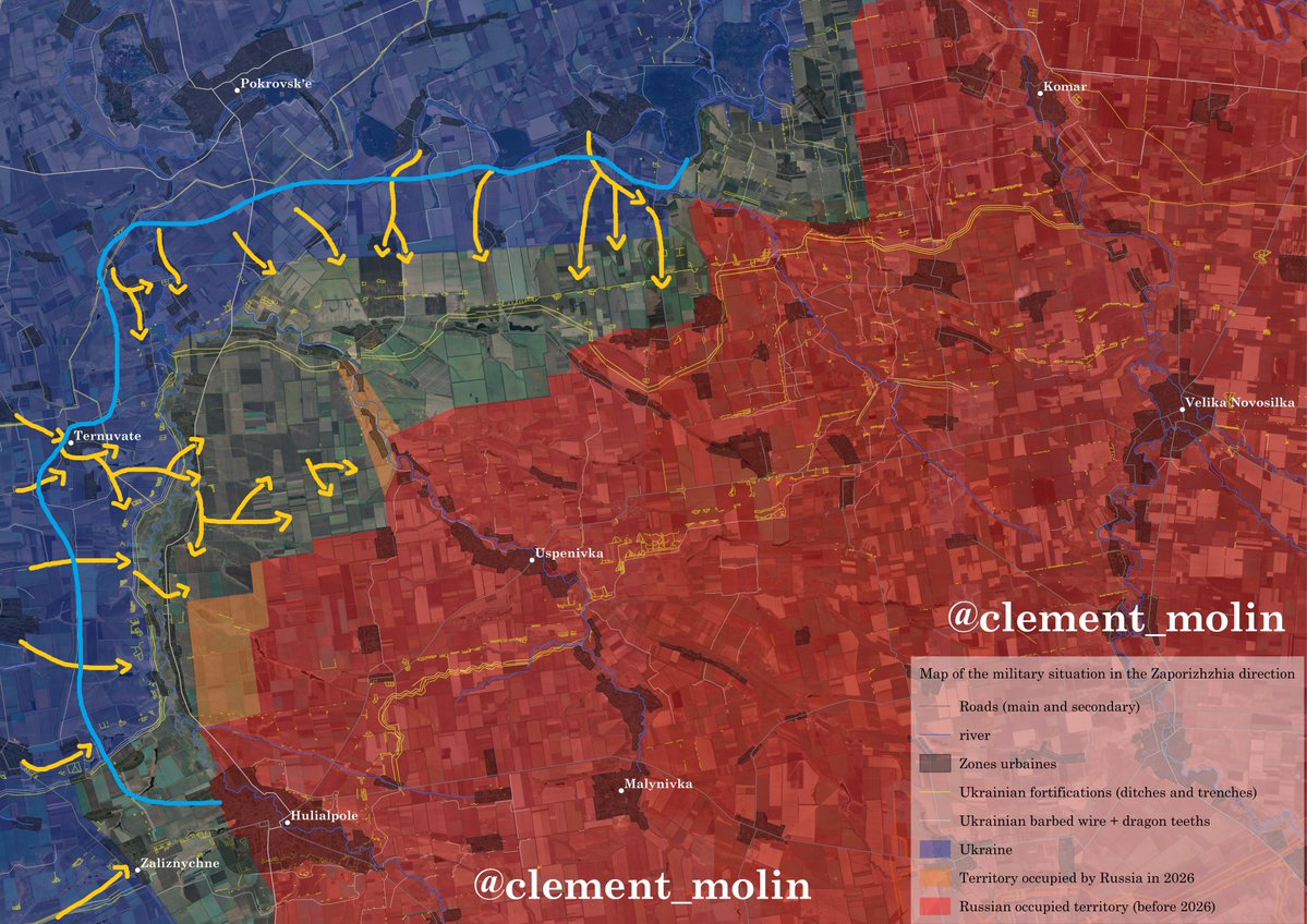
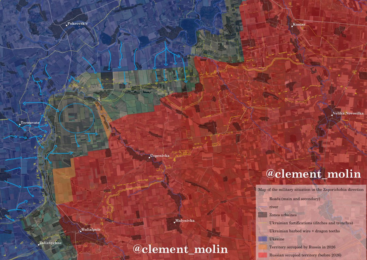
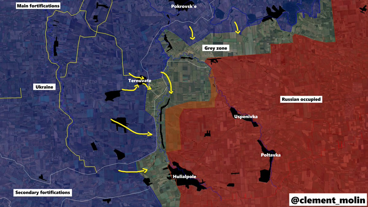
Additionnaly, there is a big vulnerability in Zaporizhia oblast. Both lines are not enough and there is a hole in the defense betseen Prossiana and Pokrovsk'e
Additionnaly, there is a big vulnerability in Zaporizhia oblast. Both lines are not enough and there is a hole in the defense betseen Prossiana and Pokrovsk'e

There is online multiple images and videos from this new line. This time, the work is being done correctly.
However, its effect will only be decided after the fall of Donbass (+/- the 9 cities I talked about), so it's not for now.
However, its effect will only be decided after the fall of Donbass (+/- the 9 cities I talked about), so it's not for now.

As always, this job takes hours and is very important to understand war dynamics. I believe that researchers, mappers, analysts, journalists, and military actively use these types of free, open-access maps.
You can support me here if you wish:
buymeacoffee.com/clement.molin
You can support me here if you wish:
buymeacoffee.com/clement.molin
Thank you for following this new thread. The best support is as simple as a like/retweet/comment.
Don't forget to also follow @atummundi !
Don't forget to also follow @atummundi !
What do you think about my work ? Do you like it ? What should I change ? What should I talk about more and do more ?
• • •
Missing some Tweet in this thread? You can try to
force a refresh