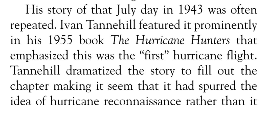
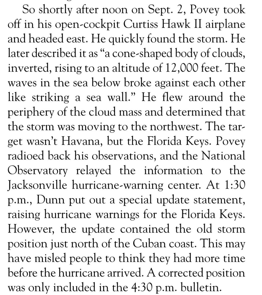
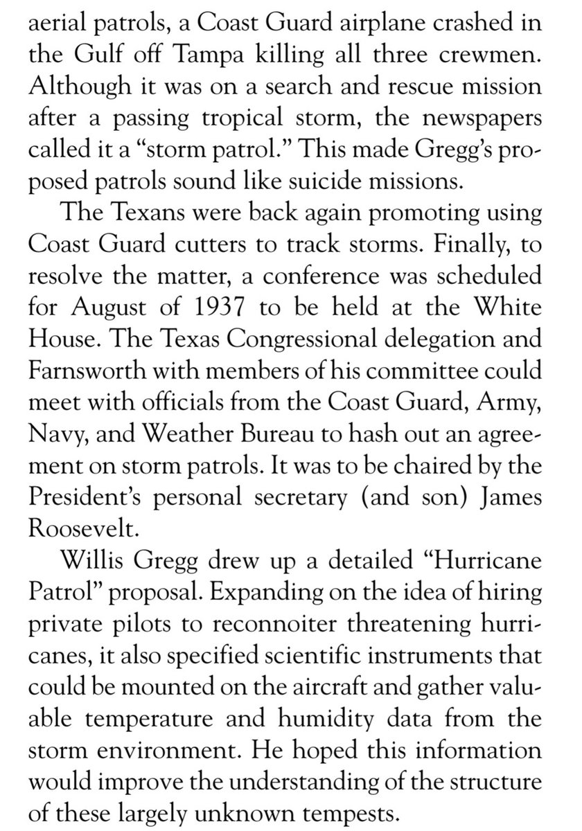
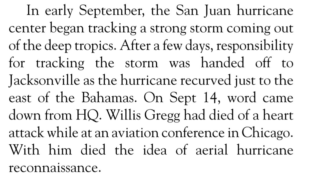
It's disappointing major weather media groups that exist off NOAA/NWS data have been deafeningly silent about federal staffing hits and proposed cuts to NOAA. No letters of support. No news reporting on their detrimental effects to forecasting. Just glaring editorial omission. 🧵
Before anyone retorts "it's their job to stick to weather, blah, blah, blah," these networks have dedicated news desks, entire news teams, journalists, news directors. They regularly report on the ongoings of NOAA and the NWS, including new tech, forecast tools, and products.
Many of these same tools, labs, and state-of-the-art computer models that private weather companies regularly use are now facing almost immediate annihilation. Why would a dedicated weather news network ignore that story?
The billion-dollar private sector weather enterprise has a longstanding, even formal, partnership with NOAA and NWS. They directly profit from the data and forecasts at risk of being dismantled. Failing to report on threats to NOAA's very foundation feels disingenuous at best.
The two largest professional meteorological organizations in the U.S. – the AMS and NWA – teamed up to urge their stakeholders to expeditously speak out on the "almost certainly disasterous" federal cuts, yet weather platforms with the widest reach have chosen not to cover.
While I and a handful of my colleagues haven't shied away from reporting on the myriad ways the proposed NOAA cuts would decimate weather forecasting, it's unfortunate it's left to local, independent, unaffiliated, or retired meteorologists to stick their necks out on this.
Kudos to folks like @JohnMoralesTV, @mattlanza, @AndyHazelton, @spann, @afreedma, @FranklinJamesL, @EricHolthaus, @WeatherSullivan, @ssdance, and others who have stayed on this issue.
Finally, since I have so many friends and colleagues that fall under the "weather media group" umbrella, let me be clear: these are management/corporate decisions. Even if prominent meteorologists at the networks wanted to cover the story, in many (most? all?) cases, they can't.
• • •
Missing some Tweet in this thread? You can try to
force a refresh
A few maps I made tonight to compare areas of rising and sinking air over the past 3 weeks to past seasons. Pretty extreme subsidence over the east Pacific with lots of rising air over Africa; sinking branch perhaps a touch too far east, maybe too much rising air over Africa.
Interesting the same period in 2022 had a similar look but the sinking branch was shifted west. This was a period without any tropical activity prior to September 1st (Danielle formed on September 1st).
Same period for 2021...sinking branch much farther southwest, with more rising air over the Atlantic. During this period we saw the formation of 7 named storms in the Atlantic.
The current outbreak of Saharan dust across the tropical Atlantic is the highest since at least early June 2022. Dust cover over the Atlantic in 2023 was the lowest since satellite records began in 2002. High dust can stifle hurricane formation and help cool down Atlantic waters.
Note: @NASA data used for this plot is only available through July 8th, so the weekly average shown on the plot likely doesn't capture the full degree of the ongoing dust outbreak.
While stronger trade winds across the subtropical Atlantic in recent weeks have probably helped cool sea surface temperatures in this area, it's also likely the extra dust is having a cooling influence by reflecting incoming solar radiation
I somehow missed this terrific Neal Dorst @WeatherwiseMag piece from January. As it turns out...
+ Col. Duckworth flew into the eye of a 1933 hurricane, a decade before his supposed first hurricane flight
+ The 1943 flight wasn't on a dare
+ Duckworth didn't disobey orders to fly
Also the 1935 Labor Day hurricane was flown into (!) by Capt. Leonard Povey – an American in the Cuban Army Corps at the time – when it was only 50-75 miles southeast of the Florida Keys and likely a Category 4 hurricane. This was done in a single engine biplane, mind you.
After the devastation from the 1935 Labor Day hurricane, Povey went to D.C. to lobby Congress for aerial hurricane tracking. The U.S. Weather Bureau Chief was on board for aircraft "storm patrol" in 1936 and drew up a proposal in 1937. Unfortunately he died in September 1938.
The June Atlantic Meridional Mode or AMM was the highest since June 2010 per @UW_AOS. The AMM explains twice the variance of Atlantic tropical activity than MDR sea surface temperatures. Typically, a strong AMM signals climate factors favoring deep tropical Atlantic hurricanes.
If you're interested in learning more about the association between the AMM and hurricane season activity, I encourage you to read Dan Vimont and Jim Kossin's seminal 2007 paper here: agupubs.onlinelibrary.wiley.com/doi/epdf/10.10…