
Hurricane Specialist & Storm Surge Expert @WPLGLocal10 Miami. Alum @NWSNHC, @FEMA, @weatherchannel, @UCAR_CPAESS, @DeptofDefense, @FLSERT. Posts my own.
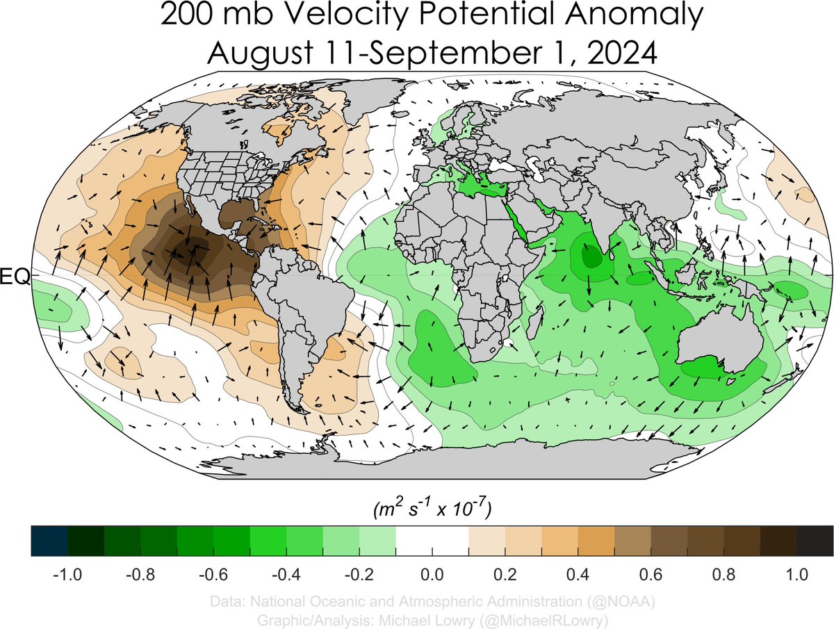 Interesting the same period in 2022 had a similar look but the sinking branch was shifted west. This was a period without any tropical activity prior to September 1st (Danielle formed on September 1st).
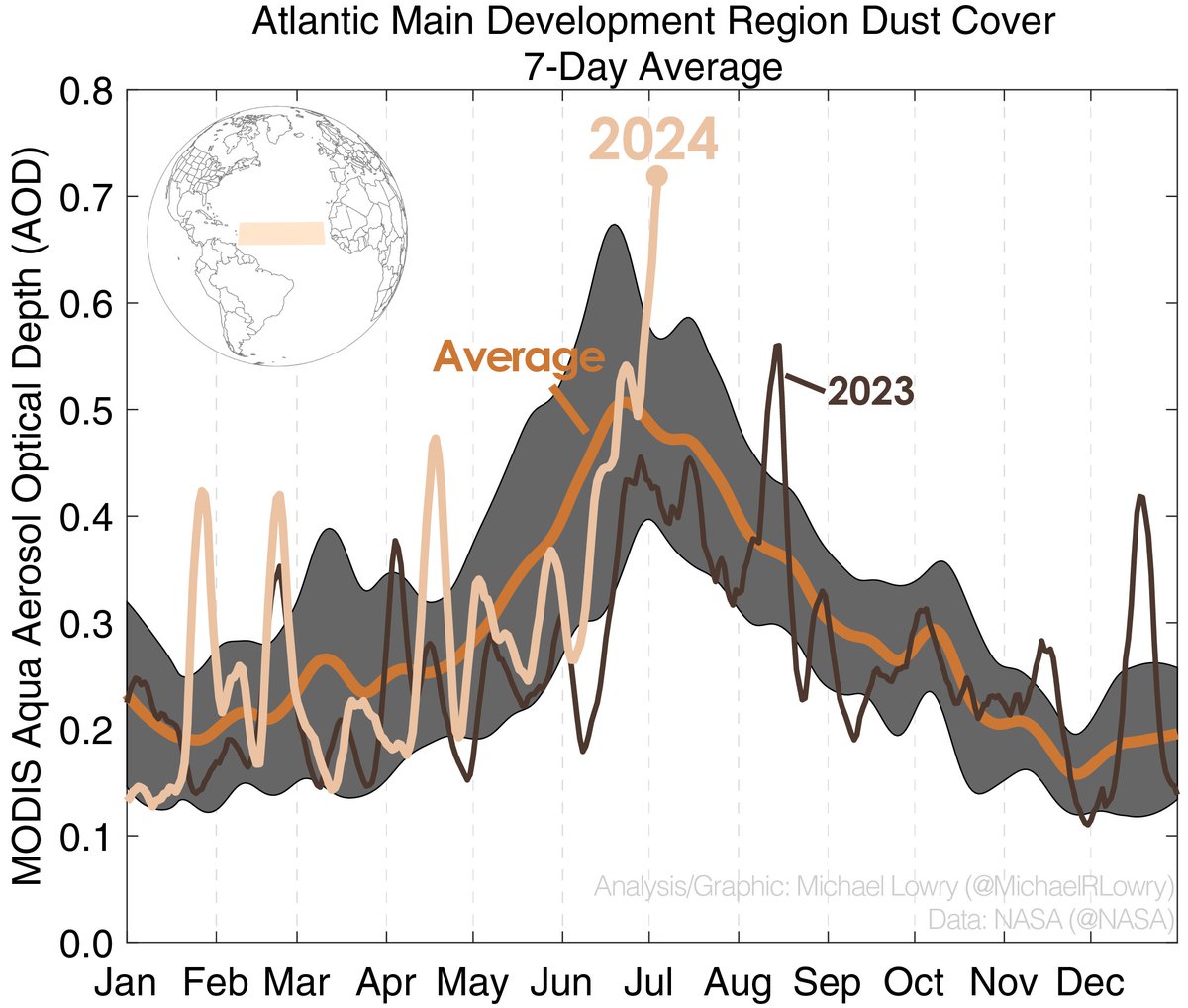
 Note: @NASA data used for this plot is only available through July 8th, so the weekly average shown on the plot likely doesn't capture the full degree of the ongoing dust outbreak.
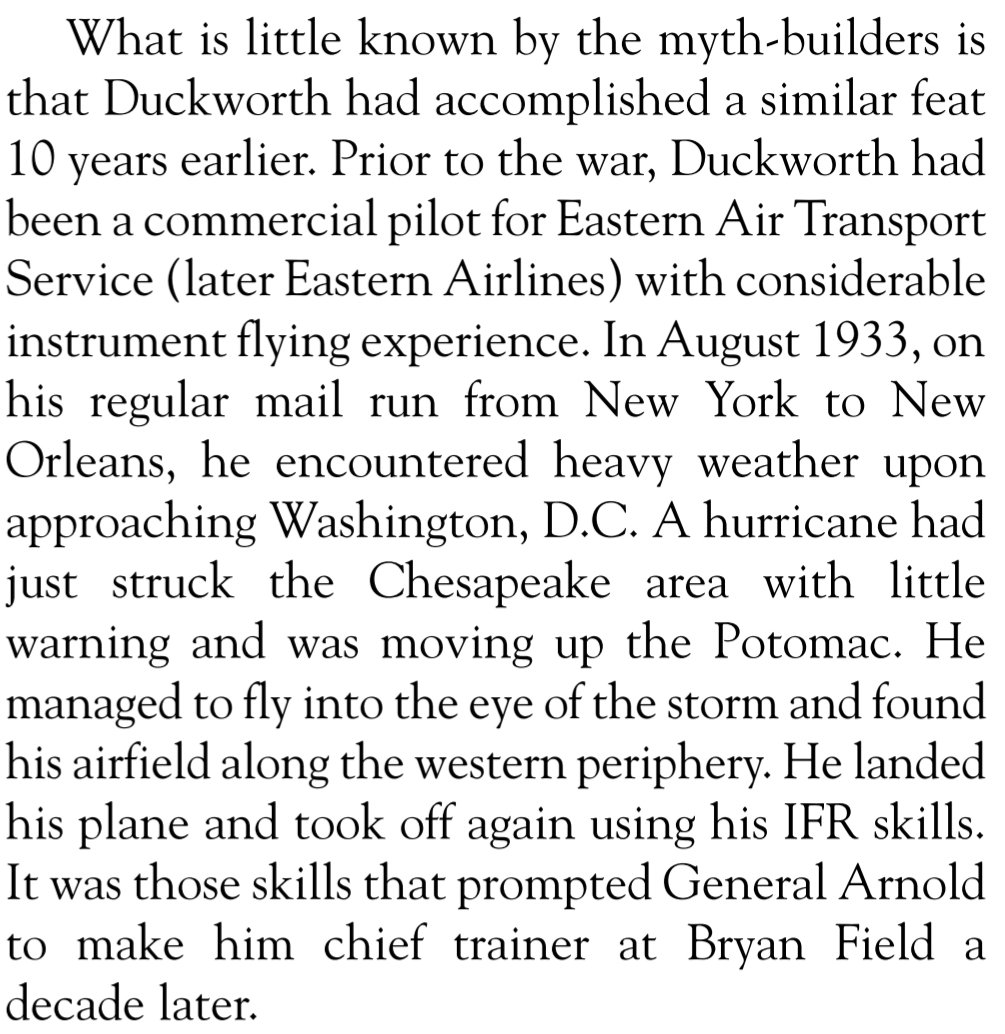
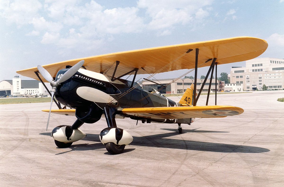
 Also the 1935 Labor Day hurricane was flown into (!) by Capt. Leonard Povey – an American in the Cuban Army Corps at the time – when it was only 50-75 miles southeast of the Florida Keys and likely a Category 4 hurricane. This was done in a single engine biplane, mind you.
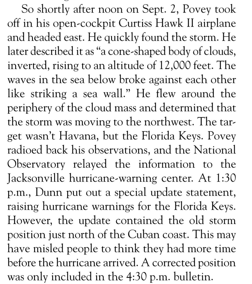
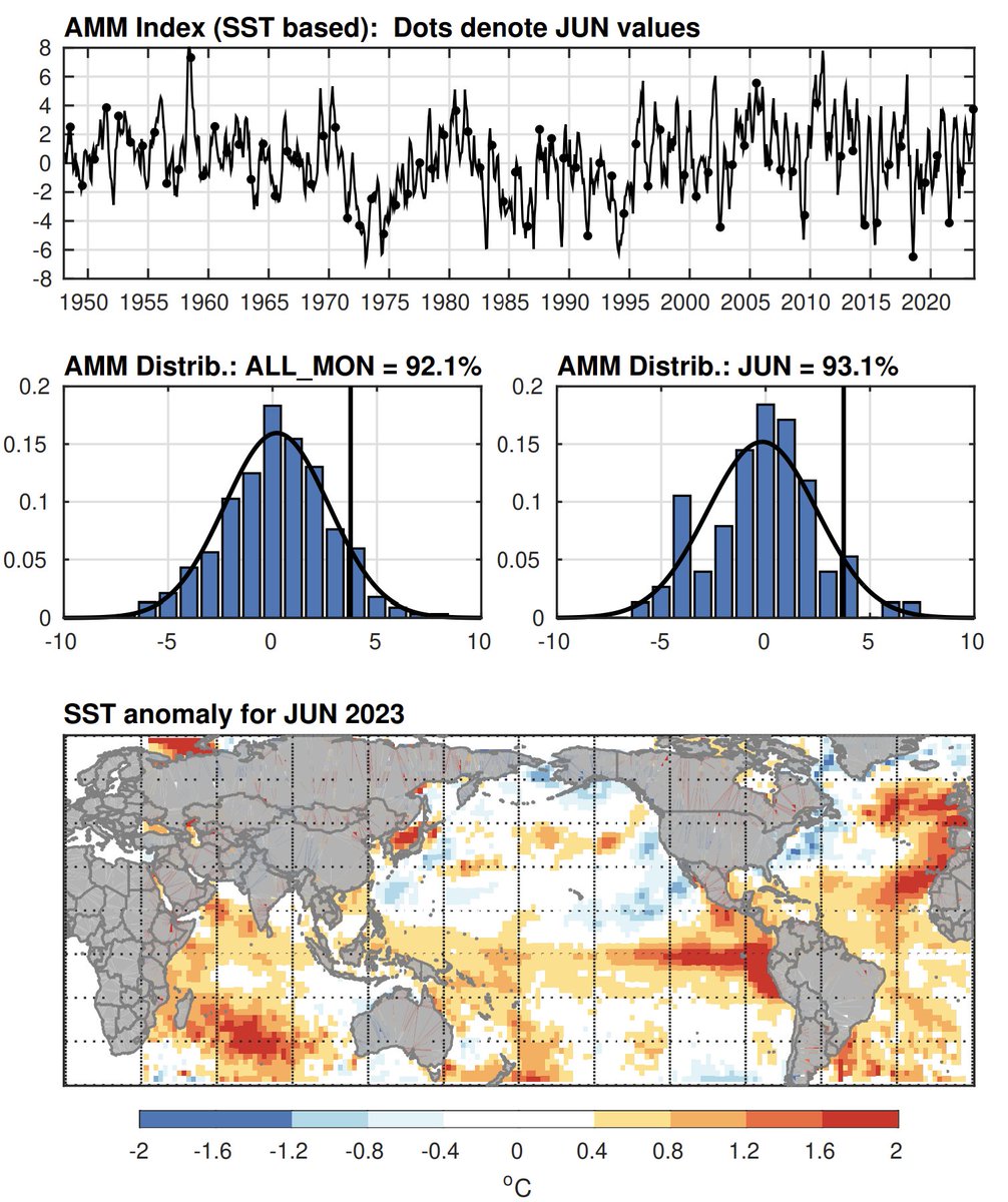 If you're interested in learning more about the association between the AMM and hurricane season activity, I encourage you to read Dan Vimont and Jim Kossin's seminal 2007 paper here: agupubs.onlinelibrary.wiley.com/doi/epdf/10.10…