Moscow is one of the weirdest capitals:
• Biggest European city
• Extremely cold
• Little farmland
• To Russia's extreme west
• Not on a coast or main river
How did it create the biggest country on Earth?
It involves horse archers, human harvesting & tiny animals 🧵
• Biggest European city
• Extremely cold
• Little farmland
• To Russia's extreme west
• Not on a coast or main river
How did it create the biggest country on Earth?
It involves horse archers, human harvesting & tiny animals 🧵
The first shocking fact is that Russia is so far north it's at the edge of arable land. How can you create a capital with so little food? Why not in the middle of the most fertile area on Earth? 

This far north is extremely cold
Moscow is the 3rd coldest capital in the world and by far the biggest: with 20M ppl, its metro population is 8x bigger than the 2nd biggest cold capital, Stockholm!
Moscow is the 3rd coldest capital in the world and by far the biggest: with 20M ppl, its metro population is 8x bigger than the 2nd biggest cold capital, Stockholm!

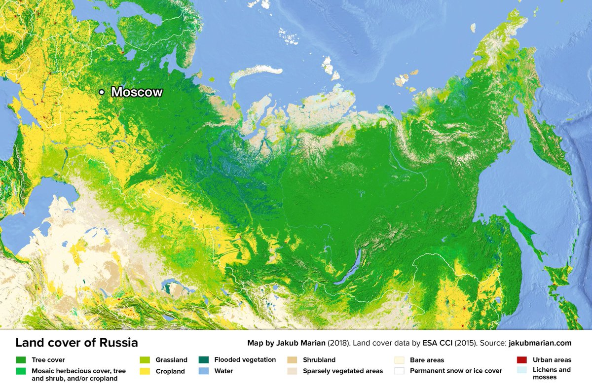
This map gives you a hint: It's on the edge between farmland and forest. In fact, it's 200 km north of the beginning of the forested area. Why?
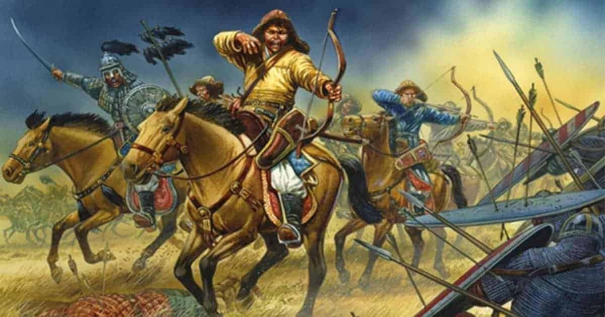
Horse archers.
This is the Mongol invasion in the 1200s, which created the biggest empire the world has ever seen. But it's elongated. Why this very long strip, and not farther north or south?
This is the Mongol invasion in the 1200s, which created the biggest empire the world has ever seen. But it's elongated. Why this very long strip, and not farther north or south?
Because of the steppe nomad lifestyle:
• Grasslands can't sustain agriculture
• But horses and sheep can eat grass, and humans can eat them
• So nomads move around to feed herds
• This makes them very mobile. They can travel >100km per day
• Grasslands can't sustain agriculture
• But horses and sheep can eat grass, and humans can eat them
• So nomads move around to feed herds
• This makes them very mobile. They can travel >100km per day
These nomadic horseback archers could move fast, prod the enemy (in farms), find the weak spot, and attack
The enemy couldn’t easily retaliate because the nomads would simply withdraw too fast
The enemy couldn’t easily retaliate because the nomads would simply withdraw too fast
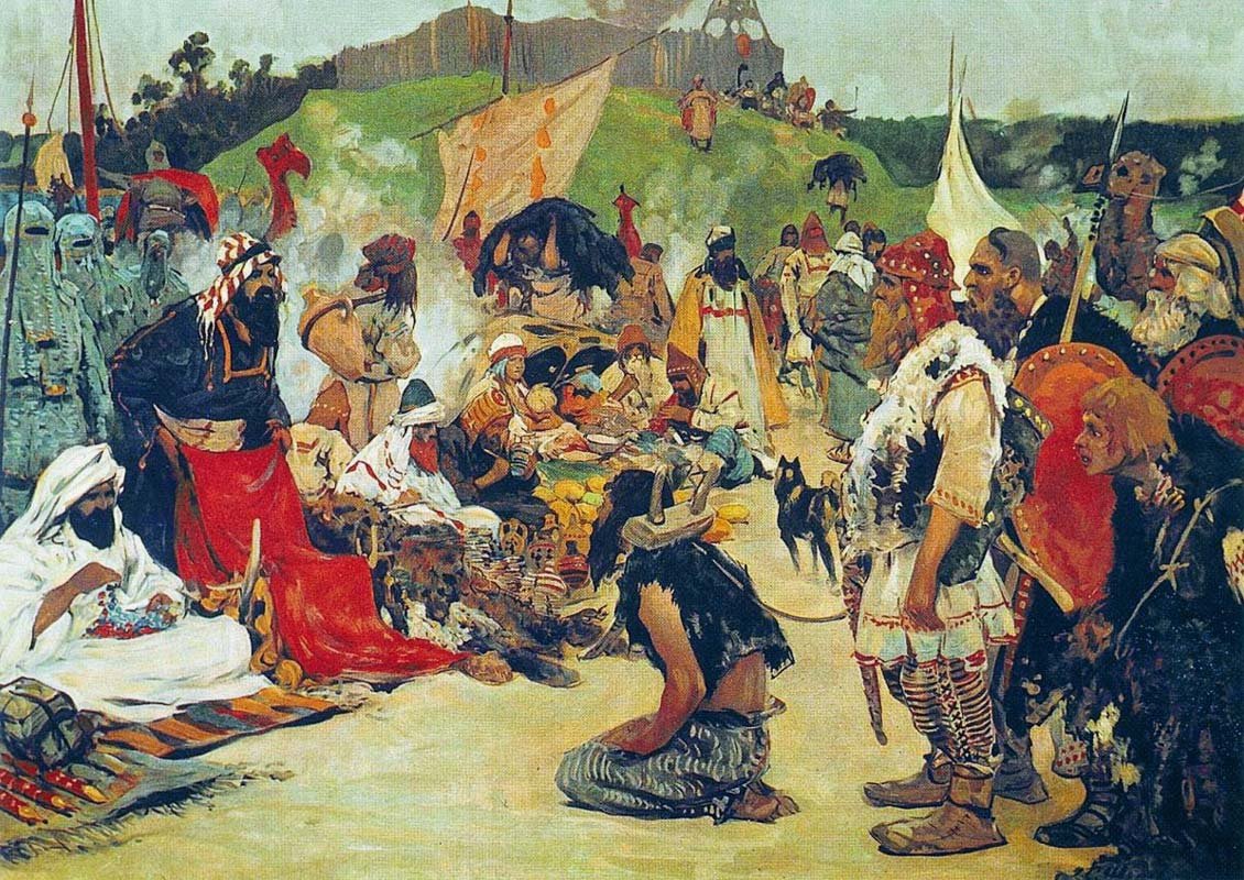
When the steppe nomads attacked farmlands... They literally harvested farmers!
~3M ppl Slavs were taken as slaves in the 15th and 16th centuries!
~3% of Russia's population!
You might have guessed it: "slave" comes from "Slav" as they were the main type of slave in Byzantium!
~3M ppl Slavs were taken as slaves in the 15th and 16th centuries!
~3% of Russia's population!
You might have guessed it: "slave" comes from "Slav" as they were the main type of slave in Byzantium!
But horses can't move fast in forests, and arrows can't fly through trees
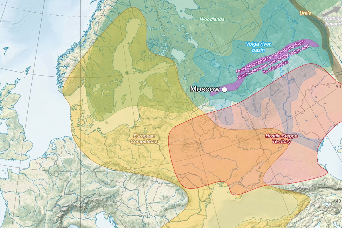
So Moscow is 200 km north of the grassland-forest limit: North enough to get protection from trees, but south enough to still have some farmland
But why on this specific point of the border?
So Moscow is 200 km north of the grassland-forest limit: North enough to get protection from trees, but south enough to still have some farmland
But why on this specific point of the border?
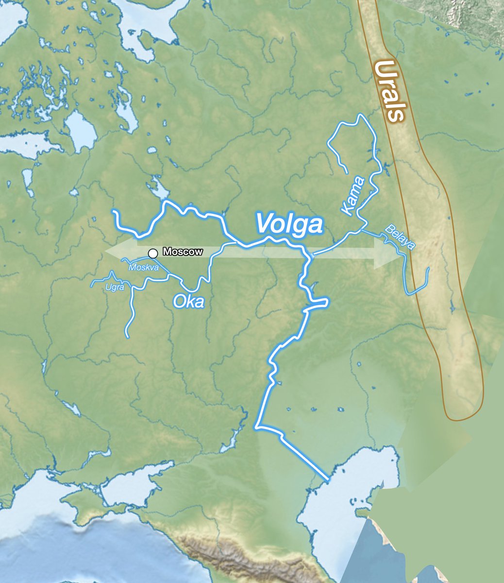
All rivers in the region run north to south, so they didn't stop the nomadic warriors coming from the south every summer. But Moscow has not 1, but 2 layers of defense river defense:
• The Ugra–Oka
• The Moskva
These were hard for steppe warriors to pass
• The Ugra–Oka
• The Moskva
These were hard for steppe warriors to pass
Since this is at the northern edge of what nomads could raid, it was already hard to reach. The Muscovites then built walls and forts, using rivers wherever possible, like the Great Wall of China or the Roman Limes.
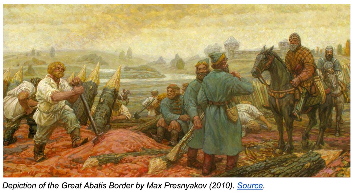
Over time, they built several layers of walls, pushing the border south. This literally took centuries though!
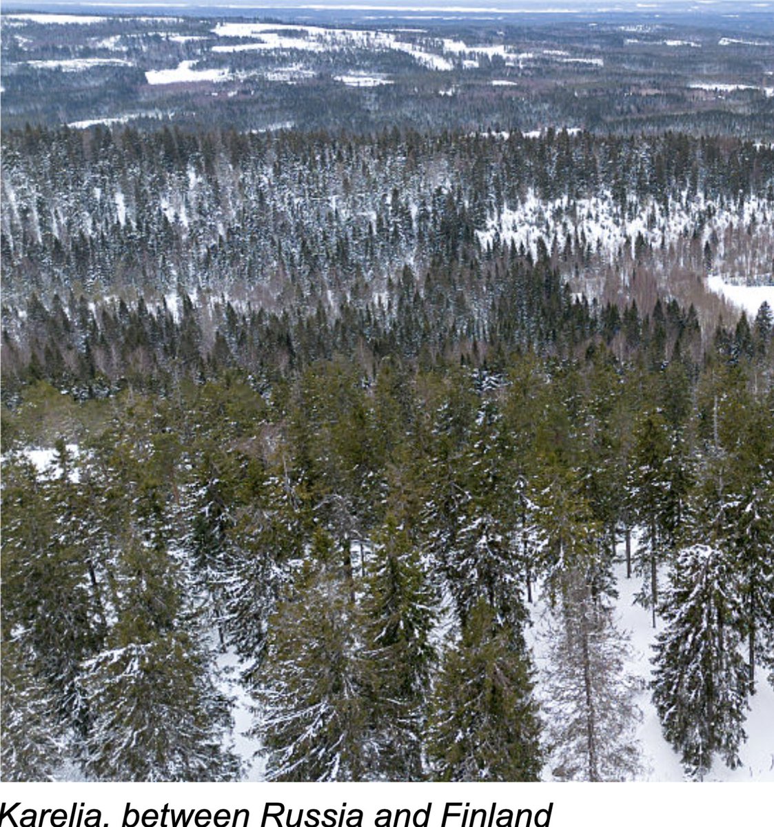
During all that time, however, the other side of Moscow was nearly empty: The north just had the Taiga forest
During all that time, however, the other side of Moscow was nearly empty: The north just had the Taiga forest
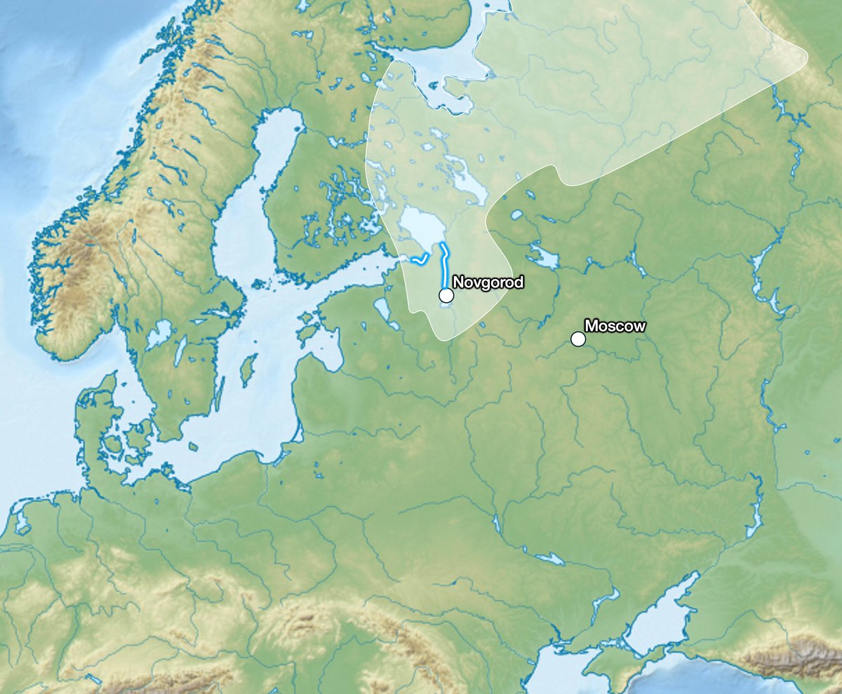
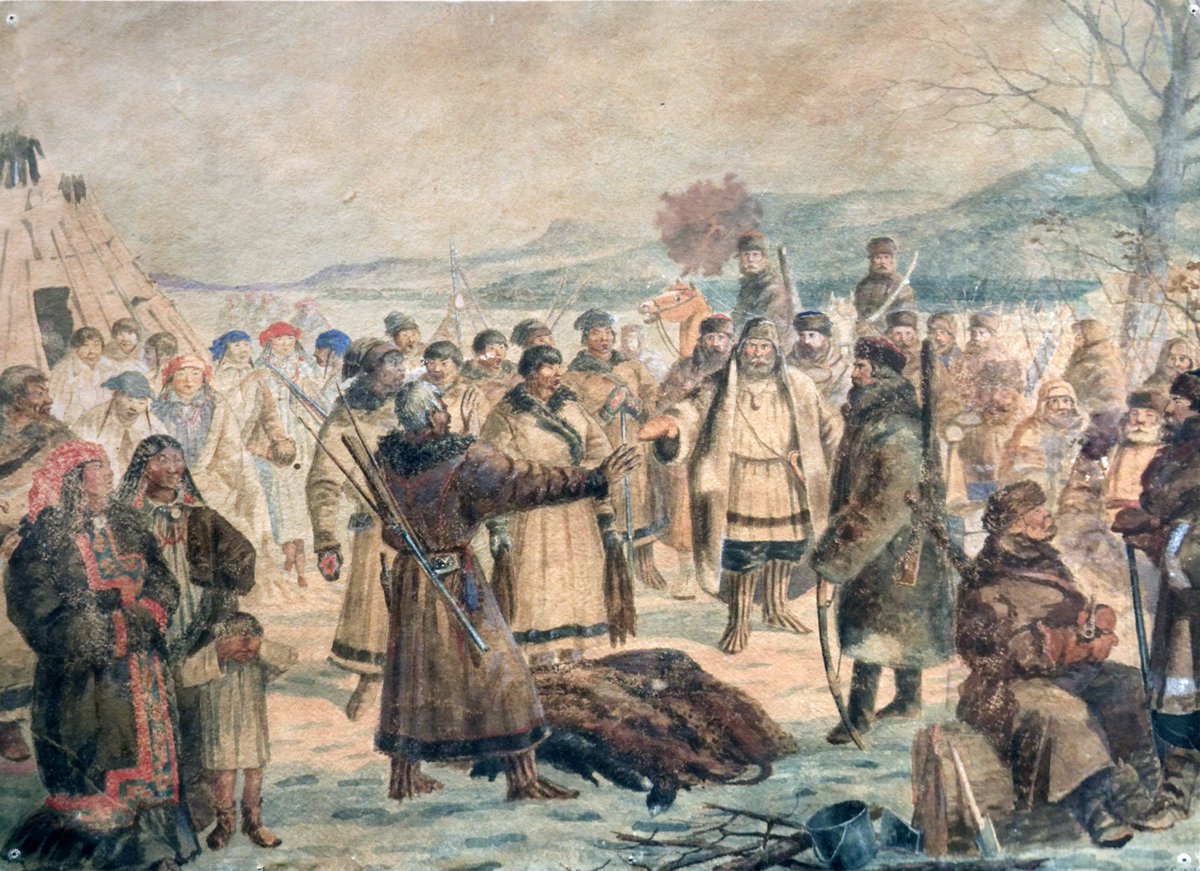
So Moscow conquered in the 1400s all of what used to be the Republic of Novgorod, a trade center with the Baltic.
And why would Russia be interested in that?
To take over Novgorod's trade, of course
But what did Novgorod produce that was so valuable to the rest of the Baltic?
These tiny animals
And their furs
To take over Novgorod's trade, of course
But what did Novgorod produce that was so valuable to the rest of the Baltic?
These tiny animals
And their furs
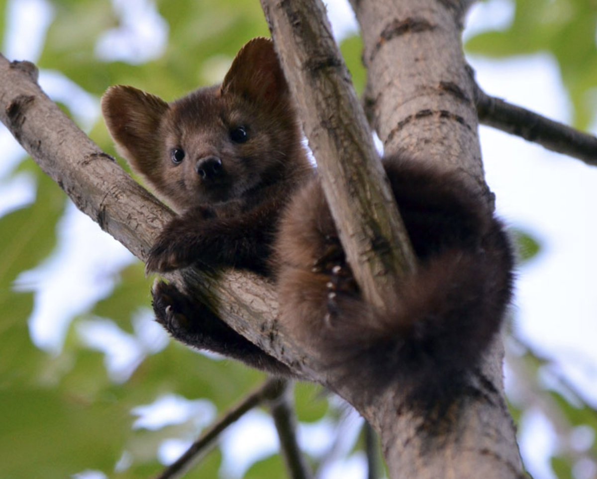
Moscow took over the Sable trade, and with it all its wealth
This was so valuable that Muscovites then decided to expand to the other big region with plenty of furs: Siberia
This was so valuable that Muscovites then decided to expand to the other big region with plenty of furs: Siberia
Russia's eastward expansion was lightning fast: in less than a century it reached the Pacific Ocean!
This is because Siberia is too cold for farming, so population densities were low
And like Spain in America, a majority of locals died of disease
This is because Siberia is too cold for farming, so population densities were low
And like Spain in America, a majority of locals died of disease
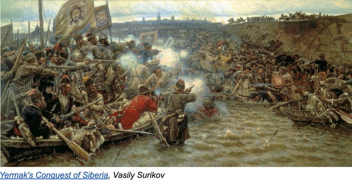
This is how we get to the crazy fact that Russia reached the Pacific in the 1600s, before it reached the Baltic or the Black Seas!
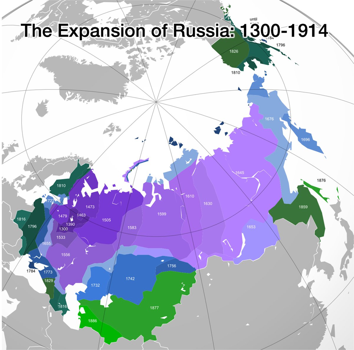
It took centuries to conquer the south: Russians needed layers of forts➕gunpowder to stop nomadic warriors
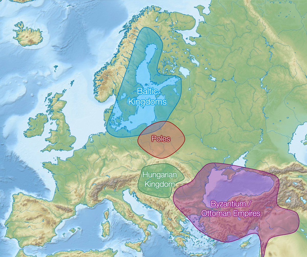
And to its west Moscow had strong competitors:
• Strong kingdoms on the Baltic coast
• Hungary in the Hungarian Plain, the Ottomans in Turkey
• Poland-Lithuania
And to its west Moscow had strong competitors:
• Strong kingdoms on the Baltic coast
• Hungary in the Hungarian Plain, the Ottomans in Turkey
• Poland-Lithuania
So this is why Moscow is where it is:
• North enough to be protected from nomadic steppe warriors
• South enough to still have some farmland
• West enough to get close to Baltic & Black sea trades for their furs
• But not further west because of competition
• North enough to be protected from nomadic steppe warriors
• South enough to still have some farmland
• West enough to get close to Baltic & Black sea trades for their furs
• But not further west because of competition
All of this fueled by harvesting: of humans from southern nomads, of furry animals from Moscow
I'm leaving a million insights & sources. Read them in today's article:
unchartedterritories.tomaspueyo.com/p/why-is-mosco…
I'm leaving a million insights & sources. Read them in today's article:
unchartedterritories.tomaspueyo.com/p/why-is-mosco…
• • •
Missing some Tweet in this thread? You can try to
force a refresh