Russian 🇷🇺 airforce launched 700 NEW airstrikes near Pokrovsk 🇺🇦 in 2 weeks, with more than 80% in the Pokrovsk-Dobropilla direction.
To sustain its offensives operations, Moscow also launched 800 strikes at Lyman and Siversk and 2 800 at Sumy !
🧵THREAD🧵1/19 ⬇️
To sustain its offensives operations, Moscow also launched 800 strikes at Lyman and Siversk and 2 800 at Sumy !
🧵THREAD🧵1/19 ⬇️
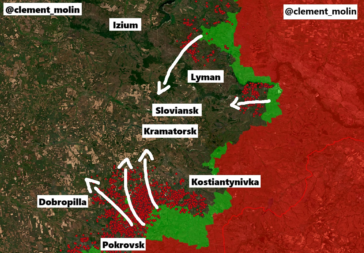
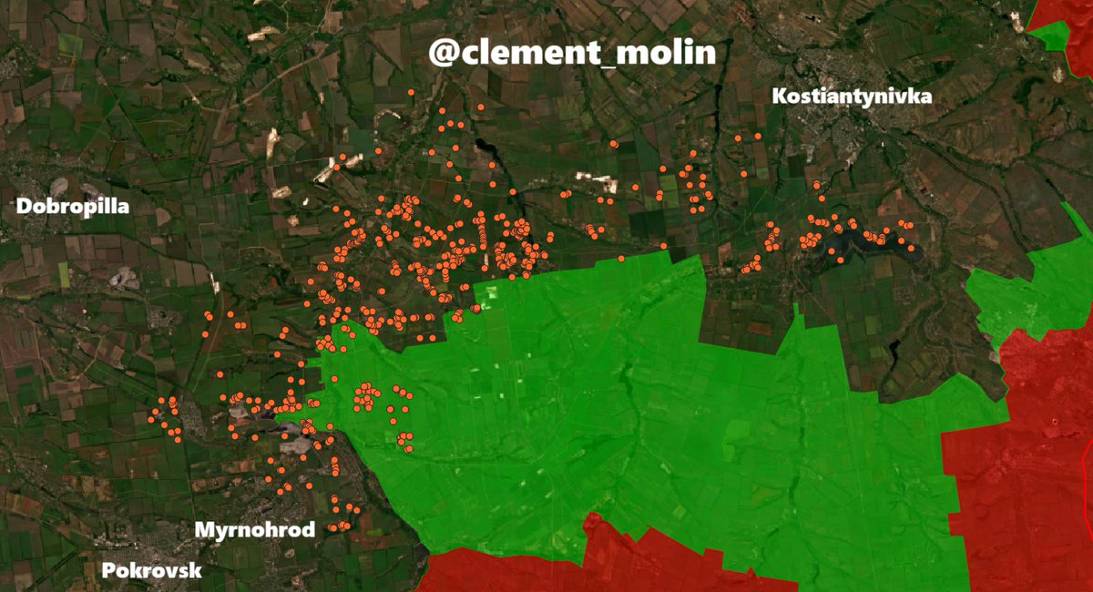
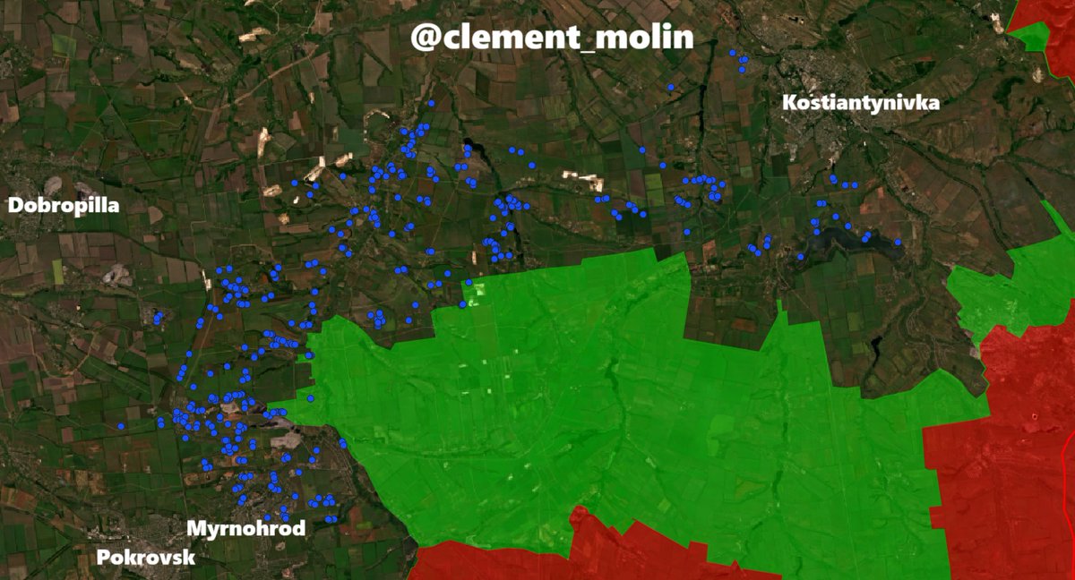
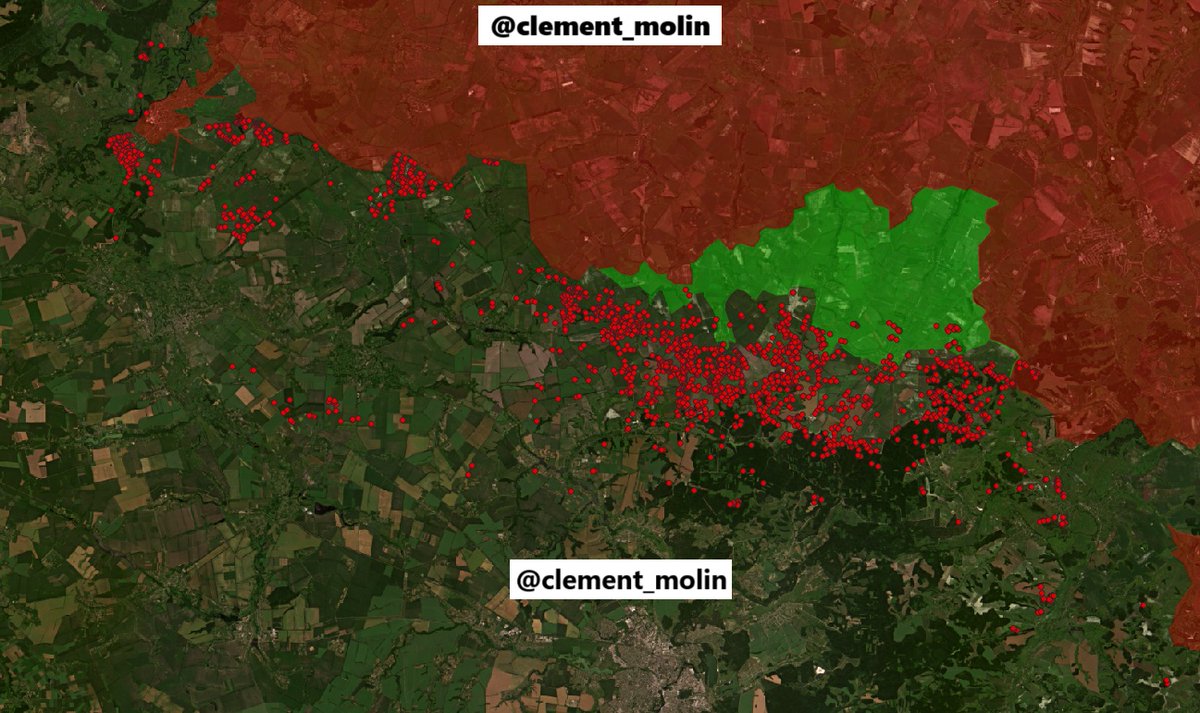
1- Pokrovsk-Kostiantynivka
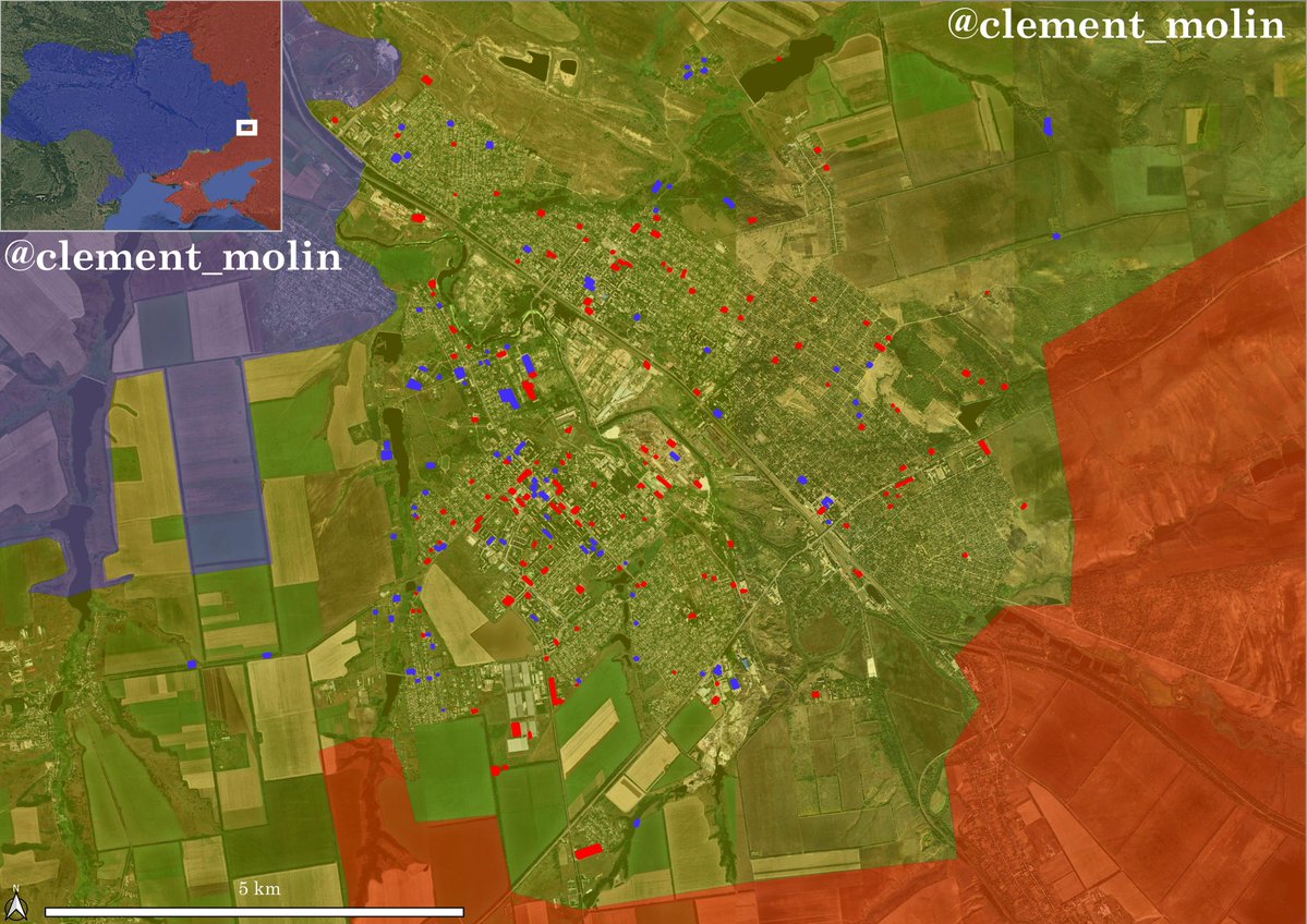
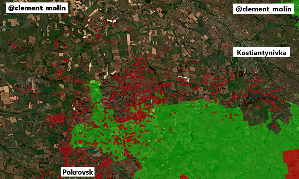
Since may, I'm mapping most of russian airstrikes betwee, the two key cities of Pokrovsk and Kostiantynivka.
The frontline is 50km long and I mapped around 3 800 airstrikes there in 4 months !
Since may, I'm mapping most of russian airstrikes betwee, the two key cities of Pokrovsk and Kostiantynivka.
The frontline is 50km long and I mapped around 3 800 airstrikes there in 4 months !
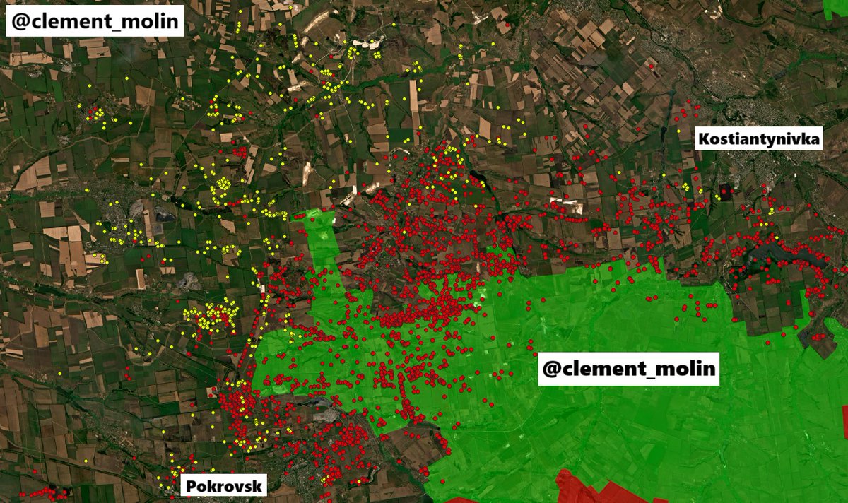
Here, you can find 3 different colors.
I've used red for may to june 11th. I also use red for non dated airstrikes elsewhere (Sumy, Lyman, Siversk).
Orange is for june 11th to july 11th, blue from july 11th to august 11th and finally yellow, just bellow.
I've used red for may to june 11th. I also use red for non dated airstrikes elsewhere (Sumy, Lyman, Siversk).
Orange is for june 11th to july 11th, blue from july 11th to august 11th and finally yellow, just bellow.

I've already mapped around 700 new airstrikes, I still need to have good sattelitte images for the Kostiantynivka direction to see if there are more (no images from there since 6 days).
Thus, we have 4 main airstrikes concentration, around the New Donbass Line and around 3 main cities, Bilytske, Bilozerske and Dobropilla.
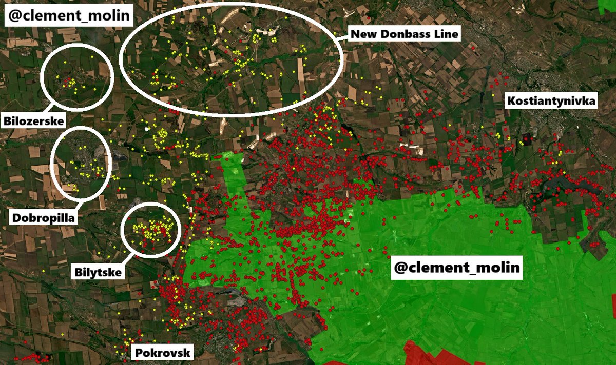
Here, near Nove Shakove, we can see that Russia bombed a treeline (around 15 impacts) where ukrainien forces were trying to progress during there counter-offensive.
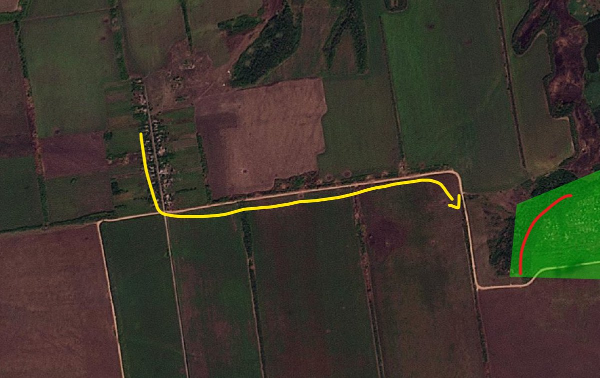
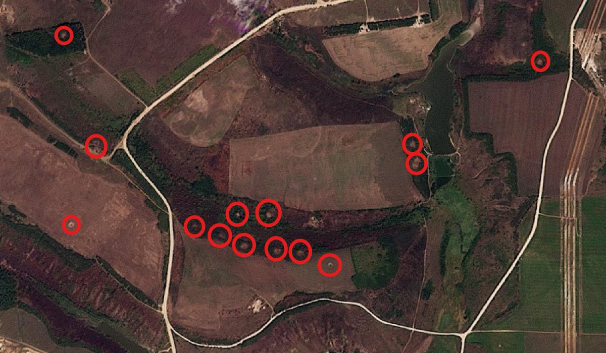
Here, around the New Donbass Line, a very large and well prepared defensive line, we can see multiple airstrikes. We are more than 20km from the frontline.
As usual, this is showing where russian army is willing to make progress in the next weeks and months.
First, they destroy ukrainian positions, then they launch assaults.
First, they destroy ukrainian positions, then they launch assaults.
Yesterday, I published this map showing the advancement of my reasearch work.
As you can imagine, it is free and it takes me a lot of time and energy. Now, I discovered something new :
As you can imagine, it is free and it takes me a lot of time and energy. Now, I discovered something new :
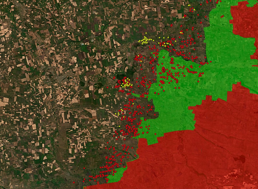
2- Lyman and Siversk
In Lyman and Siversk, russian airforce conducted around 800 airstrikes, with more than 80% in the last 3 weeks.
It comes amid the fall of the fortified Serebyanka forest and russian progress north-west of Lyman.
In Lyman and Siversk, russian airforce conducted around 800 airstrikes, with more than 80% in the last 3 weeks.
It comes amid the fall of the fortified Serebyanka forest and russian progress north-west of Lyman.
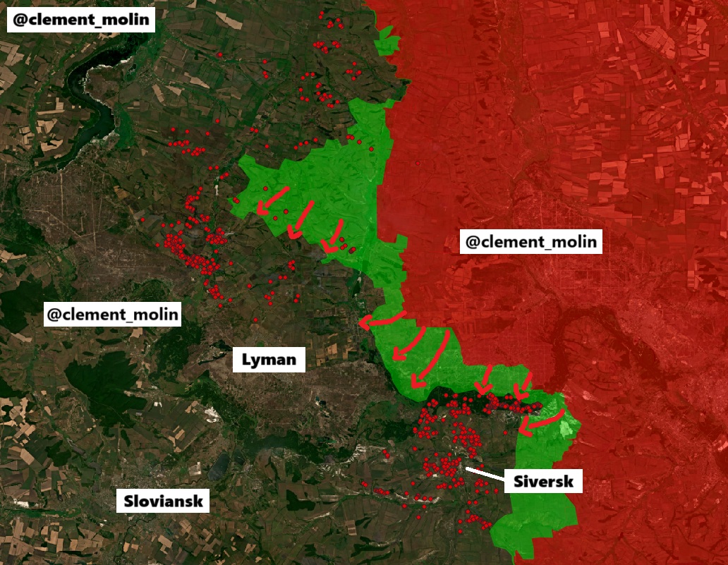
What does it tells us ?
Russia is pushing north of Lyman and will try 1 to cut the city and 2 to go beyond Sloviansk.
At the same time, they are pushing to finally take Siversk.
Russia is pushing north of Lyman and will try 1 to cut the city and 2 to go beyond Sloviansk.
At the same time, they are pushing to finally take Siversk.
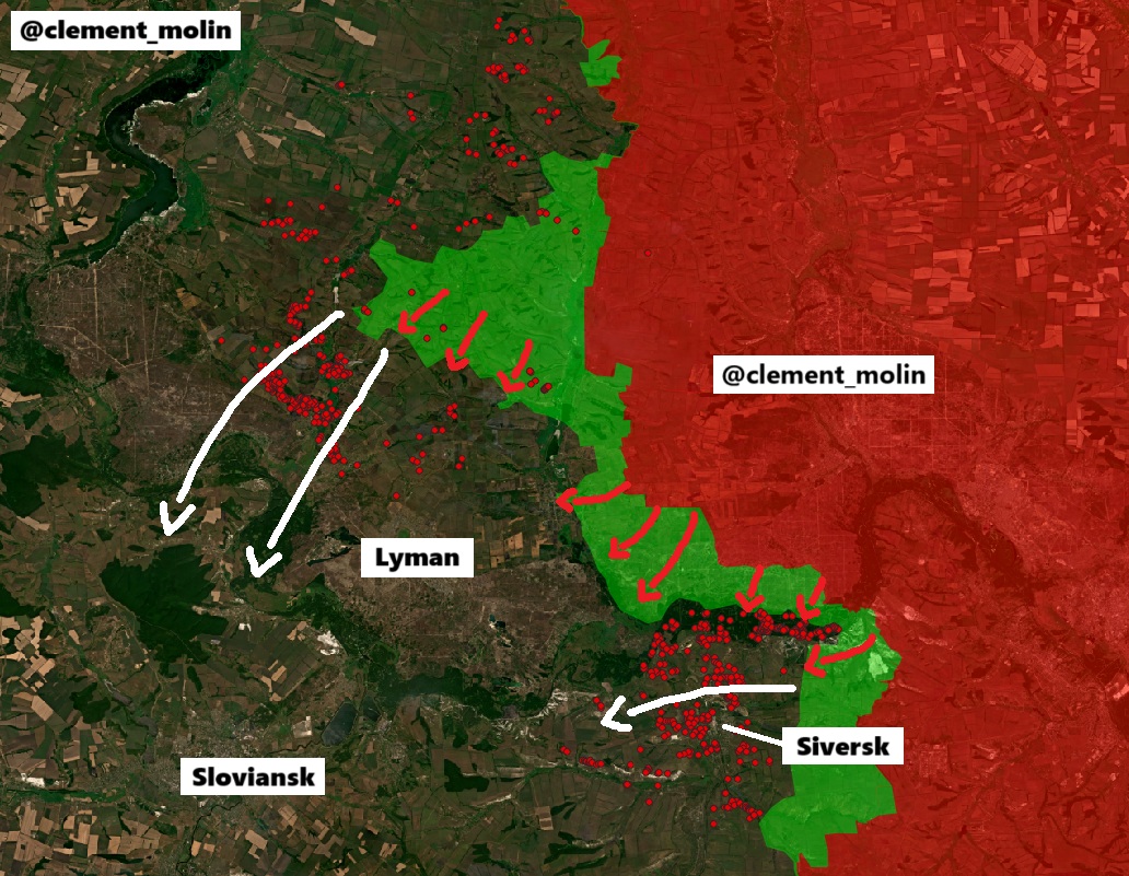
Among the clouds, you can see here, west of Lyman, around 100 airstrikes in a single forest, probably an area where Ukraine is hiding manpower, artillery...
I'll be waiting for additionnal images from the area, probably this evening or tomorrow !
I'll be waiting for additionnal images from the area, probably this evening or tomorrow !

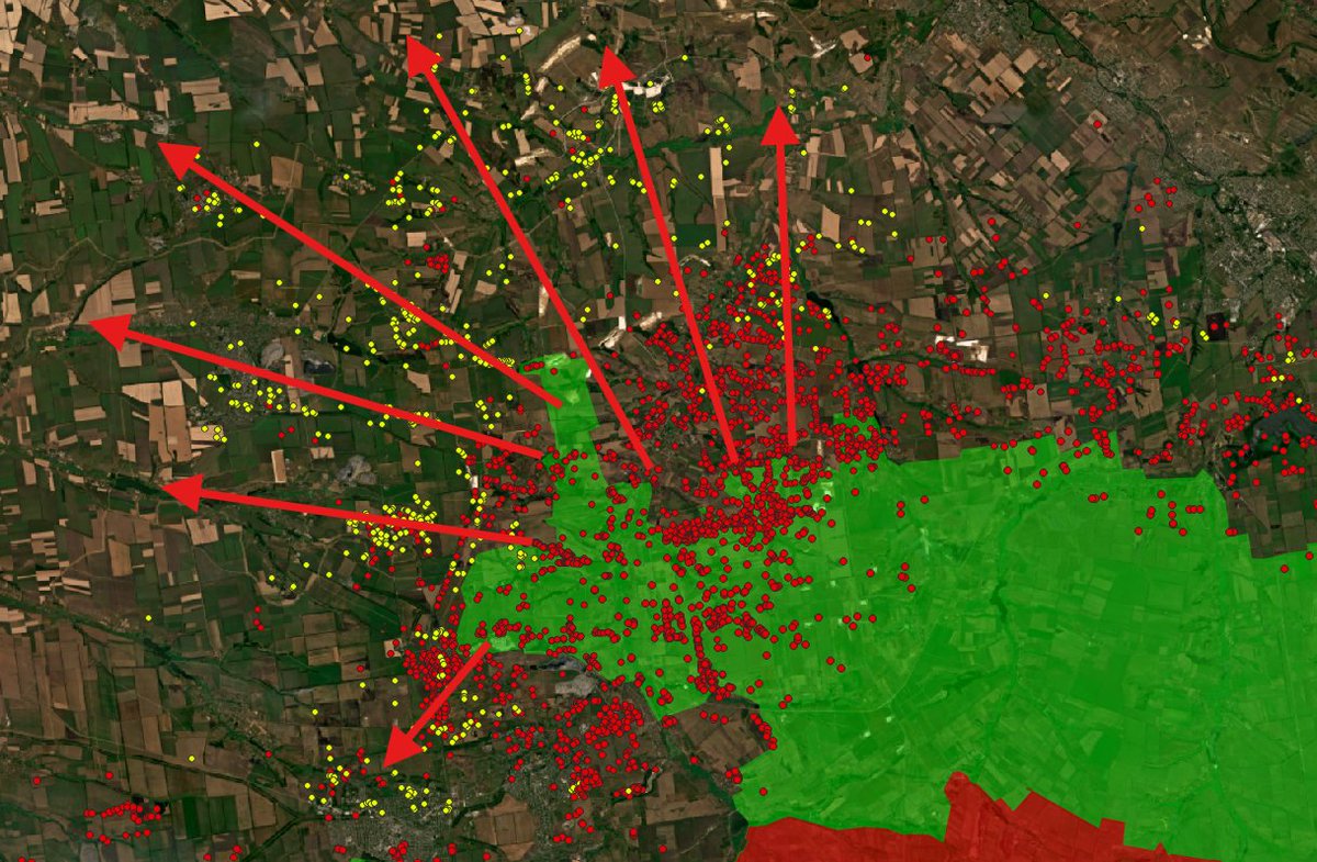
3- Sumy
Around the Sumy incursion, I've now mapped 2 800 (!) airstrikes.
Around 85% are present in the treelines, villages and forests north of the city, around russian presence. This campaign is massive.
Around the Sumy incursion, I've now mapped 2 800 (!) airstrikes.
Around 85% are present in the treelines, villages and forests north of the city, around russian presence. This campaign is massive.
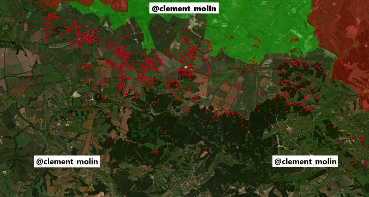
Here is a more general map from the area !
As for every map here, a dot represent an airstrike !
As for every map here, a dot represent an airstrike !
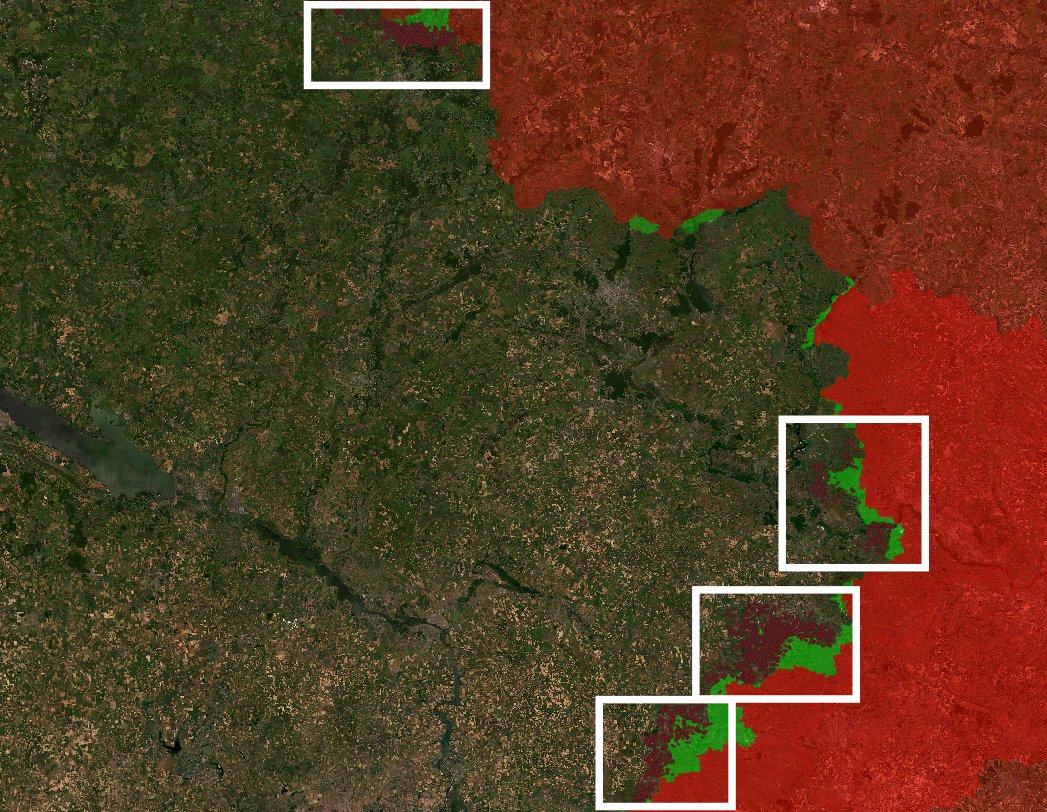
4- Southern front
From Pokrovsk to Hulialpole, russian forces are also pushing and making progress. This is sustained by a strong airstrike campaign. I couldn't update all the map yet, but I've at least this :
From Pokrovsk to Hulialpole, russian forces are also pushing and making progress. This is sustained by a strong airstrike campaign. I couldn't update all the map yet, but I've at least this :
I looked a bit into Kupiansk, Kharkiv or Chasiv Yar. There are a lot of impacts there as well, but less than in the highlighted areas.
I sadly don't have enough time and interest into mapping all this, but it gives us a good overview.
I sadly don't have enough time and interest into mapping all this, but it gives us a good overview.
Main informations :
-Russia increased its airstrike activity north and west of Lyman
-Russia is bombing the river banks of Siverki Donets near Siversk
-Russia continued to massively target the Pokrovsk-Kostiantynivka diection with around 350 to 400 airstrikes a week there.
-Russia increased its airstrike activity north and west of Lyman
-Russia is bombing the river banks of Siverki Donets near Siversk
-Russia continued to massively target the Pokrovsk-Kostiantynivka diection with around 350 to 400 airstrikes a week there.
I really thank everyone who take time to read me until the end.
As usual, you can support my "free" work here and also follow my think tank account @atummundi
buymeacoffee.com/clement.molin
As usual, you can support my "free" work here and also follow my think tank account @atummundi
buymeacoffee.com/clement.molin
You can find the last thread I wrote for @atummundi here :
Next, I will post an update to fortifications, where they are being build, how they function, if there are useful...
Next, I will post an update to fortifications, where they are being build, how they function, if there are useful...
https://x.com/atummundi/status/1960704416257826987
• • •
Missing some Tweet in this thread? You can try to
force a refresh