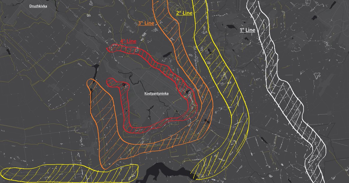
Legendary Kreminna forest and the 16,500 trenches inside: the most precise public mapping ever made of this battlefield.
Interactive map:
🧵Gallery thread🧵1/⬇️ google.com/maps/d/u/0/vie…
Interactive map:
🧵Gallery thread🧵1/⬇️ google.com/maps/d/u/0/vie…

2/🧵
Summing everything, in total the project took about 2 weeks of mapping, or about 30 hours if I hadn't stopped (haven't counted exactly, that's an estimate).
In the project is included just about everything:
- Trenches visible from updated satellite imagery ESRI
- World War 2 trenches and emplacements
- Singular foxholes
- Invisible trench systems under foliage, only visible through Planet imagery
- Dragon's teeth obstacles
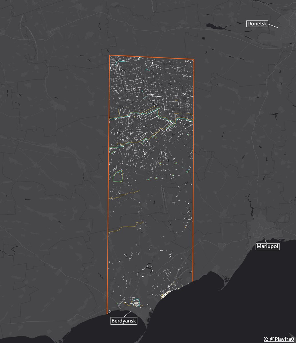
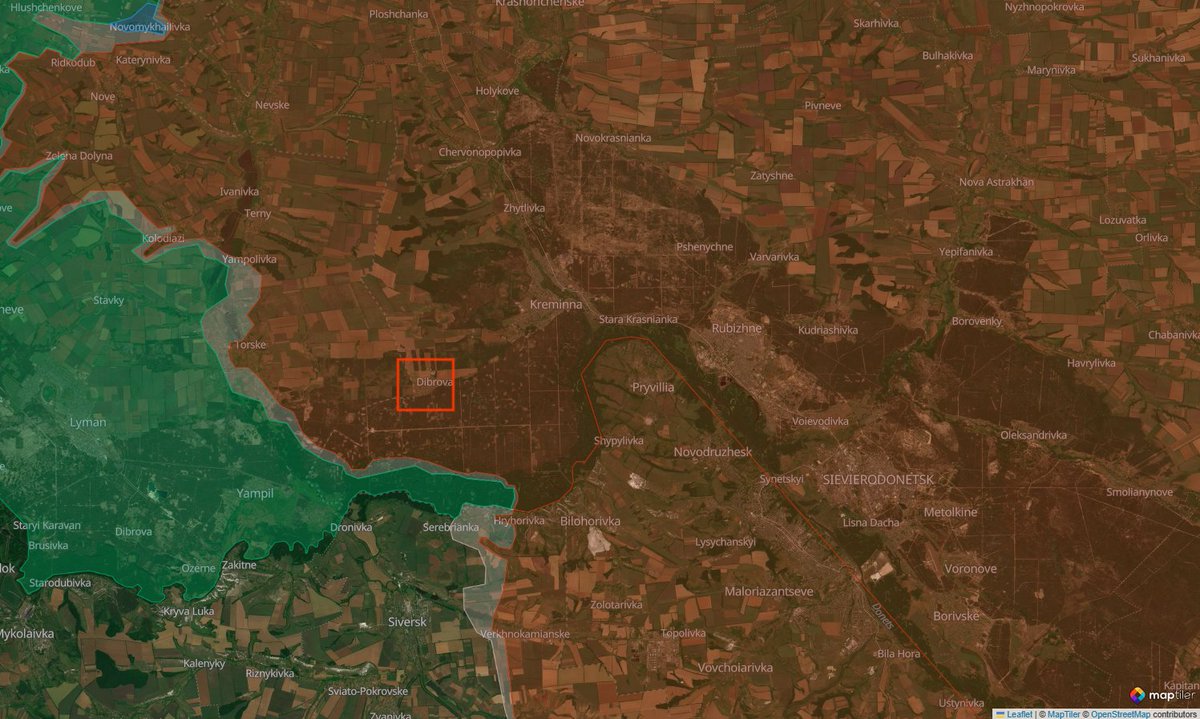
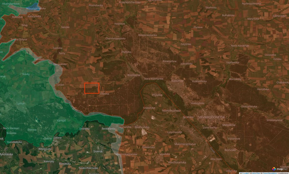
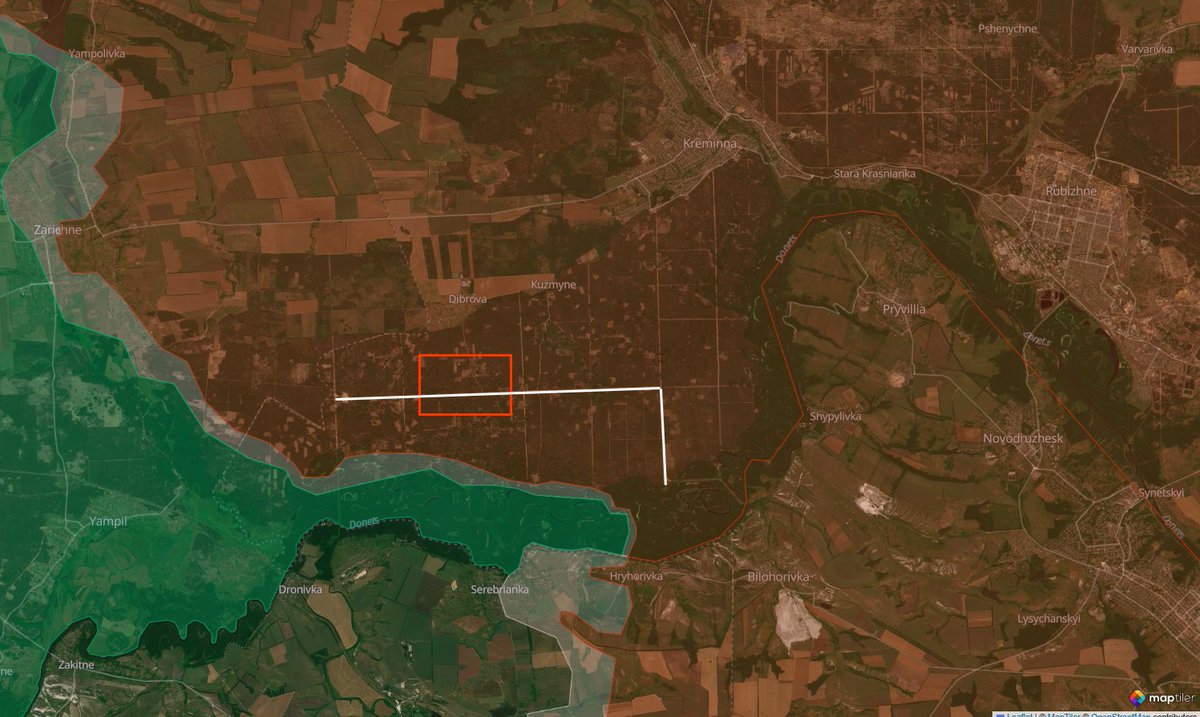
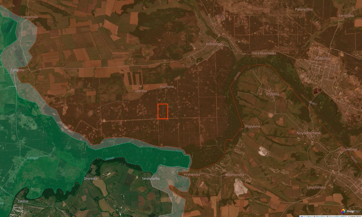
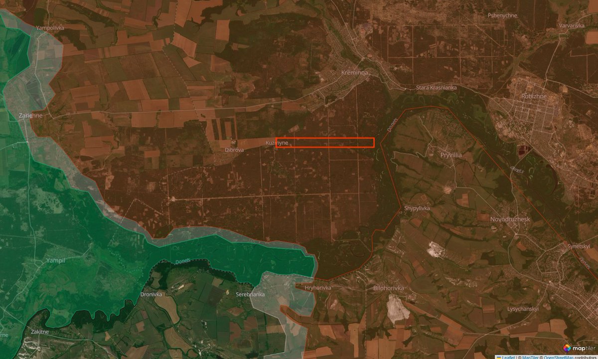
The covered area goes from the village of Torske to Kreminna, totaling 175 km².
Summing everything, in total the project took about 2 weeks of mapping, or about 30 hours if I hadn't stopped (haven't counted exactly, that's an estimate).
In the project is included just about everything:
- Trenches visible from updated satellite imagery ESRI
- World War 2 trenches and emplacements
- Singular foxholes
- Invisible trench systems under foliage, only visible through Planet imagery
- Dragon's teeth obstacles
The covered area goes from the village of Torske to Kreminna, totaling 175 km².
3/🧵
This thread won't really be a standard one, but rather some sort of "gallery" with photos and descriptions of different kinds of interesting things I found in the forest and the trenches dug in it.
This thread won't really be a standard one, but rather some sort of "gallery" with photos and descriptions of different kinds of interesting things I found in the forest and the trenches dug in it.
4/🧵
Just a tiny bit of history before starting.
The Kreminna forest was first captured by Russian forces in April - May 2022 at the start of the war, but was partially recaptured in early October of the same year after Ukraine's September counteroffensive.
From then on until 2023-2024, fierce fighting raged for every centimeter of the forest, with both sides sending their best and most élite units there.
Because of the importance of the forest (for the Ukrainians it shielded Lyman, for the Russians Kreminna), and because of the numbers involved, both sides dug long trench systems going through all the forest, which created a constant WW1 atmosphere that you can still see today with the help of shelling of a such scale that only tree stumps remained.
In late July the Russians finally found a weak spot, caused by the progressive transferring of the Ukrainian élite units from there to other areas of the front, and by constant Russian pressure, and, having been able to exploit it, forced the Ukrainians, after 4 years, to the extreme outskirts.
Also please remember the extreme ecological damage that this forest suffered, and the thousands of soldiers of both sides whose corpses lie still today in the No Man's Land.
5/🧵
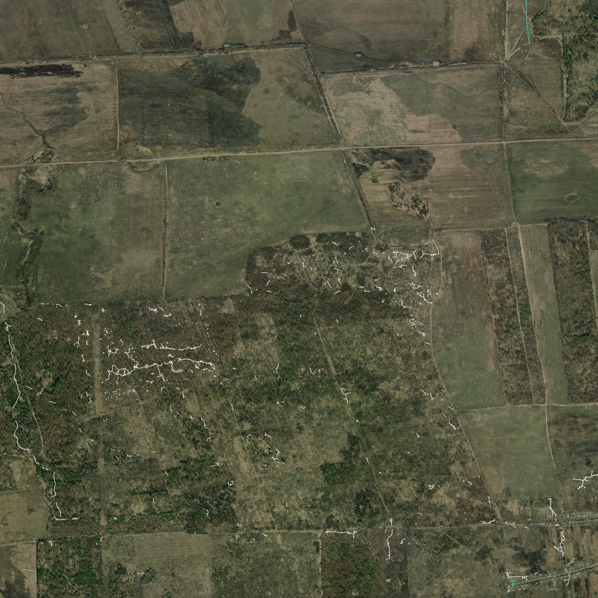
Dibrova, March 2024. Russian trench systems protecting the village's flanks and going between houses. Improvised roadblocks made of dragon's teeth (light blue) to counter Ukraine's summer 2023 counteroffensive.
Dibrova, March 2024. Russian trench systems protecting the village's flanks and going between houses. Improvised roadblocks made of dragon's teeth (light blue) to counter Ukraine's summer 2023 counteroffensive.
6/🧵
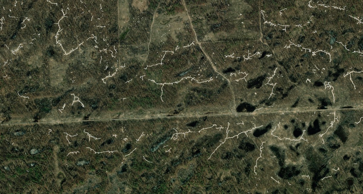
Dibrova's northern flank, March 2024. Trench systems at the conjunction of 2 bloody battlefields: Kreminna and Torske, with the latter direction being fough over since early 2023.
Dibrova's northern flank, March 2024. Trench systems at the conjunction of 2 bloody battlefields: Kreminna and Torske, with the latter direction being fough over since early 2023.
7/🧵
South of Dibrova, March 2024. Western section of the part of contact line going through the main horizontal road of the forest (in white in photo #2).
South of Dibrova, March 2024. Western section of the part of contact line going through the main horizontal road of the forest (in white in photo #2).
8/🧵
South of Dibrova, March 2024. Ukrainian side of the main road. Ground is not visible anymore because of the craters.
Not even tree stumps remain, the area has been turned into a plain clearing.
The forest, for the rainiest periods of the year, turns into a swamp because of the craters. This area was likely extremely hard to navigate.


9/🧵
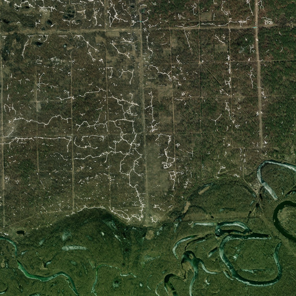
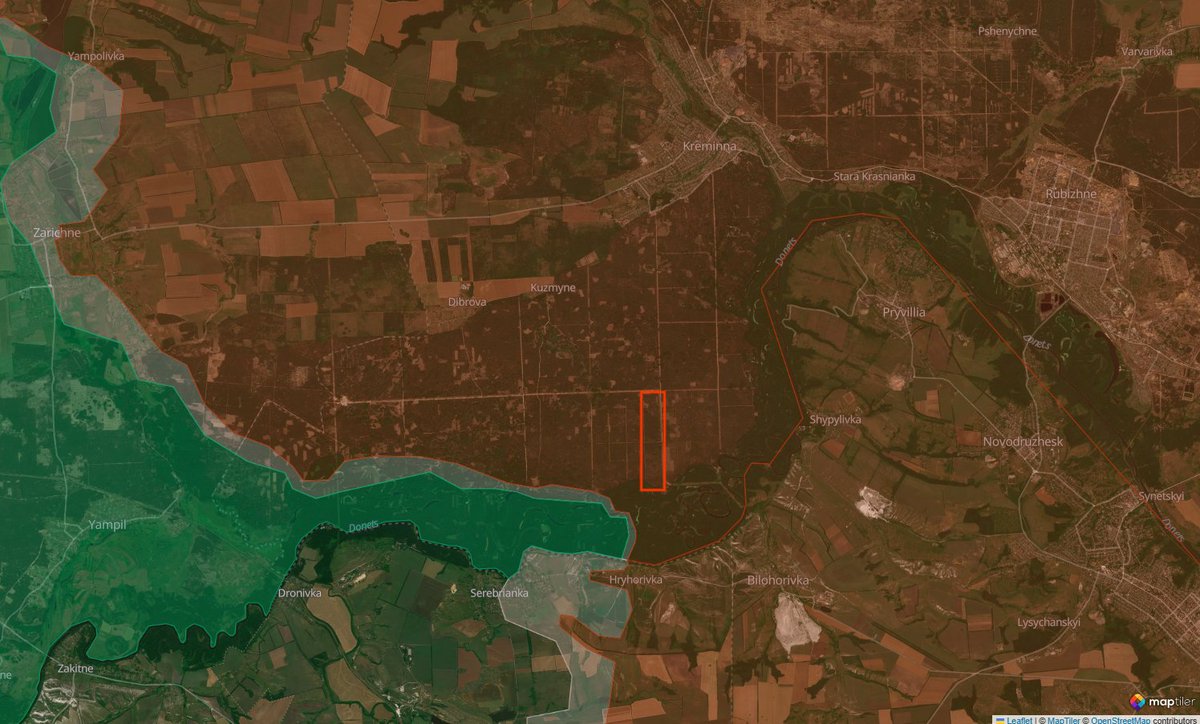
South-east of Dibrova, south of Kuzmyne, March 2024, Russian side of the main road. Russian V-Shaped trench system designed to protect against attack coming from 3 sides. Complex configuration of reserve and communication trenches, as well as high concentration of foxholes and dugouts.
South-east of Dibrova, south of Kuzmyne, March 2024, Russian side of the main road. Russian V-Shaped trench system designed to protect against attack coming from 3 sides. Complex configuration of reserve and communication trenches, as well as high concentration of foxholes and dugouts.

10/🧵
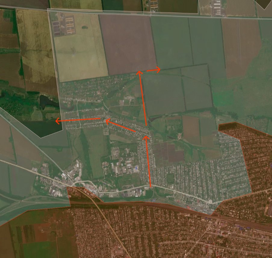
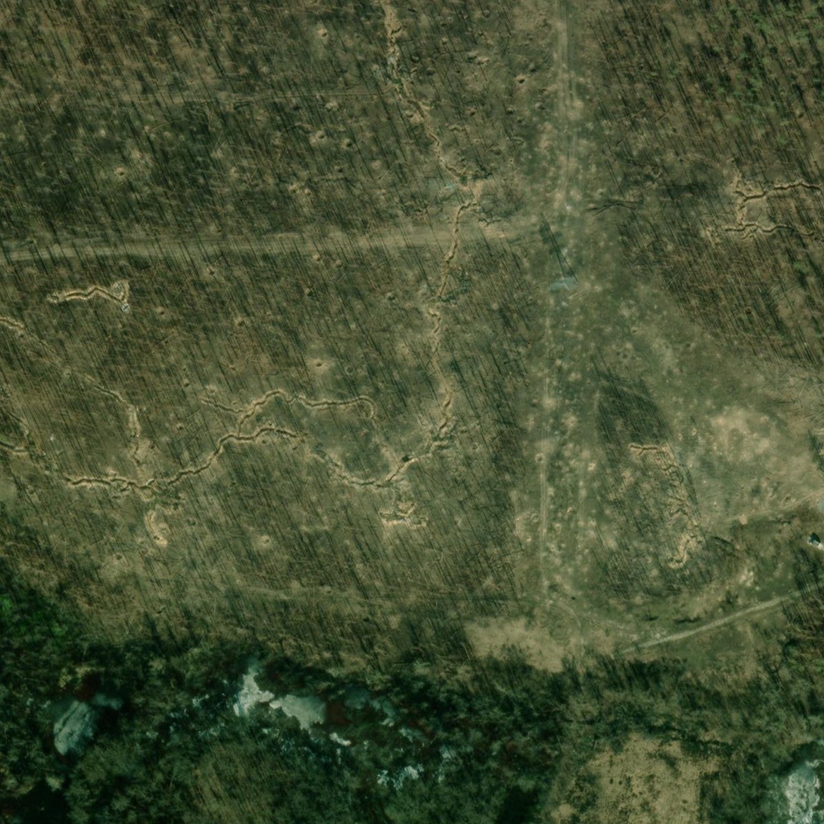
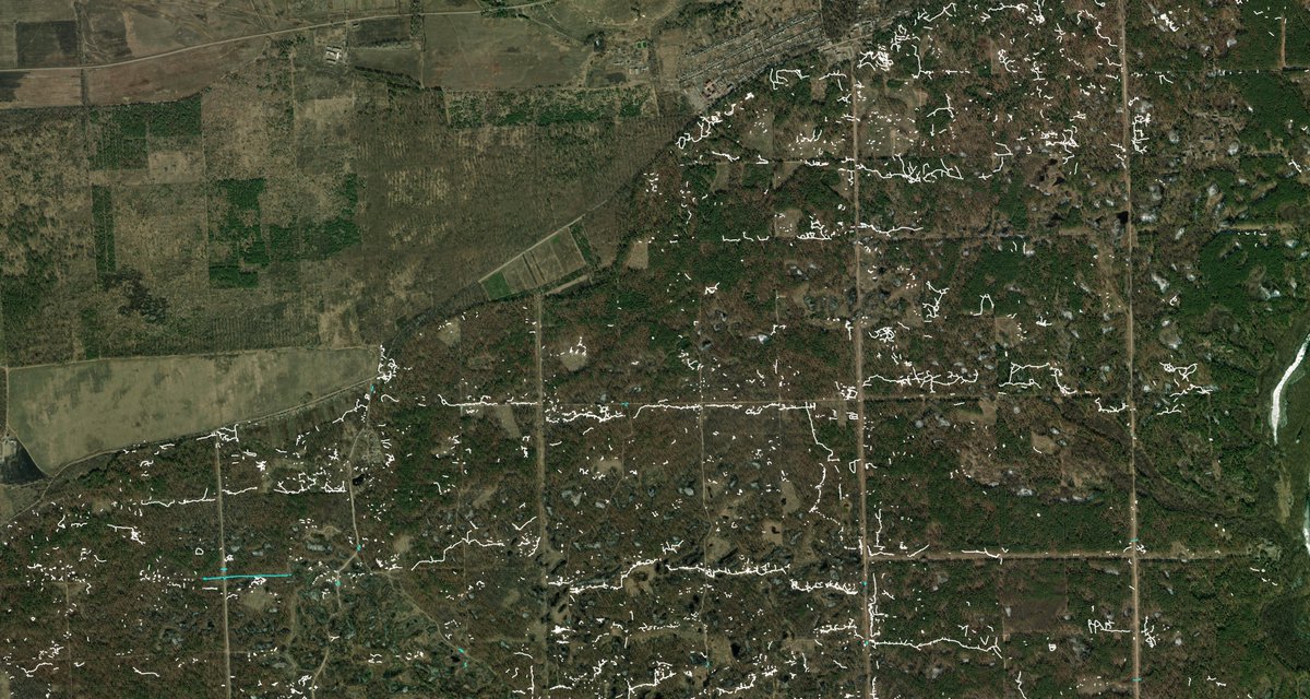
North of Hryhorivka, southern edge of the forest, March 2024. On the Ukrainian side, in the southern edge of the photo, we find the place with the highest concentration of trenches of the whole forest. The trench system was designed to protect from the east and south, in case of a Russian advance in the thicker forest south of the river. High concentration of craters and shelling traces.
North of Hryhorivka, southern edge of the forest, March 2024. On the Ukrainian side, in the southern edge of the photo, we find the place with the highest concentration of trenches of the whole forest. The trench system was designed to protect from the east and south, in case of a Russian advance in the thicker forest south of the river. High concentration of craters and shelling traces.
11/🧵
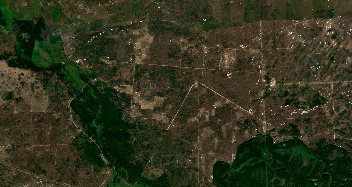
South of Kreminna city, March 2024, Russian side. Multiple horizontal fallback lines designed to slow down Ukraine's 2023 summer counteroffensive and dug by hand in the course of positional warfare because of the extremely high number of forces available concentrated in the forest.
No evident signs of heavy fighting, but the area is burned.
12/🧵
Just south of Kreminna city, July 2025 Planet, Russian side. Very high concentration of, as 12/, fallback lines and trench systems designed to counter Ukraine's 2023 offensive. Complex configuration, no unified line. The objective was likely to have the Ukrainians reach a high degree of attrition before Kreminna, so the battle could start in favorable conditions for the Russians.
Just south of Kreminna city, July 2025 Planet, Russian side. Very high concentration of, as 12/, fallback lines and trench systems designed to counter Ukraine's 2023 offensive. Complex configuration, no unified line. The objective was likely to have the Ukrainians reach a high degree of attrition before Kreminna, so the battle could start in favorable conditions for the Russians.


13/🧵
Westernmost part of the Kreminna forest, Ukrainian side, July 2025 Planet. Almost complete lack of fallback lines except a weak one in the right part of picture #1, behind a vertical road.
Unlike the Russians, the Ukrainians were confident that they could hold on for much longer in their positions in the forest, but did not take into account that forces would be removed because of worsening conditions, and that they wouldn't be able to dig such trench systems while retreating again.

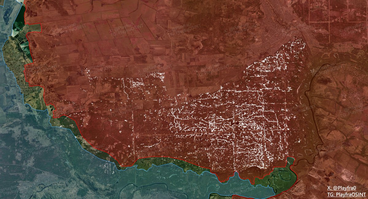
14/🧵
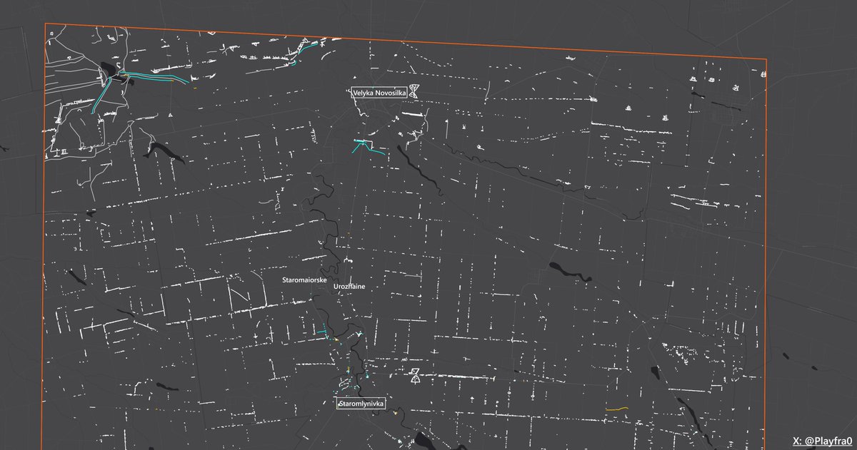
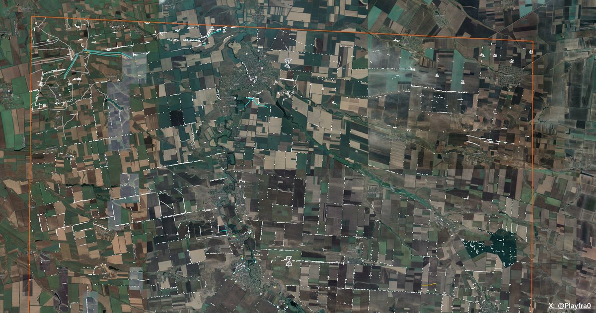
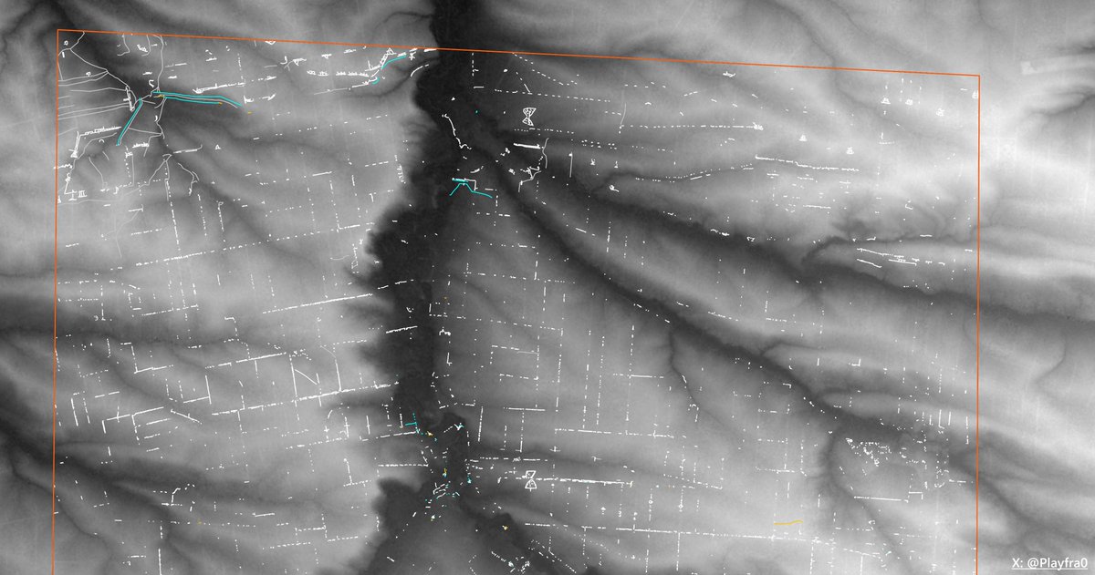
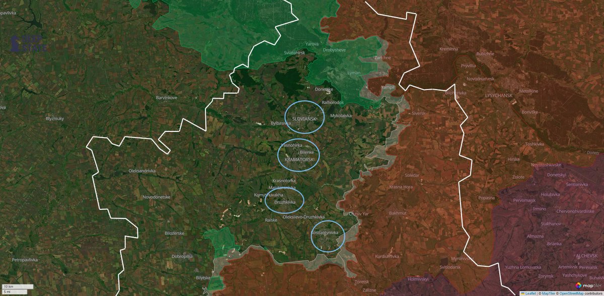
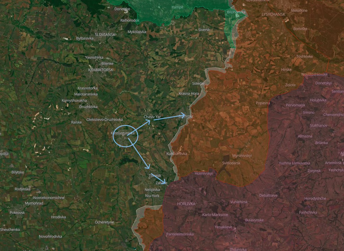
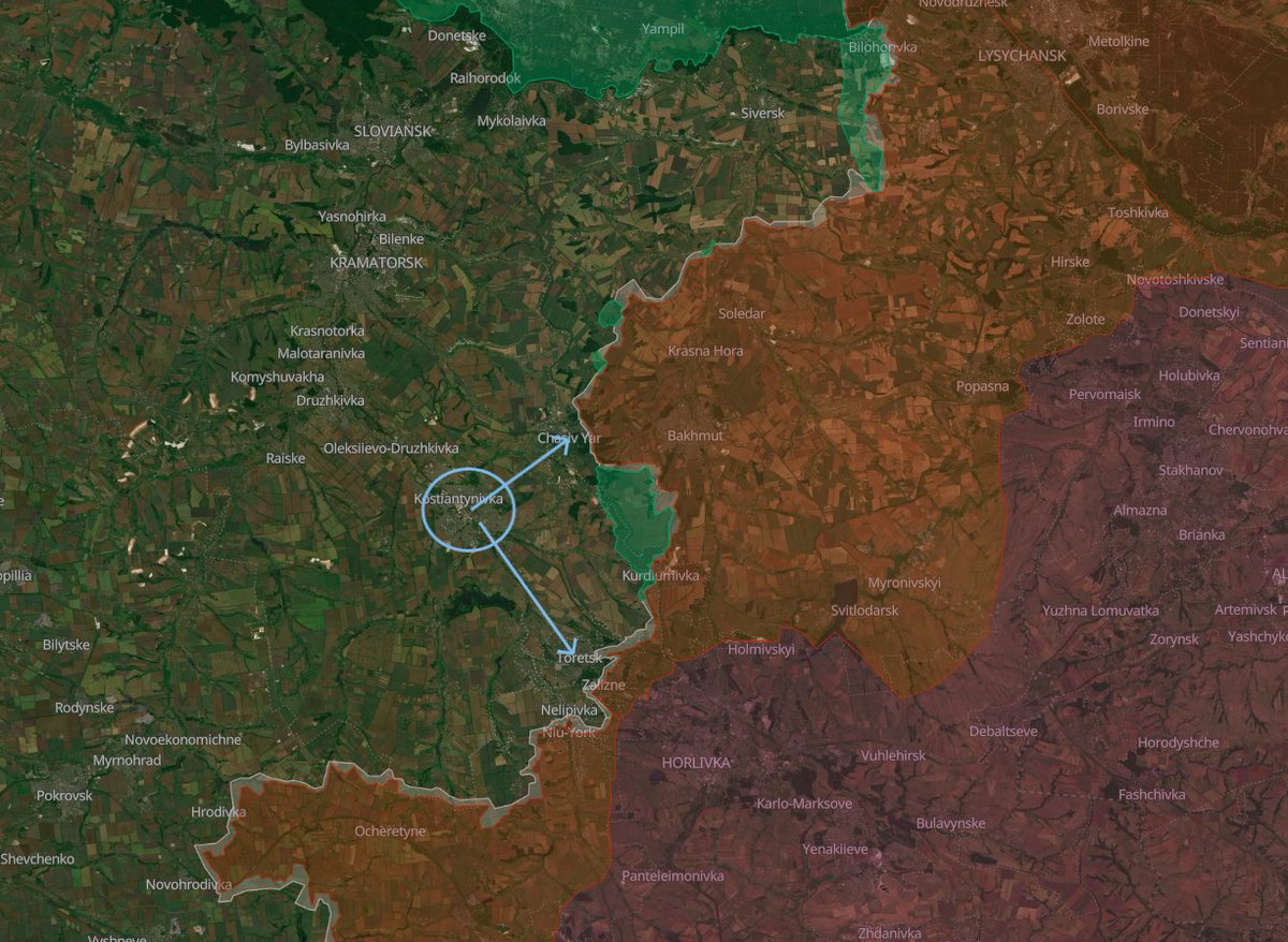
General view with current frontlines.
General view with current frontlines.
15/🧵
Thanks a lot for reading!
Remember that you can find the interactive map of this project here: google.com/maps/d/u/0/vie…
If you want to support the countless hours that went into this project, you can donate any amount that you wish at coff.ee/playfra, or simply giving a follow and a repost.
Also, as always, don't forget to join my Telegram channel! --> t.me/PlayfraOSINT
Have a good day everybody :)
• • •
Missing some Tweet in this thread? You can try to
force a refresh