
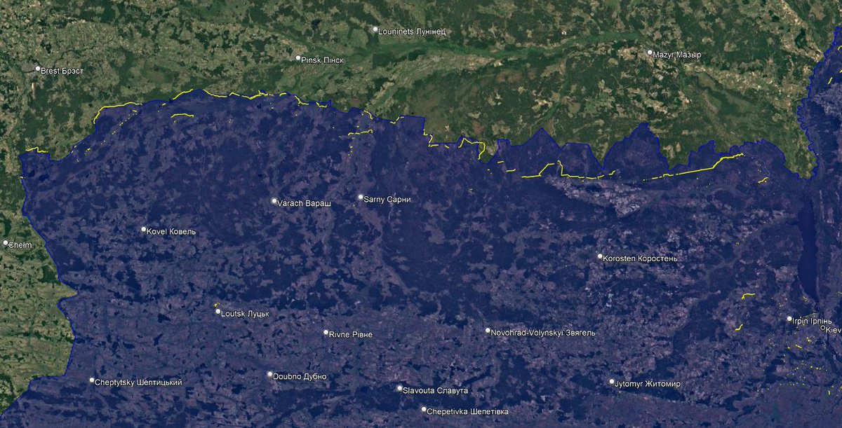
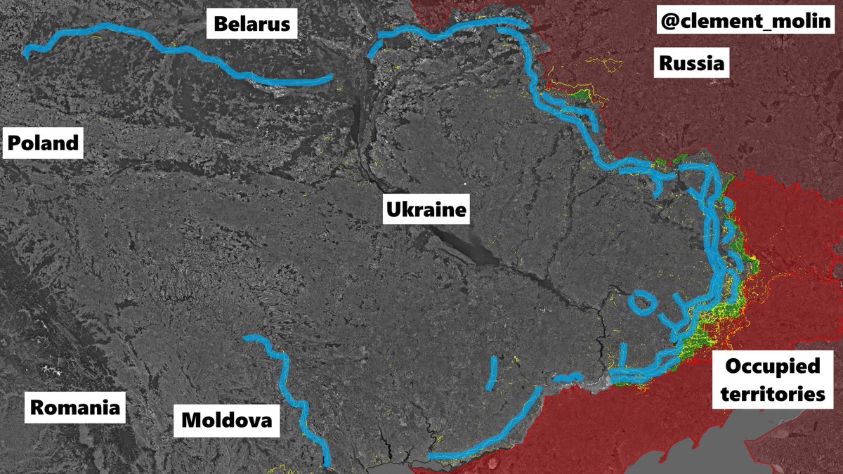
From Poland 🇵🇱 to Moldova 🇲🇩 stretches the longest Ukrainian 🇺🇦 defensive line, 2 800 km !
The biggest fortification system is in the east, in Donbass, but we can also find massive fortifications near Belarus, Kharkiv, or Odessa.
Let's analyse what is new :
🧵THREAD🧵1/25 ⬇️
The biggest fortification system is in the east, in Donbass, but we can also find massive fortifications near Belarus, Kharkiv, or Odessa.
Let's analyse what is new :
🧵THREAD🧵1/25 ⬇️

Since 2014, ukrainian forces have been fortifying the frontline, primarly with trenches, dugouts and bunkers.
In 2022, 2023 and 2024, they also added new defensive lines everywhere, with anti-tank ditches and open-air trenches, which are now obsolete. 2025 saw a new program :
In 2022, 2023 and 2024, they also added new defensive lines everywhere, with anti-tank ditches and open-air trenches, which are now obsolete. 2025 saw a new program :

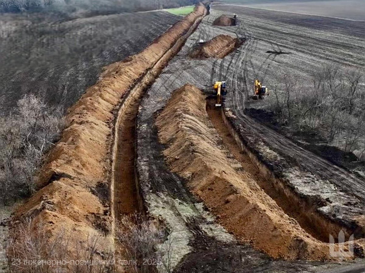
Previous trenches and fortifications were obsolete, no dugouts, no firing positions, no cover against drones and too large for small infantry teams.
Thus, since the first months of 2025, we have seen a new strategy of trench and fortification building.
Thus, since the first months of 2025, we have seen a new strategy of trench and fortification building.


The first, and main defensive system has been called "New Donbass Line" by @Playfra0 and myself.
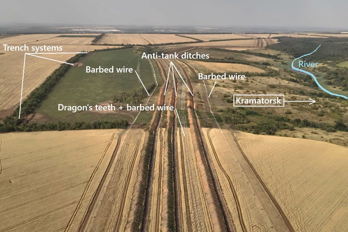
It consists of one (and now two) massive 3 rows anti-tank ditches, with hidden positions behind, barbed wire and dragon teeths. It run from the Kharkiv oblast border to south-Donetsk
It consists of one (and now two) massive 3 rows anti-tank ditches, with hidden positions behind, barbed wire and dragon teeths. It run from the Kharkiv oblast border to south-Donetsk
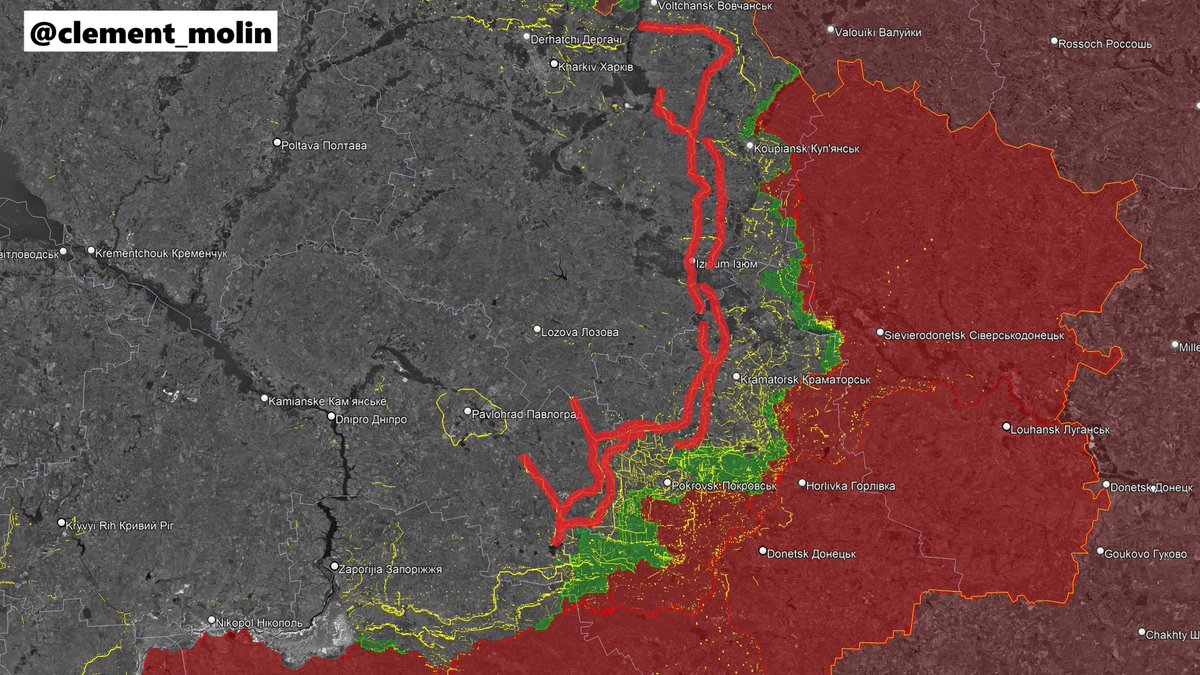
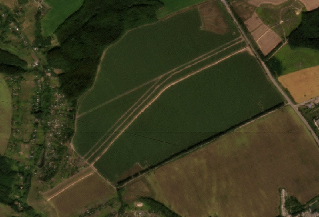
This line is simply massive, here are some pictures and a map showing how it works.
Of course, it is not perfect, because there are obviously holes (roads, rivers...), but it is the best thing ever done by Ukraine.
It mainly stretches behind the main Donbass cities.
Of course, it is not perfect, because there are obviously holes (roads, rivers...), but it is the best thing ever done by Ukraine.
It mainly stretches behind the main Donbass cities.

After a summer break, ukrainian engineering units started again to dig, especially filling the hole in the system north of Dobropilla, and preparing a new line south of Kramatorsk to avoid any progress between both lines.
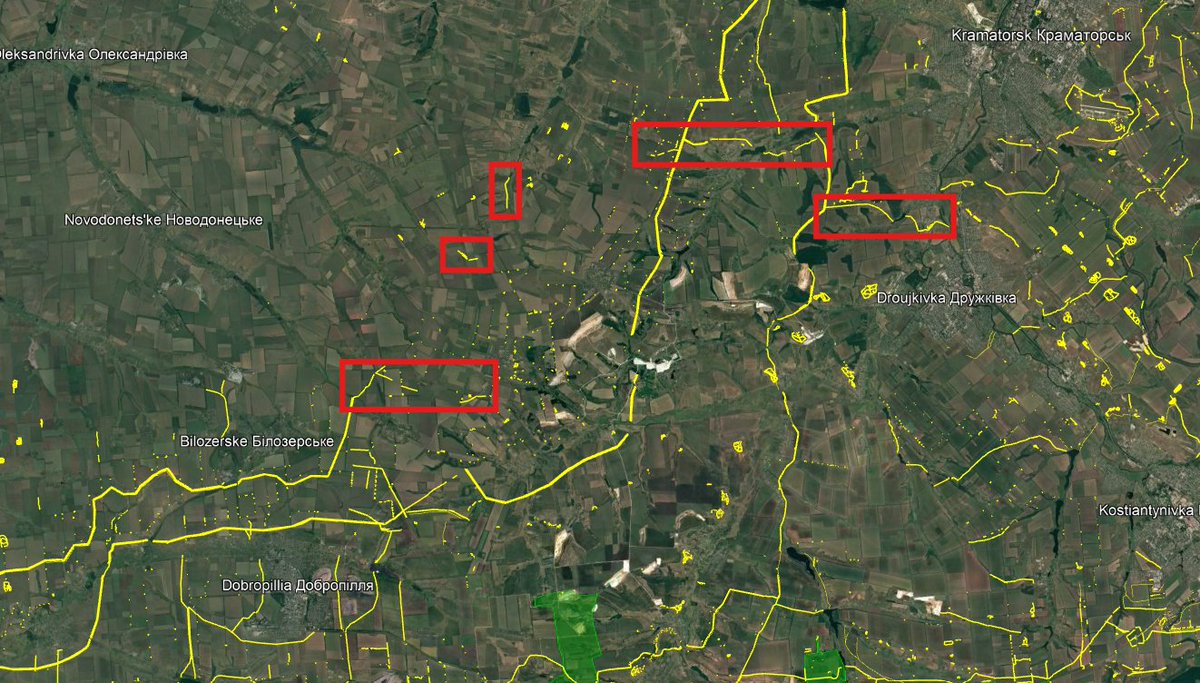
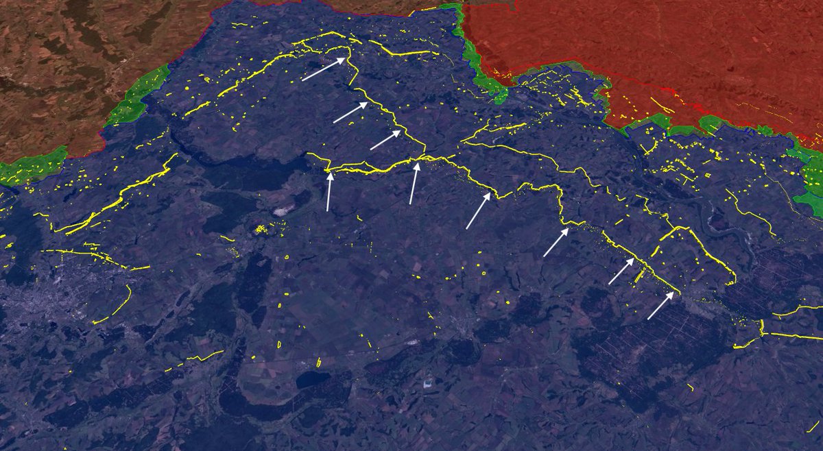
As you can see in this zoomed vision, Ukraine is adding 2 more anti-tank ditches to the existing one on the first line (built after the second) and are expanding the east-west line.
As you may know, in red, you can find trenches from 2025 and in yellow older ones.
As you may know, in red, you can find trenches from 2025 and in yellow older ones.
However, if you clicked on this thread, it's because you want to know something else. I said from Poland to Moldova :
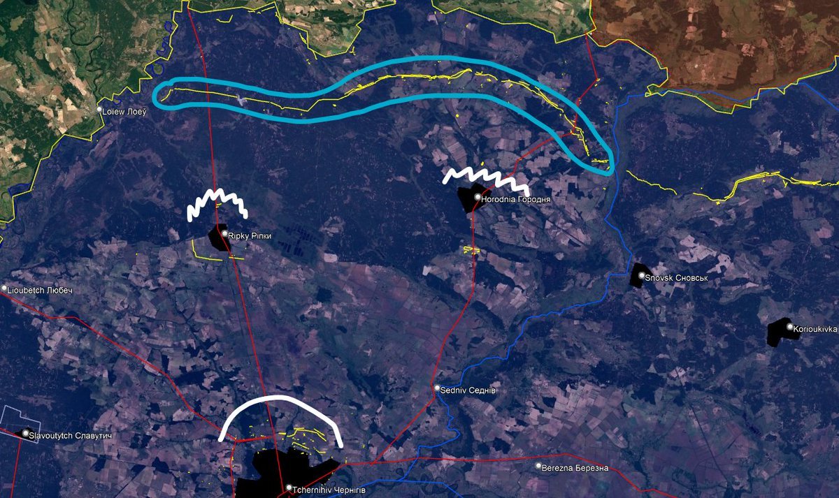
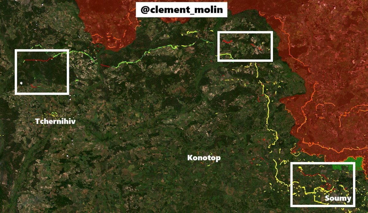
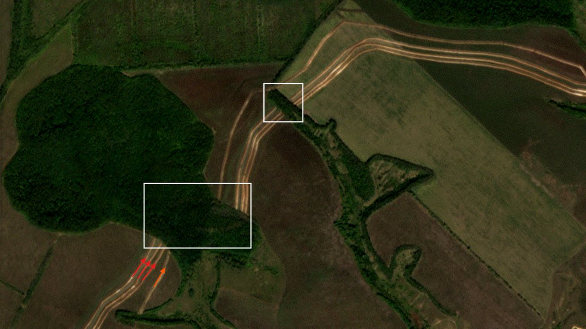
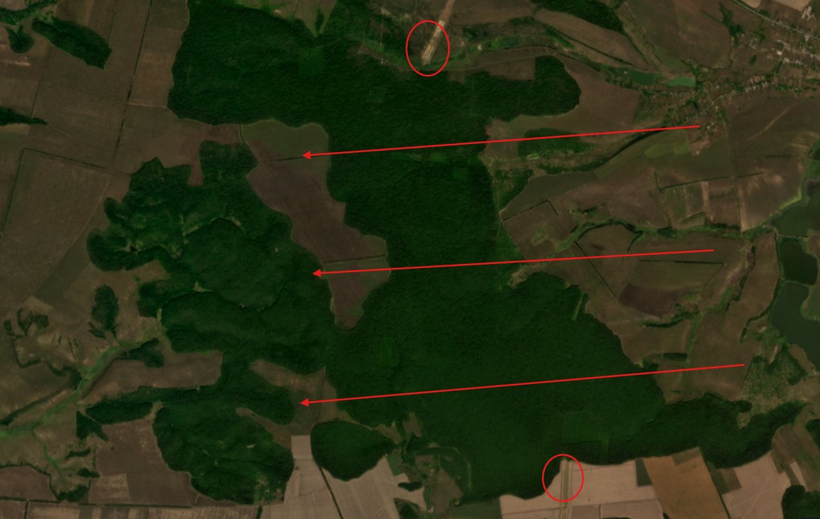
While looking at Chernihiv oblast, I saw this. Holes in the forests and brand new ditches. It shows something new is being prepared.
While looking at Chernihiv oblast, I saw this. Holes in the forests and brand new ditches. It shows something new is being prepared.

Few weeks ago, I sighted the first expansion of the "New Donbass Line" method to the northern part of the country, with the massive line being sighted north of Yampil in Sumy oblast.
This area was not fortified before and we are around 10km from the border.
This area was not fortified before and we are around 10km from the border.
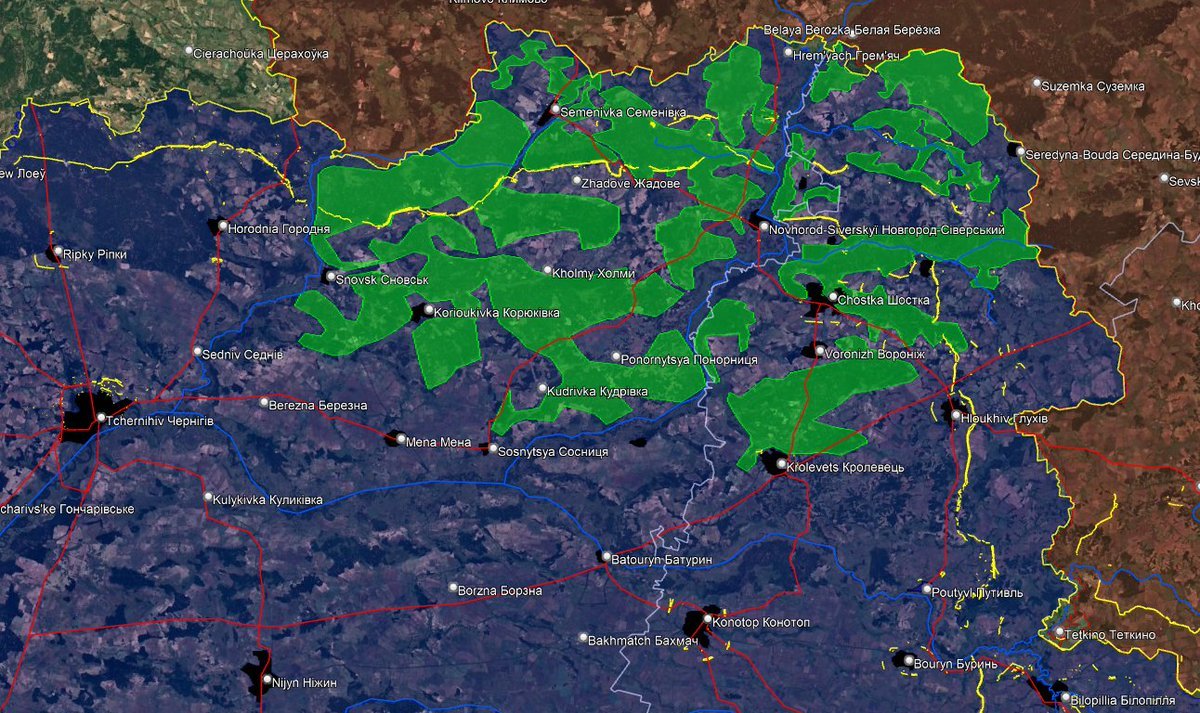
If you read my threads, you may have read one about the defensive line of the north-eastern corner of Ukraine.
Indeed, I mapped the 2024 defensive line there.
Indeed, I mapped the 2024 defensive line there.
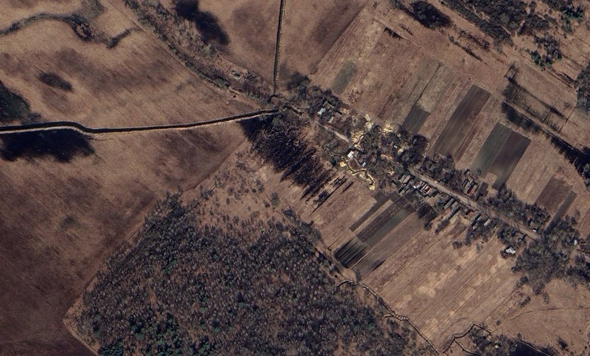
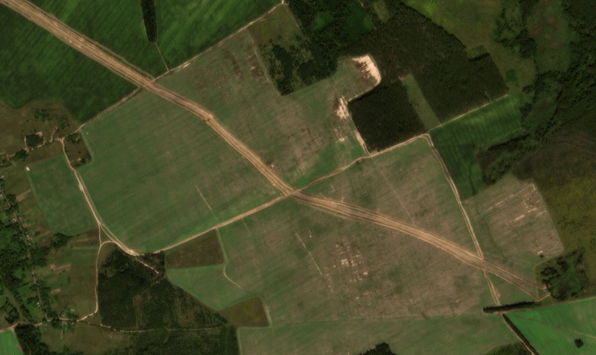
Through sentinel-2, I managed to see a long deforestation line ongoing west of Slavutytch, parrallel to the Dnipro river, facing Belarus.
It is in fact the first sight of a modern defensive line : they are getting ready to dig in the middle of the forest.
It is in fact the first sight of a modern defensive line : they are getting ready to dig in the middle of the forest.

And this is not the only area where the new defensive line is being improved on the russian/belarussian border.
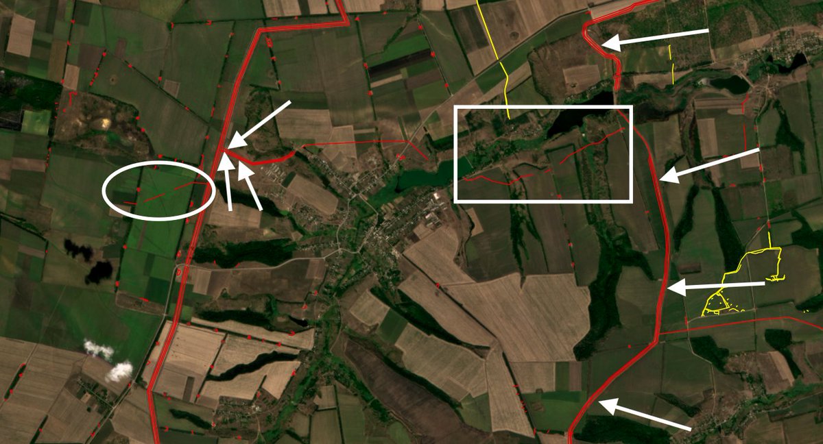
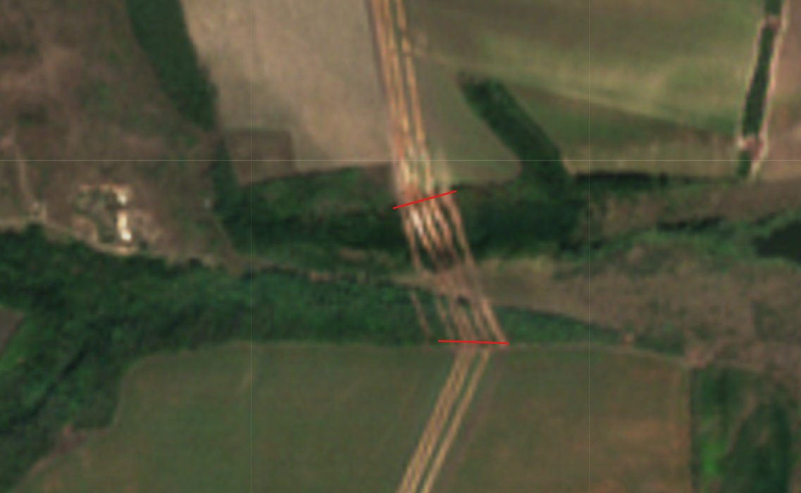
I managed to find the first portions of new 3 rows ditches + barbed wire and dragon teeths lines in Sumy and Kharkiv oblast.
I managed to find the first portions of new 3 rows ditches + barbed wire and dragon teeths lines in Sumy and Kharkiv oblast.
Here are some pictures of these new lines.
How does construction works ?
Generally, military units are in charge to fortify the frontline, the military engineering units are fortifying behind them and private companies are doing the big lines.
They mooved from east to north.
How does construction works ?
Generally, military units are in charge to fortify the frontline, the military engineering units are fortifying behind them and private companies are doing the big lines.
They mooved from east to north.
What about the Poland-Kyiv line ?
It was mainly built in 2023 and 2024, but local units and companies are still improving existing lines. Since the area mainly concists of swamps and forest, there are only few roads to fortify.
Around Chernobyl, there is constant improvment.
It was mainly built in 2023 and 2024, but local units and companies are still improving existing lines. Since the area mainly concists of swamps and forest, there are only few roads to fortify.
Around Chernobyl, there is constant improvment.
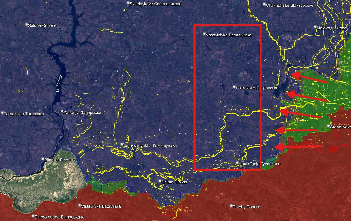
What about the Zaporizhia defensive lines ?
This is where there is a big problem. The 2024 two Zaporizhia lines are still here, even if they are being croped from the east with russian push.
But there have been no new improvment. Zaporizhia, Pokrovsk'e or Vassylkivka are left widely undefended...
This is where there is a big problem. The 2024 two Zaporizhia lines are still here, even if they are being croped from the east with russian push.
But there have been no new improvment. Zaporizhia, Pokrovsk'e or Vassylkivka are left widely undefended...
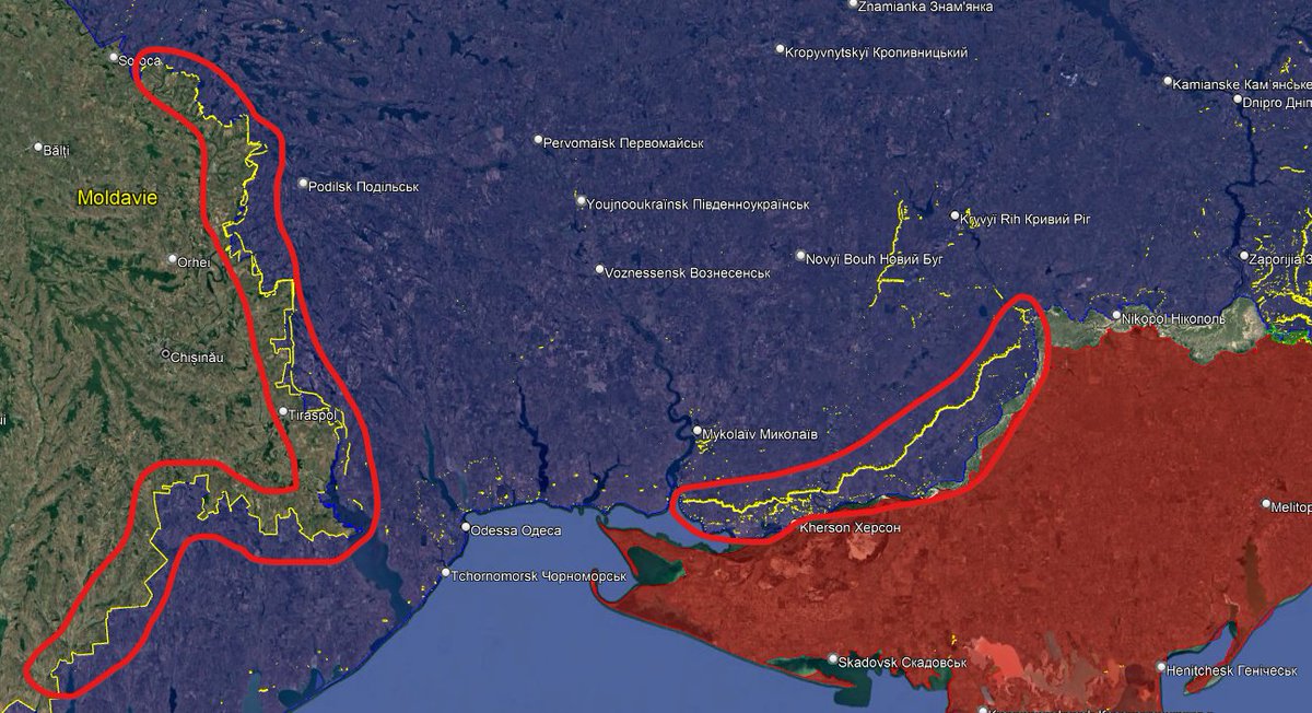
In Kherson, Mykolaiv and Odessa oblasts, we can still find older fortifications, including the Kherson defensive line behind the city going from the sea to the northern part of the oblast.
There is also a long anti-tank ditch system on the border with Transnistria and Moldova
There is also a long anti-tank ditch system on the border with Transnistria and Moldova
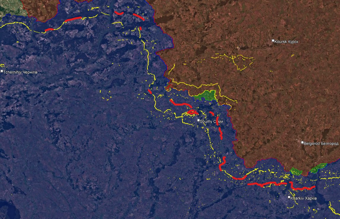
To understand the 2 800 km line, we have to cut it into 7 parts, I will rate the fortification by how good, long and useful they are.
-Poland-Kyiv : 4/10
-Tchernihiv/Sumy/Kharkiv : 5/10
-Kharkiv/Izium : 8/10
-Donbass : 8/10
-South : 4/10
-Kherson : 4/10
-Odessa/Moldova 3/10
-Poland-Kyiv : 4/10
-Tchernihiv/Sumy/Kharkiv : 5/10
-Kharkiv/Izium : 8/10
-Donbass : 8/10
-South : 4/10
-Kherson : 4/10
-Odessa/Moldova 3/10
Now that we saw all the main areas of this long line and how different it can be, lets do 3 case study of Kharkiv, the Oskil and Donbass, where the defensive line is finished.
Kharkiv : for the first time, there is a correct line north of the city, only vulnerability is forests.
Kharkiv : for the first time, there is a correct line north of the city, only vulnerability is forests.

Here, west of Kharkiv, we can see 4 ditches, 3 new and one older. The line looks good, but there is one problem, it should also go through the forest to avoid infantry penetration.
The Oksil line : behind the Oskil river and before the Siverski Donets one, we can see two lines, the main one, behind, is very good. No holes, a lot of small positions and in front of small cities.
The first one is still to be completed.
The first one is still to be completed.
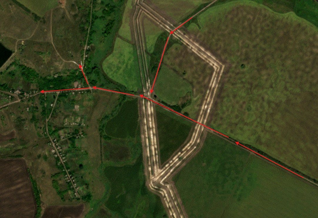
A very good point here, how they covered the roads. You have to let roads, for your own troops to go and retreat.
But they are also used by your ennemy to attack. Here, the fire can be concentrated between the ditches, honestly, it is nearly impossible to cross here.
But they are also used by your ennemy to attack. Here, the fire can be concentrated between the ditches, honestly, it is nearly impossible to cross here.
For the Donbass part, there is one big vulnerability, it is west of Sloviansk. This forest can be easily crossed by infantry (maybe there is barbed xire, I cannot tell).
Another vulnerability between those mines, the ditch was stopping, now they are filling the hole.
Another vulnerability between those mines, the ditch was stopping, now they are filling the hole.

My next work will be to map all the holes (road, rivers, forests... in the new defensive lines to understand where Russia will try to cross it.
Here, there was a big hole (even if vehicles cannot cross, infantry can), but they did good work.
Here, there was a big hole (even if vehicles cannot cross, infantry can), but they did good work.
Let's be clear, fortifications cannot stop the russian army, but :
-It stopped all armoured assaults
-It forces the infantry to take another road
-It concentrates ukrainian means and firepower
-It offers a good defensive position
-> When you see how massive lines are, with 3 ditches filled with barbed wire, with barbed wire everywhere and dragon teeths, that you see the reduced number of suitable roads, you understand how useful they will be when Russia will reach them.
It will be way more difficult to push, because it would require time, men and a lot of means to cut the barbed wire, cross the ditches and establish supplies with an increasing number of drones.
I will soon offer new perspectives with videos, photos and a map of all suitable holes for infantry and vehicles for a better understanding of where Russia will push !

Thank you all for following and reading this thread. Besides the writing work is a longer one, mapping. It takes time, energy but it is very useful.
You can support me here :
Don't hesistate to ask me questions :buymeacoffee.com/clement.molin
You can support me here :
Don't hesistate to ask me questions :buymeacoffee.com/clement.molin
• • •
Missing some Tweet in this thread? You can try to
force a refresh


