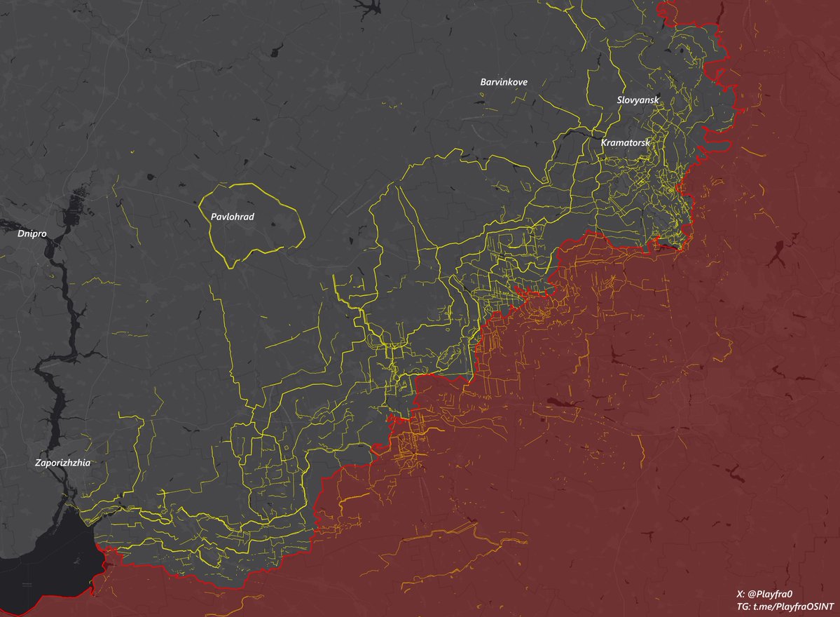
🇺🇦⚔️🇷🇺 Day 1300, comprehensive frontline and rear situation report: territorial changes, trends, strategies and objectives of both sides, fortifications.
🧵Thread🧵1/⬇️
🧵Thread🧵1/⬇️

2/🧵
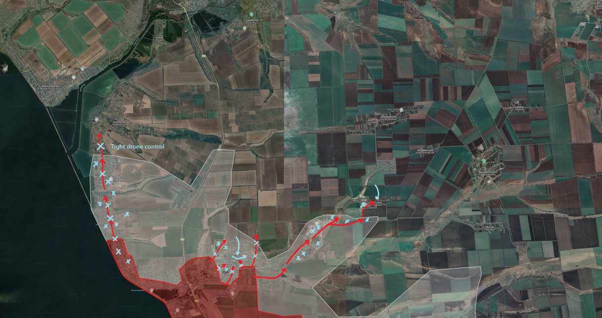
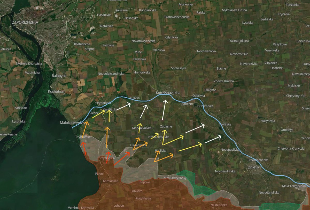
Zaporizhzhia Oblast', Stepnohirsk sector.
Russian forces continue offensive operations in the sector, despite generally low media coverage.
The Russians gather up in Plavni's center to move through the gray zone to northern Plavni, and accumulate there. After this, they try to move into southern Prymorske, but are eliminated in the accumulation phase or cleared out by frequent Ukrainian infantry raids.
The Russians also often try to move through the kill zone in the fields north of Kamyanske, but the area is open enough for Ukrainian drone operators to control well and eliminate any movement, causing high casualties to the Russians.
Further northeast, the Russians constantly attempt to move into the 3rd microdistrict. This is because the district is composed of still mostly intact high rise buildings, that can be used for a safer accumulation for further assault operations.
From the 3rd microdistrict, the Russians seem to prefer attacking Ahrarna St. in southern Stepnohirsk.
Because of this predictability, the Ukrainians are zeroed in and constantly counterattack with all fire methods available.
Because of little successes evidenced after trying to take Stepnohirsk head-on, the Russians are slowly shifting their attention eastwards. An accumulation is recorded northeast of Kamyanske in the indicated area.
In general, the Ukrainians seem to be effectively holding the borders, combining fire damage with active defense, and achieving a favorable ratio of casualties with the Russian side. Russian successes here, at the moment, are not significant in any way.
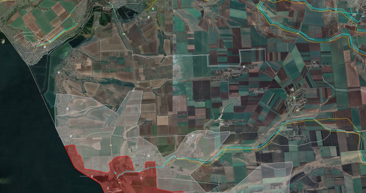
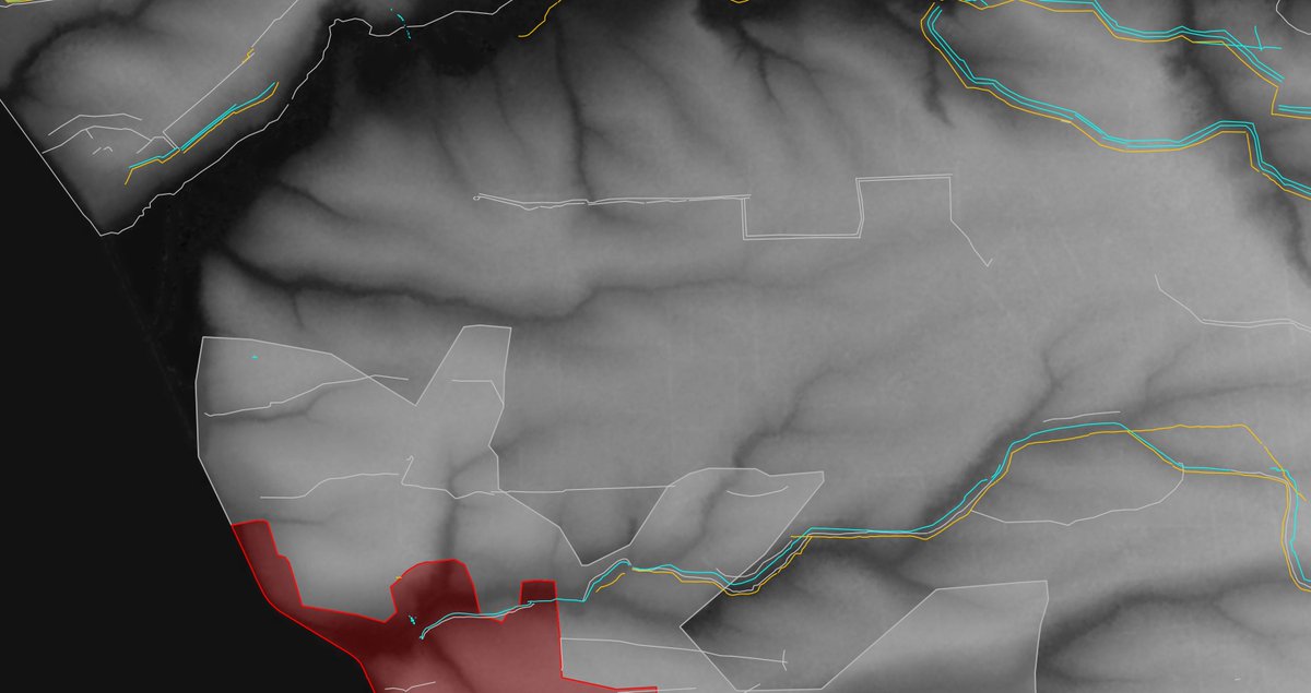
White = trenches
Yellow = ditches
Blue = dragon's teeth
Gray = barbed wire
Zaporizhzhia Oblast', Stepnohirsk sector.
Russian forces continue offensive operations in the sector, despite generally low media coverage.
The Russians gather up in Plavni's center to move through the gray zone to northern Plavni, and accumulate there. After this, they try to move into southern Prymorske, but are eliminated in the accumulation phase or cleared out by frequent Ukrainian infantry raids.
The Russians also often try to move through the kill zone in the fields north of Kamyanske, but the area is open enough for Ukrainian drone operators to control well and eliminate any movement, causing high casualties to the Russians.
Further northeast, the Russians constantly attempt to move into the 3rd microdistrict. This is because the district is composed of still mostly intact high rise buildings, that can be used for a safer accumulation for further assault operations.
From the 3rd microdistrict, the Russians seem to prefer attacking Ahrarna St. in southern Stepnohirsk.
Because of this predictability, the Ukrainians are zeroed in and constantly counterattack with all fire methods available.
Because of little successes evidenced after trying to take Stepnohirsk head-on, the Russians are slowly shifting their attention eastwards. An accumulation is recorded northeast of Kamyanske in the indicated area.
In general, the Ukrainians seem to be effectively holding the borders, combining fire damage with active defense, and achieving a favorable ratio of casualties with the Russian side. Russian successes here, at the moment, are not significant in any way.
White = trenches
Yellow = ditches
Blue = dragon's teeth
Gray = barbed wire


3/🧵
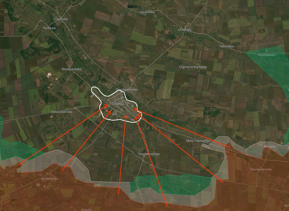
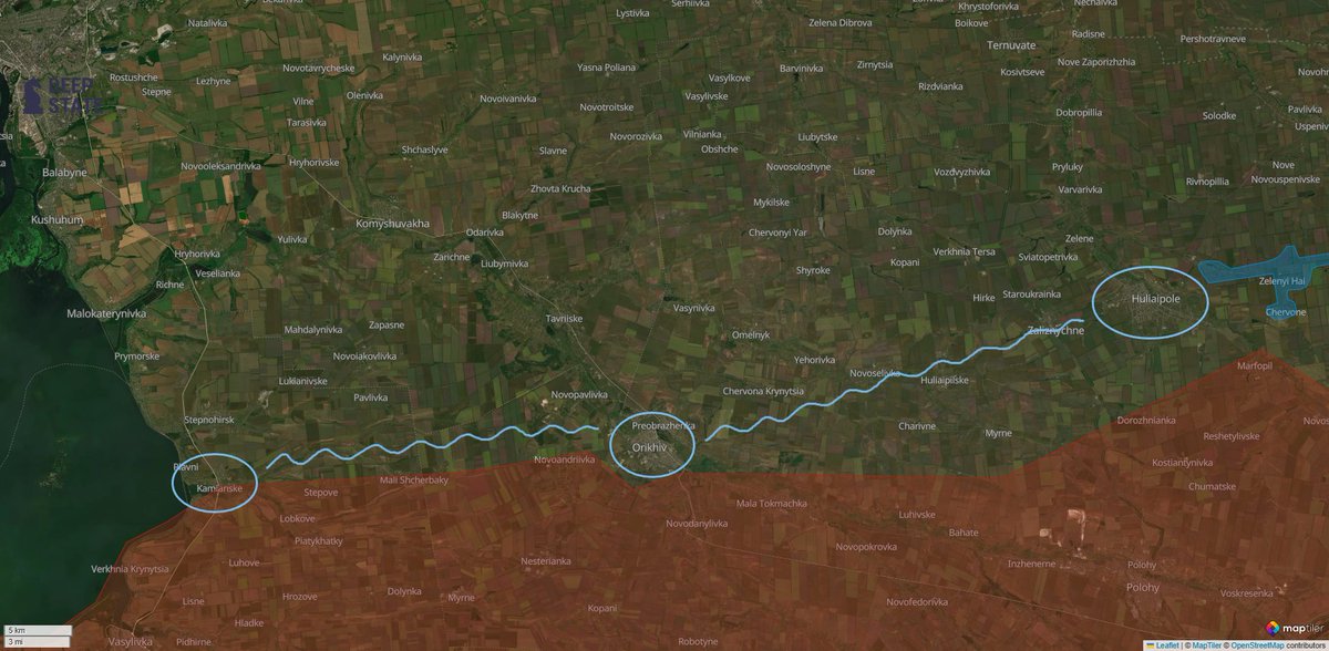
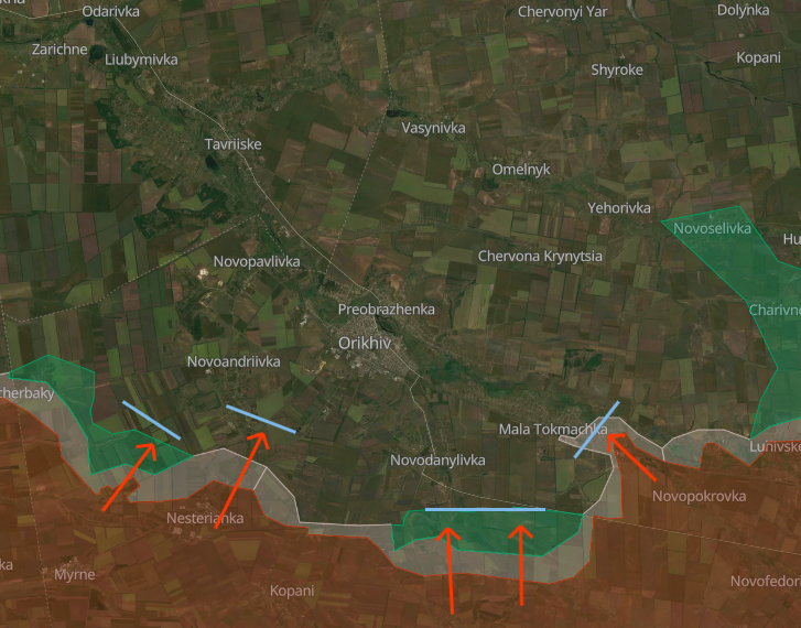
Zaporizhzhia Oblast', Pokrovske - Huljajpole direction.
In the Uspenivka sector, Russian forces are advancing through vast rural areas. The Ukrainians can do little to nothing to counter this because of the almost total lack of manpower in this particular direction, that has not seen activity since 2022, and from which many units were transferred to other areas deemed more critical.
The trenches you see in this direction are either empty, because of the critical lack of men to man them, or unused, because they are outdated relative to drone warfare, as they are situated in the middle of fields and uncovered.
At the moment, fighting is ongoing for Olhivske, and Russian forces came close to Novoivanivka, for which fighting will likely soon start.
A bit north, after the capture of Zaporizke without much resistance, the village of Novomykolaivka was captured soon after. Russian forces are expected to continue along this small valley to Kalynivske, which suffered heavy FAB bombardments last week.
Near fortified Berezove, Russian forces decided to bypass both this village and Ternove, seemingly after encountering resistance, and advanced significantly between the 2 villages in the treelines.
This forced the Ukrainians to retreat from Ternove, for which fighting is ongoing, in favor of some outdated fortifications just north of it, which, as said multiple times, provide only an extremely small advantage.


4/🧵
Novopavlivka direction.
At Ivanivka, according to DeepStateMap's September 14th update, Russian forces crossed both the Ukrainian obstacles of the so-called "New Donbas Line" and the Vovcha river, to then cross a barbed wire line on the opposite shore and occupy the outermost buildings of Ivanivka.
Unless the amount of infantry that was able to cross these obstacles is sufficient enough, I think that this bridgehead could be eventually eliminated because of the extreme logistical hassle that all of these obstacles pose, and that attempting such an operation from the Russian part is a wrong decision.
For now, the situation is under clarification.
Further east, near Filiya, counter battles continue, with the situation being extremely dynamic as both sides attack and counterattack.
In particular, Russian units are trying to break through the main obstacle line here, too, and to finally consolidate in the forest southwest of Filiya to use it as a launchpad for further assaults in the Novopavlivka sector, but Ukrainian groups often come in and eliminate Russian accumulations in it, denying them consolidation.
The importance of these forests cannot be underestimated, as they have the effect of formidable fortifications for both sides and provide excellent cover from drones and enemy surveillance.
This is why, together with drones, the Russians are incessantly bombing them with FABs and have been doing so for weeks, hinting at their goals here.
On the shores of the Vovcha river southeast of Filiya we find Dachne. Here battles have been ongoing for months by now, and both sides are engaged in their "flag wars".
What is known for sure is that the Russians control the forest south of Dachne, and the Ukrainians the one north. Both sides, as previously explained, use these forests as good accumulation points to launch attacks, which results in the situation in the village changing extremely often. Effectively, Dachne acts as a gray zone, and drawing it under blue or red is useless.
Lastly for this area, west of Horikhove, Russian forces made significant advances in the heavily fortified fields in front of Novopavlivka in the last 2 weeks (the advancement you see is fruit of constant pressure for long periods of time, and not one day).


5/🧵
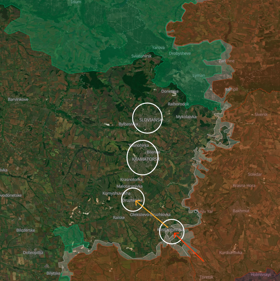
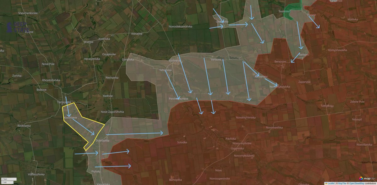
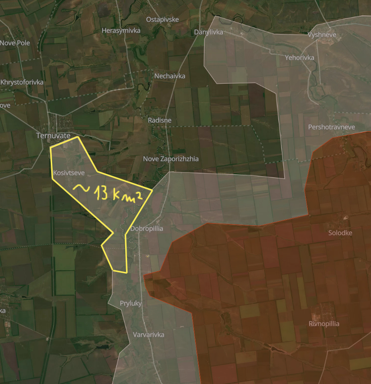
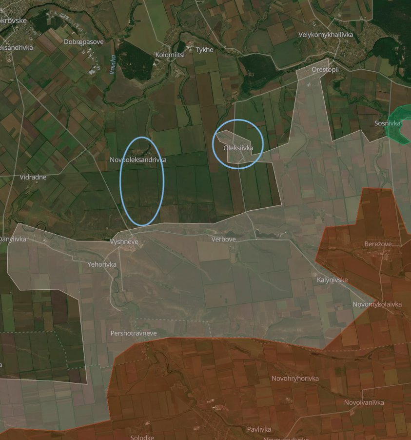
Dobropillia direction.
The situation in this direction reaches an unprecedented level of confusion, as both sides continue maintaining strict operational security policies after more than 2 months.
In picture #1 you see an attempt at the most precise representation possible of the situation without having access to private army maps and without recurring to painting the whole salient in the gray zone, as it's effectively how it acts as. Here's a summary.
In general, Ukrainian forces currently possess the initiative, but the Russians are fighting back and trying to advance towards Kucheriv Yar, and from Kucheriv Yar to Zolotyi Kolodyaz, crossing Ukrainian obstacle lines belonging to the New Donbas Line.
Ukrainian forces recaptured parts of northern, central and southern Novoekonomichne, but fighting is still ongoing there and not everything is consolidated.
Ukrainian forces are attempting a triple encirclement of Russian forces near Kucheriv Yar, between Mayak and Nikanorivka (Zapovidne) and between Novotoretske and Boikivka.
Zatyshok (Suvorove) is currently in the gray zone, with the Ukrainians trying to push the Russians out of the village.
The same goes for Nikanorivka (Zapovidne): the situation is dynamic, both sides attack and counterattack, and positions constantly change hands.
Russian forces are trying to take back the initiative at Nove Shakhove, for which fighting is ongoing, Ivanivka and Vilne. Conflicting information can be found regarding the results.
Russian forces are trying to link back up with their encircled contingent trapped in Kucheriv Yar, which is itself trying to break out and at the same time advancing northwards to Zolotyi Kolodyaz and Vesele, but were repelled, very likely because of terrible supplies and the New Donbas Line.
Russian forces continue trying to attack Shakhove, reportedly having small successes, and at the same time, the Ukrainians entered Mayak and recaptured Pankivka.
Novotoretske also saw an Ukrainian entry, with the current situation unknown.
Ukrainian forces attack south of Volodymyrivka towards Koptieve, attempting a fourth encirclement out of the salient.
Please remember that the situation changes every hour in this area, and that every source you look at claims different things. This little summary was compiled according to my own information from that area and only external sources that have proven some degree of reliability in the past.


6/🧵
Kostyantynivka front.
In its western part, near Yablunivka, this week the Russians attempted to advance along a ravine and to cross the Bychok river, but suffered fire damage from Ukrainian small arms fire and drones and did not achieve success.
Further east, according to my preliminary information, that Russian forces finally established control over Katerynivka, I will wait proof before drawing the village under Russian control.
Directly southeast of Kostyantynivka, in the past week the Russians attempted daring assaults towards the city itself and Ivanopillya.
The Russians attempted 2 times to enter dacha village "Yahidka" (in the administrative boundaries of Kostyantynivka city), but were destroyed, with the remnants of attack #2 being destroyed today.
Just east of this area, Russian presence is steadily recorded in the fields between Predtechyne and Oleksandro-Shultyne. It is evident that they are attempting to cut the retreat of Ukrainian forces in the treelines east of this area.
These treelines have been fortified ever since 2022-2023 and constitute a powerful fortification line that was designed to be the fallback line for the Canal defensive line.
Furthermore, in the past week Russian forces finally consolidated control in Stupochky.


7/🧵
Siversk - Lyman direction.
Russian forces continue attacking Siversk frontally with small assault groups with very limited success.
The most active area of the Siversk sector is recorded as the Serebryanka - Dronivka area in the past week: here, the Russians are employing extremely small assault groups and motorcycles to slip through Ukrainian defensive formations, but are very often eliminated by Ukrainian drones. This area remains a gray zone.
Just next to it, Russian forces continue attacking Serebryanka, village that was erased from the face of the earth, which in the end revealed a counterproductive measure for the Russians themselves, as there's nowhere to "gain a foothold". This village will probably remain in the gray zone under constant attacks and counterattacks for some time to come.
Indeed, Ukrainian UAVs units in the Siversk direction have a great reputation and have always been extremely effective, causing many casualties to Russian forces and effectively being able to fly freely deep into Russian-controlled territory. This contributes in large quantities to why this sector held for 4 years under relentless assaults.
North of the Siversky-Donets river, in Yampil, the sides are currently fighting for the ostrich farm east of the village, which was turned into a formidable fortification built to defend after the fall of the Kreminna defensive formations.
Russian forces have been recorded as far as Yampil itself and have been destroyed, but despite this, the area remains permeable and very dynamic, so it is drawn as a gray zone for the best possible representation.
Just north we find Zarichne. The best comparation we could make is by comparing it to Serebryanka: erased from the face of the earth, subject to constant changing of hands of positions, attacks and counterattacks, which in the end makes it a gray zone. Ukrainian forces still solidly cling to the outskirts.
Remember that this area will probably not cede rapidly, because of the amount of units that recently retreated from Kreminna forest and that are now defending a much shorter front.


8/🧵
Kupyansk direction.
Here, the Russian Oskil bridgehead expanded rapidly in the past week or so.
Russian forces established solid positions in Kupyansk city and continue to advance.
At the moment, fighting is ongoing for the vast high rise buildings area of the city situated in its northern part, that, as always, constitute formidable fortifications.
West of this area, in Moskovka, positions of both sides are mixed, and the village can be considered a gray zone.
What I'm most worried about in Kupyansk city is the situation becoming just like Toretsk 2024, where the Russians very simply pushed frontally because of low Ukrainian resistance at the start, occupied the first high rise buildings, accumulated there and initiated a chain reaction for the weaker fortifications set up in the residential buildings and similar housing, advancing through literal waves of small and big assault groups.
This is because, at the moment, the southern highway supplying Kupyansk is still usable, and the western dirt roads haven't been cut off completely yet, too, so a frontal assault might seem viable to Russian forces, since many units were transferred from Kupyansk sector to, for example, Dobropillia.
A thing to note here. Recently, a gas pipeline by the name of "Transbalkanskiy gas pipeline" was found, leading from Lyman Pershiy in the Russian close rear to areas in the Ukrainian rear, with an exit in Radkivka village.
According to various reports, Russian soldiers have been using this pipeline for a while (and Ukrainian soldiers knew about this for a while, too) to transport supplies and troops to the bridgehead safely and avoid exposure to dense Ukrainian drone control.
The trip for Russian soldiers going through it lasts 4 days, and a logistical system was organized inside it, with small carts pushing soldiers through. Small areas dedicated to "stops" were also improvised to have the soldiers eat and drink in it.
After exiting the pipe, Russian soldiers would disperse in a forest immediately nearby and wait to accumulate for further assault operations.
Other pipelines are present in many other parts of Ukraine, exactly like this one, that have been used and will likely be used again, and Ukraine should take example from past events and start to systematically block and render them unpassable.
Reportedly, in Kupyansk sector alone 4 others were found and blocked, with this being the only one left for whatever reason.
Indeed, we've seen an example of barbed wire inside one of them, which seems to be a good sign.


9/🧵
Here, that's the end of this (long) thread, which took multiple painful hours to make, but was necessary, seeing how complicated to understand some situations were🫠
Thank you a lot for your attention, and if you liked this analysis, it would be great if you could simply repost and give me a follow.
If you would like to do something more, here's my donation link: coff.ee/playfra.
And lastly, don't forget to join my Telegram at t.me/PlayfraOSINT.
Have a good day everybody :)
• • •
Missing some Tweet in this thread? You can try to
force a refresh