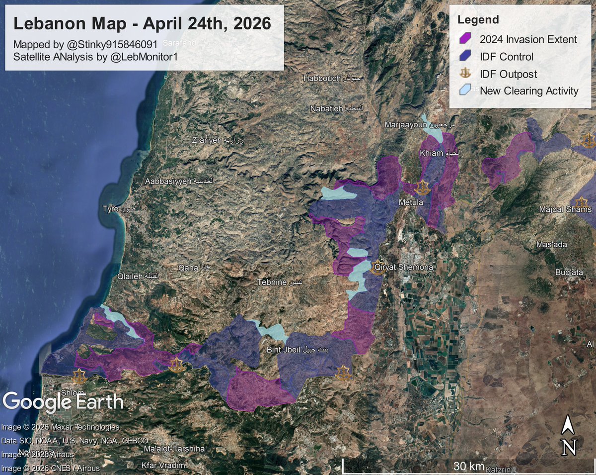
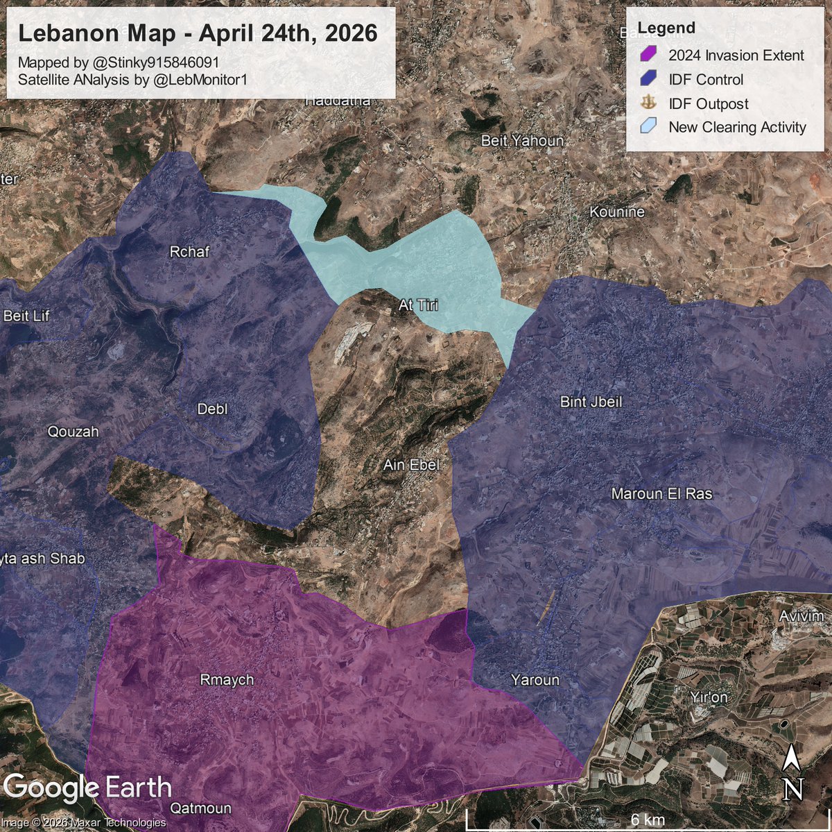
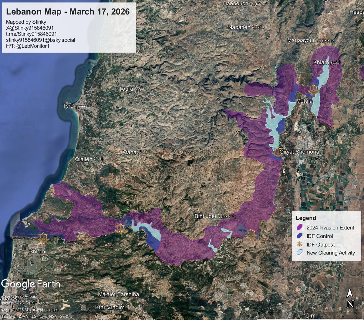
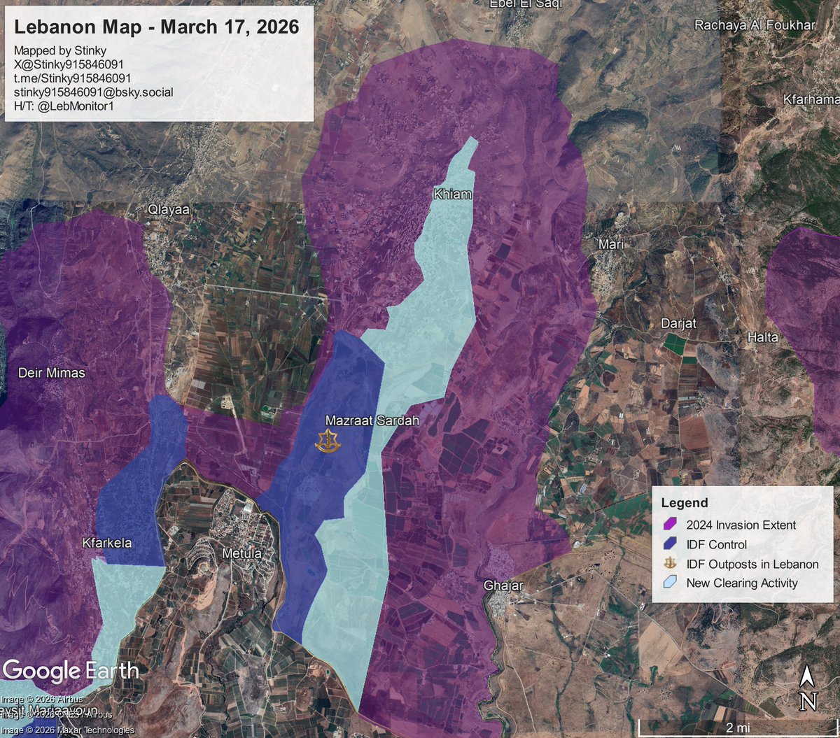
The Al-Qassam Brigades [Hamas] has released its footage of the August 20 battle with the IDF near Khan Yunis.
In this thread, I will be geolocating video clips released by the group, as well as showcasing additional footage previously unseen, provided by @orfialkov (thank you!)
In this thread, I will be geolocating video clips released by the group, as well as showcasing additional footage previously unseen, provided by @orfialkov (thank you!)
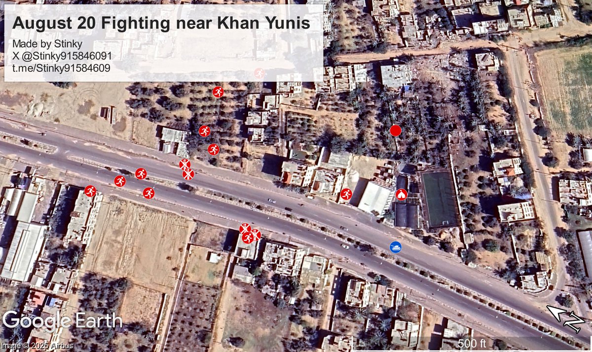
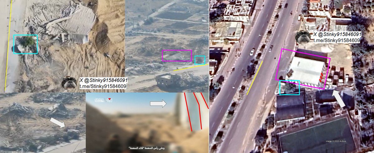
Firstly, the video starts off with a militant climbing out of a tunnel and showcasing the area around, one can see old cell towers along Salah Al Din road. The POV is located approximately here (see tunnel in quoted tweet)
https://x.com/Stinky915846091/status/1958226113999810910
Temporary encampment that is set up by the Al- Qassam Brigades [Hamas], which is used as a staging point for the ambush.
Location: 1.321346, 34.315765
8G3P88C8+G8 Qa' al Kharaba, Khan Yunis Governorate, Gaza Strip
@GeoConfirmed
Location: 1.321346, 34.315765
8G3P88C8+G8 Qa' al Kharaba, Khan Yunis Governorate, Gaza Strip
@GeoConfirmed
Al-Qassam [Hamas] terrorists moving along the main road and into a nearby house.
Location [Initial move]: 31.321628, 34.315552
8G3P88C8+M6 Qa' al Kharaba, Khan Yunis Governorate, Gaza Strip
@GeoConfirmed
Location [Initial move]: 31.321628, 34.315552
8G3P88C8+M6 Qa' al Kharaba, Khan Yunis Governorate, Gaza Strip
@GeoConfirmed
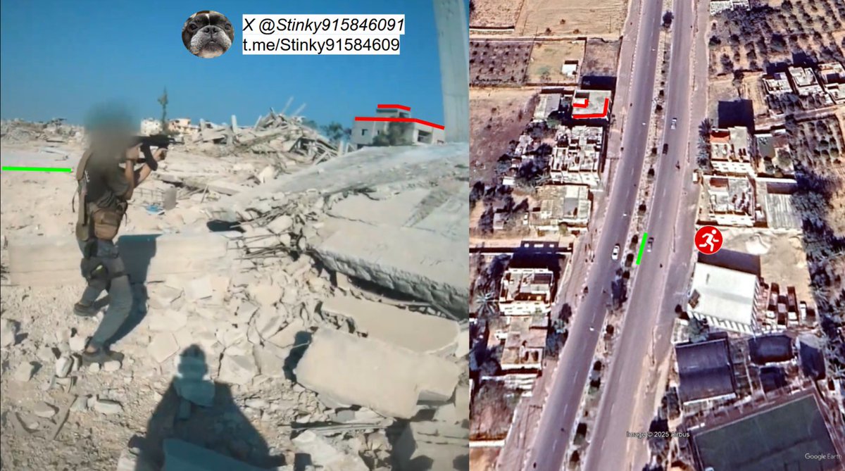
Location [House]: 31.321971, 34.314880 8G3P88C7+QX Qa' al Kharaba, Khan Yunis Governorate, Gaza Strip @GeoConfirmed

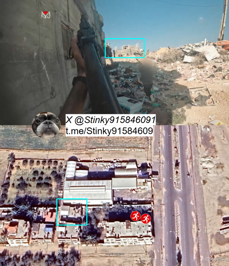
Al-Qassam [Hamas] terrorists shooting into a house, a crane is also visible in the footage likely used as a surveilance site by the IDF.
Location [POV]: 31.322991, 34.314531
Location [Crane]: 31.323094, 34.314256
8G3P88F7+6P Qa'al Kharaba, Khan Yunis Governorate, Gaza Strip
Location [POV]: 31.322991, 34.314531
Location [Crane]: 31.323094, 34.314256
8G3P88F7+6P Qa'al Kharaba, Khan Yunis Governorate, Gaza Strip
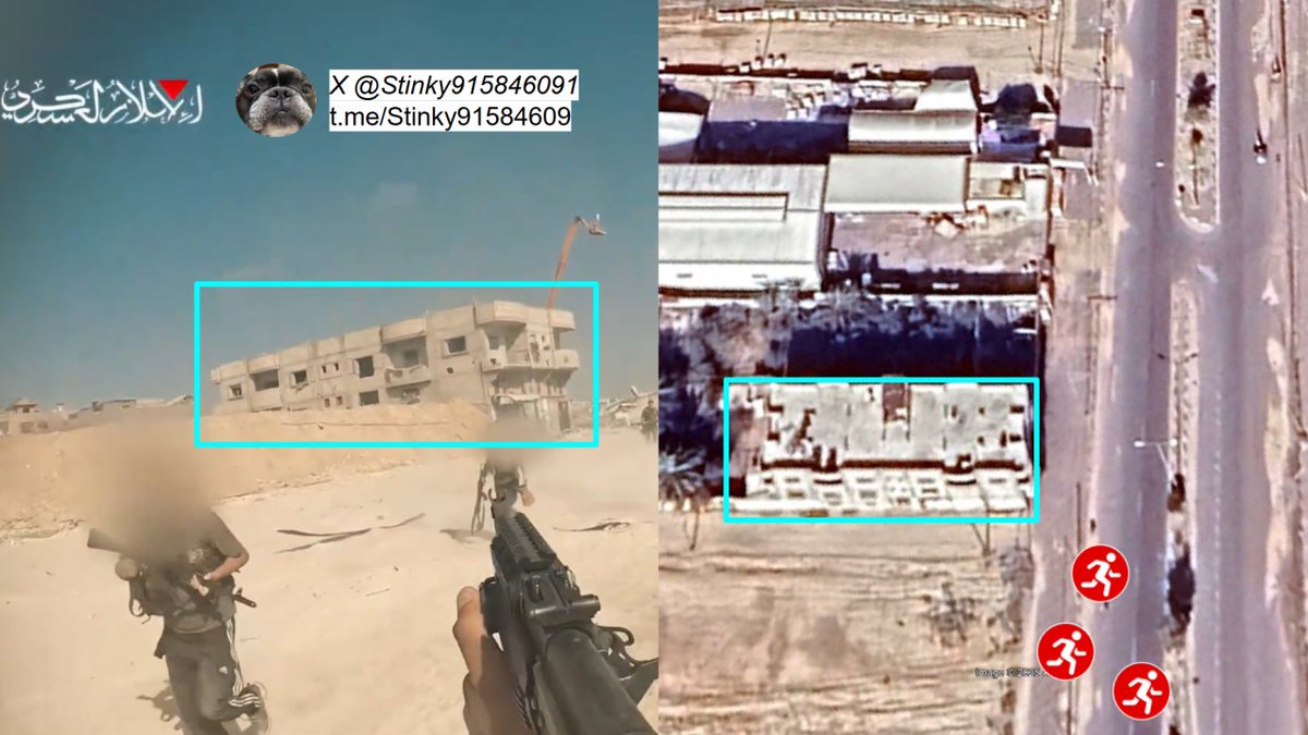
In the last geolocatable clip of the video, we see Al-Qassam [Hamas] terrorists retreating after being repelled by IDF forces.
Location: 31.323094, 34.314256
8G3P88F7+6P Qa' al Kharaba, Khan Yunis Governorate, Gaza Strip
@GeoConfirmed
Location: 31.323094, 34.314256
8G3P88F7+6P Qa' al Kharaba, Khan Yunis Governorate, Gaza Strip
@GeoConfirmed
That is all geolocatable footage from what was posted by Al-Qassam [Hamas], however, previously unseen footage that has been provided to me by @orfialkov gives us an additional insight (as well as some of the aftermath) of the battle.
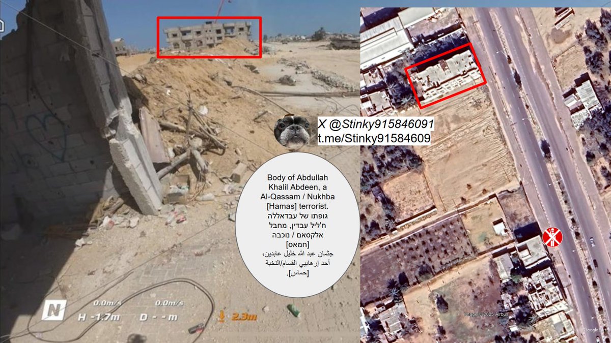
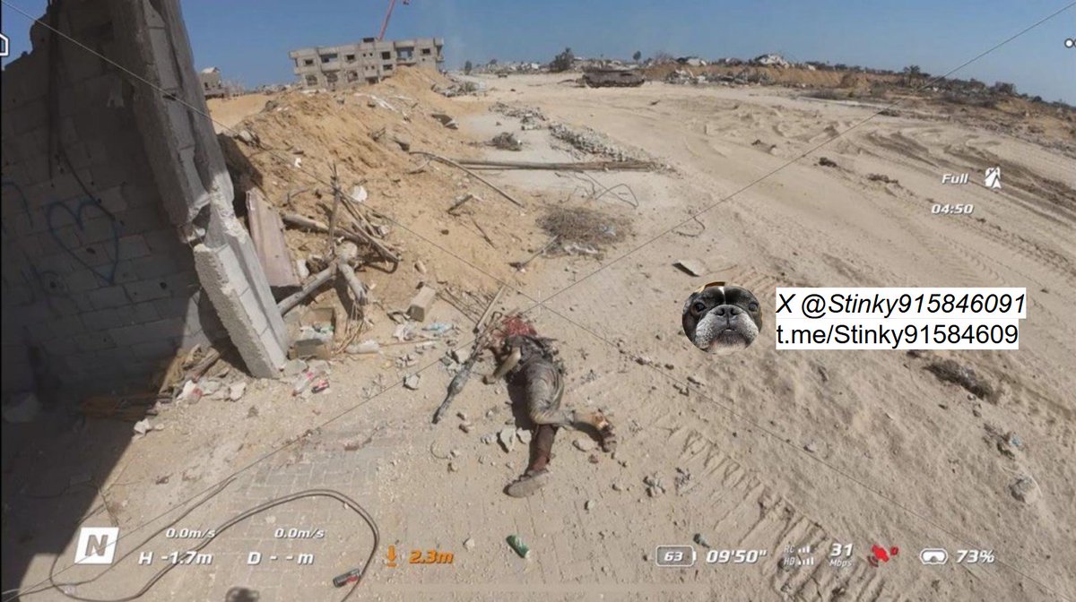
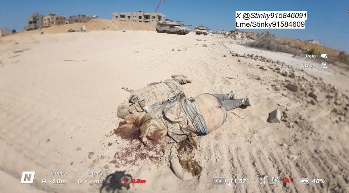
Drone footage of a dead Al-Nukhba [Hamas] member. he is the same individual seen in the tank ramming video during the ambush.
Location: 31.322021, 34.314954
@GeoConfirmed
Relevant Video:
Location: 31.322021, 34.314954
@GeoConfirmed
Relevant Video:
https://x.com/Stinky915846091/status/1958209898078248972
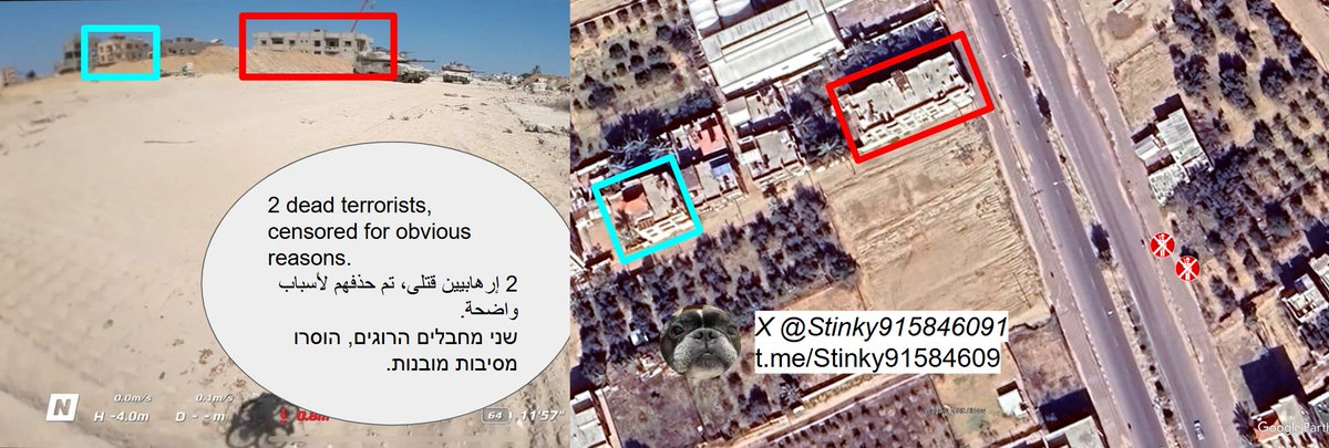
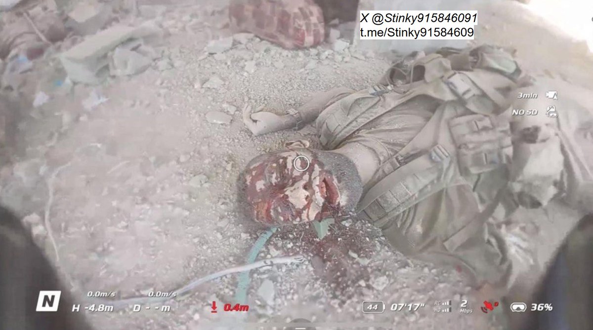
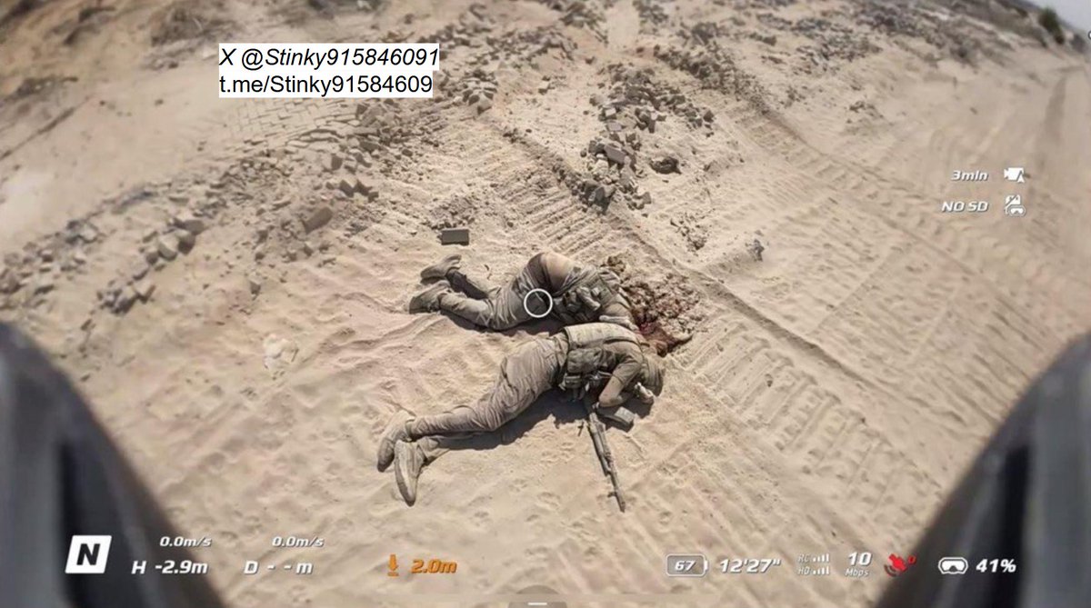
Two dead Al-Qassam [Hamas] terrorists on the side of Salah-Al Din road following the failed ambush against the IDF.
Location: 31.322502, 34.315058
8G3P88F8+22 Qa' al Kharaba, Khan Yunis Governorate, Gaza Strip
@GeoConfirmed
Location: 31.322502, 34.315058
8G3P88F8+22 Qa' al Kharaba, Khan Yunis Governorate, Gaza Strip
@GeoConfirmed
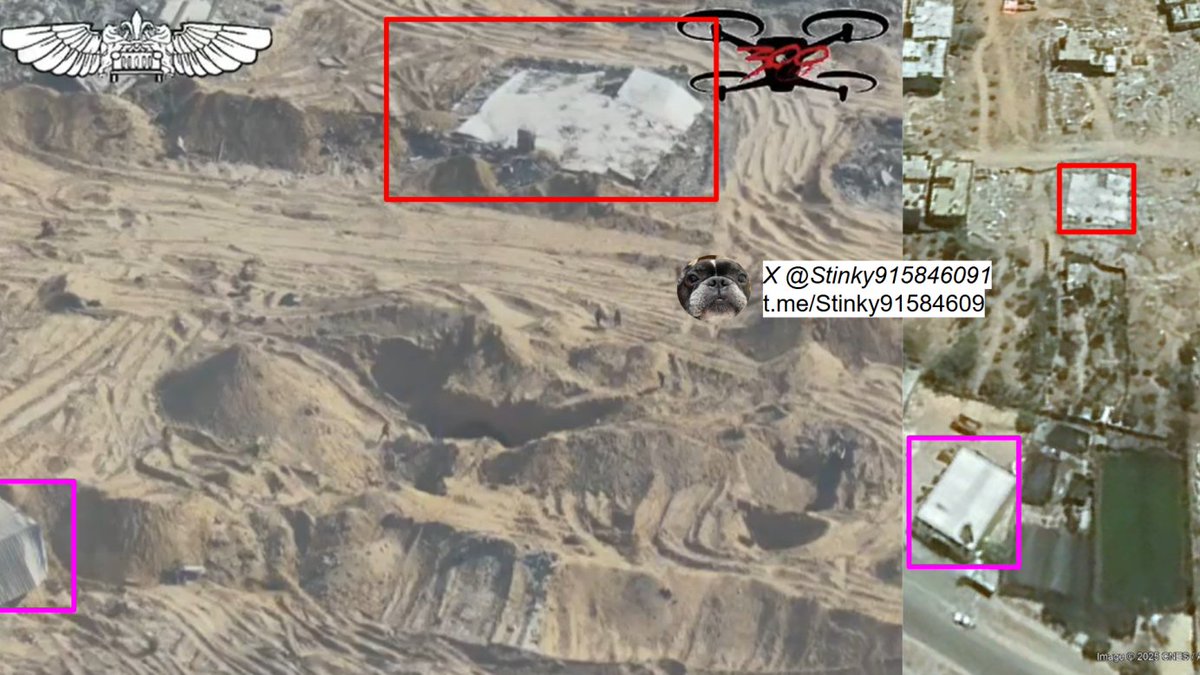
Drone footage showing 8 Al-Qassam Militants retreating back into the tunnel that they initially emerged from after the ambush.
Location: 31.321559, 34.316126
8G3P88C8+JF Qa' al Kharaba, Khan Yunis Governorate, Gaza Strip
@GeoConfirmed
Location: 31.321559, 34.316126
8G3P88C8+JF Qa' al Kharaba, Khan Yunis Governorate, Gaza Strip
@GeoConfirmed
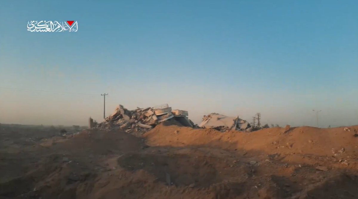
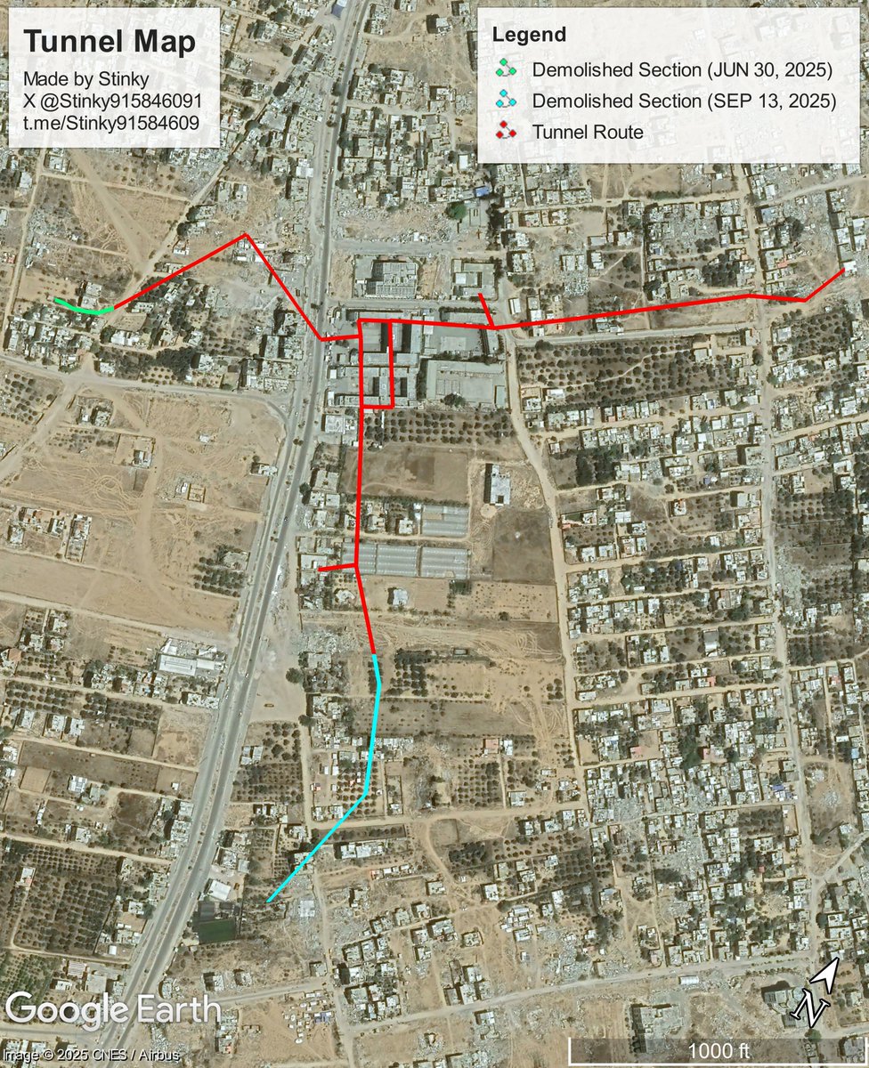
It is worth noting that, this tunnel had been previously found by the IDF 3 months ago, on June 30th to be exact, though it is clear that not all of the tunnel had been demolished seeing that the ambush occurred in the first place.
Source: idf.il/300717
Source: idf.il/300717
Reference Video (Al-Qassam [Hamas] POV), source link: t.me/CLL7D/28706
Reference Video (1), courtesy of @orfialkov
Reference Video (2), courtesy of @orfialkov
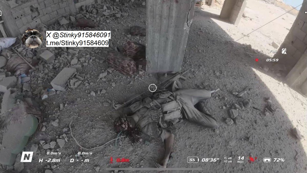
Frames provided by @orfialkov showing the dead from the battle (no IDF fatalities, all of them were Al-Qassam [Hamas] Militants)
(GRAPHIC WARNING)
(GRAPHIC WARNING)
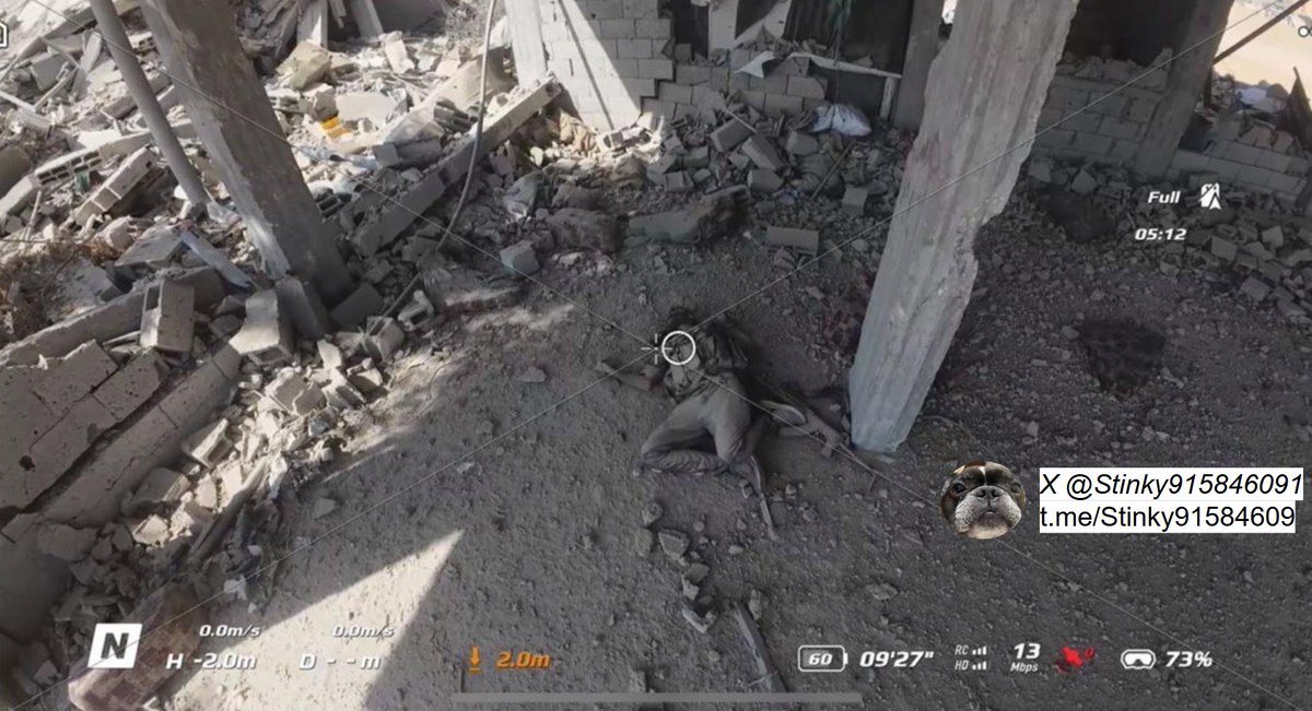
Additional frames (credit: @orfialkov ) showcasing dead Al-Qassam [Hamas] gunmen following the battle.
(GRAPHIC WARNING)
(GRAPHIC WARNING)
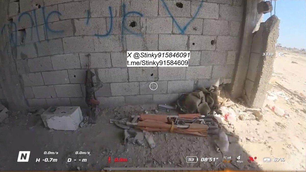
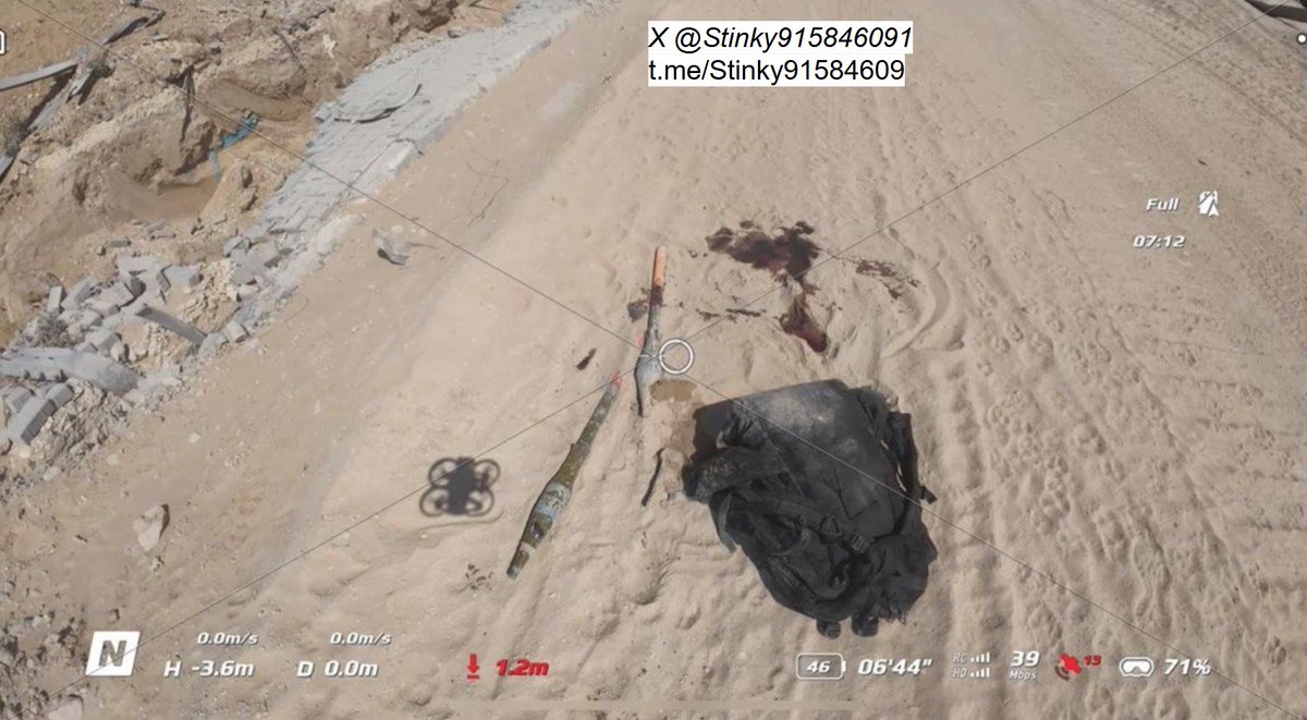
Last two (non-graphic frames) showcasing weaponry left behind by the gunmen. (Credit: @orfialkov)
The Al-Qassam Brigades [Hamas] have released the names of some of the fatalities it took from the failed raid, they are:
Rabi’ Muhammad Nofal
Mahmoud Hijazi
Abdul Rahman Abu Mustafa
Omar Abu Teim
Muhammad Al-Buraim
Mahmoud Abu Omar
Suhaib Abu Khater
Tariq Al-Buraim
Rabi’ Muhammad Nofal
Mahmoud Hijazi
Abdul Rahman Abu Mustafa
Omar Abu Teim
Muhammad Al-Buraim
Mahmoud Abu Omar
Suhaib Abu Khater
Tariq Al-Buraim

Additional Geolocations in relation to the thread:
1. x.com/Stinky91584609…
2. x.com/Stinky91584609…
3. x.com/Stinky91584609…
4. x.com/Stinky91584609…
5. (Tunnel Demolition, September 13) x.com/Stinky91584609…
6. (Tunnel Demolition, June 30) x.com/Stinky91584609…
1. x.com/Stinky91584609…
2. x.com/Stinky91584609…
3. x.com/Stinky91584609…
4. x.com/Stinky91584609…
5. (Tunnel Demolition, September 13) x.com/Stinky91584609…
6. (Tunnel Demolition, June 30) x.com/Stinky91584609…
Thank you for reading this fairly long thread.
Wish to join the telegram channel? I provide more info and additional satellite images there.
Link: t.me/Stinky91584609
If you would like to leave a donation for the reasearch, See here: gofundme.com/f/aid-stinkys-…
Wish to join the telegram channel? I provide more info and additional satellite images there.
Link: t.me/Stinky91584609
If you would like to leave a donation for the reasearch, See here: gofundme.com/f/aid-stinkys-…
• • •
Missing some Tweet in this thread? You can try to
force a refresh