MoundLore Profile picture
Oct 22, 2025 8 tweets 3 min read Read on X
THE ERIE CANAL, PART II
CARVING THE BACKBONE (1817–1825)

They built it by hand.
363 miles through wilderness and rock.
🧵 Image
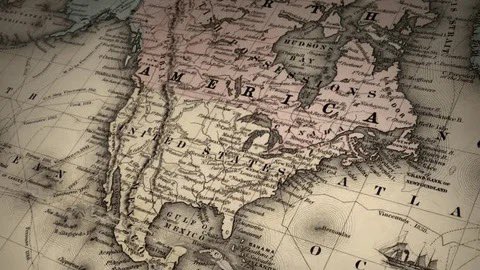
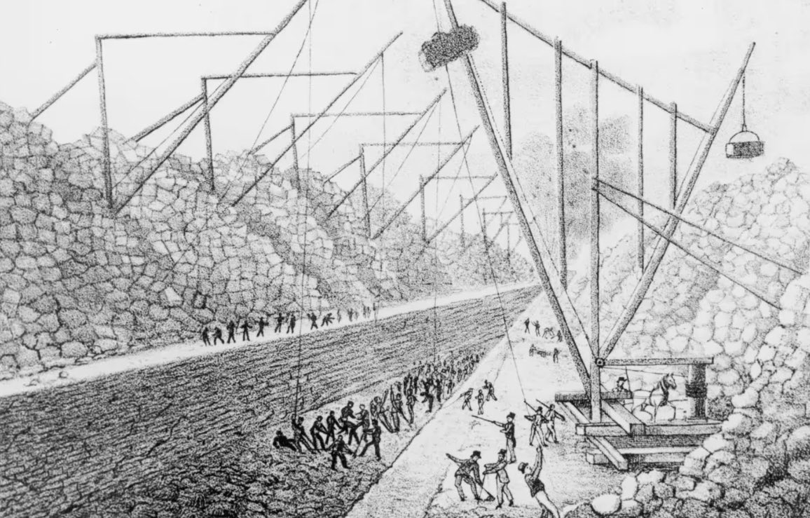
The Erie Canal wasn’t born of machines.

It was carved by men with shovels, picks, and wheelbarrows…Irish immigrants, farmhands, veterans, drifters.

For eight years they dug a river through the bones of New York. Image
Image
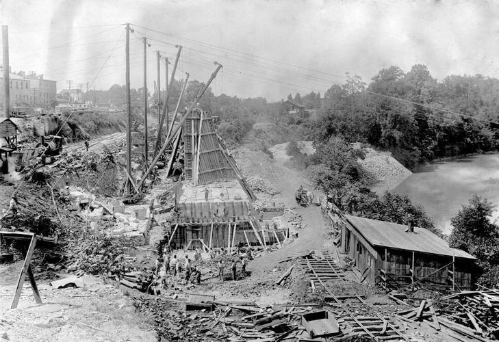
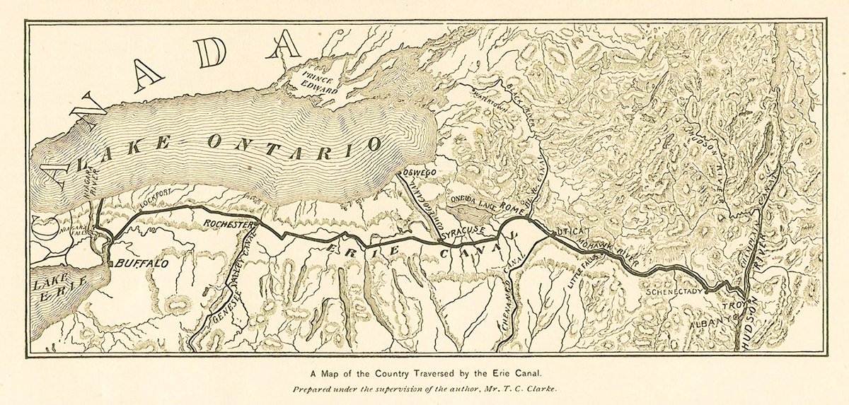
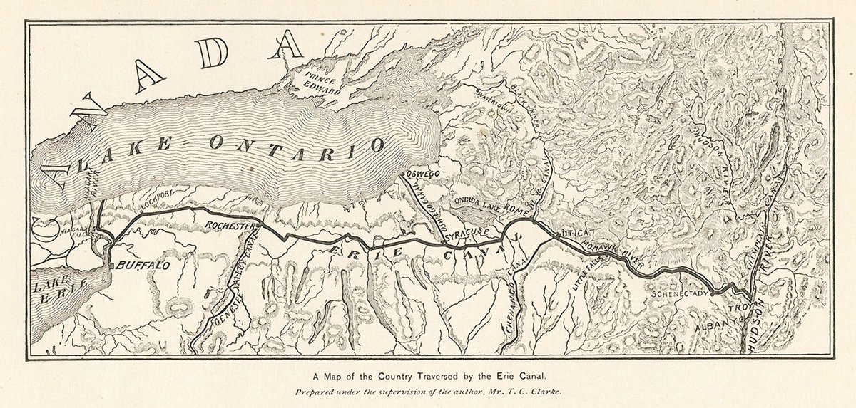
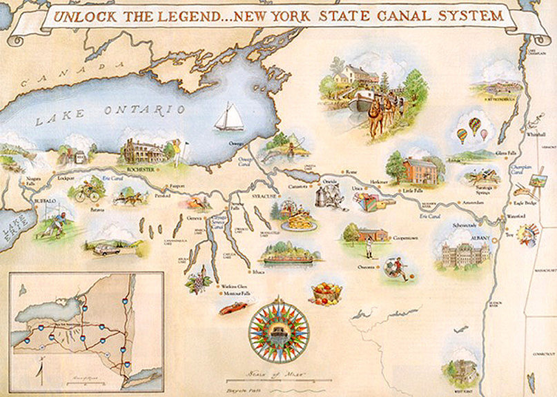
From Albany to Buffalo: 83 locks, 18 aqueducts, 363 miles.

They cut through swamps that swallowed tools and blasted limestone with black powder.

When the charges fired, thunder rolled west across the forest.
America was teaching itself to build. Image
Most earned less than a dollar a day.

They slept in shanty towns, fought cholera, froze in winter, and vanished in cave-ins.

There were no names in the papers….just graves beside the towpath.

The canal’s foundation wasn’t stone.
It was labor. Image
Out of that mud came invention.

American engineers….denied European help and created hydraulic cement, a mortar that hardened underwater.

It would go on to build bridges, dams, and ports worldwide.

The Erie wasn’t only a canal; it was a classroom. Image
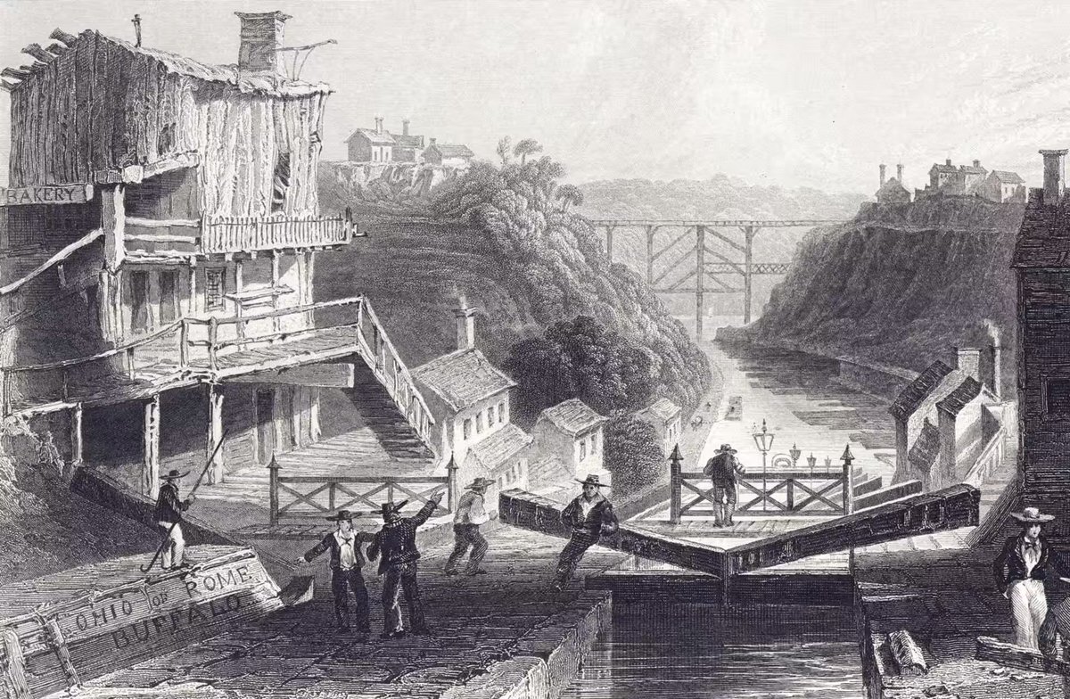
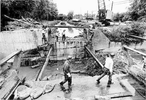
The waterway climbed 565 feet from the Hudson to Lake Erie.

Locks lifted barges like elevators of stone and water, each gate balanced by hand-cut timber.

Every drop measured, every hinge exact.
They got it right on the first try. Image
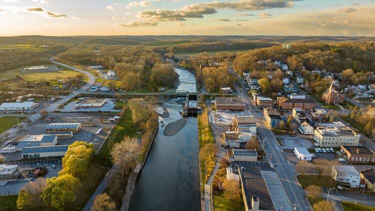
By 1823, towns bloomed along the route.

Utica, Syracuse, Rochester.
Mule teams hauled freight by day; fiddles and whiskey filled the taverns by night.

People said you could walk the length of New York without ever losing the sound of picks in the earth. Image
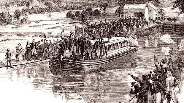
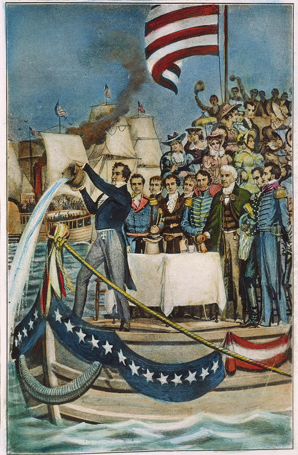
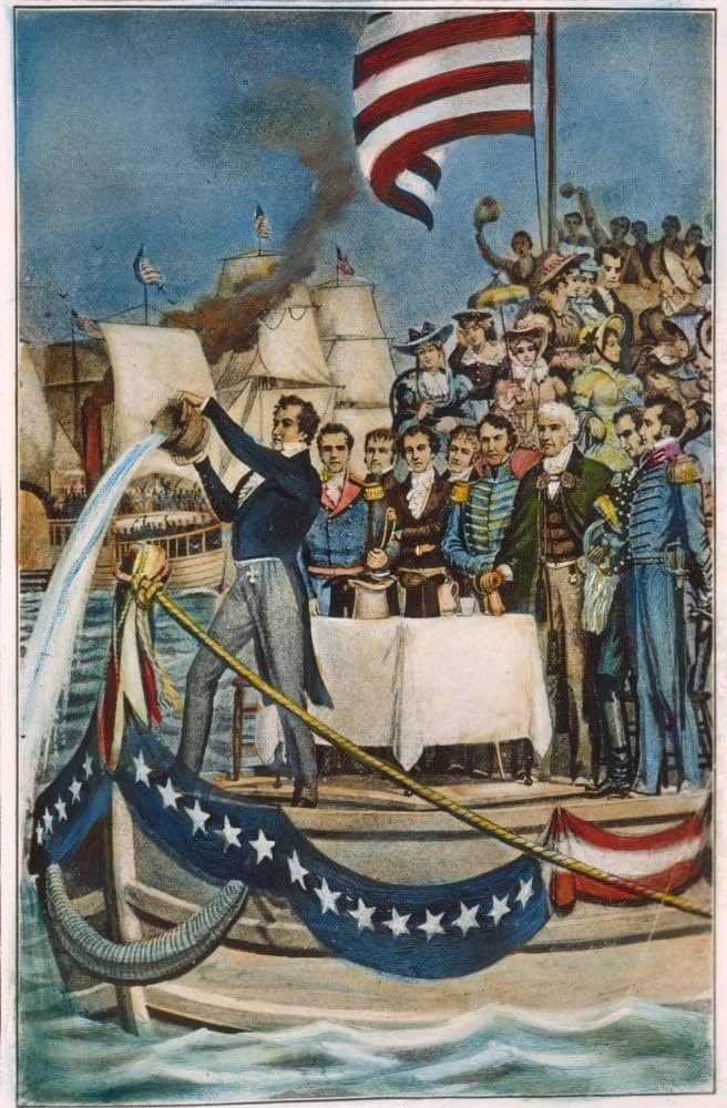
In 1825, the last cut met the water at Buffalo.

Governor DeWitt Clinton poured Lake Erie into the Atlantic…the “marriage of the waters.”

The wilderness was connected.
Commerce had a spine.
And America began to move.

Next: “The Empire Awakens (1825–1840)” how a hand-dug ditch turned New York City into the capital of the modern world.Image

• • •

Missing some Tweet in this thread? You can try to force a refresh
 

Keep Current with MoundLore

MoundLore Profile picture

Stay in touch and get notified when new unrolls are available from this author!

Read all threads

This Thread may be Removed Anytime!

PDF

Twitter may remove this content at anytime! Save it as PDF for later use!

Try unrolling a thread yourself!

how to unroll video
  1. Follow @ThreadReaderApp to mention us!

  2. From a Twitter thread mention us with a keyword "unroll"
@threadreaderapp unroll

Practice here first or read more on our help page!

More from @MoundLore

Dec 12, 2025
Erase every American city from the map for a moment.
Leave only the rivers and the land underneath.

You know what happens? The same cities grow back in the same spots.
Louisville. Cincinnati. St. Louis. Pittsburgh.

Because those places weren’t chosen by architects or settlers🧵 Image
A river ford.
A place where the water runs shallow enough to walk.
They were more than a crossing. It was a continent’s nervous system.

Animals moved through it. Hunters watched it. Nations met there.

Across the East and Midwest, these fords created natural funnels where every trail, migration route, and trade path eventually converged.Image
Image
Image
Image
Take Louisville: the Falls of the Ohio was the only place for hundreds of miles where the river forced you to stop.

You couldn’t just drift past… you had to portage. That choke point made it a gathering spot for thousands of years.

Indigenous nations camped there. Traders waited there. Wildlife tracked the banks there.

By the time European settlers arrived, the land had already made the decision:
“Build here.”Image
Image
Image
Image
Read 8 tweets
Dec 11, 2025
Most Americans don’t realize it, but many of our highways follow routes far older than the country itself.

Originally corridors carved by geology, crafted by bison migrations, and turned into continental road systems by Indigenous nations.

Let’s peel back the asphalt.🧵 Image
Bison weren’t just wandering the continent.
They were reading it.

They followed the logic of the land:

• ridge spines avoiding deep valleys
• wind gaps cut by ancient rivers
• river terraces high enough to stay dry
• limestone benches that drain clean
• the shallowest possible fords
• salt and mineral lines that shaped migration

Then they pounded that wisdom into the ground for thousands of years, turning soft forest into hardened corridors that could handle tens of thousands of animals in motion.

The first paths.Image
Indigenous nations recognized these corridors for what they were:
pre-built highways laid down by the land itself.

The Shawnee, Cherokee, Miami, Haudenosaunee, Chickasaw, Catawba, Yuchi, Delaware, and dozens more expanded these traces into continental road systems.

They widened choke points.
Cut back brush.
Marked turns with bent trees.
Carved steps into steep bluffs.
Built causeways over seasonal wetlands.
Created rest sites, shrines, trading stations, and war camps along the routes.

This wasn’t “primitive travel.”
A buffalo trace became a diplomatic road, then a trade artery, then a military highway.Image
Read 8 tweets
Oct 25, 2025
Beneath the brown water of a New England river sits a 40-ton sandstone mystery….etched long before a European map ever touched this coast.

Figures. Spirals. Hands.
Symbols no outsider could read.

They called it Dighton Rock.
And it rewrites what “history” looks like. Image
When colonists found it in the 1600s, they couldn’t believe it was Native.
They blamed Vikings, Phoenicians….even a lost Portuguese explorer.

But the Wampanoag already knew the river, the stone, and its stories.

They didn’t need to “discover” it.
They remembered it. Image
The boulder sat half-drowned in the Taunton River, catching light with every tide.

To early archaeologists it looked chaotic but to those who lived here, it mirrored the flow of water, stars, and spirit.

Each line carried rhythm.
Each tide polished memory. Image
Read 7 tweets
Oct 24, 2025
The Erie Canal Part III:
The Empire Awakens (1825 – 1840)

In 1825, a boat named Seneca Chief left Buffalo carrying two kegs of Lake Erie water. 🧵 Image
When it reached New York Harbor, that water was poured into the Atlantic.

Cannon fire answered every fifteen minutes from Buffalo to the sea….a chain of thunder across 363 miles of handmade earth.

A young republic proved it could reshape its continent. Image
The canal crushed distance.

A barrel of flour that once cost $100 to move now cost $5.
What took three weeks took five days.

By 1830, more than 3,000 boats a year glided between the Great Lakes and the Hudson….carrying grain, iron, salt, and hope.

The interior and the coast finally breathed the same rhythm.Image
Read 9 tweets
Oct 20, 2025
When the Missouri River was dammed, the water didn’t rush…it crept.

By 1962, it had swallowed whole Lakota and Mandan worlds.

Homes. Graves. Schools. Churches.
All gone beneath a reservoir called Lake Oahe.

They said it would bring light and power.
It brought silence. Image
Lake Oahe came from the Pick–Sloan Plan…a postwar promise to “tame” the Missouri.

Six great dams.
Billions in federal money.
Flood control. Irrigation. Hydropower.

But under that progress lay the fine print: Over 200,000 acres of tribal land flooded.

No consent. No repair. No return.Image
Image
Image
Image
Oahe drowned 26 Native communities across Standing Rock, Cheyenne River, and Crow Creek.

Families watched from the bluffs as the water took their homes.

Cemeteries. Gardens. Sacred trees.

One elder called it “the second Trail of Tears….but slower.”
The river rose inch by inch until the past disappeared.Image
Image
Image
Read 7 tweets
Oct 12, 2025
“They handed the keys of the White House and abandoned Black America.”

In 1877, the U.S. elite made a secret deal. What followed was a century of suffering.

This is the story of the Compromise of 1877…..but also, a warning from history. 🧵👇 Image
The Civil War was over, but peace wasn’t.

The South was burning with resentment.
The North was tired of fighting.
And Black Americans were building real power for the first time.

Then came the election of 1876….the dirtiest in U.S. history. Image
Democrat Samuel Tilden won the popular vote.
Republican Rutherford B. Hayes claimed fraud.

20 electoral votes were disputed…enough to swing the presidency.

Armed militias gathered.
Rumors of a second civil war spread.
The Union was about to crack again. Image
Read 9 tweets

Did Thread Reader help you today?

Support us! We are indie developers!


This site is made by just two indie developers on a laptop doing marketing, support and development! Read more about the story.

Become a Premium Member ($3/month or $30/year) and get exclusive features!

Become Premium

Don't want to be a Premium member but still want to support us?

Make a small donation by buying us coffee ($5) or help with server cost ($10)

Donate via Paypal

Or Donate anonymously using crypto!

Ethereum

0xfe58350B80634f60Fa6Dc149a72b4DFbc17D341E copy

Bitcoin

3ATGMxNzCUFzxpMCHL5sWSt4DVtS8UqXpi copy

Thank you for your support!

Follow Us!

:(