Analysis of Russian 🇷🇺 airstrikes north of Sumy in 2025
This year, I've closely followed russian airstrike campaign.
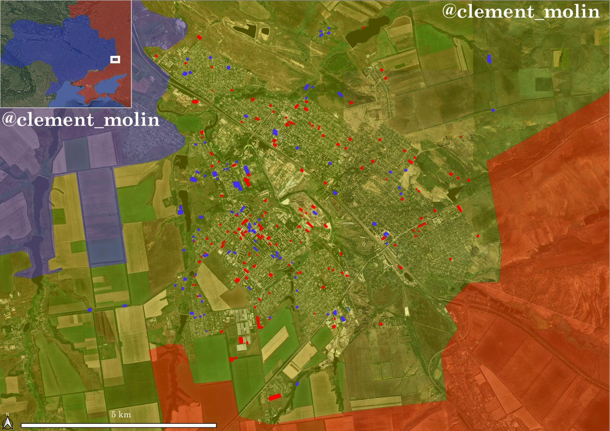
In Sumy, I mapped around 4 000 strikes. With recent satellite images of a small 153 km2, I found 1641 airstrikes impact !
🧵THREAD🧵1/14 ⬇️
I found very recent sattelite images from May or June 2025.
What they are showing is really crazy. Multiple airstrikes impacts and wiped out villages, it helps to understand russian strategy.
Thus, I have decided to cover this small area of 153km2 with airstrikes visible on the high resolution images of june in white and the ones on mid resolution from october and november in pink.
1641, it's 10.7 per km2 !
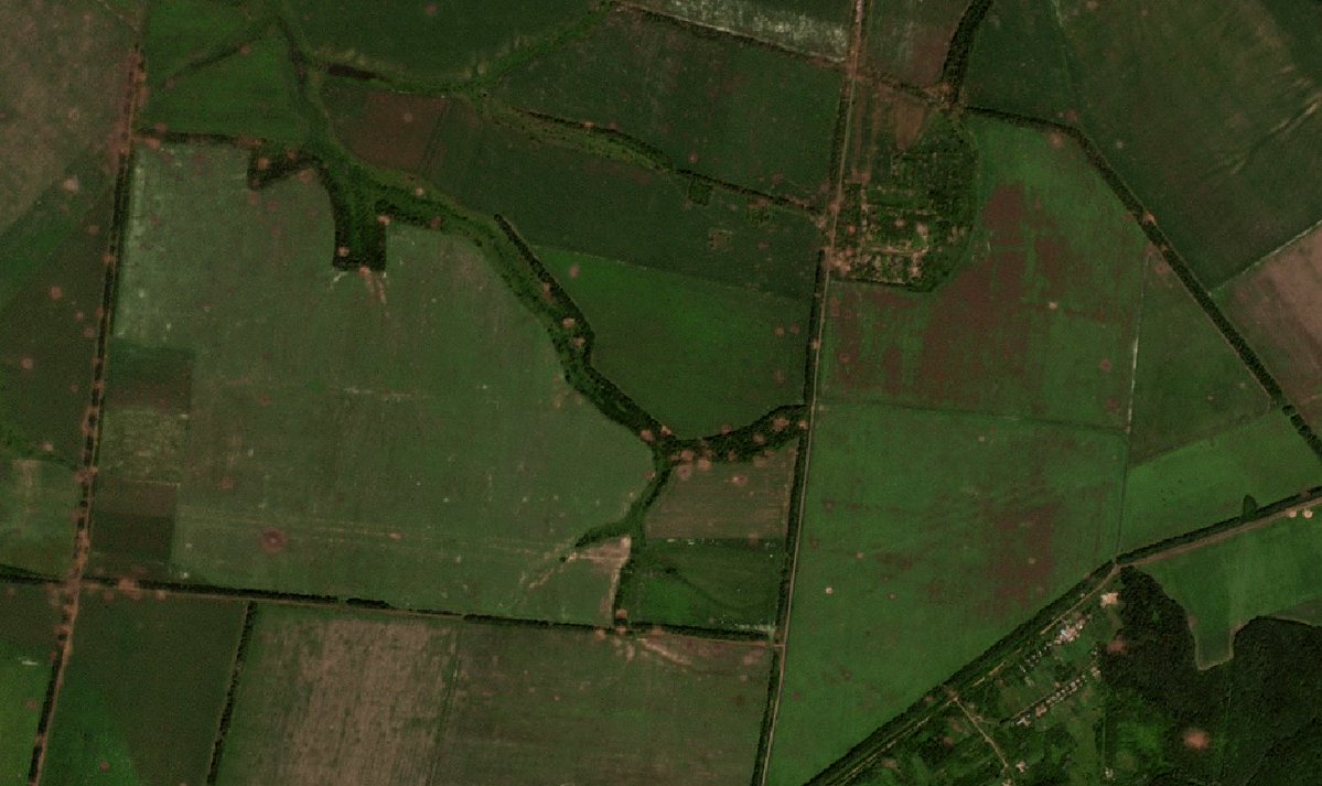
This is the area with villages names :
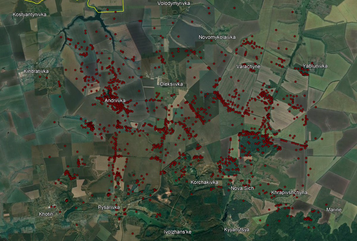
In white, we can see the period when Russia was attacking, from february to june, with multiple impacts in strong resistance areas and the main supply roads.
The purple ones are showing a period when Ukraine had the initiative, slowly pushing back russian forces. We can see airstrikes mooved north, they got very precise, with a methodic work to destroy treelines.
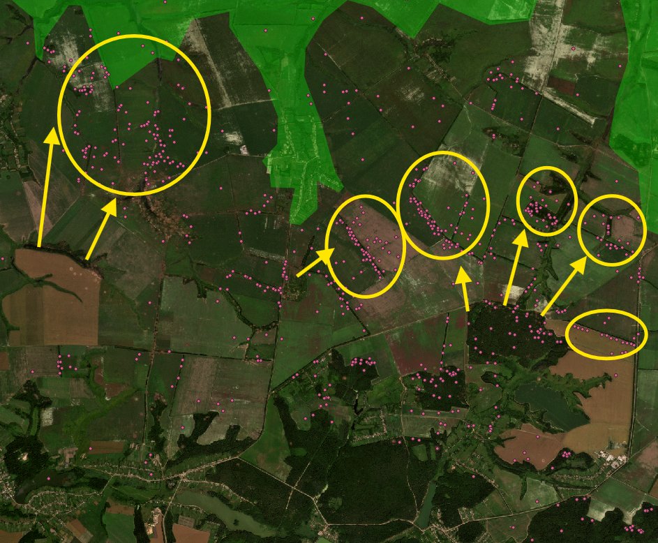
With images of the january-june strikes, we can see massive impacts on key roads such as this one. You can see how precise those FAB bombs are getting.
People asked me multiples times how I could see the difference between airstrikes and artillery impacts.
Here you can clearly see it. There is a high concentration of impacts close to a possible ukrainian stronghold, troops deployment.
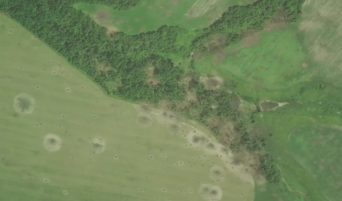
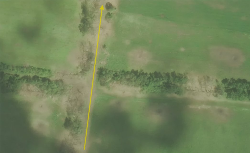
Airstrikes are often targetting small trenches, dugouts and positions. Here you can see a trench which was hidden between the trees.
Also, look the multiple artillery impacts all around !
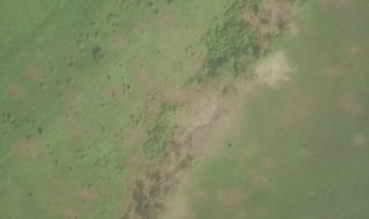
Depending on how big the FAB bomb is (500, 1000, 1500, 3000...), the impact can get bigger.
A year ago (example in Kursk oblast), airstrikes were far less precise than today.
An interesting fact to keep in mind.
More recent images are showing multiple airstrikes in the same direction. In total, for Sumy oblast (I mainly looked from Tetkino to Sumy), I found 4 050 airstrikes impacts for this year.
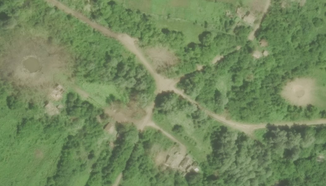
Forest areas remain the most important ones for soldiers, places where they can find cover and move freely.
Thanks for following this thread ! I will continue to map and analyse the airstrike campaign, as long as there won't be clouds anymore !
On Ukraine's 🇺🇦 southern front, Russian 🇷🇺 forces are pushing near Orikhiv, while ukrainian forces continue to launch cleaning operations.
The Russian army has intensified its attempts to push the front, while the ukrainians reinforced their fortifications.
🧵THREAD🧵1/13 ⬇️
The southern/south-esatern front of Ukraine is the one that saw the biggest change since 2024 started.
This front is currently the second most important for Russia (1st is Donbas, 3rd is the Oskil).
Maps in the thread are from @M0nstas's online map.
In the Novopavlivka-Ivanivka area west of Pokrovsk, Russia is trying to capture ukrainian strongholds in the region.
They have a lot of difficulties due to the number of ditches, fortified lines and rivers. In Novopavlivka, infiltration attempts continue without much success.
On the first (unfinished) fortified line, russian forces are trying to cross under fire the ditches (more than 100 bodies are lying there) and constantly manage to advance to Ivanivka before getting destroyed.
Behind the Oskil River, the Ukrainian 🇺🇦 army is still holding out in three pockets: Kupiansk, Borova, and Lyman.
The Russian 🇷🇺 army has intensified its infiltrations in Lyman and Kupiansk in recent weeks, using the cover of trees.
🧵THREAD🧵1/10 ⬇️
In four years, the Oskil front (named after the river crossed in October 2022) has barely moved.
Russian forces have mainly succeeded in advancing in three directions: toward Senkove, cutting the front in two; then toward Lyman, cutting it in three; and finally toward Dvorichna.
Near Lyman, russian forces are launching important infiltrations, using the tree cover in the region.
They are mainly pushing south and north of the city, some soldiers even crossed the Siverski Donets river. The main objective is to cut the city from the rear.
In the remaining Ukrainian 🇺🇦-controlled Donbas, Russia is currently pushing 3 offensives, on 3 key cities : Sloviansk, Kostiantynivka, and Dobropilla.
The Russian army has recently made some progress towards several key positions in the region.
🧵THREAD🧵1/14 ⬇️
The first direction is the Sloviansk one. After the fall of Siversk 6 months ago, russian forces have been slowly crawling towards Rai Oleksandrivka, a strategic height overlooking Sloviansk/Kramatorsk agglomeration.
They are slowly nearing Mykolaivka and Sloviansk itself.
Here are the suspectied russian offensive routes in black, with geolocated videos of ukrainian strikes in the last 31 days in red.
Blue circles are ukrainian strongholds. The grey zone is expanding and the situation is slowly worsening, this is the main russian success of 2026.
Dans le Donbass, ce sont 22 000 robots terrestres qui ont remplacé des soldats ukrainiens 🇺🇦 sur la ligne de front durant les premiers mois de 2026.
(English 🇬🇧 below for the slides)
🧵THREAD🧵1/10⬇️
Le chiffre est du Président Zelensky lui-même, sur le seul premier trimestre 2026.
Il montre à quel point cette nouvelle technologie est sur le point de devenir indispensable sur le front.
➤ Le marché ukrainien est passé de 500 drones terrestres produits en 2024 à environ 20 000 au seul premier trimestre 2026. Plus de 280 entreprises, près de 310 modèles distincts. Une bascule de l'artisanat à la production de série en dix-huit mois.
Comment suivre la guerre en Ukraine 🇺🇦🇷🇺 soit-même ?
Oubliez Liveuamap, oubliez l'ISW, oubliez les médias traditionnel, il est ici question des véritables outils accessibles gratuitement !
Les outils en sources ouvertes pour suivre la guerre en Ukraine :
🧵THREAD🧵1/22 ⬇️
1- Une bonne carte
Il existe des dizaines de cartes en ligne, voici les plus intéressantes :
🔹map.ukrdailyupdate.com (pro-ukraine, mais avec plus de 200 vidéos géolocalisées par jour)
🔹playframap.github.io (carte de Playfra, pro-ukraine mais la carte est plutôt neutre, utilisant de nombreuses sources de terrain)
🔹deepstatemap.live (pro-ukraine, proche du gouvernement ukrainien mais conservant une constance dans la guerre + beaucoup des sources de terrain)
🔹google.com/maps/d/u/0/vie… (carte d'AMK mapping, pro-russe, carte bien plus progressive que les autres)
🔹ukraineviews.org (outil rassemblant 12 ! cartes interactives dont 6 pro-russes)
🔹uacontrolmap.com (carte neutre utilisant uniquement les vidéos géolocalisées)
...