The NEW DONBAS LINE, a massive ukrainian 🇺🇦 fortification program
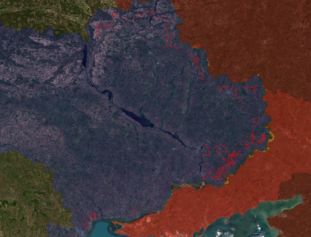
This year, Ukraine built important fortifications that may be able to stop or slow down russian 🇷🇺 forces. Visible from space, these fortifications have already proven useful.
🧵THREAD🧵1/25 ⬇️
This year, Ukraine built important fortifications that may be able to stop or slow down russian 🇷🇺 forces. Visible from space, these fortifications have already proven useful.
🧵THREAD🧵1/25 ⬇️
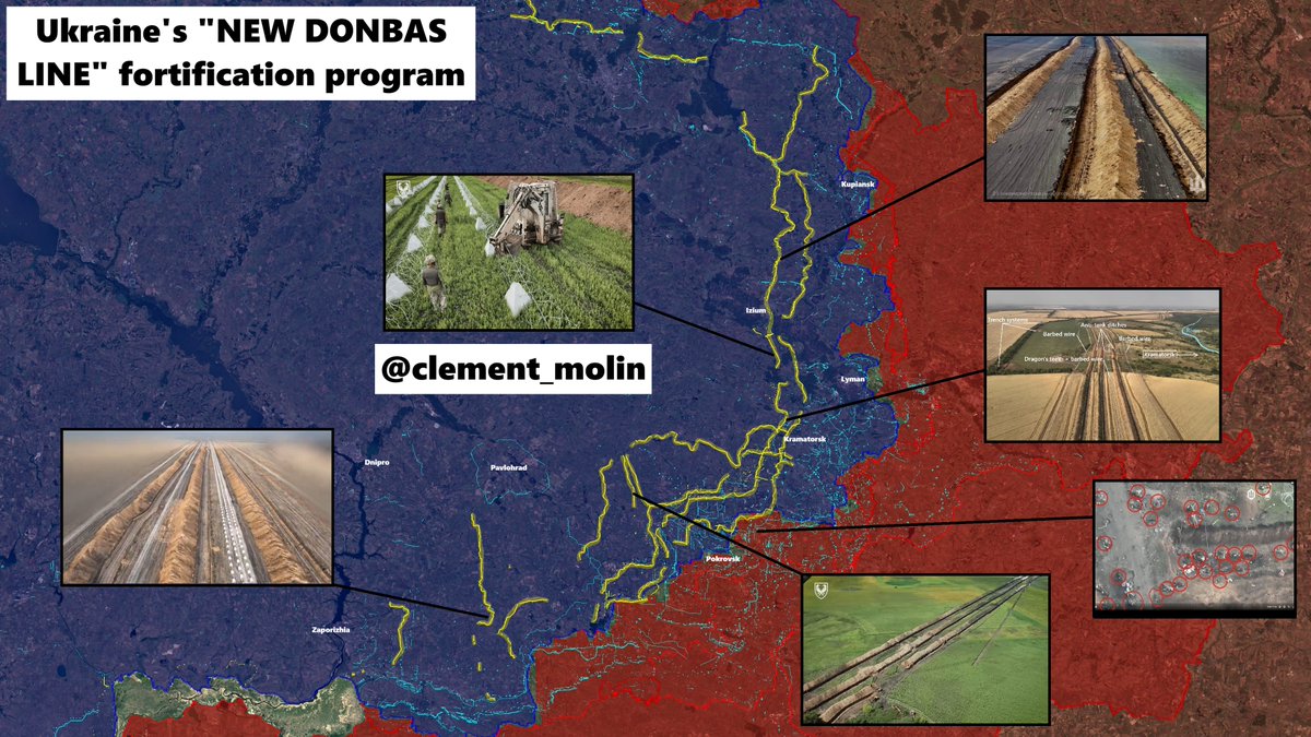
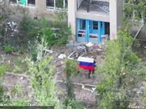
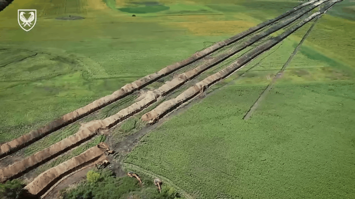
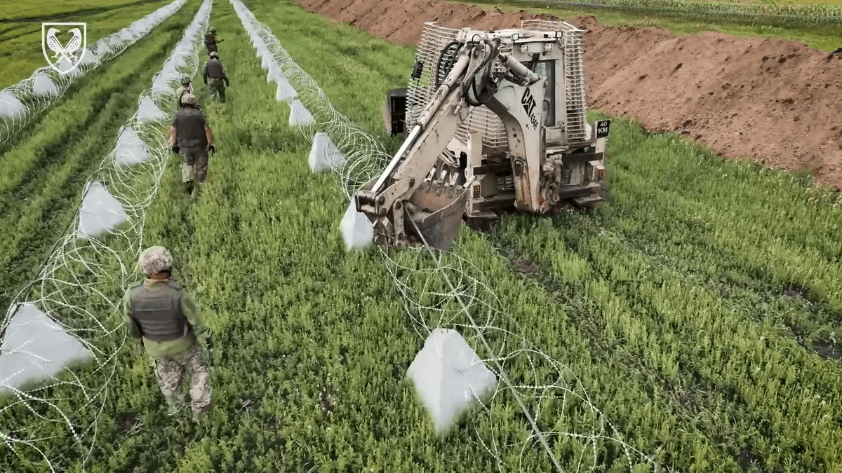
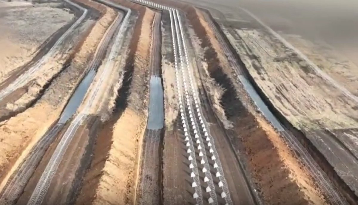
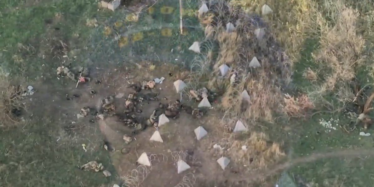
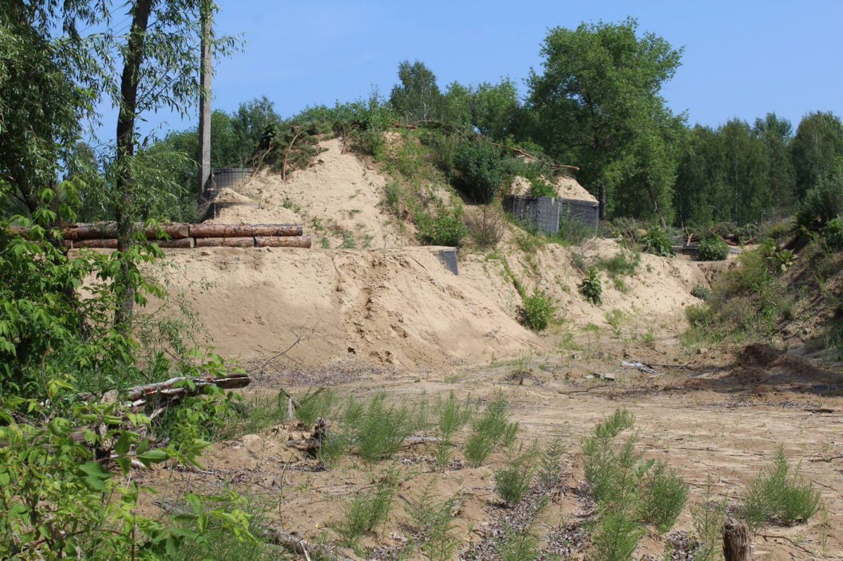
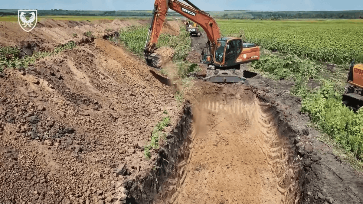
This weekend, Ukraine published this video showcasing their new defensive line.
For the first time, they officially showed the results of months of digging effort. This video shows the most advanced defensive line, with only two holes in 16km !
For the first time, they officially showed the results of months of digging effort. This video shows the most advanced defensive line, with only two holes in 16km !
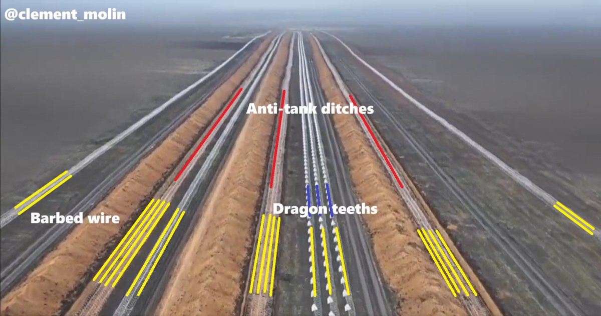
This line is new because it is not only anti-tank or anti-infantry obstacles, but all of them at the same time.
We can count 21 barbed wires rows (4 lines and 3 lines at the bottom of ditches), 3 dragon teeths rows and 3 rows of anti-tank ditches.
We can count 21 barbed wires rows (4 lines and 3 lines at the bottom of ditches), 3 dragon teeths rows and 3 rows of anti-tank ditches.
In a recent article, @United24media talked about those defenses, with a good adaptation of my map (without directly quoting it 🙃but anyway), I recommend the article :
united24media.com/war-in-ukraine…
united24media.com/war-in-ukraine…
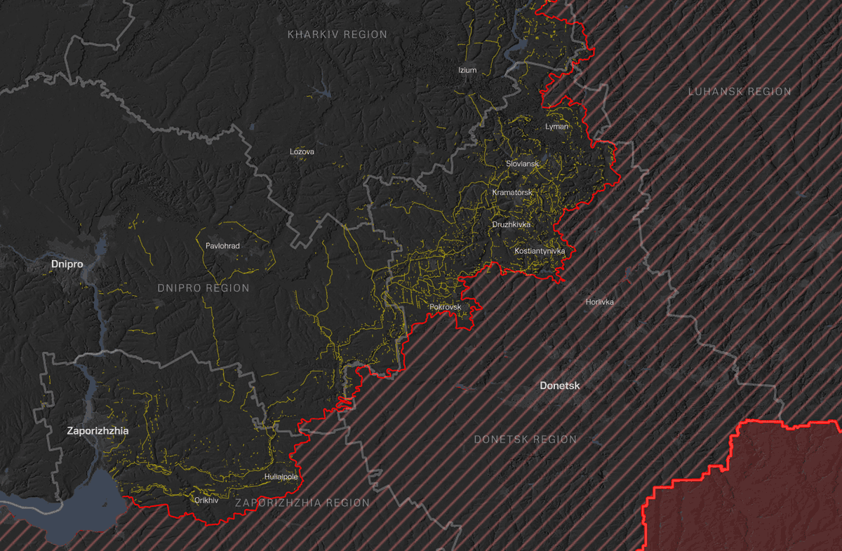
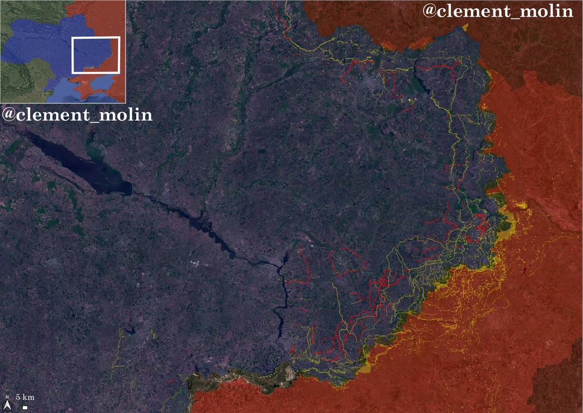
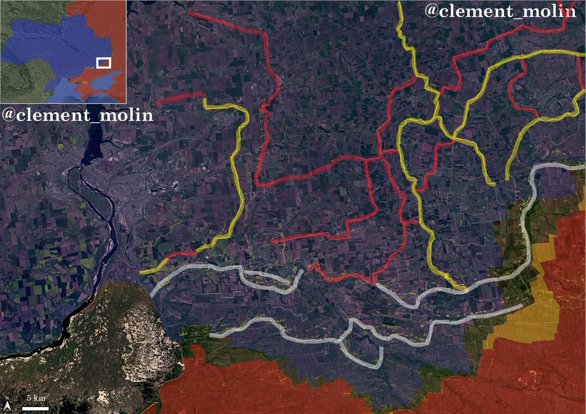
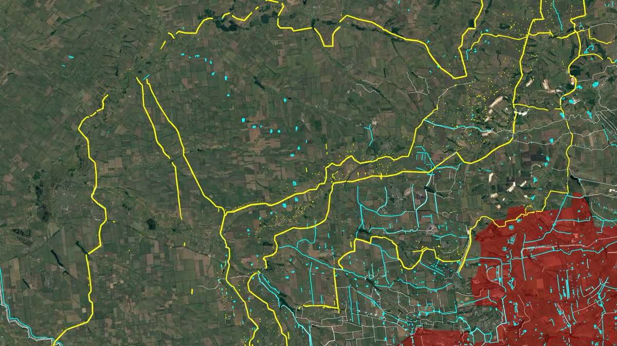
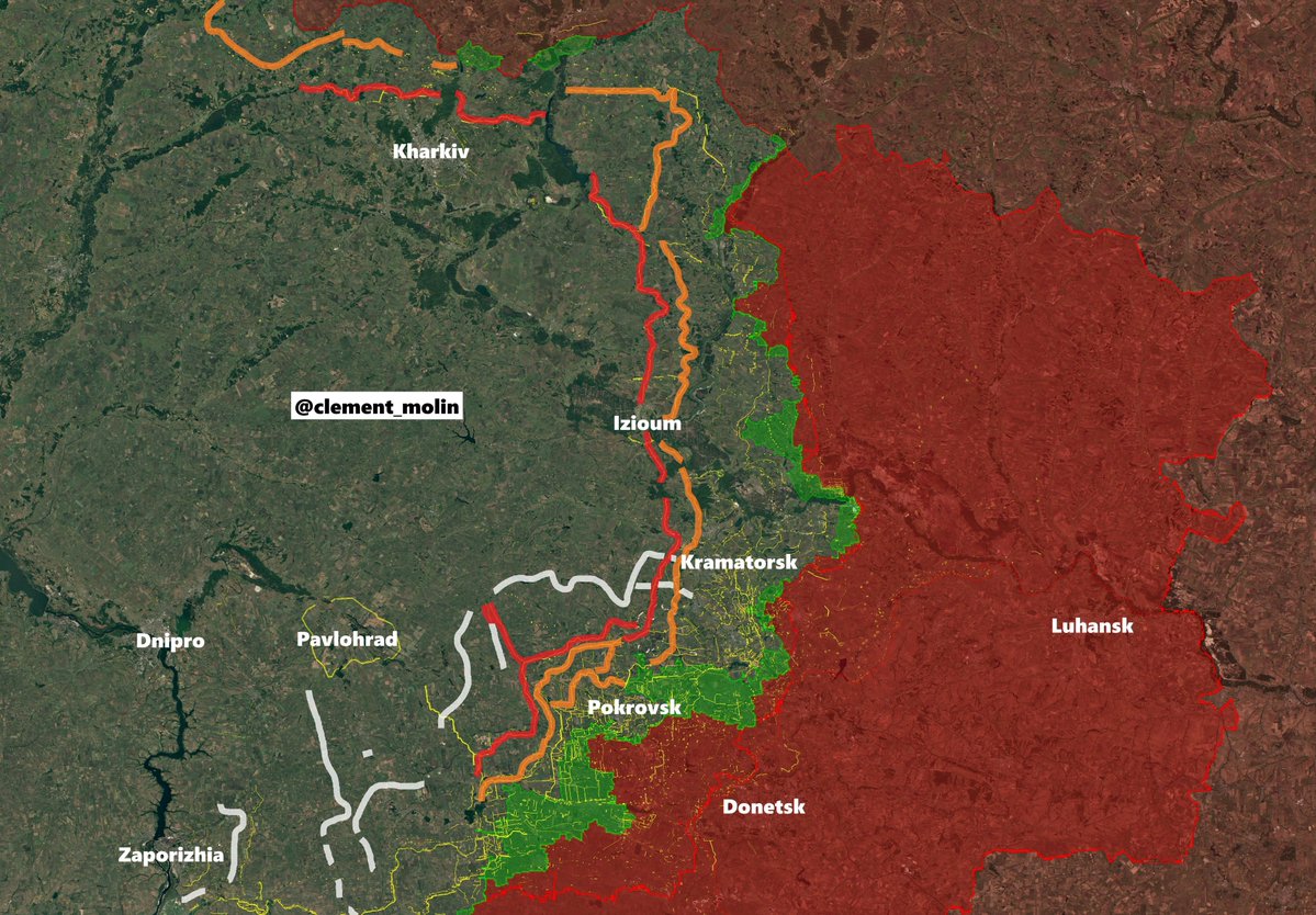
Since the first days of 2025, the previous fortifications programs have been abandonned and replaced by new massive continuous lines.
You can see them here in yellow, with in white the constructions ongoing, you can see the coherence of this new defensive system.
You can see them here in yellow, with in white the constructions ongoing, you can see the coherence of this new defensive system.
Together with @Playfra0 I also started adding barbed wire and dragon teeths visible on SAR images.
Those can give a good understanding of where the next lines will be and to also understand how difficult it will be to cross the new lines.
Those can give a good understanding of where the next lines will be and to also understand how difficult it will be to cross the new lines.
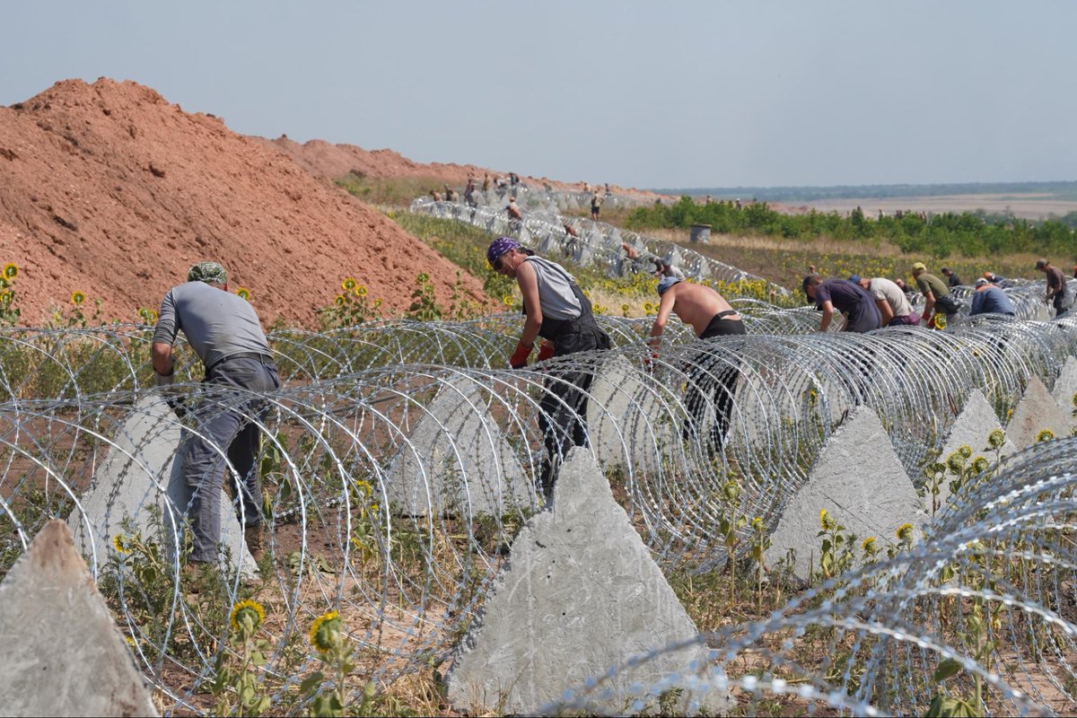
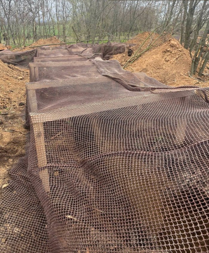
For months, ukrainian excavators have been digging 3 rows anti-tank ditches. Even if russian forces cross the first one, they will have to cross the second and third ones.
-> Any breaching operation will get way more difficult, or maybe even impossible.
-> Any breaching operation will get way more difficult, or maybe even impossible.
Also, after the first row of ditch (which is of course very deep -probably around 2 meters- and filled with barbed wire (impossible to cross if you want to disconnect the teeths)), you will find 3 rows of dragon teeths, also with barbed wire on tope...
Additionnaly, independant systems of barbed wire are also prepared, as I said, you will need to cross 7 obstacles, 3 with only barbed wire and the others filled with barbed wire.
It would take a lot of time and a lot of men to cross...
It would take a lot of time and a lot of men to cross...
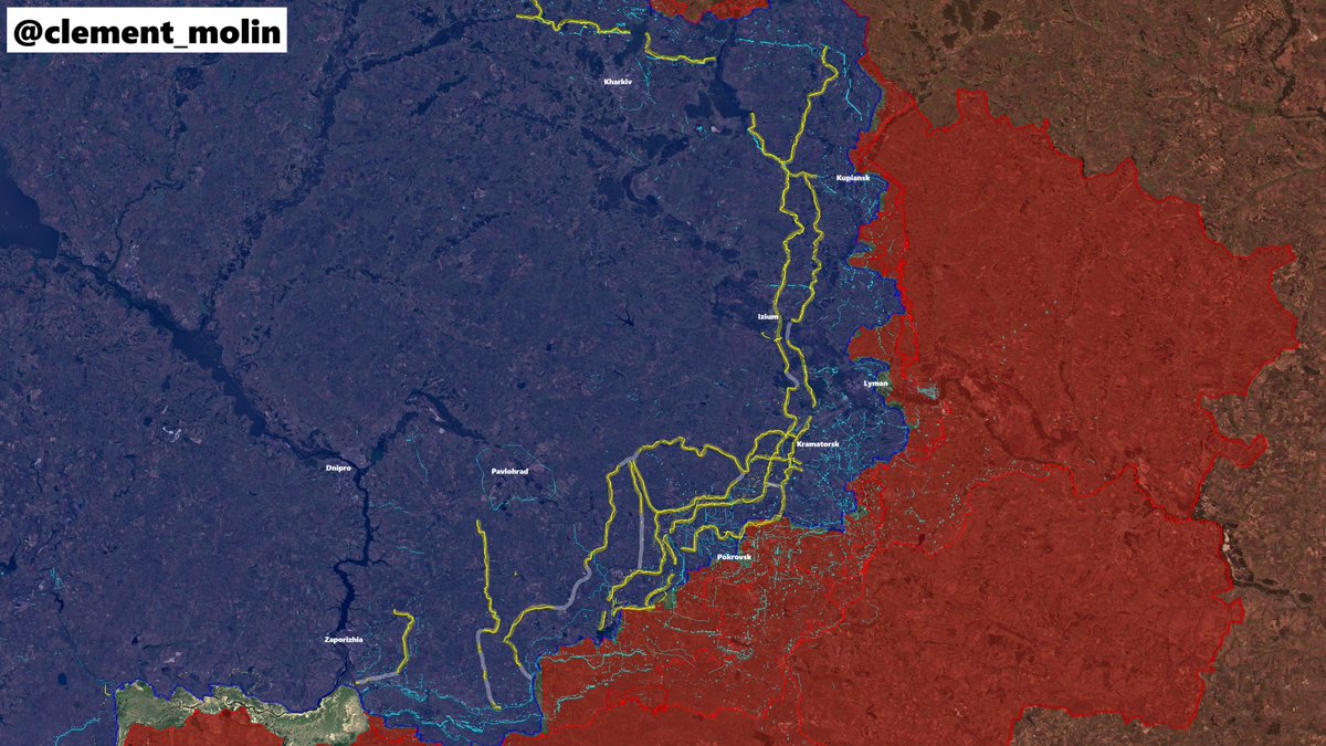
In august, the most critical situation was for the southern frontline, mainly in Zaporizhia and Dnipropetrovsk oblasts.
Urgently, 3 defensive lines have been built, one east of Zaporizhia (completed now south of it), one near Novomykolaivka and one behind Pokrovsk'e.
Urgently, 3 defensive lines have been built, one east of Zaporizhia (completed now south of it), one near Novomykolaivka and one behind Pokrovsk'e.
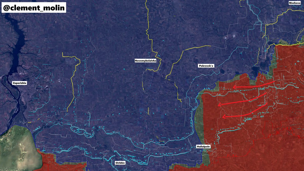
These lines are nearly finished, despite Russia trying to reach them as fast as possible if they want to start the battle for Zaporizhia next year.

The main vulnerability of those lines are the roads, the small holes that have to be kept open for ukrainian forces to go to the frontline or later retreat behind the line.
This is also a good point, artillery and drone teams can target one point instead of a 10km area...
This is also a good point, artillery and drone teams can target one point instead of a 10km area...
This summer, when russian forces broke through in Dobropilla, they managed to cross the New Donbas Line for few days.
Ukraine understood the problem and new lines are now also covering rivers and forest, no hole is left except designated roads.
Ukraine understood the problem and new lines are now also covering rivers and forest, no hole is left except designated roads.
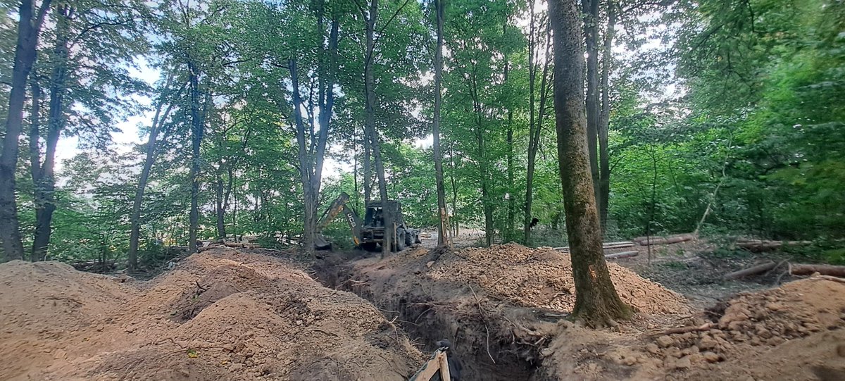
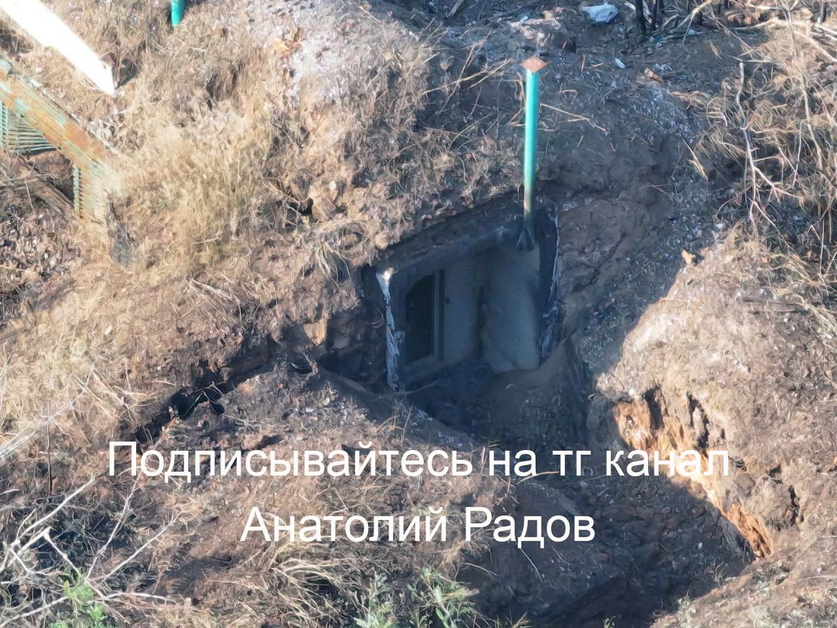
Additionally, small entrenched positions have been built just behind the defensive lines. There are multiple ones so drone teams and infantry can hide in different places and move.
Those positions are concealed in treelines and will soon disappear with the trees.
Those positions are concealed in treelines and will soon disappear with the trees.
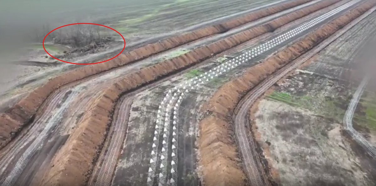
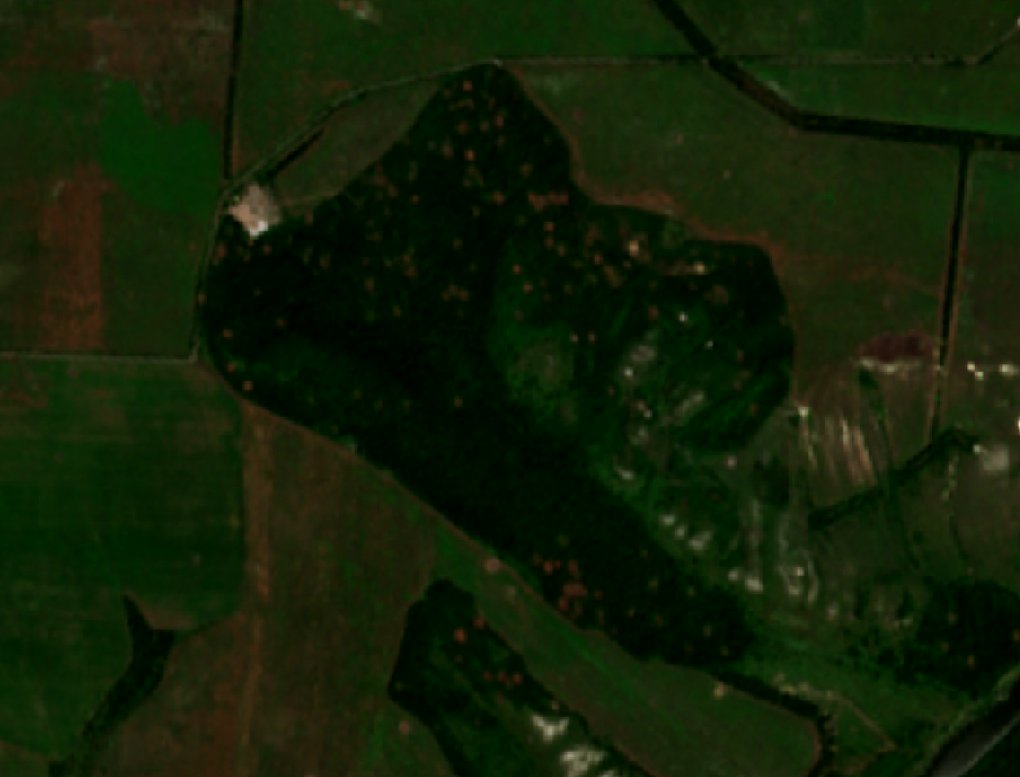
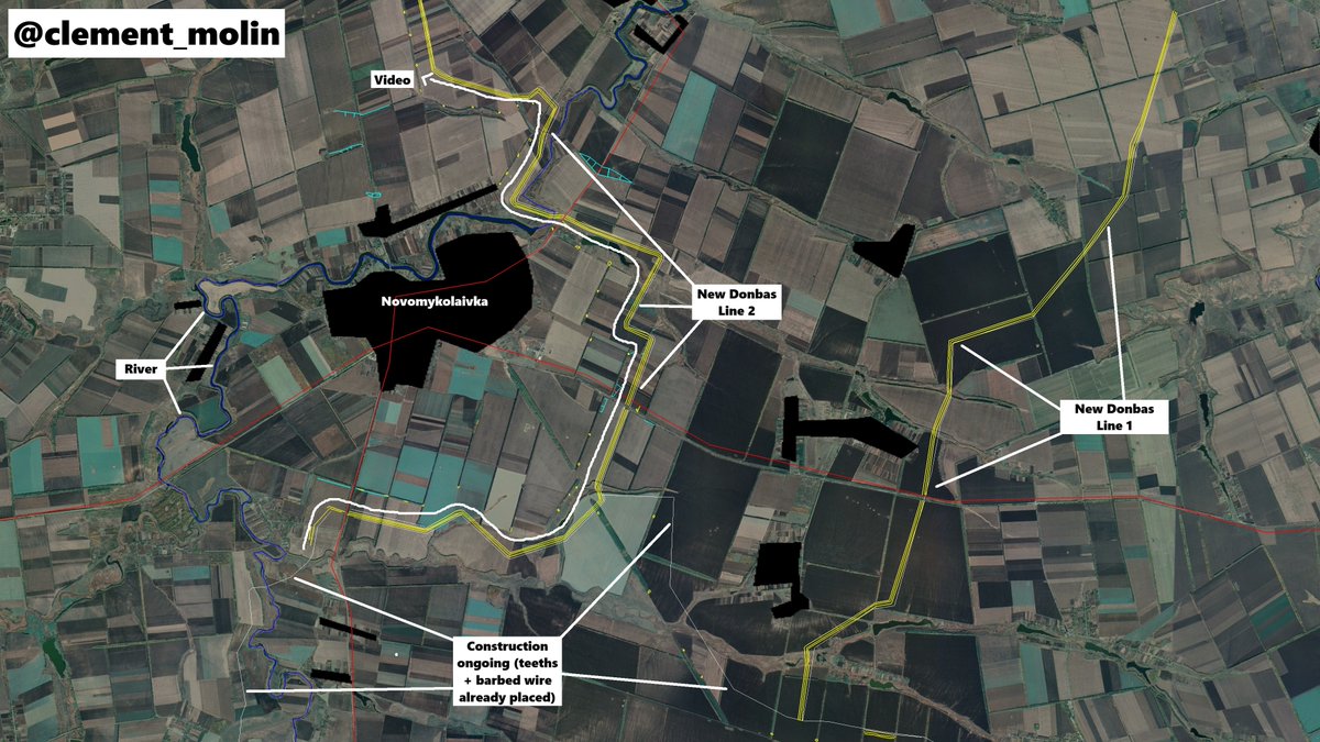
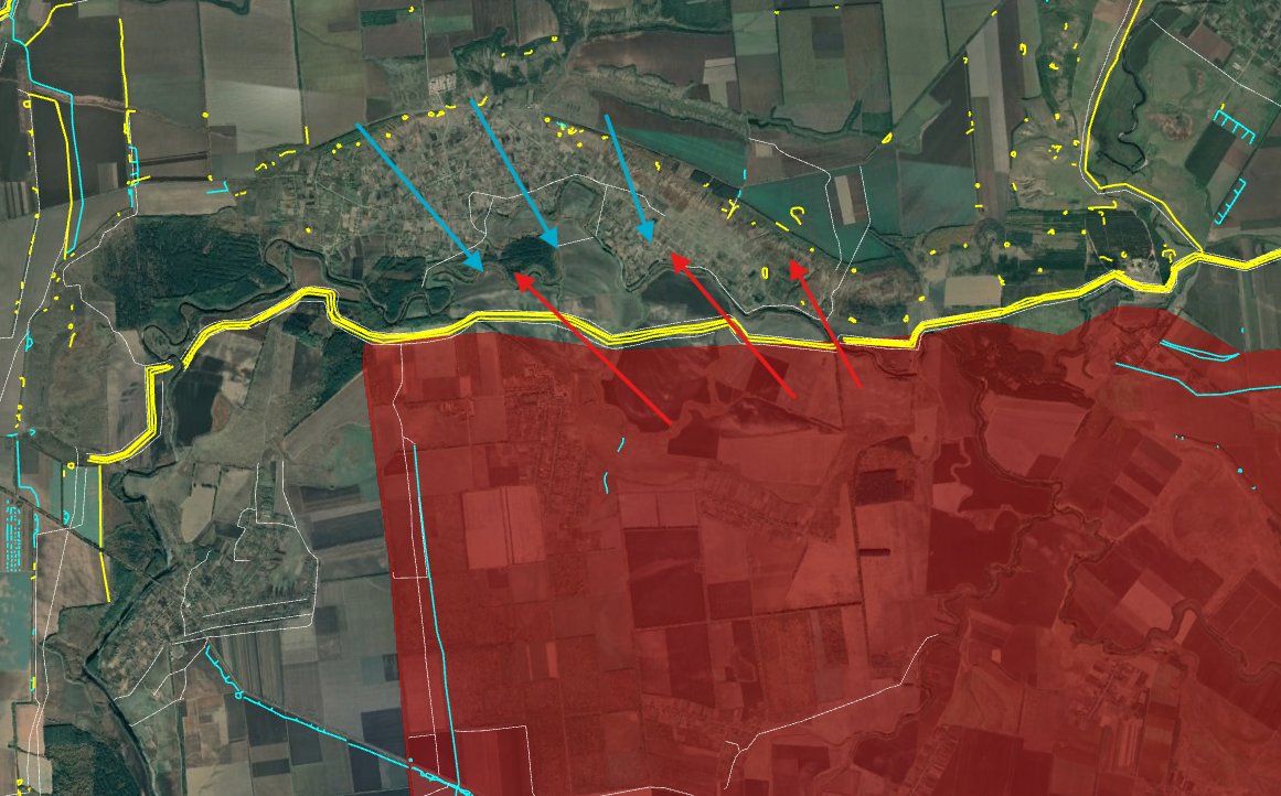
Case study, Novomykolaivka :
Near this small countryside town where the video above was filmed, two lines have been recently dug. Both are in front of urban areas, being completed southwards and a river is even behind, as another natural defense.
Near this small countryside town where the video above was filmed, two lines have been recently dug. Both are in front of urban areas, being completed southwards and a river is even behind, as another natural defense.
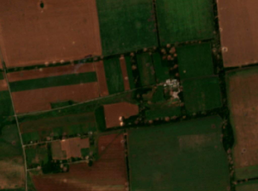
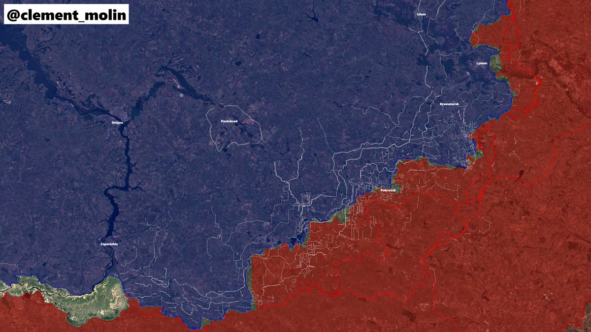
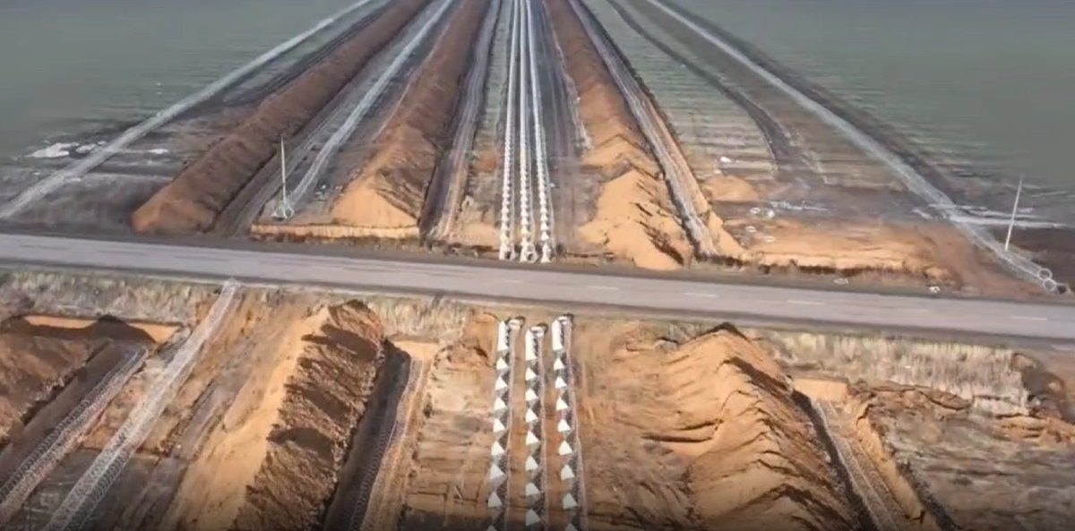
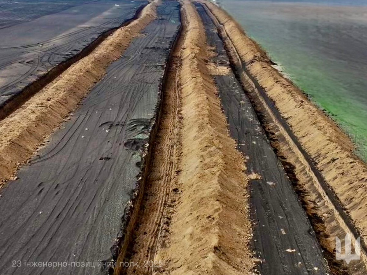
West and north-west of Pokrovsk, massive defensive lines are standing. The upper ring is still being completed, it should be soon finished despite the snow)
Just west of Pokrovsk, russian forces will face a lot of ditches and barbed wire before even reaching the first of 4 lines
Just west of Pokrovsk, russian forces will face a lot of ditches and barbed wire before even reaching the first of 4 lines
Are those lines useful ?
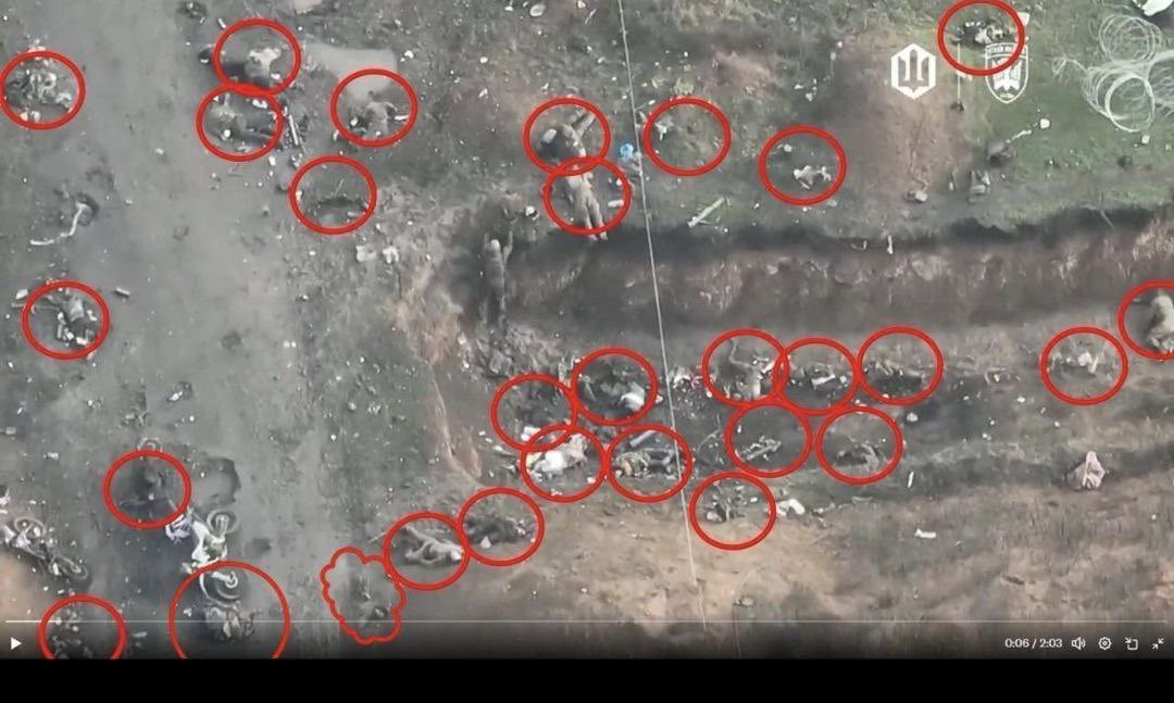
Yes, Here, with just one ditch, russian forces have to go on a road, which has been mined (you can mine roads with UGVs.
And this video is old. Russia is now mainly using unarmoured vehicles...
Yes, Here, with just one ditch, russian forces have to go on a road, which has been mined (you can mine roads with UGVs.
And this video is old. Russia is now mainly using unarmoured vehicles...
You have seen those images, but ditches and barbed wires will increase russian losses : russian forces now have to cut through wires or walk on small roads in order to cross those lines.
-> It is getting very deadly.
-> It is getting very deadly.
What about ukrainian positions ?
Ukraine is lacking men, but those lines will allow less men to hold an area : you need men to cover the line, mainly drone teams and the holes.
They can be safely hidden in small trenches and bunkers behind the line.
Ukraine is lacking men, but those lines will allow less men to hold an area : you need men to cover the line, mainly drone teams and the holes.
They can be safely hidden in small trenches and bunkers behind the line.
Another thing you want is concealed artillery and mortar positions.
With this kind of positions, it will be easy to strikes russian forces approching or trying to cross the line.
With this kind of positions, it will be easy to strikes russian forces approching or trying to cross the line.

In july, I published this map with the New Donbas Line fortifications back then. I added the most recent ones in white.
It clearly shows that the construction is ongoing very fast and it will get more and more difficult to push.
It clearly shows that the construction is ongoing very fast and it will get more and more difficult to push.
How can Russia cross those lines ?
They can use massive artillery, FAB and FPV barrage on the line to open holes into it.
But one should remember that the line is 100-150 meters long, so it will need a lot of precise strikes.
They can use massive artillery, FAB and FPV barrage on the line to open holes into it.
But one should remember that the line is 100-150 meters long, so it will need a lot of precise strikes.
And even after, it will still be difficult to cross the line under fire.
So, this new type of line is the new strategy. Today, a small unfinished portion of it is on the frontline, in Ivanivka, it allowed ukrainian forces to hold and push back the russians there.
So, this new type of line is the new strategy. Today, a small unfinished portion of it is on the frontline, in Ivanivka, it allowed ukrainian forces to hold and push back the russians there.
We will see soon if those lines are working and if new ones are under construction (too much clouds for 2 months).
I will continue to map them and to analyse their use. Many people are still laughing at me when I talk about it, saying that it is not an important aspect of ukrainian defenses.
I believe they are wrong, those lines are meant to change the course of the war, by stopping Russian forces at least temporarily at a series of points where they will lose a lot of men and time.
Thank you for following this long and detailed thread on ukrainian fortifications.
It is a long and difficult work that I do for free, so if you want to support me, you can do it here :
Thank you !buymeacoffee.com/clement.molin
It is a long and difficult work that I do for free, so if you want to support me, you can do it here :
Thank you !buymeacoffee.com/clement.molin
• • •
Missing some Tweet in this thread? You can try to
force a refresh