1/🧵 The situation in and around fortress Kostyantynivka: is it in danger, what are the main problems, and what's next. 
2/🧵
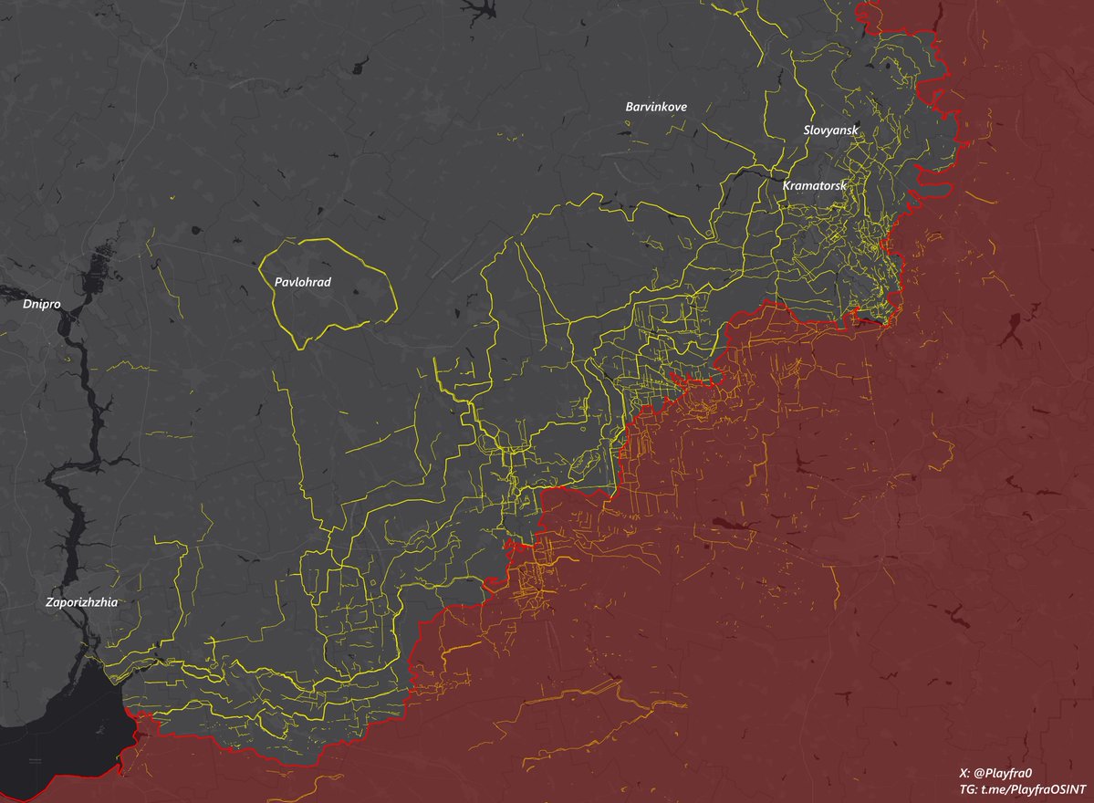
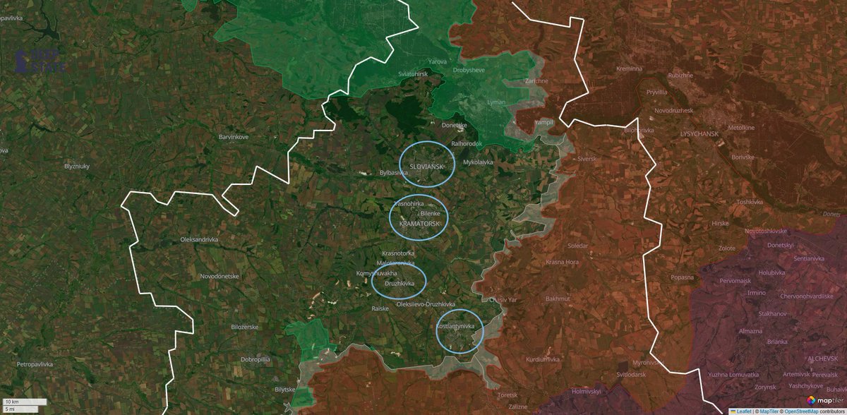
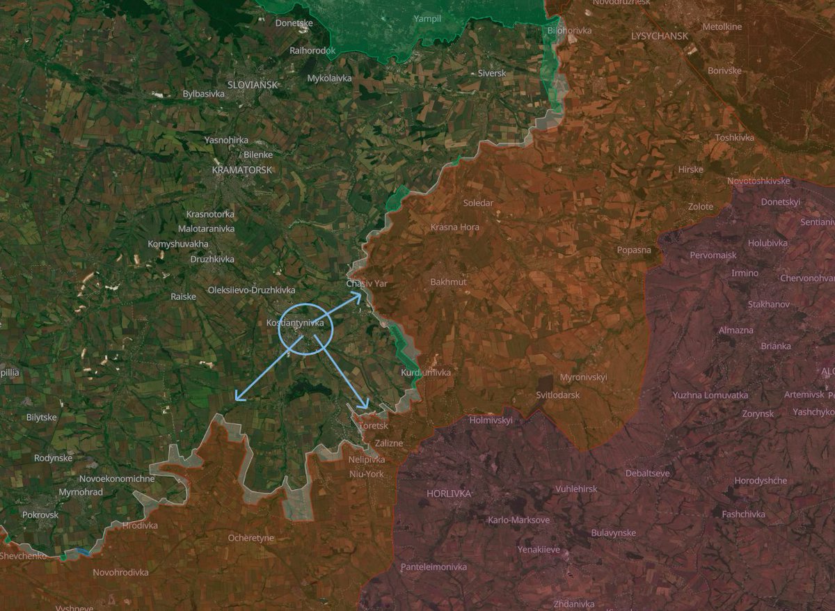
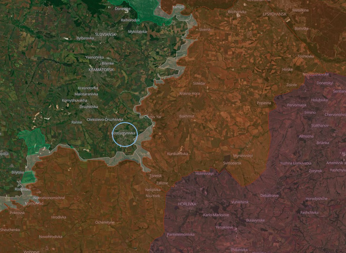
Kostyantynivka is a quite sizeable city in northern Donetsk Oblast, with a population of 67,000 as of 2022, and is part of Ukraine's formidable Kostyantynivka - Druzhkivka - Kramatorsk - Slovyansk defensive node, where Kostyantynivka is the southernmost city of the four.
These four cities are factually the last of their size still in Ukrainian-controlled Donbas.
3/🧵
Ever since 2023, up to this day, Kostyantynivka has served, and continues to serve, critically important purposes for Ukrainian forces in some of the hottest areas of eastern Ukraine, like the Bakhmut, Toretsk, Chasiv Yar, and Rusyn Yar sectors, being used, for example, as an accumulation hub, logistical base, and (probably) command point.
Ever since 2023, up to this day, Kostyantynivka has served, and continues to serve, critically important purposes for Ukrainian forces in some of the hottest areas of eastern Ukraine, like the Bakhmut, Toretsk, Chasiv Yar, and Rusyn Yar sectors, being used, for example, as an accumulation hub, logistical base, and (probably) command point.
4/🧵
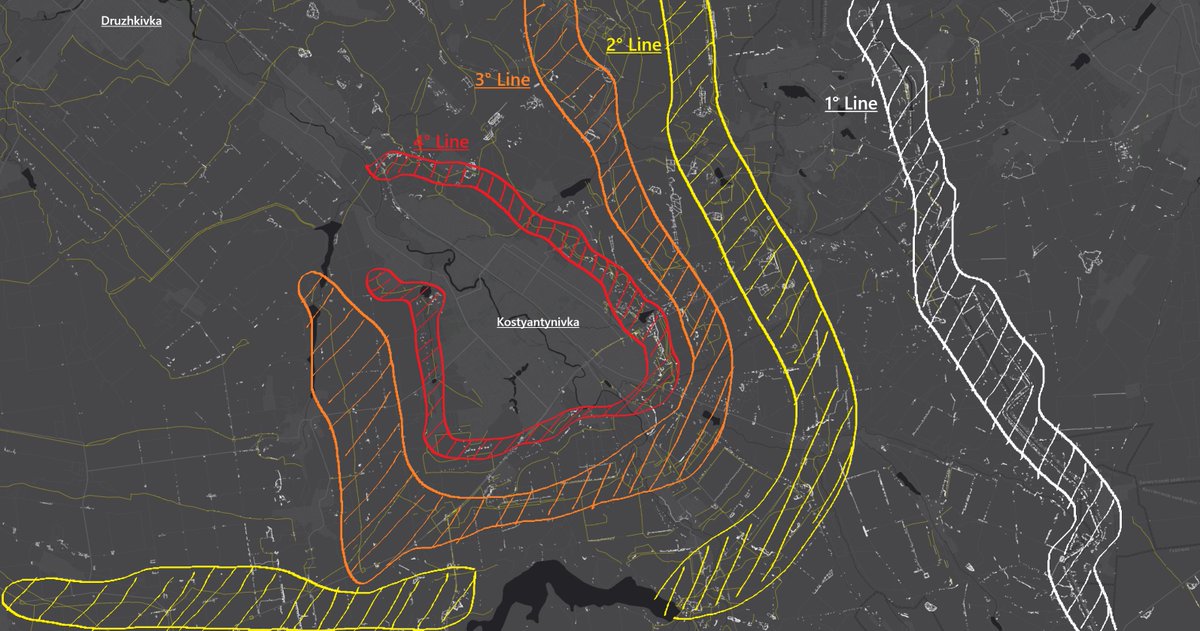
Since mid-2022, Ukrainian forces have been active in reinforcing this fortress city even further, constructing 4 defensive lines and rings around and in front of the city, identifiable in the two pictures below.
The time to do this was found thanks to sacrifices on the Bakhmut/Chasiv Yar and Toretsk sectors, which, as fortresses themselves, held for months or years and gave the time for Ukrainian engineers to build new improvised but numerous defenses in the close rear.

5/🧵
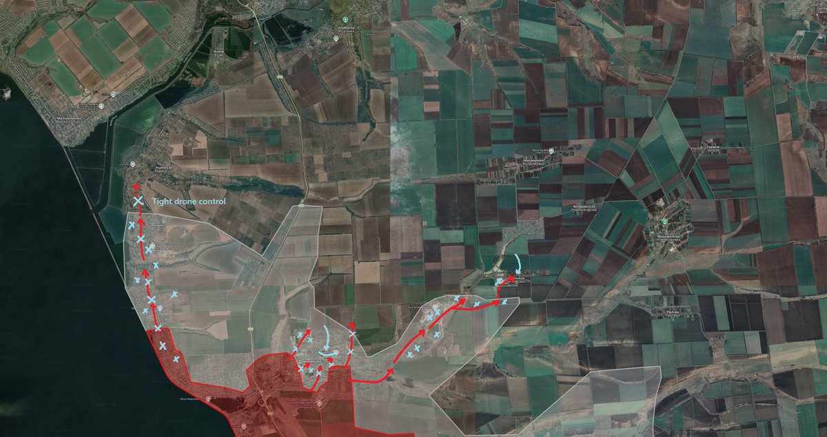
After the factual fall of Toretsk, though, the southern gate of Kostyantynivka suddenly found itself uncovered, and a big effort, especially from the 100th, 28th, and 36th Brigades, was needed to somewhat stabilize the situation and slow the Russians down.
The effort had mostly successful results, and the Russians were bogged down in the fields dotted with strongpoints and barbed wire everywhere.
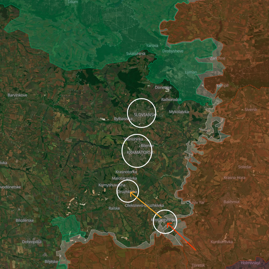
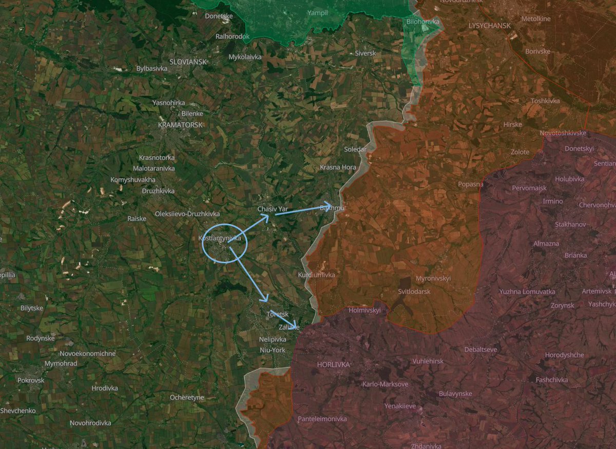
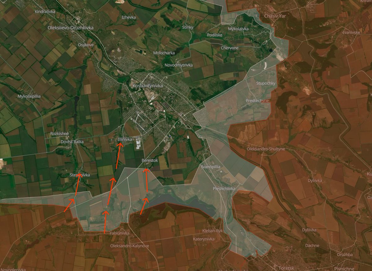
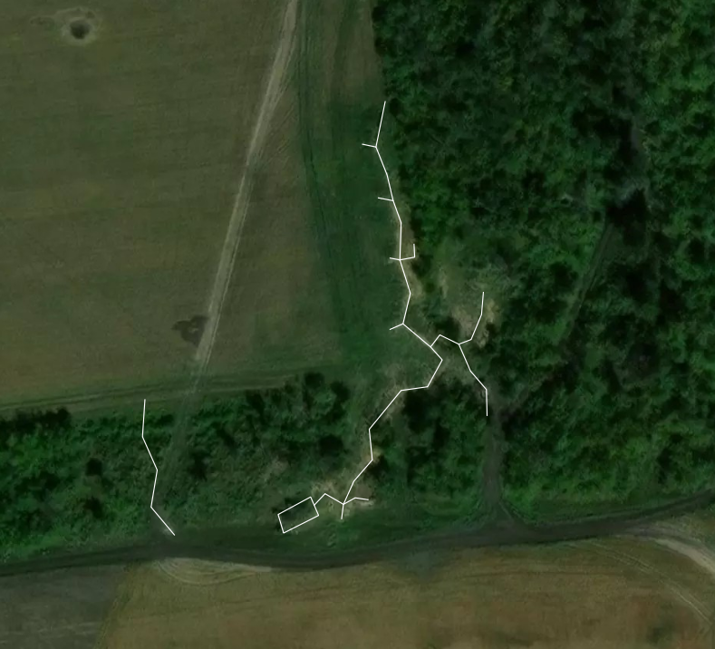
Today, the status quo remains, with the Russians still experiencing severe difficulties in advancing through such open areas and under a very big number of Ukrainian drones. In the picture below, you can see what are now Russia's favorite attack routes. In particular, we note how they have settled for attacking through urban areas, thick treelines, and forests where possible, exactly to avoid the problem that they have been having for a long time, though with very limited success.
After the factual fall of Toretsk, though, the southern gate of Kostyantynivka suddenly found itself uncovered, and a big effort, especially from the 100th, 28th, and 36th Brigades, was needed to somewhat stabilize the situation and slow the Russians down.
The effort had mostly successful results, and the Russians were bogged down in the fields dotted with strongpoints and barbed wire everywhere.
Today, the status quo remains, with the Russians still experiencing severe difficulties in advancing through such open areas and under a very big number of Ukrainian drones. In the picture below, you can see what are now Russia's favorite attack routes. In particular, we note how they have settled for attacking through urban areas, thick treelines, and forests where possible, exactly to avoid the problem that they have been having for a long time, though with very limited success.
6/🧵
About the current situation.
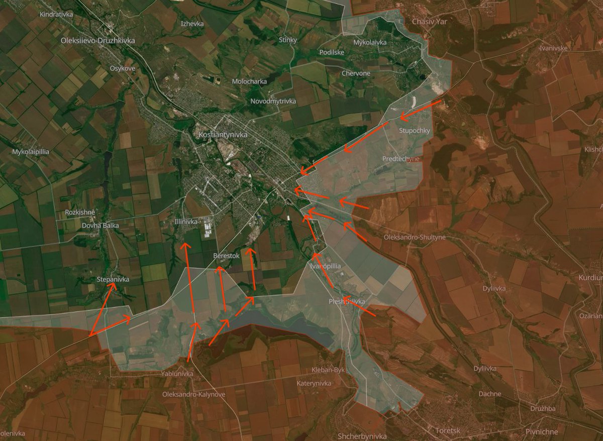
In early-mid January, the city experienced some hardships, and doubts began to surface about the further, difficult defense of Kostyantynivka.
At the time, Russian forces launched a series of attacks on an identified weak point in Ukrainian defenses in the Stepanivka - Illinivka - Berestok sectors.
The Ukrainians had known for a long time that this area was endangered and that it was a weak spot, and the Russians had been bombing and mining the southwesternmost part of Kostyantynivka heavily even before the start of this "wave" of assaults, so these new vectors didn't come as a surprise to the Ukrainians.
After a period in which Russian reconnaissance groups were reaching even northern Illinivka and southwestern Kostyantynivka, the Ukrainians managed to somewhat stabilize the situation with the help of heavy drones and possibly physical clearings.
The freezing temperatures, which to this day go as far down as -18°C, also forced the Russians to scale down their offensive operations here, but the situation still remains very tense and dangerous.
About the current situation.
In early-mid January, the city experienced some hardships, and doubts began to surface about the further, difficult defense of Kostyantynivka.
At the time, Russian forces launched a series of attacks on an identified weak point in Ukrainian defenses in the Stepanivka - Illinivka - Berestok sectors.
The Ukrainians had known for a long time that this area was endangered and that it was a weak spot, and the Russians had been bombing and mining the southwesternmost part of Kostyantynivka heavily even before the start of this "wave" of assaults, so these new vectors didn't come as a surprise to the Ukrainians.
After a period in which Russian reconnaissance groups were reaching even northern Illinivka and southwestern Kostyantynivka, the Ukrainians managed to somewhat stabilize the situation with the help of heavy drones and possibly physical clearings.
The freezing temperatures, which to this day go as far down as -18°C, also forced the Russians to scale down their offensive operations here, but the situation still remains very tense and dangerous.
7/🧵
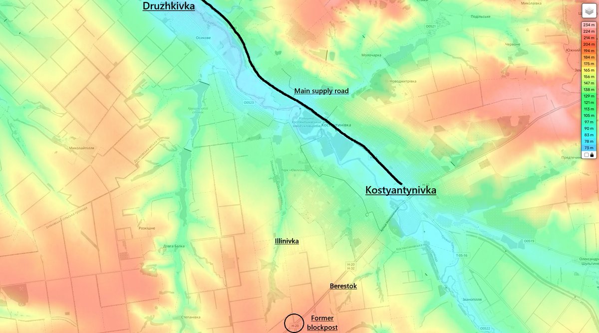
The importance of this sector is impossible to underestimate.
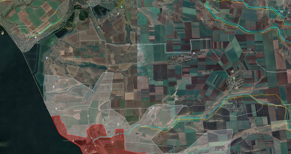
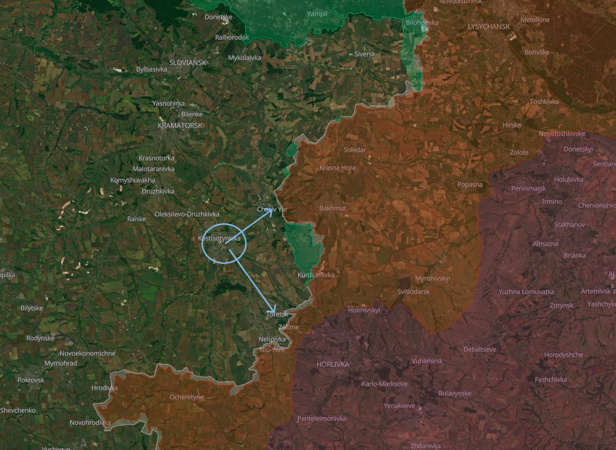
As you can see from the picture, Russian consolidation in Illinivka and Berestok would be catastrophic for Ukrainian supplies into Kostyantynivka, already severely limited and harassed by extremely high Russian drone and remote mining activity.
First of all, Russian forces would be able to bring limited amounts of drone operators in the southwestern parts of these two villages, which are very close to the main supply road and are also on the dominant heights.
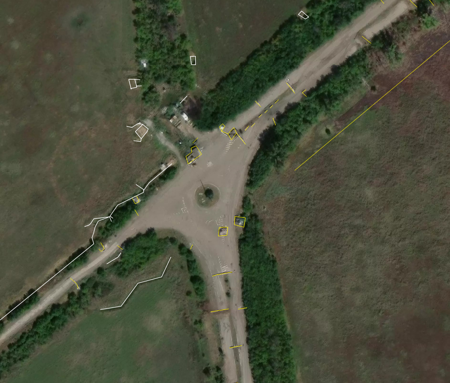
Worst of all, the Russians would be able to secure the area of the former blockpost, which is exactly on the peak of the dominant hill of the whole southwestern sector of this front.
At that point, they could place a massive number of drone operators in the well-built Ukrainian trench systems near the former blockpost, which would render supply runs into Kostyantynivka a lottery at the same level as supply runs into Pokrovsk and Myrnohrad some months ago.
The importance of this sector is impossible to underestimate.
As you can see from the picture, Russian consolidation in Illinivka and Berestok would be catastrophic for Ukrainian supplies into Kostyantynivka, already severely limited and harassed by extremely high Russian drone and remote mining activity.
First of all, Russian forces would be able to bring limited amounts of drone operators in the southwestern parts of these two villages, which are very close to the main supply road and are also on the dominant heights.
Worst of all, the Russians would be able to secure the area of the former blockpost, which is exactly on the peak of the dominant hill of the whole southwestern sector of this front.
At that point, they could place a massive number of drone operators in the well-built Ukrainian trench systems near the former blockpost, which would render supply runs into Kostyantynivka a lottery at the same level as supply runs into Pokrovsk and Myrnohrad some months ago.
8/🧵
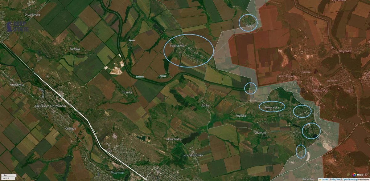
Moving on to the other flank of Kostyantynivka city, the northern one, the situation is different: somewhat more stable and fortified, but lacking any margin of error at all.
Here, the units are generally fresher and less exhausted than, for example, the 28th and 36th in the southern part of Kostyantynivka, as they have experienced a long period of general inactivity in and north of Chasiv Yar, after Russian forces got bogged down in the city.
The Ukrainians exploited this and created a series of interesting and different fortifications.
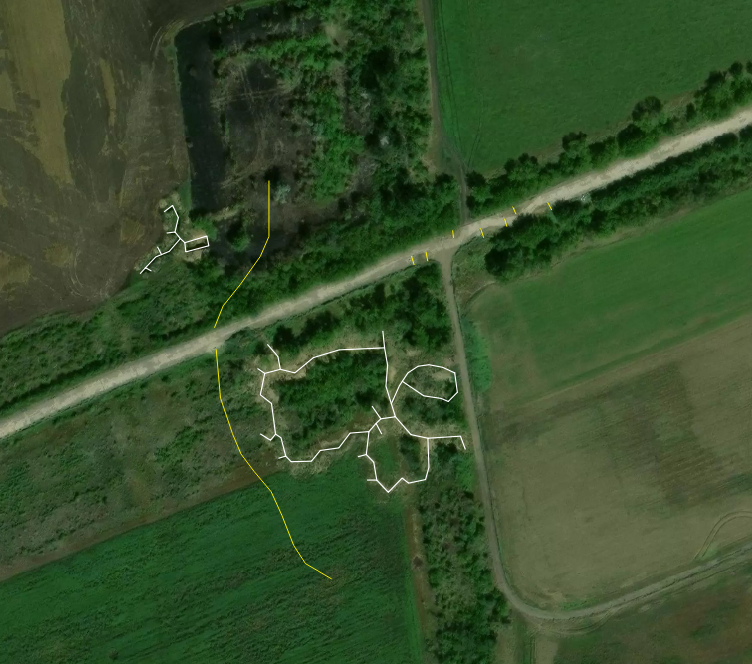
Up north near Maiske, Ukrainian forces consolidated their infantry in the covered parts of large trench systems behind a line of barbed wire, making it painfully hard for Russian drones to dislodge them from their positions.
Near Virolyubivka, the Ukrainians opted for a similar approach, with the help of much more barbed wire and a bigger urban area in the close rear that supported their movements and accumulations.
At the border with Chasiv Yar, Ukrainian infantry holds strong positions in well-built trench systems right on the railway line and a very big number of small, concealed dugouts under the trees, which, again, makes detection and destruction tedious for Russian forces.
In Chasiv Yar itself, Ukrainian forces went for a different approach: they fortified individual houses over the course of a long period of inactivity, thus forming a node of independent strongpoints in basements and houses that need to be captured individually to advance further.
Moving on to the other flank of Kostyantynivka city, the northern one, the situation is different: somewhat more stable and fortified, but lacking any margin of error at all.
Here, the units are generally fresher and less exhausted than, for example, the 28th and 36th in the southern part of Kostyantynivka, as they have experienced a long period of general inactivity in and north of Chasiv Yar, after Russian forces got bogged down in the city.
The Ukrainians exploited this and created a series of interesting and different fortifications.
Up north near Maiske, Ukrainian forces consolidated their infantry in the covered parts of large trench systems behind a line of barbed wire, making it painfully hard for Russian drones to dislodge them from their positions.
Near Virolyubivka, the Ukrainians opted for a similar approach, with the help of much more barbed wire and a bigger urban area in the close rear that supported their movements and accumulations.
At the border with Chasiv Yar, Ukrainian infantry holds strong positions in well-built trench systems right on the railway line and a very big number of small, concealed dugouts under the trees, which, again, makes detection and destruction tedious for Russian forces.
In Chasiv Yar itself, Ukrainian forces went for a different approach: they fortified individual houses over the course of a long period of inactivity, thus forming a node of independent strongpoints in basements and houses that need to be captured individually to advance further.
9/🧵
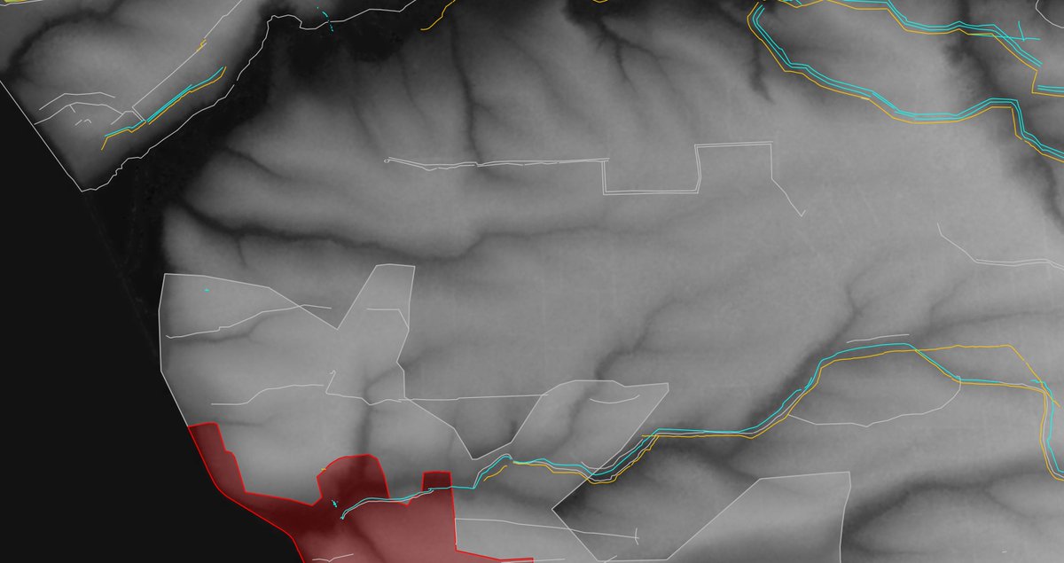
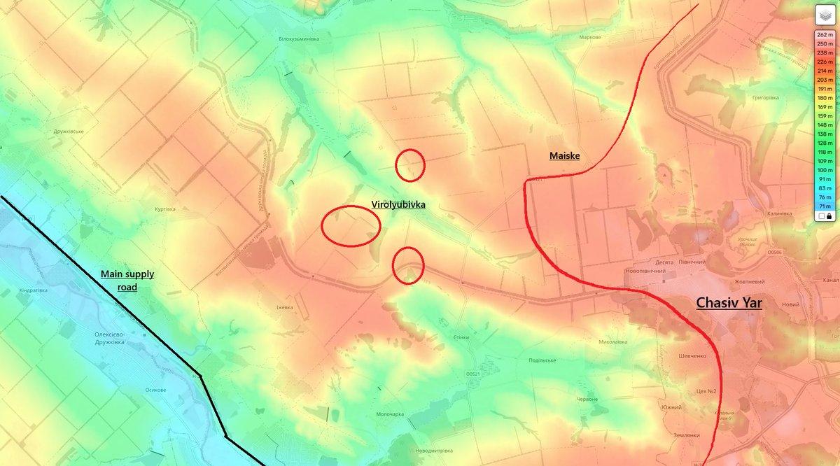
Here, though, the Ukrainians face a problem: Virolyubivka is indeed well defended, in some places by 13 (!) lines of barbed wire, but that's about it: if Virolyubivka is lost, supplies into Kostyantynivka are lost as well, just like if Illinivka and Berestok are lost, so, as I was saying, the Ukrainians have no margin of error whatsoever.
In other words, they need to be extremely careful to guard well the strongpoints on the railway, which is basically an infantry highway on the dominant heights for the Russians, and also the heights overlooking Virolyubivka, both east and west of it.
From the picture below, we can also clearly see why most of the drone attacks on the main supply road into Kostyantynivka come from the Chasiv Yar direction: Chasiv Yar is exactly on the peak of the dominant hill of the region, and Russian forces have access to high-rise buildings and sturdy industrial areas right on top of this hill, a drone operator's paradise.
10/🧵
You might've noticed that I have talked and focused a lot on supplies and drone attacks in this thread, while I usually focus much more on fortifications and the actual contact line.
This is exactly because of Kostyantynivka's nickname: "fortress".
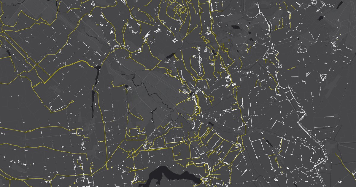
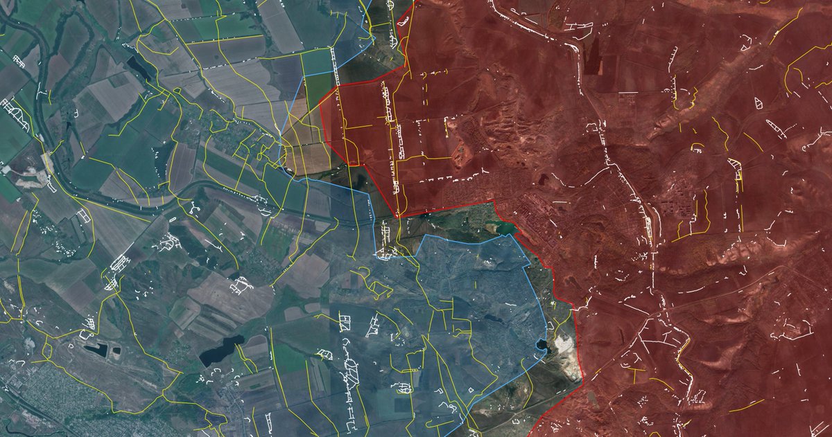
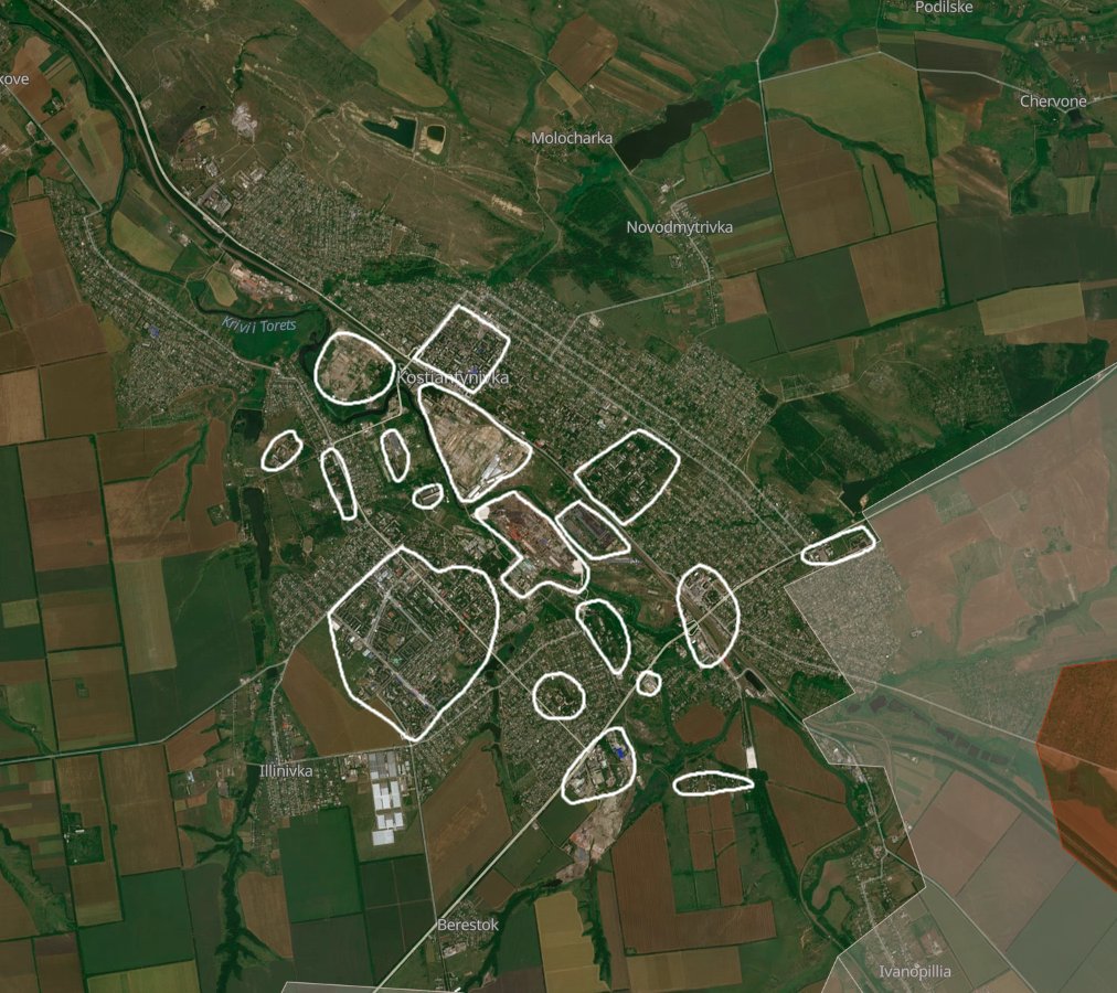
The city is packed full of strong points everywhere. In the picture below I circled in white the main ones: industrial areas, high-rise areas, multi-story apartment areas, artificial and natural obstacles and chokepoints, forests, and more. The southwestern high-rise area alone is 8 times bigger than Toretsk's central high-rise area, which, if you remember, was a formidable fortification that caused Russia a ton of problems.
So, we can see Kostyantynivka city as Toretsk's bigger brother.
If it took Russia about a year to capture Toretsk, capturing Kostyantynivka would be borderline impossible without first acting on what goes to defend the city in the first place, which has to come from only two roads.
Now, we also start seeing how vulnerable Kostyantynivka's supplies are, and the problem with the city's flanks underlines itself.
You might've noticed that I have talked and focused a lot on supplies and drone attacks in this thread, while I usually focus much more on fortifications and the actual contact line.
This is exactly because of Kostyantynivka's nickname: "fortress".
The city is packed full of strong points everywhere. In the picture below I circled in white the main ones: industrial areas, high-rise areas, multi-story apartment areas, artificial and natural obstacles and chokepoints, forests, and more. The southwestern high-rise area alone is 8 times bigger than Toretsk's central high-rise area, which, if you remember, was a formidable fortification that caused Russia a ton of problems.
So, we can see Kostyantynivka city as Toretsk's bigger brother.
If it took Russia about a year to capture Toretsk, capturing Kostyantynivka would be borderline impossible without first acting on what goes to defend the city in the first place, which has to come from only two roads.
Now, we also start seeing how vulnerable Kostyantynivka's supplies are, and the problem with the city's flanks underlines itself.
11/🧵
I'm often asked if the anti-drone nets that have been placed on the main artery to Kostyantynivka help or not.
The answer is yes, but they're not a game changer.
They are useful up to a certain point when they can still be reliably repaired (in other words, when the frontline is still somewhat far), and they are designed to save lives, not make the road 100% safe to pass through.
Ukraine employs special groups to repair and maintain such anti-drone net tunnels, which were proven to be effective, but Russian drones are, as you can understand, much, much more numerous than those teams, and the road to Kostyantynivka remains unsafe.
12/🧵
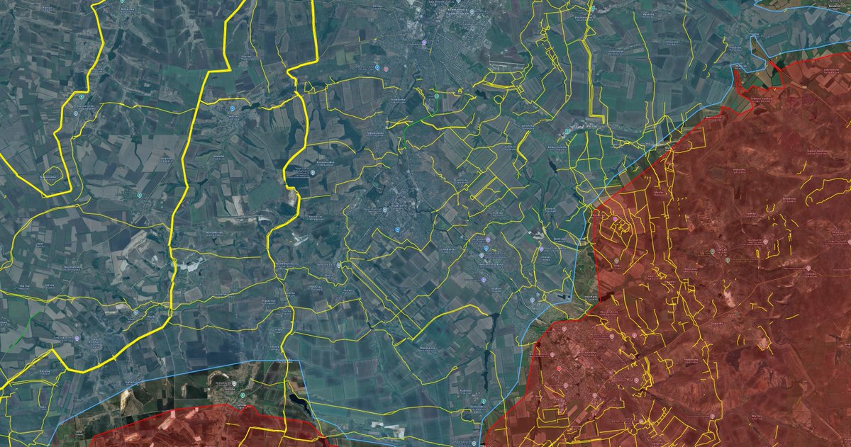
Let's look at the following hypothetical scenario, with Kostyantynivka mostly captured by Russian forces, just like the surrounding areas and some territory in the Shakhove direction, and with some Ukrainian remnants still clinging onto the last districts of Kostyantynivka.
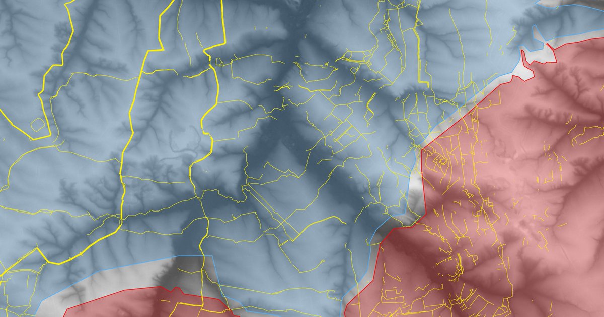
In the second photo is the same scenario and represented area, but with the topographic overlay.
We can clearly see how the next steps for Russian forces would be Oleksiievo-Druzhkivka and Druzhkivka itself, which, again, will be quite hard to take on from the east and south.
Furthermore, with the fall of Kostyantynivka, the frontline would significantly shorten, slightly bettering Ukraine's manpower problem (but also concentrating Russian forces).
It is logical to assume that the Russians would want to repeat the Kostyantynivka scenario: an advancement on the flanks that threatens Druzhkivka's supplies in the first place, through drones.
For this to be achieved, the Russians would need a foothold on the hill east of Druzhkivka, which, though, is guarded by a convenient chokepoint near Izhevka that you can see on the topographic map, and the crucial hill west of Druzhkivka, which is instead guarded by 3 vertical lines of obstacles and some weaker horizontal lines along rivers and creeks, which would funnel Russian forces into a kill zone.
Coupled with the experienced units defending the area west of Druzhkivka, gaining a foothold on any of the two hills on Druzhkivka's sides would not be easy at all for Russian forces, and securing their foothold by enlarging it on the sides would be even harder because of Ukraine's obstacle lines.
Let's look at the following hypothetical scenario, with Kostyantynivka mostly captured by Russian forces, just like the surrounding areas and some territory in the Shakhove direction, and with some Ukrainian remnants still clinging onto the last districts of Kostyantynivka.
In the second photo is the same scenario and represented area, but with the topographic overlay.
We can clearly see how the next steps for Russian forces would be Oleksiievo-Druzhkivka and Druzhkivka itself, which, again, will be quite hard to take on from the east and south.
Furthermore, with the fall of Kostyantynivka, the frontline would significantly shorten, slightly bettering Ukraine's manpower problem (but also concentrating Russian forces).
It is logical to assume that the Russians would want to repeat the Kostyantynivka scenario: an advancement on the flanks that threatens Druzhkivka's supplies in the first place, through drones.
For this to be achieved, the Russians would need a foothold on the hill east of Druzhkivka, which, though, is guarded by a convenient chokepoint near Izhevka that you can see on the topographic map, and the crucial hill west of Druzhkivka, which is instead guarded by 3 vertical lines of obstacles and some weaker horizontal lines along rivers and creeks, which would funnel Russian forces into a kill zone.
Coupled with the experienced units defending the area west of Druzhkivka, gaining a foothold on any of the two hills on Druzhkivka's sides would not be easy at all for Russian forces, and securing their foothold by enlarging it on the sides would be even harder because of Ukraine's obstacle lines.
13/🧵
In conclusion, from this thread you should take that it is of crucial importance for Ukrainian forces to focus the bulk of their efforts on the Shakhove front: a good occasion to cause catastrophic casualties to Russian forces, thus exhausting their offensive potential there, but also a critical area to defend for Ukraine if they want to continue holding Kostyantynivka and Druzhkivka.
Then, it's important to understand that anti-drone nets are not as much of a game changer as some think, even though they're still very useful, and finally that the supply situation for Kostyantynivka is slowly degrading and getting more vulnerable every day that passes, and retreat plans from Kostyantynivka must already be drawn to be ready for the worst-case scenarios: Ukraine can't afford a catastrophe here at all. The command should watch this area very closely and check for dangerous movements because, as I said, there is no more margin of error.
14/🧵
Thanks for reading this (pretty long) thread!
Feel free to ask questions in the comments (or in my DMs).
If you're currently fighting in this direction, please message me in my DMs, I'm extremely interested in hearing your opinion on the situation.
Remember to join my Telegram channel: t.me/PlayfraOSINT
My Discord server: discord.gg/P3XsgQFBPV
And, if you liked this analysis, you can donate whatever amount you want here: coff.ee/playfra.
Have a nice day/night!
• • •
Missing some Tweet in this thread? You can try to
force a refresh