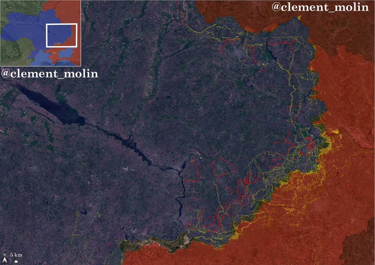
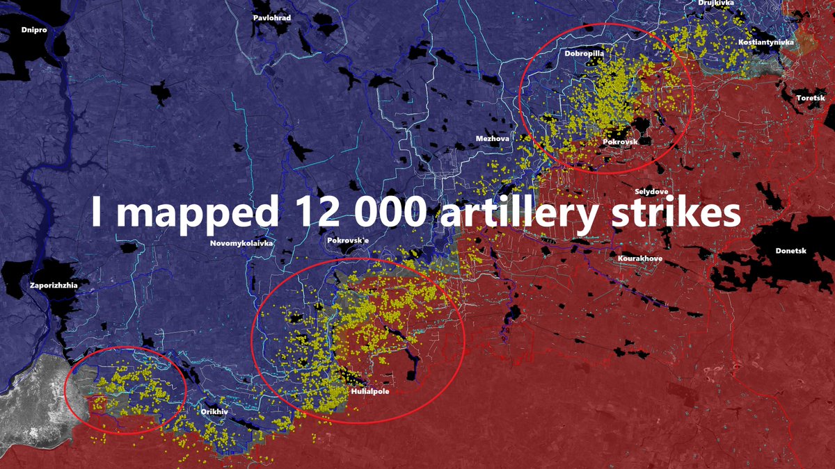
On a 250 km long frontline, I managed to map 12 000 russian 🇷🇺 and ukrainian 🇺🇦 artillery strikes thanks to the snow cover
With this map, I'll analyse with precision the current trends and next movements on the frontline as well as the location of the frontline
🧵THREAD🧵1/20⬇️
With this map, I'll analyse with precision the current trends and next movements on the frontline as well as the location of the frontline
🧵THREAD🧵1/20⬇️
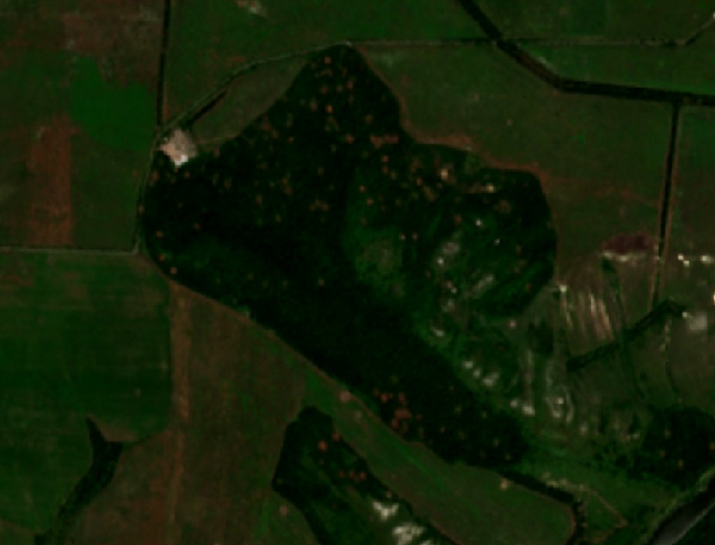
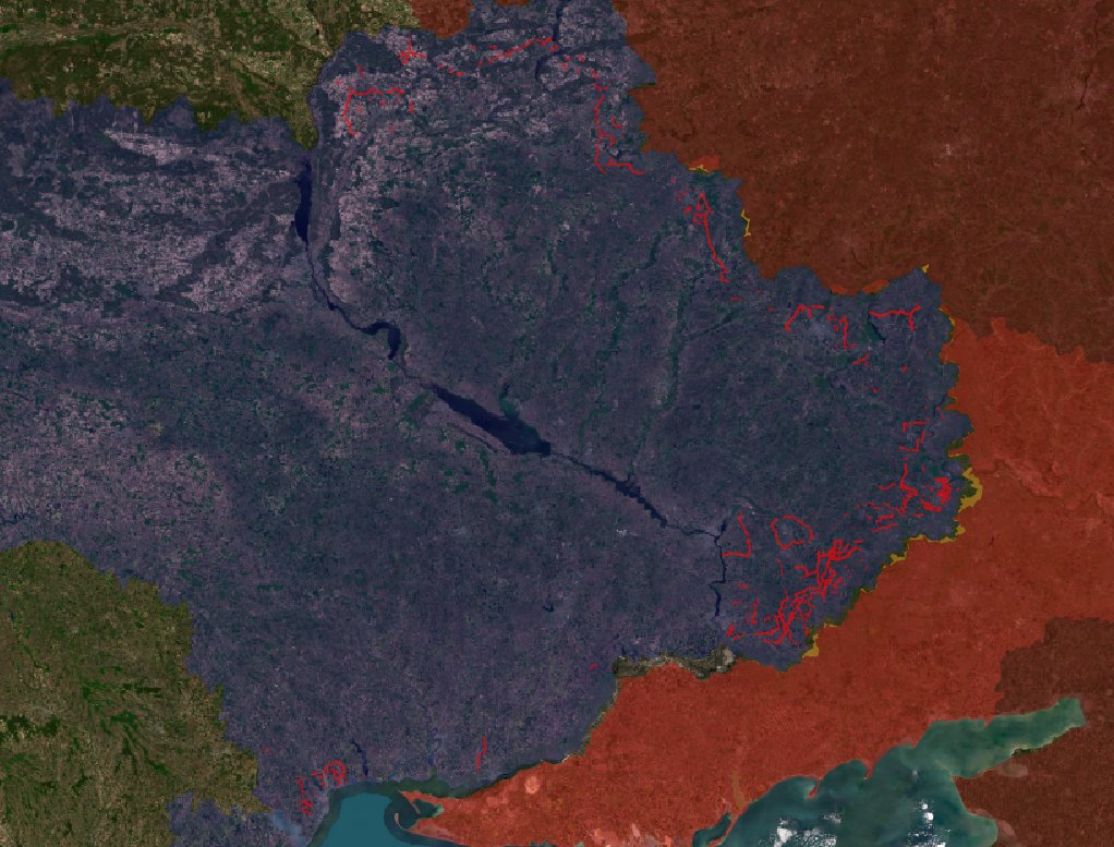
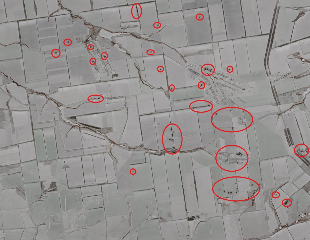
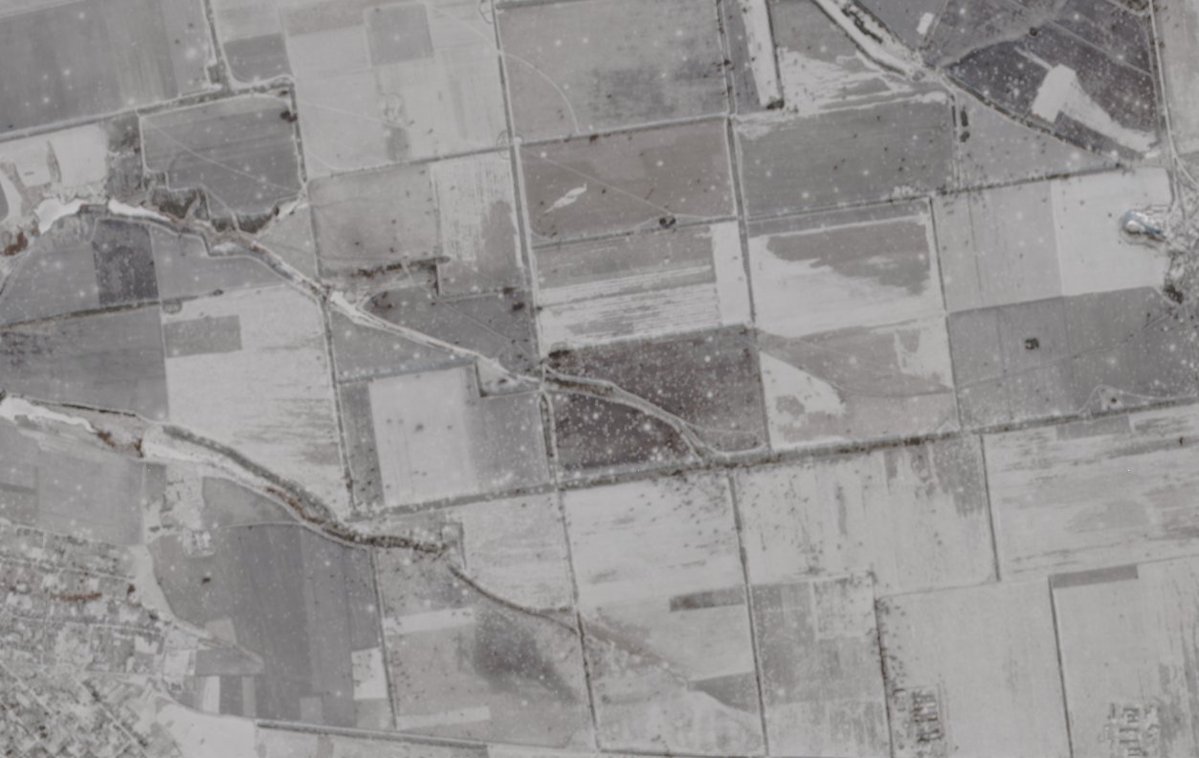
The latest commercial satellite images (Sentinel-2) showed most of eastern Ukraine covered with snow, which is very useful.
Indeed, we can see every artillery and airstrike impacts, something we cannot see otherwise. I mapped 12 000 of them between Kostiantynivka and the Dnipro river, with two holes, the area around Novopavlivka/Ivanivka (some clouds) and the one north of Stepnohirsk and along the Dnipro, because there was no snow.
Disclaimer, this map is obviously not showing all the impacts, I may have missed some, and the ones in urban areas are a bit more difficult to map. Moreover, some of those impacts are in fact airstrikes, but it is a minority.
Let's start !
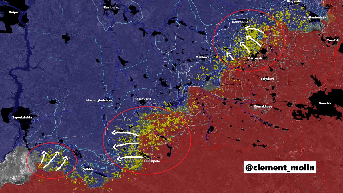
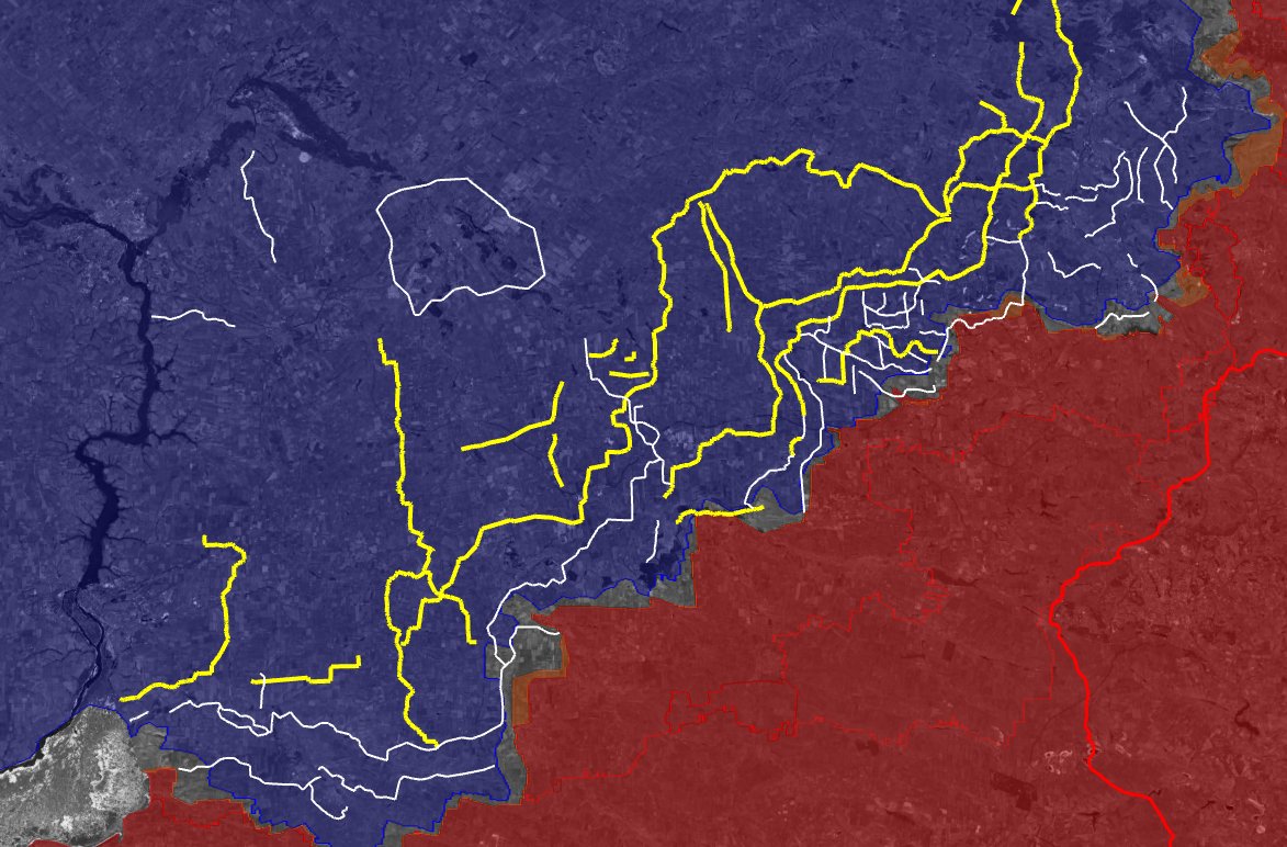
First, we can see 3 main areas of bombing : Pokrovsk-Dobrbropilla, Hulialpole-Ternuvate and Stepnohirsk.
There is one trend : Russia is putting a big effort to attack Orikhiv from both sides and to take Dobropilla in the first part of the year.
There is one trend : Russia is putting a big effort to attack Orikhiv from both sides and to take Dobropilla in the first part of the year.
First, with Hulialpole. The number of impacts is extremely high, part of them are on the russian controled territory, most in Ukrainian controled.
The ones in the middle are both russians (to destroy ukrainian positions) and ukrainians (to fight russian assaults.
The ones in the middle are both russians (to destroy ukrainian positions) and ukrainians (to fight russian assaults.
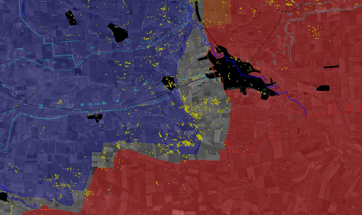
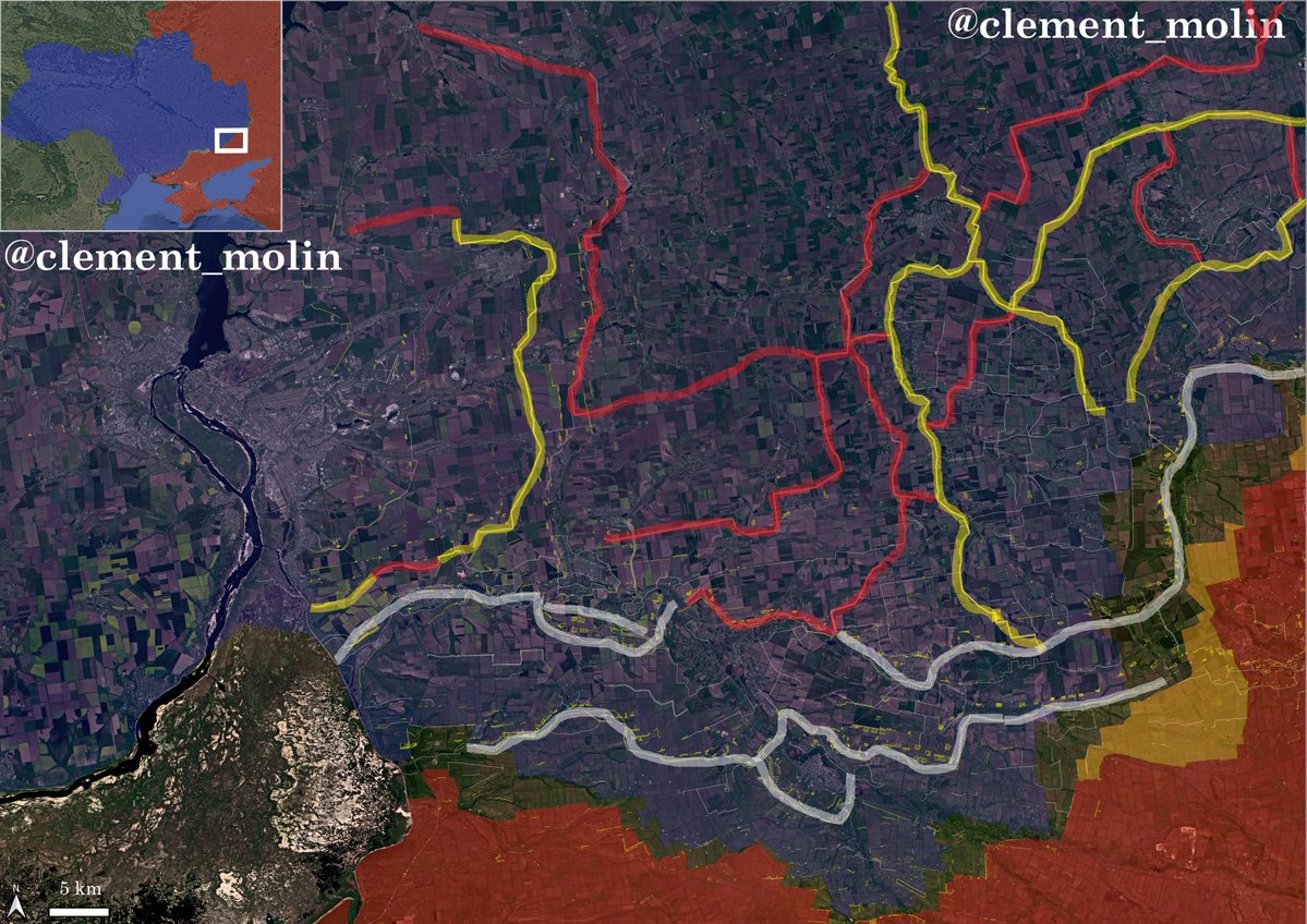
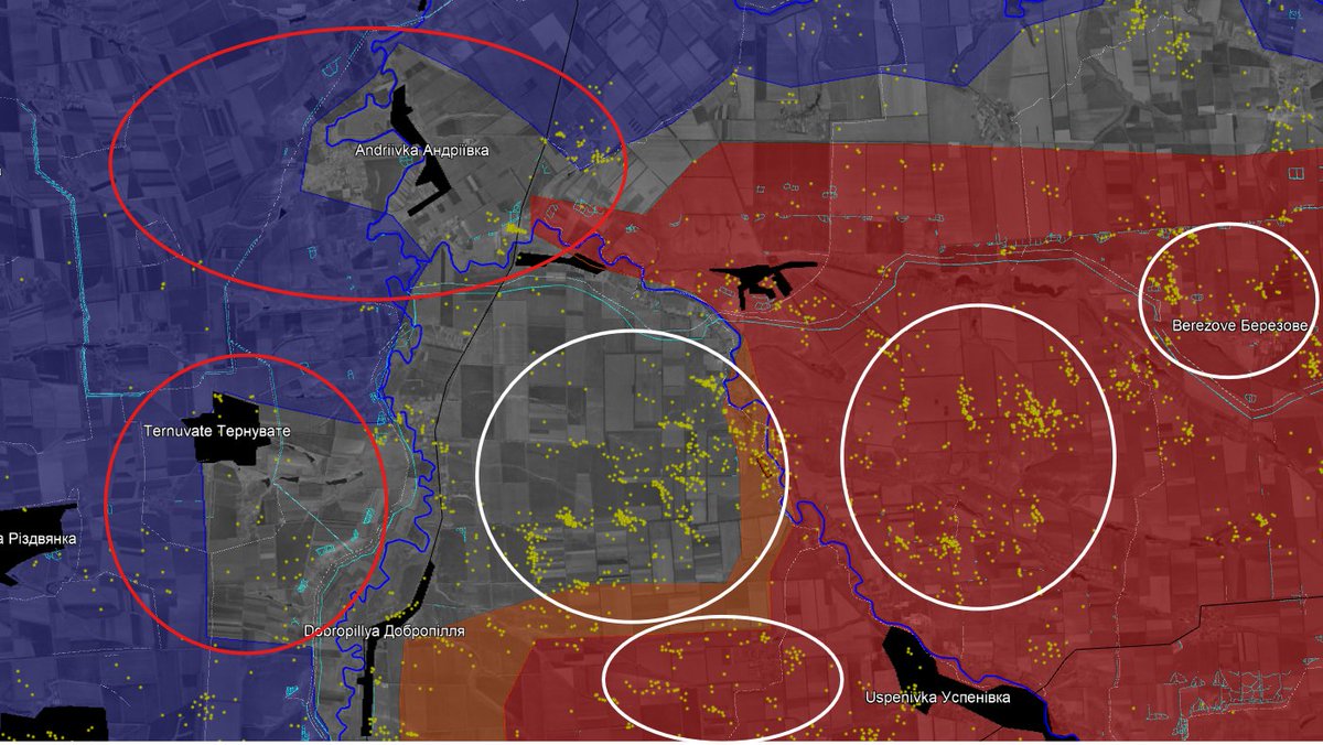
But if we go just north of Hulialpole, we cannot see much shells impacts in and around Ternuvate, which, according to multiple accounts fell.
Most of the shellings are happening on treelines east of the town, which can be both russian and ukrainian.
Most of the shellings are happening on treelines east of the town, which can be both russian and ukrainian.
If we look more closely, there is barely any artillery impact in and around the areas that many marked as russian controled for months.
Worst, ukrainian artillery was still striking very hard areas that are (if you say an howitzer has to be 10km from the frontline) 30km and more from their positions.
At the same time, russian artillery is largely unable to strike Pokrovsk'e or Ternuvate and neighbouring villages.
Worst, ukrainian artillery was still striking very hard areas that are (if you say an howitzer has to be 10km from the frontline) 30km and more from their positions.
At the same time, russian artillery is largely unable to strike Pokrovsk'e or Ternuvate and neighbouring villages.
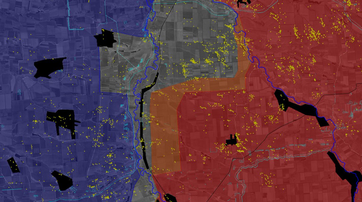
I have an explanation. I believe the russian logistic and artillery (so consolidation) is stuck far behind the frontline, around the white line.
DRG's are far beyond (15km), showing their flag videos and harassing logistics. Ukrainians are still present in the yellow areas, slowly pushed back. If Russia was controling the towns where we see flags, there would be strikes everyday on Pokrovsk'e and multiple other areas, which is not the case here.
You can see, however, around Hulialpole, that Russia consolidated and is striking far behind the line.
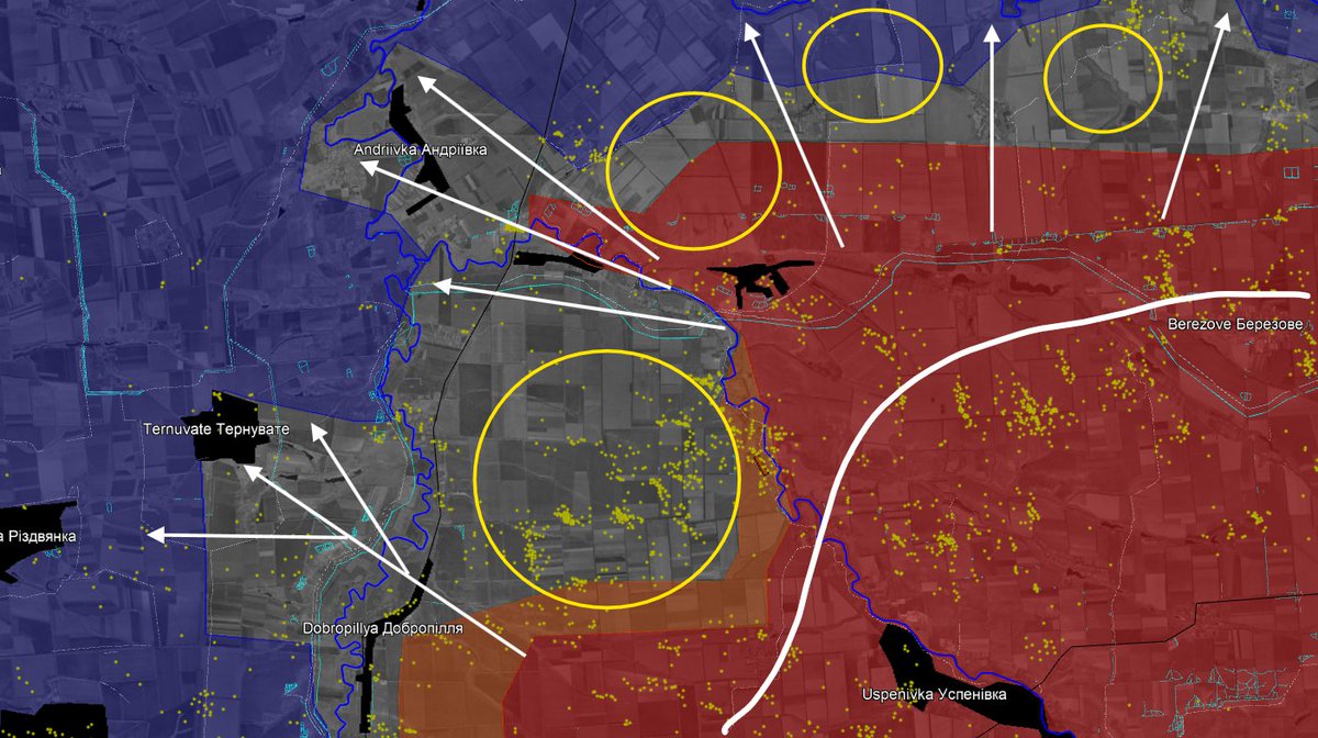
In addition, we can see that ukrainian artillery is still striking deep behind the frontline, mainly along roads, villages and treelines, which means they are trying to disrupt logistics as much as possible.
For Orikhiv, we can see the clear danger that is coming for this city, a ukrainian fortress.
Massive artillery and airstrikes are happening east of the town, very few south and a lot on the west.
Massive artillery and airstrikes are happening east of the town, very few south and a lot on the west.
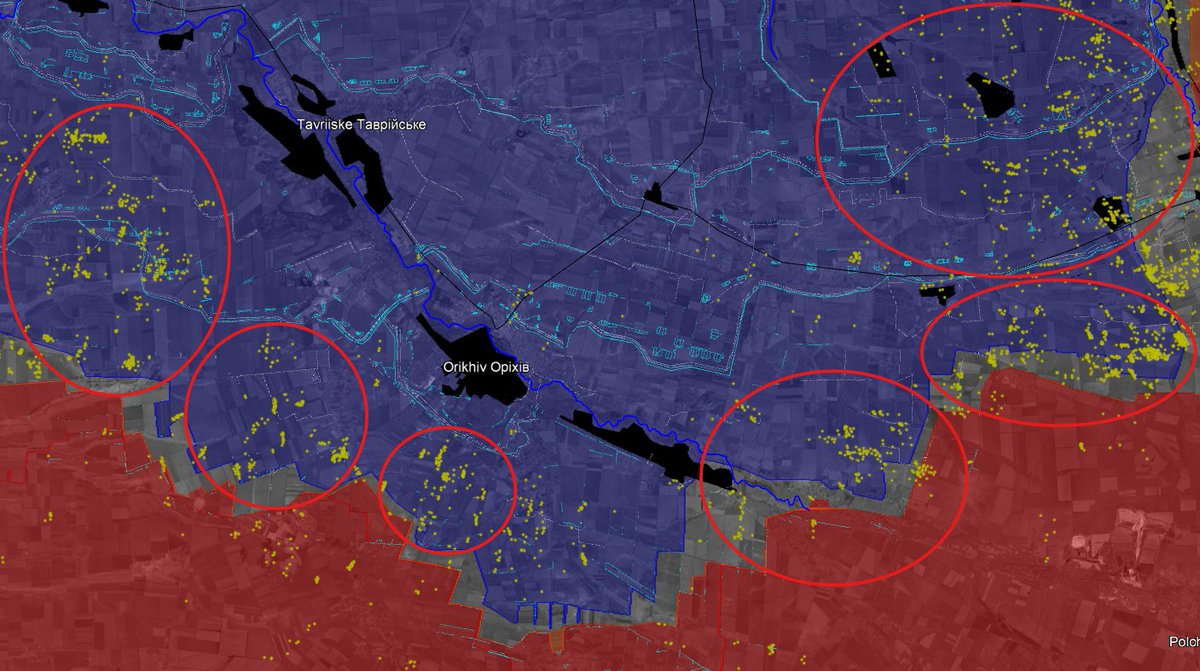
South-west of Hulialpole, we can see important strikes, by both forces, showing how important ukrainian defenses may be looking like and how Ukraine is preventing russian troops to advance.
Also, most of the dots you can see west of Hulialpole are airstrikes, the impacts are bigger and very visible when you compare to traditionnal artillery shelling.
On the Stepnohirsk direction, we can see a shifting of the strategy. (the yellow area didn't had snow so I couldn't map).
Multiple artillery strikes are avoiding the narrow Dnipro river valley and the Orikhiv urban area, showing pressure is going to Komyshuvakha...
Multiple artillery strikes are avoiding the narrow Dnipro river valley and the Orikhiv urban area, showing pressure is going to Komyshuvakha...
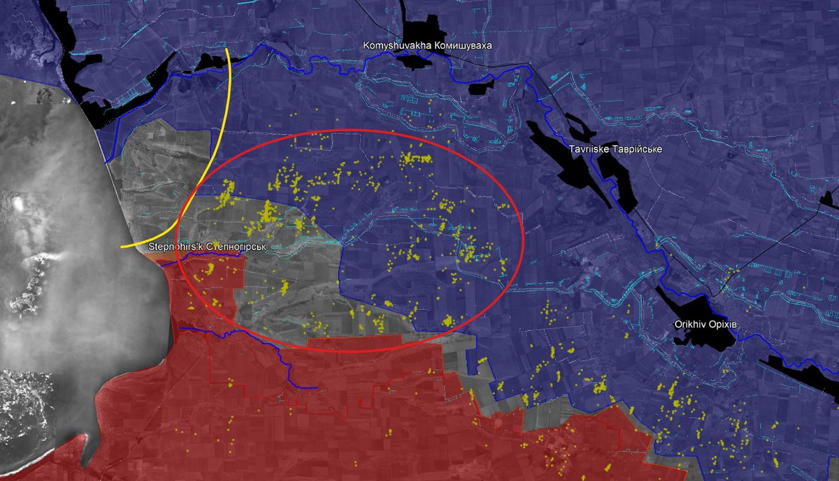
Most of the strikes are russian in this direction. You can see how inprecise those strikes are, but some may be targeting infantry or vehicles in the fields.
Now, let's go to the Pokrovsk area.
Now, let's go to the Pokrovsk area.
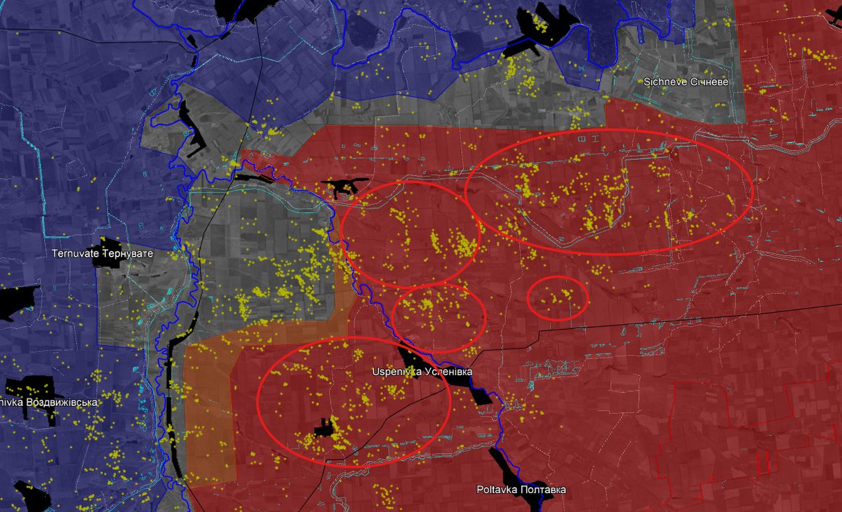
First thing to notice in the Pokrovsk direction is the small numbers of strikes on the Mezhova direction, which means it is a secondary axis for now.
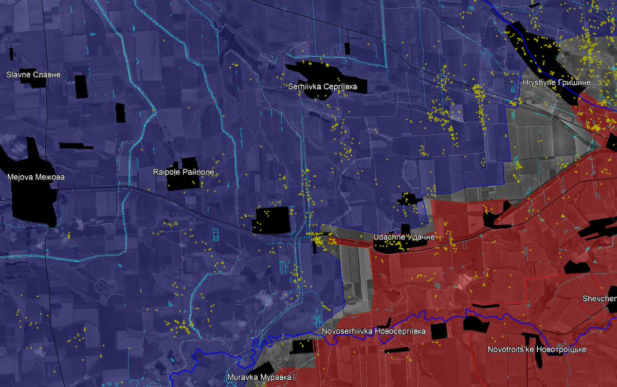
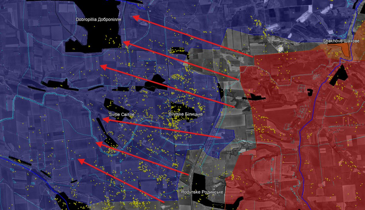
However, there is a very high number of strikes west of Pokrovsk. Inside the city itself, the strikes are very few (probably I couldn't see them). This means russian effort shifted in attacking the fortified area west of the city, intending to use it as the main regional supply hub.
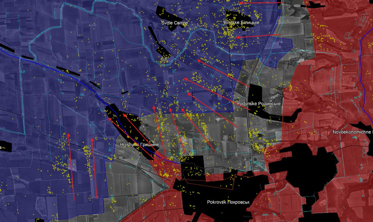
With all those dots inside ukrainian controled territory, we can understand the area between Dobropilla and Pokrovsk (Bilytske, Svitle, Rodynske...) is going to be soon attacked.
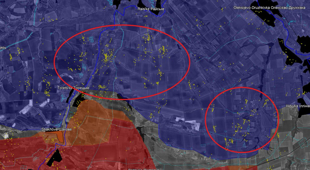
I also found multiple artillery impacts north of Shakove, on the Raiske direction, the next russian objective, as well as west of Kostiantynivka.
With the context of drone war, we often forget how important artillery is. If today, Ukraine is still largely using artillery, it's mainly because european partners are helping.
Same for Russia, that is still using North Korean ammo as well as domestically produced.
Same for Russia, that is still using North Korean ammo as well as domestically produced.
With automn and winter, it is very difficult to continue to map russian airstrike campaign at least 1 time a month because of cloud cover.
We at least have confirmation that this campaign continues. I will start again in april or may !
We at least have confirmation that this campaign continues. I will start again in april or may !
OSINT does not rely only on using what other products. I'm myself following what is related to satellite images, such as fortifications and shells impacts.
If you want to support me, you can do it here :
Thank you a lot ! buymeacoffee.com/clement.molin
If you want to support me, you can do it here :
Thank you a lot ! buymeacoffee.com/clement.molin
• • •
Missing some Tweet in this thread? You can try to
force a refresh