We obtained the first known satellite image of Ayatollah Ali Khamenei's compound in Tehran. There are several destroyed buildings. While the current whereabouts of Iran's supreme leader are unknown, the compound is generally used as his official residence. 🛰️📸: @Airbus 
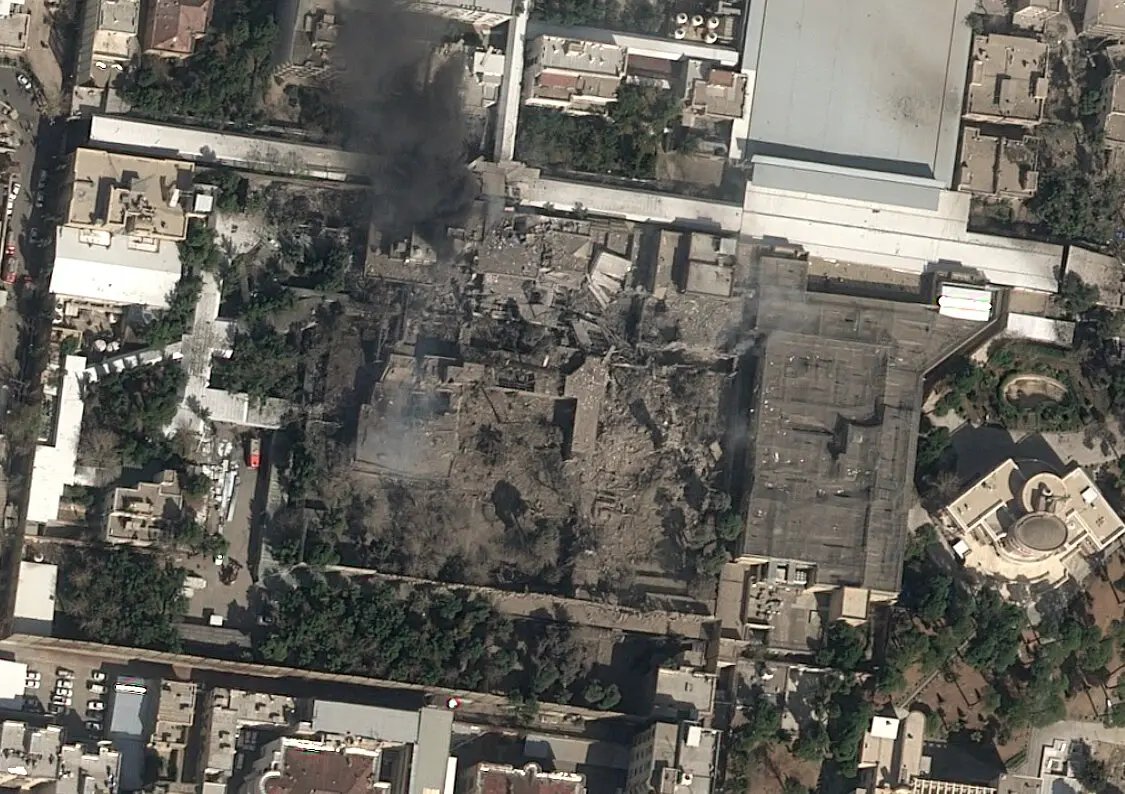
*first publicly released satellite image
Either way, it goes to show that triangulating the lines of sight from four geolocated videos lead precisely to a main strike location in Tehran.
Either way, it goes to show that triangulating the lines of sight from four geolocated videos lead precisely to a main strike location in Tehran.
https://x.com/trbrtc/status/2027657311200690353
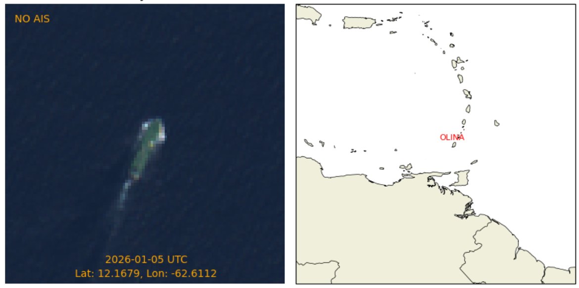
More updates on the @nytimes live blog: nytimes.com/live/2026/02/2…
@nytimes This is the second location that was struck in Tehran.
https://x.com/Stinky915846091/status/2027647763953975394
@nytimes This is the third known location that was struck in Tehran. I'm currently not aware of any other sites that were hit in the Iranian capital, but there's been so much going on that I may have missed some.
https://x.com/trbrtc/status/2027685517618229440
• • •
Missing some Tweet in this thread? You can try to
force a refresh