Stinky Profile picture
Mar 18 6 tweets 4 min read Read on X
🧵Lebanon Update 3.17.26 (H/T: @LebMonitor1)
S2: @SoarAtlas

Summary:
- IDF re-enters Yaroun+Maroun El Ras
- IDF enters Taybeh
- Heavy demolition activity in Ayta al Shab and Rab El Thalathine
- IDF Controls most of Khiam

Map Link:

More info below ⏬ google.com/maps/d/u/1/emb…Image
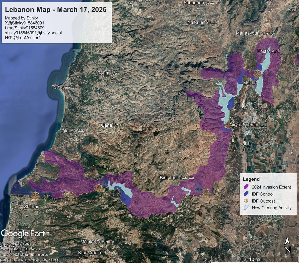
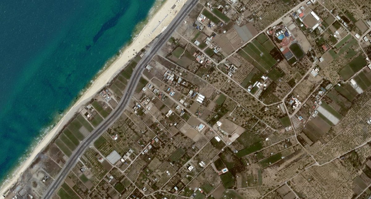
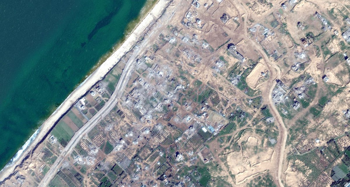
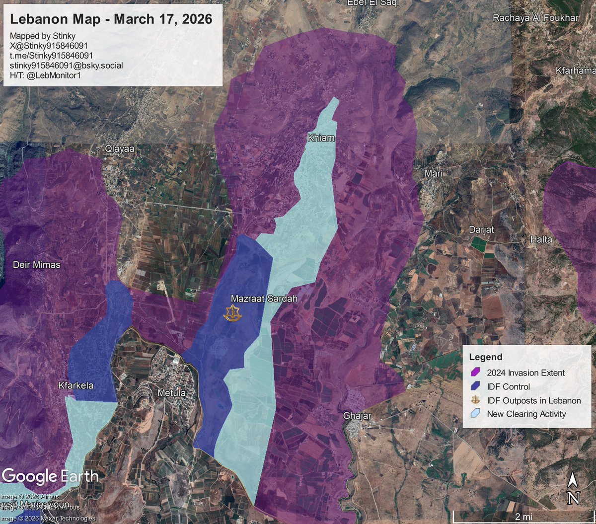
Since the last update, the IDF has taken control of most of Khiam, and Sentinel-2 imagery from @Soaratlas shows demolition activities in the eastern portions of the town. Image
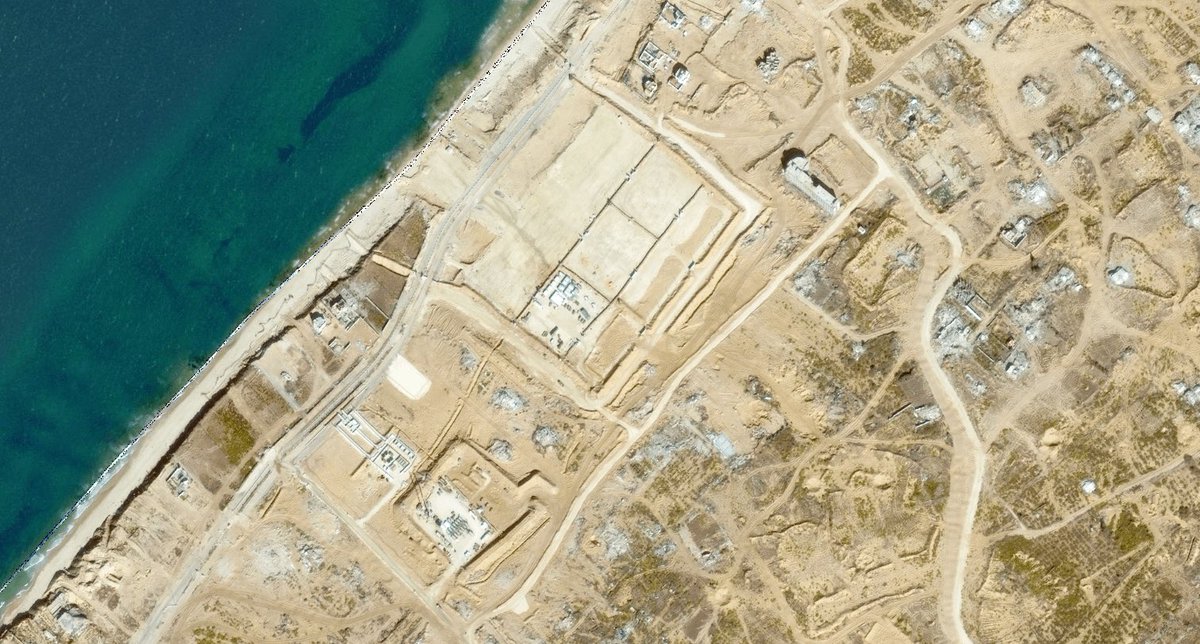
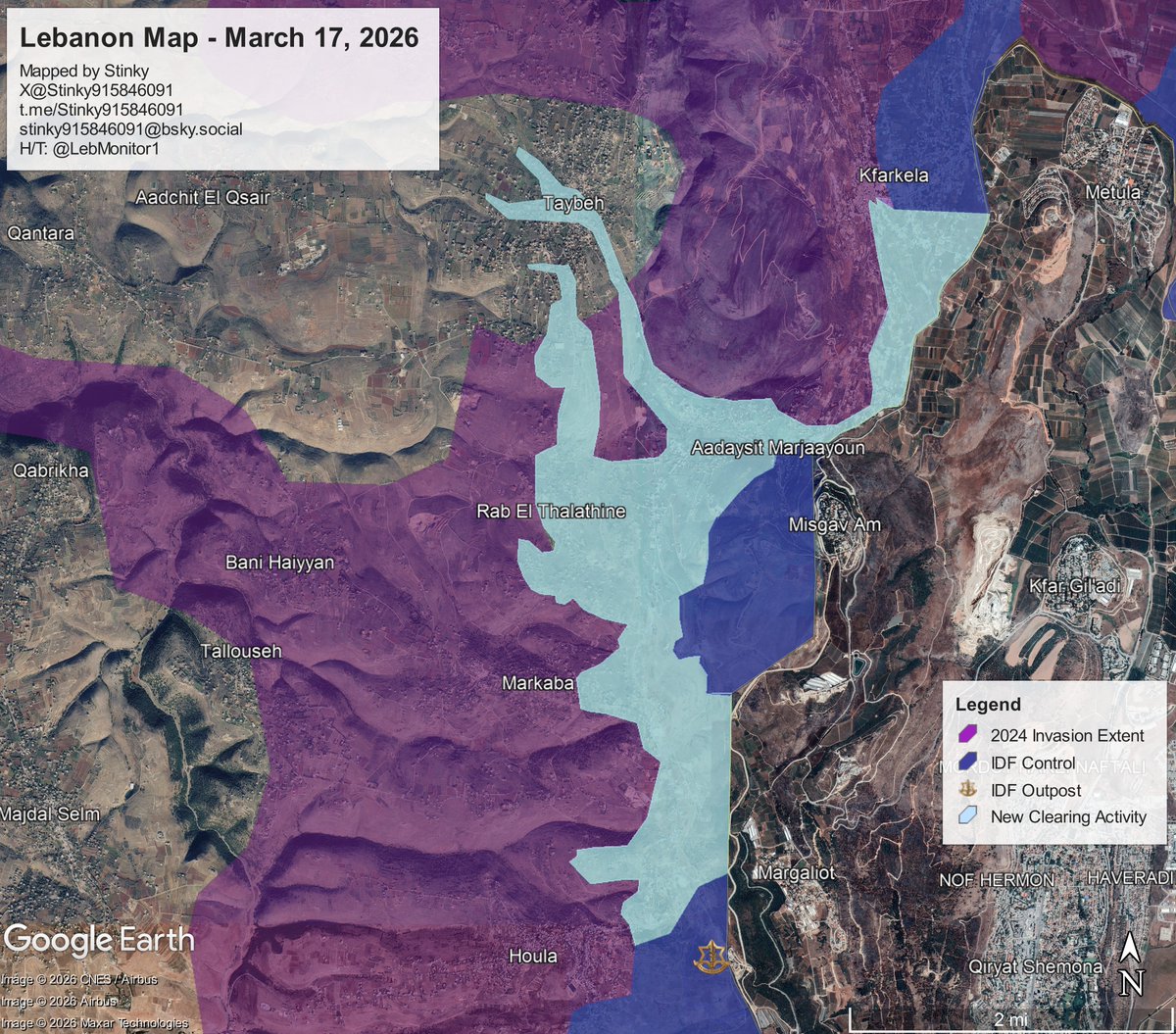
The IDF has expanded its area of control heavily, taking control of Rab El Thalatine, Kfarkela, and Markaba.

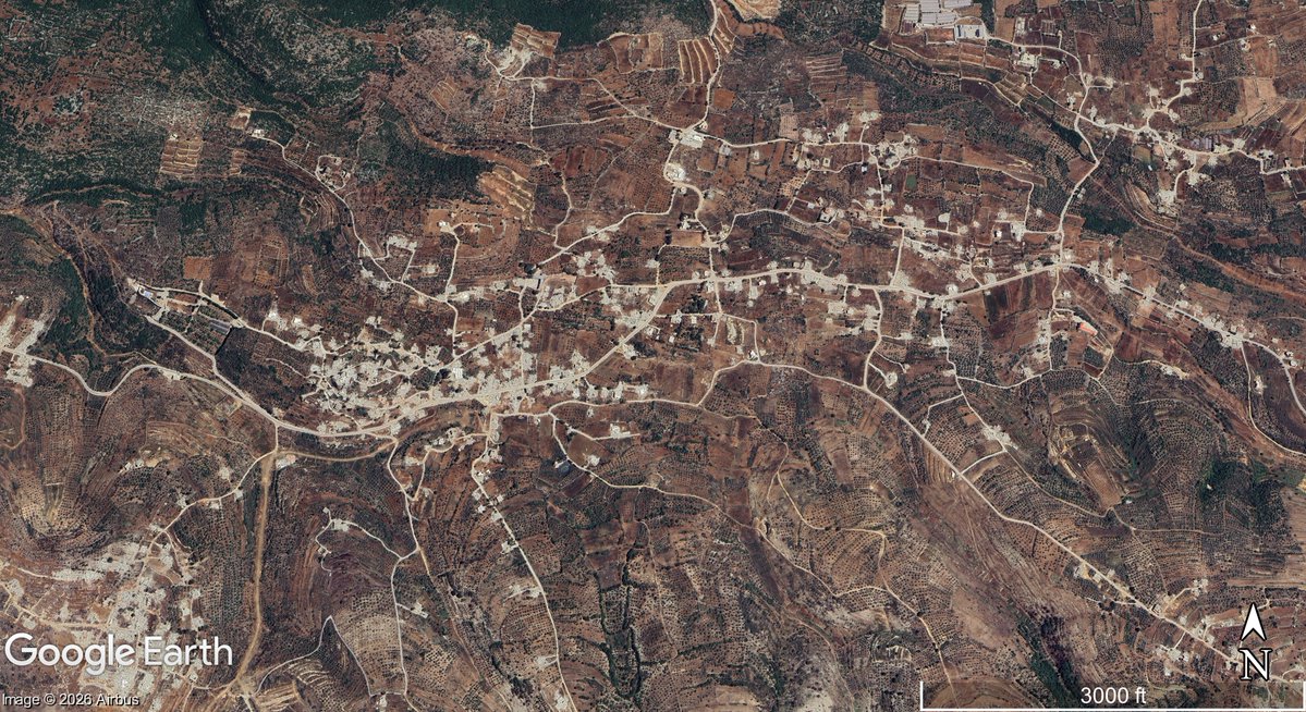
Sentinel-2 📸 indicate they enter Taybeh for the first time.

A previous geolocation shows they were also active in the area near Houla.
Geo: Image
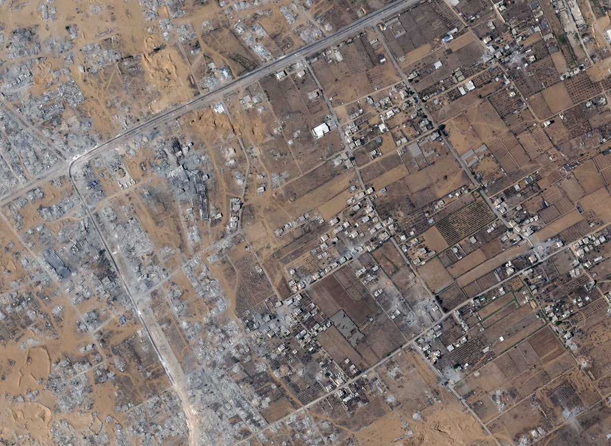
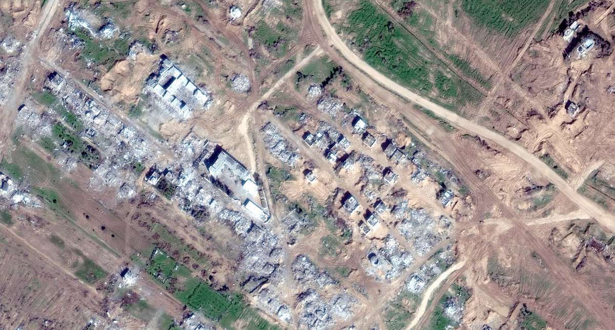
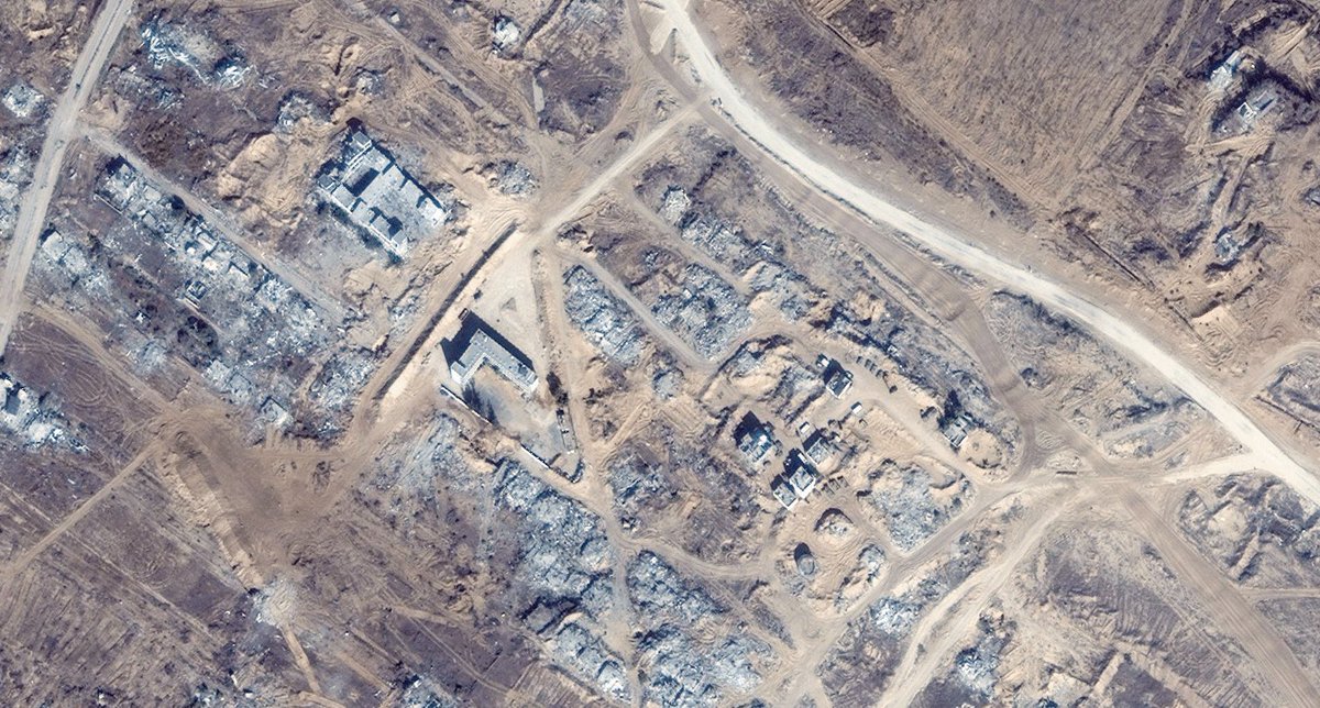
Over the past 2 eweks, the IDF has taken control of (and has conducted extensive excavation/demolition) in Ramyeh, and Ayta ash Shab, as seen in the Sentinel-2 images from @SoarAtlas (see gif).

A previous geolocation I did shows one such demolition.

Image
Lastly, the IDF appears to have also entered the town of Yaroun and Maroun El Ras. Vehicle tracks are visible on the roads leading to both towns, all the way to the blue line (de-facto Israel/Lebanon border) Image
That concludes the update. Thanks for reading.

Feel free to join the telegram, if you have any questions/requests, you can contact me over there too.
Link: t.me/Stinky915846091

• • •

Missing some Tweet in this thread? You can try to force a refresh
 

Keep Current with Stinky

Stinky Profile picture

Stay in touch and get notified when new unrolls are available from this author!

Read all threads

This Thread may be Removed Anytime!

PDF

Twitter may remove this content at anytime! Save it as PDF for later use!

Try unrolling a thread yourself!

how to unroll video
  1. Follow @ThreadReaderApp to mention us!

  2. From a Twitter thread mention us with a keyword "unroll"
@threadreaderapp unroll

Practice here first or read more on our help page!

More from @Stinky915846091

Jan 10
🧵Google has released a big update updating its satellite photos to 2025 in large portions of Lebanon and Southern Syria.

In this thread we will be looking at sites I found interesting while I explored this new update. Image
Disclaimer: this update as of posting, is only available on the Google Earth "Pro" app, not the web version that you can get on your browser/phone.

To explore on the Pro version, see , scroll down, and click Download Earth Pro on Desktop.

Now let's begin! google.com/earth/about/ve…Image
Image
Border villages following the Israel-Hezbollah war from 2024.

Location: 33.106957, 35.238338
Image Date: June 5, 2025. Image
Read 12 tweets
Dec 6, 2025
🧵Who are the current Anti-Hamas militias operating inside the Gaza strip?

This is an updated version of a similar thread written by @Arabosint a few months ago, after new developments.

So far, there are 5 militias, spread out throughout each governorate of the Gaza Strip. Image
Popular Forces

It was the first Major Anti-Hamas militia to appear, established during the IDF's Rafah Offensive, and is based in Al Bayuk, southern Rafah. (31.268407, 34.291348)

It has also conducted light operations in the southern Deir Al Balah area.

Image
Image
Image
Until a few days ago, it was headed by Yasser Abu Shabab, who founded the group.

He was killed in a gun fight following an internal dispute.

He was succeeded by his deputy, Ghassan Duhine

See links for more info:
1. x.com/ariel_oseran/s…
2. x.com/Philipp2796084… Image
Read 10 tweets
Oct 28, 2025
The following thread will be publicizing Gaza militants who were killed in the war. The process of identification will mainly be derived from the guide written by @MiddleEastBuka on combatant identification.

My focus will be primarily those on the GHM list available on Airwars. Image
Note that not all details will be 100% accurate. Any additions to the circumstances of a militant's death will be appreciated.

For those interested in researching how to identify these types of individuals, have a look at the quoted thread:
October 18, 2023, Jabalia

Abd al-Ftah Sameir Abd al-Ftah al-Tananei
عبد الفتاح سمير عبد الفتاح الطناني
🆔MoH ID: 400124202
⚠️Popular Front for the Liberation of Palestine [PFLP] (Abu Ali Mustafa Brigades)

Notes: 7/10 Participant

Source: t.me/abualiajel/680Image
Image
Read 46 tweets
Sep 29, 2025
The Al-Qassam Brigades [Hamas] has released its footage of the August 20 battle with the IDF near Khan Yunis.

In this thread, I will be geolocating video clips released by the group, as well as showcasing additional footage previously unseen, provided by @orfialkov (thank you!) Image
Firstly, the video starts off with a militant climbing out of a tunnel and showcasing the area around, one can see old cell towers along Salah Al Din road. The POV is located approximately here (see tunnel in quoted tweet) Image
Temporary encampment that is set up by the Al- Qassam Brigades [Hamas], which is used as a staging point for the ambush.

Location: 1.321346, 34.315765
8G3P88C8+G8 Qa' al Kharaba, Khan Yunis Governorate, Gaza Strip
@GeoConfirmed Image
Read 21 tweets
Jul 3, 2025
This is an updated version of a previous thread I did of the same type, identifying more camps.

Below you will see a satellite comparison of Identified Hamas-affiliated terrorist camps in the Gaza strip, when they were built, and their fates.

google.com/maps/d/edit?mi…Image
Nissanit base.

Once an IDF base guarding northern Gaza settlements, the site became a training camp before 2016 and was demolished early in the Gaza ground operations after the Oct. 7 attacks.

Location: 31.555285, 34.525534
maps.app.goo.gl/8Ypuhy1LGzQCaf…
Dugit training site.

It was built prior to 2014, as satellite imagery from geomolg indicated it was razed in the 2014 war, before being subsequently rebuilt.

It was demolished in the start of the invasion, November 2023.

Location: 31.572953, 34.489482
maps.app.goo.gl/fwP1NrFmzG9jCj…
Read 16 tweets
Mar 14, 2025
Looks like this went pretty well, let’s try another one.

This thread in particular will be showing sat photos for the IDF bases that were in operation in the Netzarim corridor throughout the war.

NOTE: Most recent high resolution photos in this thread are from December 2024. Image
First off, Qseria outpost, in Juhor a Dik.

Was among the first places affected during the start of the ground invasion.

Remained operational till the ceasefire came into effect, from which the IDF withdrew.

Location: maps.app.goo.gl/E6LQh1Bg9qd4S4…Image
Image
Image
Al Rashid base

The largest in the Netzarim corridor, was built in February / March of 2024, first known for the World Kitchen port, then the JLOTS, lastly as the Al Rashid checkpoint.

Demolished 2025.

Location: maps.app.goo.gl/aWQ8qwhHw2V7nS…

Demolition Post: x.com/stinky91584609… Image
Image
Image
Read 10 tweets

Did Thread Reader help you today?

Support us! We are indie developers!


This site is made by just two indie developers on a laptop doing marketing, support and development! Read more about the story.

Become a Premium Member ($3/month or $30/year) and get exclusive features!

Become Premium

Don't want to be a Premium member but still want to support us?

Make a small donation by buying us coffee ($5) or help with server cost ($10)

Donate via Paypal

Or Donate anonymously using crypto!

Ethereum

0xfe58350B80634f60Fa6Dc149a72b4DFbc17D341E copy

Bitcoin

3ATGMxNzCUFzxpMCHL5sWSt4DVtS8UqXpi copy

Thank you for your support!

Follow Us!

:(