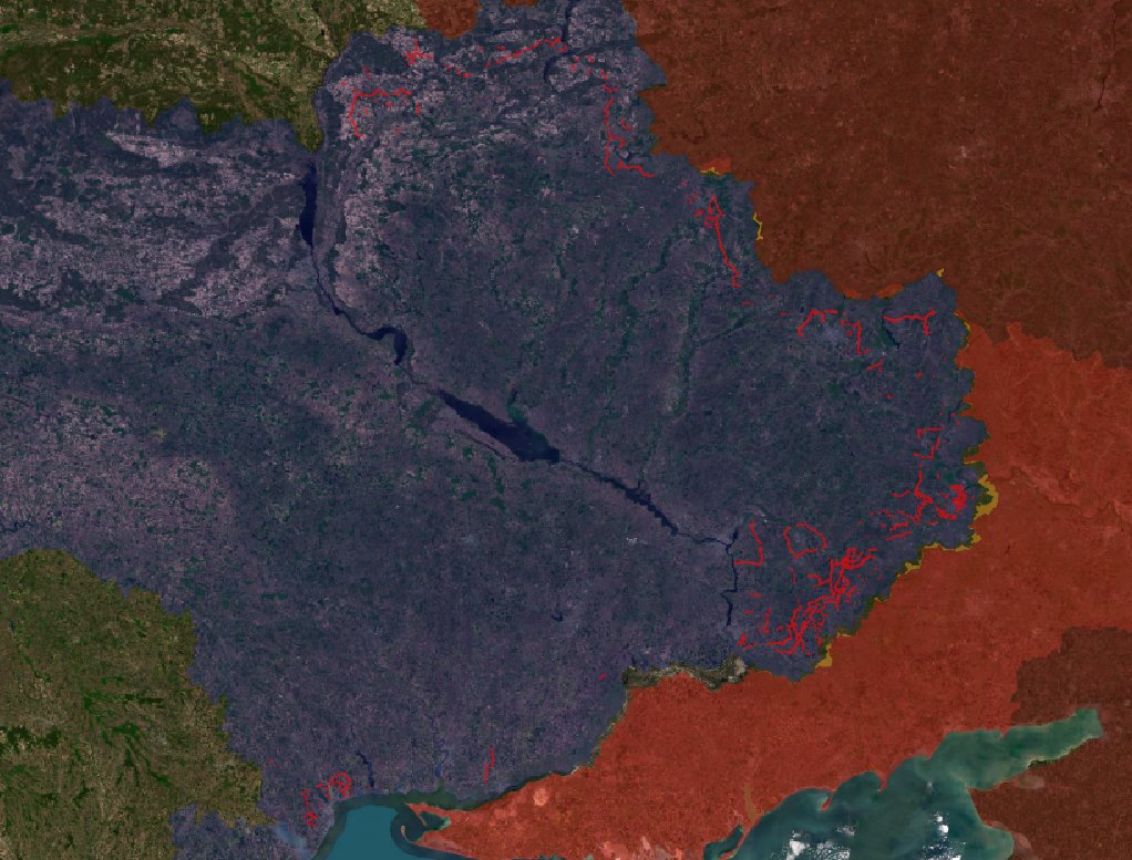
Since the start of the year, Ukraine 🇺🇦 dug more than 1 250 km of defenses in the rear areas of the frontline
The "kill zone grid" around the New Donbas Line is quickly expanding. Here is what you need to know and a detailed geographic analysis :
🧵THREAD🧵1/20 ⬇️
The "kill zone grid" around the New Donbas Line is quickly expanding. Here is what you need to know and a detailed geographic analysis :
🧵THREAD🧵1/20 ⬇️

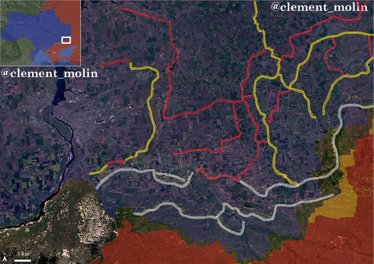
This is the small town of Shakhtarske in the Dnipropetrovsk region.
You can see one line 5km east of the town, a second one 1km east, which is a ring, going all around, protecting it on all flanks, which will allow it to be a strongpoint.
You can see one line 5km east of the town, a second one 1km east, which is a ring, going all around, protecting it on all flanks, which will allow it to be a strongpoint.
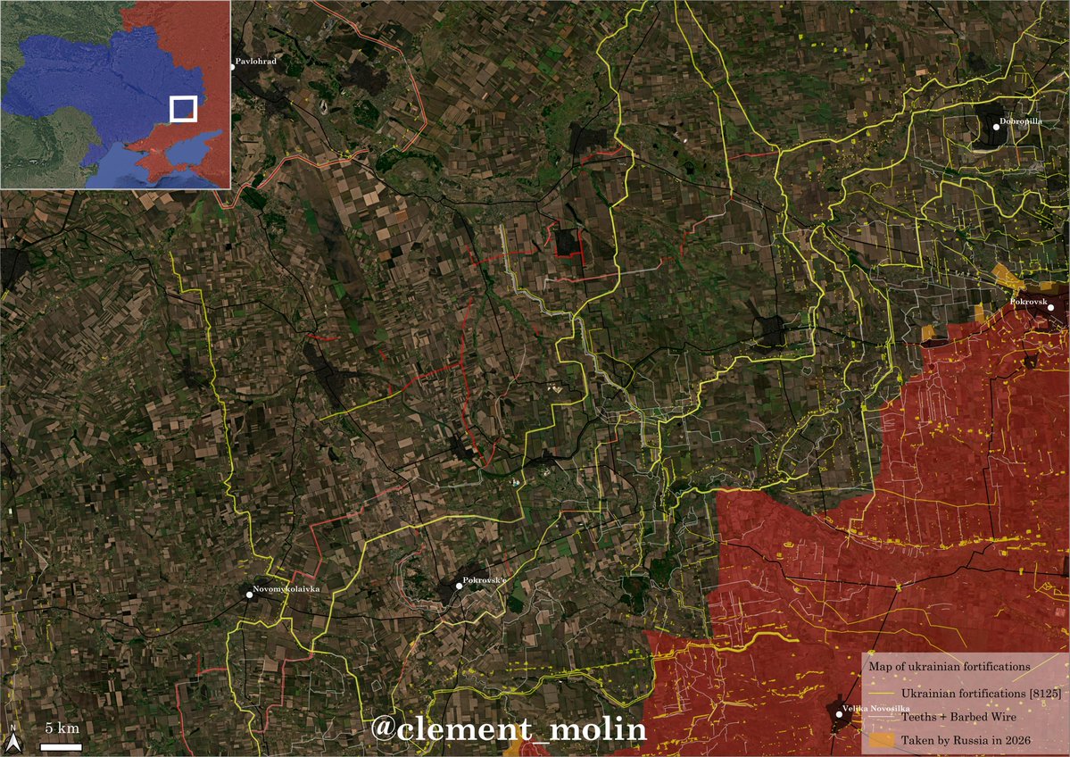
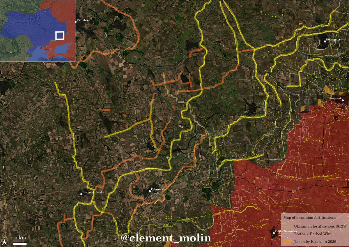
In the south first, you can see here the new fortifications built this year in red. Ukrainian counter-attacks near Pokrovsk'e allowed them to reorganize the defenses of Pokrovsk'e and Novomykolaivka, both of which are now fortified strongholds.

Here, you can see in yellow the New Donbass lines finished version and in orange where the construction/upgrade is ongoing.

Here near Novomykolaivka, we can see the construction direction, one east, in the direction of Ternuvate and one south.
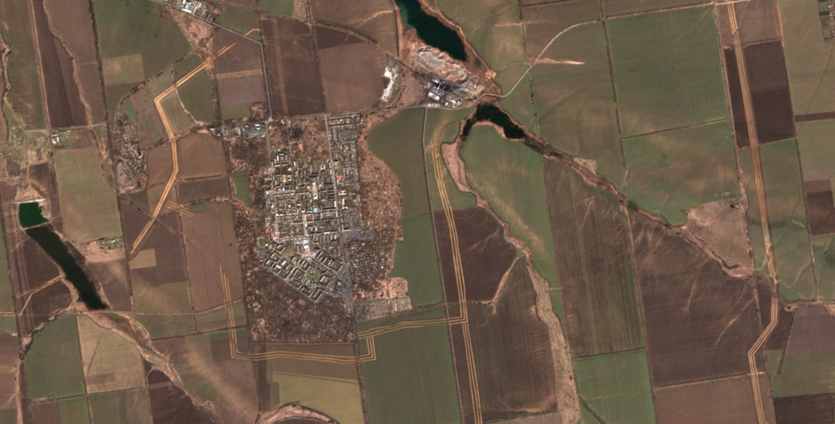
The current absence of tree cover allows to see individual positions hidden in the woods (for drone teams and infantry).
The current absence of tree cover allows to see individual positions hidden in the woods (for drone teams and infantry).

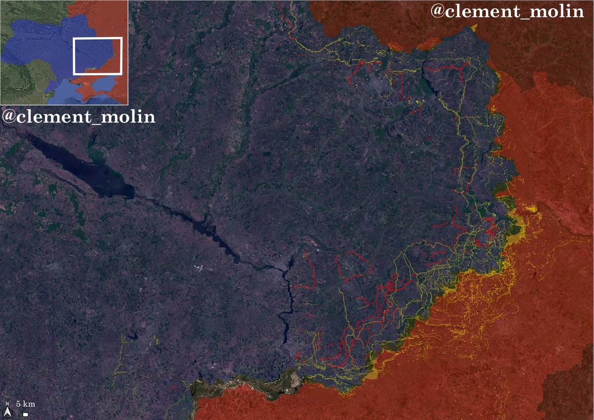
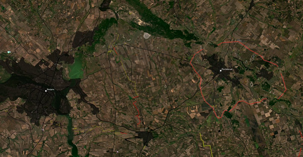
The next map is for the central part of the frontline, from the Vovocha river to Pavlohrad.
In this direction, 4 lines are under construction/improvement and 4 ring defenses are under preparation for Pokrovsk'e, Vassylkivka, Pavlohrad and Shakhtarske.
In this direction, 4 lines are under construction/improvement and 4 ring defenses are under preparation for Pokrovsk'e, Vassylkivka, Pavlohrad and Shakhtarske.
With the colors, we can see how extended the defensive grid is. Lines are interconnected and construction ongoing on 5 different lines if we include the Pavlohrad ring.
If you zoom, you can see how the main towns are perfectly fitting into these lines.
If you zoom, you can see how the main towns are perfectly fitting into these lines.
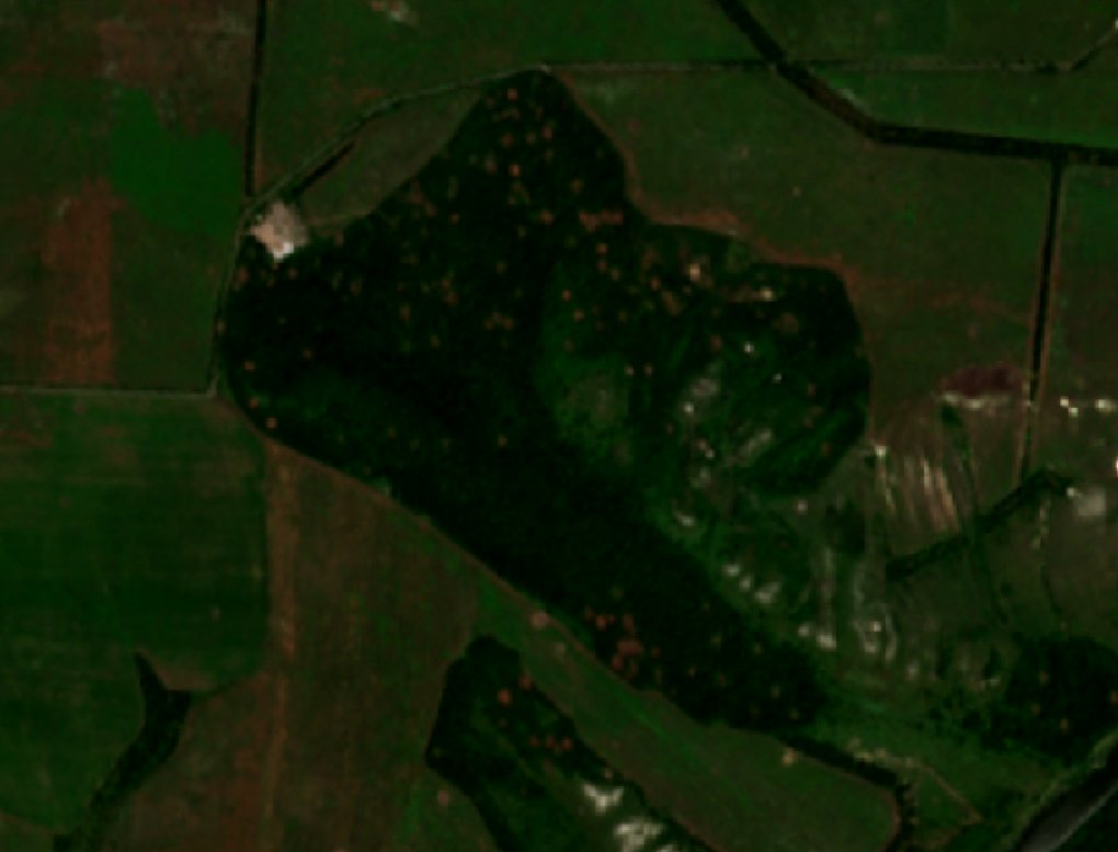
This satellite image from today is showing the ongoing construction of a ring defense for Vassylkivka.
The construction started only few weeks ago and nearly half has been done.
The construction started only few weeks ago and nearly half has been done.

Here are all the current and under construction lines. These are only the ones which are with 2-3 ditches as well as 2-3 rows of barbed wire...
Now for the central part of Donbas. The construction of alone ditches continue all around Kramatorsk and Sloviansk, while the New Donbass lines behind are expanding.
Two new lines behind Dobropilla as well, one around Barvinkove.
Two new lines behind Dobropilla as well, one around Barvinkove.
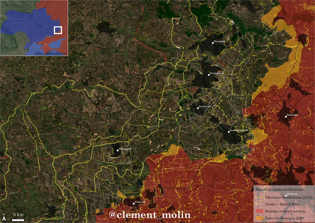
With the colors, we can see fewer lines under construction mainly because this was the priority before and the main lines are now finished. Pavlorhad and Zaporijjia are the priorities now.

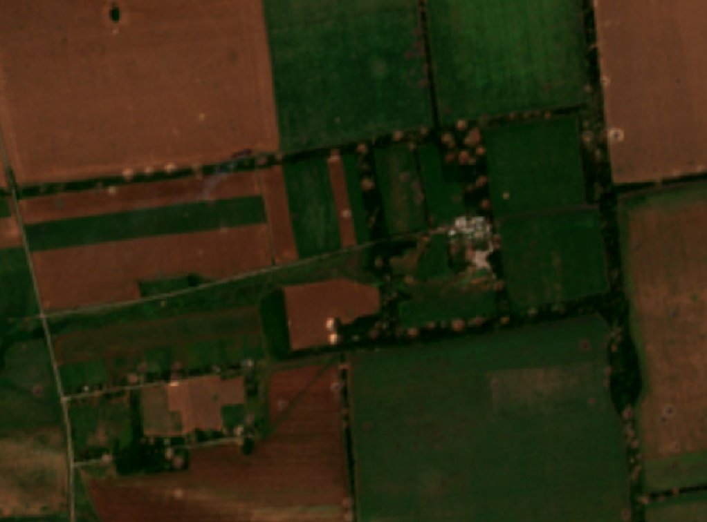
Here are some images from today to show how the construction is going and to see that we can see this very easily with satellite images.


Another area where there is some construction, the Oskil and Izium.
This is clearly a secondary area, mainly because the first line here is the Oskil river and it is largely enough to hold the future offensives.
This is clearly a secondary area, mainly because the first line here is the Oskil river and it is largely enough to hold the future offensives.
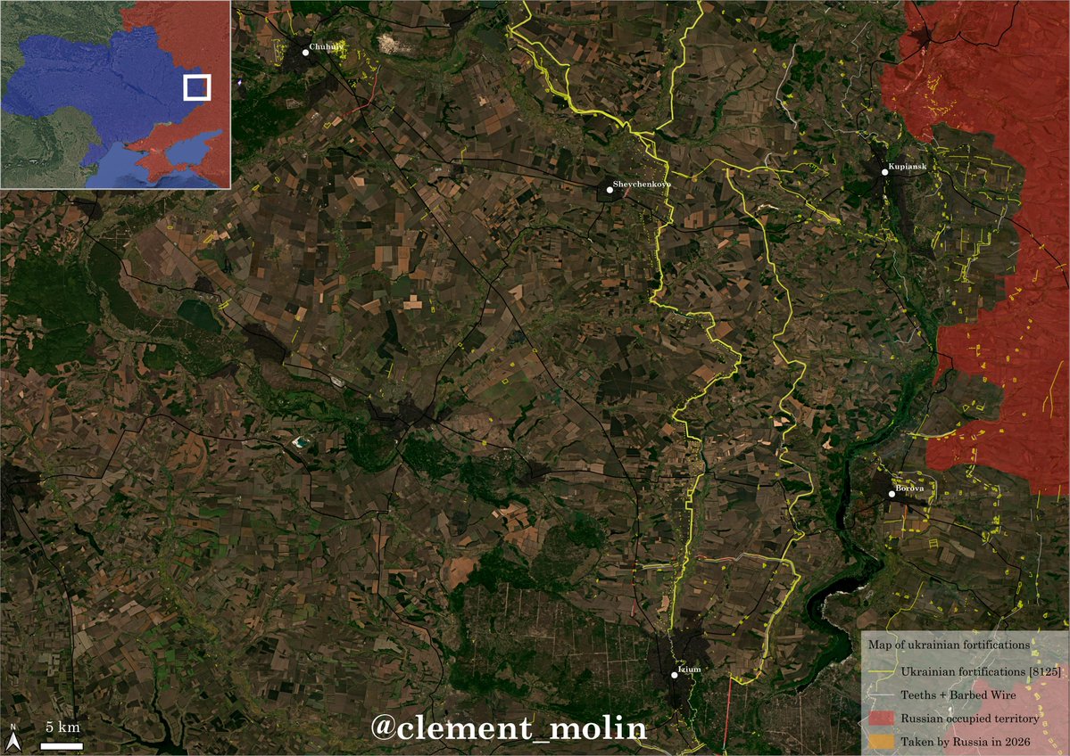
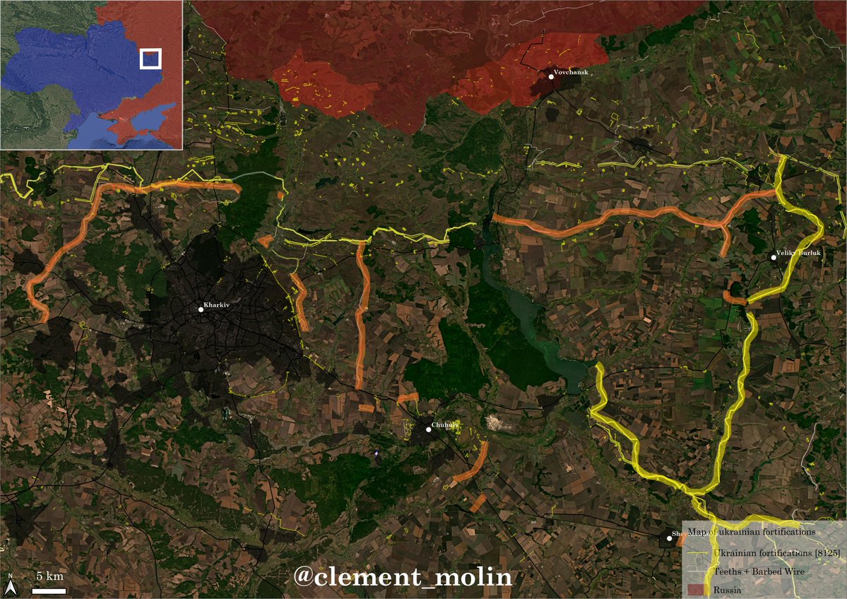
Furthur to the north, we can see new fortifications all around Kharkiv and east of the Donets river, around Veliky Burluk. A ring defensive line is also being prepared around Chuhuiv.
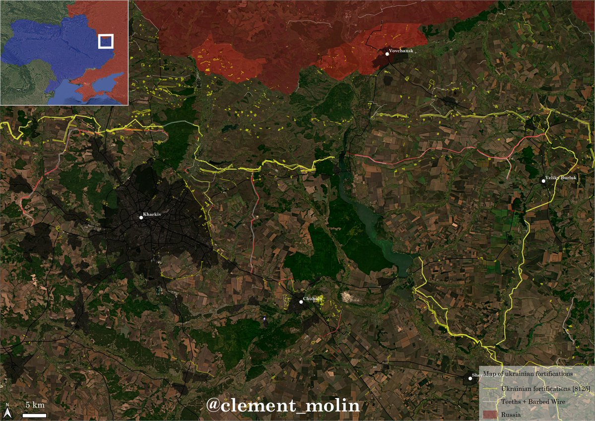
With the colors, we can see that the missing lines are being completed. This is highly secondary and not a priority.
In the northern regions, fortifications are also under preparation, mainly on a second line far from the border, as well as around Chernihiv.

To understand how deep the fortifications are going, this is Dnipro, more than 110km from the frontline.

Fortifications are a very important trend to follow if you want to understand both the defensive dynamic of Ukraine and the offensive dynamic of Russia.
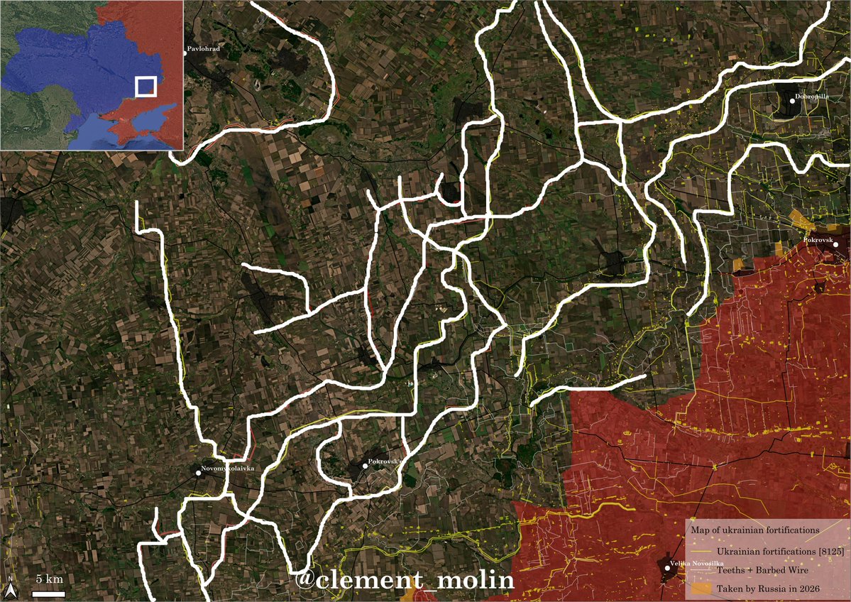
Here is white are the main cities and towns, all surrounded by defenses.
Here is white are the main cities and towns, all surrounded by defenses.

Thanks for following this thread. I will probably try to map again the russian airstrikes, since we can see them again.
I will probably start with march this year since an intense preparation started.
I will probably start with march this year since an intense preparation started.

I finish by sharing this good new tool that is very useful.
Thank you all !
Thank you all !
https://x.com/M0nstas/status/2036180399252996114?s=20
• • •
Missing some Tweet in this thread? You can try to
force a refresh