100 km of kill zone, let's dive inside one of Ukraine's 🇺🇦 best defensive line
The Verkhnya Tersa line -with only 18 crossing over 100km- is one of the strongest and best prepared fortified line in Ukraine. Here is a detailed analysis :
🧵THREAD🧵1/18⬇️
The Verkhnya Tersa line -with only 18 crossing over 100km- is one of the strongest and best prepared fortified line in Ukraine. Here is a detailed analysis :
🧵THREAD🧵1/18⬇️

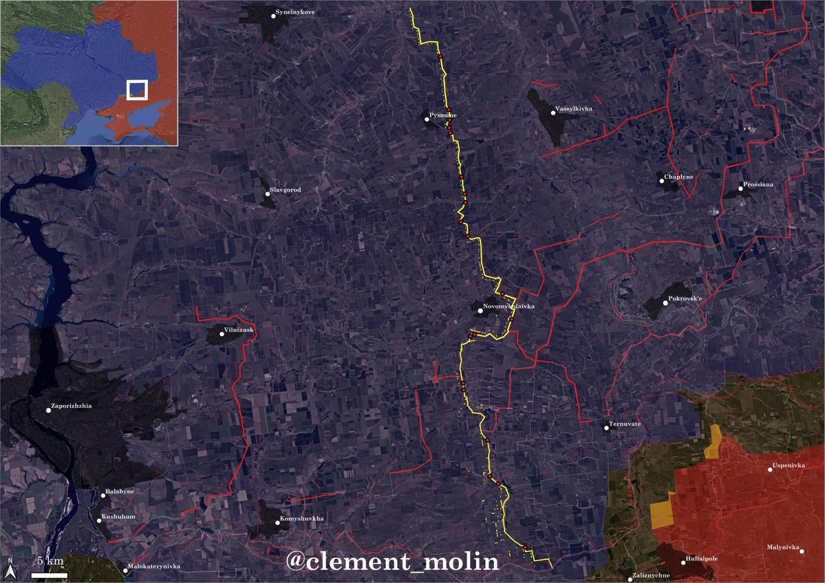
First "New Donbas Line" style prepared in the Zaporizhzhia and Dnipropetrovsk region, this line is covered north of Novomykolaivka by 3 other lines, while only one before Novomykolaivka.
South of it, this line is the first defensive line, only protected by older line and barbed wire.
South of it, this line is the first defensive line, only protected by older line and barbed wire.
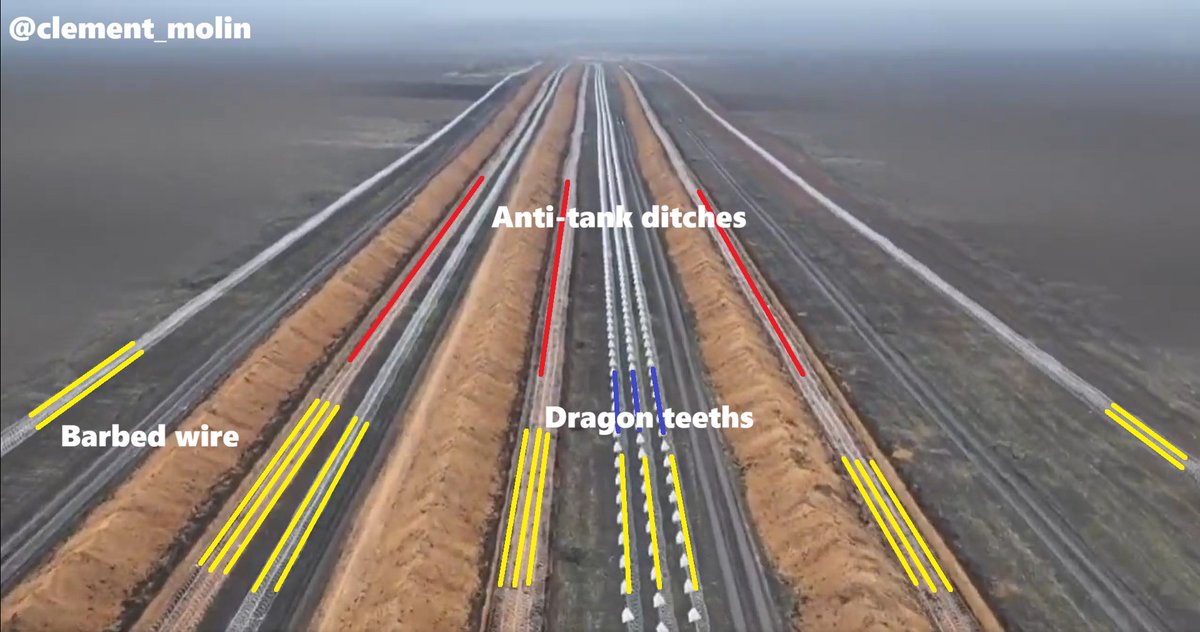
Here is a video from few months ago of the central part of this line, the one protecting Novomykolaivka.
This area of around 25 km is the most ready on the 100 km of that particular line. North of Novomykolaivka, barbed wire has not been installed, the frontline is too far.
This area of around 25 km is the most ready on the 100 km of that particular line. North of Novomykolaivka, barbed wire has not been installed, the frontline is too far.
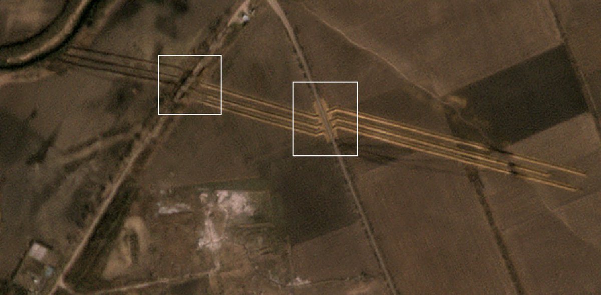
As you can see, there are 18 rows of barbed wire on 6 different lines, including 3 at the bottom of anti-tank ditches and one on top of draon teeths.
There are as well three anti-tank ditches and anti-vehicle obstacles, the dragon teeths.
This is an obtsacle line.
There are as well three anti-tank ditches and anti-vehicle obstacles, the dragon teeths.
This is an obtsacle line.
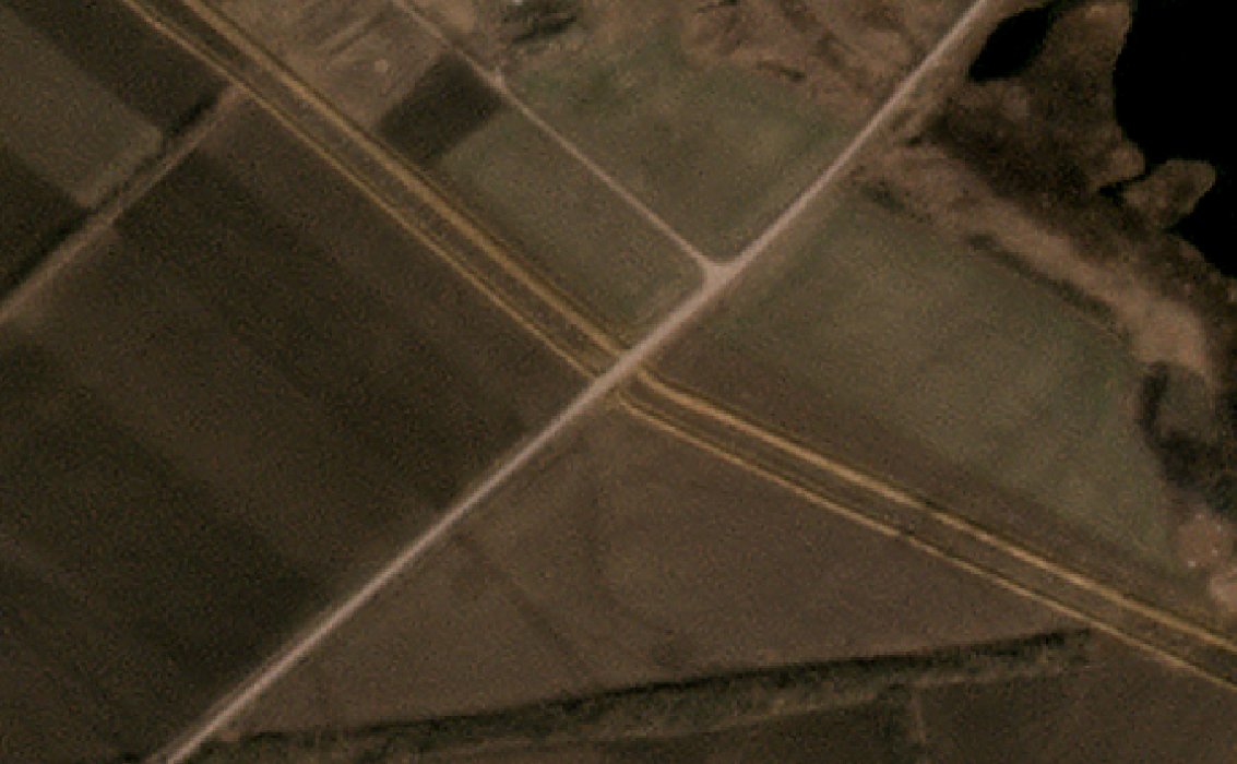
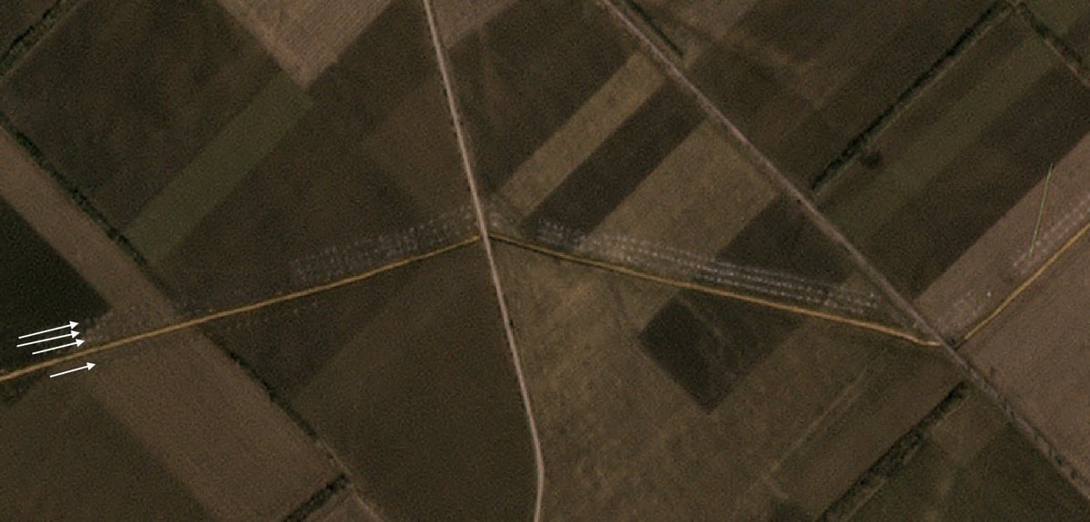
Here is a closer view of a road, which is let open to allow logistics.
If the line is a problem for Russia, it can quickly become one for Ukraine as well, making any movement more difficult. We could see Ukraine forced to breach its one lines...
If the line is a problem for Russia, it can quickly become one for Ukraine as well, making any movement more difficult. We could see Ukraine forced to breach its one lines...
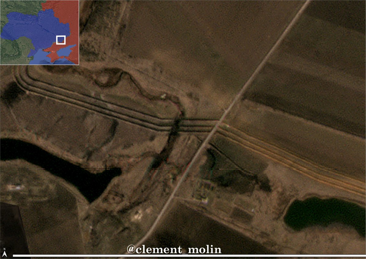
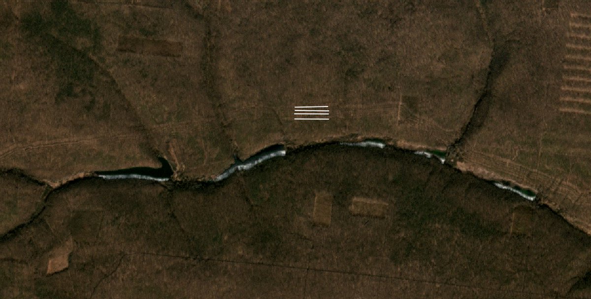
The revolution of these new lines are that they even cover forest, ponds and rivers. No more holes are let behind, except the prepared ones.
In total, 18 roads for 100 km is one every 5.5 km, but if we take only the part of the line south of Novomykolaivka, it's one every 6.6 km
In total, 18 roads for 100 km is one every 5.5 km, but if we take only the part of the line south of Novomykolaivka, it's one every 6.6 km
With a 90° rotation, we can see how this line is meant to secure a large countryside area. Just behind are lying more than 170 small hidden positions for soldiers and drone teams.

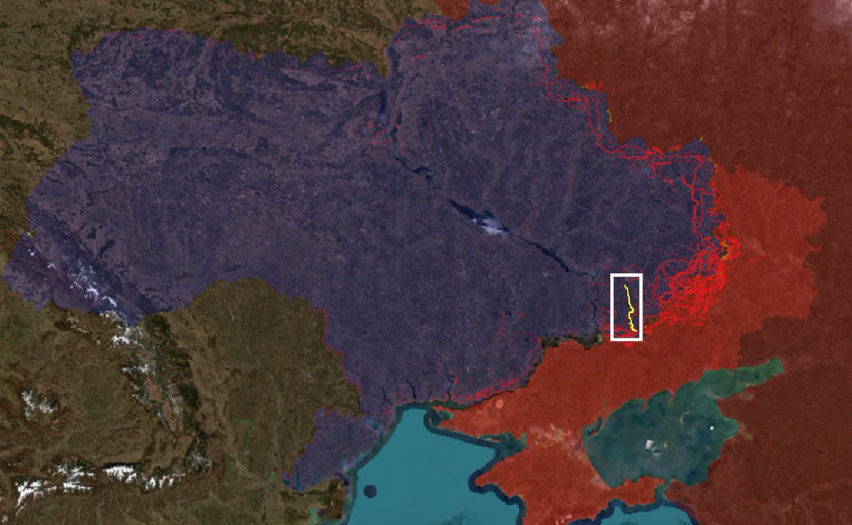
To understand the scale of the line, here is where it is in Ukraine. This line is not even the longest continous one. For example, a line going from Ternuvate to Sloviansk is 250 km long !
Ones under construction could be even longer.
Ones under construction could be even longer.
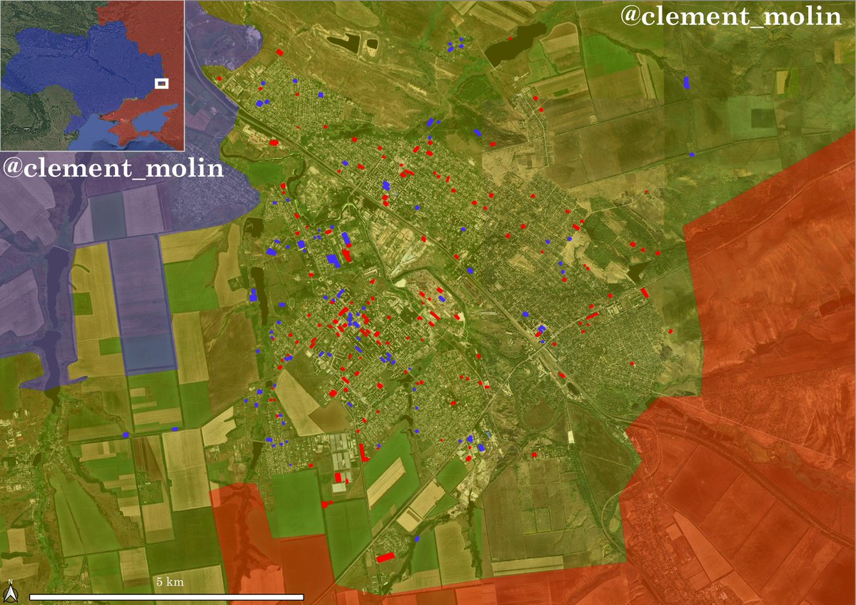
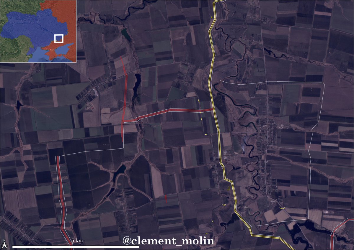
Here is a closer view of the weaker part of the line. South of Novomykolaivka, Ukraine switches from 3 to 2 anti-tank ditches (they are doing this when they don't have the time to dig a full line).
You can see a new line under construction west and few barbed wires.
You can see a new line under construction west and few barbed wires.
Russia will be forced to push into open terrain with a lot of barbed wire. All this area will be under ukrainien fire control, which will be safe from infiltrations and attacks behind their lines.
These fields will create high attrition for russians that will struggle to push.
These fields will create high attrition for russians that will struggle to push.

This strategy is being prepared everywhere with 3 to 6 lines !
Overall, we can see a grid being formed as I already talked about it in the past.
Overall, we can see a grid being formed as I already talked about it in the past.

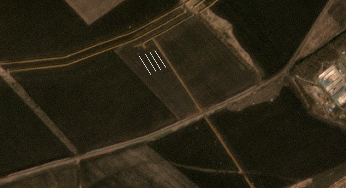
Let's get back to more recent images. Everyday that passes is an occasion to better the defenses. Ukrainian counter-attacks near Pokrovsk'e allowed the placement of 4 rows of barded wire which are roughly 100 meter large !
This was made to fill the holes in the lone ditch line.
This was made to fill the holes in the lone ditch line.
Here too, we can see multiple rows of barbed wire being placed, both around a line that is under construction and also in the middle of fields.

To cover the roads, the ukrainians are now also digging a small corridor of around 100 meter along key roads, which will complicate the crossing of these roads.
In the north, Ukraine is now adopting 4 lines of barbed wire + 3 lines of ditches. This will be extremely deadly to cross.
The last things : positions. The ukrainian forces are preparing small trenches that will be hidden in summer.
These are bunkers to hide infantry/drone teams... Other positions are everywhere as well.
These are bunkers to hide infantry/drone teams... Other positions are everywhere as well.

Thanks for following this analysis on a particular sector of the defensive lines.
This line is interesting because it's finished, continuous and well built. If you want, I can do same for other lines, just tell me which ones !
This line is interesting because it's finished, continuous and well built. If you want, I can do same for other lines, just tell me which ones !

For the ones that are still saying that I'm helping Russia :
-I'm doing this in an analytical way, to understand where Russia will attack and Ukraine defend
-Ukrainian forces will need to know where are the safe roads, I can help them
-Russian forces are losing hundred of recon drones above these areas everyday, they know everything
-These are public images, accessible by everyone
-I'm doing same for Russia, but they are not digging any big line
-Russian bloggers are already doing their own maps, example : opor_2014
• • •
Missing some Tweet in this thread? You can try to
force a refresh