Daily Ukraine map thread for Monday 20th April 2026
Ukraine deep strikes into the occupied territories continue to wreak havoc, with logistics points hit across the back line and no sign of it slowing down.
Prymary drones struck two landing ships in Sevastopol - notably NOT Fire Point drones.
Tuapse was struck further, causing massive smoke clouds across the area. It appears to be burning at multiple points, but as always, we'll wait for the full damage assessment - right now we estimate approximately 8 storage tanks have gone up, so there's plenty more to hit.

2/ Many storage tanks on fire following an extensive attack by Ukraine on the oil depot in Tuapse, Russia. POV
Coordinates: 44.109422, 39.080685
Source:
Coordinates: 44.109422, 39.080685
Source:
https://x.com/Grimm_Intel/status/2046055763857002533
3/ Ropucha class landing ship Yamal and Tapir class landing ship Nikolai Filchenkov was hit by Ukrainian Prymary drones in Sevastopol
Coordinates: 44.620655, 33.576496
Source:
Coordinates: 44.620655, 33.576496
Source:
https://x.com/99Dominik_/status/2046115656098107667
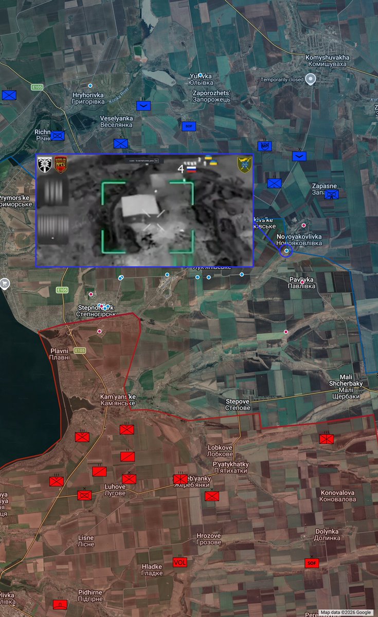
4/ 154th Mechanized Brigade hits a Russian-held dugout with a Fibre Optic FPV Drone south-west of Zaliznychne date: 10/04/26
Coordinates: 47.625621, 36.121429
Source:
Coordinates: 47.625621, 36.121429
Source:
https://x.com/AudaxonX/status/2046167027782455745
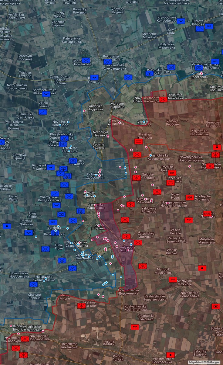
5/ UA 225th Assault Regiment destroys RU armoured vehicle in Hulyaipole, Zaporizhia Region, Ukraine. We truly don't know what vehicle this is. It is later hit by HIMARS
Coordinates: 47.642830, 36.303380
Source:
Coordinates: 47.642830, 36.303380
Source:
https://x.com/meowqai/status/2046169945952727290
6/ 225th Assault Regiment film HIMARS strike on Russian building with vehicles inside in Hulyaipole
Coordinates: 47.640956, 36.303443
Source:
Coordinates: 47.640956, 36.303443
Source:
https://x.com/MaxximOSINT/status/2046177807345099175
7/ Burnt storage tanks x 4 at Tikhorets oil depot after strikes in March 2026
Coordinates: 45.84427, 40.18001
Source:
Coordinates: 45.84427, 40.18001
Source:
https://x.com/UAControlMap/status/2046223153601335478
8/ A vehicle reported as radar of Russian S-350 Vityaz air defense system is hit with a drone by the 414th UAS brigade near Novooleksandrivka.
Coordinates: 47.384288, 38.270493
Source:
Coordinates: 47.384288, 38.270493
Source:
https://x.com/blinzka/status/2046174642922995831
9/ RU 85th Motor Rifle Brigade hit UA position east of Rai-Oleksandrivka.
Coordinates: 48.814877, 37.888432
Source:
Coordinates: 48.814877, 37.888432
Source:
https://x.com/richardzai38580/status/2046173770612875745
10/ RU 37th Motor Rifle Regiment hits UA Positions in School no.2 in Lyman
Coordinates: 48.977199, 37.827796
Source:
Coordinates: 48.977199, 37.827796
Source:
https://x.com/ne_kotletka/status/2046201655947866601
11/ A Ukrainian drone struck the alleged base of Russian drone operators in Pryshyb, Zaporizhia, 422nd Luftwaffe
Coordinates: 47.259073, 35.324282
Source:
Coordinates: 47.259073, 35.324282
Source:
https://x.com/99Dominik_/status/2046208665162490107
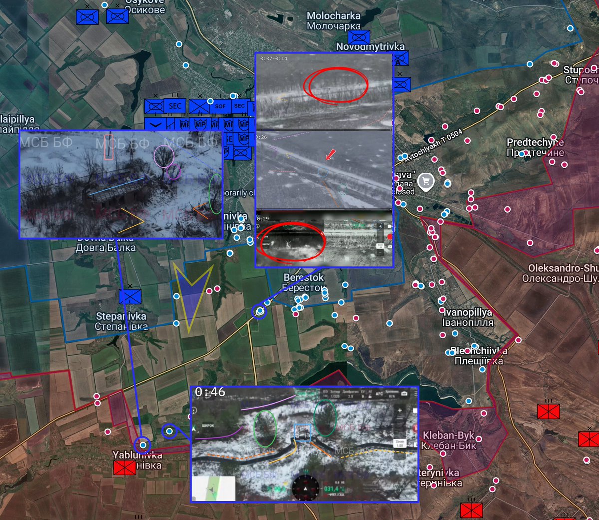
12/ Russian soldier split in half like Bishop from Aliens by a drone while trying to capture Verkhnya Tersa, Zaporizhzhia Oblast
Coordinates: 47.685840, 36.085179
Source:
Coordinates: 47.685840, 36.085179
Source:
https://x.com/Bielitzling/status/2046230977173659995
13/ 34th Marine Brigade intercepts Molniya-2 near Kherson (thread of interceptions)
Coordinates: 46.618199, 32.552524
Source:
Coordinates: 46.618199, 32.552524
Source:
https://x.com/MikiValbuena/status/2046235158789988461
14/ 56th Motorized brigade shell Russian motorcycle assault near Chasiv Yar. The IFV destroyed there a few days ago is visible
Coordinates: 48.608600, 37.854600
Source:
Coordinates: 48.608600, 37.854600
Source:
https://x.com/moklasen/status/2046236907303063577
15/ Ukrainian SSO deepstrikes Russian warehouse across the occupied territories with Firepoint drones
Coordinates: 47.202969, 37.300828
Source:
Coordinates: 47.202969, 37.300828
Source:
https://x.com/MaxximOSINT/status/2046253123669229695
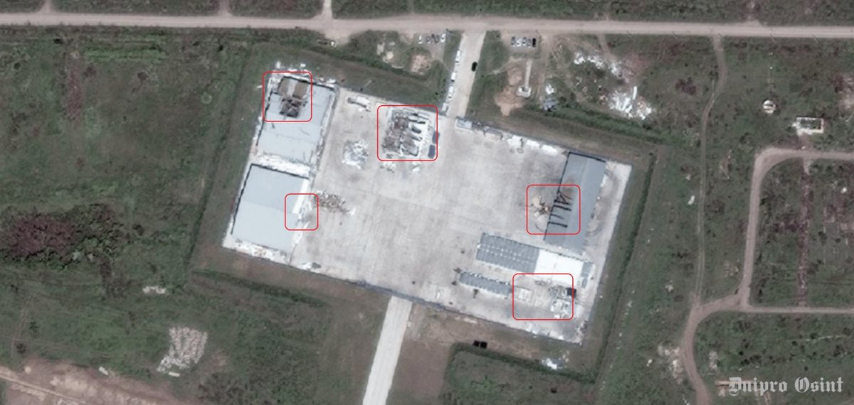
16/ A Russian base was destroyed by Ukrainian SSO drones in Terpinnya, Zaporizhia Oblast, Ukraine
Coordinates: 47.014732, 35.435373
Source:
Coordinates: 47.014732, 35.435373
Source:
https://x.com/99Dominik_/status/2046258283669795088
• • •
Missing some Tweet in this thread? You can try to
force a refresh