
https://t.co/90GX4OdiFW showing geolocations, frontlines, and unit positions. DM for contact / media.

 2/ Ukrainian 40th Marine brigade shows Russian infantry hit trying to cross the Vovcha river over the destroyed Pontoon near Yalta
 2/ Russian shelling against buildings in Stepnohirsk, Zaporizhzhia Oblast
 2/ Ukrainian 3rd SSO Regiment Hornet drone strikes van with soldiers near Yakymivka, Zaporizhia Oblast, Ukraine
 2/ A Russian BM-21 Grad was destroyed by Ukrainian 42nd Mech FPV drone near Sribne, Donetsk Oblast, Ukraine
 2/ Powerful detonation of Russian vehicle carrying soldiers (and presumed ammo) after FPV drone strike. Siversk, Donetsk Oblast, Ukraine
 2/ Compilation of the RU 1472nd Regiment (68th Army Corps) trying to stop Ukrainian advances in West Donetsk.
 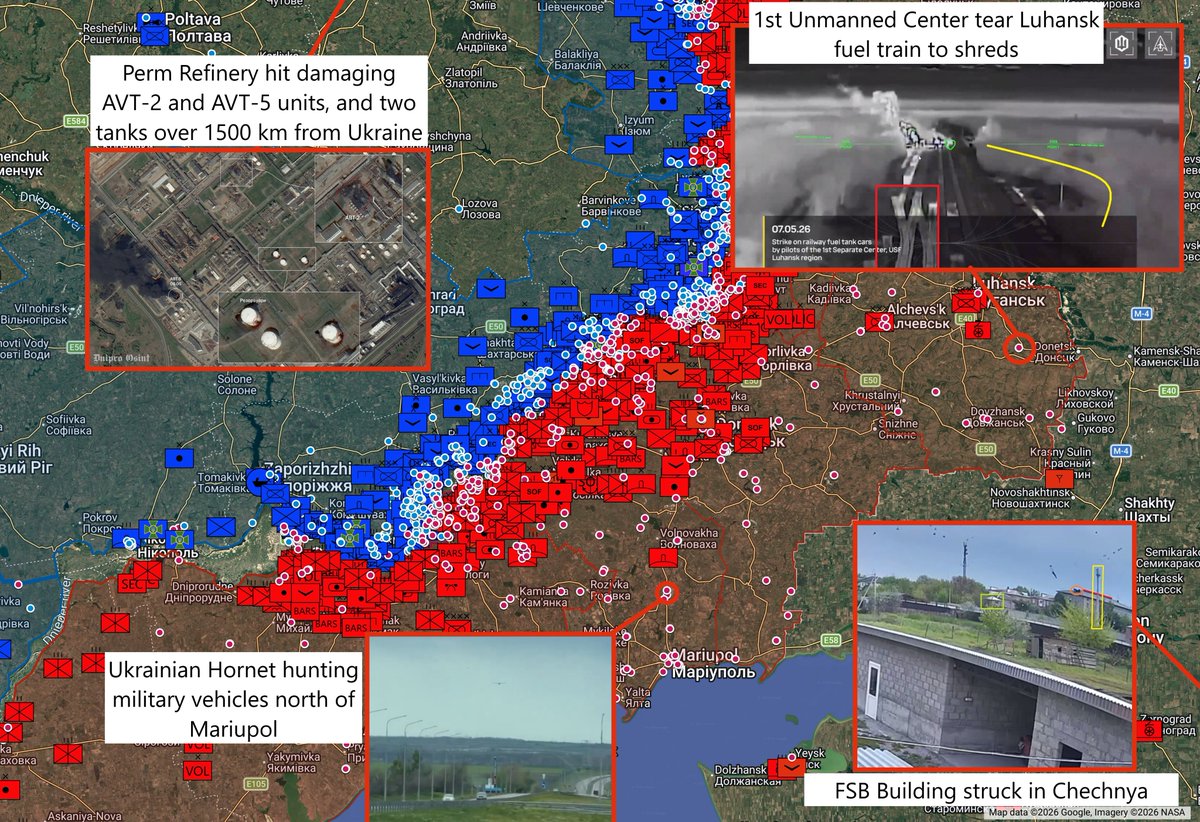 2/ A train with fuel tankers is hit with drones by the 1st unmanned systems center of Ukraine near Novosimeikyne, Luhansk.
 2/ The SBUs Ivan Franko Group hits Russian truck near Pisky, and other mid range strikes
 2/ High res of destruction at Orion UAV hangars in Kirovske airfield, Crimea
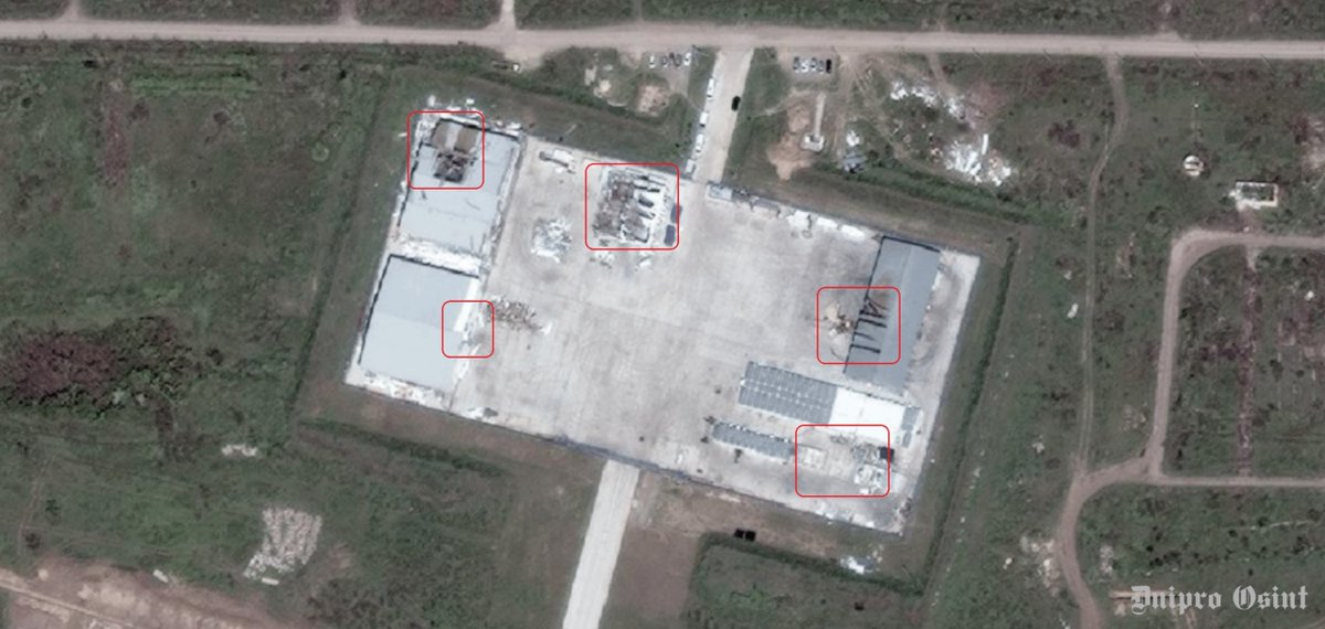
 2/ Many storage tanks on fire following an extensive attack by Ukraine on the oil depot in Tuapse, Russia. POV
 2/ 110th Mech troop rotation east of Ternuvate. As so many of us have pointed out, Russia is deep into lying out their cornhole about the situation here
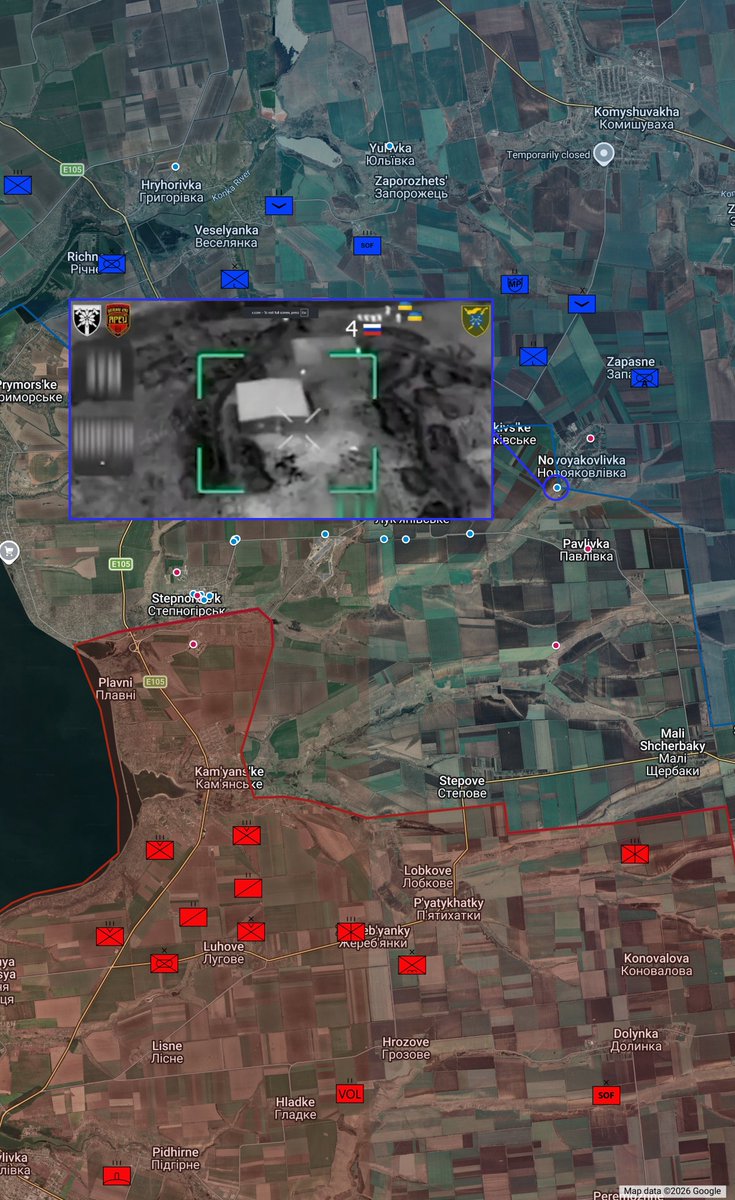 2/ "Hart" brigade of the border patrol soldiers clearing a basement in Nesterne, Kharkiv oblast. The RU soldier refused to surrender and was killed by an FPV-drone.
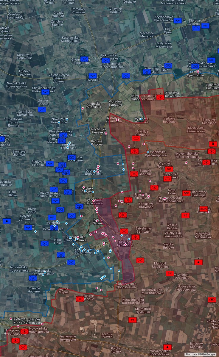 2/ F-16 decoy at Kanatove Air Base hit by BM-35 drone
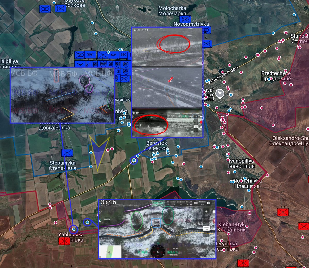 2/ Russian forces attacked a Ukrainian dugout east of Dobropillia, Zaporizhzhia oblast with multiple FPV drones and drone dropped grenades, showing a Ukrainian advance.
 2/ 79th Air Assault troops detonate Russian occupied building in Pokrovsk
 2/ 156th Mechanized Brigade hits a presumed Russian-held dugout with a Queen Hornet Dive Bomber drop south of Berestok
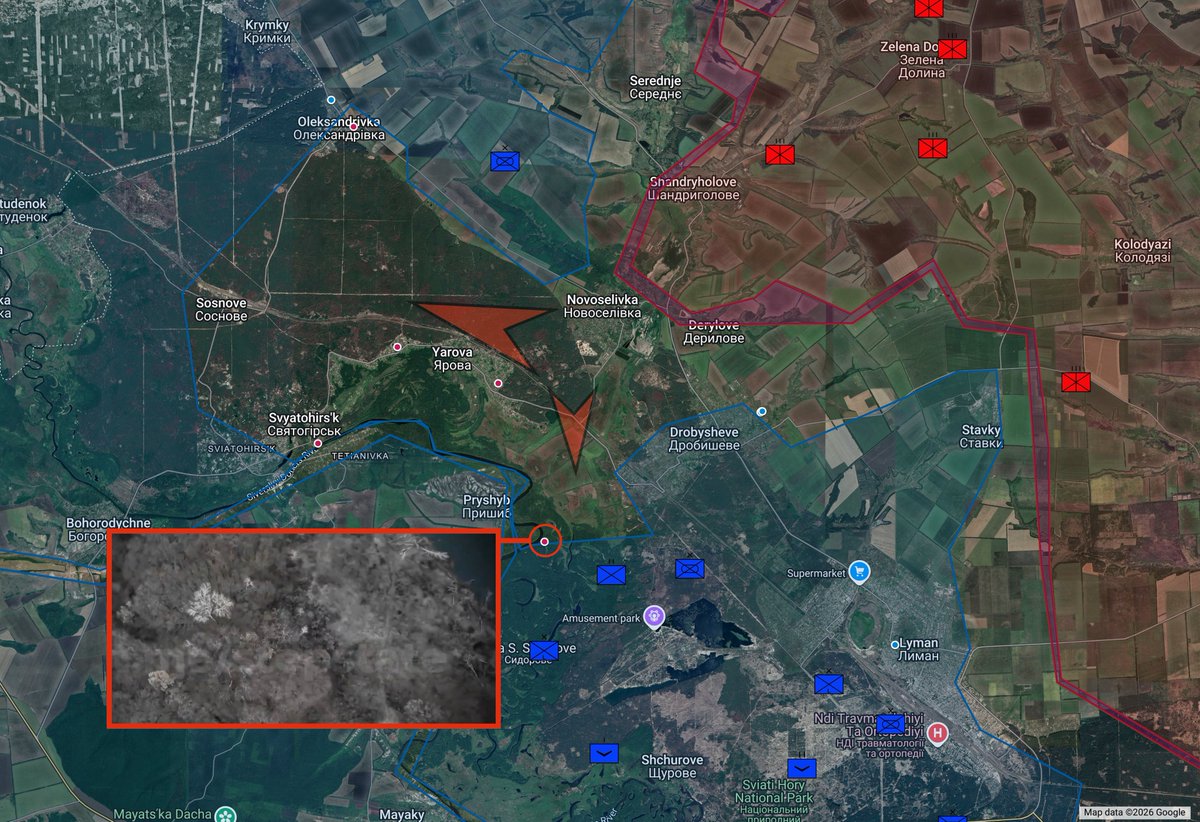 2/ Ukrainian drone drop hits Russian infantry east of Pryshyb, Lyman direction
 2/ PoV of Salyut aircraft factory on fire in Moscow
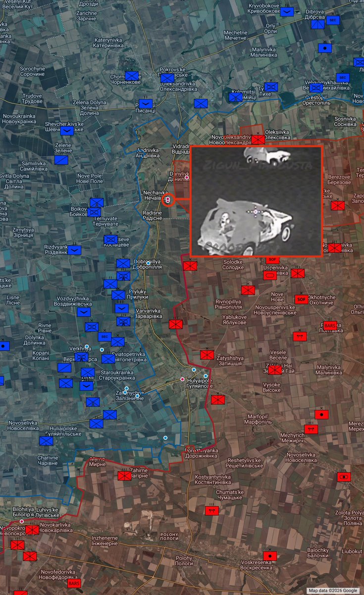 2/ Repeated strikes on JSC Energiya plant in Yelets
 2/ In 2025, the war was firmly settled into attritional drone warfare, where Russia decided that they'd save their few remaining vehicles and attempt to advance with manpower, taking and accepting the resultant trade off in personnel casualties.


 2/ Russian shadow fleet oil tanker Dashan on the way to a Russian port was hit by Group 13 USVs and disabled (Rough location via AIS)