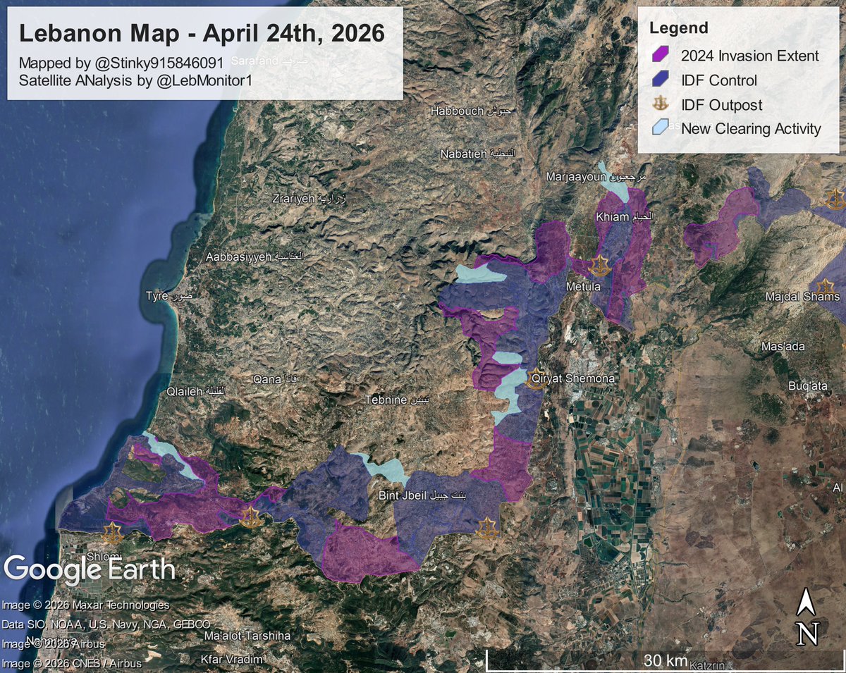
🧵Lebanon Update 4.24.26
Summary:
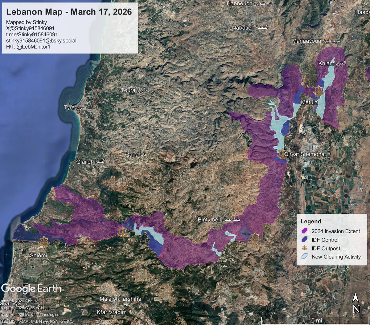
- IDF Raids Dibbine / North Marjaayoun
- Demolition Activity in Houla and Bint Jibel
- IDF Enters At Tiri
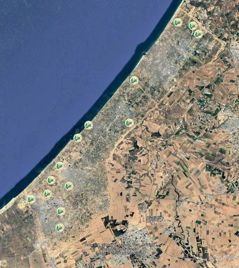
- Clearing Activity along the coast
Map Link: google.com/maps/d/u/0/emb…
H/T: @LebMonitor1
Satellite Imagery: @SoarAtlas
More Info Below⏬ x.com/Stinky91584609…
Summary:
- IDF Raids Dibbine / North Marjaayoun
- Demolition Activity in Houla and Bint Jibel
- IDF Enters At Tiri
- Clearing Activity along the coast
Map Link: google.com/maps/d/u/0/emb…
H/T: @LebMonitor1
Satellite Imagery: @SoarAtlas
More Info Below⏬ x.com/Stinky91584609…
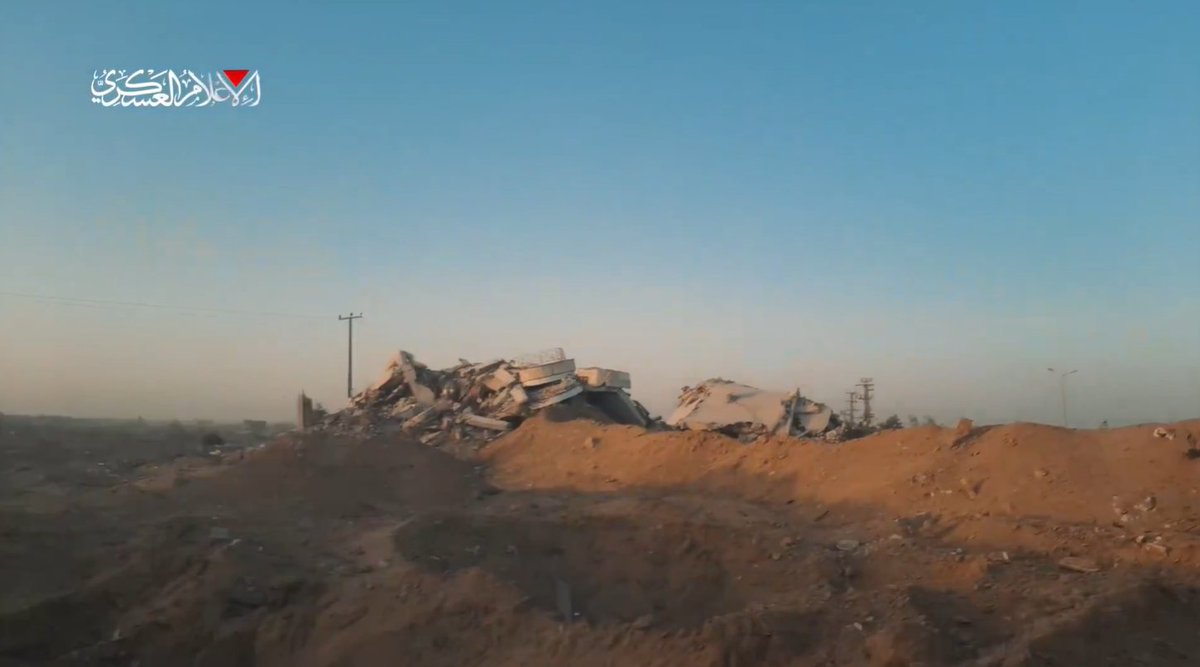
Sentinel-2 images confirm that the IDF conducted a raid on the village of Dibbine just before the ceasefire.
It is highly likely that they withdrew from the area now that the ceasefire came into effect, however it is still unclear.
It is highly likely that they withdrew from the area now that the ceasefire came into effect, however it is still unclear.

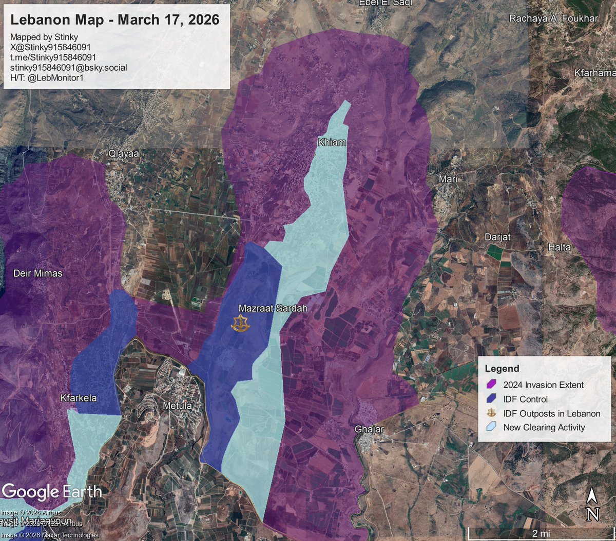
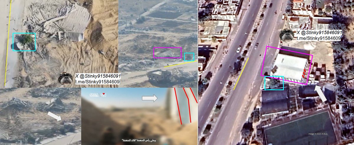
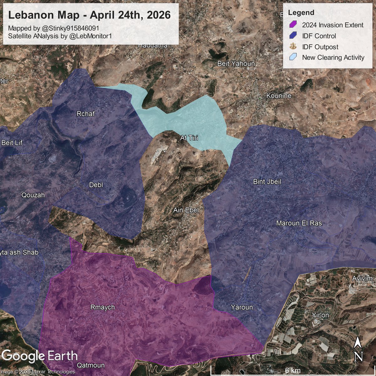
The IDF entered At-Tayri for the first time, with demolition activity visible on S2.
Looking east, a large expansion of demolition ops is clear in in the city of Bint Jibel, a former Hezbollah Stronghold.
Other clearing activity spotted in Hanine/Rchaf.
Looking east, a large expansion of demolition ops is clear in in the city of Bint Jibel, a former Hezbollah Stronghold.
Other clearing activity spotted in Hanine/Rchaf.
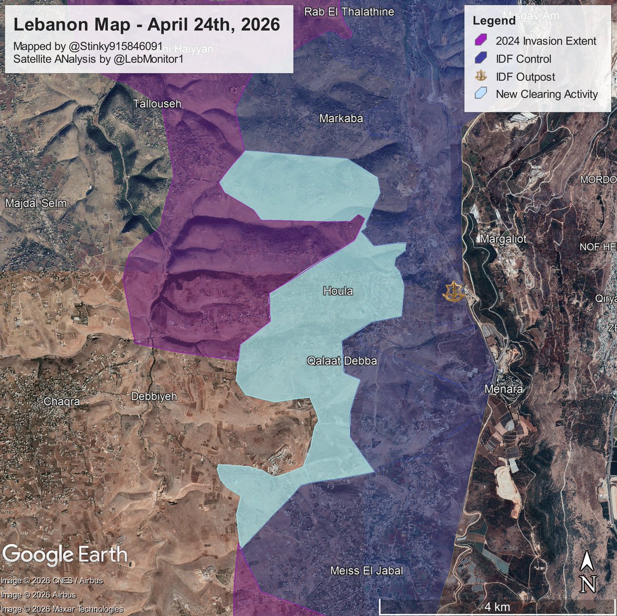
Along the eastern border, demolition operations continue in the Towns of Houla, Qalaat Debba, and Meiss El Jabal.
Looking at the gif (image 2), you can see the major step-up in demolition operations since the last update I made on this specific region.
Looking at the gif (image 2), you can see the major step-up in demolition operations since the last update I made on this specific region.
Along the coastal area, demolition operations continue, new destruction is seen in the southern edge of Mazraat Byout El Saiyad, as well as in the town of Chamaa, stopping before the UNIFIL Base.

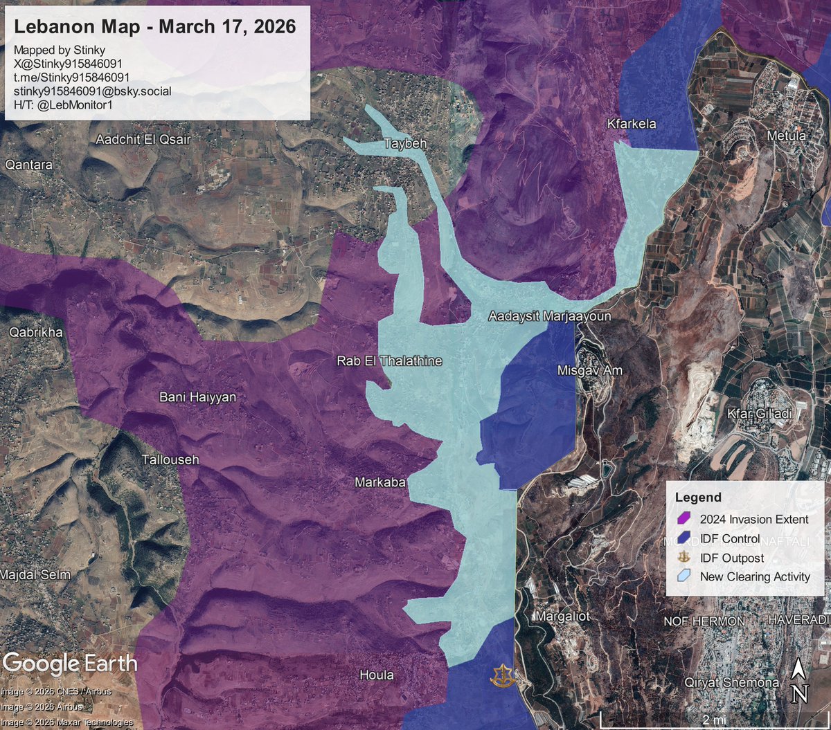
Lastly, in the Taybeh area, Sentinel-2 images show visible demolition operations in the towns o fDeir Seryan, and Aadchit El Qsair.
If you look at the gif (second image, marked by arrows), you can also see some clearing in the valley between the towns. Not sure what its for.
If you look at the gif (second image, marked by arrows), you can also see some clearing in the valley between the towns. Not sure what its for.

That concludes the update. Thank you for reading.
Questions, comments, concerns can either be made in the comments of the top post, or in DMs.
Feel Free to join the telegram, link: t.me/Stinky91584609…
Questions, comments, concerns can either be made in the comments of the top post, or in DMs.
Feel Free to join the telegram, link: t.me/Stinky91584609…
• • •
Missing some Tweet in this thread? You can try to
force a refresh