New: A Washington Post satellite imagery review reveals that Iran has caused far more damage to US military sites than previously reported.
Amid a US imagery blackout, Iran has released more than 100 images of strikes on US bases.
We analyzed them: washingtonpost.com/investigations…
Amid a US imagery blackout, Iran has released more than 100 images of strikes on US bases.
We analyzed them: washingtonpost.com/investigations…
Shortly after the war began, America's two largest satellite imagery providers, Planet and Vantor, bowed to government requests to withhold imagery of the region while the conflict continued.
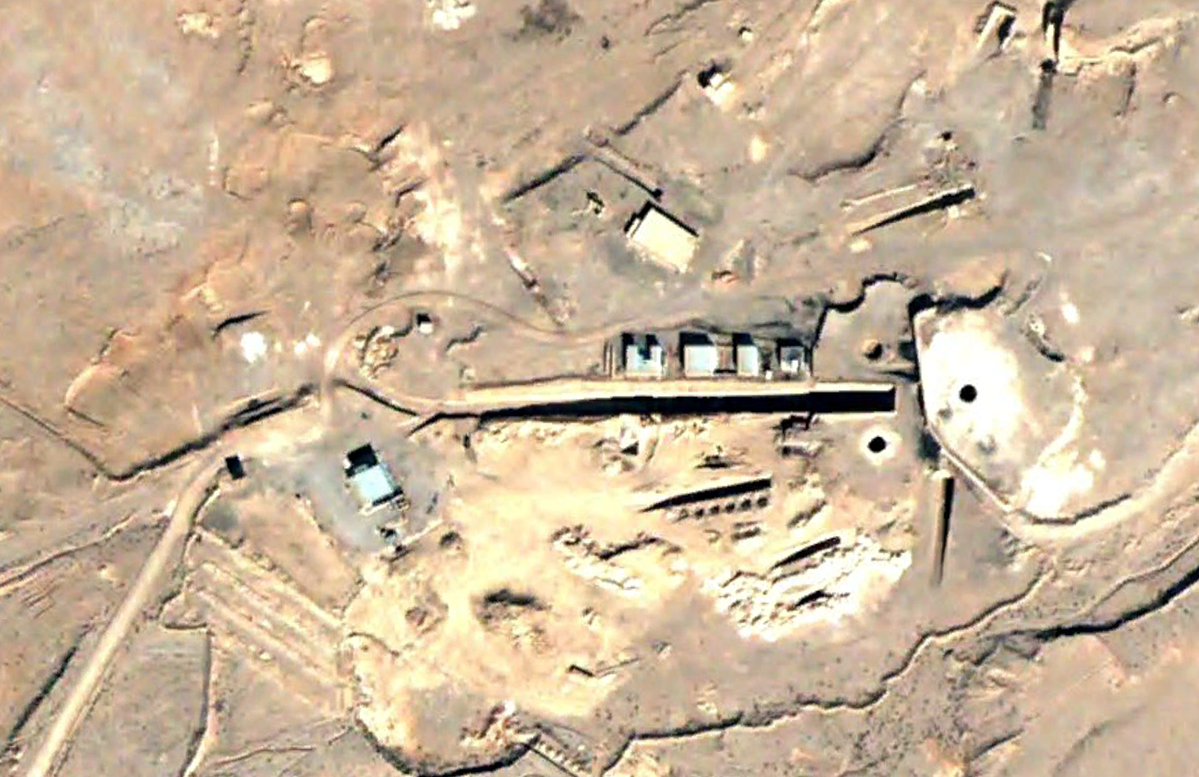
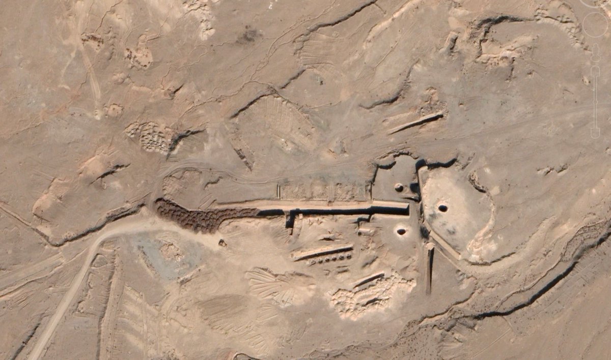
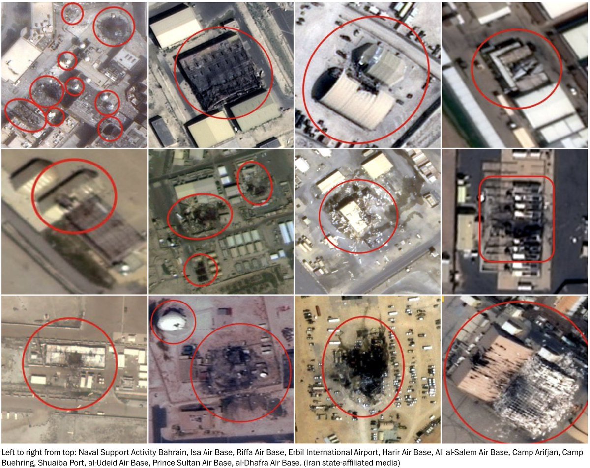
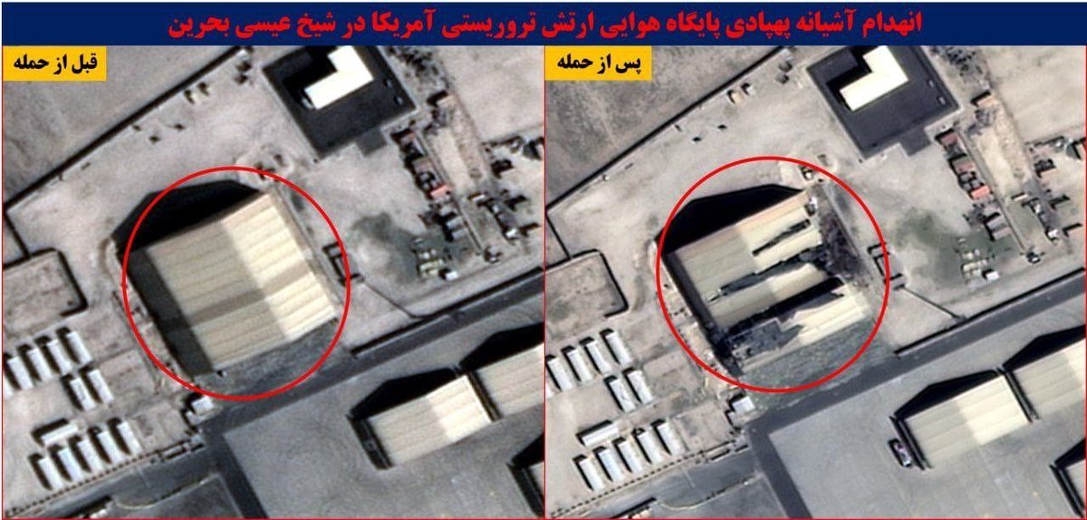
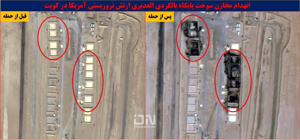
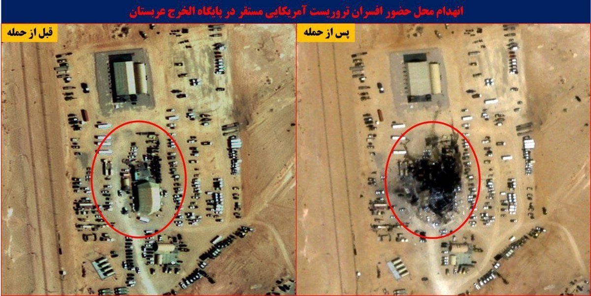
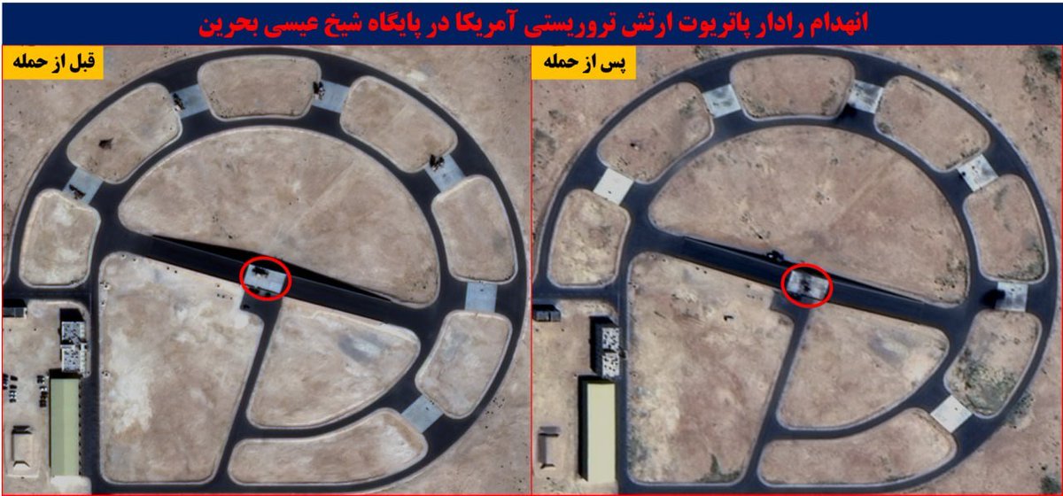
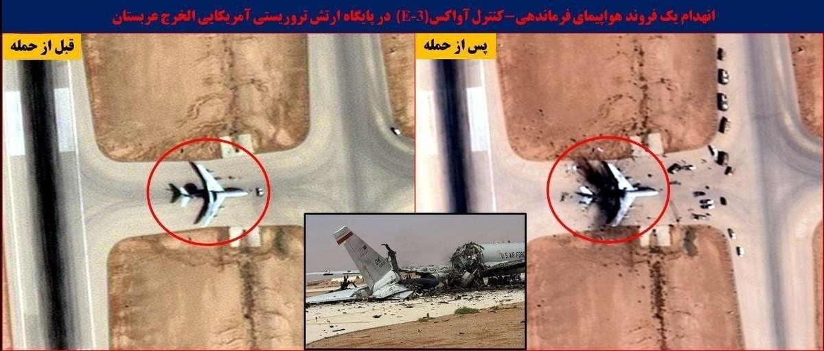
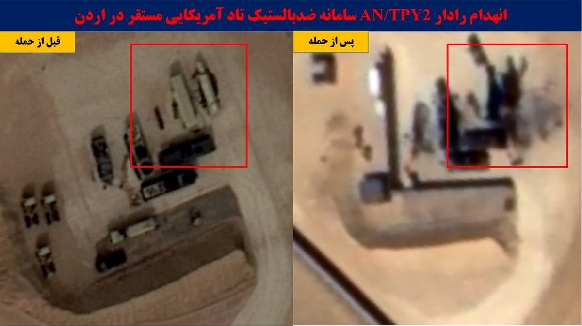
But Iranian state-affiliated media published scores of high-resolution images:
But Iranian state-affiliated media published scores of high-resolution images:
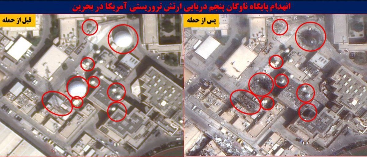

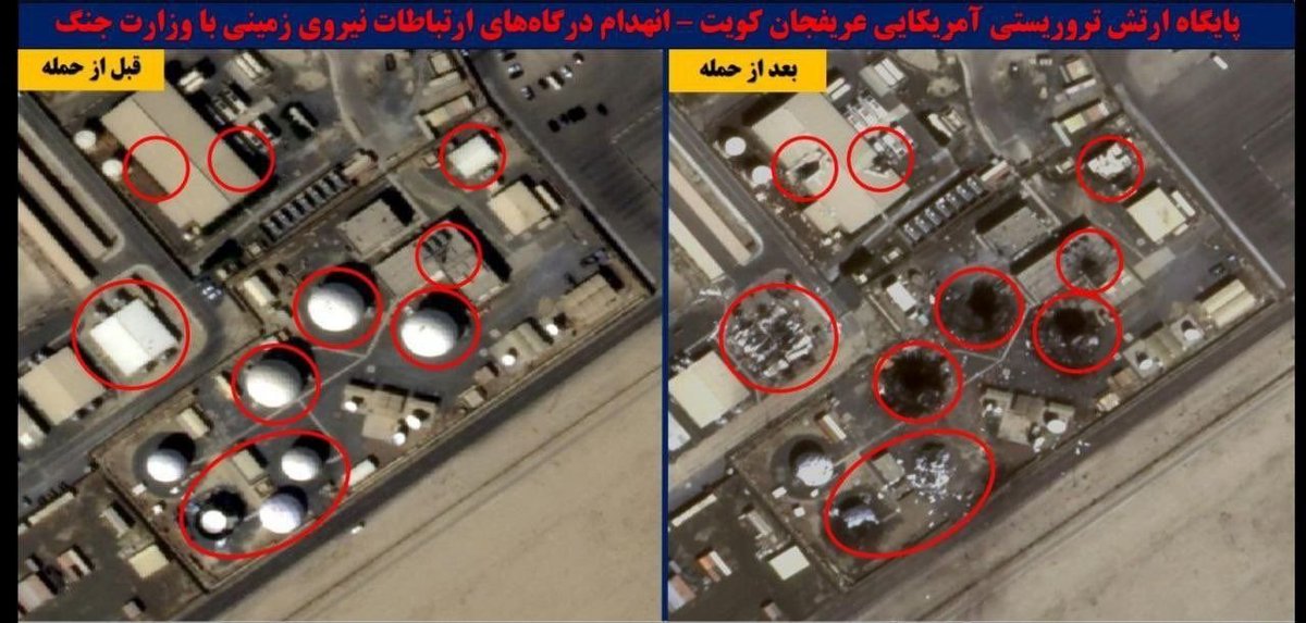

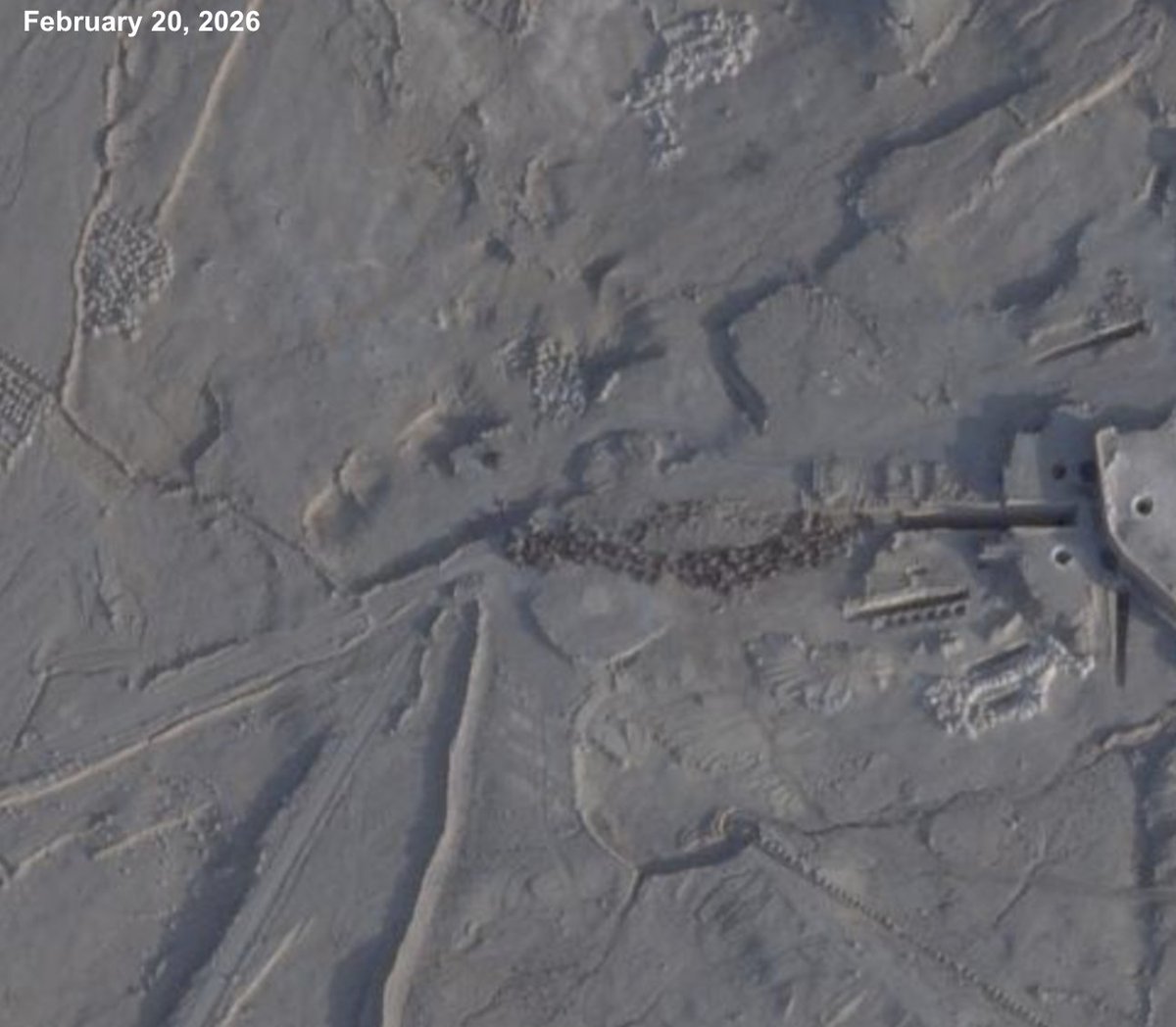
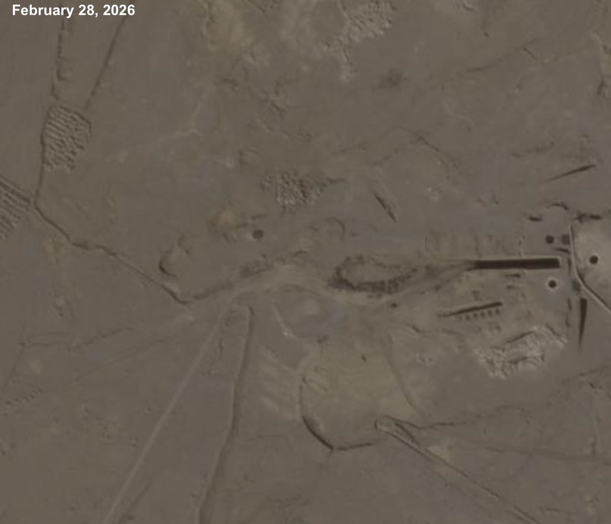
We accumulated 128 Iranian images, geolocated them, and compared them to open-source Sentinel-2 satellite imagery and Planet imagery when available, ultimately confirming 109 of the images. We found no evidence the Iranian images had been manipulated.

Per government requests, Planet isn't providing any images taken after March 8. But using the Iranian images, we scoured Planet's available imagery for discrete damage points.
Conservatively, we counted 217 damaged or destroyed structures across 15 US military sites.
Conservatively, we counted 217 damaged or destroyed structures across 15 US military sites.
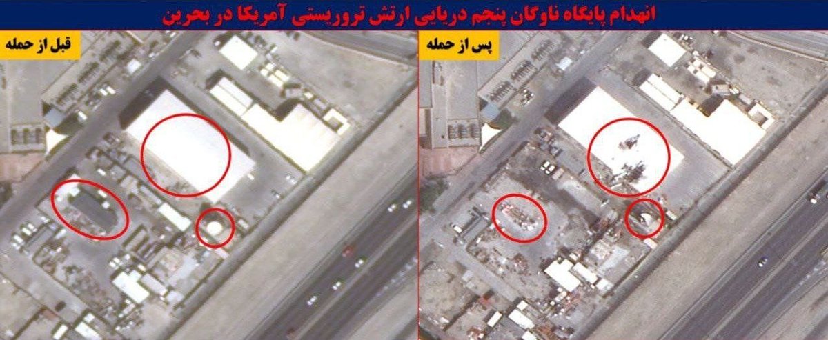

The structures included hangers, barracks, fuel bladders, and maintenance buildings:

The imagery also showed the damage or destruction of at least 11 pieces of equipment, including Patriot missile defense radars, satellite communications dishes, the E-3 Sentry aircraft, and the THAAD battery at Muwaffaq Salti Air Base:

Experts who reviewed The Post’s analysis said the damage at the sites suggested that the U.S. military had underestimated Iran’s targeting abilities, not adapted sufficiently to modern drone warfare and left some bases under-protected.
“The Iranian attacks were precise. There are no random craters indicating misses,” said @MarkCancian, a senior adviser with the Center for Strategic and International Studies, who reviewed the Iranian images at The Post’s request.
@ka_grieco told us that the apparent US strategy to destroy Iran’s missile and drone forces fast enough to prevent them from inflicting serious damage underestimated “the depth of Iran’s pre-positioned targeting intelligence on fixed U.S. infrastructure.” Instead, Iran was able to continually strike US sites for more than a month.
Most US forces had left endangered bases by early in the war, officials said, and experts noted that the military may have let some Iranian strikes land if they were going to hit unimportant sites.
@Justin_Br0nk told us that U.S. and allied air defenses had done an impressive job intercepting attacks, but “at an enormous cost in terms of surface-to-air missile interceptors and air-to-air missiles.”
A @CSIS estimate says the military used at least 190 THAAD interceptors and 1,060 Patriot interceptors between Feb. 28 and April 8, representing 53 percent and 43 percent of their prewar inventories, respectively.
Many strikes appeared to be precise and reflected a comparatively new ability to penetrate air defenses.
“While [drones] have small payloads — some of these did not do that much damage — they are more difficult to intercept and much more accurate, making them a much bigger threat to U.S. forces,” said Decker Eveleth, an associate research analyst at the Center for Naval Analyses.
“While [drones] have small payloads — some of these did not do that much damage — they are more difficult to intercept and much more accurate, making them a much bigger threat to U.S. forces,” said Decker Eveleth, an associate research analyst at the Center for Naval Analyses.

Damage from Iranian strikes will force planners to consider new tradeoffs involved in putting troops in harms way, said Max Bremer of the Stimson Center.
Two officials said U.S. forces may never return to regional bases in large numbers, though no final decision has been made.
Two officials said U.S. forces may never return to regional bases in large numbers, though no final decision has been made.
To report this story, The Post sent Iranian and comparison imagery to @sam_lair and Will Goodhind of @ContestedG, who checked and analyzed them. I'm very grateful for their generosity with their time. Other experts reviewed the images to offer their comments.
Also important to acknowledge the ongoing work open source researchers online are doing aggregating and looking into this Iranian imagery; @EGYOSINT in particular. This is a good thread
https://x.com/EGYOSINT/status/2052083707859595435
Gift link to our reporting: wapo.st/4w8pfDL
Thank you to @ka_grieco, @MarkCancian, @dex_eve, @sam_lair, Max Bremer and @ContestedG for offering their expertise for this article.
Reported by myself, @osviz_jarrett, @DanLamothe, @AlexHortonTX and @TaraCopp. Edited by @ElyseSamuels, @ericrich, @adegrandpre & @nadineajaka.
Reported by myself, @osviz_jarrett, @DanLamothe, @AlexHortonTX and @TaraCopp. Edited by @ElyseSamuels, @ericrich, @adegrandpre & @nadineajaka.
• • •
Missing some Tweet in this thread? You can try to
force a refresh