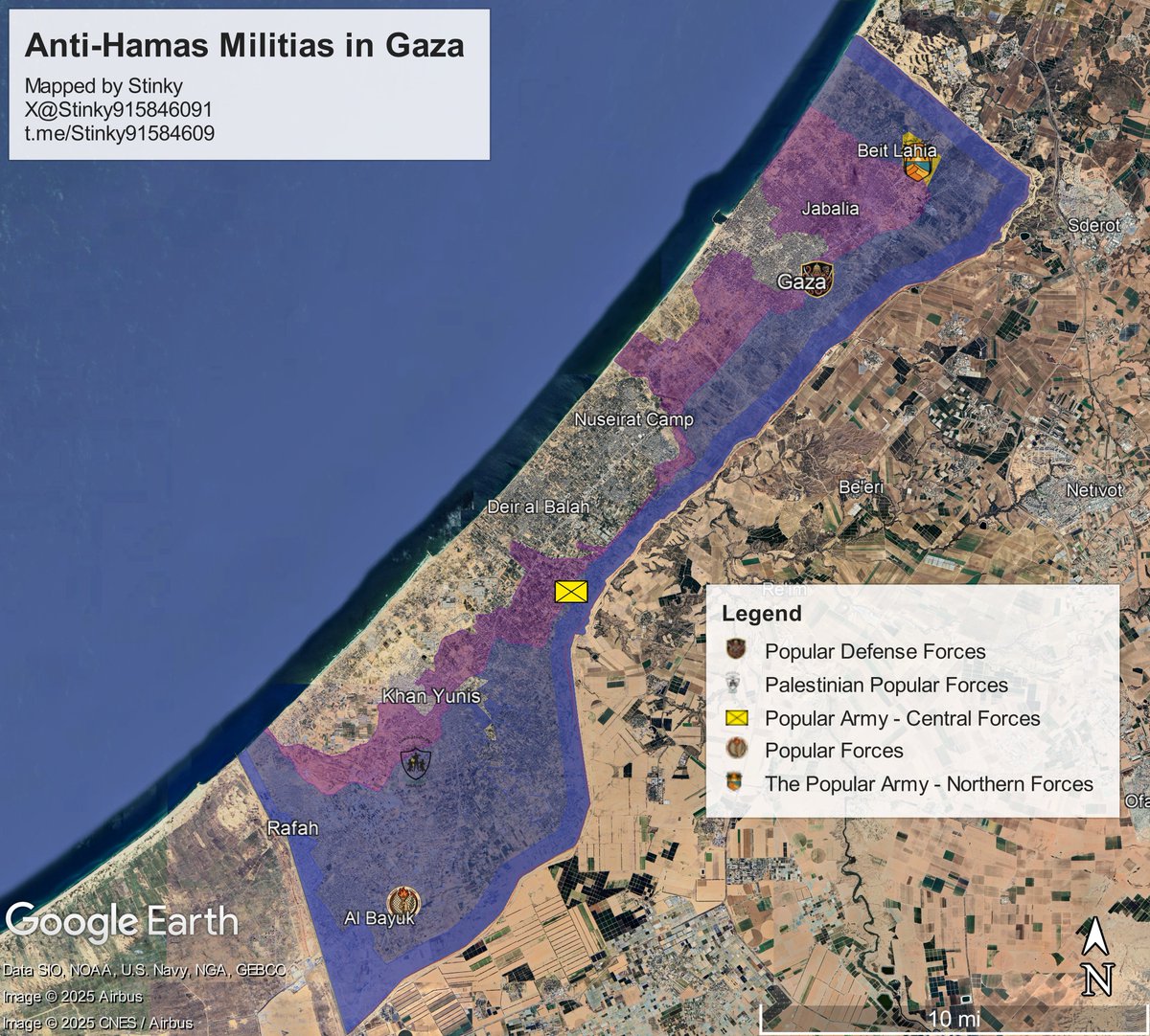
🧵Who are the anti-Hamas militias in Gaza?
In recent weeks, these groups expanded beyond their usual areas, clashing with Hamas, entering new zones, and interacting openly with locals.
This thread aims to explain who they are, where they operate, and who leads them.
In recent weeks, these groups expanded beyond their usual areas, clashing with Hamas, entering new zones, and interacting openly with locals.
This thread aims to explain who they are, where they operate, and who leads them.

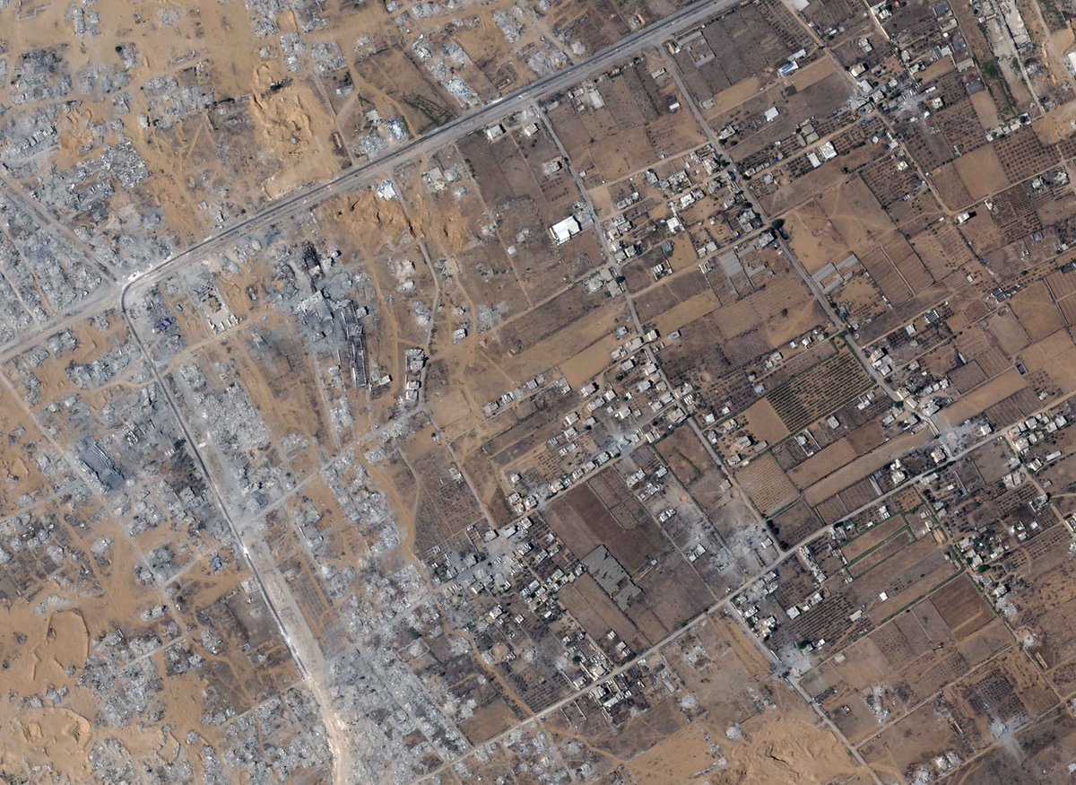
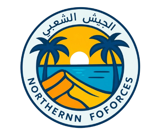
Popular Army - Northern Forces.
Established in September of 2025, by Ashraf al-Mansi. It is Headquartered at the Izbat Beit Hanoun Elementary School for Boys, on Al Awda Street.
Location: 31.547334, 34.518417
8G3PGGW9+W9 North Gaza Governorate, Gaza
Established in September of 2025, by Ashraf al-Mansi. It is Headquartered at the Izbat Beit Hanoun Elementary School for Boys, on Al Awda Street.
Location: 31.547334, 34.518417
8G3PGGW9+W9 North Gaza Governorate, Gaza


Since April, videos posted by the Northern Army, with some being geolocated by @Arabosint show them operating beyond the yellow line in Atatra/Beit Lahia, mingling with locals, while distributing material/financial aid to them.
More Info:
More Info:
https://x.com/Arabosint/status/2046234922382147847

Next, we have the Shujaya Popular Defense Forces.
Also established September of 2025, its based at the Shujaya School Complex. Alongside their armed force, Gazan civilians seeking refuge from Hamas moved to the complex, residing there. More info of that in the reply.
Also established September of 2025, its based at the Shujaya School Complex. Alongside their armed force, Gazan civilians seeking refuge from Hamas moved to the complex, residing there. More info of that in the reply.
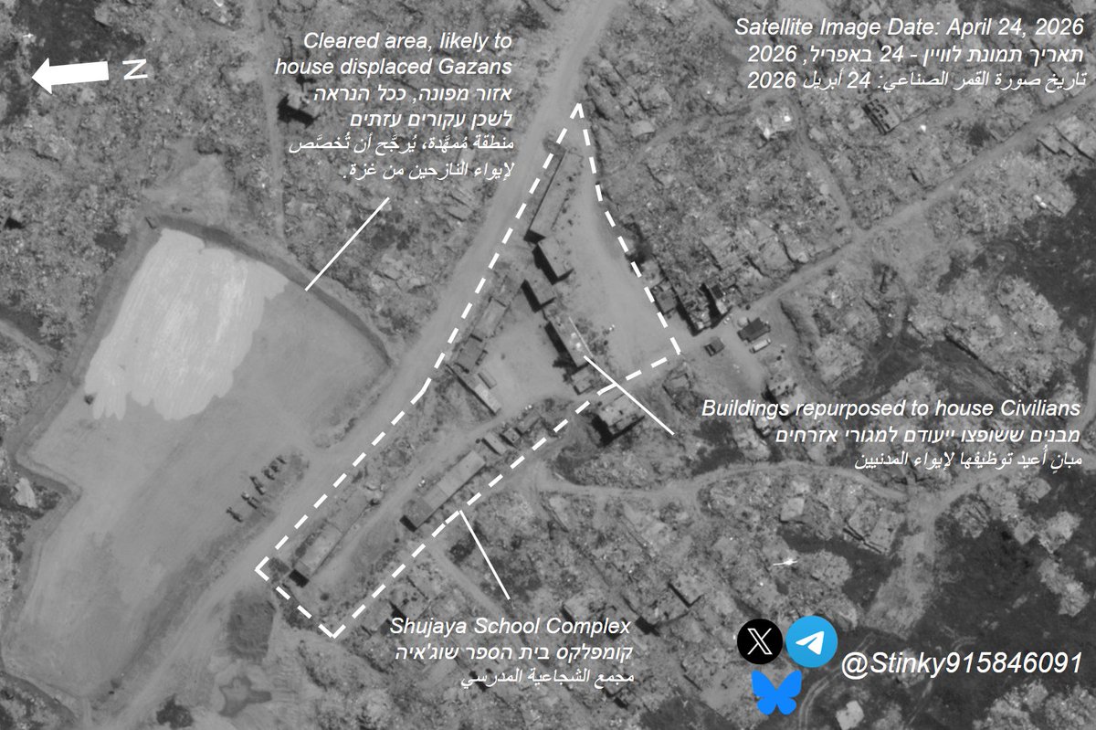
Before continuing to the next set of groups, it is necessary to note:
According to @afalkhatib, and multiple individuals residing in the Gaza Strip that myself and @Arabosint have spoken to, the Northern Militias that we just covered have reportedly been buying up parcels and
According to @afalkhatib, and multiple individuals residing in the Gaza Strip that myself and @Arabosint have spoken to, the Northern Militias that we just covered have reportedly been buying up parcels and
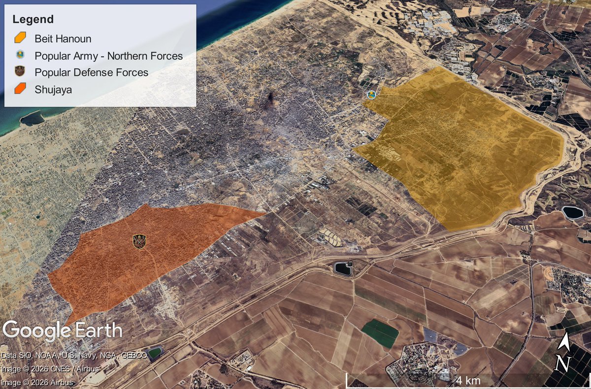
all sorts of plots in the Shujayah and Beit Hanoun towns in Gaza.
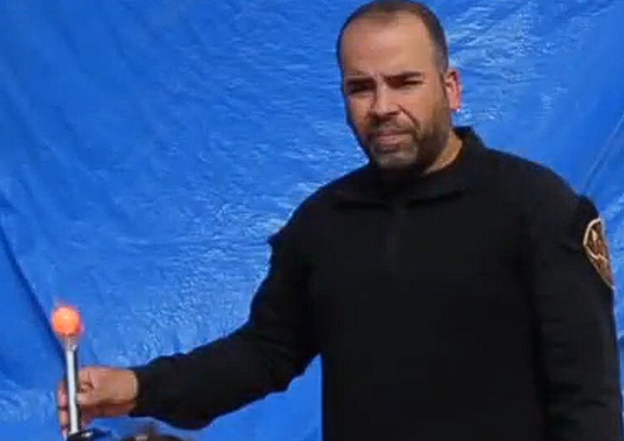
This coincides with a recent announcement made by Rami Halas, the head of the Popular Defense Forces, which told Gazans to follow the group's instructions when transferring
Source: facebook.com/10005080155677…
This coincides with a recent announcement made by Rami Halas, the head of the Popular Defense Forces, which told Gazans to follow the group's instructions when transferring
Source: facebook.com/10005080155677…
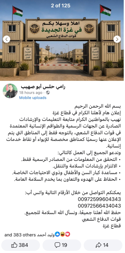
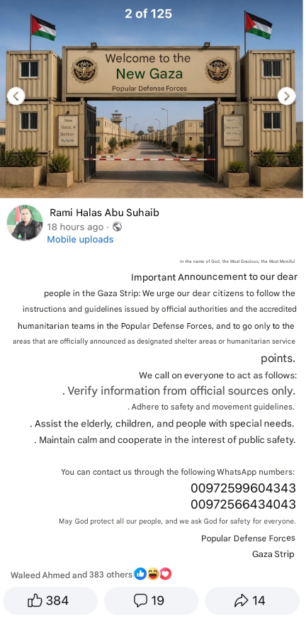
to the territories that are under the control of said Anti-Hamas Militias. This most likely explains the large clearing just outside the HQ's for these factions, as it is likely that they may utilized to house tents for civilians displaced during the war after being vetted.


Free Homeland Forces
Established in November 2025, they are based in the Masadaa Ibn Abed Allah Al Azmi Basic Co-education school, they are led by Shawqi Abu Nassira, a former PA General, and Ex-Police Chief in the Rafah Region.
They're located 450m from the yellow line.
Established in November 2025, they are based in the Masadaa Ibn Abed Allah Al Azmi Basic Co-education school, they are led by Shawqi Abu Nassira, a former PA General, and Ex-Police Chief in the Rafah Region.
They're located 450m from the yellow line.


Their most recent raid, per my knowledge was on April 6th, where they went into Al-Maghazi and assasinated Mussa Al-Aydi, an Al-Qassam [Hamas] commander, alongside 5-10 other Al-Qassam members (exact number unclear, within that range)
Geolocation:
Geolocation:
https://x.com/Stinky915846091/status/2041315401628324067

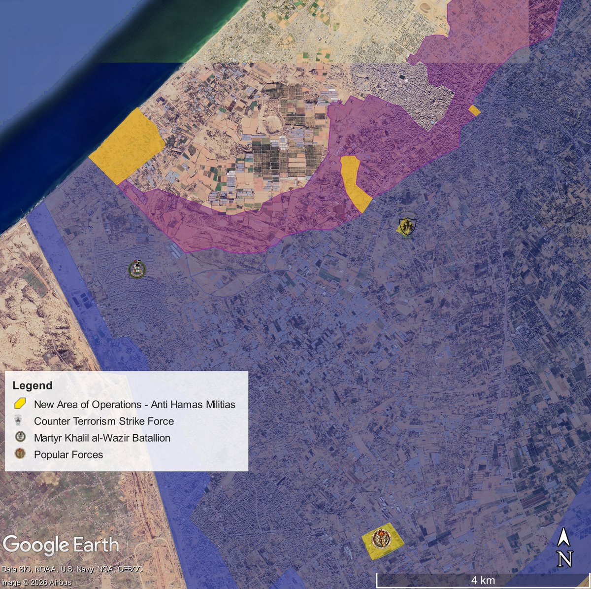
Counter Terrorism Strike Force
Established in August of 2025, it is ran by Hussam Al Astal, and based in Qizan An Najjar, by the Magen Oz corridor.
Geolocated footage showed them active in the center of Khan Yunis, distributing aid, clashing with Hamas.
Established in August of 2025, it is ran by Hussam Al Astal, and based in Qizan An Najjar, by the Magen Oz corridor.
Geolocated footage showed them active in the center of Khan Yunis, distributing aid, clashing with Hamas.
https://x.com/Stinky915846091/status/2046384874634760268
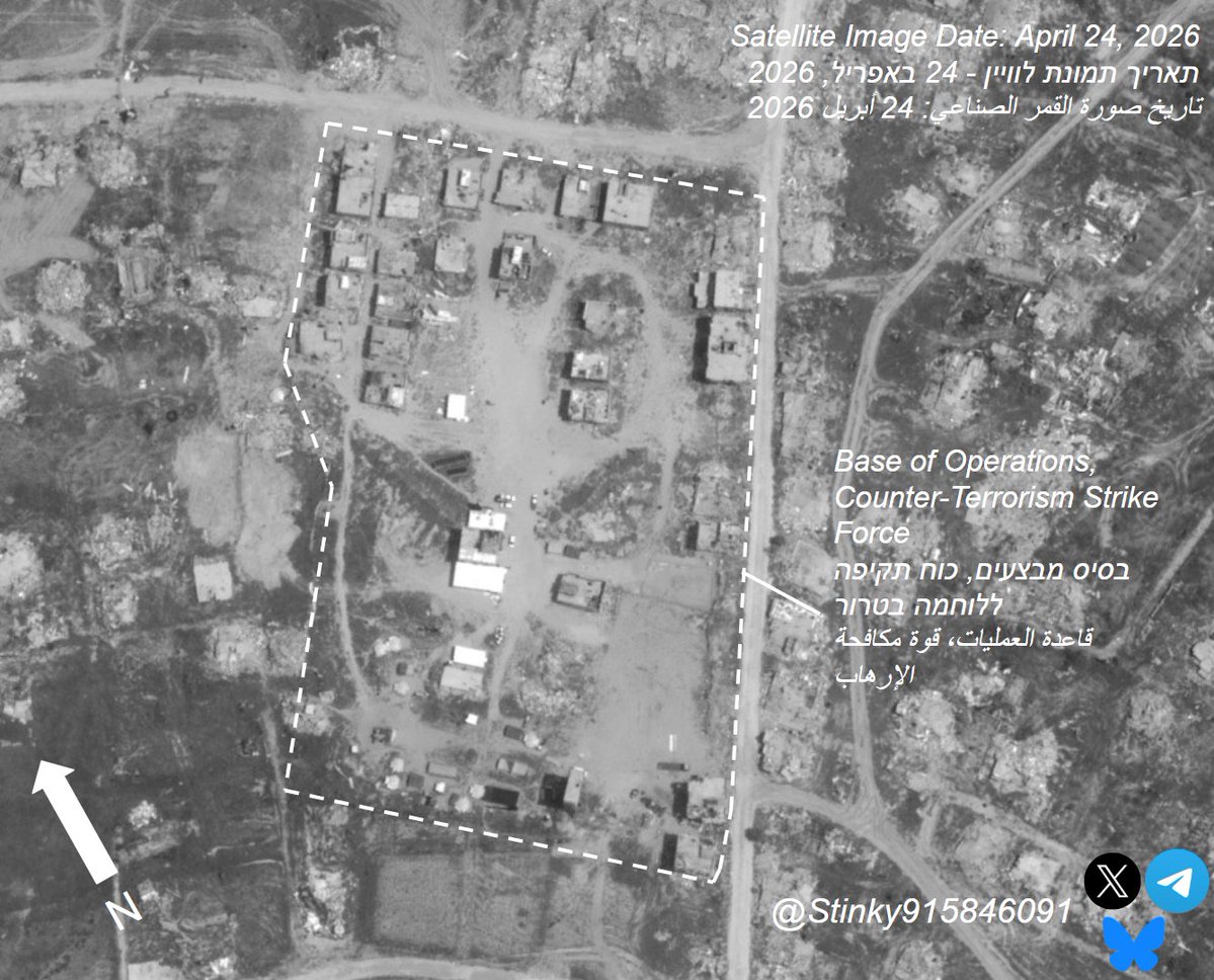
Additional Footage filmed at their base of operations (located here: 31.321869, 34.296842) also shows a formation of an all-female police force in the area they control, meant to serve as internal security for the area of Qizan An Najjar.
Videos Courtesy of @Arabosint
Videos Courtesy of @Arabosint
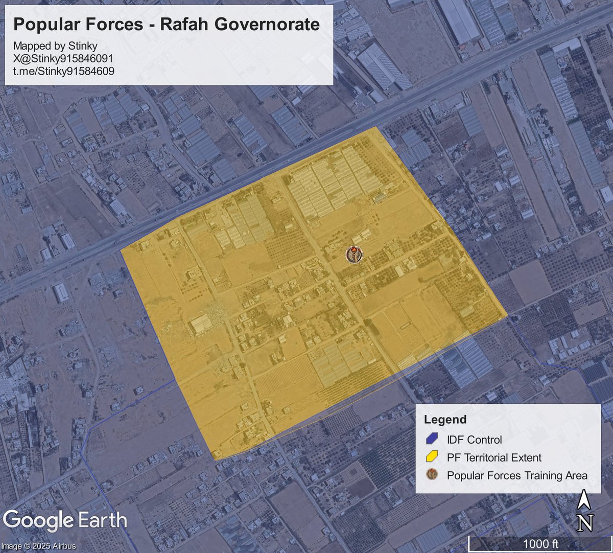
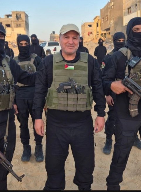
Popular Forces
Based in Al Bayuk, it is the oldest/largest militia out of all the groups. Founded by now deceased Yasser Abu Shabab in 2024, it has since led by Ghassan Al Dahini.
They have been active in multiple areas of the Rafah Governorate.
Based in Al Bayuk, it is the oldest/largest militia out of all the groups. Founded by now deceased Yasser Abu Shabab in 2024, it has since led by Ghassan Al Dahini.
They have been active in multiple areas of the Rafah Governorate.


The main headquarters for the Popular Forces Administration is located here: 31.268504, 34.291377
Their field school (for the al bayuk area) is located here: 31.269418, 34.291261
You can also see the bus that they utilized to transport Gazans to and from Morag - Rafah Crossing.
Their field school (for the al bayuk area) is located here: 31.269418, 34.291261
You can also see the bus that they utilized to transport Gazans to and from Morag - Rafah Crossing.
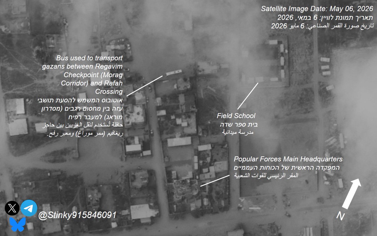
Recent footage posted on Ghassan al Dahini's facebook shows construcition activity in the Al Bayuk area, as well as setting up a parade square, where they held a military parade a few days ago.
The square is located roughly where the bus is in sat image.
The square is located roughly where the bus is in sat image.
https://x.com/JoeTruzman/status/2051076669100953933
Martyr Khalil al-Wazir Batallion
Set up in December 2025, it is based out of the Al-Quds Open university, in the Tel Al Sultan area of Rafah.
It is still unclear who leads them.
Set up in December 2025, it is based out of the Al-Quds Open university, in the Tel Al Sultan area of Rafah.
It is still unclear who leads them.

Both the Popular Forces (under its armed wing, the Gazan Counterterrorism Service) and Martyr Khalil al-Wazir Batallion were active during the activities in april, in Al-Mawasi, Al Shakosh, and Qizan An Najjar.
See Geos:
1. x.com/Stinky91584609…
2. x.com/Stinky91584609…
See Geos:
1. x.com/Stinky91584609…
2. x.com/Stinky91584609…
This concludes the overview for the Anti-Hamas militias.
With the possibility of the resumption of war in Gaza, it will be interesting to see whether or not they will be engaged in the front lines against Hamas and its armed wings.
With the possibility of the resumption of war in Gaza, it will be interesting to see whether or not they will be engaged in the front lines against Hamas and its armed wings.
Thank you to those who helped out for this thread:
@Arabosint, who played a big role in researching and find the videos posted by the militias.
@GEOIMINT and @ChrisOsieck, who provied high-resolution satellite images for the bases of these Anti-Hamas militias.
@Arabosint, who played a big role in researching and find the videos posted by the militias.
@GEOIMINT and @ChrisOsieck, who provied high-resolution satellite images for the bases of these Anti-Hamas militias.
• • •
Missing some Tweet in this thread? You can try to
force a refresh