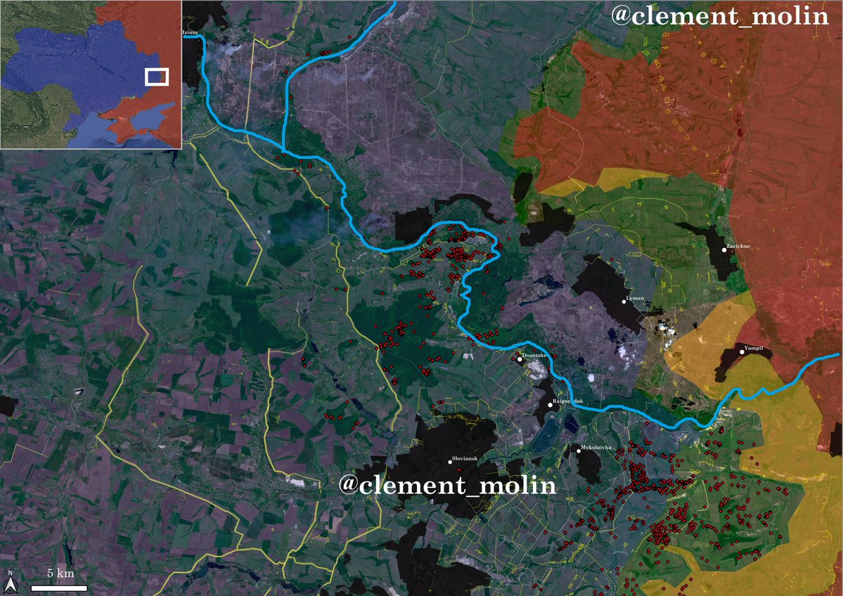
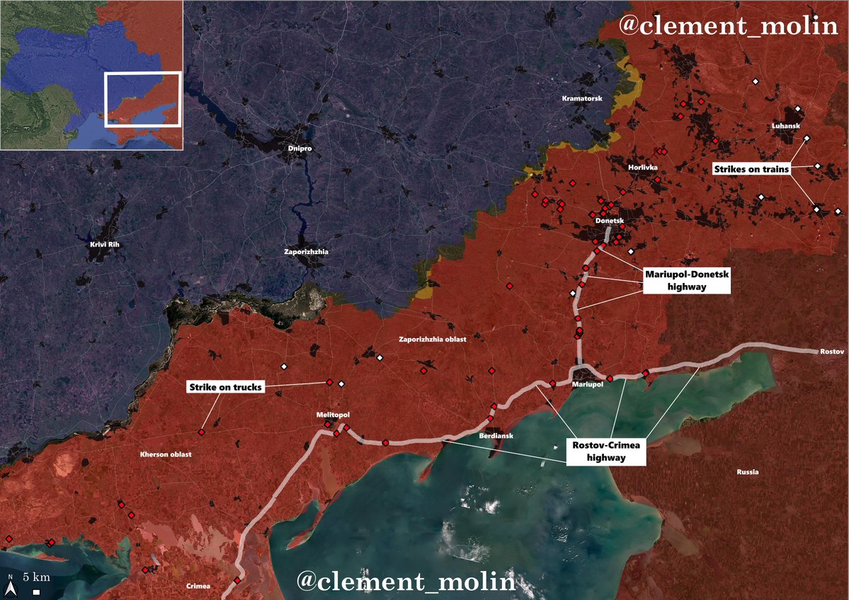
These last 2 months, Ukraine 🇺🇦 dug 1 300 km of fortifications from Kyiv to Odesa
In the eastern part of the country, the AFU can now rely on 2 to 6 defensive lines, with kilometers of obstacle lines extending behind the front.
🧵THREAD🧵1/24⬇️
In the eastern part of the country, the AFU can now rely on 2 to 6 defensive lines, with kilometers of obstacle lines extending behind the front.
🧵THREAD🧵1/24⬇️

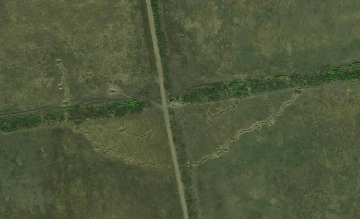
When we talked about fortifications in Ukraine from 2014 to 2024, we were talking about those large trenches in the middle of the fields.
Drone war has made those completely obsolete. I put here famous ones, try to find where they are :
Drone war has made those completely obsolete. I put here famous ones, try to find where they are :


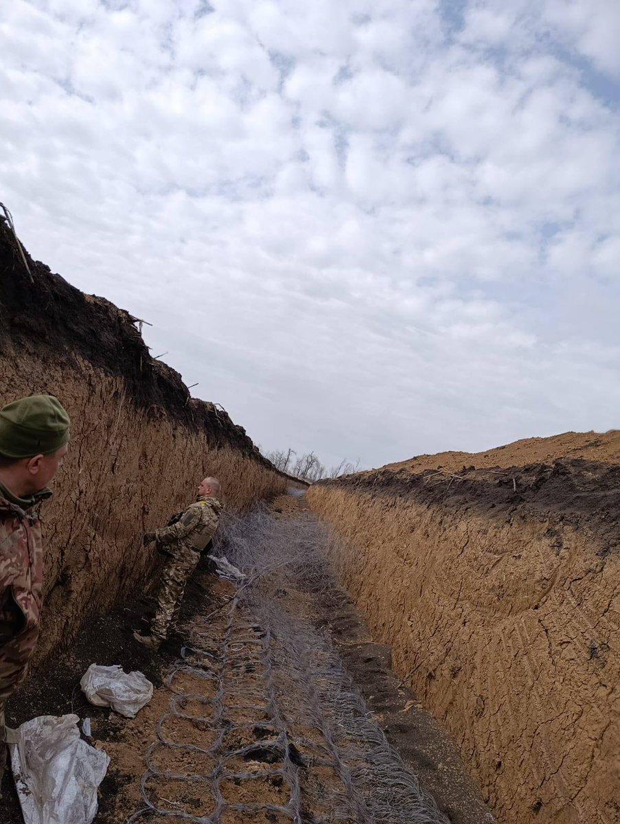
Today's fortifications are much different. The priority is not to hide soldiers, but to prevent the ennemy from advancing.
That's why those new defensive lines are composed of 3 anti-vehicle ditches filled with anti-infantry barbed wire and multiple barbed wire lines.
That's why those new defensive lines are composed of 3 anti-vehicle ditches filled with anti-infantry barbed wire and multiple barbed wire lines.

Thus :
🔹No vehicle can get through without a consequent breaching operation.
🔹Destroying the barbed wire lines is impossible because of the dragon teeths
🔹Soldiers cannot cross easily because of multiple barbed wire lines, including at the bottom of the ditches.
🔹No vehicle can get through without a consequent breaching operation.
🔹Destroying the barbed wire lines is impossible because of the dragon teeths
🔹Soldiers cannot cross easily because of multiple barbed wire lines, including at the bottom of the ditches.


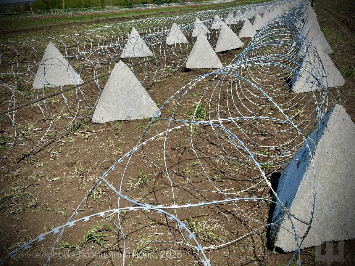
More interestingly, when ditches and fortifications usually didn't cover forest, urban areas or rivers, it is now the case.
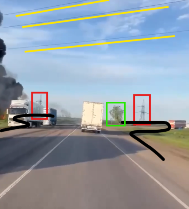
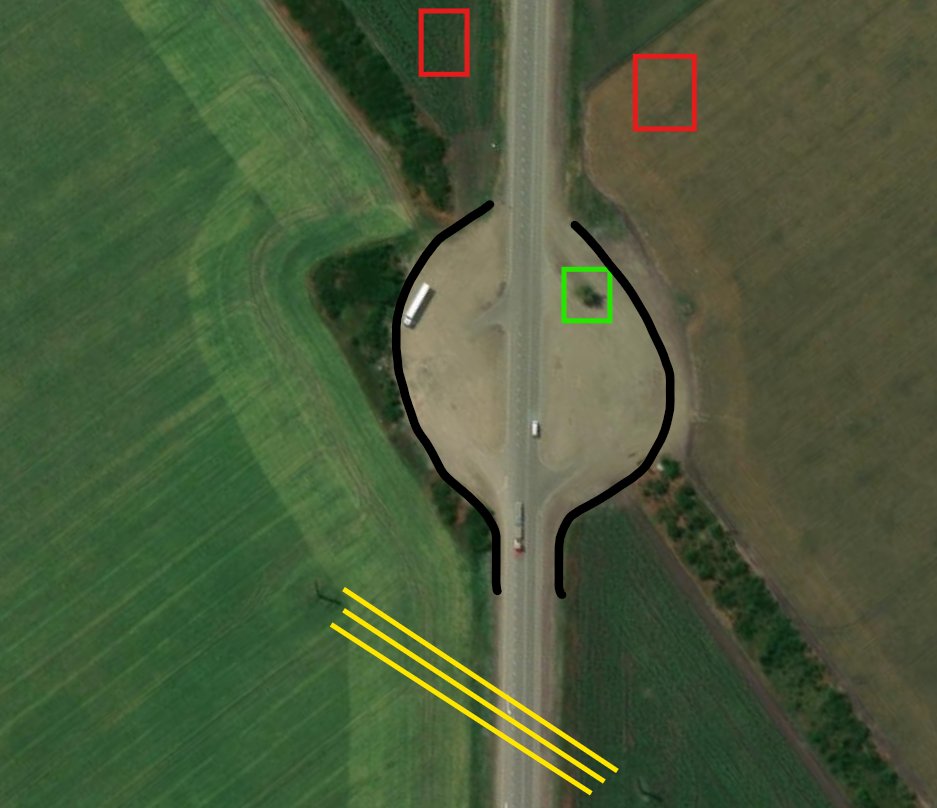
No unplanned hole is left behind, as I showed last month with those only 20 planned roads on a 100km obstacle line.
No unplanned hole is left behind, as I showed last month with those only 20 planned roads on a 100km obstacle line.

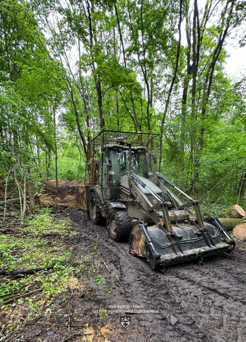
Ukraine is now systematically cutting trees hundred meters from their lines, which means russian soldiers won't get any cover before reaching those lines.
Most of the time now, they will need to attack a line in the open, without any cover.
Most of the time now, they will need to attack a line in the open, without any cover.

How can russian soldiers cross those lines ? I would say they will try to open gaps with artillery, FABs and FPV drones, but you can imagine how much munitions and precision you need to breach a 100 meter large line.
Also, this does not change the road problem :
Also, this does not change the road problem :

For their own troops and to avoid any breakthrough, Ukraine built some specific roads. Those are planned holes in the lines, where russian forces will try to cross.
One important thing is how large those roads are, we are talking about ~150-180 meters long, exposed road.
One important thing is how large those roads are, we are talking about ~150-180 meters long, exposed road.

Those lines are intended to protect fortified positions where frontline infantry and drone teams will hide.
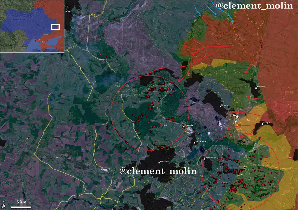
I mapped thousands of those positions but I will maintain opsec on their exact positions, even if it's quite easy to see those.
I mapped thousands of those positions but I will maintain opsec on their exact positions, even if it's quite easy to see those.

But in general, yes, the russians understood where those positions are since they are massively bombing with FAB guided bombs the treelines west of Hulialpole.

Those small positions are built in treelines, which makes them harder to locate and are covered on the top most of the time to avoid artillery and FPV strikes.
However, the best positions remains villages, town and cities, with basements or industrial areas more fortified.
However, the best positions remains villages, town and cities, with basements or industrial areas more fortified.
Mapping those very visible lines is very easy and we can easily see how villages and towns are just behind those lines, where drones can be launch. Areas between those lines are what we call "kill zone".

This "kill zone" is also layered with barbed wire lines that complicate any movement, ou can see those in white here.
On the right, you can btw see the only (unfinished) new line being attacked, it held for 10 months and around 100 corpses are sitting there.
On the right, you can btw see the only (unfinished) new line being attacked, it held for 10 months and around 100 corpses are sitting there.

And that's another interesting point : the new defensive lines have remained untouched at 99%. Only one small portion is currently on the frontline and most of those lines are 5 to 10 km minimum from the frontline.
Imagine having to cross 4, 5 or 6 of those lines !
Imagine having to cross 4, 5 or 6 of those lines !

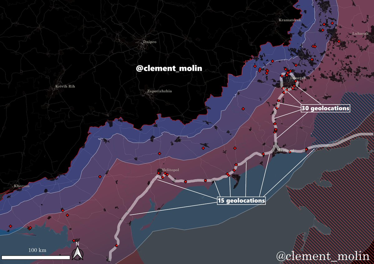
Where is Ukraine digging ? In 2025 (orange), most of the lines were completed in Donetsk oblast, with around 1 line in other frontline oblasts.
In 2026 (yellow), new lines priorise Dnipropetrovsk, Zaporizhzhia and Kharkiv oblasts.
In 2026 (yellow), new lines priorise Dnipropetrovsk, Zaporizhzhia and Kharkiv oblasts.
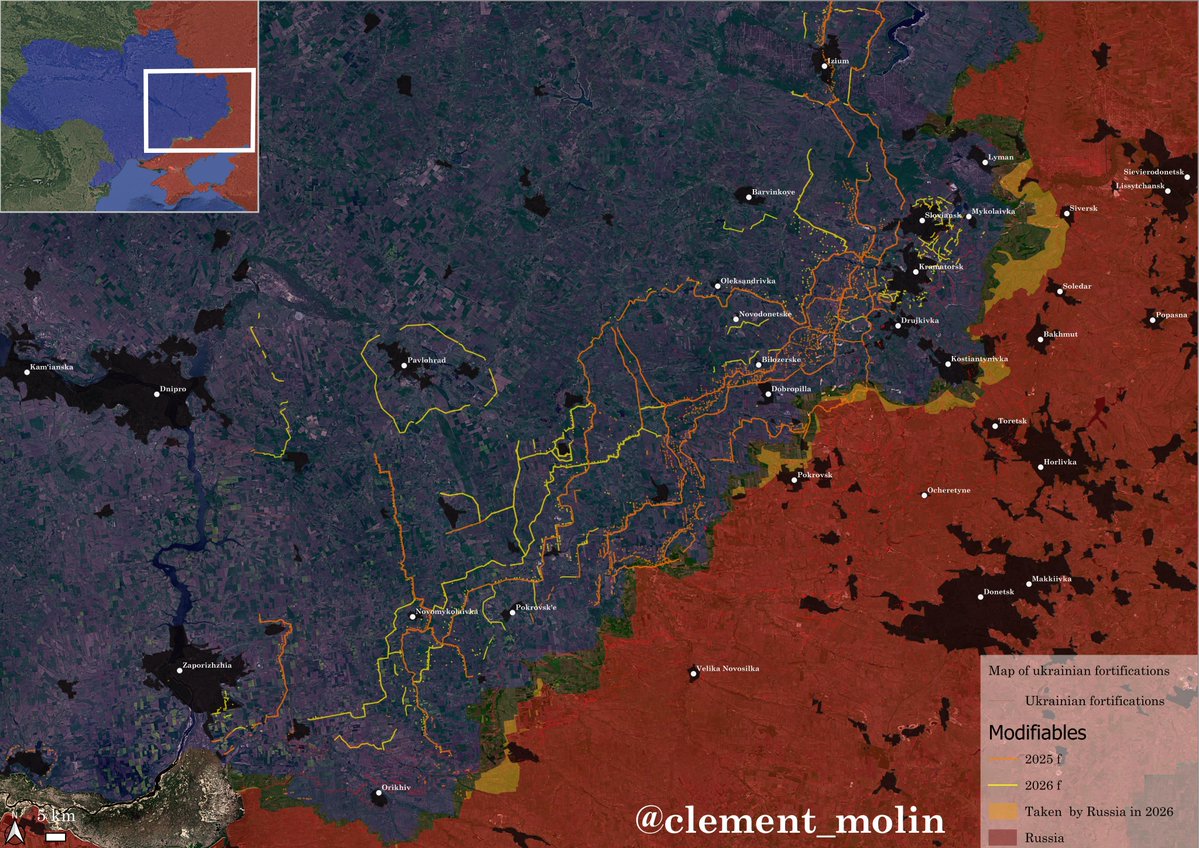
In the remaining part of ukrainian controled Donbas, new fortifications are being built in front of Novodonetske and in front of Kramatorsk and Sloviansk.

Both cities are still being fortified with multiple ditches and barbed wire lines in the eastern side of those.
It is now impossible to dig big lines, so Ukraine is prioritising multiple obstacle to maximise the kill zone.
It is now impossible to dig big lines, so Ukraine is prioritising multiple obstacle to maximise the kill zone.

New fortifications are also being dug around Kharkiv and in Kharkiv oblast. Finally, most of the border is now covered and a second line is under construction closer to the city.
Izium, Chuhuiv and Veliky Burluk have also been fortified.
Izium, Chuhuiv and Veliky Burluk have also been fortified.

In Sumy, the construction is ongoing for the second line, but it is more difficult because of the large forest areas in the region.

Even Chernihiv oblast is now completing new fortified lines, including the regional capital, Tchernihiv.

Finally, new ring fortifications are also covering Dnipro, Zaporizhzhia as well as Mykolaiv and Odesa.

It's very clear that this new fortification program that started in december 2024 is central in the AFU defensive strategy.
More obstacles means less men to man the frontlines, with more losses for the ennemy trying to assault, especially in the drone war.
More obstacles means less men to man the frontlines, with more losses for the ennemy trying to assault, especially in the drone war.
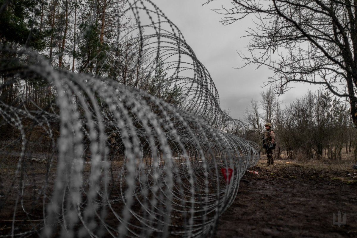
I will continue to follow closely these new trends and this new ukrainian strategy.
This mapping job is unpaid and takes a lot of time, you can support me here if you wish so ! buymeacoffee.com/clement.molin
This mapping job is unpaid and takes a lot of time, you can support me here if you wish so ! buymeacoffee.com/clement.molin
If some journalists want to ask some questions, they can do it freely by sending me an email : clement.molin2005@gmail.com
(BTW, I won't be giving the fortification KML for free anymore, as you can understand)
Thank you all for following !
(BTW, I won't be giving the fortification KML for free anymore, as you can understand)
Thank you all for following !
• • •
Missing some Tweet in this thread? You can try to
force a refresh