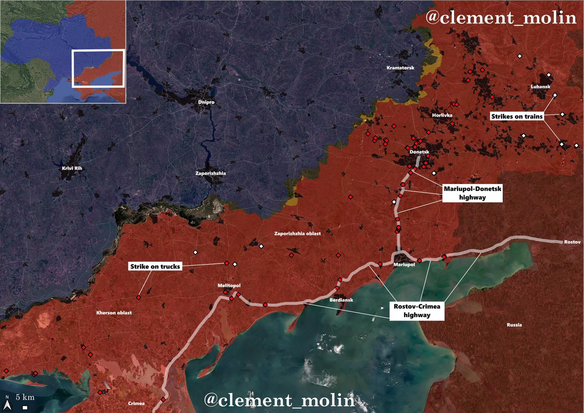
Russia 🇷🇺 is shutting the Rostov-Crimea road for civilian traffic after multiple ukrainian 🇺🇦 strikes hit this critical road
More strikes are also hitting the Mariupol-Donetsk highway. Right now, all the land corridor to Crimea is threatened.
🧵THREAD🧵1/10 ⬇️
More strikes are also hitting the Mariupol-Donetsk highway. Right now, all the land corridor to Crimea is threatened.
🧵THREAD🧵1/10 ⬇️
https://twitter.com/moklasen/status/2057560497466040790
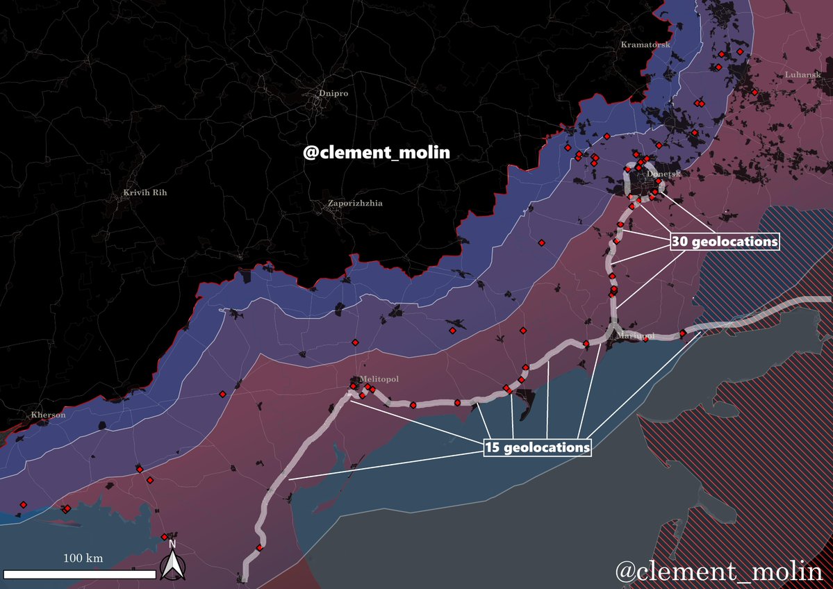
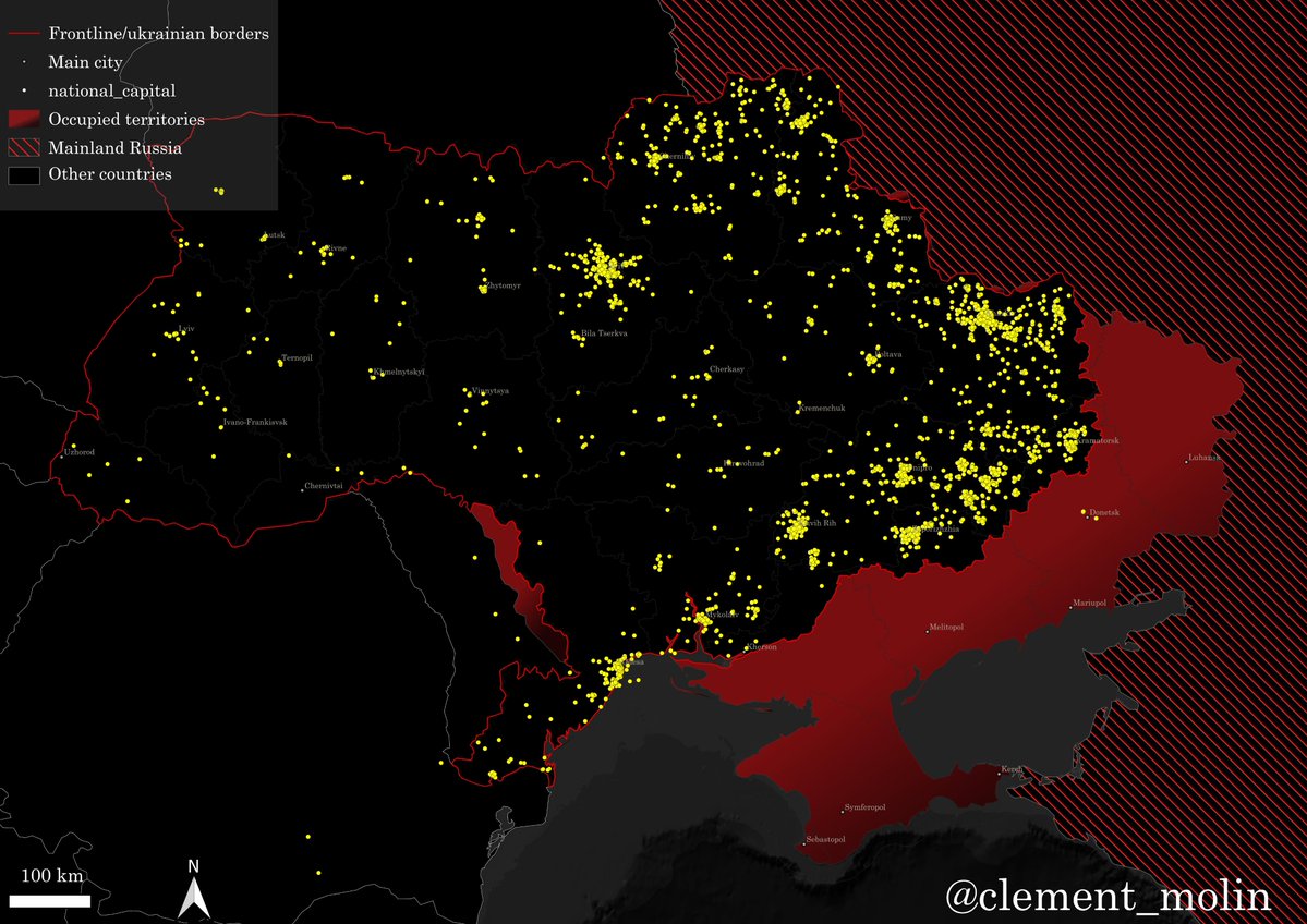
This map is made thanks to multiple geolocations from : @99Dominik_ @blinzka @carse_n @dmitrij46839 @federicoborsar1 @franfran2424 @GarbuzYe @hochu_dodomu @klinger66 @Kukulkan415 @MaxximOSINT @moklasen @neonhandrail @AndrewPerpetua @NotWoofers @tom_bike @VyshnyaOstap (among others) and my own geolocations.
I have a total of 73 trucks hit since march, but I believe this is barely 20% of the real numbers, since most of the results are not filmed and multiple videos cannot be geolocalized.
I have a total of 73 trucks hit since march, but I believe this is barely 20% of the real numbers, since most of the results are not filmed and multiple videos cannot be geolocalized.
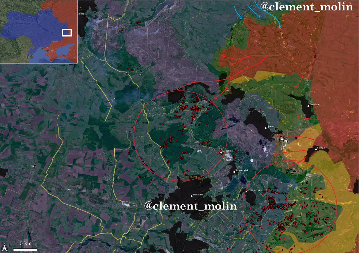
More and more videos from southern Ukraine are showing the results of Ukraine's middle strikes, mainly done with Hornet drones as well as long range FPV drones, which can now reach 50 km.
On this particular video, we can see a Honet drone looking for a target above a road in southern Ukraine, as soon as a military truck will be seen, it will target it.
This is a zoom of geolocalized hits around Donetsk city, which, again, means multiple ones are not on video or not mapped.

The Rostov-Crimea and Mariupol-Donetsk roads are the backbone of russian presence in the south.
These roads have been improved for logistical purposes. Also, military trains are more and more targeted.
These roads have been improved for logistical purposes. Also, military trains are more and more targeted.
https://x.com/clement_molin/status/2053818789590901045?s=20

This video from today shows some AI guided FPV drones targeting the Mariupol-Donetsk road near Donetsk.
With the improved range of FPV drones, the "kill zone" is getting bigger, Ukraine will soon be able to set up some areas interdictions.
With the improved range of FPV drones, the "kill zone" is getting bigger, Ukraine will soon be able to set up some areas interdictions.
To understand how the strategy is working :
🔹FP-1/2 are hitting high value targets (depots, oil infrastructure, logistic centers, command centers, air-defenses)
🔹Hornets are hitting logistics (trucks, cars...) far behind
🔹Long range FPV's are hitting closer to the frontline.
🔹FP-1/2 are hitting high value targets (depots, oil infrastructure, logistic centers, command centers, air-defenses)
🔹Hornets are hitting logistics (trucks, cars...) far behind
🔹Long range FPV's are hitting closer to the frontline.
Russia will soon start to adapt, to modify it's logistic strategy, to put air-defense teams in critical areas of the front, to cover roads with nets or to use othr roads.
But this is the ukrainian strategy, force Russia to change their strategy, which will obviously be less efficient.
But this is the ukrainian strategy, force Russia to change their strategy, which will obviously be less efficient.
I talked about the drone war more in details 10 days ago, here is the article :
I will continue to monirot those strikes and try to geolocate missing ones to have a bigger picture.
I will continue to monirot those strikes and try to geolocate missing ones to have a bigger picture.
https://x.com/clement_molin/status/2054245233370828942?s=20
• • •
Missing some Tweet in this thread? You can try to
force a refresh