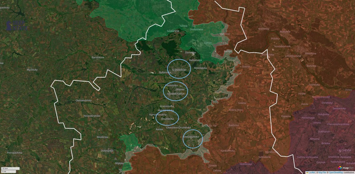
1/🧵
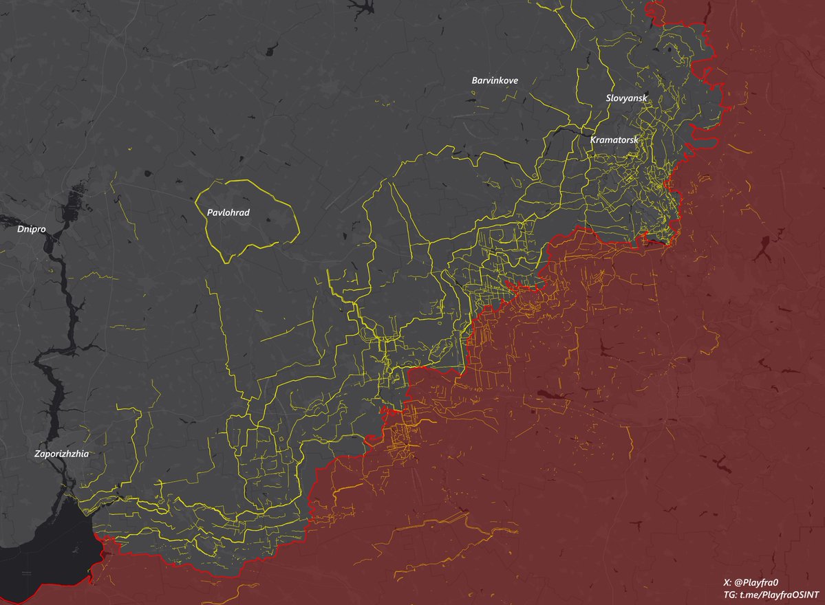
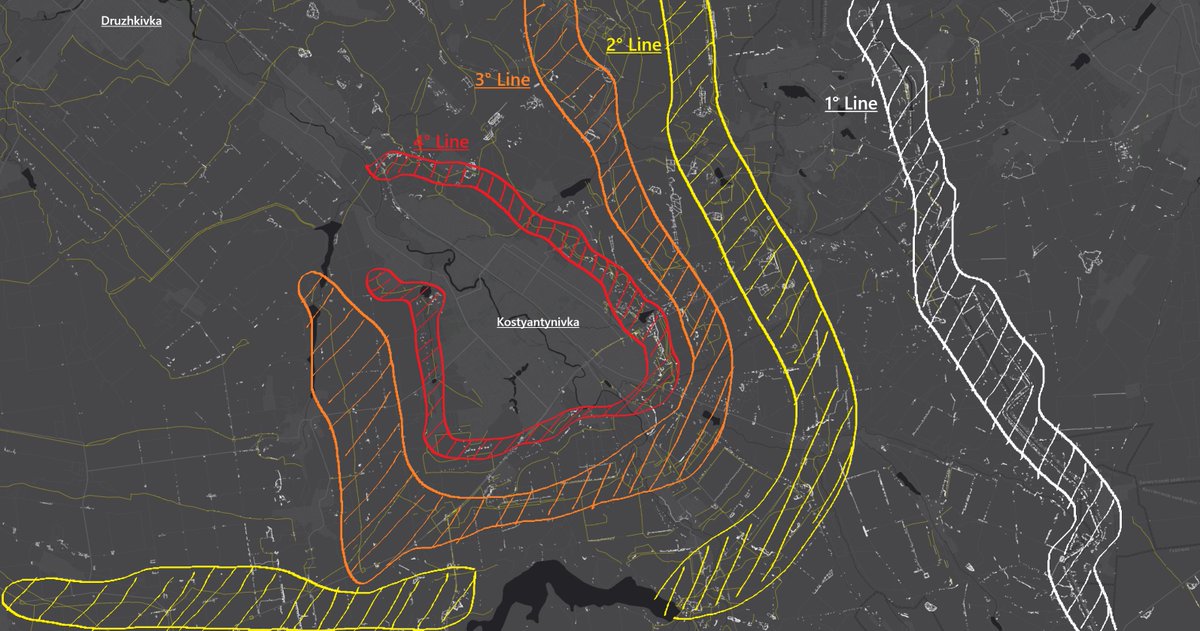
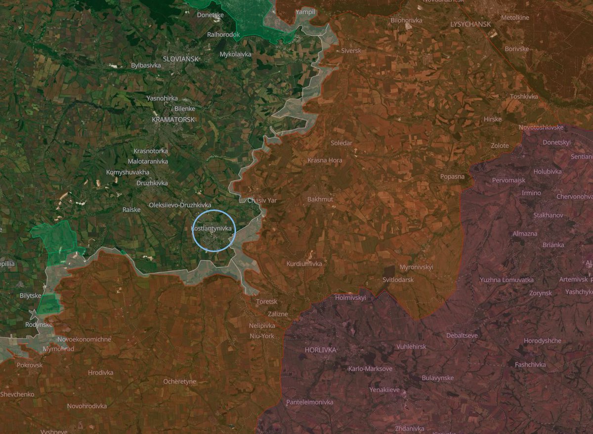
While the battle for #Kostyantynivka is in full swing, it's interesting to look more in-depth at the situation in 🇺🇦 Ukrainian-controlled Donbas and to understand what will come after this crucial battle, focusing on the next city in line for 🇷🇺 Russia: Druzhkivka.
🗺️Map: playframap.github.io
While the battle for #Kostyantynivka is in full swing, it's interesting to look more in-depth at the situation in 🇺🇦 Ukrainian-controlled Donbas and to understand what will come after this crucial battle, focusing on the next city in line for 🇷🇺 Russia: Druzhkivka.
🗺️Map: playframap.github.io

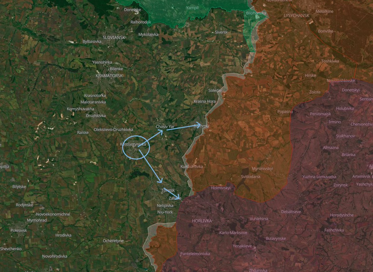
2/🧵
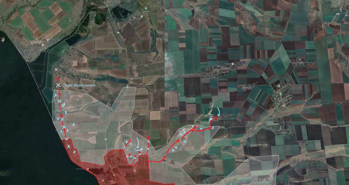
After almost 9 months of battle for the city (and especially its flanks), Russian forces were finally able to exploit a Ukrainian weak spot in the southwestern part of the city, near Illinivka and Berestok, and with heavy losses, gained the possibility of consistent infiltrations into the now contested key southwestern high-rise district of the city.
On the eastern flank, instead, Russia is putting the accent on spreading between the dense residential buildings, and their infiltrators reach as deep as the Staryi Piter citadel and the KMZ plant in the center.
Meanwhile, the Russians, since early 2026, have been able to establish a solid kill zone for Ukrainian logistics attempting to enter or exit Kostyantynivka.
At the moment, solid planning and careful execution are required to even get to position, just like an assault or infiltration operation.
From the ground, the feeling is that this battle will end in late summer or autumn.
Picture #2: google.com/maps/d/u/0/vie…


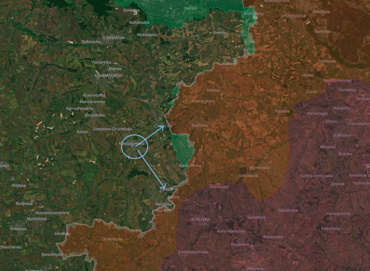
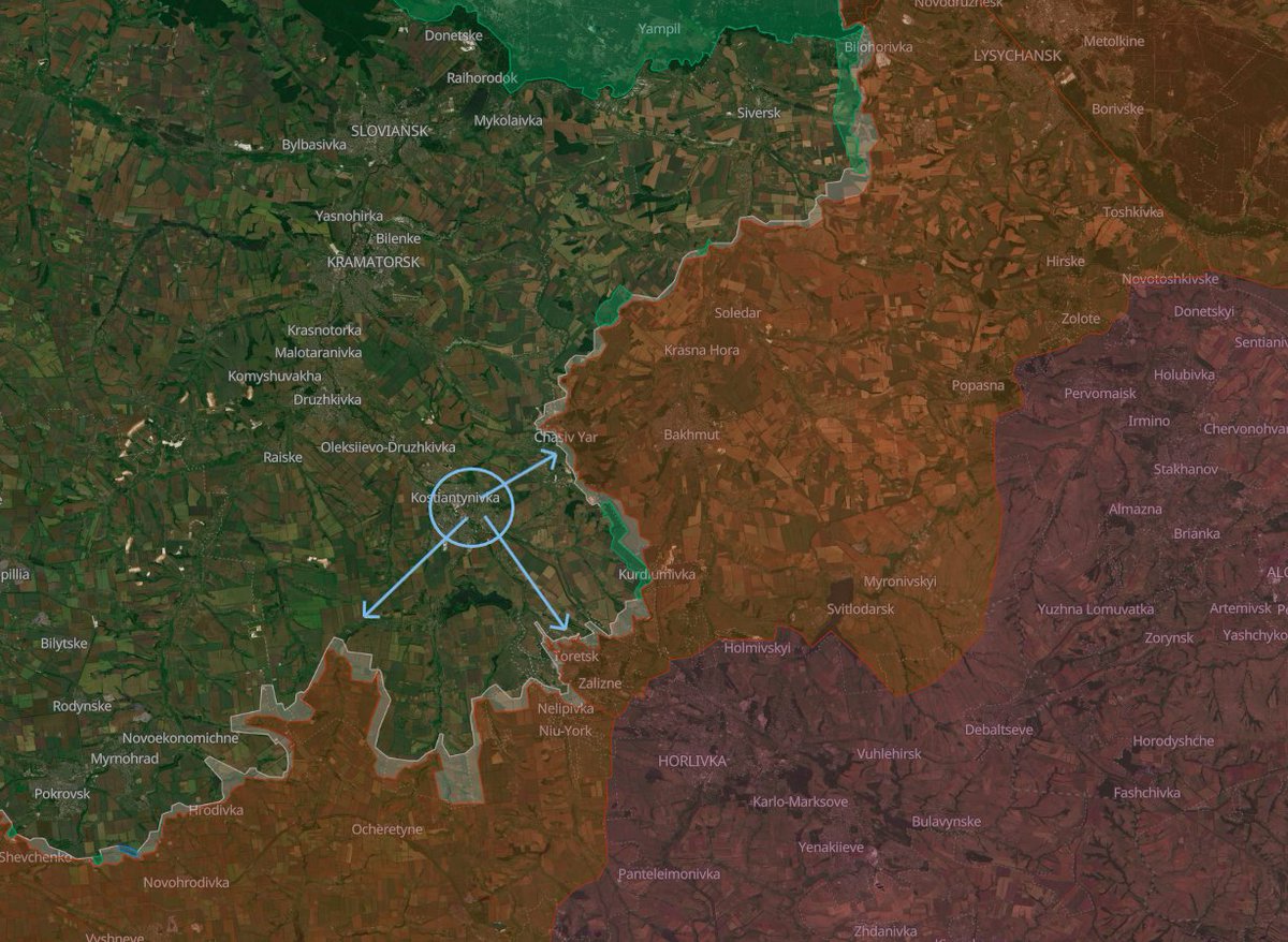
3/🧵
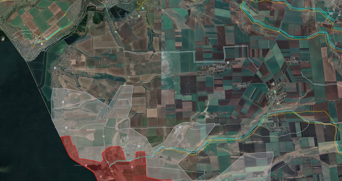
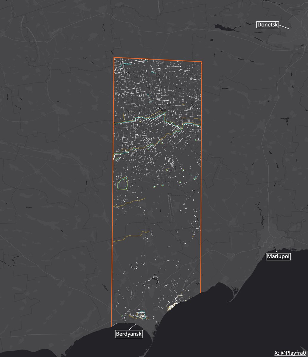
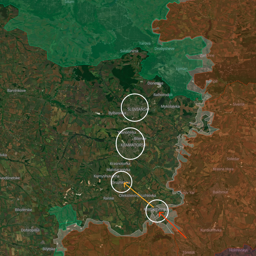
Because of this, the Russians are likely already eyeing Druzhkivka as their next target.
Just like Kostyantynivka, it's one of the 4 biggest cities of Ukrainian-controlled Donbas that also constitute a formidable urban defense belt.
Druzhkivka has just a bit fewer inhabitants than Kostyantynivka but is half its size: 33 km².
This city, too, sits on the Kryvyi Torets River valley but is divided into 3 parts because of the Kazenyi Torets River.
It also has a sizable high-rise and industrial area.
Let's look at some defensive strong and weak spots.
Picture: deepstatemap.live
4/🧵
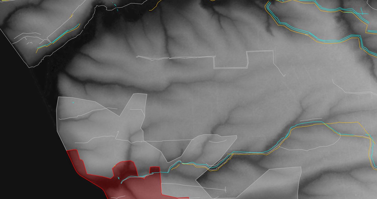
By itself, the city starts quite well.
1. 2 very big areas on the south and east flanks made up of open fields.
Some might note that in military theory, fields are the opposite of good for defense, and he wouldn't be mistaken, but the drone era has changed this, and operating in areas with limited cover except treelines is less than ideal for an attacking force.
In particular, it's also important to note that it's not a simple field-field battle in this case, because the Ukrainians have Druzhkivka always on their backs to provide centralized logistical, drone, and accumulation support, while the Russians wouldn't have anything except Kostyantynivka behind them (which is not really behind them).
This means that the closer to Druzhkivka the Russians come, the stronger Ukraine's advantage becomes, being able to strike exposed Russian logistics and infiltration routes in big swaths of open terrain: a drone paradise.
All this is exacerbated for the Russians by the barbed wire and ditches placed and dug by the Ukrainians in this time, slowing infiltrations down and giving even more time to Ukrainian drone operators to work.
Picture #1: deepstatemap.live
Picture #2: playframap.github.io


5/🧵
2. Urban defenses.
In red, in the city center, the DMZ factory offers safe accumulation points and tall and complex building structures.
The porcelain factory and a mine on the west flank of the city are situated on dominant heights overlooking Druzhkivka and Raiske (as such, the fields south of Druzhkivka as well), which constitutes a great place to position communication equipment for signal maximization and even further enhancement of drone effectiveness in the fields around the city.
In green, we can note a pretty big high-rise area, with the 7th Microdistrict in yellow being a key defensive stronghold: urban fighting positions can be easily set up there, directly overlooking the fields south of the city.
In blue, the Kryvyi and Kazenyi Torets rivers divide the city into 3 operational areas, also forming a chokepoint in its northern part, complicating organized Russian advancements.
In orange, big forests are situated on tactical heights behind the city, offering good improvised accumulation hubs and drone positions.
The topography is also friendly to defensive efforts, with the hill on the west flank serving as great artillery and drone zones, together with the forests' cover.
Picture 1: deepstatemap.live
Picture 2: en-gb.topographic-map.com/map-wmv51/Ukra…


6/🧵
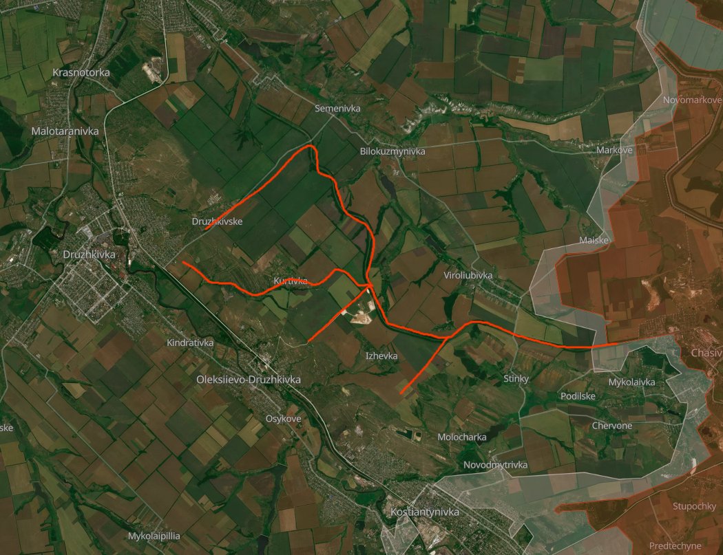
Fortifications.
Exploiting the time Kostyantynivka, Chasiv Yar, and the Dobropillia sector held firmly, the Ukrainians have been slowly (and chaotically) placing a lot of barbed wire, as well as digging some ditches.
As said, coupled with the large swaths of open terrain, these make for prime working conditions for Ukrainian drone operators.
Picture: playframap.github.io

7/🧵
But now, let's look at weak spots and areas the Ukrainians must pay attention to and, ideally, must reinforce before it's too late.
1. Not a lot of error margin available on the west flank.
Russian forces are already quite close to the dominant hill west of Druzhkivka.
If they were to get a stable foothold there, they would likely choose to immediately send a lot of drone operators and eventually mortars and light artillery to repeat what was done with Kostyantynivka: focus on logistics (and flatten the city).
Though it must be said that Ukrainian forces fortified this area more or less appropriately.
Going straight northwest isn't really an option for Russia, as the Zolotyi Kolodyaz section of the New Donbas Line blocks the way: it would be extremely costly to pass through.
The only passage is straight north, but it was made into a narrow chokepoint by building another vertical line east of this passage.
Furthermore, the capable 1st Corps "Azov" has been holding confidently and continues to do so in this sector of the frontline.
Photo #1: en-gb.topographic-map.com/map-wmv51/Ukra…
Photo #2: playframap.github.io


8/🧵
The following routes might become possible preferred Russian infiltration routes.
In the southwest one, Raiske's southern hamlet might become a small accumulation base for Russians going into Druzhkivka, and it's also at the convergence of 2 gulleys, which the Russians might use to move into the hamlet a bit more safely.
Along the route there are also bushy areas, and once infiltrators enter the Hirnyk district, the urban area merges seamlessly all the way into central Druzhkivka.
Though, between the hamlet and Hirnyk, there are up to 4 barbed wire lines, and the area doesn't have dense cover, so it might be turned into a small kill zone.
The main problem is on the southeast flank, where Kostyantynivka's, Oleksiievo-Druzhkivka's, and Druzhkivka's urban zones merge almost seamlessly if not for a couple of open areas between the 3 towns and some rare barbed wire lines.
This is the route that is most likely to become Russia's preferred, as it's the one that offers the most possibility of going undetected, as well as the one that offers the most cover from Ukrainian FPVs.
In my opinion, the bulk of the Ukrainian infantry should be stationed in this "residential area line" that goes from Kostyantynivka to Druzhkivka to constitute strong physical blocking positions for Russian infiltrators (it would be necessary to engage in small arms fire, so reinforcing these positions would be productive), as well as the Raiske-Hirnyk area for the same reasons.
On the southern flank, there are a couple of good routes with almost continuous treelines that the Russians could follow to reach southern Druzhkivka, and the most likely ones, in my opinion, are highlighted in the picture.
In general, we note how Raiske and Osykove constitute chokepoints, and efforts should be done to reinforce these areas to turn them into kill zones.
Picture: deepstatemap.live

9/🧵
On the eastern flank, the Russians will likely take as preferred the railway route, going exactly on top of the tactical heights. It will be possible for them to use this as a sort of "infantry highway" because of its westward direction, as well as the cover it offers along most of the way.
Because of this, it would be very useful for Ukraine to start cutting trees along the way to facilitate FPV work on infiltrators taking this route and establishing physical infantry blocking positions, for which even a modest number of infantry would be enough.
Placing barbed wire transversally relative to the railway's direction would also be very productive.
From the railway it's also possible to note treelines and small forests going straight down into the Kryvyi Torets' River valley, and eventually into Oleksiievo-Druzhkivka and Druzhkivka itself.
Though, here as well, it must be said that Ukrainian engineering obstacles are very dense, especially barbed wire, which seems to be quite promising.
In general, the tactical heights themselves in this area are also threatening to the Ukrainians because of the negative consequences that would affect Druzhkivka if Russian UAV operators were to take positions here: once again, logistics going in and out of the city would be at risk, even worse if both the hill on the west flank and this hill were to come under Russian control.

10/🧵
In conclusion, the defense of Druzhkivka has very good potential, with some weak spots that the Ukrainians must be careful to cover appropriately.
Capable units are also stationed in this general direction of the front, and barring unforeseen catastrophes and/or Russian breakthroughs, which should never be excluded from thought and analysis, the battle for Druzhkivka's approaches might last as long as Kostyantynivka and exhaust the Russians in this area enough to thwart their plans for a south-north attack into the last strongholds of Ukrainian-controlled Donbas, thereby forcing them to search more costly ways of advancing through the New Donbas Line.
11/🧵
Thanks for reading this thread!
Remember to join my Telegram channel: t.me/PlayfraOSINT
And my Discord: discord.gg/P3XsgQFBPV
If you would like to help the defenders of Kostyantynivka to make it so that this analysis will hopefully never be used, you can do so here:
• PrivatBank: privat24.ua/send/iz0y5
• Card number: 5168752151822858
• PayPal: l.knyazhytsky@gmail.com
• Wise: wise.com/pay/me/vratkos
• BuyMeACoffee: coff.ee/playfra
Any amount will be very appreciated!
• • •
Missing some Tweet in this thread? You can try to
force a refresh