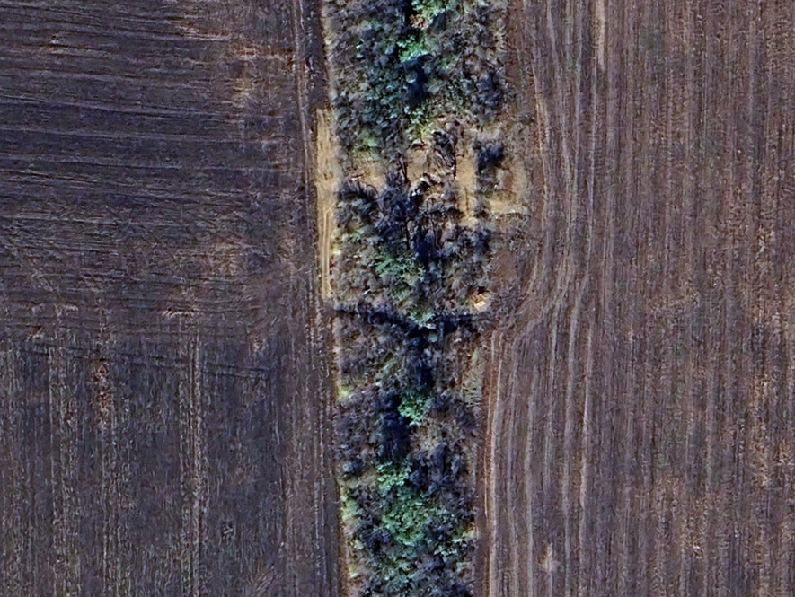
In recent months, Ukraine 🇺🇦 continued to reinforce its fortifications across the country
6 months ago, Zaporizhzhia direction was lacking defensive preparation, it now has 5 defensive lines, which shows how fast Ukraine can adapt.
🧵THREAD🧵1/12 ⬇️
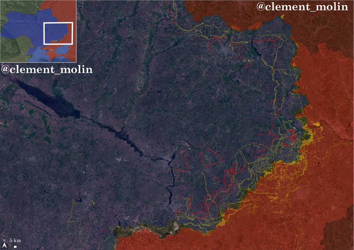
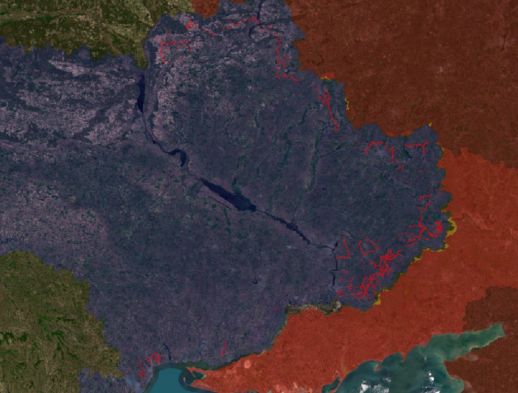
Here in red are all the new fortifications built from january to jun 2026. Lines are stretching from Chernihiv to Odessa.
You can see priority was given to Zaporizhzhia and Dnipropetrovsk oblast.
Near Zaporizhzhia, are still digging new lines, with currently 5 lines protecting the city from the east.
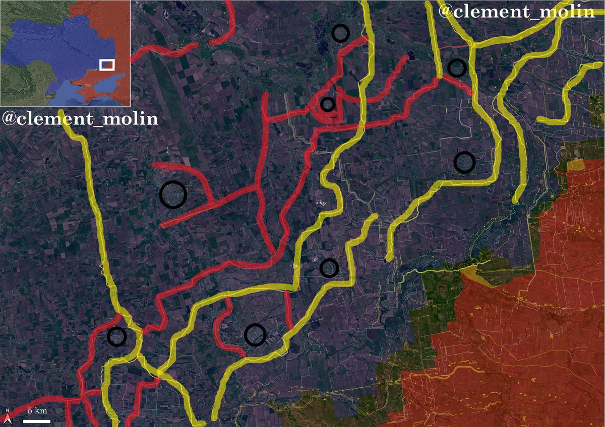
Red are lines dug in 2026, yellow in 2025 and white in 2024 (mostly obsolete).
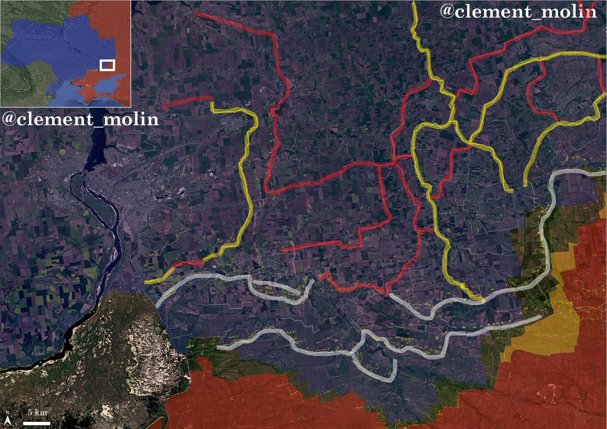
These fortifications are protecting key roads and towns, which are turned into fortified strongholds.
In Dnipropetrovsk oblast, there are now 5 lines between the frontline and Pavlohrad.
Here again, multiple towns are turning into fortified strongpoints.
These fortifications are still far from the front, the first and only one reached in Ivanivka is still holding, with the ukrainians using it to counter-attack.
Ukraine also continued to prepare important fortifications behind the fortress belt (Kramatorsk and Sloviansk), with multiple ditches and barbed wire lines all around the cities (map control is not updated).
Ukraine also continued to reinforce Izium, Kharkiv, Sumy and Chernihiv with many new defensive lines.
These defensive lines are in fact obstacle lines, with 3 rows ditches, dragon teeths and barbed wire.
Those are protected behind by small trenches covered in treelines.
New fortifications are also being prepared in Odesa and Mykolaiv.
That's all for this short update, for an online map covering fortifications in eastern Ukraine, @Playfra0 did a good job : playframap.github.io
@Playfra0 AnD YeS I wIlL TaLk aBouT KoStiAntYniVka later this week
• • •
Missing some Tweet in this thread? You can try to
force a refresh

Russian 🇷🇺 offensive assessment for June 2026
In June, Russia occupied 28 km2 and continued offensive operations in 7 directions out of 12. Russian forces took control of some neighbourhoods inside Kostiantynivka and advanced near Sloviansk.
My analysis :
🧵THREAD🧵1/13 ⬇️
Data above is from @Pouletvolant3 who has a strong regularity, using @Majakovsk73 data.
Below, Maps bases are from @M0nstas, with @Deepstate_UA and @AndrewPerpetua data.
The battle for Kostiantynivka has been ongoing for over 8 months.
Russian forces have been infiltrating the city's eastern, southern, and western sectors for several months; in recent weeks, they have—for the first time—managed to seize control of several neighborhoods, particularly in the west, and secure certain access routes to the city center.
Concurrently, Russian forces have launched a major propaganda campaign, showing flags across nearly the entire city and releasing videos showing their infiltration into most areas of Kostiantynivka.
Ukrainian forces maintain a presence throughout almost the entire city, although their hold on the southeastern and southwestern neighborhoods is increasingly threatened by the Russian advance into their rear. Fighting within the neighborhoods continues, and the Russian objective remains to seize control of the two roads supplying the city.
While the majority of Ukrainian assets—including drones and artillery—were evacuated in early June, the battle for the city (much like the earlier battle for Toretsk to the south) could drag on for weeks or even months until Russian forces achieve total control, enabling them to use the city as a hub for a northward push toward Drujkivka and Kramatorsk.
Overall, the battle for the city is lost, even though the Ukrainians still control more than a quarter of it—specifically the northeastern districts. It is important to understand that it is too early for Russian forces to use the city as a launch point for artillery or drone strikes; however, the initial drone units arriving in the coming weeks could intensify the threat to the northern supply routes leading to Drujkivka.
Since early May, Ukraine 🇺🇦 targeted nearly 800 Russian 🇷🇺 trucks and vehicles on key logistical roads.
This strike campaign continue to be scaling, with strikes on railway infrastructure, bridges and the isolation of Crimea.
🧵THREAD🧵1/17 ⬇️
Here is the video of the ~784 trucks and vehicles hit by the Ukrainians (mainly videos from the drones, since we can't always tell the difference with ground footage).
Strikes target military trucks, fuel trucks, cargo trucks, cars, buses and trucks closer to the frontline.
In total, I counted 784 trucks and vehicles hit by Ukrainian drones since early May.
🔹The per day average since May is 13
🔹May average is 7 (214 trucks)
🔹June average is 19 (570 trucks)
🔸Last 10 days average is 29 (295)
Ukraine 🇺🇦 has now targeted around 500 russian 🇷🇺 trucks and vehicles during the last 48 days.
Mid-range strikes continue to expand across occupied territories, on roads, bridges and rear base. This continues to slow down russian offensive.
🧵THREAD🧵1/13 ⬇️
From tomorrow, I will be off for more than 1 week, which means there won't be any new map/airstrike/fortification/mid-range strikes update, apart from some small tweets.
I will however continue to follow the overall trends.
In total, I have 270 geolocated strikes on trucks and vehicles since january, most of those are from May to June.
The key Rostov-Crimea road remains the priority target, but roads in Donetsk, Luhansk and Kherson oblast have also been largely targeted.
As a reminder, in February, the Ukrainian army conducted a discreet offensive for several weeks, clearing infiltrated areas, securing Pokrovsk'e and infiltrating areas that were previously under Russian control.
This counter-attack notably secured Ternuvat and prevented the use of Uspenivka to launch assaults on the Zaporizhzhia front.
This significantly slowed the Russian advance, reducing its length from 42 km to 25 km (west of Hulialpole).