
Digital Meteorologist at @weathernetwork – specializing in weather for the Pacific Northwest.
 Periods of snow intensify across VI later Tuesday afternoon, with mostly dry conditions across the Lower Mainland. There's a chance the snow is fashionably late.

 Climate change increases the frequency and intensity of heat waves. An easy way to think about it is that the temperatures in this current heatwave are a couple of degrees higher because of anthropogenic climate change. (2/7)
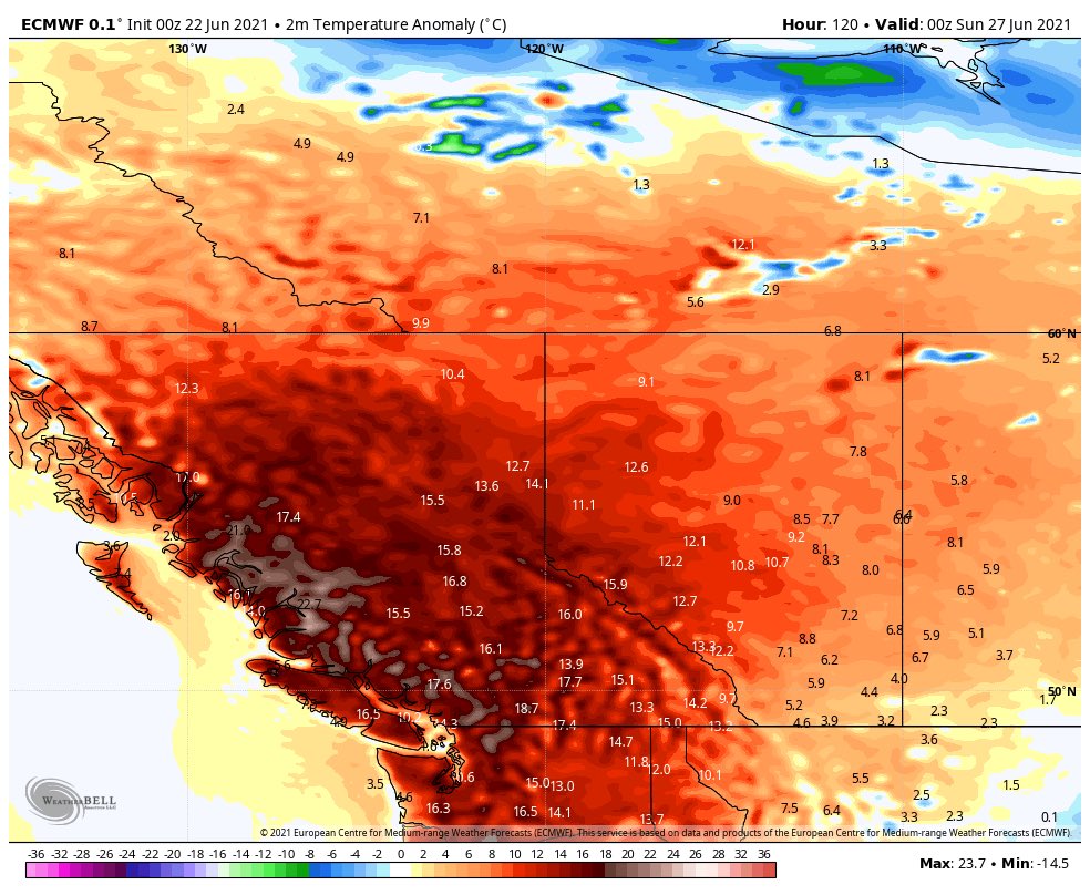 This part of the world isn’t accustomed to these temperatures: take Abbotsford as an example, perhaps 3 consecutive days at or above all-time readings.