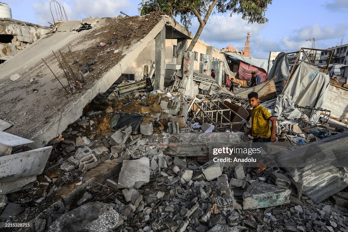
Interested in Geolocating the Humanitarian Harm in Gaza.
My Geolocations:
https://t.co/ZAmG4DHCyM
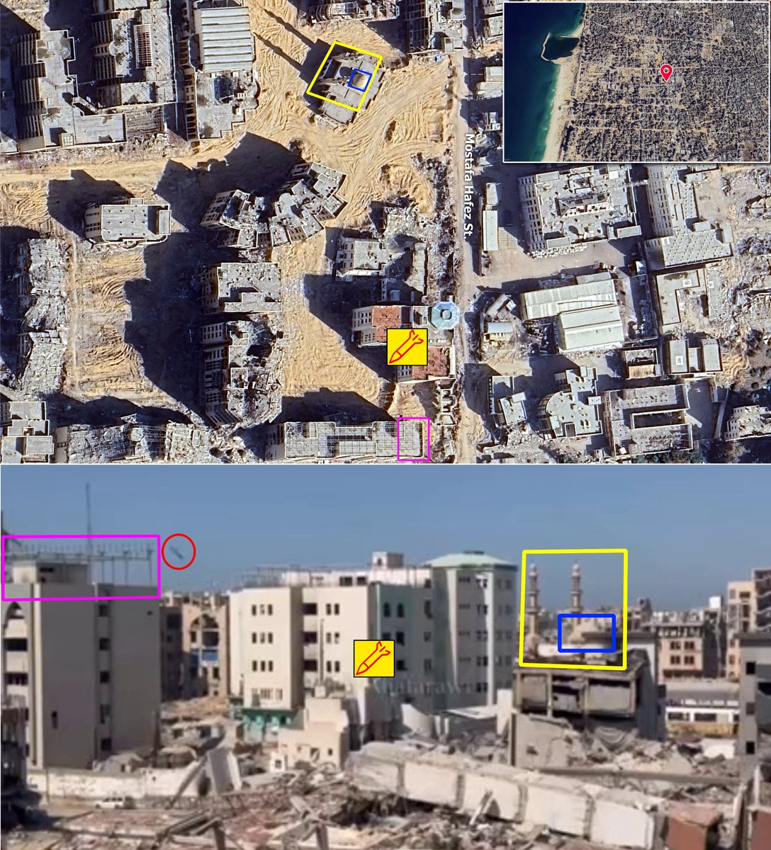
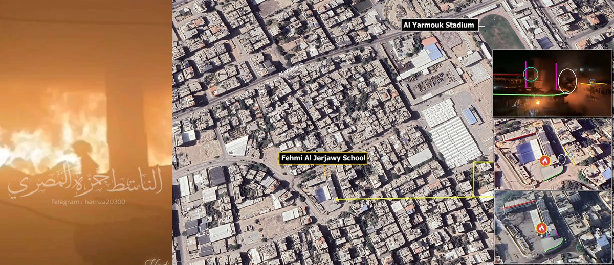
 At 00:18 Al Salhi Towers and the towers to the south are visible. Only 2 out of 9 Al Salhi Towers survived.
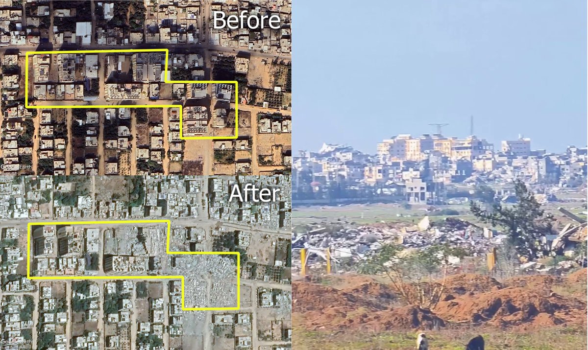
 Source:
 Source
 Source
 Sources
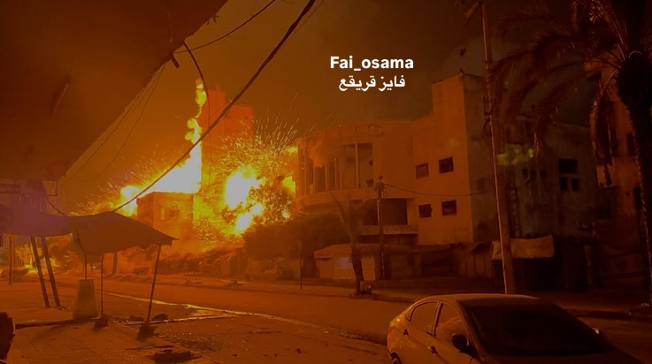
 Source clip
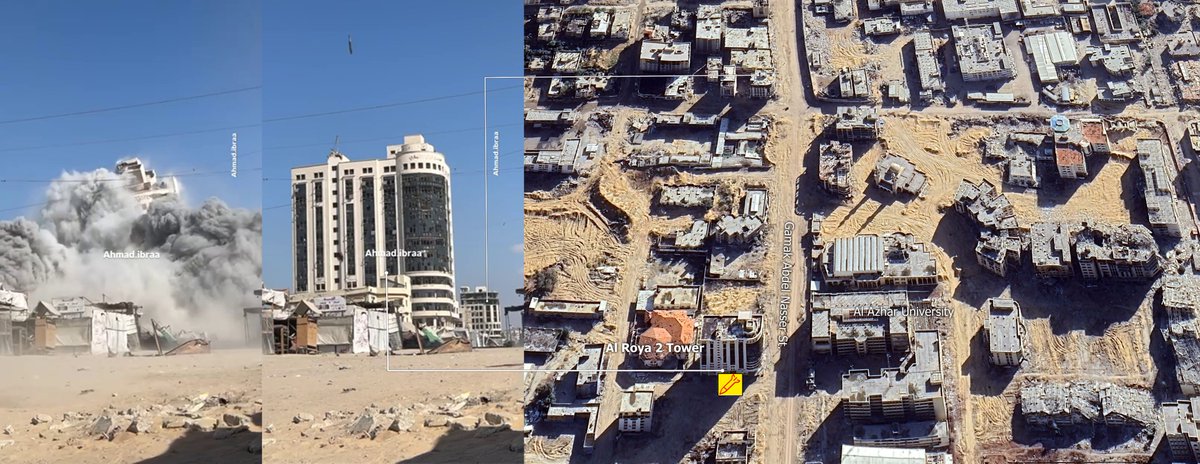 Source clip
 Source
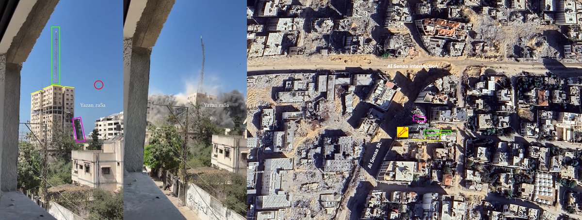 Source
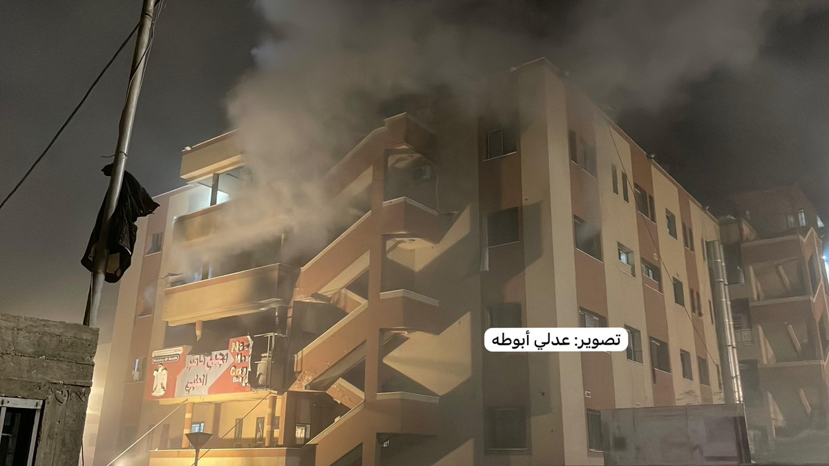
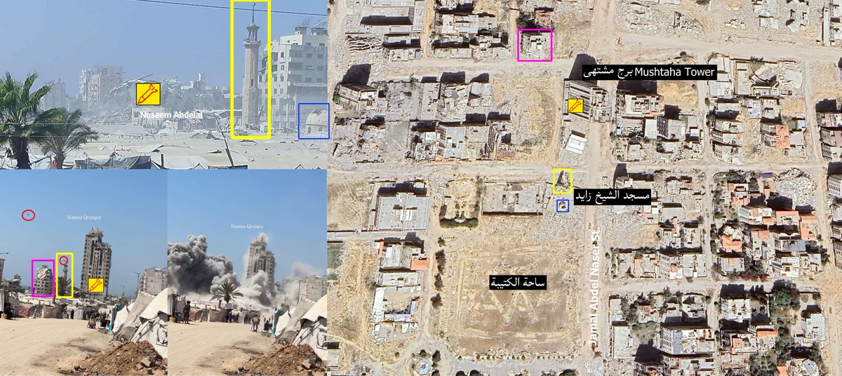 Video Source (first airstrike)
 Geolocation sources
 Geolocation sources
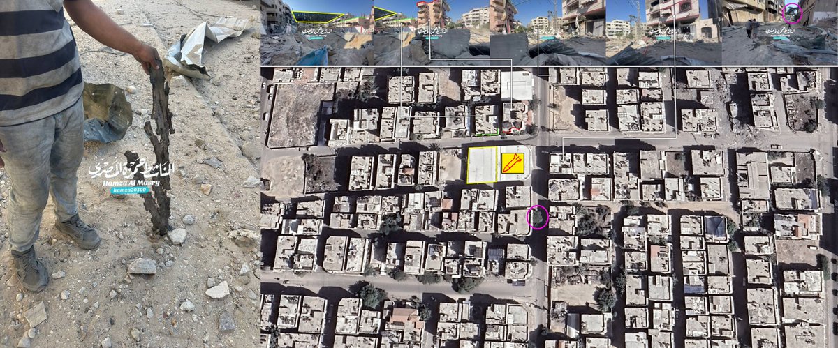
 2 clips showing people approaching the barracks in large numbers.
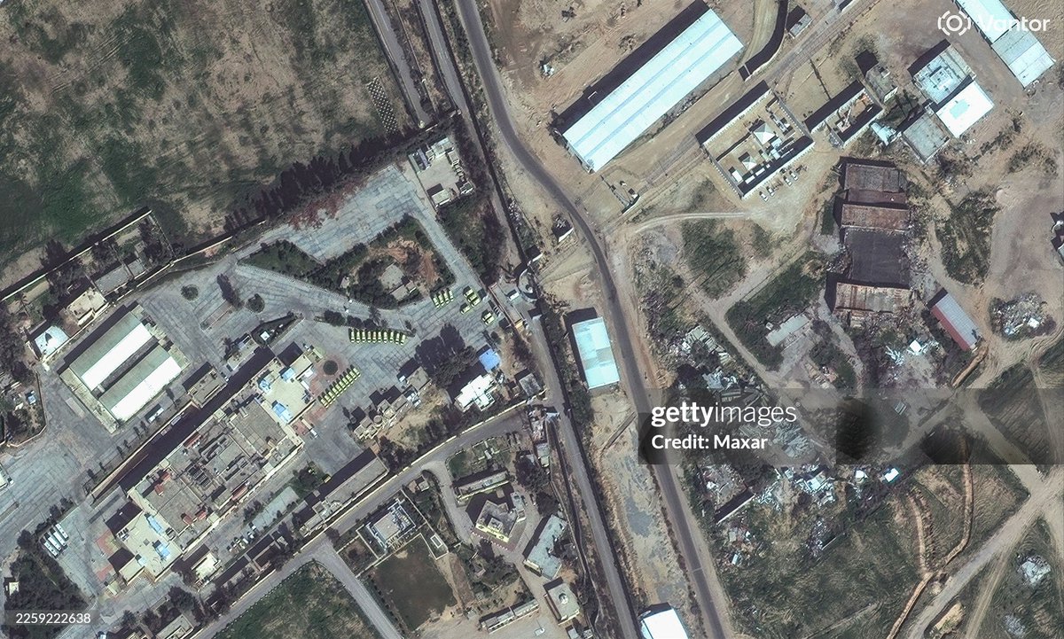
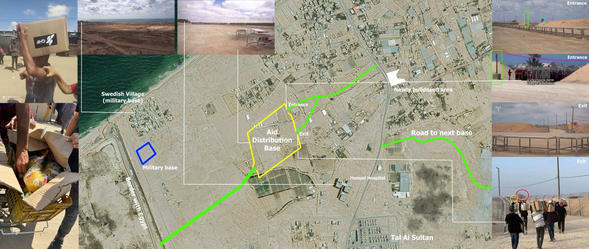 Recent satellite imageries and geolocations showed these bases (3) in Rafah, and the fourth being in Al Bureij (pointed out in the pic) which local sources mentioned is getting ready for operation.
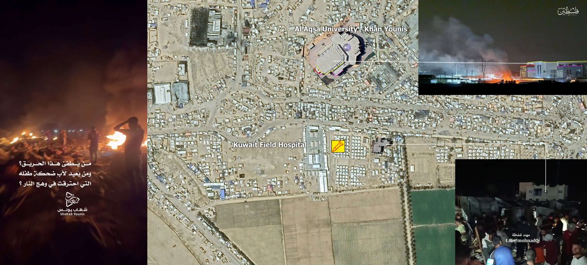
 Geolocation source:
 Geolocation sources:
 Geolcoation sources:
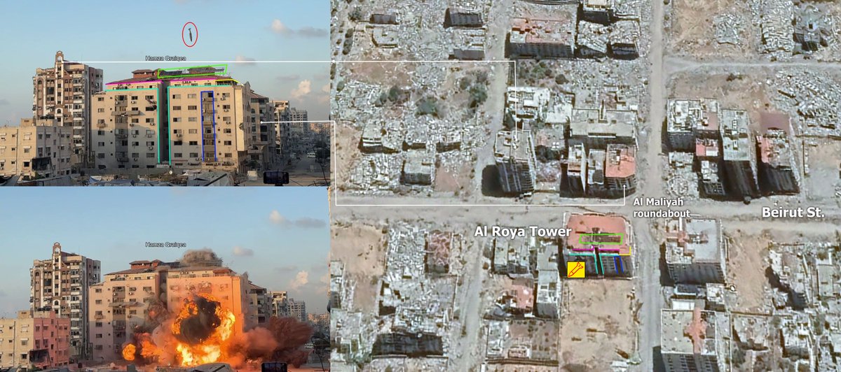
 Geolocation source:
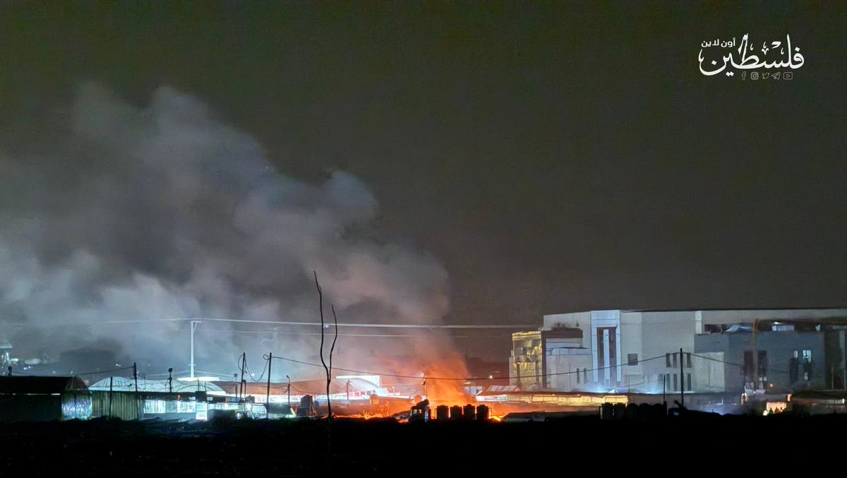
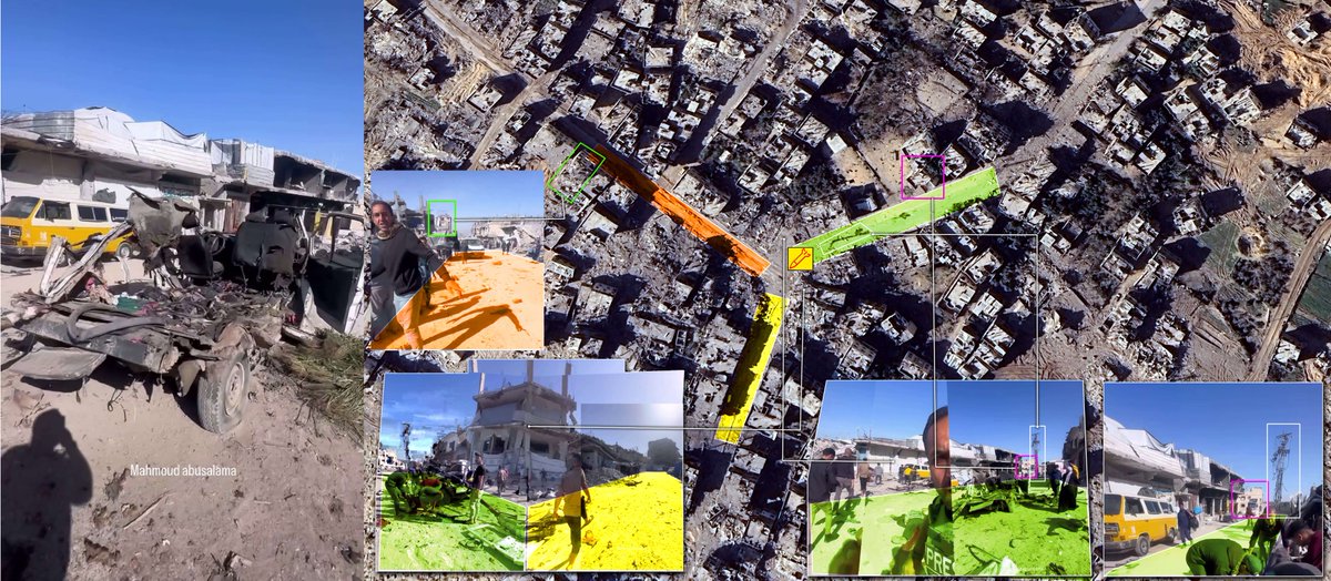 Geolocation source:
 geolocation sources: