Chief Meteorologist, @kiii3news | Certified by the National Weather Association | Avid Golfer | @UTSA & @msstate Alum
 There is a notable east shift in the 10PM forecast cone, which is now just to the east of Corpus Christi. Nicholas is forecast to become a 65mph tropical storm (75 mph gusts) en-route to the Middle Texas Gulf Coast TUE morning. Nicholas slows and weakens over SE TX WED/THU. 2/5

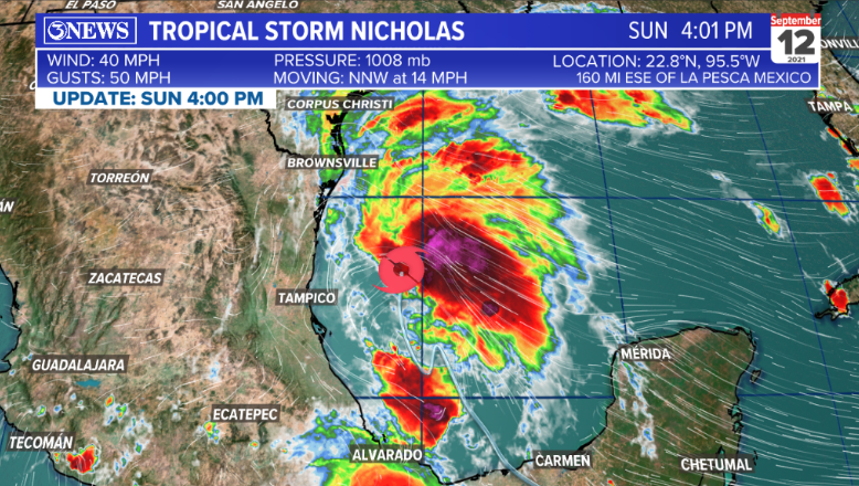 Nicholas will move northward, paralleling the Mexico/Texas coastline through Monday. Some strengthening is expected over the next 24-36 hours. Winds near the center of the storm forecast to reach 65 mph by Monday afternoon.
 Nicholas will parallel the TX coastline, passing through/near The Coastal Bend on Monday evening/Tuesday morning as a strong tropical storm - 65 mph winds.

 A track paralleling the TX/MX coast will make landfall hard to predict & won’t be a ‘tell all’. Spread could be from MX to LA. A weaker system would likely ‘spread the wealth’ of rain across a larger area. A more developed system would concentrate the highest rain totals.
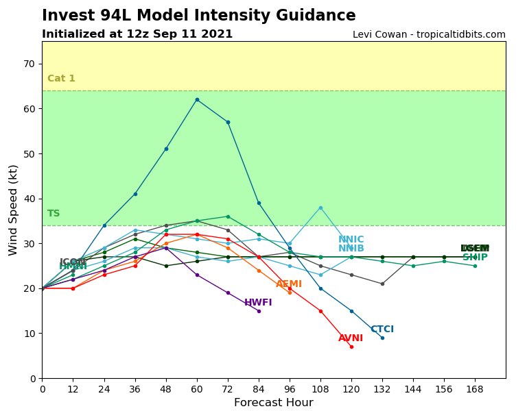
 Most guidance keeps this feature from garnering too much strength in the Western Gulf. The consensus is at least a tropical depression; meaning a cyclonically spinning storm with winds under 39 mph.