Senior Maritime Pilot | Master Mariner | Master's degree Nautical Science | Forensic Medicine | Glassblower |
 2/x The port of Halifax, Nova Scotia, Canada, is a hub for the Allies to ship ammunition, food, and supplies to Belgium and France. The Belgian Relief Commission (BRC), an American organization...

 2/x In 1921, the Dutch lifeboat service suffered major tragedies. The motor lifeboat Brandaris and the steam lifeboat President van Heel capsized or sank, resulting in the loss of fourteen rescuers. These disasters created an urgent need for safer vessels.
 2/x What is a charterer? Especially with the Houthi attacks on merchant ships, people sometimes talk about links to Israel, the UK, or the US and then mix up the terms “shipowner” and “charterer”, even though they are not the same person.

 2/x Container shipping is one of the most volatile industries globally. Freight rates (how much you pay to ship a container) can fluctuate dramatically due to changes in supply and demand, fuel prices, geopolitical events, as well as seasonal peaks and economic cycles.
 2/x The Germans were lacking gun batteries in Normandy as they had concentrated them around Pas de Calais. Their defense strategy leaned heavily on massive minefields to stop any Allied assault before it even reached the French coast.

 2/x The solution was Operation Gambit, a high-risk mission using X-class midget submarines to act as human navigation beacons. On the evening of June 2, two X-craft slipped out of their base in Britain.
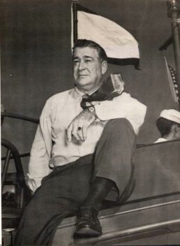 2/x Higgins was an American businessman and boatbuilder. In 1926, he designed the Eureka boat, a shallow-draft craft for use by oil drillers and trappers in operations along the Gulf coast and in the lower Mississippi River.
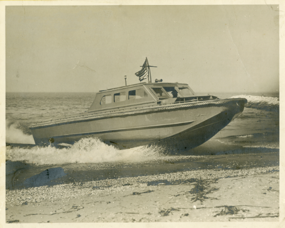
 2/x Hugo van Kuyck was born on December 1, 1902, in Antwerp, Belgium. From a young age, Hugo was fascinated by the sea. At age 15, he designed and built his first sailboat, Zwaluw 1 (Swallow 1), followed by Zwaluw II. (photo of Zwaluw 1)

 2/x 2024 saw an increase in containers lost due to ships rerouting in response to attacks on merchant shipping in the Red Sea. These disruptions led to a significant rerouting of vessels, with a 191 percent increase in transits around the Cape of Good Hope.
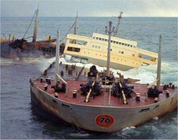
 2/x The MSC Napoli was a container ship with a capacity of 4,418 TEU and 276 m long. It operated on the South Africa–Europe route and called at the European ports of Felixstowe, Hamburg, Antwerp, Le Havre, and Sines.
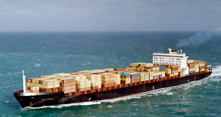
 2/x As usual in shipping, it all stems from disaster, and this time it was the Herald of Free Enterprise disaster in March 1987. A roll-on/roll-off passenger ferry capsized shortly after leaving Zeebrugge, Belgium, due to the bow doors being left open. It resulted in 193 deaths.
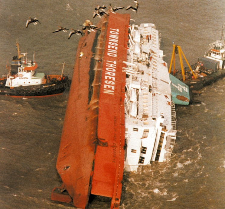

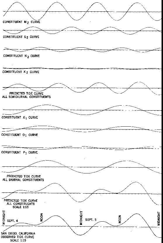
 2/x The first topic is the origin of tides. Most people say that tides are caused by the Moon's gravity, which attracts water towards it. This is why we experience high water (HW) on the side of the Earth facing the Moon. Yay! Cool and all, but why then 2x HW per day...?
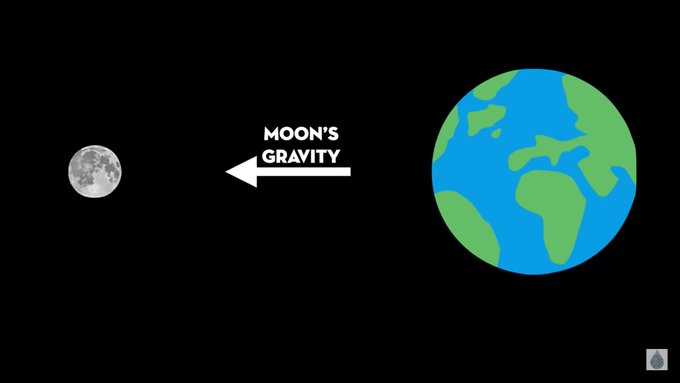

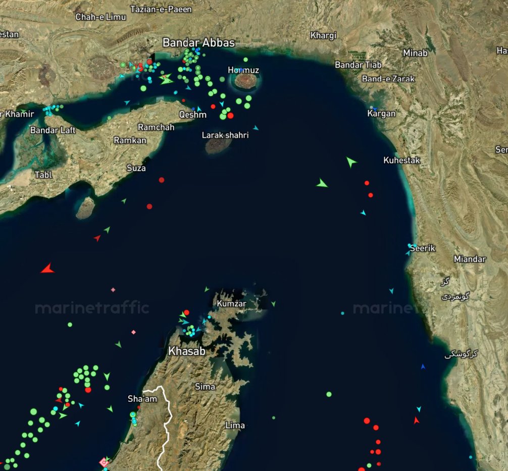 2/x Those two terms stem from UNCLOS 1958 and UNCLOS 1982. If you want a history of how UNCLOS came to be, check the link below:
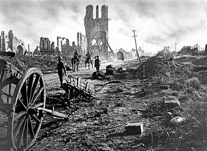
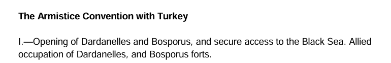
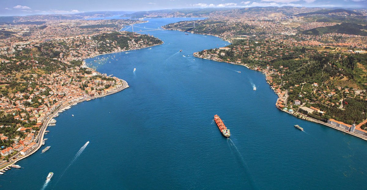 2/x After WW1, the Armistice of Mudros (October 30, 1918 ended hostilities between Ottoman Turkey and the Allies. The Mudros document's 25 articles gave the Allied Powers the right to use the Dardanelles and Istanbul Straits freely and occupy fortifications on their shores.
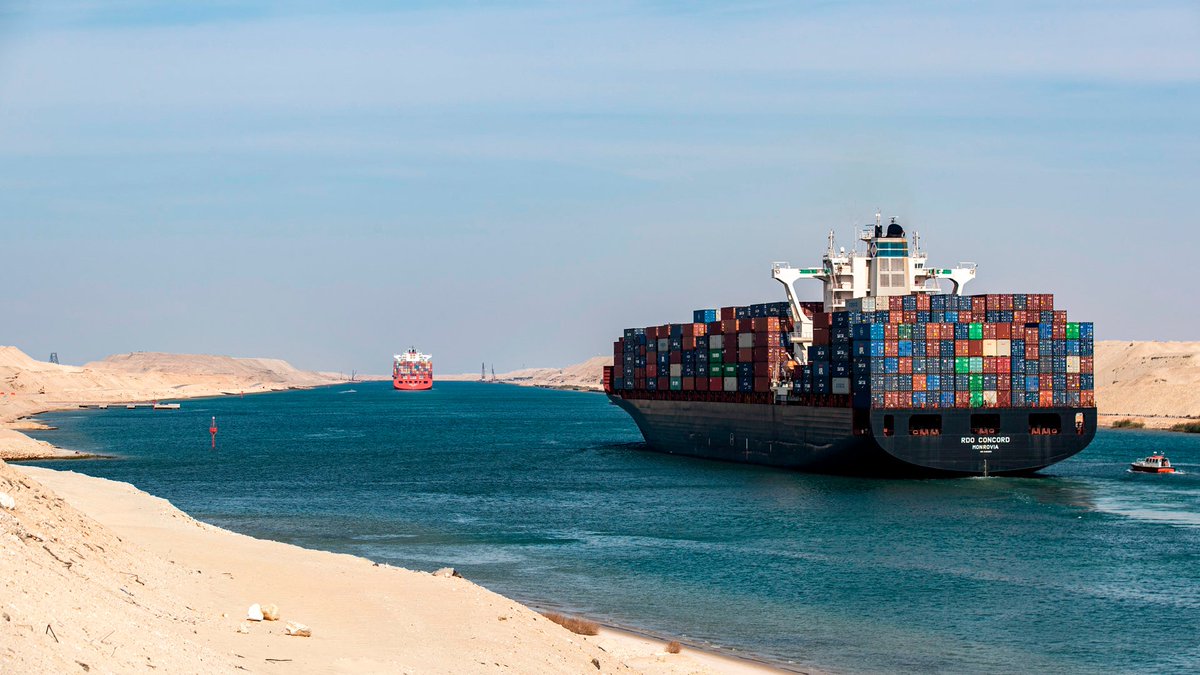 2/x The big difference is, of course, that the Canal is man-made and not a natural strait. It is also located entirely within Egyptian territory. It is fully subject to Egyptian sovereignty and jurisdiction, just like any other part of Egyptian land or inland waters.
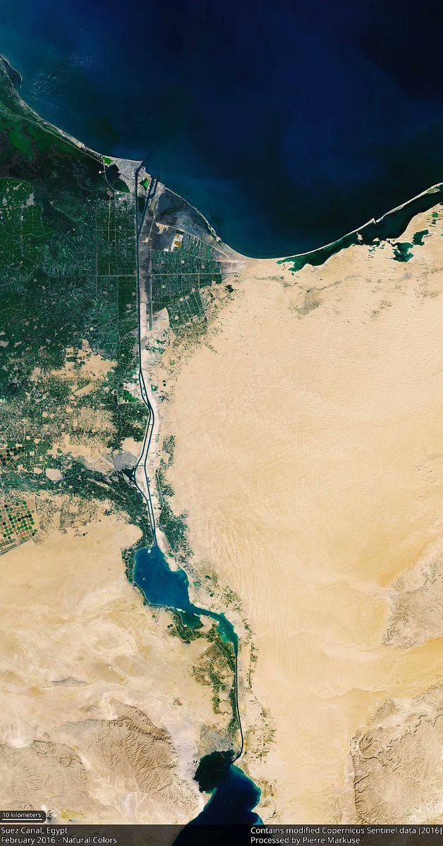
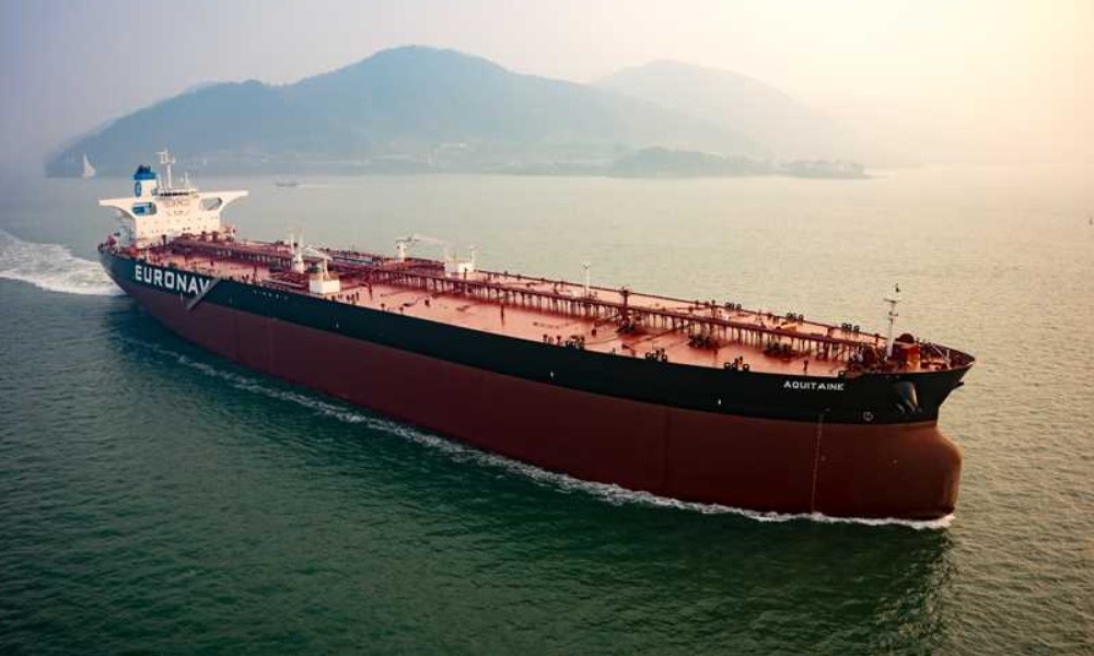 2/x In the tanker market (crude oil, refined products, and other liquid bulk), voyage charters (also called spot charters) dominate. On a voyage charter, vessels are hired to carry cargo from a load port(s) to a discharge port(s) at an agreed freight rate.
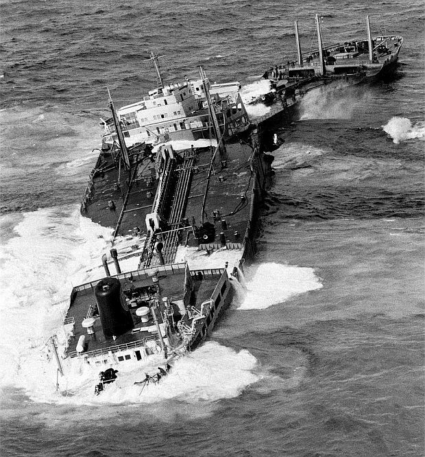 2/x This was the case with the Torrey Canyon where the US Limitation of Liability Act of 1851 said"...the owner's liability shall not "exceed the amount or value of the interest of such owner in such vessel after the incident, and her freight then pending."