
 More information:
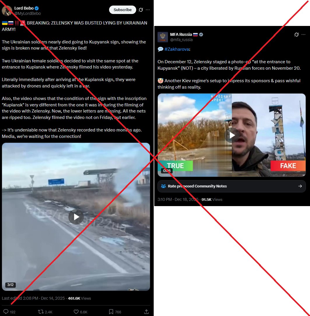 The initial video is posted on Zelenskyy his Telegram at 14h31 on the 12th of December.
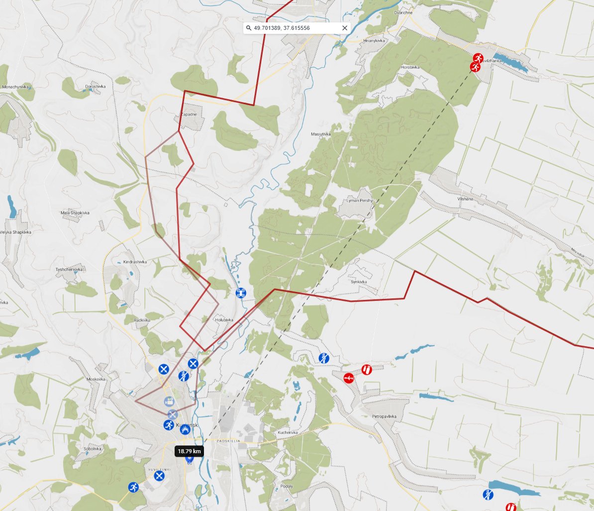


 Over 1,000 videos analyzed and more than 500 geolocations mapped.

 We will start by the North Wind claim.
 GeoConfirmed 7OCT23.
 October 7th 2023.
 October 7th 2023.
 First the videos:
 Great first fact-check by @BuschModelar
 Over a year ago.
 First, the original footage:
 At night: Russian AD working in Novorossiysk, first explosions reported.
 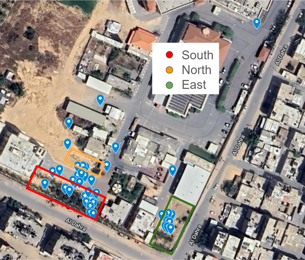 22 January 2024.

 25 JAN 2024 - Palestinian burials by Palestinian people in Nasser Hospital. (VID 01)