
Ontario's independent and community-driven weather organization. Providing context to severe weather since 2013. Download our app: https://t.co/HIGhpa8g3m
 This is why we had so much uncertainty with the expected accumulation in this area. You can see that London is currently under a very intense band of snow but just a few kilometers to the northwest and there’s barely a flake.
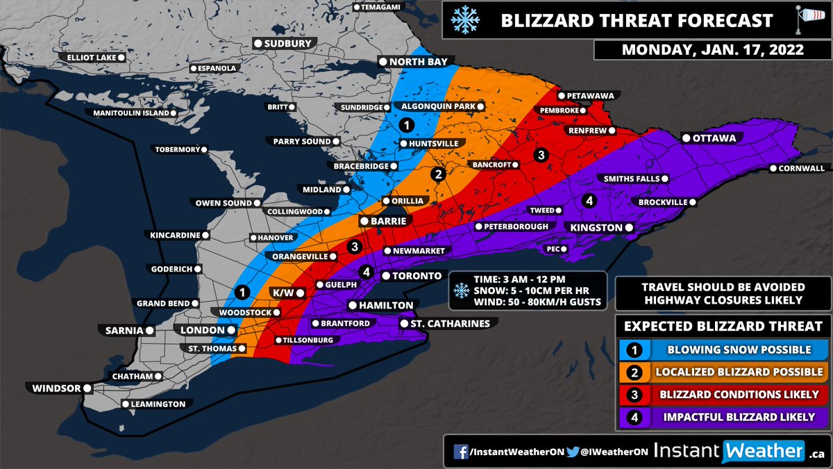 Combined with wind gusts approaching 50-80km/h will lead to potentially dangerous blizzard conditions along the Lake Ontario shoreline and parts of Eastern Ontario. The worst conditions will start around 3 am and continue until noon.
 NOTE: School boards have already started announcing cancellations tonight. We will keep an updated list of cancellations within the snow day forecast.
 Once again, we ask you to please *read* the entire forecast as many of your questions and concerns will be answered there. This is a very complex system and just reading the headline or looking at the map won't be that helpful.
 Clearly, this isn't meant to be a scientific forecast by any means. Storm chips tend to be more of an Atlantic Canada tradition, however, it appears to be catching on here. We figured why not put out something a little more light-hearted to ease the stress of this snowstorm.

 It's very important to *read* the entire forecast instead of just focusing on the map. There are a lot of variables with this system in particular which makes it very difficult to forecast.
 Our app uses a unique method different from our custom forecasts and can be useful to compare the two different forecasts for your location.
 We believe it’s important to post a forecast this early due to the potentially significant impacts it could have on our region. This is now your chance to plan for a snowstorm and make any alternative arrangements for Monday should it occur.
 Please be sure to dress accordingly if you’re planning on being outside for an extended period of time. Frostbite and other cold-related dangers can become life-threatening in a matter of minutes with temperatures this cold!