Keystone Intel Profile picture
OSINT, international relations, poli sci, & aerospace policy | Nikon D500 w/ 150-600mm | RTs, posts & opinions are my own |
Apr 29, 2025 8 tweets 4 min read
MORE F-16s TO UKRAINE: On April 26th, conservative conspiracy theorist Laura Loomer posted pictures sent to her by one of her followers, showing shrink-wrapped aircraft being loaded into a Ukrainian-operated Antonov An-124. 🧵 Image 
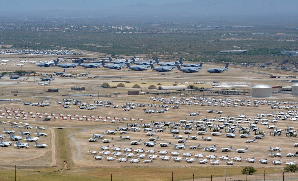
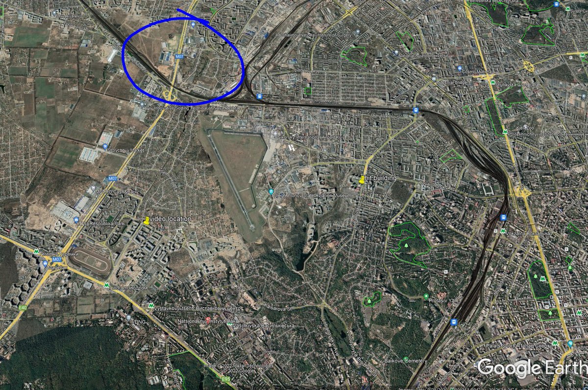
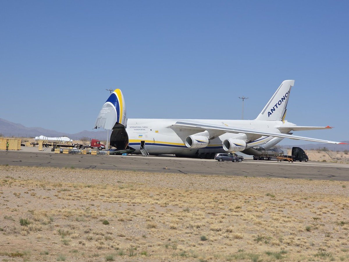
The An-124 pictured, 'Be Brave Like Kharkiv' UR-82027 (#508015), landed empty at Tuscon International Airport #TUS on April 25th. Tuscon International Airport is only miles away from Davis-Monthan AFB, the home to the US military's aircraft boneyard. Image
Image
Feb 12, 2024 4 tweets 1 min read
I was sitting on some pictures I got of the damaged HIMARS. Other pictures and videos of them have came to light so I feel more comfortable posting them now.

More pictures to come soon. Image 
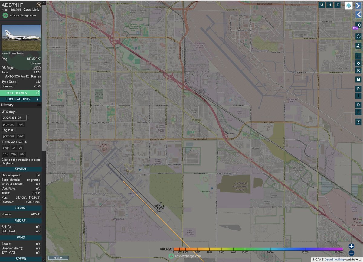
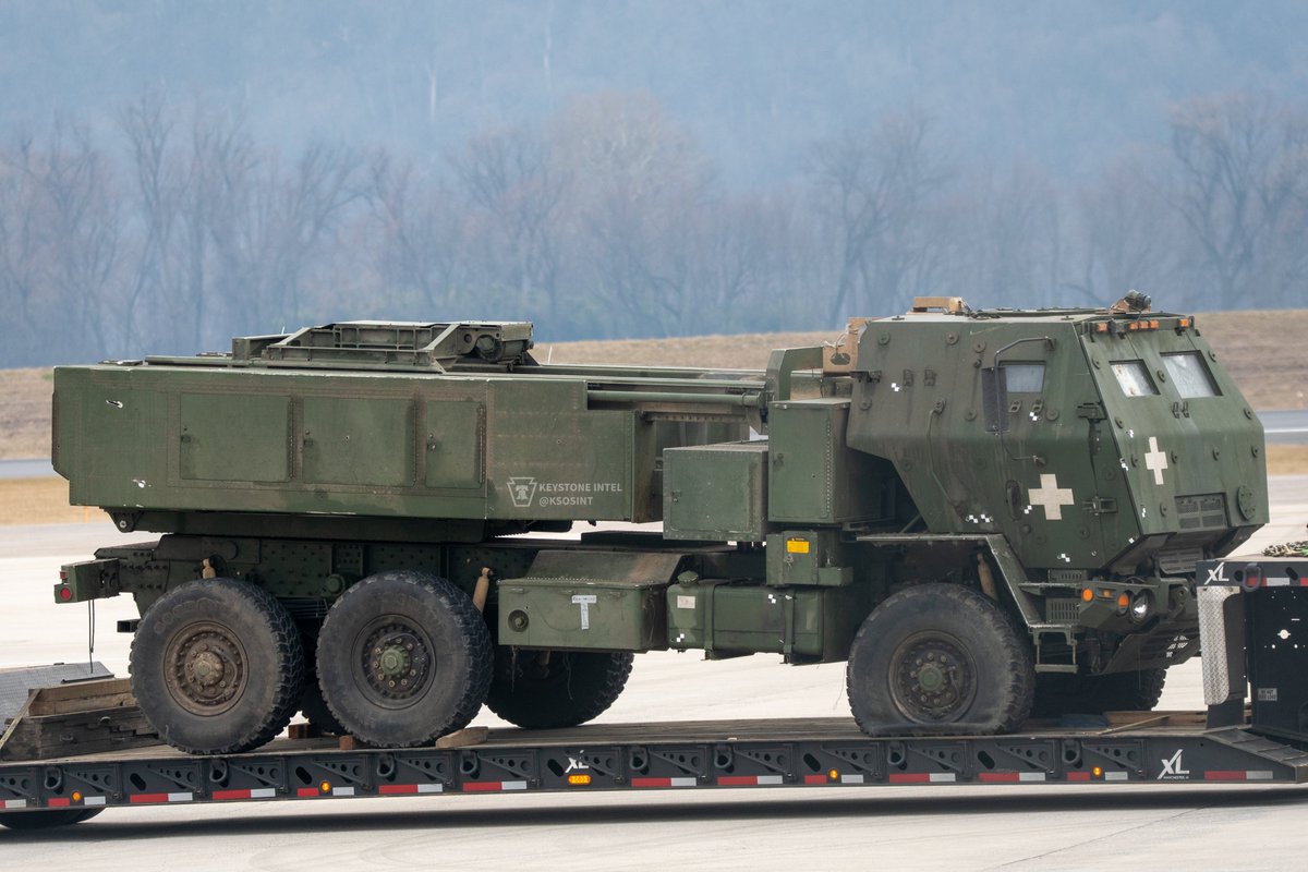
@TheIntelFrog @TieDyeIntel closer up: Image
Dec 17, 2022 31 tweets 11 min read
With the change of Twitter policy on "doxing", the banning of accounts like @ElonJet & @ADSBexchange, and Musk's lack of understanding of plane tracking, I will explore in this thread what ADS-B is, how it is used to track aircraft, and why & how this information is public. 1/X Automatic Dependent Surveillence-Broadcast (ADS-B) is a system that allows for quick, easy, and accurate positioning of aircraft for collision avoidance and air traffic management. As the name suggests the system is automatic and requires little input from the pilot. 2/X
Feb 26, 2022 17 tweets 6 min read
In this thread I would like to give a concise and full explanation to proof that a SAM missile accidently hit a apartment building in Kyiv yesterday morning. aljazeera.com/news/2022/2/26… Before images of the impact at the apartment came in, this video was circulating of a missile launch near the city. This launch seems similar to a launch of a S-300 Surface-to-air system. (Of note both Russia and Ukraine operates these systems)
Feb 26, 2022 6 tweets 2 min read
Video was taken from 50°23'8.04"N 30°27'25.89"E
google.com/maps/place/50%… You can see the location of the building hit by a missile in Kyiv and the location where the launch video is taken. The blue is where I believe the launch took place. Which is well south of Kyiv and not likely a position the Russians occupy or could have set up a SAM site at.
Feb 25, 2022 5 tweets 3 min read
A Sierra Pacific Airlines 737 SPA708 reg:N708S (#A973D6) is coming to #KMDT from #KTUS. Looks to be a chartered flight, probably by the Feds. DoD has a contract with them, but I wonder if this an ICE flight. ICE flights by another charter line iAero are common at Harrisburg Int' ImageImage 
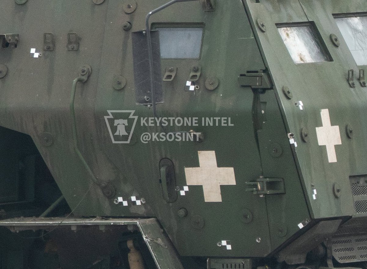
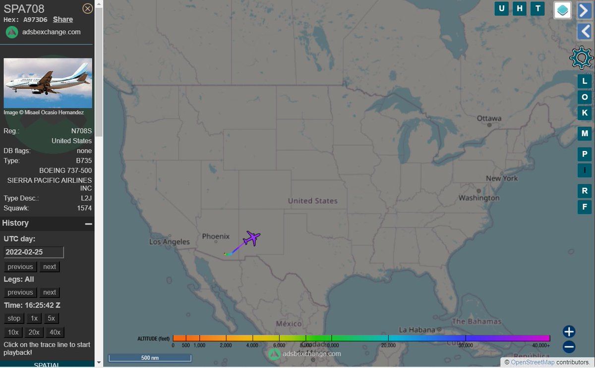
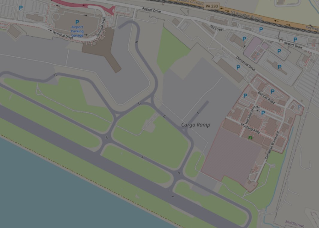
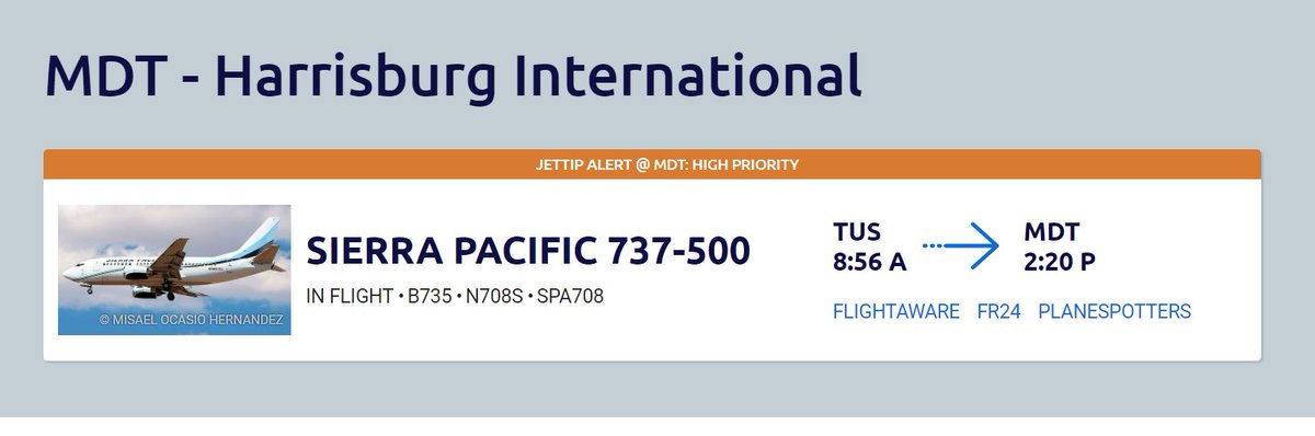
One way to tell is where it taxis to when it lands. If it taxis to the terminal it is probably a DoD or normal charter, but if it taxis to the cargo ramp than it is an ICE flight. I could not find any info if ICE charters them. Image